Lezhe, Albania
31 August 2018
With Andy, Tilo and Wen
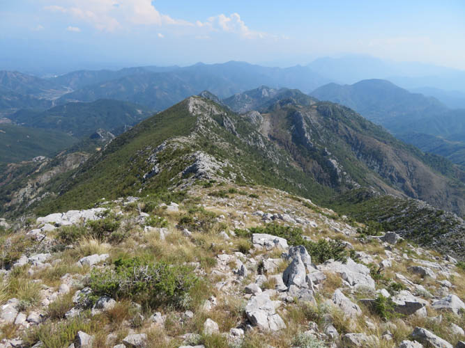
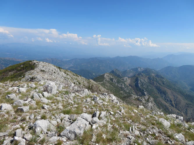
A barren, shrubby ridge
After spending a few days lazying around on the beaches of Shenjin in northern Albania, it was time for another short hike up a small mountain. Tilo, who was travelling with us for a week, didn’t mind a change from beach life and neither did Andy, the easy-going Brit we had met near Herceg Novi in Montenegro a couple of weeks earlier. All of us had already done a few hikes together over the past week, in various combinations, including Montenegro’s highest mountain (Zla Kolata) as well as some terrific scrambles in Durmitor National Park (Bear traverse, Savin Kuk). They had all turned out to be very enjoyable and adventurous outings, so why not have another mountain adventure in Albania!?!
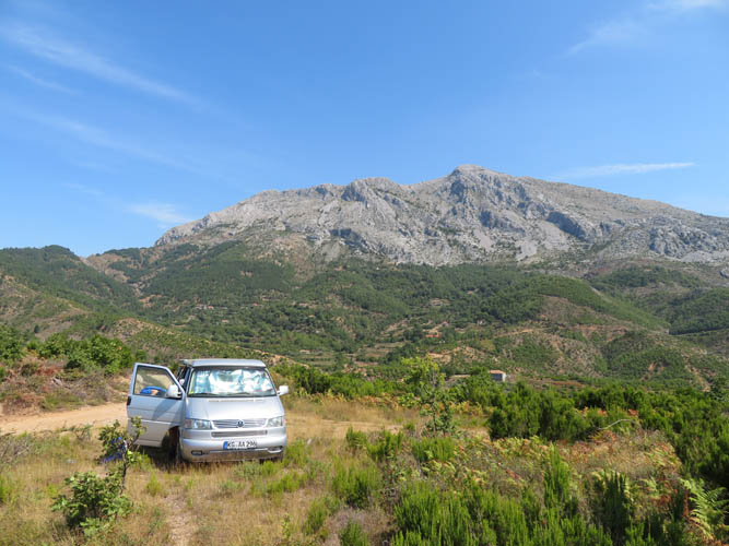
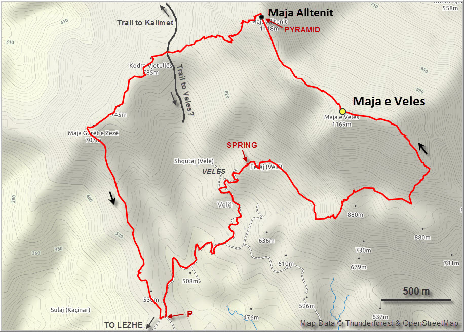
Today’s hike to the summit of Maja e Veles turned out to be ENTIRELY different. Although the mountain can be seen quite nicely from the coast near the city of Lezhe, it takes a while to get to. We got driving directions and GPS tracks from palmtreeproduction.com (chock-full of detailed info on Albanian mountains, probably the best hiking resource for this country!). Thankfully, a 4WD vehicle is not required anymore to drive up to the village of Veles, which is basically just a collection of houses spread out over the rolling hills at the foot of the mountain. Our old VW T4 made it all the way up without problems, but some parts are pretty steep and the pebbles made our wheels spin a few times when we didn’t have enough momentum. Andy’s newer T5 seemed to have no issues at all.
One of the reasons why this hike was so different was that it gets scorching hot down here by the coast in the summer. We could’ve avoided much of the midday heat by starting really early, but of course none of us felt like getting up early when on vacation… That meant carrying at least 3 litres of water each! All of us except Wen had used it up completely by the end of the trip.
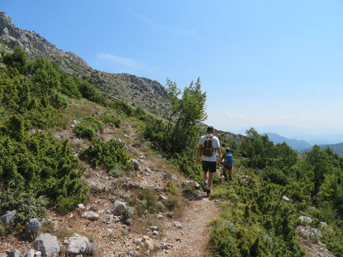
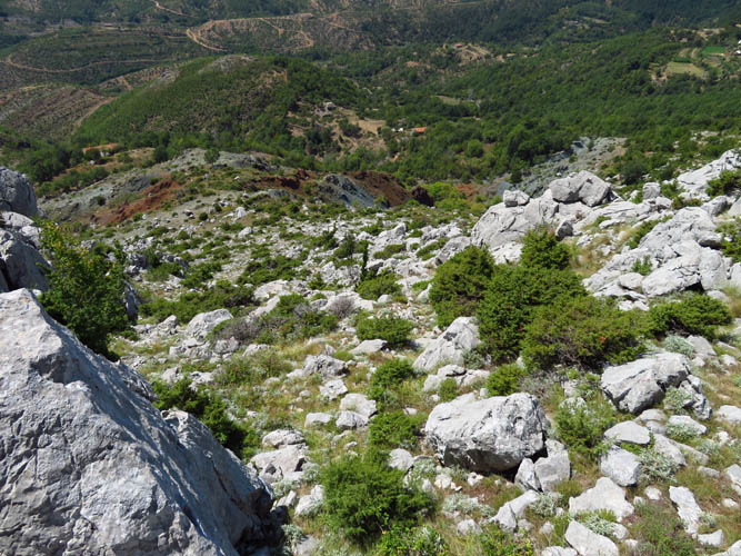
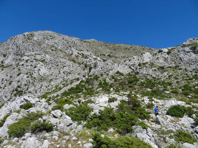
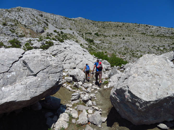
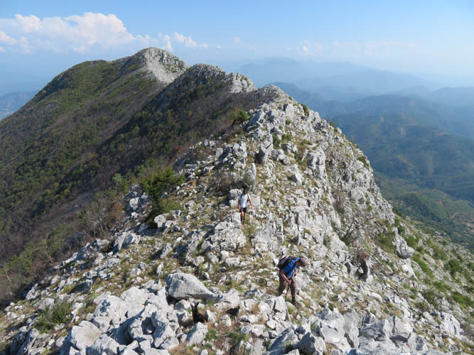
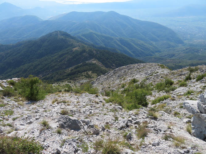
The terrain was another aspect that made this trip so different from previous ones. It’s dry and barren, with only the toughest shrubs and thorny bushes growing in the karsted limestone landscape. This wouldn’t have been much of an issue if there was a trail, but there is basically none. After walking along the road from our parking spot to the last house at the foot of the mountain, we followed a very faint path for a while that in effect contours around the mountain to the southeast without gaining any elevation. Eventually we just hiked straight up, roughly aiming for the south ridge of Maja e Veles. Just before reaching a shoulder with a flat muddy patch we came across an old trail again – no paint markers or flagging here, but judging by the worn rock this path had clearly been used some time in the past. Like before, this trail also contoured around the mountain instead of gaining elevation, so we left it again and just hiked straight up to the ridge crest.
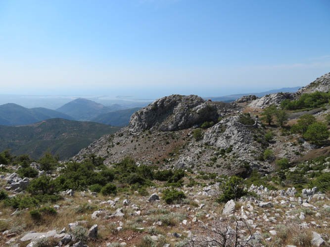
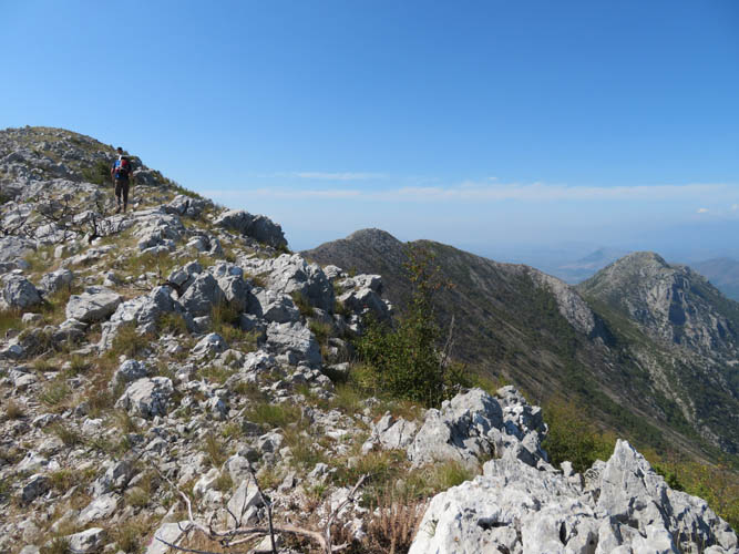
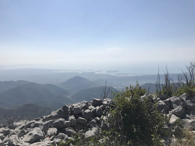
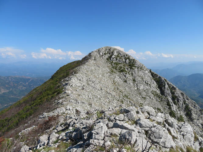
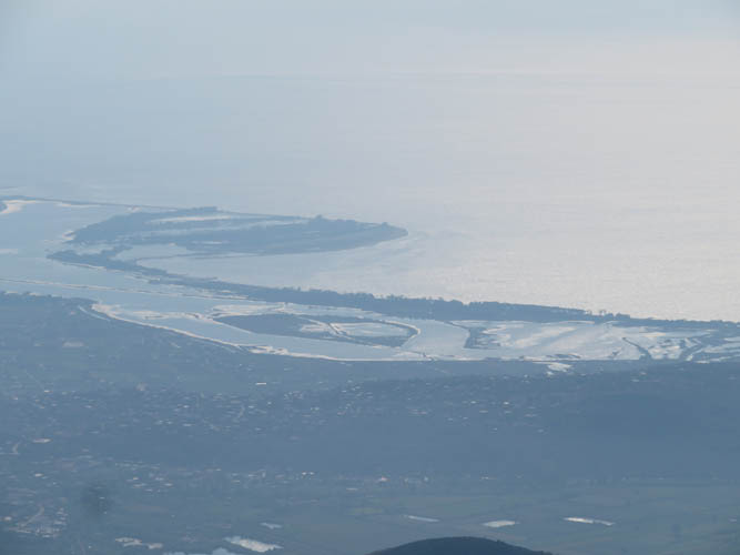
The crest showed a smattering of a trail here and there, which made for slightly more pleasant hiking. After a few minor ups and downs we finally stood on the highest point of Maja e Veles, adorned with a large summit cairn but no register. Although it was pretty hazy, the views of the coastline to the west and higher distant peaks to the east were quite rewarding.
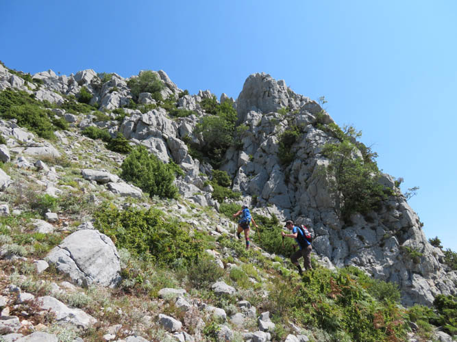
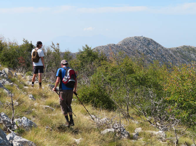
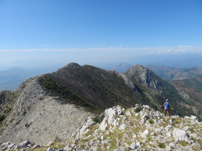
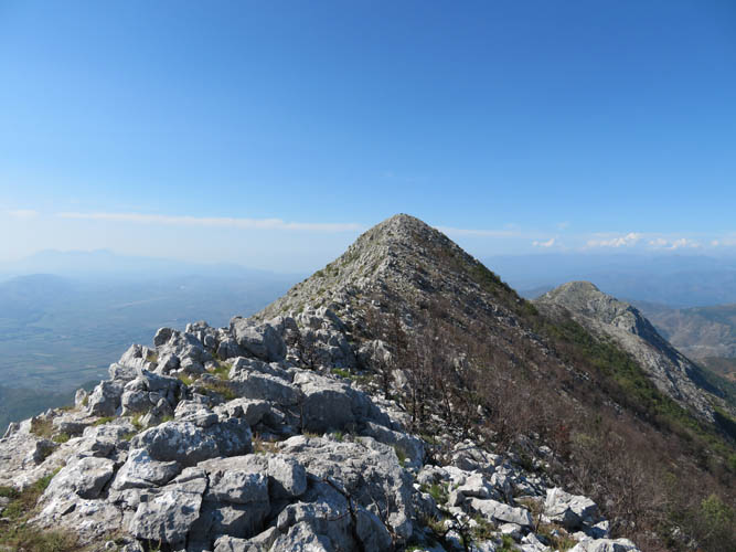
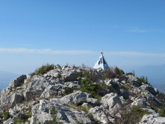
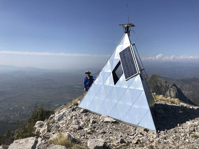
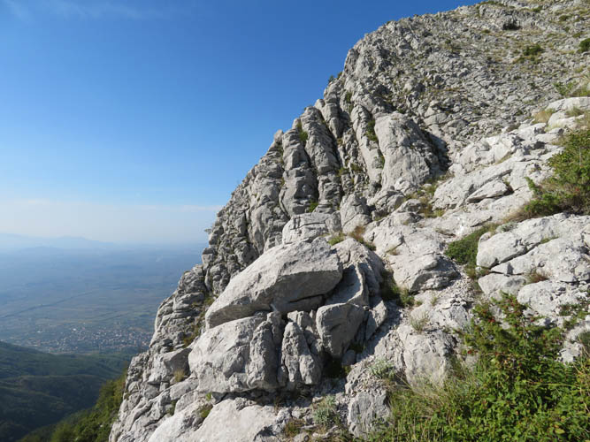
To complete our loop and traverse of the ridge, we continued northwest towards a slightly lower summit that features a silver steel pyramid hosting a weather station and a small Madonna statue inside. On some maps this summit (1118 m) has its own name – Maja Alltenit. Traversing the ridge was by far not as easy and pleasant as it seemed when looking at the mountain from below: there is no trail so you basically have to find your own line of least resistance over large chunks of rock and through shrubs and burnt trees. There were also a few spots of (easy) scrambling required to get over some large blocks of limestone, and the ridge involves several ups and downs and therefore is quite time-consuming. Personally, I don’t think it was that bad, but I’m pretty sure my companions wouldn’t agree with me here :).
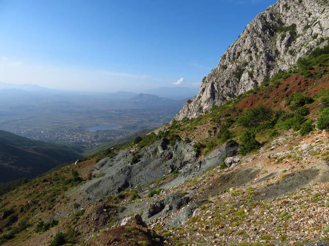
The relief of having reached the small weather station pyramid on Maja Alltenit was short-lived. The descent – again without a trail and even steeper now – was a tiring one. We slowly made our way down directly below the summit on rubble-covered rock ledges, heading towards the treed shoulder below us. (Note that the description on palmtreeproduction.com mentions a trail further north of our route here, but we saw no evidence of the existence of a trail when we scouted out our descent from the pyramid. We probably just missed it!)
At the treed shoulder we actually encountered a good path that originates in the village of Kallmet to the NW. It appears to pass over the shoulder and continue down to the village of Veles. Coming up from Kallmet might thus be an alternative approach for this mountain.
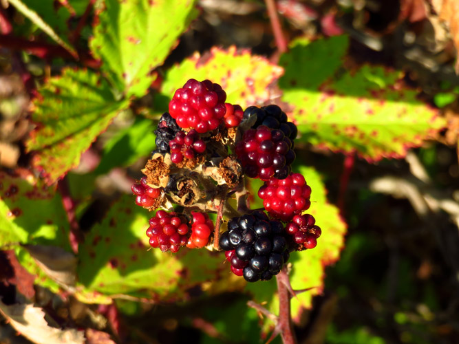
We followed the top of the gently undulating ridge on a faint trail that later turned into an old logging track. Here, the hiking was finally getting stress-free – and sweetened by an abundance of succulent blackberry bushes lining the track.
The highlight of the trip, hands-down, came a few hundred metres before we reached our vans. The logging track suddenly ended at a gate on private property, but a super friendly Albanian fellow kindly led us through and even invited us into his house for a glass of cold water and some fresh grapes from his field. Although we couldn’t really communicate with him (he didn’t speak English and our Albanian was limited to Faleminderit – thank you), this spontaneous act of hospitality, of welcoming complete strangers into his house really struck us by surprise and remains the most wonderful memory of the entire day.
| Elevation: | 1169 m (official), 1165 m (my GPS) |
| Elevation gain: | 850 m |
| Time: | 6.5 h |
| Distance: | 9.7 km |
| Difficulty level: | Easy to moderate (Kane), T3/T4 (SAC) |
| Reference: | www.palmtreeproduction.com |
| Personal rating: | 2 (out of 5) |
DISCLAIMER: Use at your own risk for general guidance only! Do not follow this GPX track blindly but use your own judgement in assessing terrain and choosing the safest route.