Banff, AB, Canada
15 August 2021
Solo
A big and rarely visited peak
The second day of my mid-August “smoky summer adventure” was supposed to be easier and shorter than the first day when I climbed Cuthead Peak and Flints Peak. Yes, it was easier as I had some beta from Phil and Vern, but it was still a very long and strenuous day. Unfortunately, the weather was once again quite hot and stuffy, with views heavily impaired by widespread smoke.
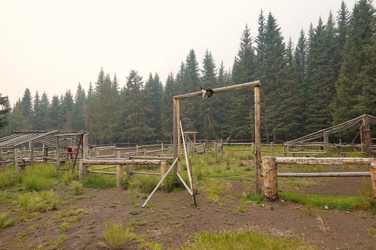
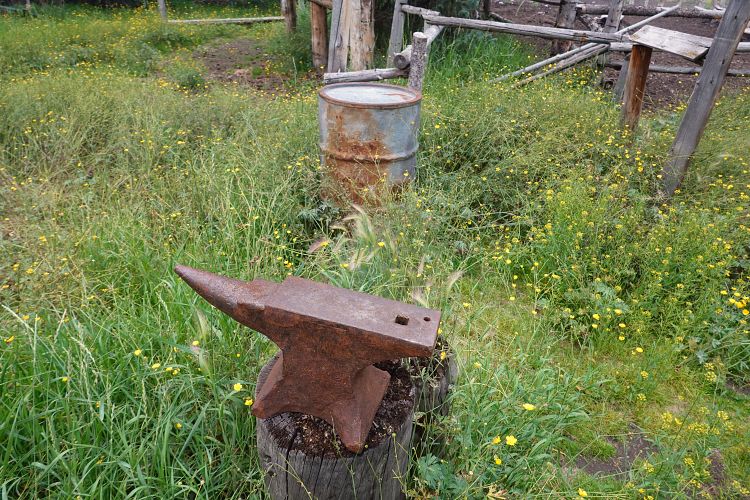
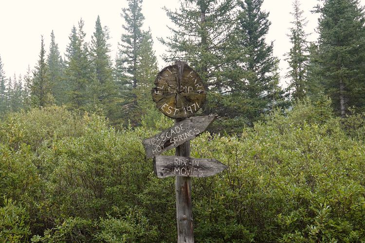
After leaving the campsite at Flints Park I noticed a good trail leading down to the Cascade River a few km further east. I decided to take the short detour and explore where this wide trail would lead to. A few hundred metres down the trail I found a surprisingly large camp with several horse corrals, benches, a heavy anvil, and other items reminiscent of the good old pioneering times a hundred years ago. “Flints Camp est. 1970” is engraved in a wooden sign at the entrance, so not quite 100 years old but it certainly had the feel of the wild west. There was nobody around, so I headed back to the main trail to continue the long trek south.
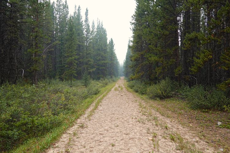
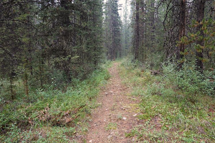
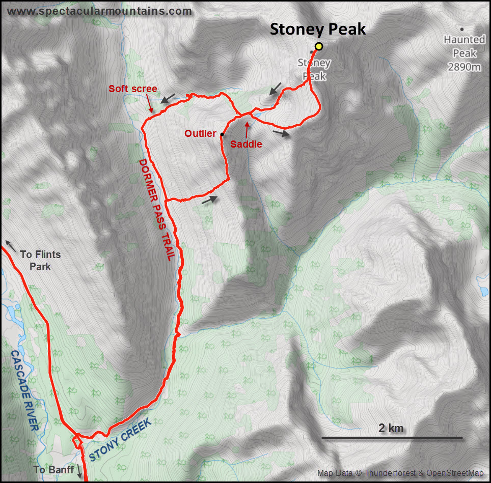
At the bison gate, just before Stony Creek campground (yes, that’s officially “Stony” without an ‘e’!), I dropped my overnight pack and headed up the Dormer Pass Trail with my day pack. I was surprised how good the trail was as I’m sure it doesn’t see more than a dozen travellers every year at the most. The trail crosses Stony Creek after 1.7 km, then hugs the east side of the creek as it heads upstream.
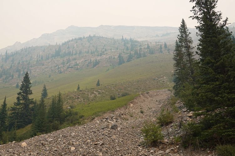
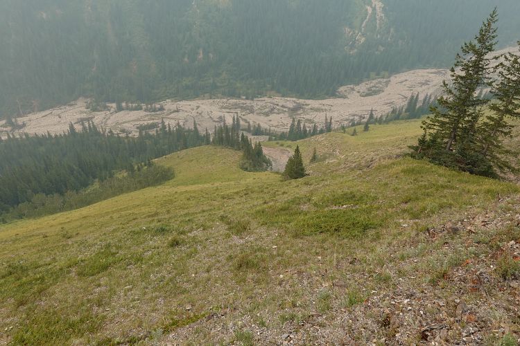
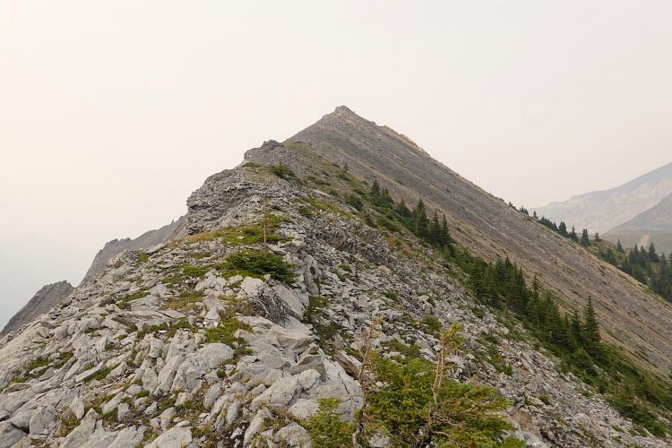
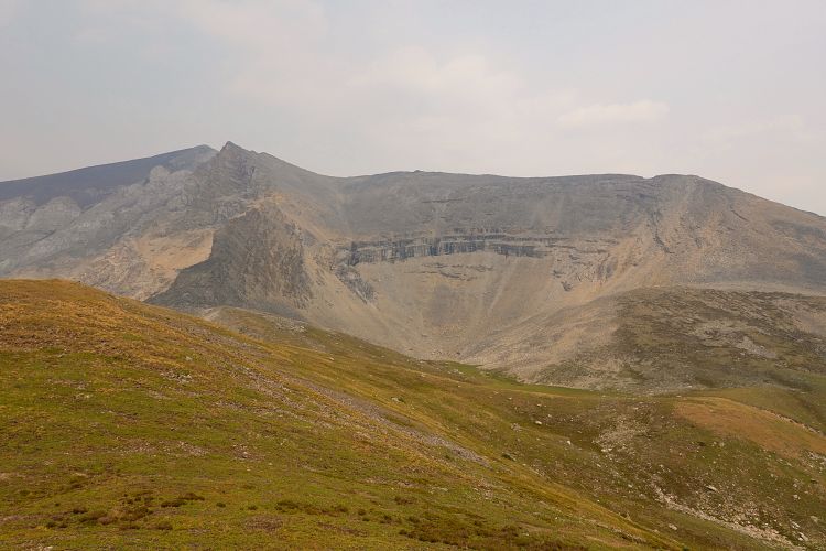
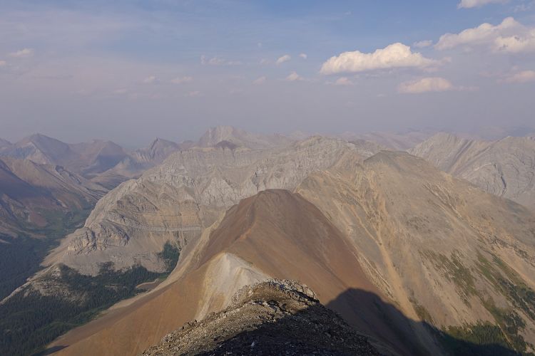
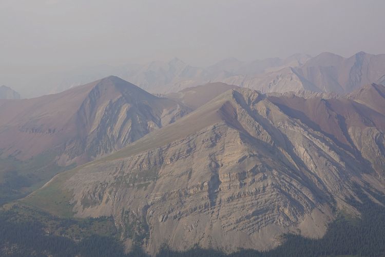
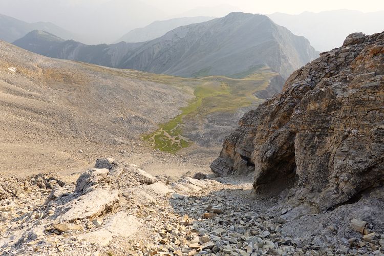
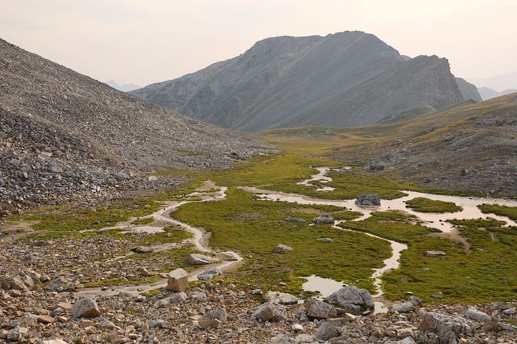
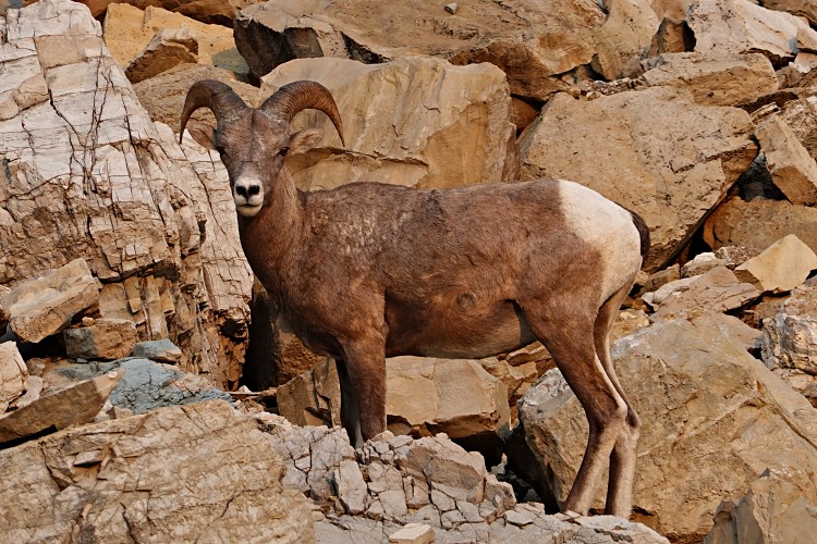
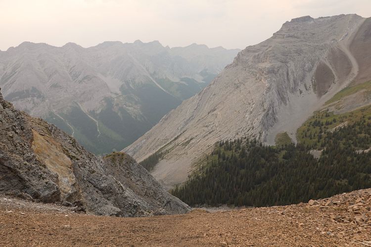
Stoney Peak has a significant outlier just southwest of it and it is the steep, open southwest slopes of this outlier that I chose as my ascent route (another 2.6 km from the above creek crossing), analogous to the route Phil and Vern had taken. It’s a steep grind that seems to never end, and I was huffing and puffing in the smoky heat, taking several breaks on the way up. The slope leads to a ridge that can then be followed north to the top of the outlier. There is some unpleasant terrain with large angular chunks of sandstone here that needs to be negotiated to get down to the wide saddle between the outlier and Stoney Peak proper, an elevation loss of about 110 m. The saddle is a lovely high alpine miniature basin with patches of green grass and a small tarn where I saw some Bighorn sheep on the way back. Very picturesque!
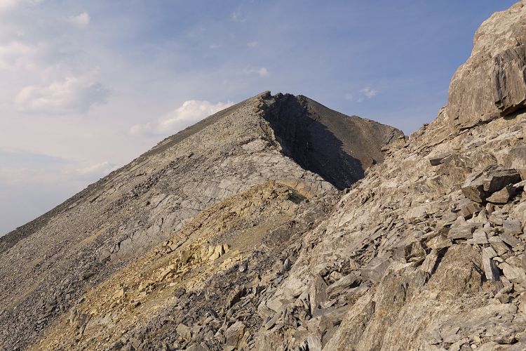
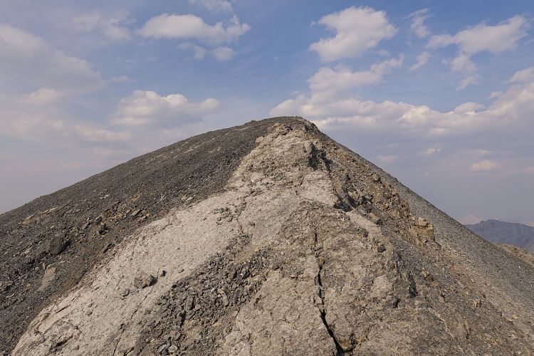
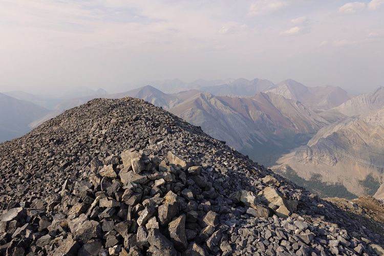
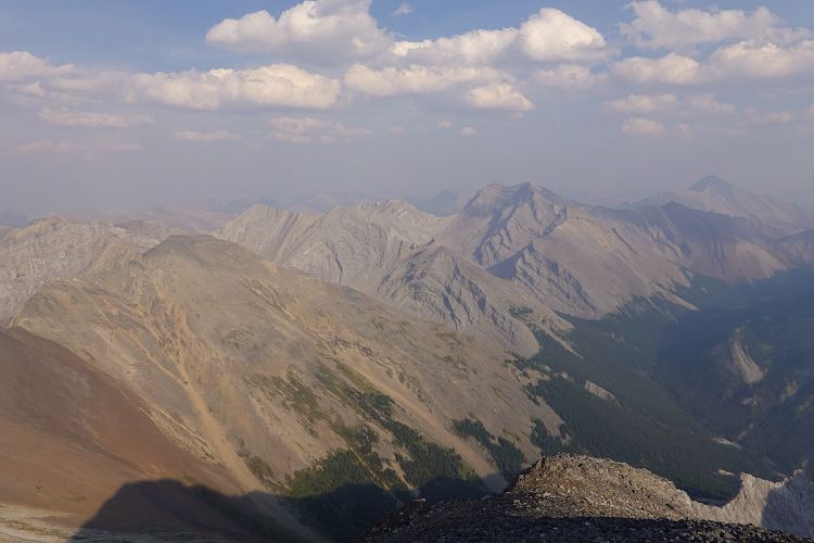
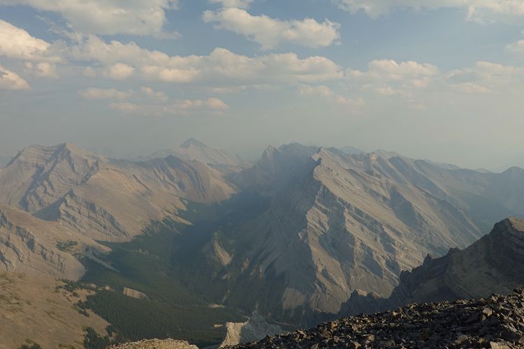
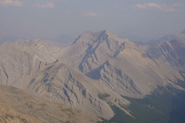
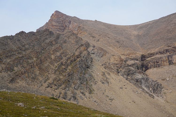
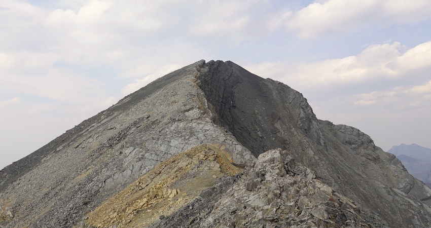
From the saddle I headed up the talus slope on climber’s right to gain the summit ridge. Once again some awkward terrain with loose choss, but technically easy. There was a small cliffband with a short downclimb (easy to moderate scrambling), but no other hurdles on the way to the summit with its huge cairn. Great views of a remote corner of the Ghost from here, including Haunted, Psychic, Revenant and Aylmer.
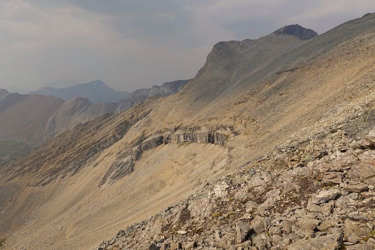
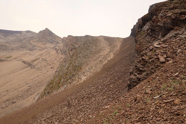
On my way back I decided to head straight down to the saddle, sticking to skier’s right to avoid some cliff bands. The terrain was still awkward and loose here in places, but less so than on my way up the talus slope and it was a bit shorter. At the saddle I then chose to descend on the north side into a side valley in an effort to avoid re-climbing the outlier. Thankfully, it turned out to be a much faster and easier route back down into the valley.
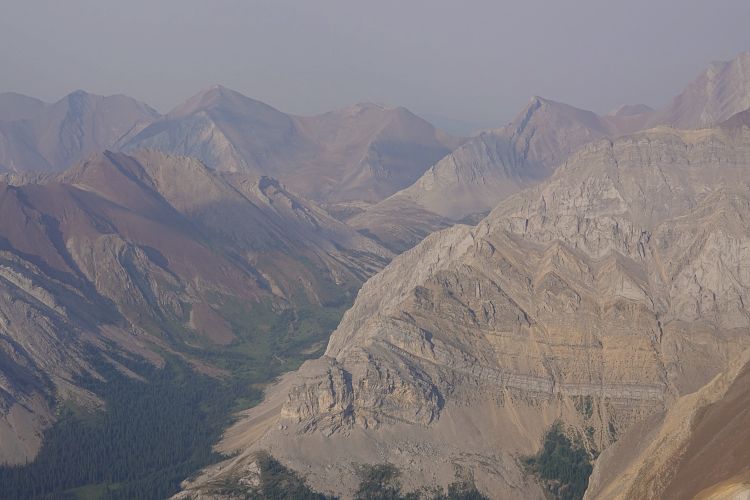
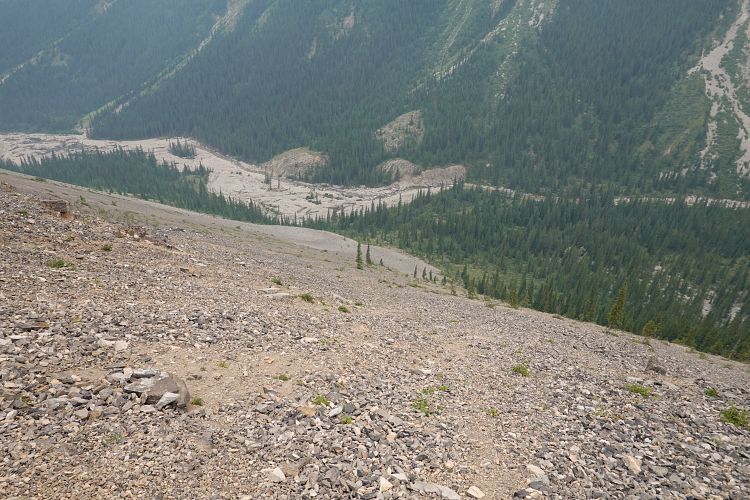
There are several obvious brown-red scree slopes that connect the saddle with this side valley on the north side. The first one that descends from the lowest point of the saddle is probably the best one to take: it’s steep in the upper part, but the scree is relatively soft. Down in the side valley, I stuck to the left side on grassy patches until the valley narrowed. Here, I circled around the left to open slopes on the northwest side of the outlier. Pleasantly soft scree allowed me to plunge-step all the way down to Stony Creek and before I knew it I was back on the trail. This would definitely be my recommended route for the descent, and probably also for the ascent if you stick a little closer to the edge of the trees to avoid the soft scree when going up.
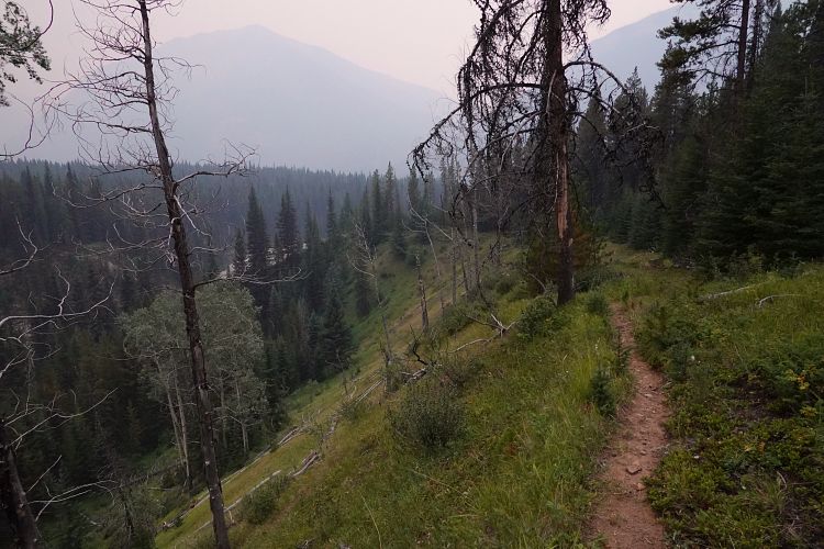
Now I had about a good hour of leisurely hiking to get back to the Cascade Fire Road, where I picked up my big pack and crossed Stony Creek on last time on the foot bridge to pick up my bike on the other side. It was already 9:30 PM and getting dark – time to put on my headlamp for a fun and fast ride back on the Cascade Fire Road.
The day concluded with an eerie experience only a few km before I reached my car. As I was whipping along the old road in the middle of the pitch black forest, I came around a corner and noticed two bright eyes staring at me in the distance. Whatever it was, it didn’t move at all even as I came closer, yelling and making lots of noises. And it was huge! I came to within about a hundred metres, stopped and pulled out my bear spray just in case. Now I could see it: a massive elk with an impressive antler! It just wouldn’t move, no matter what I did or how much I yelled. The forest was too dense to bushwhack through with my bike, so eventually I had no option but to slowly shuffle past the animal… Quite eerie to see an elk so up-close, eyes lit up and breath illuminated by my headlamp. I now realize that it was pretty risky to approach an elk so closely and the best course of action would’ve been to simply wait it out from a safe distance, even if it had taken hours. But I made it past it and with much relief eventually reached my car at 11 PM after a long and adventurous day.
|
Elevation: |
3012 m |
|
Elevation gain: |
2040 m (elevation loss: 2430 m) |
|
Time: |
14.0 h |
|
Distance: |
49.7 km (of which 15 km by bicycle) |
|
Difficulty level: |
Easy to moderate (Kane), T4 (SAC) |
|
Comments: |
Stats refer to hike from Flints Park backcountry campground to Stoney Peak summit, back to the Cascade Road, then by bike to parking near Lake Minnewanka. |
|
Reference: |
Vern & Phil plus own routefinding |
|
Personal rating: |
3 (out of 5) |
NOTE: This GPX track is for personal use only. Commercial use/re-use or publication of this track on printed or digital media including but not limited to platforms, apps and websites such as AllTrails, Gaia, and OSM, requires written permission.
DISCLAIMER: Use at your own risk for general guidance only! Do not follow this GPX track blindly but use your own judgement in assessing terrain and choosing the safest route. Please read the full disclaimer here.