Castle, AB, Canada
24 August 2019
With Trevor, Richard, Vern & Wietse
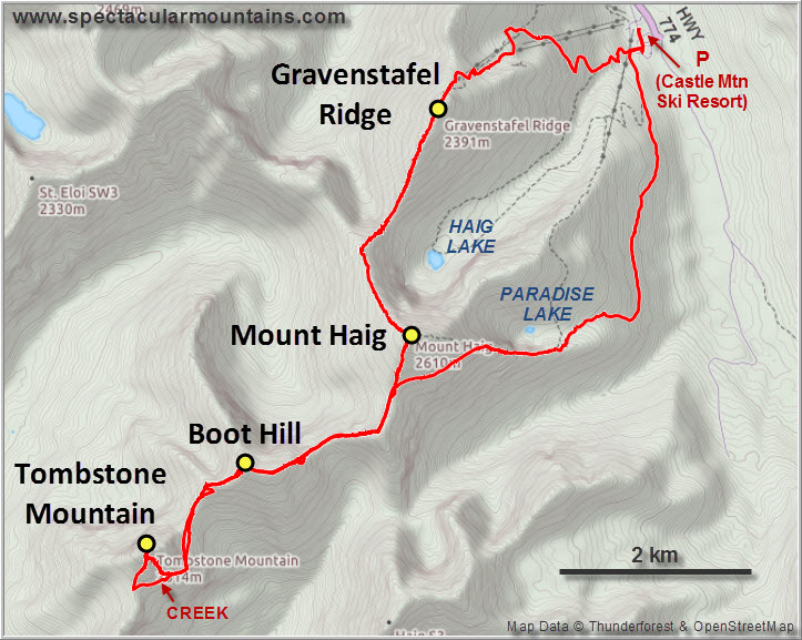
A fantastic high-level traverse across four colourful peaks of the Castle
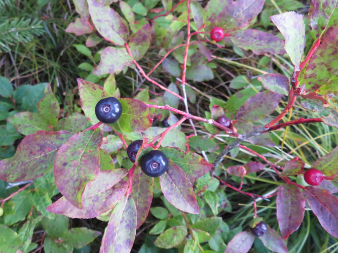
Trevor really wanted to indulge in some huckleberry picking during prime berry season this year, so he suggested scrambling Mount Haig in the Castle where, incidentally, the annual Huckleberry Festival was taking place this weekend. Richard and I were on board right away. After doing a little more research into Mount Haig I realized that it was “on the way” to Tombstone Mountain, another bigger objective that I had always kept in the back of my mind for a long, gorgeous summer day. I’m a firm believer in grabbing opportunities by the horn when they present themselves, so why not tag on Boot Hill, Tombstone Mountain and Gravestafel Ridge to make this a nice long day with a full traverse? The boys agreed and Trevor proceeded to research the route in detail, contacting both Vern and Andrew to confirm some route statistics and enlisting Vern and Wietse as new team members in the process (read Vern’s beautifully illustrated trip report here).
Trevor and I drove down to the Castle the night before and camped in my van at a nearby site, while the others met us at the trailhead in the morning. Surprisingly, the big parking lot at the Castle Ski Resort was largely empty – perhaps the chance of rain in the weather forecast was keeping people away from the festival, or more likely we were just here too damn early!
Luckily, there was no rain for us today… except until the very end. The traverse was much more straightforward than I had expected and simply a delight, especially with such great company. I rarely hike with more than two people, normally preferring the seclusion and simplicity of hiking in a small group, but today worked out perfectly with a great mix of entertaining conversations, joint routefinding, and quiet trudging up steep ridges.
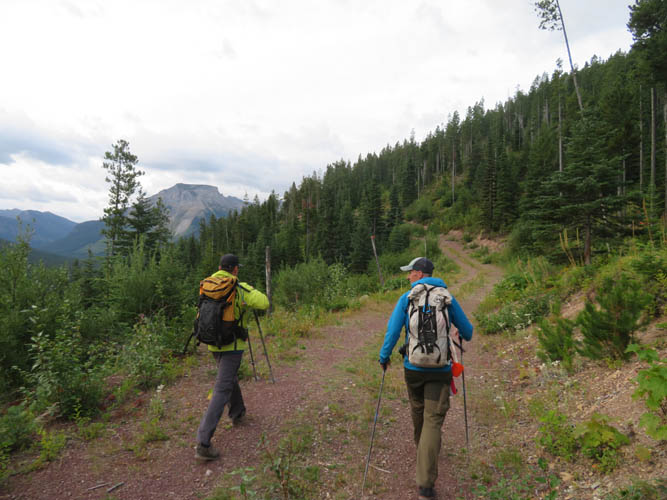
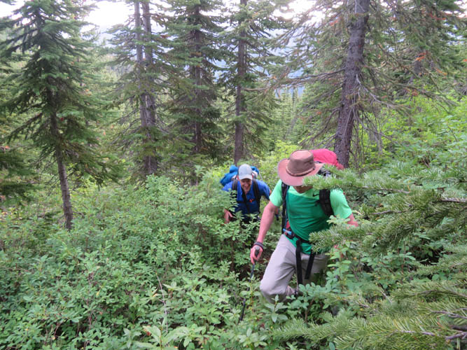
The Paradise Lake Trail is a great alternative for the initial approach to Mount Haig. We first followed a dirt road and then a good trail through the forest that goes around the east side of Haig’s NE ridge, then heads up the mountain’s east ridge. There was a short section of bushwhacking where we had temporarily lost the main trail (we should’ve kept further to the right), but it wasn’t too bad and as a bonus we ran into a ton of luscious huckleberry bushes! In any case, this initial approach avoids some of the additional elevation gain and loss on the normal route up the NE ridge.
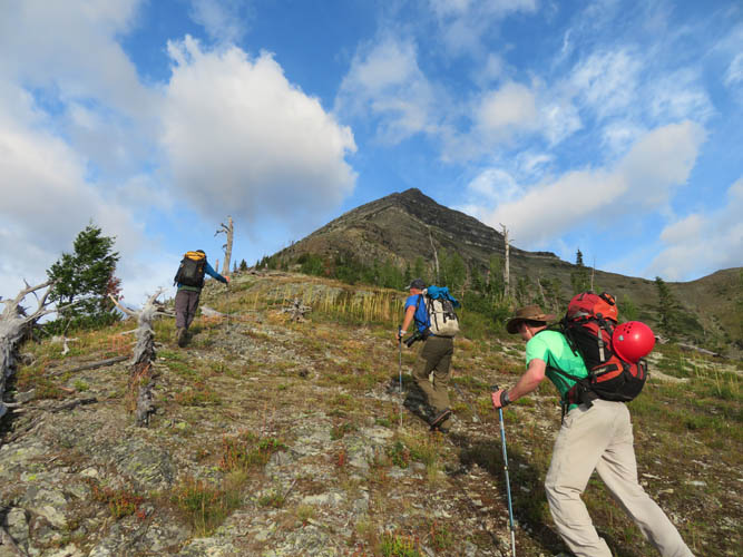
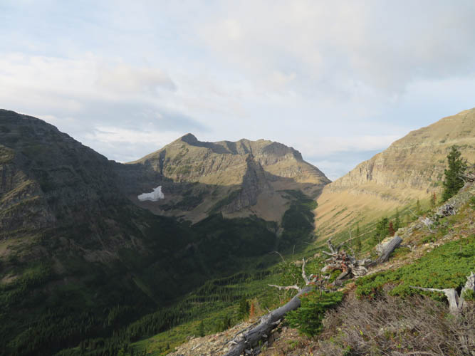
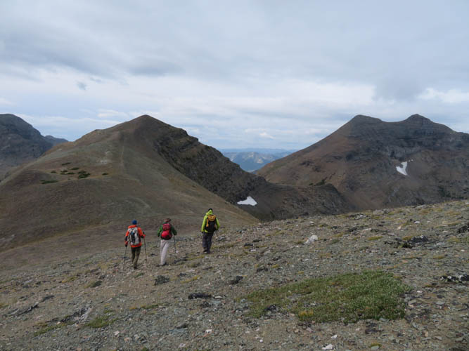
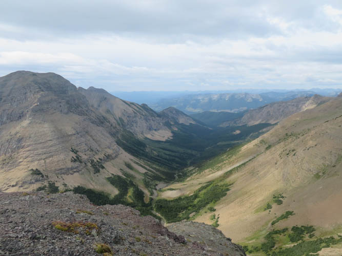
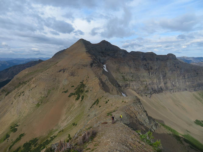
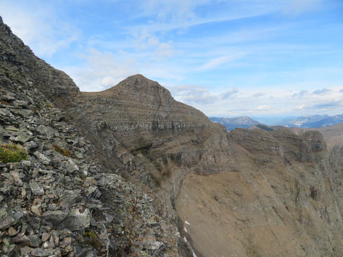
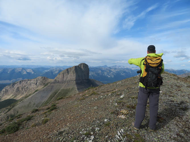
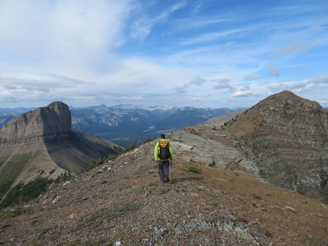
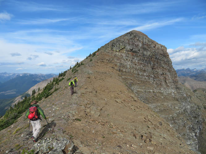
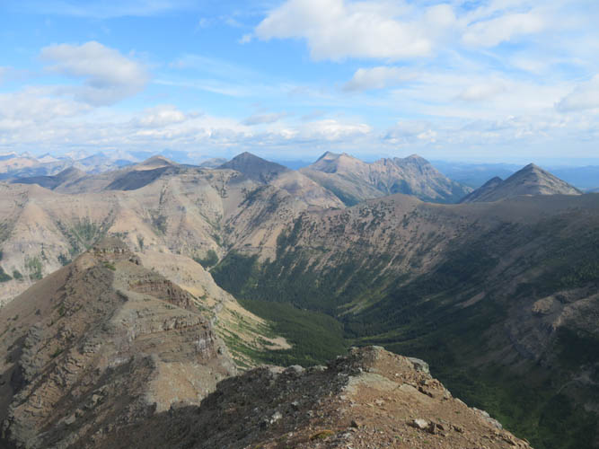
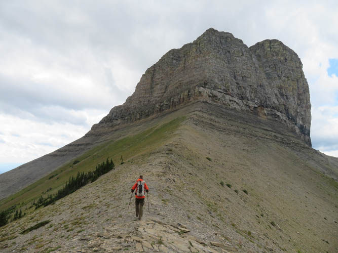
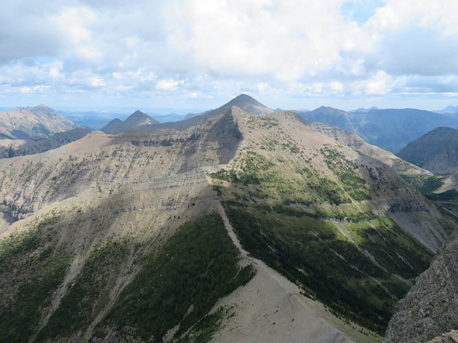
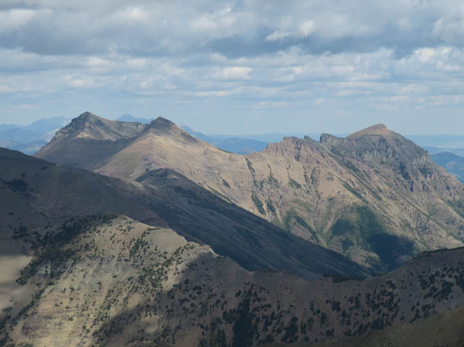
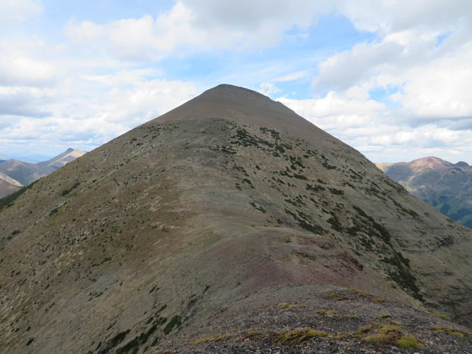
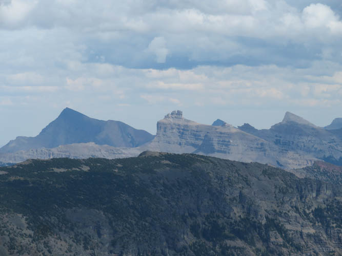
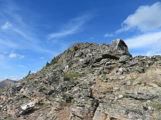
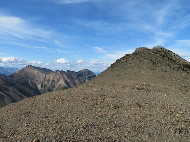
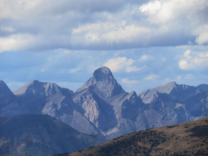
Vern had climbed Mount Haig before (which mountain hasn’t he done!?) and had previously attempted Tombstone Mountain, so he knew the terrain well and picked exactly the best point for us to start traversing around Haig’s south side to get to the saddle between Haig and the unnamed bump to the south. From the bump the ridge heads west to Boot Hill, involving significant elevation loss and regain. We all really enjoyed this part; it’s mostly pleasant hiking with bits of easy to moderate scrambling and very little in terms of exposure. The views of Boot Hill were impressive throughout, topped only by the imposing Tombstone Mountain itself that eventually appeared behind the ridge. What a beautiful sight!
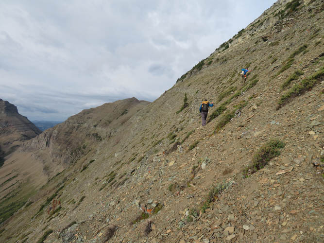
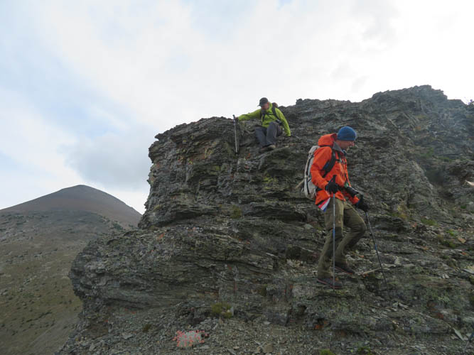
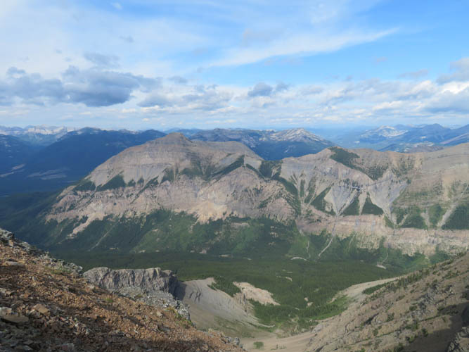
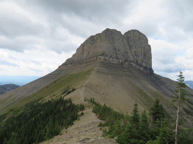
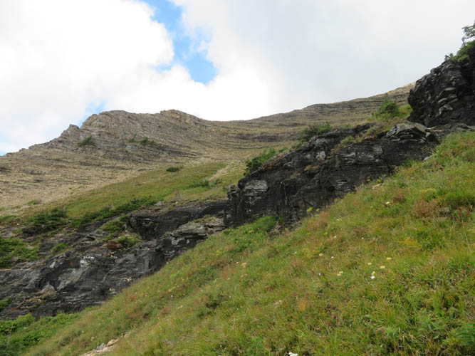
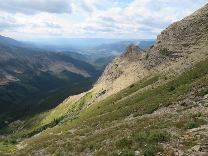
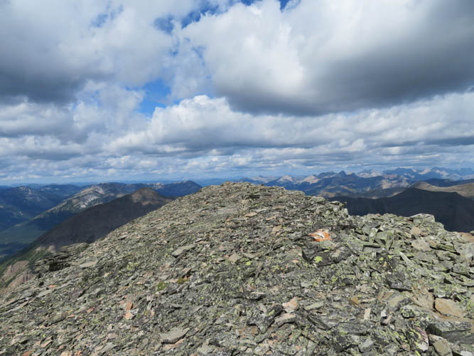
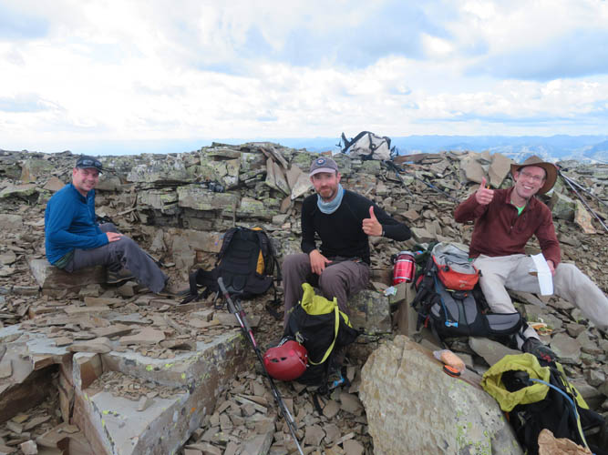
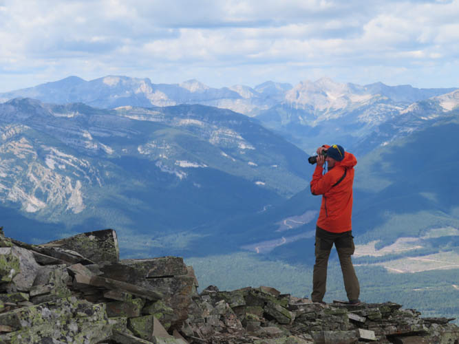
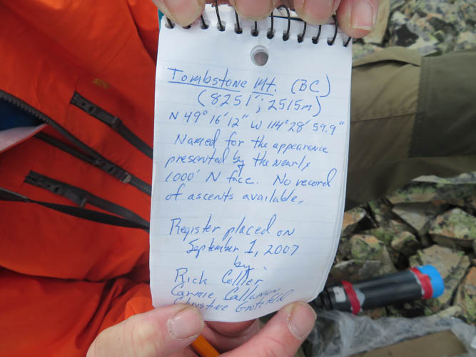
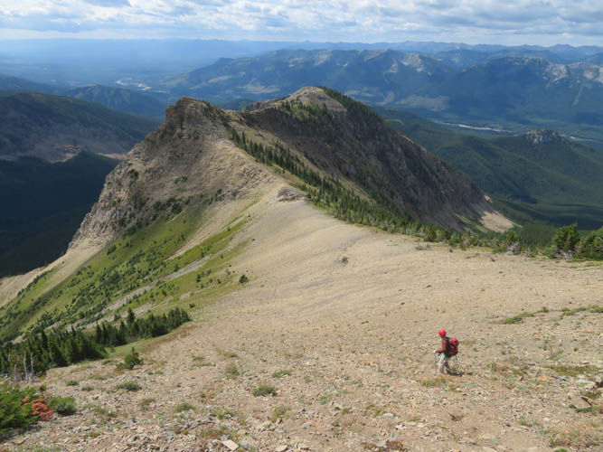
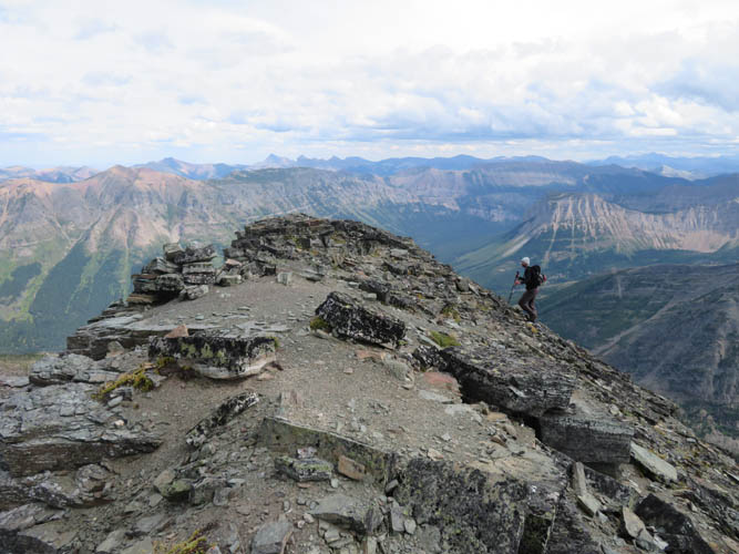
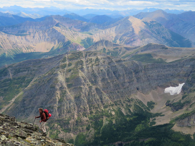
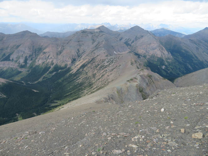
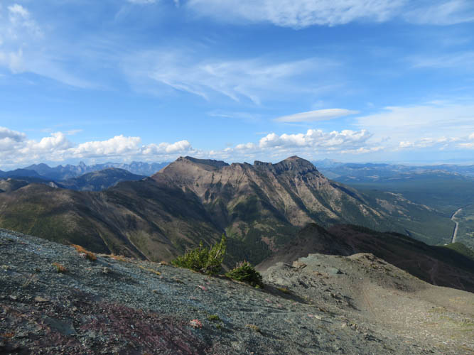
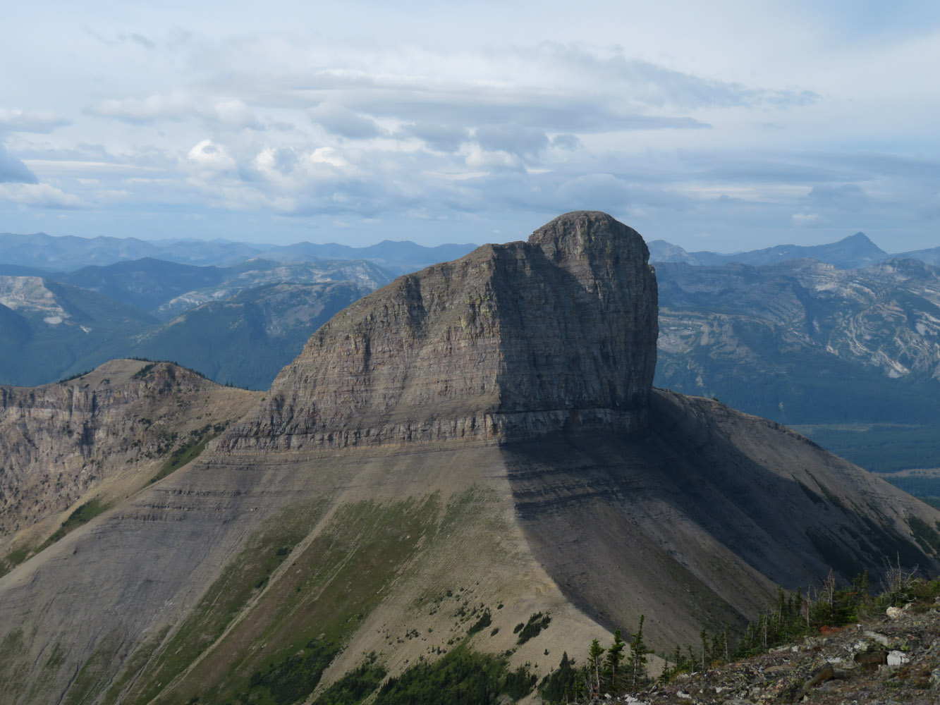
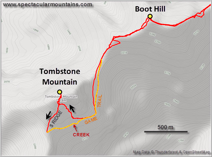
After an easy descent from Boot Hill we contoured around the east and southeast side of Tombstone on scree, later stumbling upon a good game trail. As Nugara accurately describes, there’s a fairly easy ascent line up the southeast slopes of Tombstone with only a few minor cliffbands in the way that can all be easily scrambled (the lowermost one in the trees probably being one of the slightly more challenging ones). About five hours after setting off from the parking lot our group made it to the summit of Tombstone Mountain for a well-deserved lunchbreak while taking in beautiful views of the many colourful peaks and ridges around us. The register, originally placed by Rick Collier in 2007, has seen an increasing number of ascents after Andrew Nugara published the route in his More Scrambles book. Still, we counted no more than one or two entries in any given year, so it’s not exactly a popular destination as the long approach and many ups and downs along the ridge probably keep the masses away.
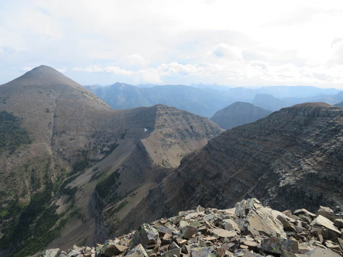
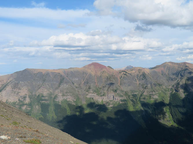
It’s a shame, because this area is truly one of the most charming and scenic I’ve experienced in the Rockies. Very different from the steep, grey limestone towers of other regions to the north, perhaps with less grandeur but somehow warmer and more inviting. Upon descending Tombstone, Richard and I chose a slightly different (and easier) line down the south ridge, which avoids any of the cliffs altogether. We made a sharp left turn onto a good game trail that contours around the south and southeast side, eventually connecting up with the same game trail of our original ascent route. Despite our legs getting progressively heavier on all the ups and downs during the hike back, we didn’t mind and truly enjoyed every part of the traverse again.
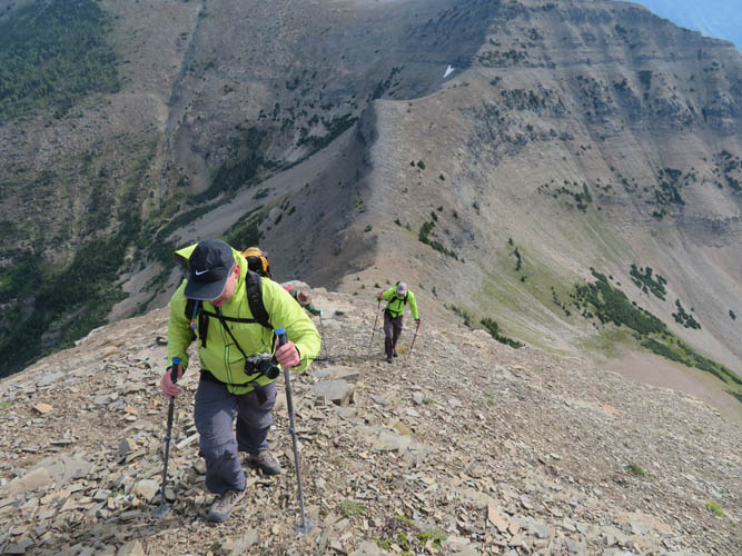
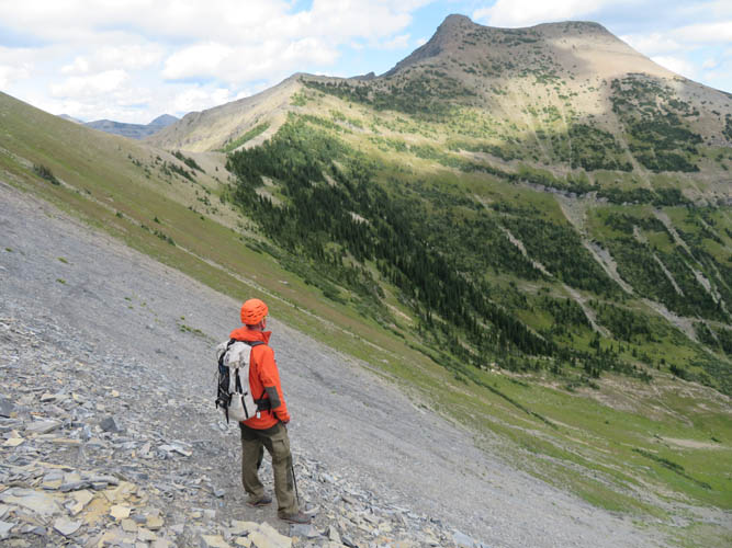
At the saddle before Mount Haig it was time to say good-bye to Vern and Wietse, who had done Haig and Gravenstafel before and headed back the same way to Paradise Lake Trail. Trevor, Richard and I took a short break, wolfed down some energy bars, and got ready to tackle our penultimate objective for the day. Mount Haig is no more than a simple trudge on a talus-covered slope, but of course by now our legs were really feeling it… Clouds were moving in from the west and the skies were getting hazy, so after a short and windy summit stay we decided to keep on moving.
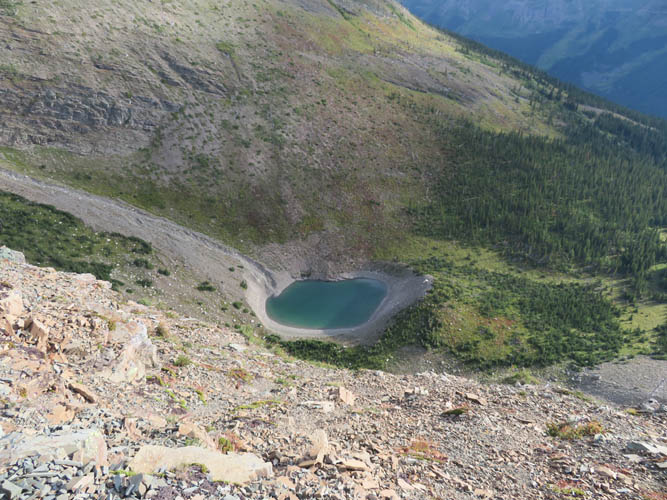
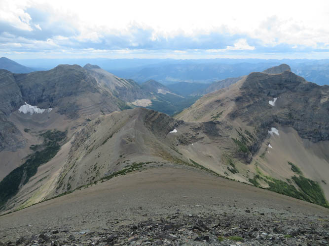
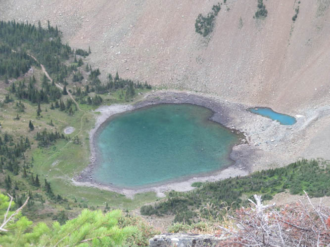
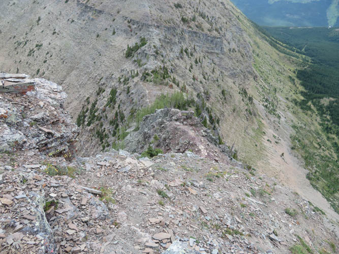
Coming down Haig’s north ridge was pleasantly fast and efficient on stretches of soft scree, especially in the upper part. With nice views of Haig Lake below us we started the descent towards the col before Gravenstafel Ridge. This was probably the most demanding scrambling we had to do all day, but still no more than moderate in difficulty. It just took a bit of time to navigate the interesting microterrain, overall a really fun scramble. The hike up to Gravenstafel Ridge summit was pretty easy but we were of course not the fastest at this point… the cumulative elevation gain of about 2700 m was certainly having an effect!
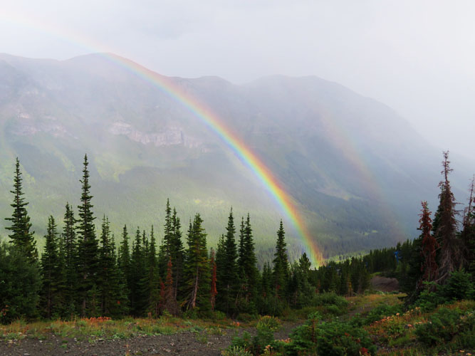
Ski runs and maintenance roads criss-cross the northeastern slopes of Grafenstafel Ridge leading down to the Castle Ski Resort. Not exactly very pretty, but we certainly didn’t mind having a choice of trails that conveniently led us straight back to the parking lot. We were almost back when the grey sky decided to give us a farewell rain shower, but it also brought out a beautiful rainbow, one of the most vibrant I’ve ever seen in the mountains.
For a long, beautiful day in the mountains the Tombstone Traverse is hard to beat. Absolutely amazing landscapes and highly recommended on a sunny day!
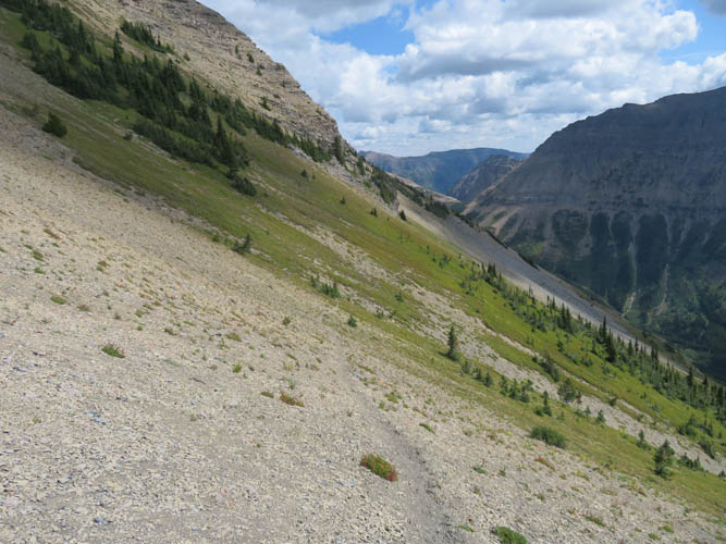
Note: We found a small creek on Tombstone’s southeast side during our return along the game trail originating from Tombstone’s south ridge (see second map). This could be a potential water source although I’m not sure if the creek would still be flowing during a particularly hot and dry summer.
|
Elevation: |
Boot Hill: 2498 m (my GPS) |
|
|
Tombstone Mountain: 2514 m (official), 2510 m (my GPS) |
|
|
Mount Haig: 2610 m (official), 2599 m (my GPS) |
|
|
Gravenstafel Ridge: 2383 m (my GPS) |
|
Elevation gain: |
2750 m |
|
Time: |
12 h |
|
Distance: |
23.5 km |
|
Difficulty level: |
Moderate (Kane), T4 (SAC); Easy / T3 for Mount Haig |
|
Reference: |
Nugara |
|
Personal rating: |
5 (out of 5) for Boot and Tombstone, 4 (out of 5) for Haig, 3 (out of 5) for Gravenstafel |
NOTE: This GPX track is for personal use only. Commercial use/re-use or publication of this track on printed or digital media including but not limited to platforms, apps and websites such as AllTrails, Gaia, and OSM, requires written permission.
DISCLAIMER: Use at your own risk for general guidance only! Do not follow this GPX track blindly but use your own judgement in assessing terrain and choosing the safest route. Please read the full disclaimer here.