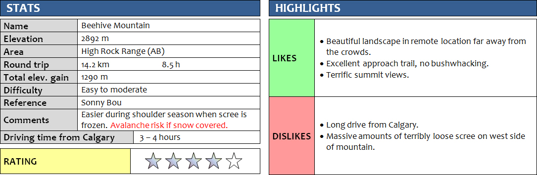
31 July 2017
With Wen
Beehive Mountain was a brilliant outing in one of the more remote parts of the Alberta Rockies, but the huge amounts of terribly loose scree on the west slopes were painful. After an easygoing day hike on Hailstone Butte and Sentinel Peak yesterday, we decided to camp at the end of the Oldman River road – or at least as far as our Honda CR-V could take us – to get an early start for our trip up Beehive Mountain. There was a washout in the road about 2 km from the trail head and we barely managed to squeeze through here. Past the washout, all traffic ceased and we had the area to ourselves.
There are a number of really nice and flat grassy spots to put up a tent at the end of the driveable road (the bridge across Slacker Creek is broken). It was a beautiful and peaceful place to spend the night. However, to say we were all alone is not quite true… dozens of curious cows were grazing nearby as we set up camp and prepared our dinner! There was some occasional loud mooing, otherwise we were left undisturbed…
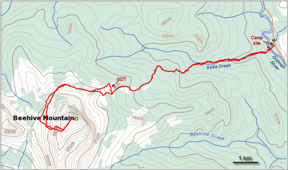
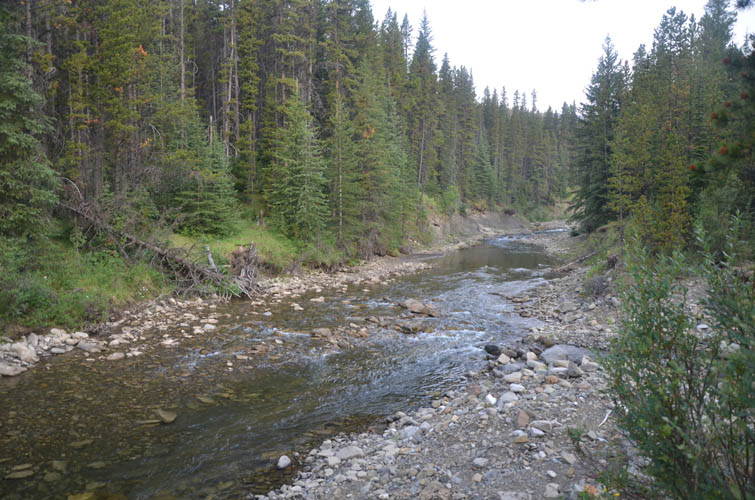
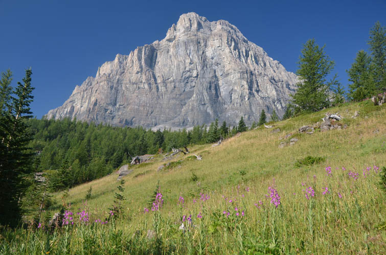
Following Sonny Bou’s excellent description of his scouting missions to Beehive Mountain, we crossed the Oldman River and found the very good access trail right across from our unofficial camp site. The river crossing was short and shallow, but cold enough to give us a good jolt in the morning! The trail on the other side runs along the north side of Soda Creek for the first part and is marked on trees with white paint. It was in surprisingly good shape! After about 2 hours of leisurely hiking and steadily gaining elevation, we left the forest and reached the intersection with the Great Divide Trail (GDT) that runs north-south here, parallel to the mountain chains. We turned right and followed it for a few hundred metres, then turned left up an open shoulder directly towards Beehive Mountain. The views of the sheer cliff on the mountain’s eastern side were simply awe-inspiring!
There is a fairly good trail that has formed in the scree around the north side of Beehive – easy to follow and even a few cairns here and there. We came around the back side with Mount Lyall now in plain view, and a broad grassy valley opened up where dozens of elk were grazing. What a beautiful sight!
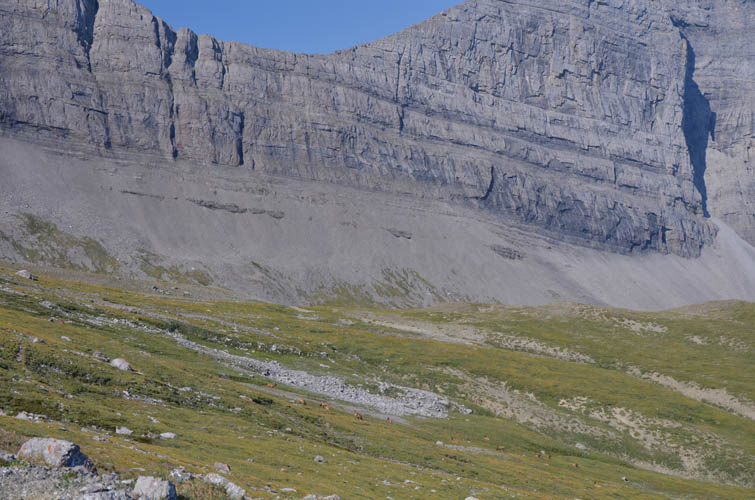
We continued to contour around the mountain to its western slopes. Now the trail had fizzled out and we were left to trudge through piles of rubble as we slowly gained elevation during our traverse. In retrospect, it would’ve been easier and less annoying to stay lower in the grassy slopes even in spite of a minor elevation loss required (which is what we did on the way back).
The vertical cliffs that almost entirely surround the mountain give way to scree-covered slopes and ramps on the west side, which offers an obvious route up to the summit ridge. There was some minor scrambling at the beginning, and Wen certainly had her fair share of fun here! If you’re not used to this kind of terrain it can truly be frustrating: an abundance of loose rubble covers the slopes and is strewn across every solid rock ledge and rib that might possibly give you some solid footing. As a result, it’s tedious treadmill grovelling all the way up to the summit ridge, the “three steps forward, two steps backward” kind of style. We both agreed that it was some of the most horrible scree we’ve ever encountered, and to make matters worse it wasn’t even good for scree-skiing down later on. I could imagine that during fall or early winter it would be significantly easier to go up these slopes – as Sonny Bou did on his second and successful trip – since much of the scree might be frozen or buried underneath a layer of snow then (but too much snow can result in dangerous avalanche conditions!). After what felt like an eternity, we eventually managed to stumble our way up to a broad ridge, which easily led to the summit in another half an hour.
We were rewarded with absolutely magnificent views of this remote corner of the High Rock Range. Peaks to the west, north and south as far as the eye can see, and swathes of forest, rolling hills and front range ridges to the east. This place is far from the crowds and there is definitely a sense of isolation when you stand on the summit! Only about a handful of visits were recorded in the glass jar register, which is somewhat surprising given the excellent access trails.
Despite the annoying piles of talus on Beehive’s west side, going down was considerably easier and we were back down on the trail in no time. We were a bit worried about potential afternoon rain showers affecting that road washout, but thankfully the dark clouds stayed away and we enjoyed a sunny hike until the end. Beehive Mountain was both frustrating and fantastic at the same time. Despite the long drive in and terribly loose scree, it’s the incredibly beautiful and pristine landscape that make it worth the effort.
DISCLAIMER: Use at your own risk for general guidance only! Do not follow this GPX track blindly but use your own judgement in assessing terrain and choosing the safest route.
The Oldman River – we had to take off our boots and wade it to get across, but it wasn’t very deep.
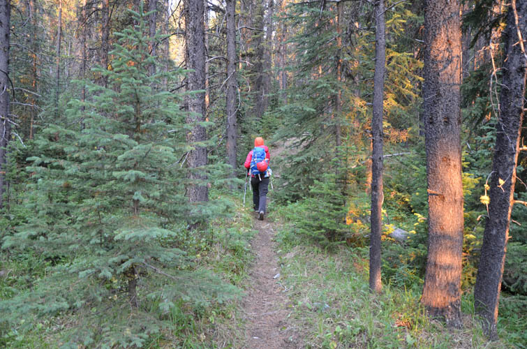
Following a good trail along Soda Creek.
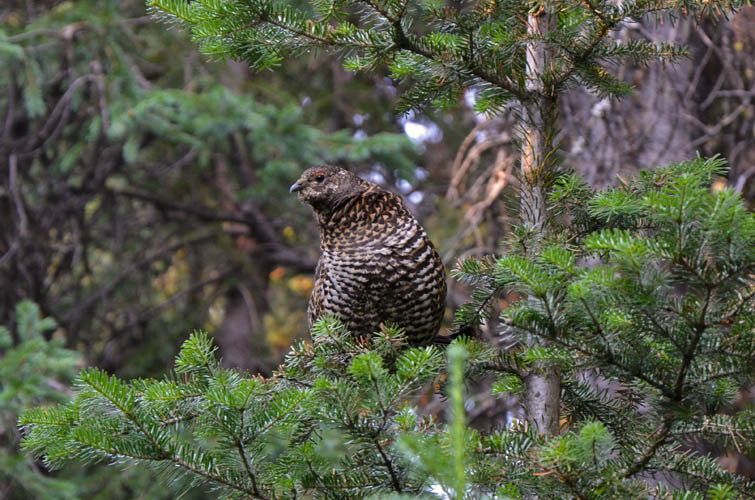
A mother ptarmigan.
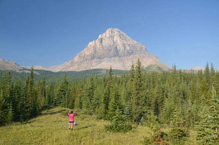
As the trail emerges from the forest, we enjoy this fantastic view of Beehive Mountain.
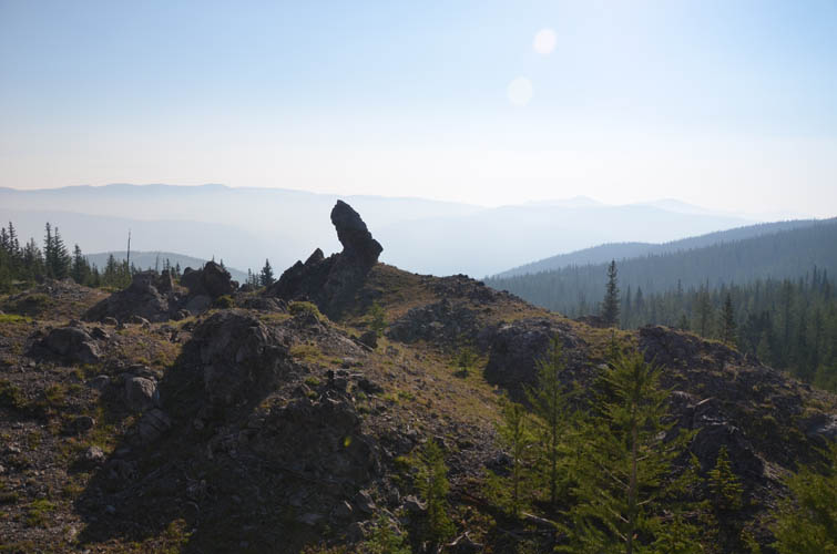
Curious rock features along the way.
The east face of Beehive is one huge precipice.
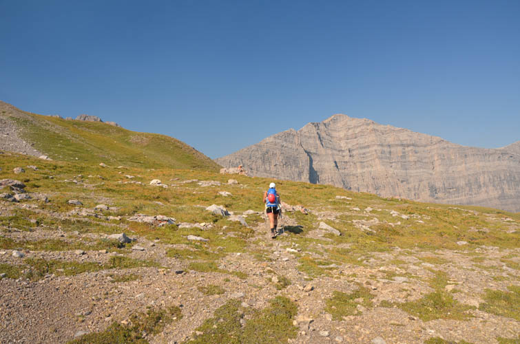
A faint trail goes around the north side of Beehive.
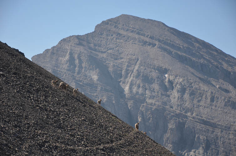
A herd of elk in the small valley NW of Beehive.

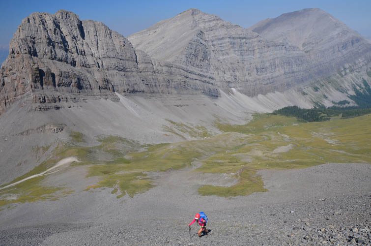
Crossing this scree slope wasn’t fun… better to stay in the grass below and contour around.
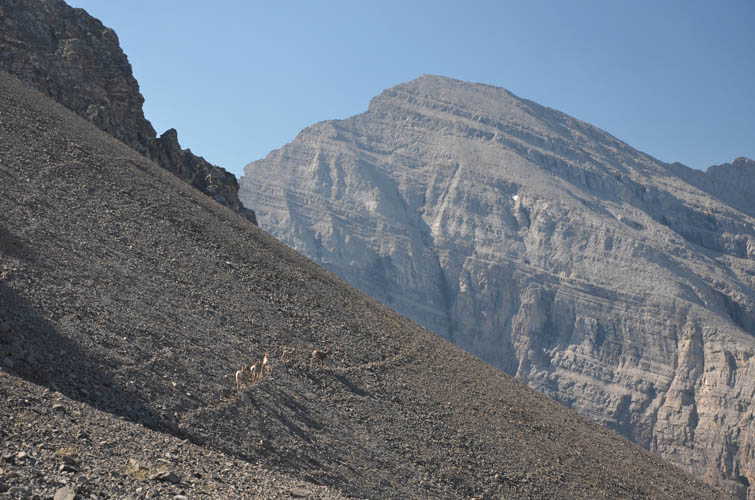
Thankfully, goats had trampled the rubble into a faint trail here and there.
An impressive looking mountain, but unnamed I think.
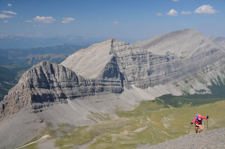
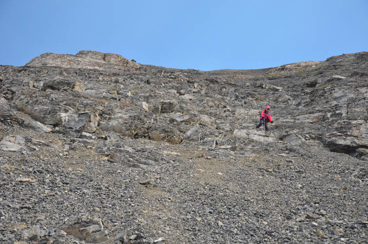
Grunting up treadmill scree on Beehive’s west slopes. Behind are Mount Lyall (right) and two unnamed peaks.
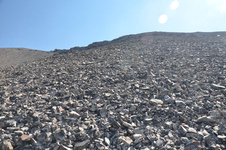
This is terrible stuff!!
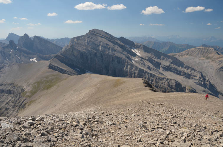
The entire west slope seems to consist of extremely loose talus, ready to slide at the touch of a toe…
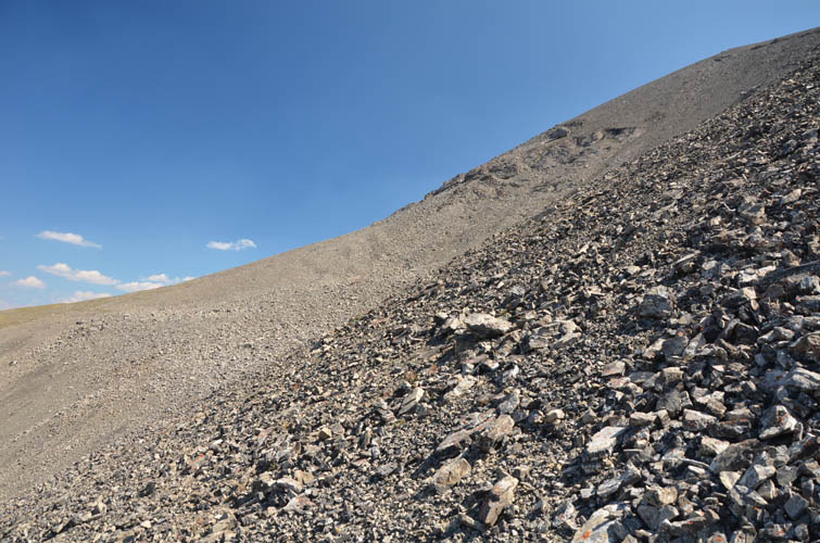
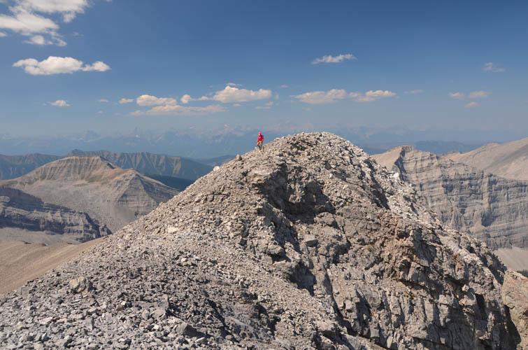
Final steps to the summit ridge… the scree is behind us at last!
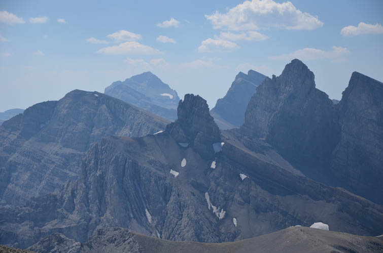
Gorgeous views of “The Elevators” to the south. Tornado Mountain is the high peak in the distance on the left.
Looking west: lots of unnamed peaks and ridges.

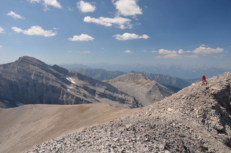
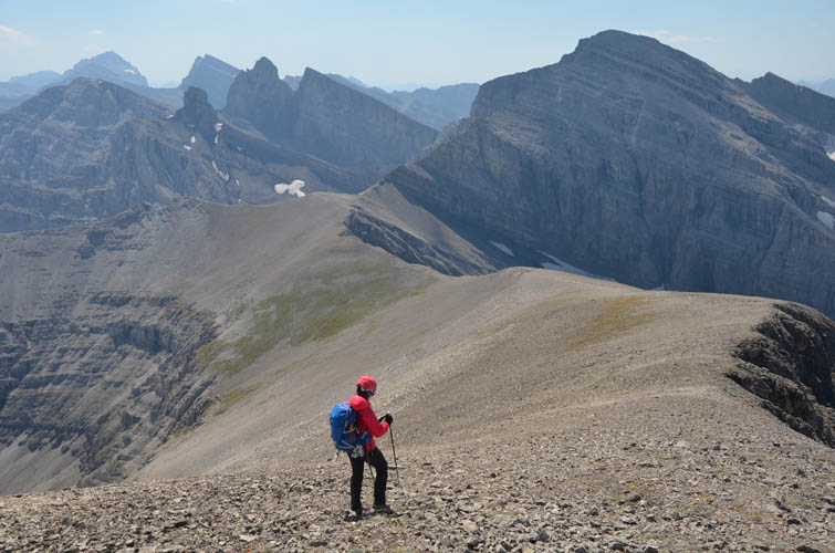
Now the rest is easy! The summit is a short hike away.
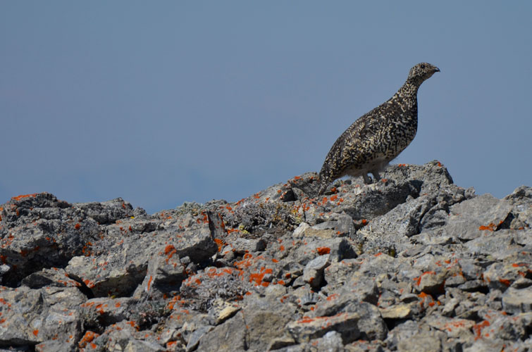
Surprisingly, even up here there are ptarmigans hanging out!
Fantastic views!
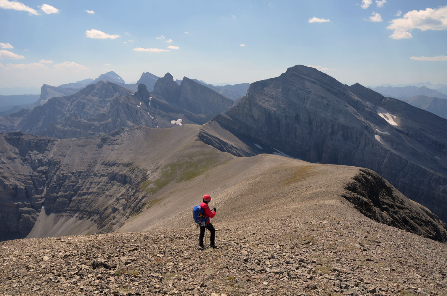
Wen coming off the western bump of Beehive’s double summit. The eastern one (where this picture is taken from) is slightly higher according to my GPS readings.
We had gained the main ridge just left of the small, grassy patch.
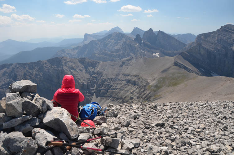
Enjoying beautiful views to the south from the summit.
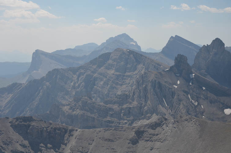
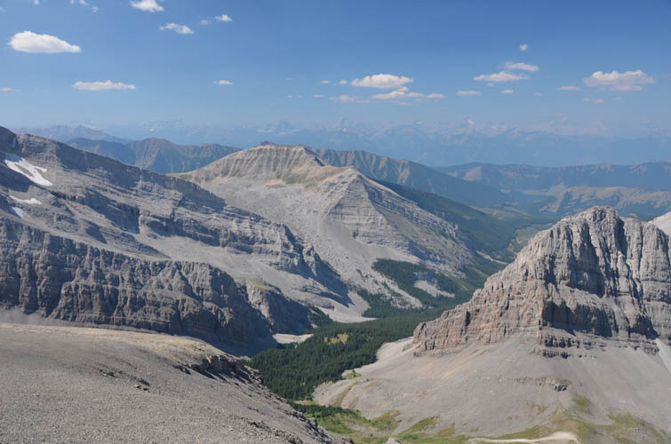
Close-up of the High Rock range to the south of Beehive Mountain, with Tornado Mountain at the centre back. Lots of scrambling potential in this range!
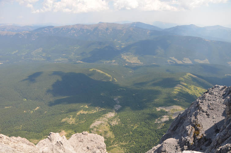
Wide open views over the front ranges and foot hills to the east.
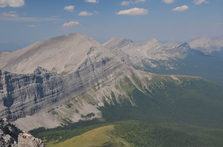
An endless wave of peaks and saddles forms the continuation of the High Rock Range to the north. Mount Lyall on far left.
Hiking back down the summit ridge.
There are a few rock steps and ribs to scramble down in the lower part of the west slope (probably of moderate difficulty, but easier options may exist). It’s a lot steeper than it looks in this photo.
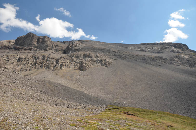
A look at the break in the cliff on the western side where all that rubble spills onto the lower slopes. We went through the cliffs just right of centre.
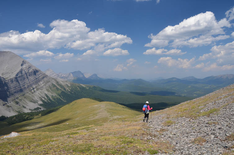
Is there a better way to spend a wonderful summer afternoon than hiking down this beautiful meadow?