Highwood, AB, Canada
9 August 2019
Solo
More than I asked for… once again
My legs were still sore from the long trip the day before when I spent more than 12 hours going up and down Mount Farquhar on the Continental Divide. I had slept in my campervan right at the trailhead, glad not having to drive back to Calgary after such a strenuous and exhausting day.
The weather wasn’t nearly as nice today – cloudy with a chance of thunderstorms in the afternoon – but not bad enough to dissuade me from attempting my second objective, Highwood Peak. According to K-Country guidebook author Gillean Daffern, famous local climber Don Forest scaled this peak in 1996 together with Lyn Michaud and supposedly left behind a small film container with a note naming the peak “Mount Peggy” after his wife. I’m not sure how the name Highwood Peak came about. It’s named so on Google Maps and the only two trip reports I could find online also refer to Highwood Peak as their destination. The first by Andrew Nugara, who in 2007 approached the summit from the west ridge but got stopped by steep cliffs; the second by the Rocky Mountain Ramblers, who came up the valley to the SW of the summit in 2010. Out of their party of five, two successfully reached the summit via a short stretch along the west ridge, described as a “difficult climber’s scramble”.
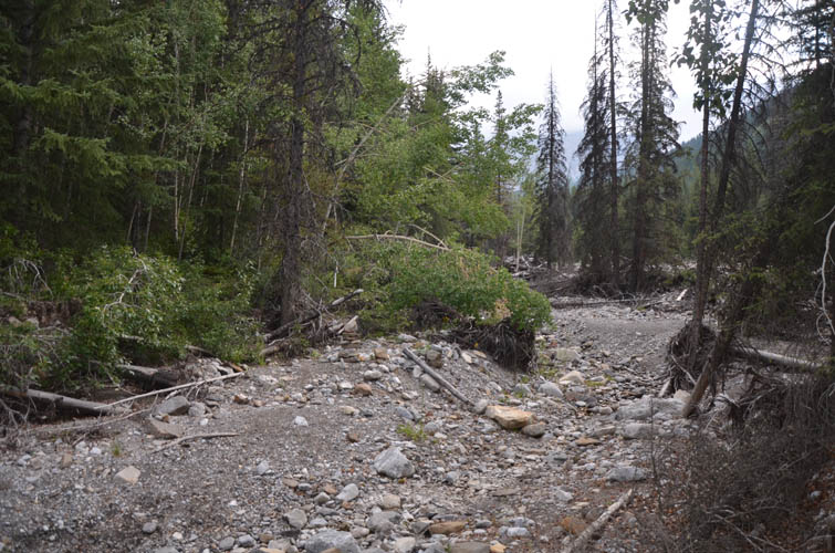
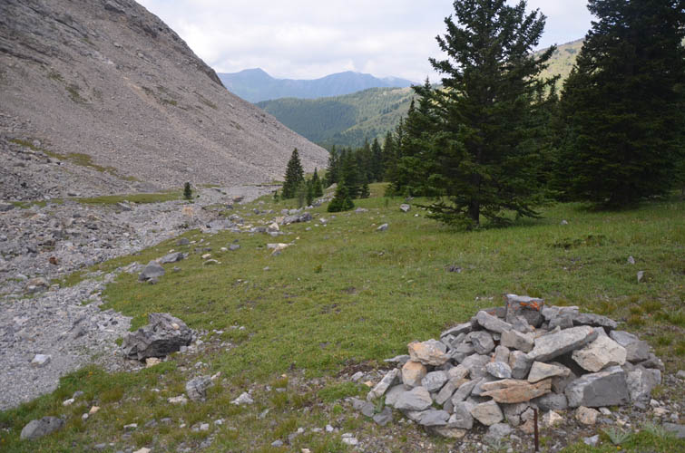
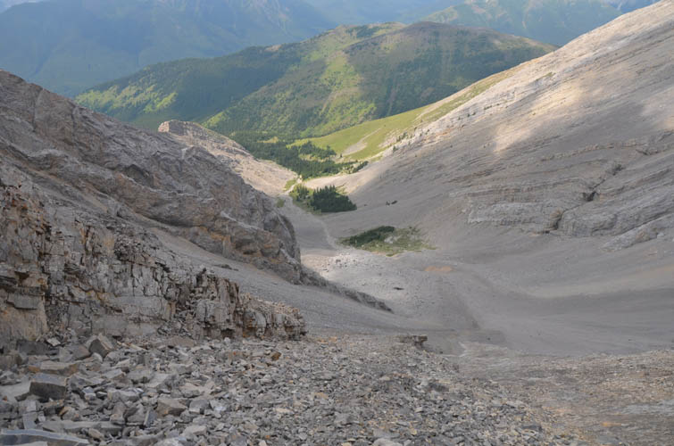
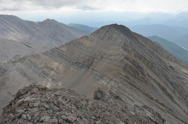
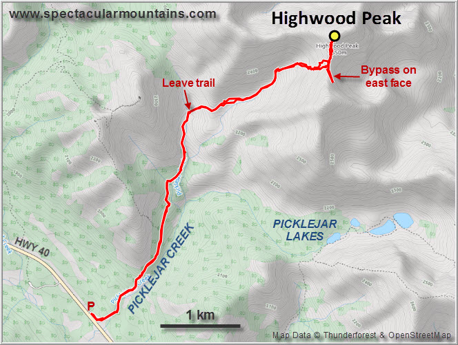
The approach to Highwood Peak is, in my opinion, simple, elegant and very enjoyable. There is a very good trail along the west side of Picklejar Creek that first passes debris from the 2013 floods (cairned), then steadily gains elevation in the woods until it emerges near a trail junction with the right turn-off heading to Picklejar Lakes. I kept going straight past this junction for another 400 m, where open meadows invited me to head up a shoulder and into the SW valley of Highwood Peak. This is a charming little valley with patches of green grass, small stands of pine trees, and a big cirque with an impressive wall of light grey rock slabs straight ahead.
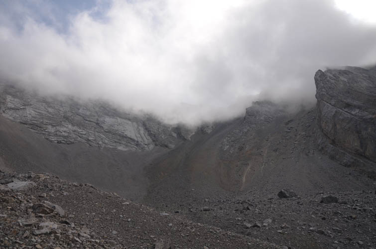
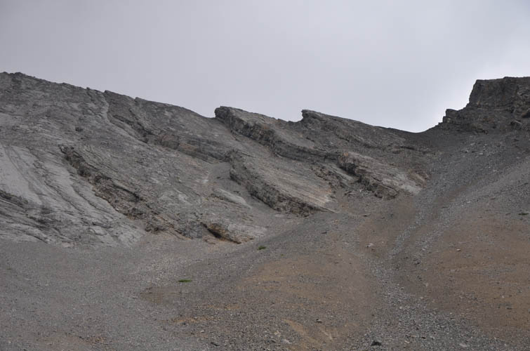
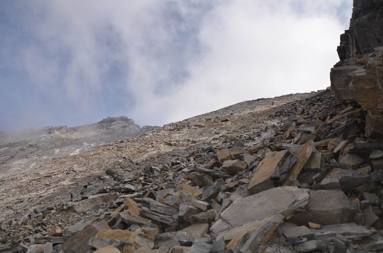
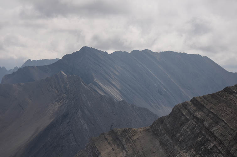
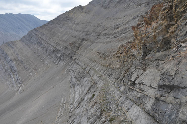
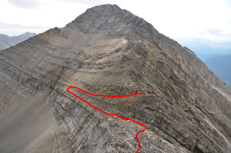
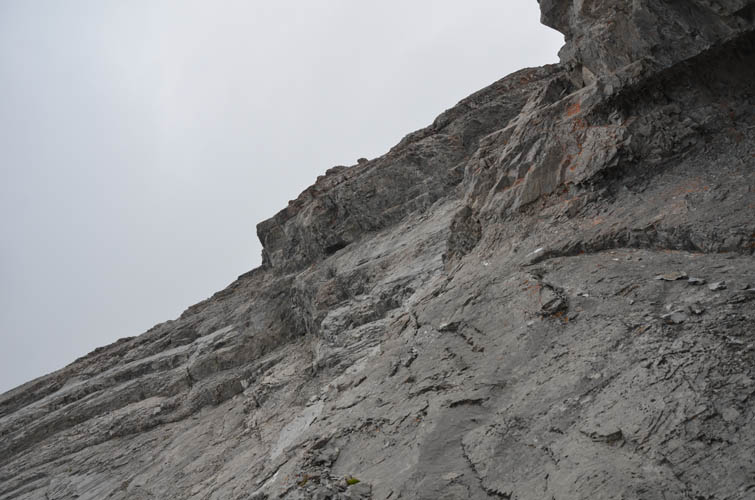
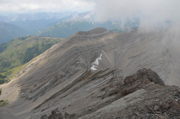
Lacking any detailed route information, I decided to head up a scree slope slightly to the right of the summit, which was still shrouded in the clouds this morning. Both the west and the south ridge of Highwood Peak are characterized by jagged notches and drop-offs, a result of tilted strata dipping mostly to the southwest. The scree wasn’t too bad to ascend and I found more solid footing on a rock rib higher up, leading me straight to a small saddle along Highwood Peak’s south ridge. From here I finally had a good view of the summit mass directly to the north, which was only a few hundred metres away.
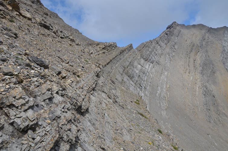
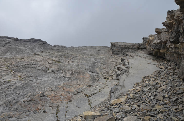
This is where my trip almost ended. Only metres away from me, a steep vertical drop-off blocked my route – it was only 4 or 5 metres high and probably no more than a 5.4 downclimb, but the rock looked crumbly and a slip would’ve resulted in a fall hundreds of metres down the east side. Hmm… definitely not something I felt comfortable with, especially going solo and without ropes. Well, it was either going back home, or… yes, there was perhaps a chance I could circumvent this drop by following goat tracks on a narrow ledge along the east face towards the south, crossing down a level to the ledge below via scree, then slogging back up on the bed below me only to emerge below and north of the cliff that had hampered my progress. Given that I had no idea if this was going to work out, it was a rather apprehensive affair of tiptoeing in very exposed terrain with massive cliffbands below me, requiring my fullest concentration. Although this bypass was cumbersome and not very elegant, it worked.
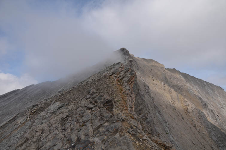
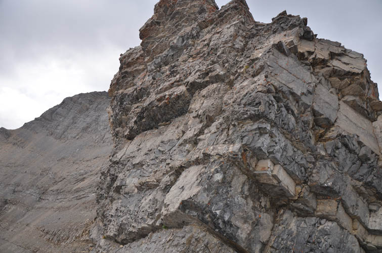
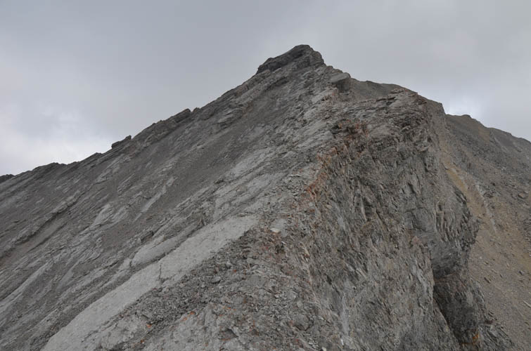
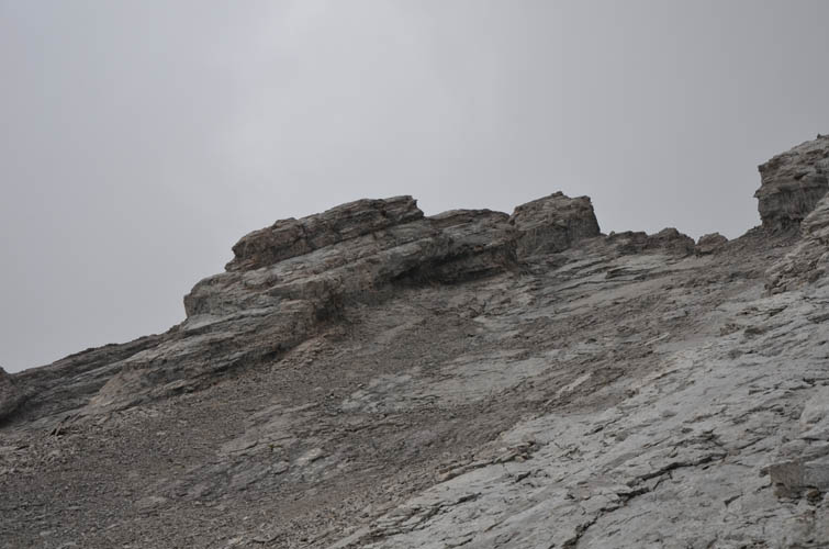
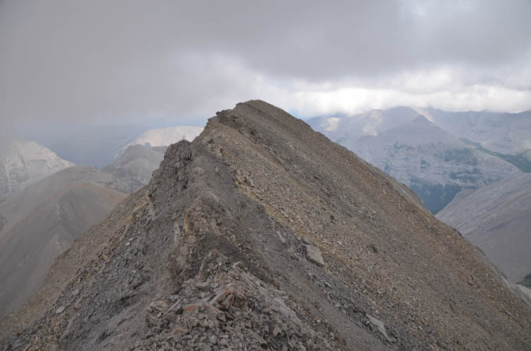
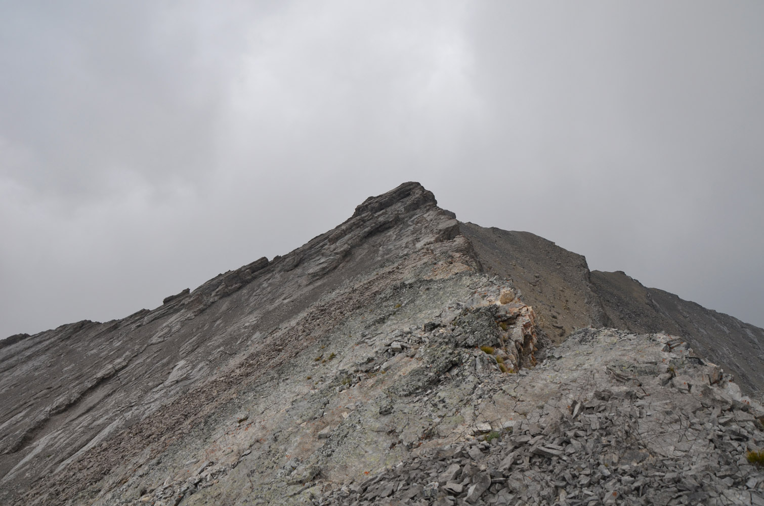
Continuing along the south ridge, I quite enjoyed the scrambling at first. The ridge narrowed significantly, with a vertical drop down the east side and steep, pebble-covered slabs on the left, but mostly good solid rock. Several additional drop-offs required small detours to the left, then the terrain suddenly got more serious. Insurmountable cliffs along the ridge forced me on very steep slabs to climber’s left, then up rubble and more slabs past a distinctive rock window and back onto the crumbly ridge to the summit. The terrain here is very exposed, hold are small, and the rock crumbly – more than once did I think about turning around but I eventually found a manageable route. Barely, though!
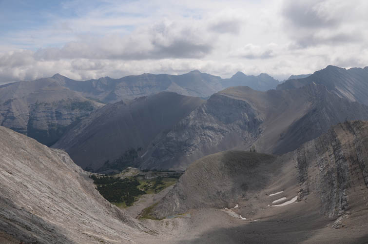
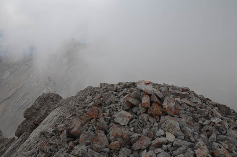
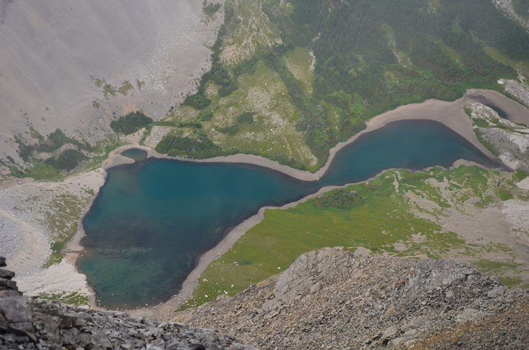
Relieved to have reached the small, weathered summit cairn (I did not find Don’s film canister), I snapped a few photos of nearby peaks and Junction Lake below me, then quickly made my way back down again. I didn’t want to spend much time relaxing. My concentration levels were on max and I didn’t want to get out of my “zone” – that heightened sense of awareness, a strange almost trance-like state of mind that I sometimes get when I scramble in very difficult terrain where I have to be ultra-careful with every move. I found a slightly better route down that took me through the window (instead of below it on slabs to skier’s right). Once back at the big drop-off that I had to circumvent earlier, I simply headed down to the right along the extension of this cliff on talus and slabs instead of doing the whole bypass again. Unseen from above, the slope steepens half-way down, making for yet another slow and difficult stretch of scrambling.
When I finally arrived at the big scree slope in the cirque below, I could finally relax again. All that routefinding and uncertainty about what’s lurking behind the next cliff was over, and it thankfully had paid off. Now all I had to do is stroll down the meadows to the trail again and enjoy an easy hike back.
I still don’t know if the Ramblers’ route on the west side is any easier; it’s hard to tell when all you see is a serrated ridge from a distance. As much as I loved the approach and the lovely valley southwest of the peak, I don’t think I can recommend my route to other scramblers because of the combination of difficult routefinding, loose rock, slabby terrain, and significant exposure on the mountain’s south ridge.
|
Elevation: |
2862 m (my GPS) |
|
Elevation gain: |
1250 m |
|
Time: |
8 h |
|
Distance: |
13.2 km |
|
Difficulty level: |
Difficult climber’s scramble (Kane), T6 / II (SAC) |
|
Comments: |
Extreme care required due to steep, exposed terrain and rubbly rock. Protective gear (ropes etc) might be a good idea. |
|
Reference: |
None for this route |
|
Personal rating: |
3 (out of 5) |
NOTE: This GPX track is for personal use only. Commercial use/re-use or publication of this track on printed or digital media including but not limited to platforms, apps and websites such as AllTrails, Gaia, and OSM, requires written permission.
DISCLAIMER: Use at your own risk for general guidance only! Do not follow this GPX track blindly but use your own judgement in assessing terrain and choosing the safest route. Please read the full disclaimer here.