Muhayil, Saudi Arabia
6 April 2019
Solo
Detours and bushwhacks
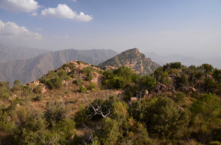
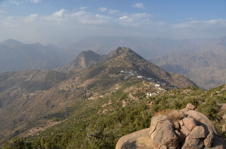
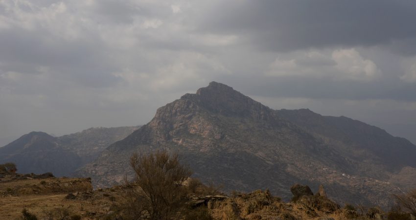
The pointed summit ridge of Jabal Durum with its rocky slopes rising steeply above the valley makes this mountain a striking landmark when coming from the city of Muhayil to the south. I noticed this beautiful peak on my approach up neighboring Jabal Hada a couple days earlier. When viewed from the south, it was hard to picture a feasible route up to the top. The terrain looked too difficult, too steep with too many large boulders and shrubs in the way. I didn’t give it much further thought.
However, after completing my Jabal Hada hike on my drive back to Muhayil I happened to run into a friendly Saudi who, in excellent English, highly recommended Jabal Durum as a hike to me. There’s a way that goes all the way up if you turn right into the small valley between Durum and Hada, he explained. We didn’t have much time to talk about the details of this route, so I was left with only a few pieces of information and a recommendation to think about… eventually enough to convince me to give it a try while I was in the area.
Well, even with recommendations from the locals, some trips can turn into miserable experiences, and that’s exactly what happened today. Nothing turned out to be as I expected: my route for the first two hours of hiking was completely wrong and got me into a dead end, then I had to drive half an hour around the mountain almost all the way up only to bushwhack the last bit through nasty terrain to the summit. It was clearly my fault: I had misunderstood the guy’s directions and I had probably also not made it clear enough that I wanted to hike on a trail and on foot, not on an asphalt road by car!
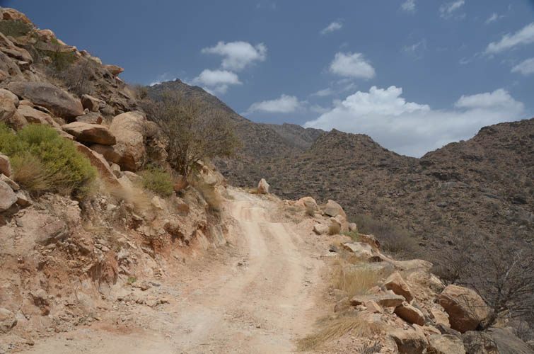
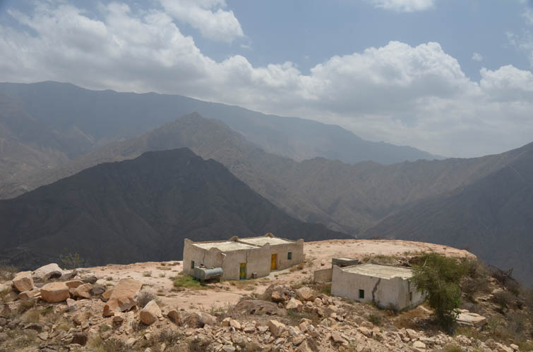
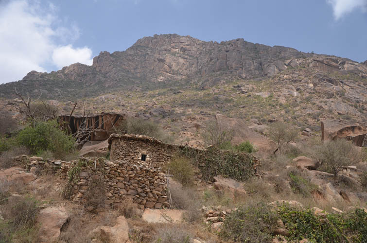
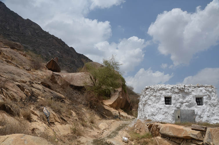
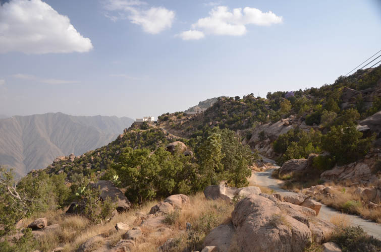
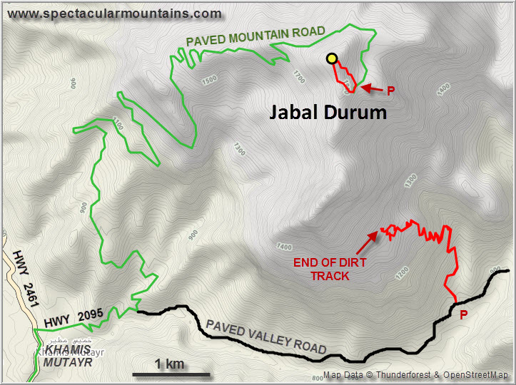
The whole morning was taken up by messing around on the south side of the mountain where I thought the trail was that would lead me to the summit. I drove east into the small valley between Jabal Hada and Jabal Durum on a small paved road, passing through several tiny villages that appeared empty. After parking my car at the start of a very rubbly and steep dirt road, I started hiking up the track for the next couple of hours. I knew the track would eventually end half way up the mountain, but I thought (or hoped) that there’d be another trail continuing to the top. Wrong! The track dead ended at a collection of small houses and fields. The Saudi owner and his two Yemeni employees were busy working on some construction project when I suddenly popped up.
Surprised looks, then some friendly smiles and an invitation to join them in the house for lunch. I politely declined, not wanting to inconvenience them or keep them from their work, but of course it’s only respectful to sit down and chat with your host for some time before heading on. No, he said, there was definitely no trail going up to the top from here and he wouldn’t recommend bushwhacking. The slope above us indeed looked complicated and full of steep rock slabs and thorny bushes. Moreover, there were dangerous leopards up there, he warned me. Leopards!?! I hadn’t thought of that! Well, this route was certainly a no-go, I thought to myself. I sat with my friendly hosts for a bit longer, listened to the young Yemeni make the midday prayer call through an improvised loudspeaker, his beautiful voice echoing across the valley, then got up to thank them for their hospitality and headed back down the track.
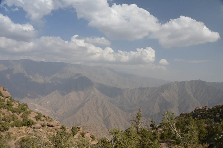
When I arrived at the car in the valley I felt pretty defeated. I had just slogged up a dusty track for 500 elevation metres, only to be turned around and tramp it all the way down again. And with regard to a route to the summit, I was none the wiser. I checked my map and decided to drive around the north side of the mountain. There was a road shown on the map that appeared to rise to within a few hundred metres of the summit. Normally I don’t like driving up mountains, preferring to hike as much as I can under my own muscle power. But here I didn’t have a choice, I simply didn’t have a clue if or where there were any hiking trails around this mountain.
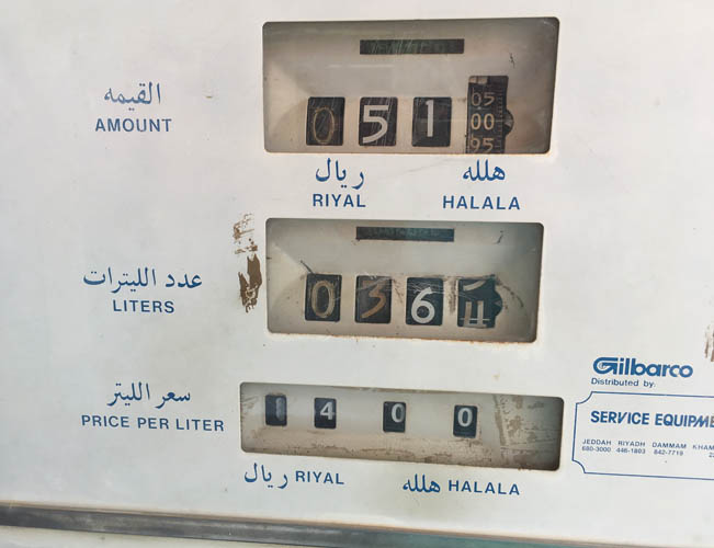
About half an hour later I passed through the small town of Khamis Mutayr, where I filled up with gas and asked some people. Nobody spoke English, so it was Google Translate once again… to no avail. The folks I asked simply didn’t understand what I was getting at, in part this is of course because of the simple fact that hiking as a recreational activity is basically unknown here. Everybody directed me to the small mountain road on the north side if I wanted to get to the top, so in the end I gave up asking for a foot path and decided to drive up.
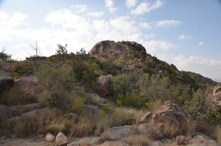
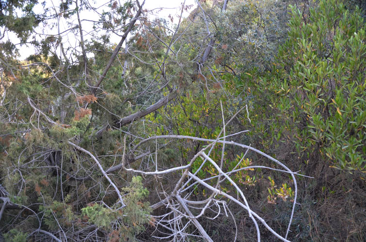
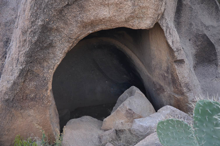
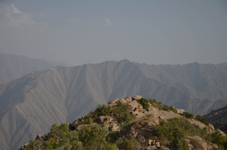
The road offers beautiful vistas of the the mountain’s western and northern slopes, with good views of the surrounding valleys and ridges as well. Towards the top it narrows significantly as it loops around the northeast side and ends by a couple of houses. There was no one around to ask for directions, so I parked in a small pullout near the highest point and just hiked up straight through the bush. “Hike” is certainly an understatement. It was more of a bash as I was slowly clambering up and around large boulders and pushing my way through tall grass and dense bushes. Here and there I came across deep cracks between boulders and small caves within the rock that would form the perfect den for any mammals living here, like those leopards the guys had told me about earlier. Leopards are largely nocturnal animals that tend to avoid humans, so I wasn’t too worried about running into one. Sadly, I saw no other wildlife at all, with the exception of a few birds.
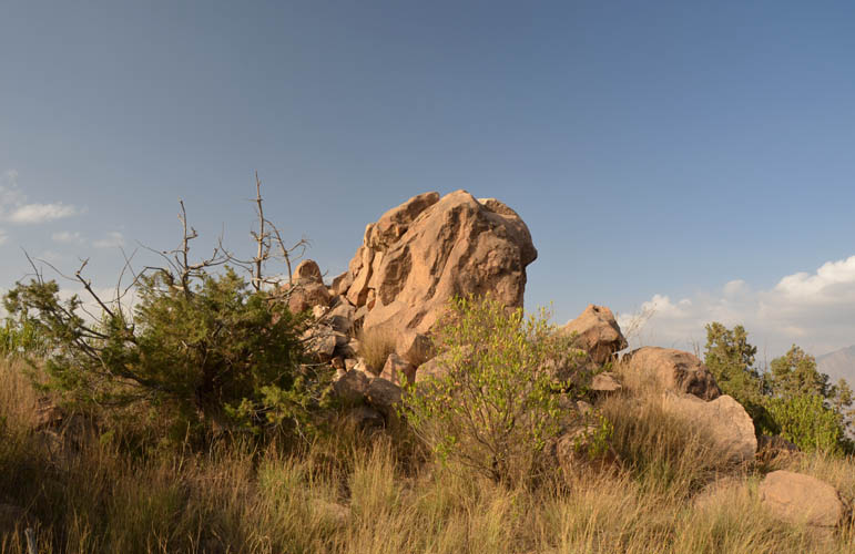
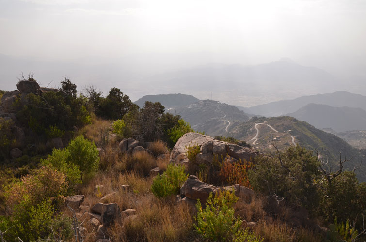
After about half an hour I reached the broad summit ridge, still covered by granite boulders and shrubs. I turned north and another half hour later I was able to climb onto a large, elongated boulder that forms the highest point at 1929 m. No summit cairn was present. It was late afternoon by now and I didn’t want to get caught in the bush in the dark (sunset was around 6 PM!), so after snapping a few photos I headed back down a slightly different way this time. The return was just as strenuous and time-consuming as I had to be careful not to step into grass-covered holes between rocks and to avoid unseen cliffs made of stacked boulders.
When I got back to my car I was covered in sweat, leaves and dirt. My clothes were so filthy I looked like a wild man! Jabal Durum… was it worth it? Hmmm this certainly isn’t one I would recommend. Nonetheless, despite all the struggles I’m still glad I had the experience. I got to see an area rarely visited by outsiders, met some wonderful villagers, enjoyed nice views from the top, and got some exercise as well. After all I came here for the adventure, and I got it!
|
Elevation: |
1965 m (my GPS) |
|
Elevation gain: |
120 m |
|
Time: |
1.5 h |
|
Distance: |
1.4 km |
|
Difficulty level: |
Difficult (Kane), T5 (SAC) |
|
Reference: |
No info was available to me prior to trip |
|
Comments: |
Stats given here are for shortest route from road near summit |
|
Personal rating: |
1 (out of 5) |
NOTE: This GPX track is for personal use only. Commercial use/re-use or publication of this track on printed or digital media including but not limited to platforms, apps and websites such as AllTrails, Gaia, and OSM, requires written permission.
DISCLAIMER: Use at your own risk for general guidance only! Do not follow this GPX track blindly but use your own judgement in assessing terrain and choosing the safest route. Please read the full disclaimer here.