Allgäu, Germany
7 August 2018
With Wen
Sausage and beer on the top of Germany
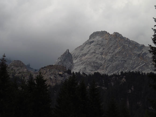
At just under 3000 m, the Zugspitze is Germany’s highest and arguably most famous mountain. Thousands of visitors take one of the gondolas up to the summit platform every year, making this one of the most visited mountains in the whole country.
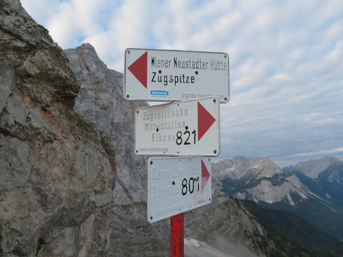
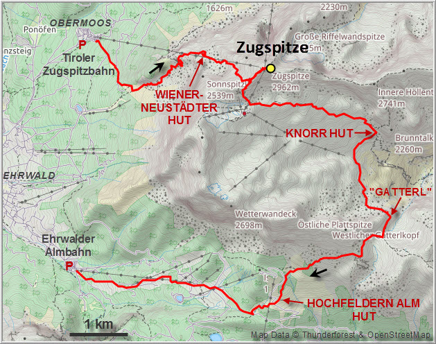
Ascending the mountain on foot is also quite popular in the summer by one of four main routes. Two of these originate on the German side in the town of Garmisch Partenkirchen: the most popular one via the Reintal (long approach, but easy), and a more challenging route by way of the Höllental that includes a via ferrata. The other two start near the village of Ehrwald in Austria: the “Stopselzieher” route from Obermoos is the shortest and features a fun via ferrata that’s not too hard, whereas the “Gatterl” route is longer but mostly a hike.
We chose the Stopselzieher route for our ascent and the Gatterl route for the descent. Most people actually just climb up and then take one of the gondolas back down, but we thought we didn’t really earn the mountain unless we hiked both up and down. Of course it’s not necessary to do this in a single day – there are lots of mountain huts and chalets along the routes that serve food and offer rooms or bunk beds.
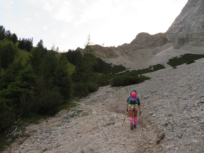
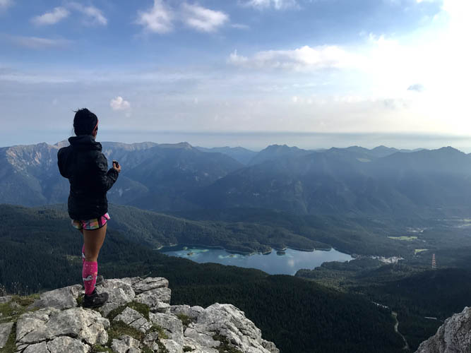
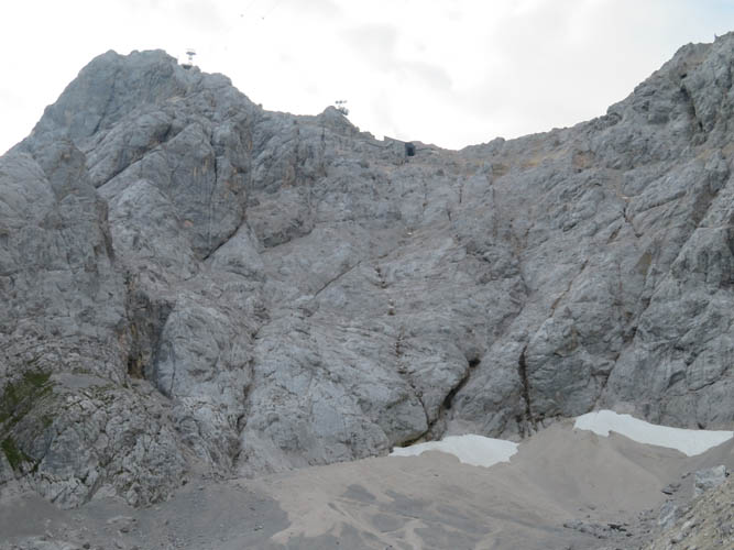
The ascent from the base station of the Tiroler Zugspitzebahn in Obermoos was fun and relatively fast. We started at 5:30 AM in an effort to avoid the crowds, especially along the more difficult sections of the via ferrata that can easily turn into a bottleneck. It turns out we weren’t so early after all: there were at least four or five parties walking by our car in the darkness as we had breakfast, and then more starting from the Wiener-Neustädter Hütte, a mountain hut that’s about half-way up.
The first part to the hut was an easy though steep hike along a good trail. There were some scree sections and then a slightly exposed part along the side of the mountain before we reached the hut, but the trail is well-maintained with steel cables and small bridges in the most dicey parts.
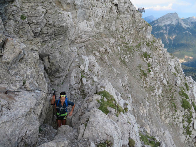
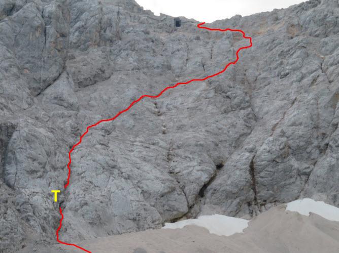
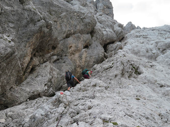
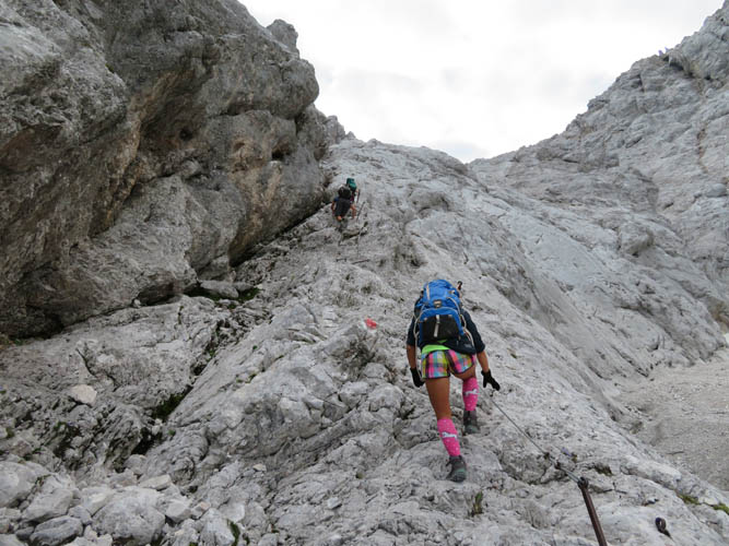
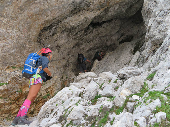
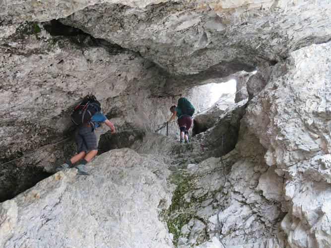
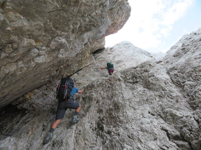
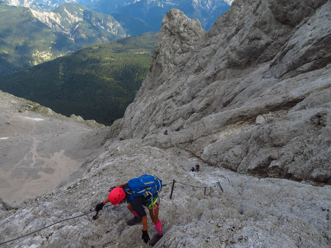
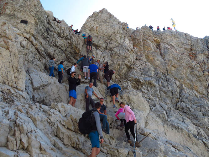
Just above the Wiener-Neustädter hut, the real fun starts. The via ferrata goes up a steep, diagonal crack and passes through a natural tunnel feature in the rock – the “Stopselzieher” (German for corkscrew). It was pretty cool to scramble up this section, especially since we only had a handful of other people above and below us (it was around 8 AM by now). Later during the day there are a lot more people climbing here, which means traffic jams are almost guaranteed!
The upper section was a little less steep and no more than moderate scrambling, but most of the way was still secured with a cable and the occasional iron hold fixed to the rock. We were both pleasantly surprised how easy it was, definitely not something where we would’ve needed additional protection. A helmet is indispensable, however, because of a real risk of rock fall with so many people clambering about! Unfortunately, most climbers we saw on this route weren’t wearing one.
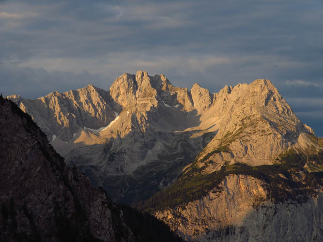
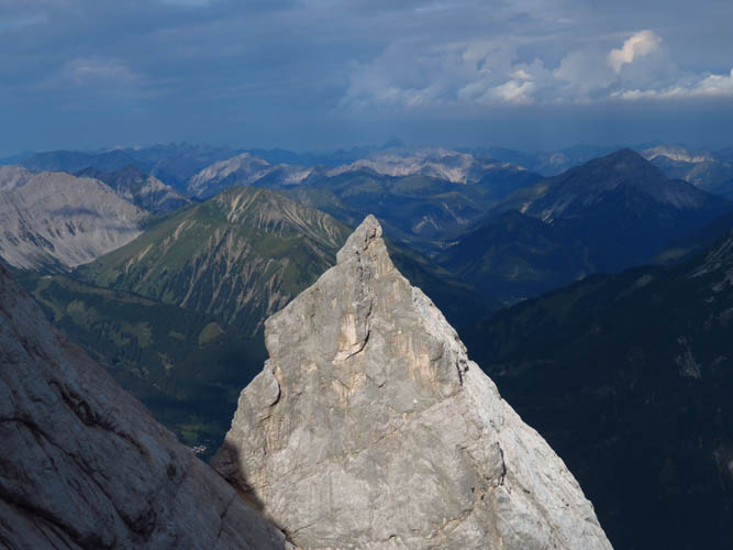
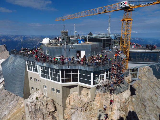
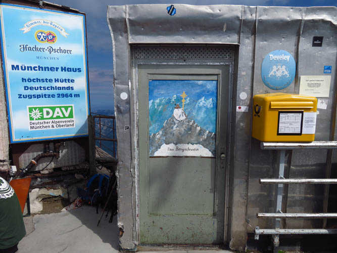
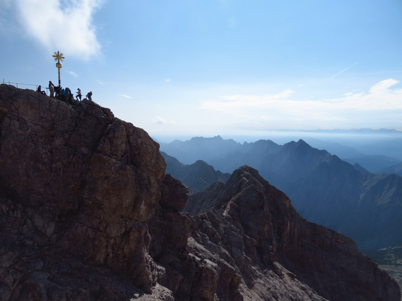
Once we reached the summit ridge, which marks the border between Austria and Germany, we turned left and could see the completely built-up summit mass in all its ugly glory…
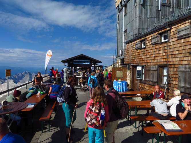
It was both a shock and a big anti-climax. Literally hundreds of people were hanging out on the big platform that features several cafes and restaurants, all here to enjoy the fantastic views from Germany’s highest mountain. I don’t blame them, of course. The gondolas have made this summit accessible to everyone, and I don’t see why only “purists” that hike or climb up by their own muscle power should have the right to enjoy the beauty of the mountains from the top.
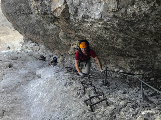
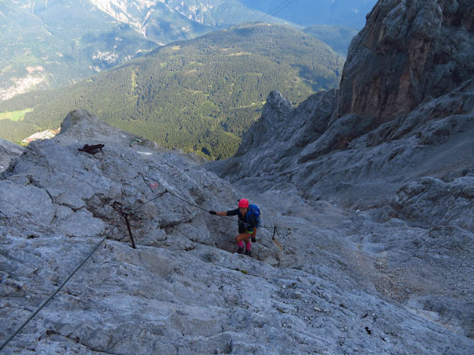
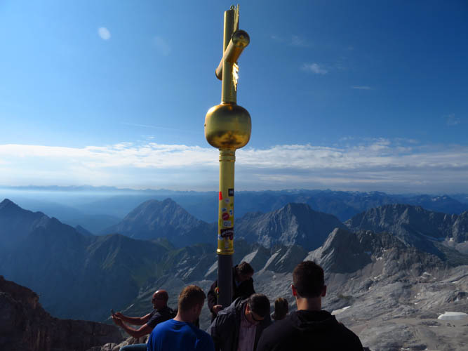
Getting to the true summit was the crux of the trip! It’s a small, jagged crag that sits off to the side of the massive visitor platform, mere metres higher than the rest of the mountain top. To get there, we had to climb down a makeshift aluminum staircase to a narrow col, climb up an iron ladder, and then scramble across a short ridge section to the golden summit cross. I say crux not because it was difficult, but because of the sheer number of people trying to go up and down at the same time. Needless to say, there were plenty of folks who either didn’t have the right shoes for this, or the right skills, or neither.
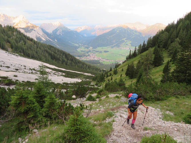
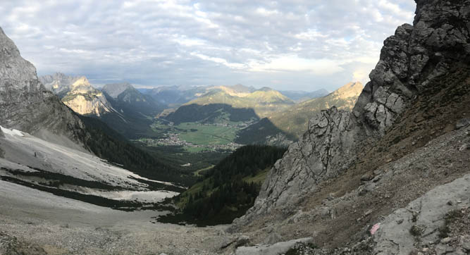
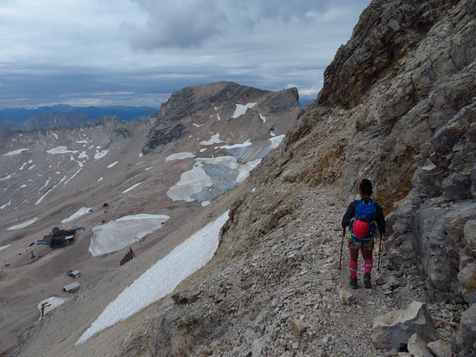
Leaving the merry masses of beer drinking and sausage eating visitors behind, we descended down the south side of the Zugspitze towards a small remnant piece of dirty glacier in a small valley. There is an easy via ferrata along the trail in the upper part to get off the steepest part of the mountain, but this is entirely avoidable by staying on a scree path just below. Tons of people were heading up as we descended, most of them coming from Garmisch Partenkirchen on the Reintal route.
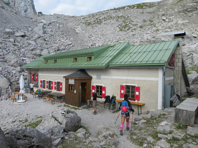
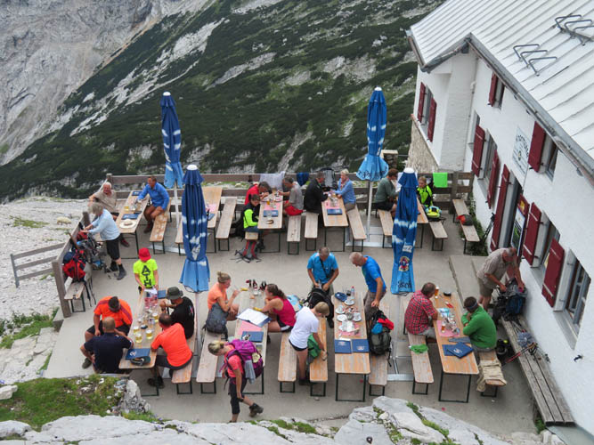
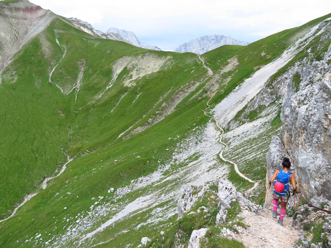
The upper valley here is a pretty barren and grey affair, not the most scenic of landscapes. About an hour and a half after leaving the summit we reached the Knorr-Hütte, also fully catered with plenty of good beer and Bavarian dishes. Here, we turned right (west) to head to the “Gatterl”, Austrian-German for “gate”. This is literally a small iron gate along a fence that marks the border between Austria and Germany. It’s unmanned of course and I doubt they would ever send the border police up here to check on people’s passports.
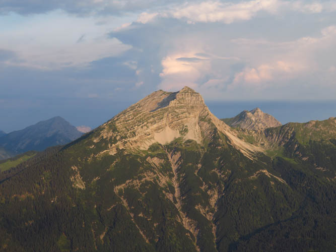
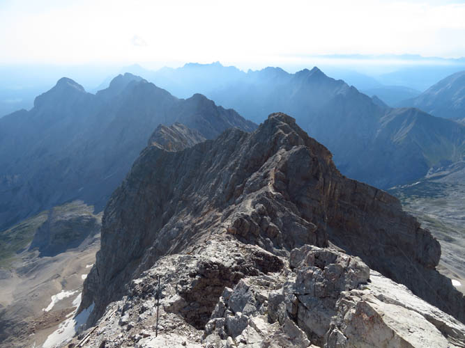
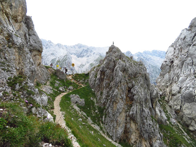
Now that we were back in Austria, the rest of the hike was pretty straightforward. The trail was excellent and the landscape somehow was prettier and more interesting than before, with plenty of lush green meadows, folded rock strata, and craggy peaks in the background. There were still quite a few people on the trail hiking up or down, most were going from hut to hut or simply returning from the Zugspitze like us.
After 10.5 hours we made it back to the bus stop at the Ehrwalder Almbahn gondola station. There’s a shuttle bus that runs every hour that took us back to our starting point at the Tiroler Zugspitzebahn in little over half an hour.
What struck me about this trip were the not only the huge crowds on the summit, but also the large number of hikers on all trails around the mountain. Moreover, we counted at least seven catered huts/chalets along our route today, each offering a full range of drinks and food! While we knew that we weren’t going to have this mountain to ourselves, of course, we were still a bit surprised by the scale of development and commercialism that has reached the mountains here. Was it worth it? Yes, it was unique, and the via ferratas were enjoyable. But I am pretty certain I won’t do it again!
| Elevation: | 2962 m (official), 2952 m (my GPS) |
| Elevation gain: | 1990 m |
| Elevation loss: | 2090 m |
| Time: | 10.5 h |
| Distance: | 19.9 km |
| Difficulty level: | Moderate to difficult (Kane), T4/T5 (SAC) |
| Reference: | Local maps |
| Personal rating: | 4 (out of 5) |
DISCLAIMER: Use at your own risk for general guidance only! Do not follow this GPX track blindly but use your own judgement in assessing terrain and choosing the safest route.