Banff National Park, AB, Canada
17 July 2021
Solo
Easy ridge walk in one of the most beautiful corners of Banff
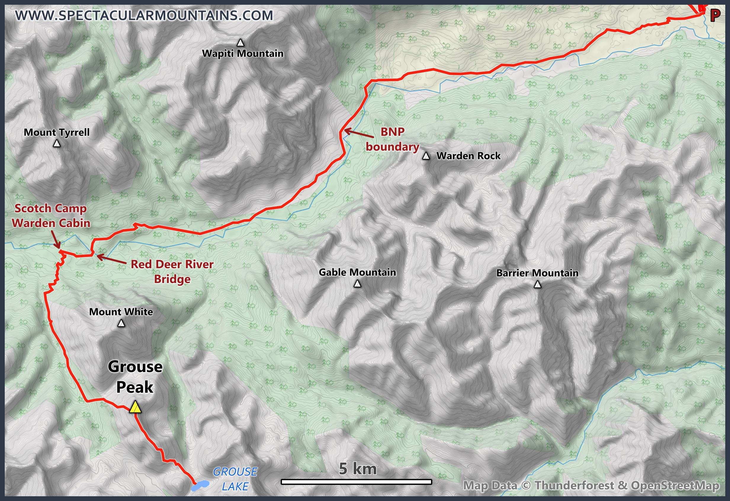
It was finally time for me to return to one of my favourite areas in the Rockies, the remote northeastern corner of Banff National Park that is accessed from the Ya Ha Tinda side. Having missed a trip with Vern and Phil the weekend earlier due to a leak in my camel bag that soaked my sleeping bag overnight, I was really keen to make up for this missed opportunity and set my eyes on four objectives: Grouse Peak, Melanin Peak, Snowflake Peak, and Prow Mountain, all accessible from the Cascade Fire Road south of the Scotch Camp warden cabin.
I figured I should be able to do all four in a fairly intense but not stressful three-day trip. The approach is quite long, of course, and I always feel that doing just one or two peaks in the area is not doing it justice with all the effort involved in getting there.
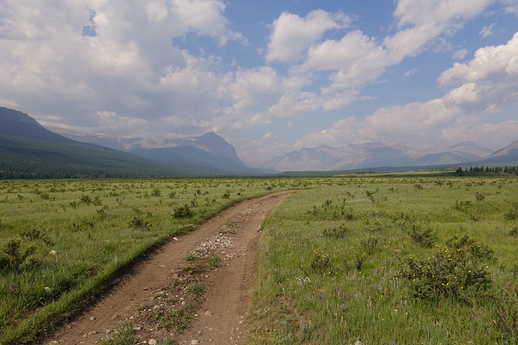
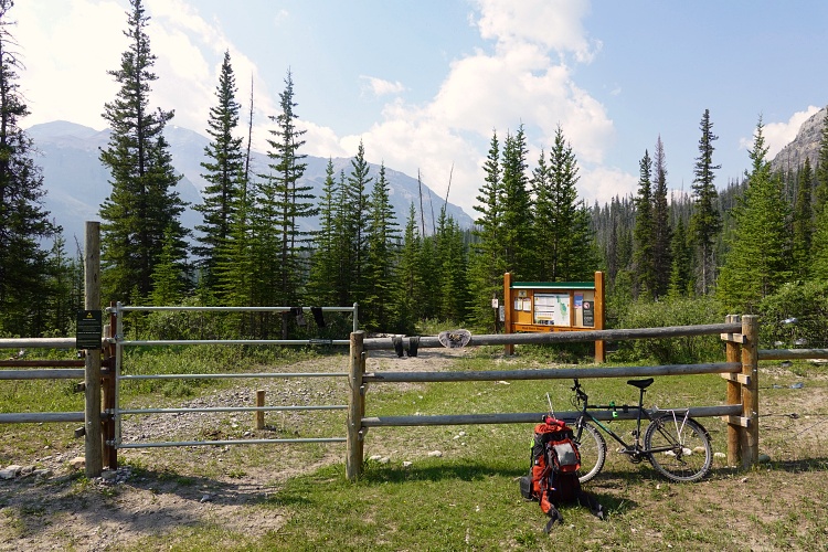
On the first day I wanted to just get to Grouse Lake, a 37 km trip from the parking lot at Bighorn Campground by the Ya Ha Tinda ranch. As with previous trips the fastest approach is by bicycle on Banff trail for the first 12 km to the Banff National Park boundary. Past this point bikes are not allowed anymore, which is really unfortunate because the flat landscape and good trails would be perfect for biking still.
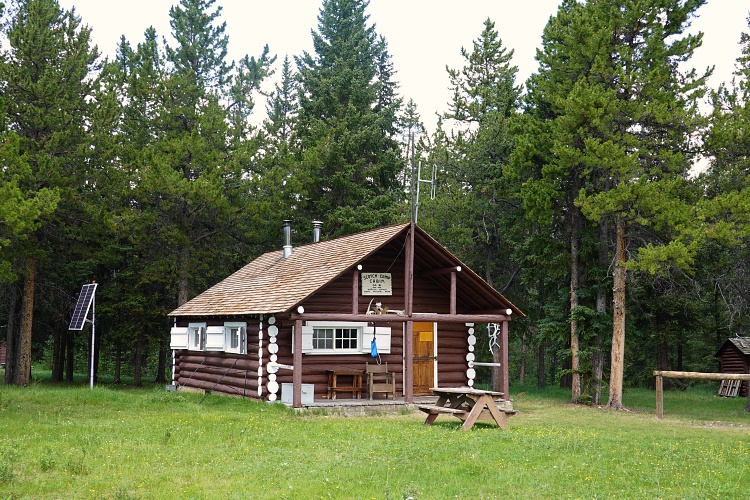
A few km into the park I ran into two university researchers who were doing some sampling of grasses not far from the trail. They were the only people I met during my 3 days out in the bush and it was lovely to chat with them about animal sightings, local trail conditions, and the Scotch Camp warden cabin (where they were staying).
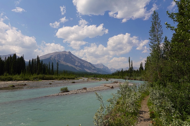
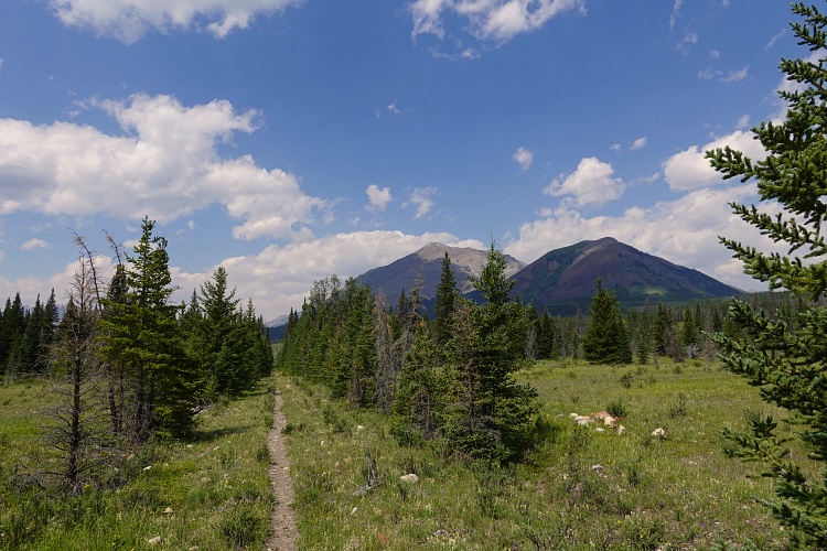
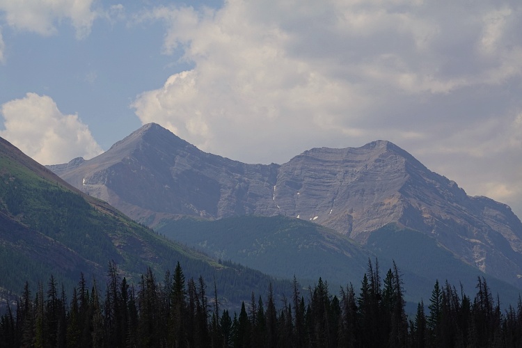
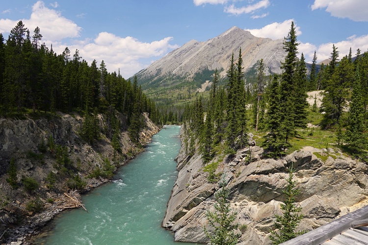
The weather was sunny and hot, conditions I absolutely love when doing long-distance hikes into remote areas. I followed the good trail along the Red Deer River, crossed over the bridge and walked across a large area of meadows to pay a quick visit to Scotch Camp where I had my lunch while staring at Mount White, a beautiful peak just across the valley. An excellent horse trail heads south from the warden cabin to link up with the Cascade Fire Road, which I followed for another few km to the start of Grouse Peak’s north ridge.
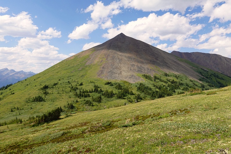
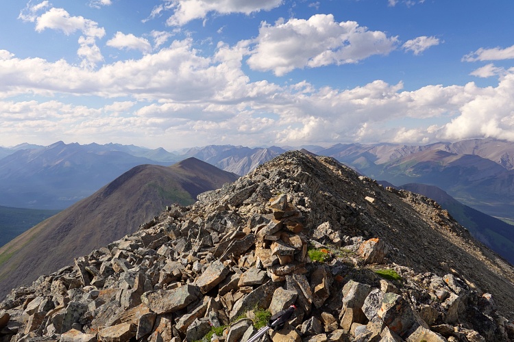
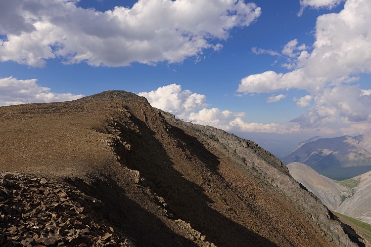
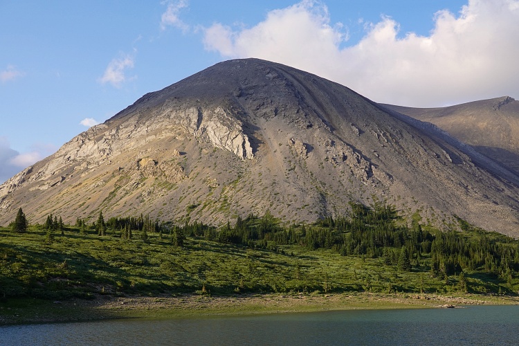
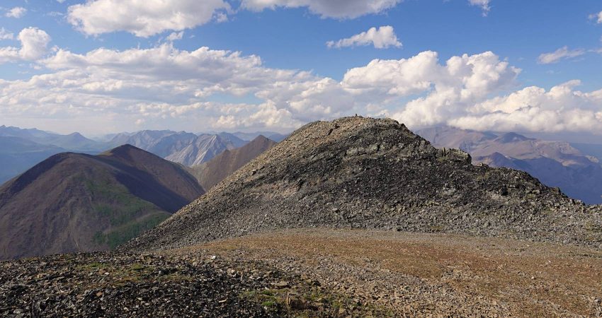
Grouse Peak is really more of a long, north-south trending ridge than a distinctive peak. Nonetheless, it’s a sizable mountain that even eclipses nearby Mount White by 20 m in elevation! Vern Dewit and Phil Richards documented a scramble up this peak after climbing Mount White in July 2020, naming it Grouse Peak after Grouse Lake to the south.
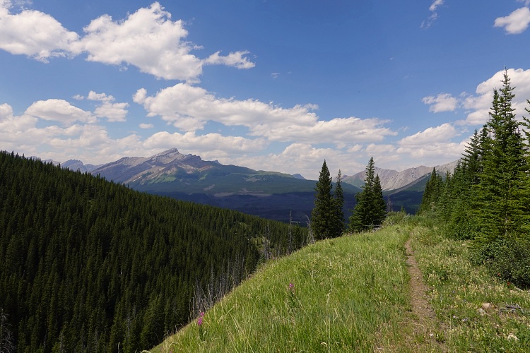
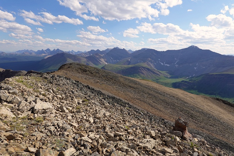
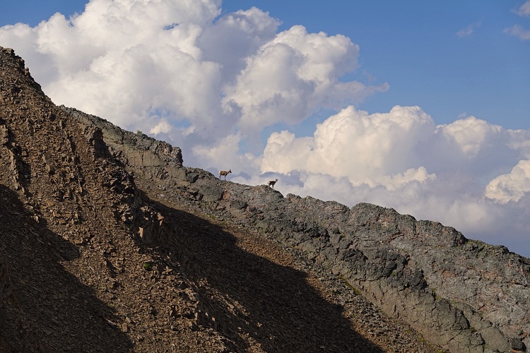
My ascent route loosely followed their descent route on the peak’s easy northwest slope, which is just a plod up grass and rubble directly to the summit. Although the hike is not difficult, it took me a while with my heavy overnight pack and I stopped frequently for breaks and to admire the views of all the little known and unknown peaks of the Bare Range.
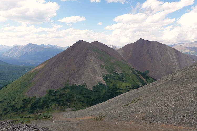
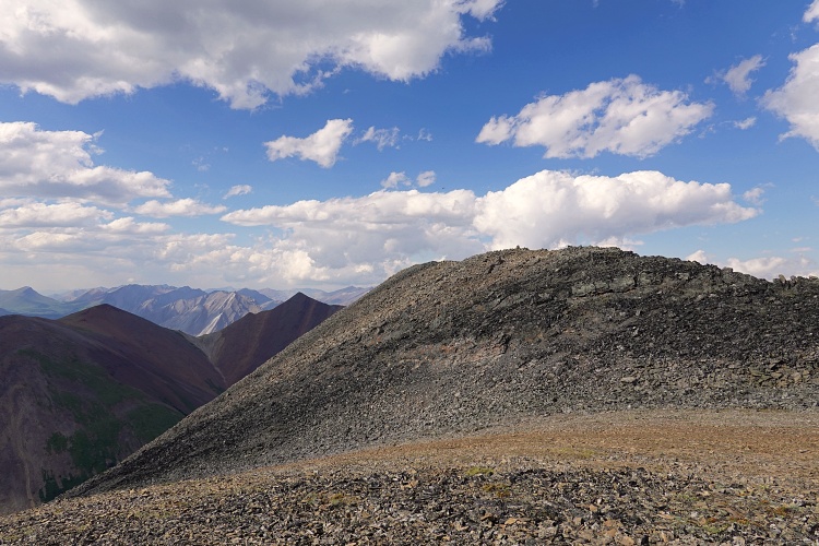
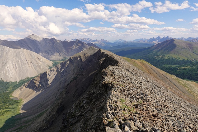
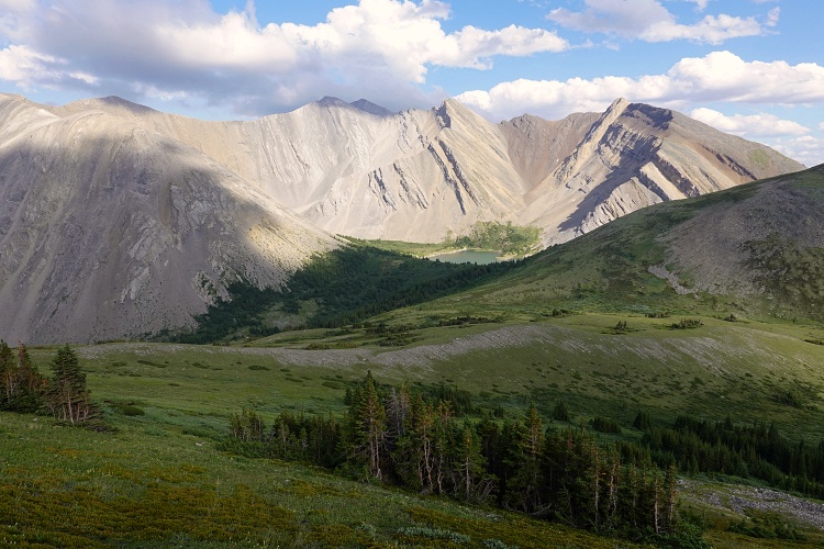
The ridge walk from the summit along the crest towards the south is both enjoyable and very scenic. Melanin Peak and many smaller subsidiary peaks fill the horizon to the south, while to the east is a very pretty and rarely visited valley with Gable Mountain behind. The ridge walk has a few ups and downs but was easy to navigate with my heavy backpack. Towards its southern end I even stumbled upon an old cairn, but this is no surprise really with the Cascade Fire Road located right next door.
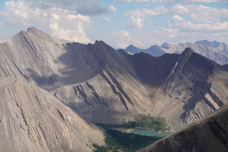
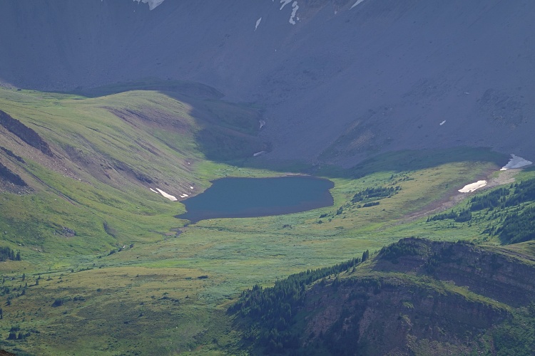
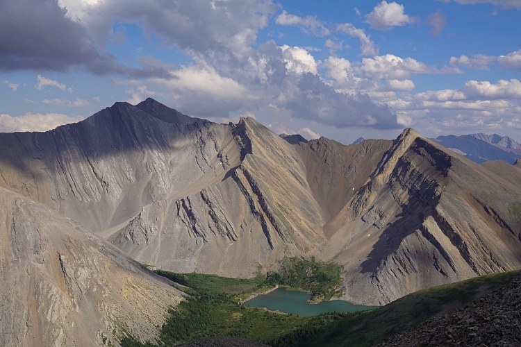
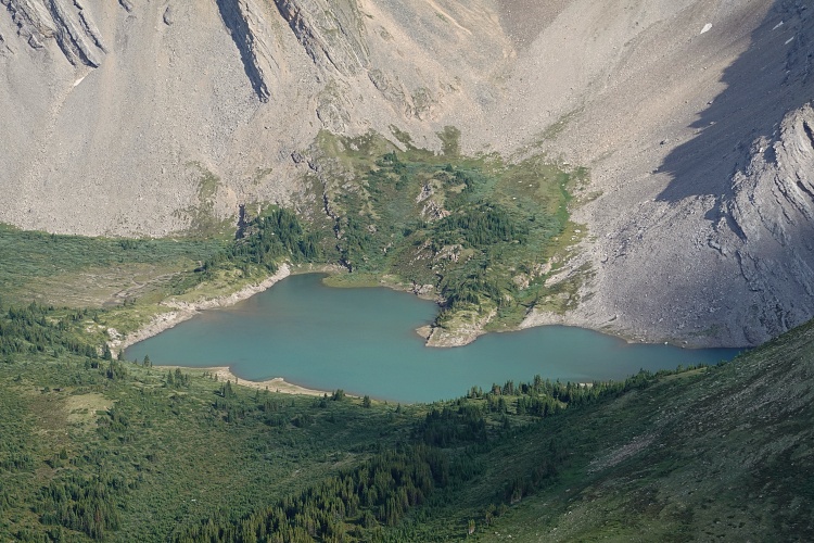
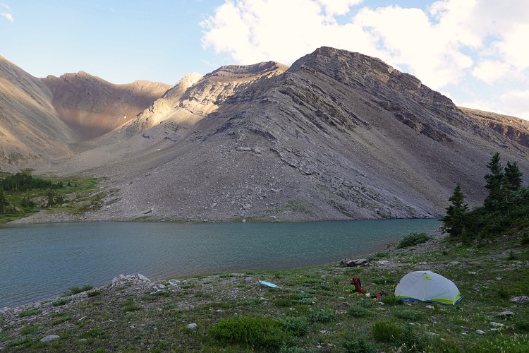
The southern end of the ridge drops relatively gently into a small, partially treed valley. I hiked down scree and grass, curved around the left (east) side of a small bump, through light trees, and shortly after reached the north shore of Grouse Lake. This is a pristine alpine lake with no signs of human activity whatsoever, no cairns or fire rings, just pure nature. Its sheltered location between the craggy ridges emanating from the Melanin Peak massif to the south and east make this an ideal place for an overnight camping spot and a good base to climb Melanin Peak. I feel torn as I write this, unsure if making something like this public will negatively impact this beautiful place by future visitors, which is the last thing I would want. What makes me still publish this info, however, is the overriding feeling of hope that people will treat these places with respect and leave them as they find them, and that perhaps more awareness about them will instill a greater urge to protect them. Only time will tell…
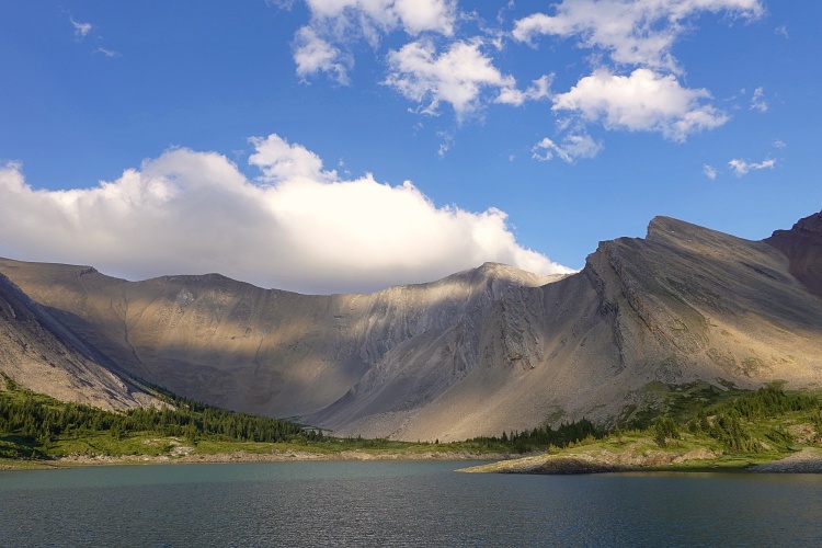
I found a nice flat space to set up my tent, filtered some water from the lake, and had a satisfying dinner while watching the light slowly fade around me. I had a very sound sleep that night. And I definitely needed it, because the next day would be a long and tiring one…
Note: A backcountry permit for random camping is required for Banff National Park.
For a detailed map of the area, including all existing trails and many possible scramble routes, see the Ya Ha Tinda & Surroundings Trail Map on Avenza (a free mapping app for offline navigation and tracking). The map is also available in print at MapTown or GearTrade.
|
Elevation: |
2771 m |
|
Elevation gain: |
1590 m |
|
Time: |
9.5 h |
|
Distance: |
36.7 km (from Bighorn Campground to Grouse Lake) |
|
Difficulty level: |
Easy (Kane), T3 (SAC) |
|
Activity: |
Hiking & Scrambling |
|
Reference: |
Own routefinding |
|
Personal rating: |
3 (out of 5) |
NOTE: This GPX track is for personal use only. Commercial use/re-use or publication of this track on printed or digital media including but not limited to platforms, apps and websites such as AllTrails, Gaia, and OSM, requires written permission.
DISCLAIMER: Use at your own risk for general guidance only! Do not follow this GPX track blindly but use your own judgement in assessing terrain and choosing the safest route. Please read the full disclaimer here.