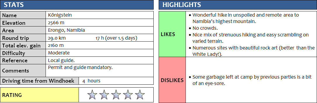
Erongo, Namibia
2-3 February 2018
With Wen
The Königstein hike was without a doubt the highlight of our Namibia trip. It was also the longest and possibly most challenging hike we did in the three weeks we spent in the country. The time commitment, logistical planning, and physical effort that this trip required was considerable but absolutely worth it – it was one of the most unique hikes I’ve ever done and I wouldn’t hesitate to do it again.
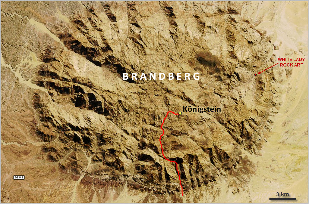
At an official elevation of 2573 m above sea-level, the summit of the Königstein (German for “king’s stone”) is Namibia’s highest point. It forms part of the Brandberg massif, a large circular granitic intrusion measuring about 30 by 25 km in size. Brandberg means “fire mountain”, a reference to the glowing red colour reflected by the mountain in the setting sun, or the intense summer heat that makes you feel you’re on fire when you walk over its black, sun-scorched rocks. Other peaks include the Horn, Numasfels and Zisabspitze, all of which are very rarely visited. Today, it seems no more than perhaps 20-30 parties make the ascent up the Königstein every year, in part owing to its remote location as well as due to the paperwork involved in getting a permit and guide. The massif is entirely uninhabited; there are no villages or people living here, and not even the locals from the surrounding towns venture up into the mountainous terrain, just the odd hikers and researchers with their guides.
We arranged our permit about two weeks before the planned hike by emailing back and forth a few times with the National Heritage Council in Windhoek, the organization officially responsible for regulating visitor traffic in the Brandberg massif. Permits and guides are both mandatory, you can’t just wander into the mountains here and go off on your own. Thankfully, the process of obtaining the necessary paperwork was pretty straightforward, albeit a bit pricey for people like us who aren’t used to paying anything for their hikes. The total cost of the permit and guide, including a food package for the guide, was N$3150 for the two of us, which equates to about 200 euros (this is independent of how long it takes you). At first I was planning to do it in one long day, which is entirely possible if you’re fit and fast and don’t carry a lot of weight. After telling Wen more and more about the area her interest got piqued and she decided to come along, so we aimed at 2 days to make it up and down the mountain, which turned out to be right on.
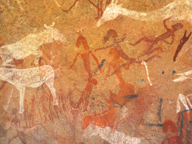
Using the nearby town of Uis as a base (there are several lodges and campgrounds here), we met our guide Justus a day before the hike to get to know him and make final arrangements. At 28 years old and of slim build, he was a quiet but very affable character who knew the area like the back of his hand. He also had an amazing wealth of knowledge about Brandberg’s avifauna, with the ability to identify any type of bird simply by their twitter. All guides are stationed at a small park office on the eastern side of the Brandberg mountain where the trail to the famous White Lady rock paintings begins. Justus spends most of his time accompanying visitors to this site, so we took the opportunity to see the White Lady for ourselves on a 2 hour walk round-trip. We were quite impressed with the quality and intricate detail shown in these 3000-5000 year old drawings of medicine men, zebras, kudus and giraffes.
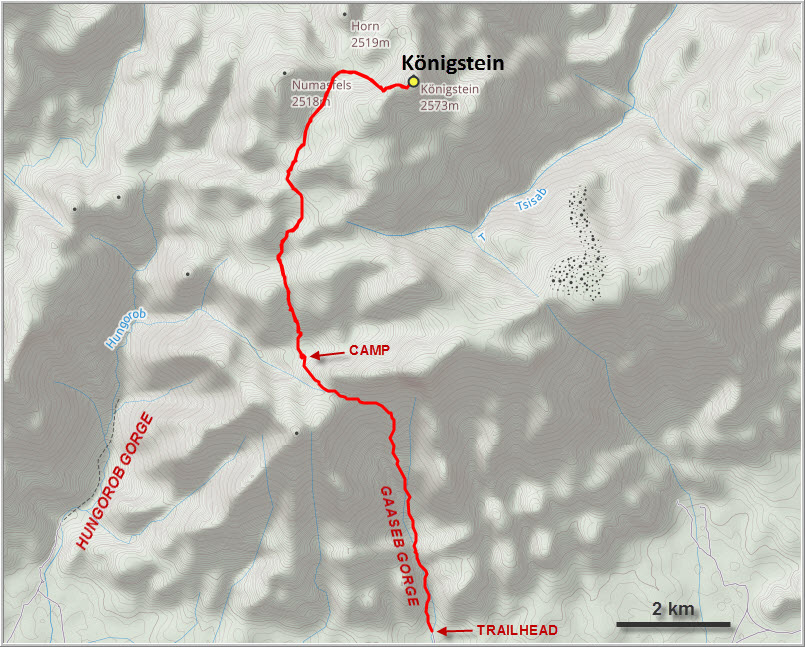
After camping the night in Justus’s village, we left before dawn the next morning to drive about 45 minutes on narrow sand tracks to the start of the hike at the entrance to the Gaaseb Gorge. A large sign reminds visitors of the requirement to have a guide and permit. There’ve been several incidents in the past where solo hikers have become lost, including the case of an American who vanished somewhere in this vast mountain area in December 2017 and was never seen again.
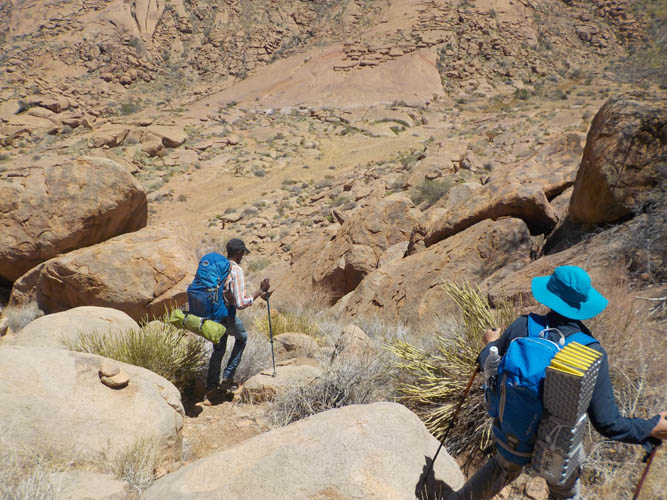
One of the challenges of doing this hike in the Namibian summer, with temperatures soaring above 30°C during the day, was availability of drinking water. With no reliable sources of water to be found anywhere on the mountain during these months, you have no choice but to haul up all the water you need yourself. For a 2-day trip that meant about 18 litres for the two of us, plus tent, sleeping bags, mats, food and extra clothing. We felt like pack mules when we started the hike!
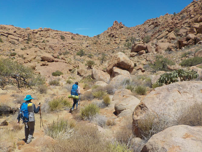
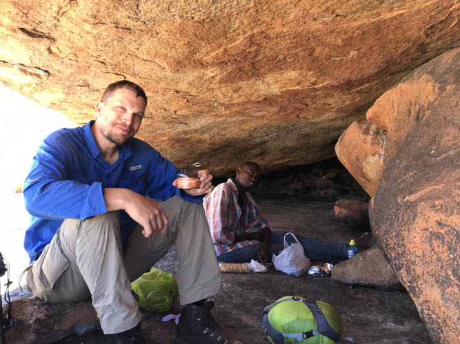
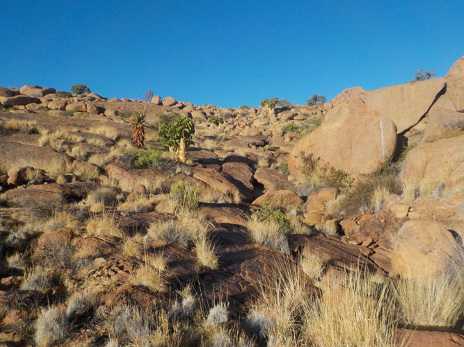
There is a trail that goes all the way from the entrance to the Gaaseb Gorge to the top, but it’s not always easy to follow, even with the occasional cairn here and there. Without our guide Justus, we probably would’ve lost the trail or taken a wrong turn somewhere. This is in part because the route crosses different kinds of terrain, from dry creek beds to big boulder fields to smooth rock slabs and grassy high plains, and cairns aren’t always present (or obvious). After a few hours of hiking in the hot sun, everything in the rocky surroundings starts to kind of blend together and you stop remembering every turn and corner. It’s dry and barren, with a very remote, almost hostile feel to be walking here, yet the landscape is beautiful and captivating in its own unique way. Scattered across the rocky terrain are small shrubs and single trees of Brandberg acacia, aloe, butter trees, and quiver trees. Imposing rock formations, steep cliffs and bizarre boulders all form part of the appeal. But another, perhaps more significant part is the presence of ancient rock paintings amongst the rocks here. There are said to be more than 900 documented sites with rock paintings in the Brandberg, and countless more that have yet to be “discovered” (or at least reported). Our route took us to four different sites, each one making for a perfect rest stop in the shade of a small cave or overhang where you could sit and admire the red and white drawings of various animals and the people that used to live in this area several thousand years ago. Their drawings depict a world that was greener, lusher and more bountiful for the hunters and gatherers who inhabited these mountains that look so barren and hostile to us now. Giraffes, zebras, kudus, springbok, snakes and even elephants all make an appearance. Apart from being picture books of history, the paintings are of course also a testament to the wonderful art the ancient Damara people had mastered. Marvelling at these intricate drawings along the trail while taking a break from our sweaty hike made this trip an unforgettable experience.
After about 7 hours of hiking we arrived at a natural campsite at 2000 m elevation where we dropped our gear and took an extended lunchbreak. This was definitely a great place to spend the night – a flat, sandy patch with a collection of water holes nearby that normally serve as a refuelling point. They were all empty, with the exception of one small puddle that had some brackish water at the very bottom with dozens of tadpoles swimming in it. I wondered how dirty this water must be, with springbok, cliffspringer, leopards, birds and other animals all drinking from the same few remaining water holes at this time of the year. Nevertheless, Justus found the water to be acceptable for drinking after he had treated it with purification tablets. Wen and I, on the other hand, were glad we had lugged up our camel backs and water bottles to last us for 2 days.
It was in the middle of the sweltering afternoon heat that we continued for the last stretch to the summit. We still had 3 hours to go and some 600 m of elevation to gain and could definitely feel our legs getting heavy towards the end. The trail winds its way across smooth slabs of granite, through boulder fields and into a beautiful Alpine meadow with saturated, green grass flanked by jagged ridges and pointy rock nubs. Of course, the elation we felt when we took those last steps to the summit made up for all the hard work and suffering. Here, at the highest point in the country, you can enjoy a brilliant 360 degree panoramic view of the numerous dark grey peaks and ridges that make up the Brandberg massif, and the hazy light brown plains of the desert beyond. The register placed in the summit cairn contained two booklets, the newer one showing only one previous entry for 2018.
We signed the book and returned the same way we came, arriving back at the camp just before sunset around 6:30 pm. Enough time to set up our tent, prepare a fire, and wolf down the sausage and bread we had brought for dinner before it got completely dark. The previous night had been pretty chilly down in the village, so we had brought lots of gear to stay warm up on the mountain – too much as it turned out as it was a perfectly warm and windless night.
The next day we awoke at 6 am after a very comfortable sleep in our little private campsite. We must’ve been the only people on the entire mountain, what a beautiful thought! We packed our bags and then turned our attention to the pile of garbage that was filling a wide crack in the rock near our fire place. Apparently, some people carelessly dump their empty plastic bottles here instead of carrying them back down, an inconsiderate and selfish behaviour I will never understand. Why would you want to spoil the pristine natural beauty of a magical place like this? Perhaps there simply needs to be more public awareness, more warnings, and more education of visitors and guides alike about environmentally friendly tourism and the “leave no trace” principles. We cleaned up as best as we could and left the campsite with our packs half loaded with trash. Granted, all those plastic bottles will probably be burnt at some landfill in Uis anyway, or perhaps they’ll simply be buried in the sand, but that’s still better than leaving them to rot away in plain sight on top of a mountain in a relatively untouched natural environment.
It was pretty smooth sailing on the hike back from camp to our car and only took about 3 and a half hours. The only real challenge on the way down was trying not to lose our concentration and make sure we didn’t trip. There was also one slightly awkward spot along a short cliff where a few moderate scrambling moves were required to get down. We reached our car at 11 am, leaving plenty of time to celebrate our accomplishment with soft drinks and chips. A formidable experience on Namibia’s highest mountain and one I would love to do again!
Notes on logistics:
- A permit to access the Königstein Peak is mandatory, as is having a guide. Both can be arranged through the National Heritage Council of Namibia in Windhoek, or alternatively through the Brandberg Rest Camp in Uis. Cost of permit & guide is N$1500 per person plus N$150 reservation fee.
- The hike takes 1-2 days for very fit, experienced hikers. Most people take 3-5 days, allowing for more time to be spent at the various rock paintings.
- In the Namibian summer months it can get extremely hot and dry here, so taking copious amounts of water (4-5 litres of water per person, per day!) is imperative and can be a real challenge because of the weight. Other essential items are sturdy boots, hiking poles (esp. for the descent), high energy and salty snacks, and adequate sun protection.
- Closest town is Uis, about 35 km away: hotels, campgrounds, supermarket, gas station, restaurants, etc.
- A visit to the White Lady site for those interested in rock art is also recommended (2 hours round-trip, N$100 per person = ca. 7 euros). Closest lodge/restaurant/campground is the Brandberg White Lady Lodge.
DISCLAIMER: Use at your own risk for general guidance only! Do not follow this GPX track blindly but use your own judgement in assessing terrain and choosing the safest route.
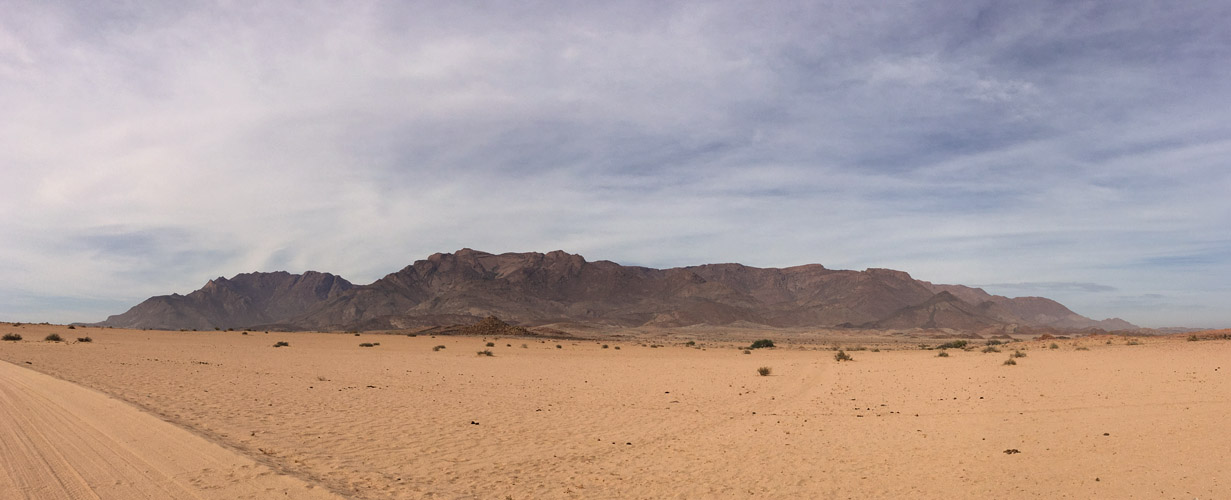
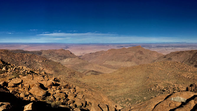
Pano of the Brandberg massif from about 10 km distance the day before our hike.
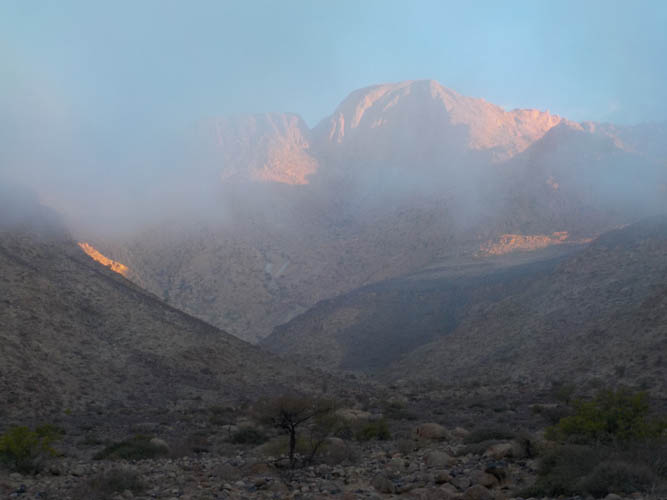
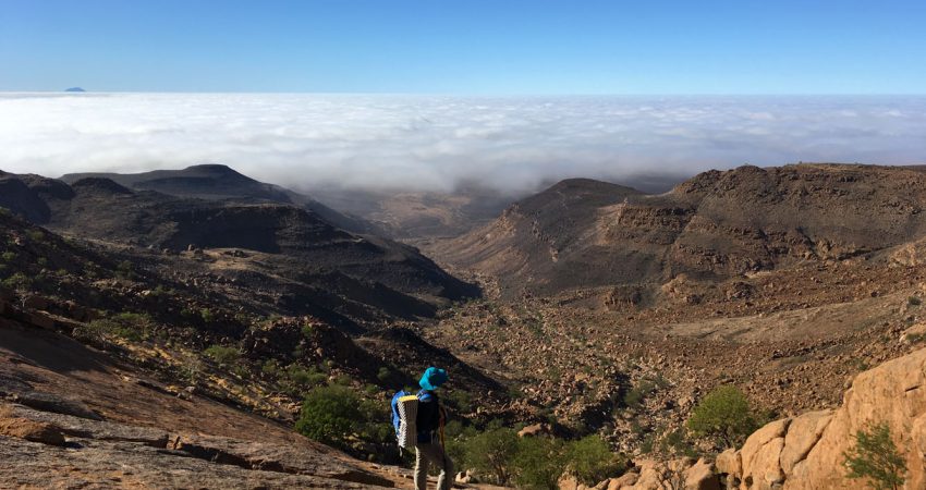
Clouds obscure the entrance to the Gaaseb Gorge in the early morning at the start of Day 1.
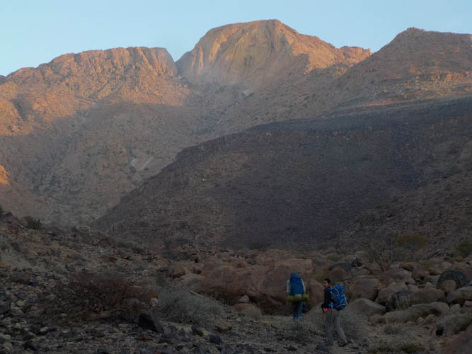
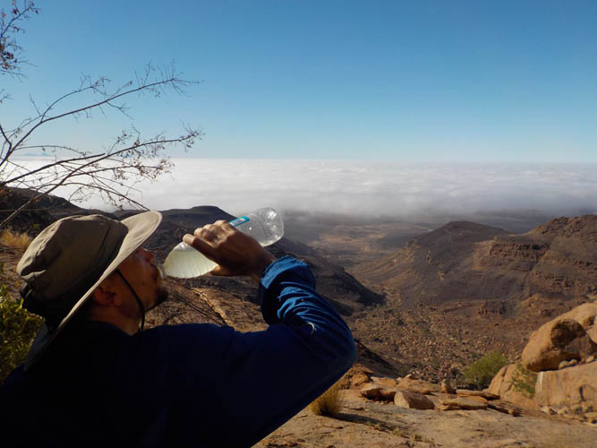
It’s 7 am and the air is pretty chilly!

But it doesn’t take long before we climb above the clouds, the full force of the sun now beating down on us.
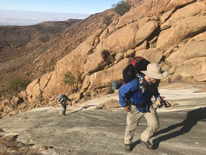
Slogging up the so-called “white slabs”, a smooth, water-worn rock feature visible from far below.
Perfect timing for a break above the clouds!
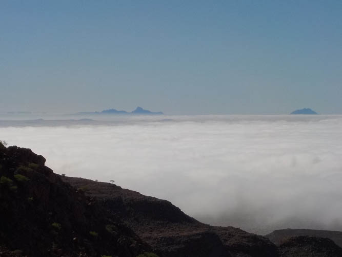
In the distance, the Große Spitzkoppe (L) and Kleine Spitzkoppe (R) float on the horizon like sailboats in a sea of clouds.
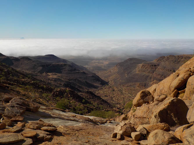
Slowly, the cloud cover is starting to retreat, revealing the full length of the Gaaseb Gorge which we just hiked.
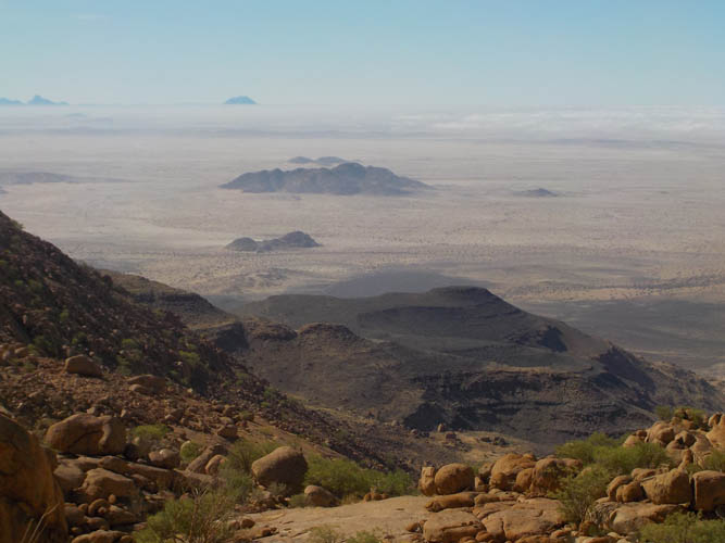
A number of smaller granite intrusions pop up in the barren plain below as the clouds disappear.
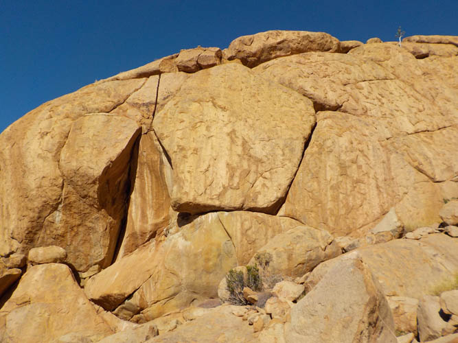
Massive chunks of rock surround us.
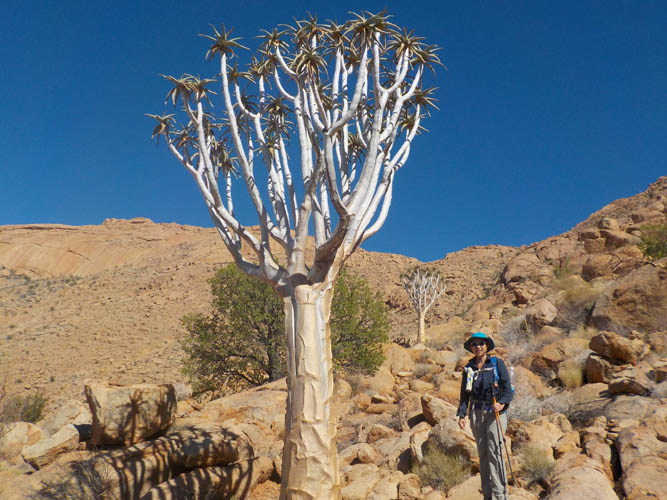
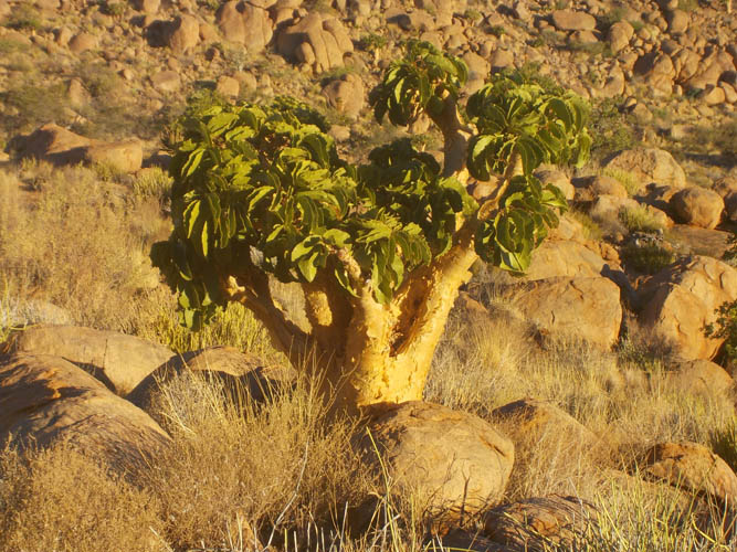
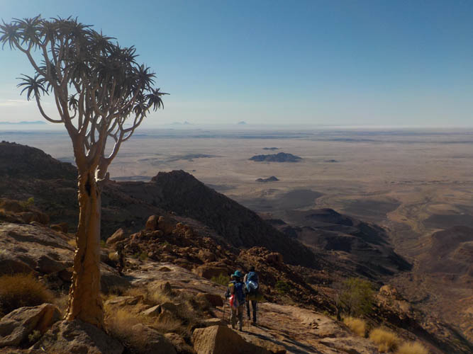
Quiver trees.
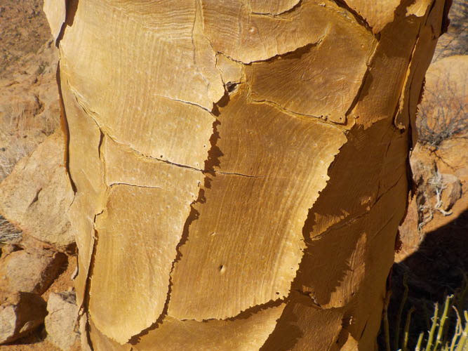
Close-up of the thick skin surrounding the trunk of a quiver tree.
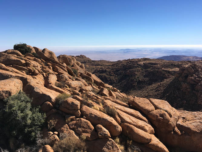
Typical view of the terrain higher up on the mountain.
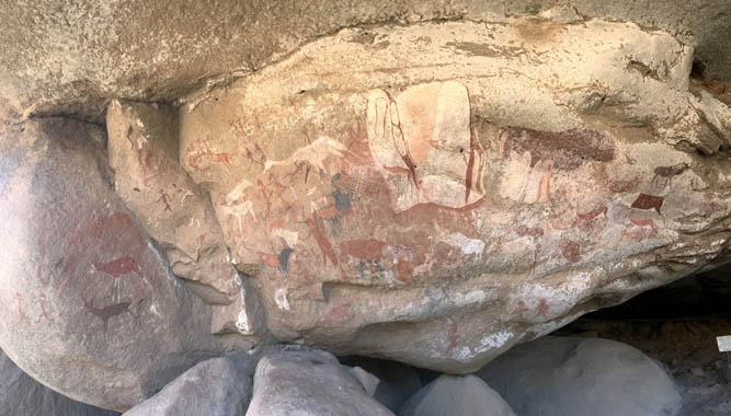
One of several fascinating sites where ancient rock paintings are on display.
They depict the people and animals that used to inhabit the Brandberg. The drawings were created at different points in time as can be seen by the different colours and the fact that they often overlap each other. Some of the animals seen here in white include giraffe, kudu, zebra and ostrich.
Descent towards a flat, sandy area, which serves as our campsite.
It’s tuna for lunch under the shade of an overhang!
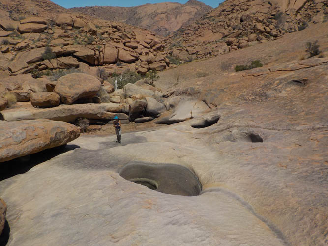
The water holes around the corner are almost all dry.
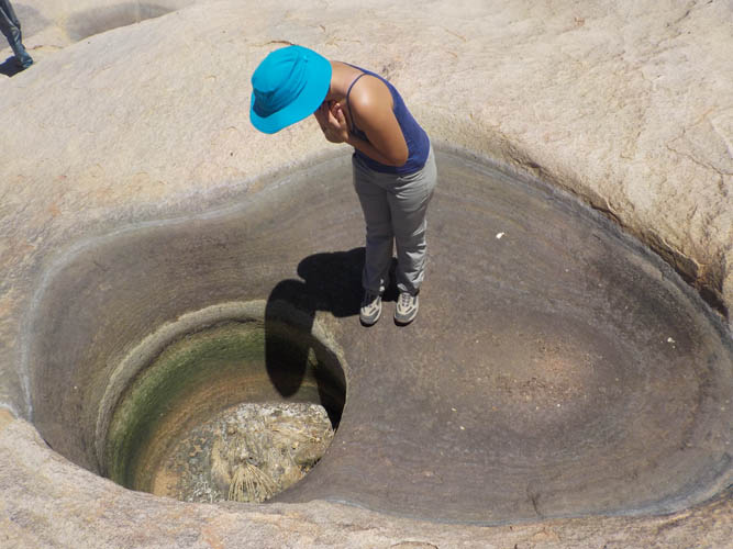
Nothing but dirt in this one… and the remains of an eagle that probably drowned in the water a long time ago.
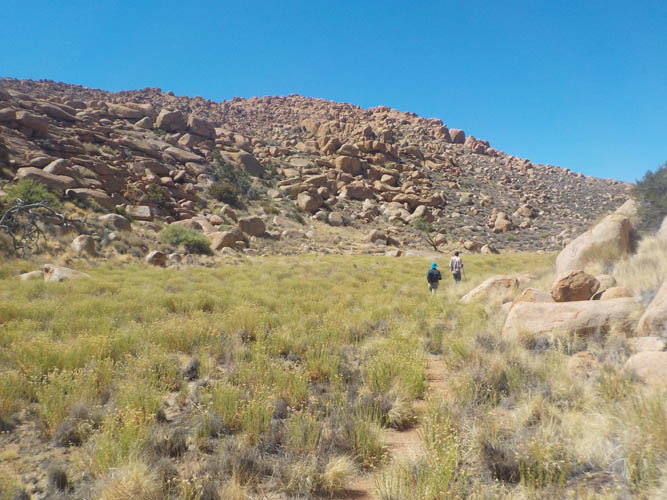
A small meadow on the way to the summit.
Lovely scenery near the summit.
A butter tree. They supposedly smell like butter, but I can’t really corroborate that. Perhaps they are named so because their yellow bark resembles the colour of butter.
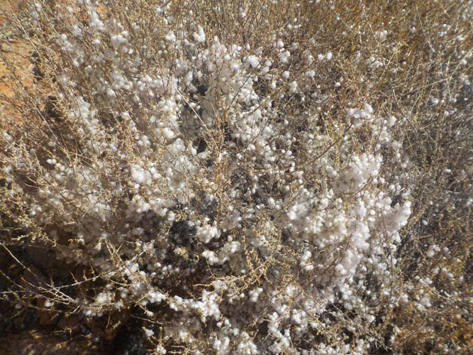
A cotton bush at 2500 m elevation.
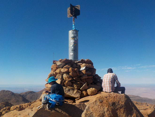
The grand summit cairn of the Königstein, Namibia’s highest point.
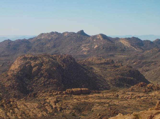
The “Horn” is one of the few other named peaks in the massif.
Sweeping views from the summit.
Other than the summit cairn, a small weather gauge nearby, and the faint trail that we came along, there is nothing man-made in the area here at all.
Descending into the valley the next day.
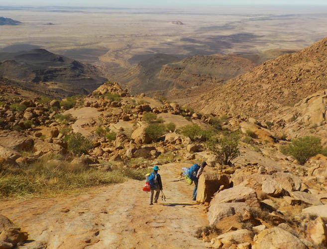
Down the smooth rock slabs towards the Gaaseb Gorge. It’s a long way back to our car!