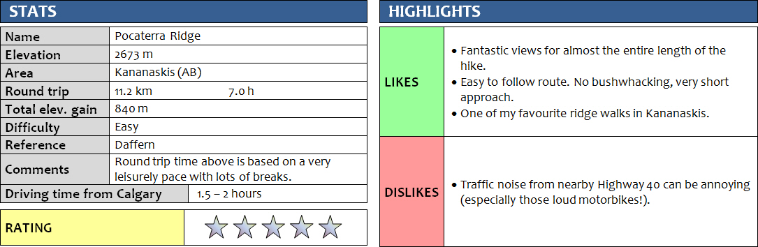
2 July 2017
With Nicolas, Stefanie & Wen
This is one of my favourite ridge walks in one of the most scenic areas of the Rockies – Highwood Pass in Kananaskis. We picked Pocaterra Ridge for our “Canada Day” hike (though a day late) and it surely didn’t disappoint! Given that it was a long weekend, we had braced ourselves for hordes of people all out and about to enjoy themselves in beautiful sunny weather with clear blue skies. To our surprise, we only ran into perhaps 3 or 4 other groups and had the ridge mostly to ourselves.
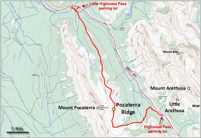
The advantage of coming here with two cars is clear: it’s an 11 km one-way trip along the ridge, so a car drop will save you the boring walk back along the highway (an alternative is to bring a bike). We started from the Highwood Pass parking lot at the southern end of the ridge, leaving one car at the Little Highwood Pass parking lot for the ride back at the end of our trip. This was a good choice as the sun was in our backs for a good part of the day, thus illuminating the ridge in front of us.
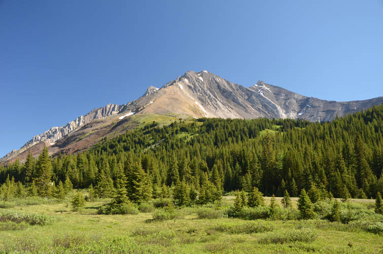
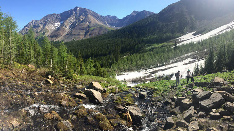
I love the approach through pretty Pocaterra valley, which is quite lush and green at the beginning and then gradually becomes more rocky higher up. It was exactly as I remembered it from previous visits when I climbed up Mount Tyrwhitt and Mount Pocaterra, but this year there was still quite some snow lingering in places, making parts of the trail muddy and wet.
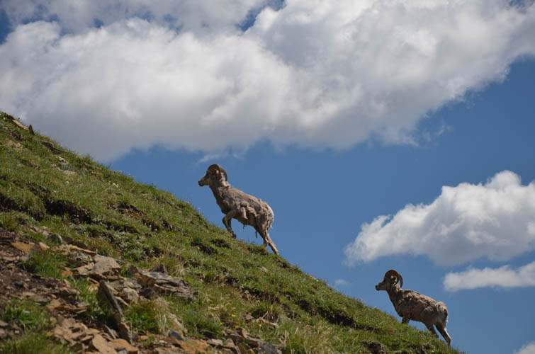
Once we left the valley, the trail to the south and highest summit of Pocaterra Ridge was quite steep. There was a group of bighorn sheep near here that conveniently posed for a photo shoot and provided a welcome break during our grunt up the slope.
After an extended summit lunch, we leisurely hiked along the ridge northward, enjoying fabulous views in all directions. The impressive Mount Elpoca with Gap Mountain to its side really stand out in the north; looking east are well-known scrambles of the Highwood Range that include Mount Arethusa, Storm Mountain, Mount Rae and Mist Mountain. I really like water features as part of the landscape and it was nice be able to see two lakes flanking the ridge: Elbow Lake to the east and a small, unnamed lake immediately west of Pocaterra Ridge.
There were about four or five high points along the ridge, which explains the 800+ m total elevation gain. The initial descent off the summit had a few steep and rubbly sections, but virtually no exposure or scrambly parts. The remainder of the ridge was a very comfortable and pleasant hike mostly on open grassy slopes.
With the exception of some route finding issues at the very end where parts of the trail have been washed out and a creek crossing is necessary (or a log walk), the entire route was straightforward and easy to follow. You could probably do the whole ridge in 3-4 hours, but on a beautiful day like today, we just couldn’t help but stop frequently to admire the gorgeous views and take a ton of photos. Pocaterra Ridge was an extremely scenic outing that in my opinion combines the best of many features the Rockies have to offer.
DISCLAIMER: Use at your own risk for general guidance only! Do not follow this GPX track blindly but use your own judgement in assessing terrain and choosing the safest route.

A broad path beginning at Highwood Pass parking lot marks the start of the route. After a few hundred metres, a left turn takes you on a smaller trail into the woods.
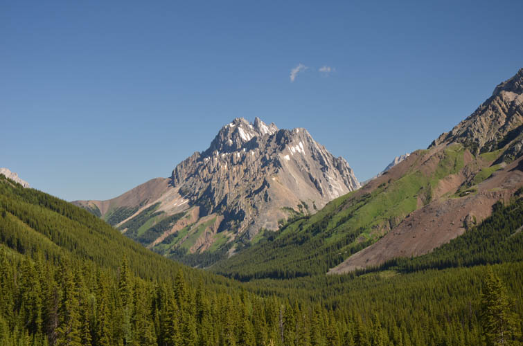
Mount Rae, a fantastic scramble, is right across the street.
The trail hugs the side of this small valley leading west towards Mount Tyrwhitt, Mount Pocaterra and Pocaterra Ridge.
The snow is melting late this year!
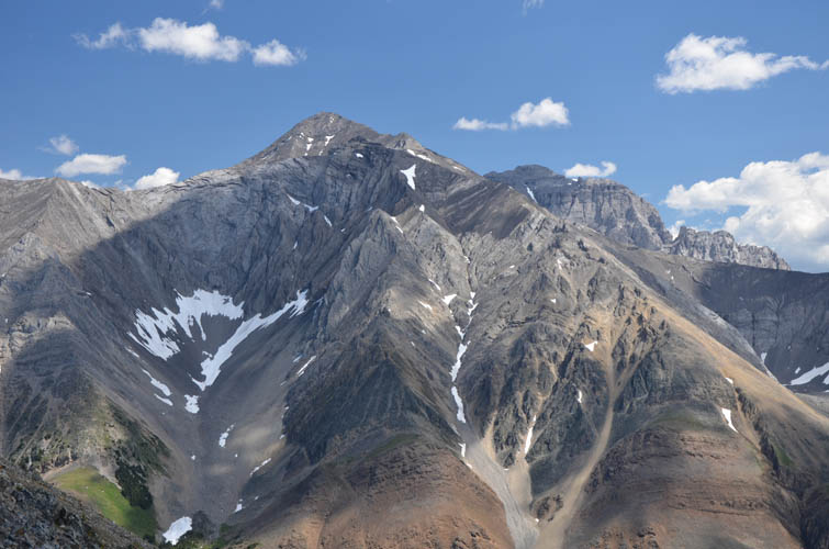
The impressive Elpoca Mountain to the north looks pretty fierce. Unfortunately (or fortunately), it’s a technical climb, not a scramble.
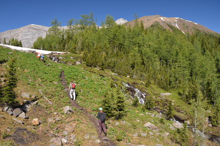
On a good trail past a small waterfall.
A gorgeous spot to take a break. [Photo by Wen]
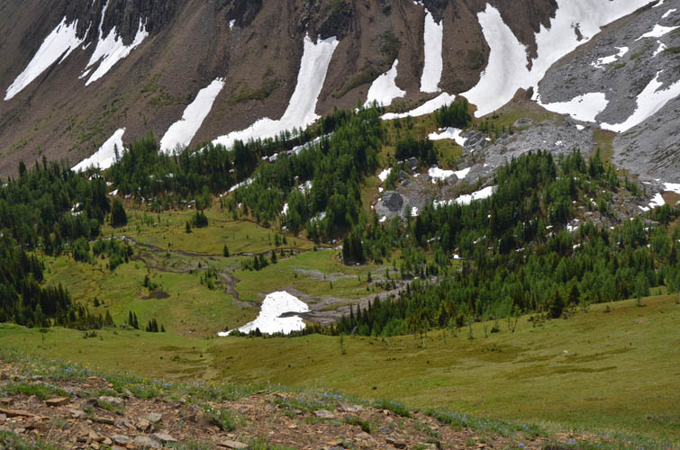
The melting snow feeds several small ponds in the valley. [Photo by Wen]
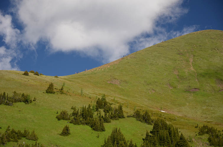
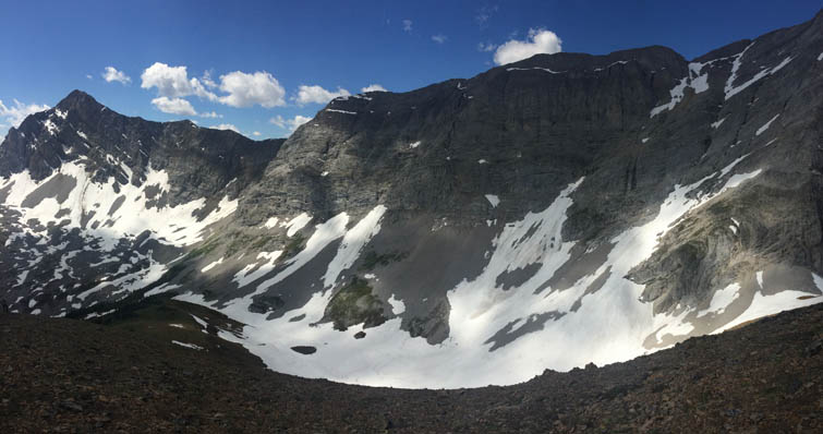
The southern end of Pocaterra Ridge looks like an Alpine meadow.
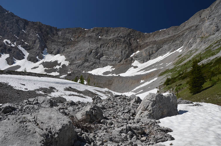
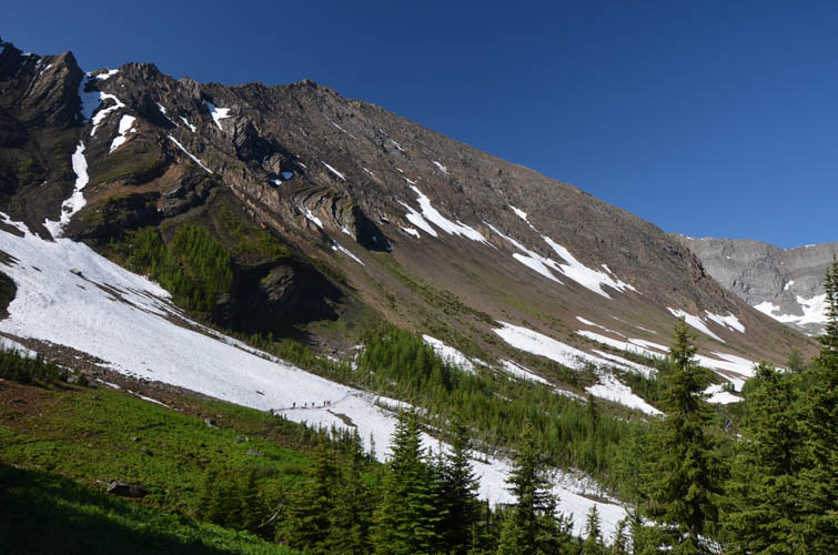
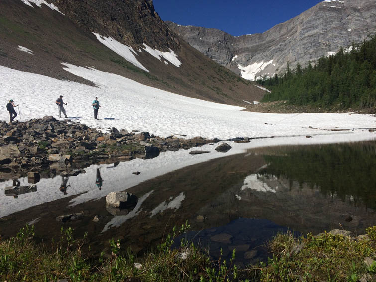
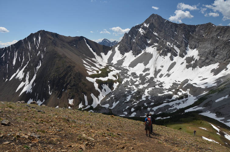
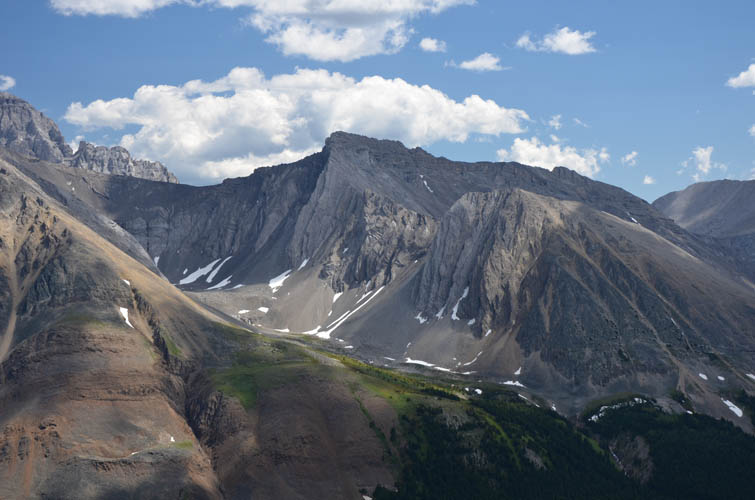
Taking a look around the beautiful rocky cirque down in the valley before we gain the ridge.
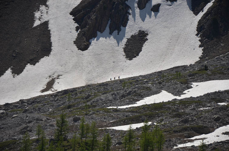
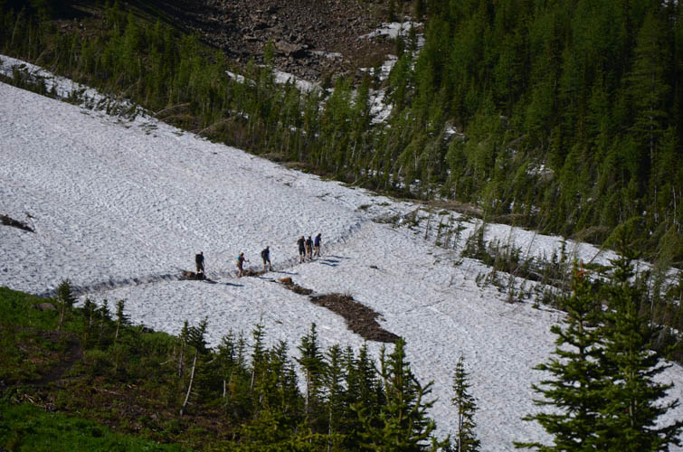
On the other side of the cirque, three hikers can be seen trudging up the trail towards Mount Tyrwhitt.
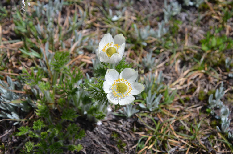
It’s flower season!
A look at the long ridge connecting Mount Tyrwhitt (far left) with Mount Pocaterra (out of sight to the right). [Photo by Wen]
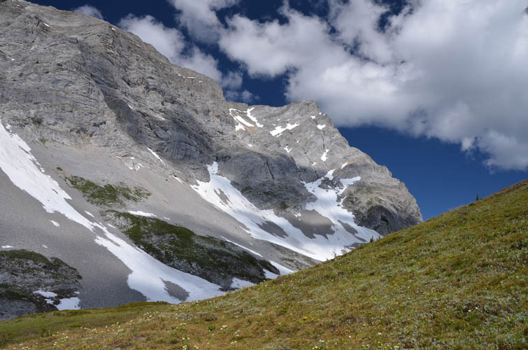
Mount Pocaterra is right next door. The summit of this moderate to difficult scramble is seen here on far right.
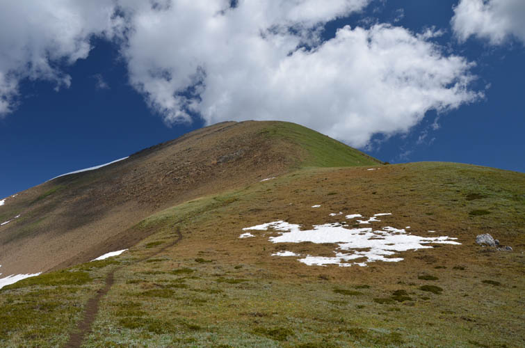
What a lovely hike up this broad, gentle ridge!
A look back down the small valley between Pocaterra Ridge and Mount Pocaterra.
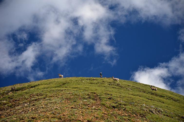
A Canada Parks warden is running down towards us, temporarily slowed by a group of bighorn sheep that seemingly appeared out of nowhere.
The stubborn sheep are standing right on the path and aren’t budging, so we try to go around them.
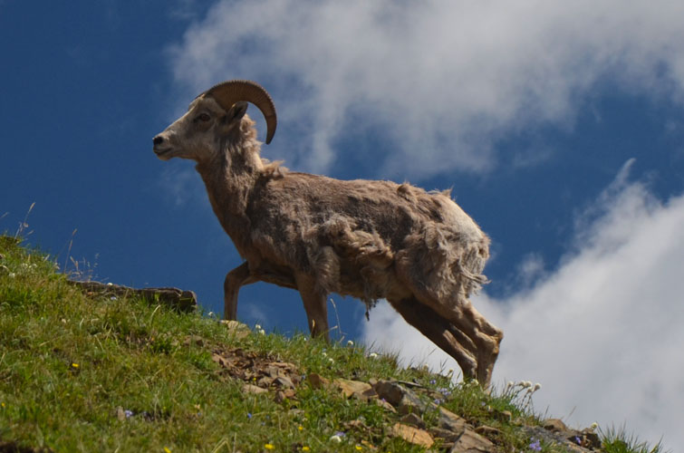
Looking pretty disheveled!
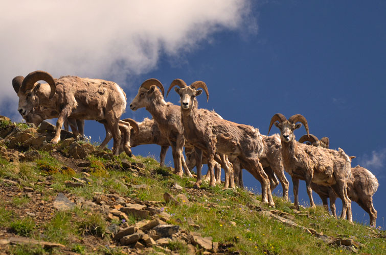
This area is famous for bighorn sheep, and there are lots of them!
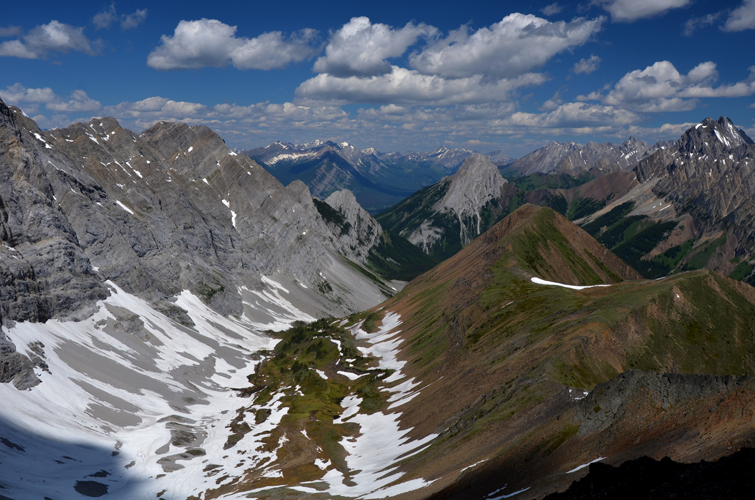
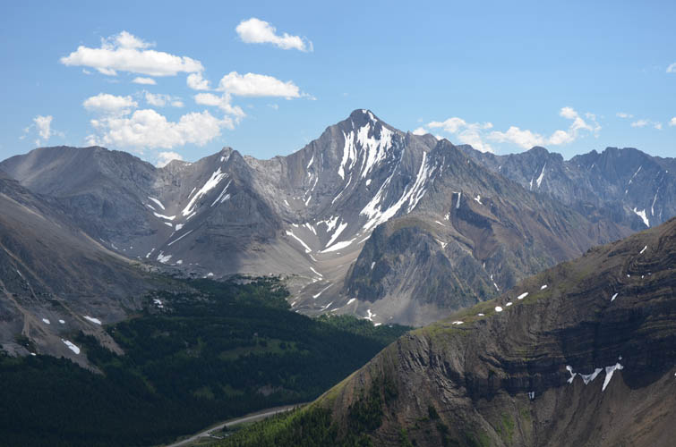
Near the summit, we turn to look back south to Mount Tyrwhitt (right) and the wide cirque below it.
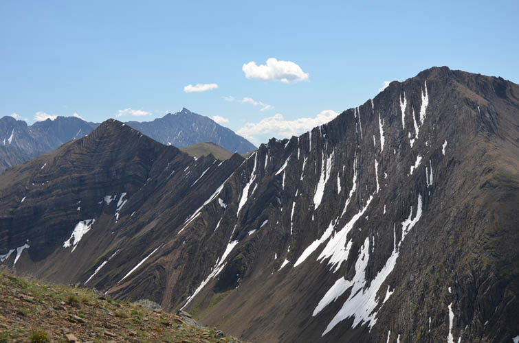
Just east of Tyrwhitt is Grizzly Ridge – very jagged looking! Mist Mountain can be seen in the background.
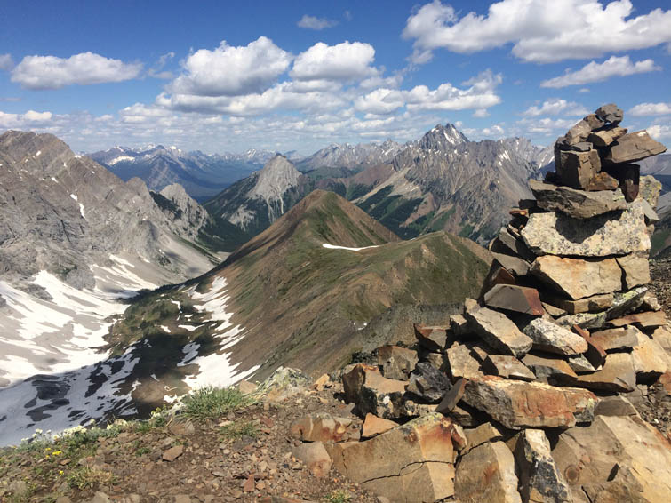
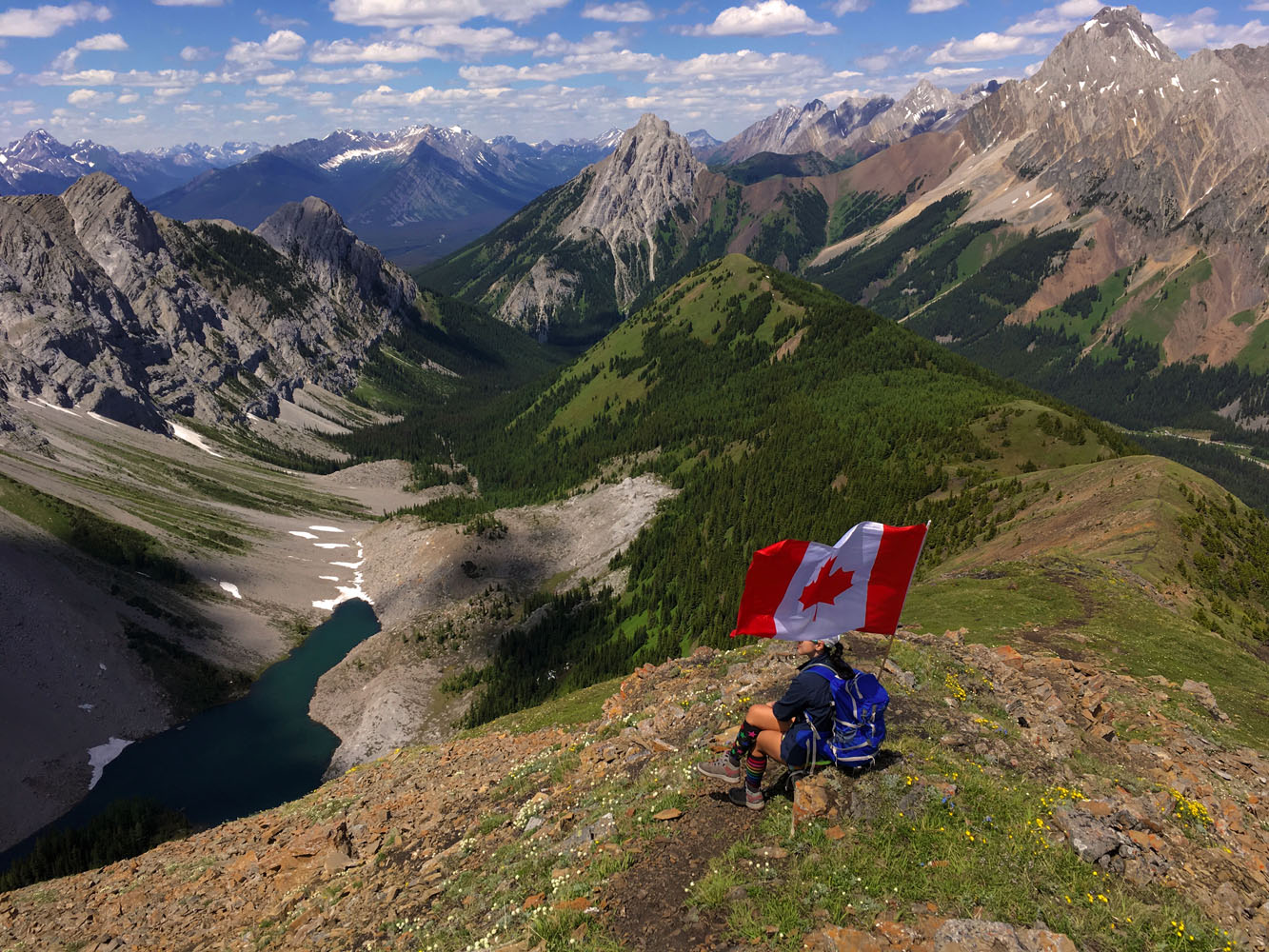
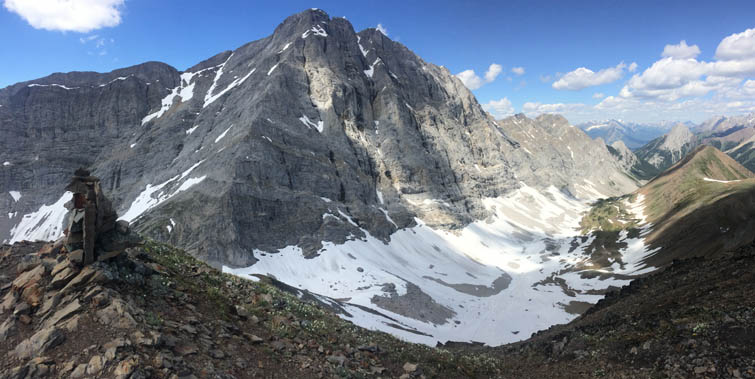
At the summit of Pocaterra Ridge!
This has to be one of my all-time favourite views in Kananaskis!
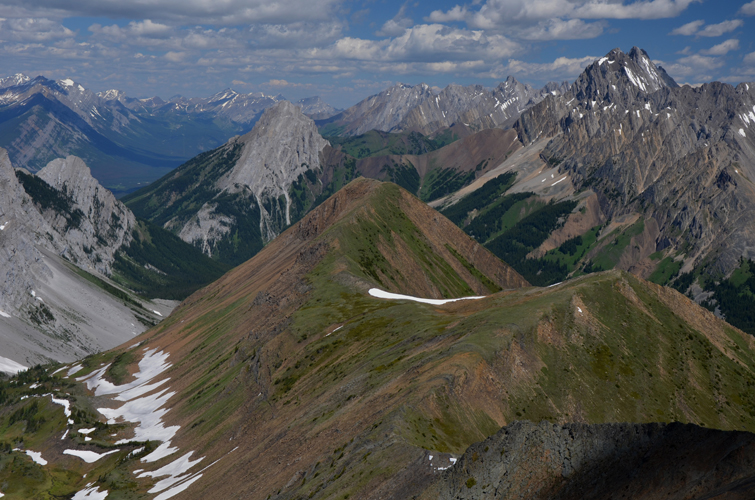
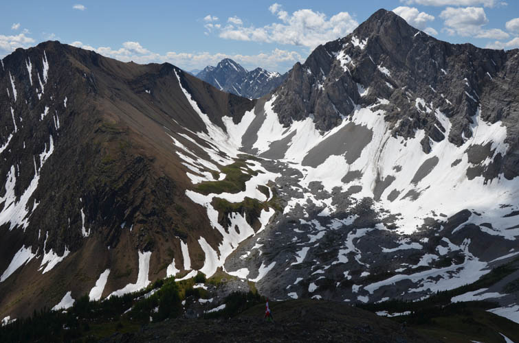
The ridge continues northward with several ups and downs. The grey peak just behind the ridge is Gap Mountain. Elpoca Mountain is on far right.
Mount Rae is one of many excellent scrambles on the east side of the highway.
South of Mount Rae are Mount Arethusa (centre) and Little Arethusa (foreground on right).
And further south is Storm Mountain, followed by Mist Mountain in the distance on the right.
Mount Tyrwhitt – a classic beauty of the Highwood.
And Mount Pocaterra again as seen from Pocaterra Ridge.
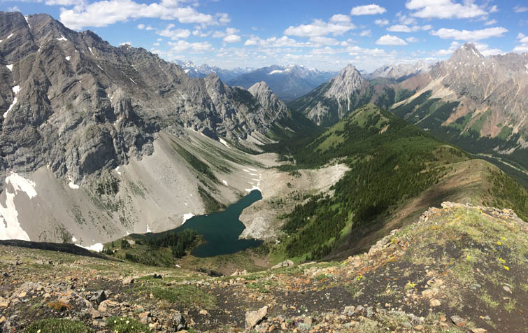
Further along the ridge, this small lake in the valley to the west comes into view. [Photo by Wen]
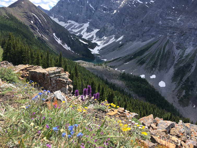
Lots of colourful flowers are in bloom. [Photo by Wen]
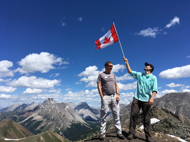
Nico and I paying tribute to Canada – a country of immense natural riches, extraordinary opportunities, and the coolest people on Earth! [Photo by Wen]