Pyrenees, Andorra
14 June 2018
With Wen
The highlight of our time in Andorra and by far the most memorable trip we had! Not only is Coma Pedrosa the country’s highest mountain, it’s also located in what I think is probably the most scenic part of this tiny principality.
We enjoyed splendid bright blue skies and sun, sun, sun all day – absolutely gorgeous weather that of course greatly helped in our very biased assessment of this trip! And I’m glad we were blessed with such a gorgeous day, because there really is no point in going all the way up there (1500 m elevation gain for Coma Pedrosa alone) if you don’t get to enjoy any views. Sunny, clear skies just make everything so much better.
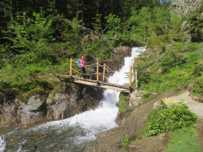
The hike from the huge parking lot on the northern end of Arinsal (designed for the ski resort) to the end of the first part, the Refugi de Comapedrosa hut, was straightforward and easy to follow. We only ran into a group of three French through-hikers who had just come down from the snow-covered Baiau pass near Coma Pedrosa. Once again we were puzzled about the lack of people – where is everyone in this sublime hiking world, they are all missing out!!
The French guys we met told us they had to don crampons in some steep section higher up. We didn’t know exactly what part they were referring to, but to be absolutely safe we decided to stick to the rocky south-facing slope of Coma Pedrosa to avoid any potentially dangerous iced-up snow. We discovered later on the descent that our fears were entirely unfounded.
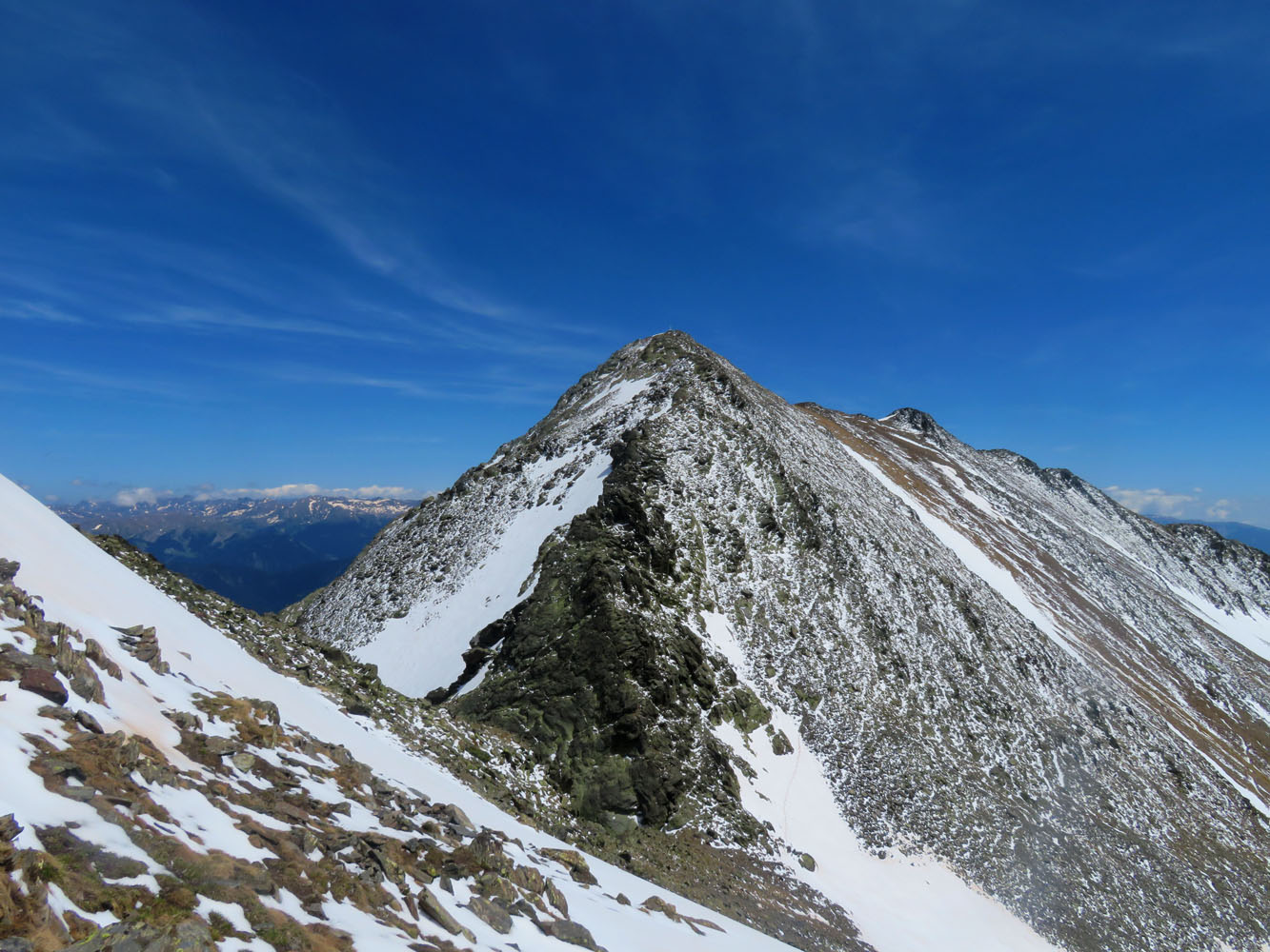
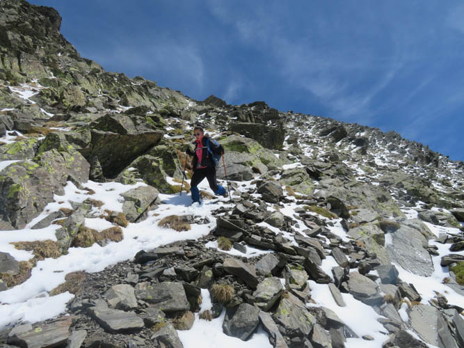
Ascending the south ridge from the hut directly to the top turned out to be fun and never more difficult than easy scrambling. There were no trails and the grass-covered slopes were pretty steep at the beginning, but as the ridge became more rocky and more defined it was actually the perfect way to gain elevation and thoroughly enjoyable at the same time. Once we reached the main ridge we encountered a trail that easily led to the summit.
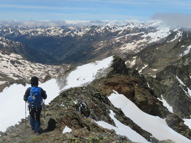
A large summit monument displays mountain panoramas in six different directions, which is really nice because it allows you to identify countless peaks you’d never know the names of (at least for us!). You could see as far as Casamanya and La Serrera peaks in the north of Andorra, and even distant Aneto, the highest peak of the Pyrenees (3404 m), showed up on the horizon to the west. The hulking Montsent de Pallars (2883 m) and Pic de la Mainera (2909 m) on the Spanish side were also pretty impressive to look at. At 2943 m, Coma Pedrosa really isn’t a very high summit, nevertheless on a clear day like this the vistas were simply unbeatable.
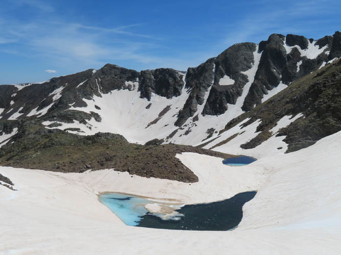
The valley immediately to the west was completely covered in snow, with several small iced-up lakes tucked away, including Estany Negre (estany is Catalan for lake). The “normal” ascent route goes up this valley, but the trail had completely vanished under the snow. All we could see was a thin line of boot prints in the snow below us where the French hikers had come down. It didn’t look overly steep and the snow had softened up by now anyway, so we decided to give it a go.
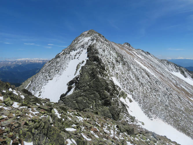
But first Pic de Baiau was on the menu. This small peak just north of Coma Pedrosa is reached via an easy to moderate scramble, crossing a small snow field in between. There are really nice views of Roca Entravessada from the top, which is apparently Andorra’s most difficult scramble, or easy rock climb, depending on the source you consult.
Having descended close to the Baiau pass (Port de Baiau) from the summit, we now had the entire snow-filled valley to our feet, like one massive snow slide! The risk of avalanches was virtually nil so late in the season and the angle of the slope was actually much gentler than it had looked from above. Perfect for plunge-stepping down and losing hundreds of metres of elevation in mere minutes!
We were excitedly yelling and screaming for joy, it was just so gorgeous to be here and there was nobody else around and. Almost nobody else… just after Estany Negre we ran into two German guys who were also on a through-hike in the Pyrenees. They were staying at the hut and were scoping out the area for the next day. We encouraged them to make a dash to the summit as we were only 300 m below and they took the challenge.
It was mid-afternoon now and the sun was out in full force, and we still didn’t have enough yet. Instead of following the main trial all the way down to the hut, we contoured around the snow-covered upper valley heading south in order to connect up with an official trail that would take us to the ridge above us. This worked well, despite one challenging spot (cairns) where a few difficult scrambling moves were necessary to get around an exposed rock outcrop.
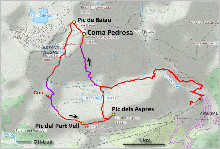
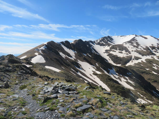
Having gained the ridge top, we enjoyed some fine views of the broad “boundary ridge” to the south. There is an official trail along this ridge that follows the Spanish-Andorran border, serving as an alternative approach to Coma Pedrosa as described in “The Mountains of Andorra”, a now out-of-print guidebook by Alf Robertson and Jane Meadowcroft. We continued along the trail-less ridge to the east to Pic del Port Vell, a small peak made up of thinly stacked plates of shale but easy to reach with very little scrambling.
Descending from the peak on the other side was even easier and actually quite comfortable along a nice, natural ditch parallel to the ridge crest. At the next col, Wen started heading down the scree and snow slopes towards the hut, whereas I still hadn’t had enough and quickly ran up the last peak along the ridge called Pic dels Aspres (easy to moderate scrambling).
Back down at the hut, we refilled our water supplies and sat down for another friendly chat with the two Germans who had just returned from Coma Pedrosa. They were the only guests staying for the night, which costs 16 Euros per person. The hut is all wood inside and looked quite spacious yet cozy at the same time. Definitely a great base for exploring the area.
It took us another hour and ten minutes for the remaining descent back to Arinsal, again we were the only people on the trail. Coma Pedrosa is hands down our favourite outing in Andorra, and I have a feeling we will be back one day to explore more in this gorgeous part of the Pyrenees!
DISCLAIMER: Use at your own risk for general guidance only! Do not follow this GPX track blindly but use your own judgement in assessing terrain and choosing the safest route.
What a lovely start to a great day!
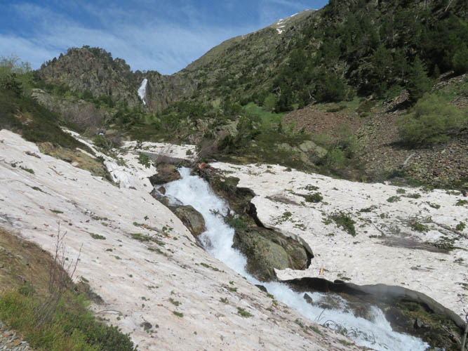
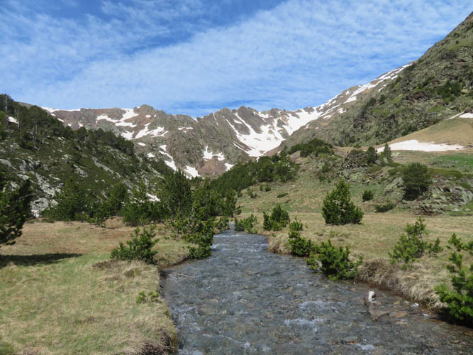
There’s still plenty of snow around, swelling creeks and lakes everywhere.
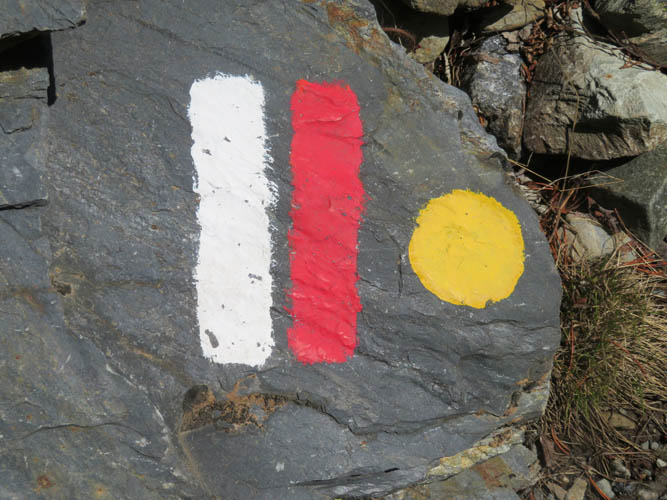
Freshly painted trail markers.
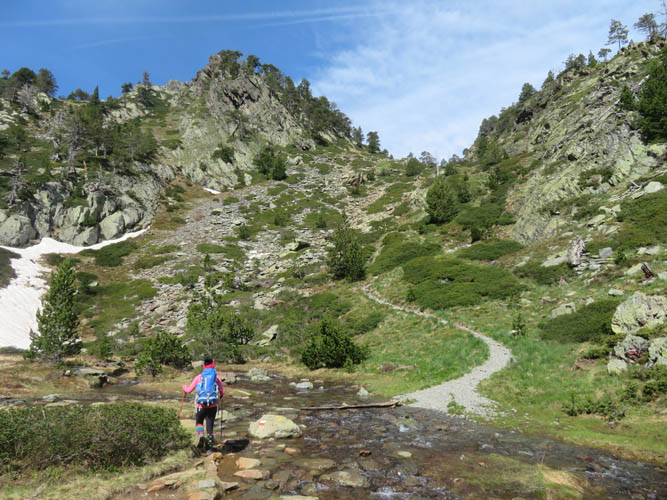
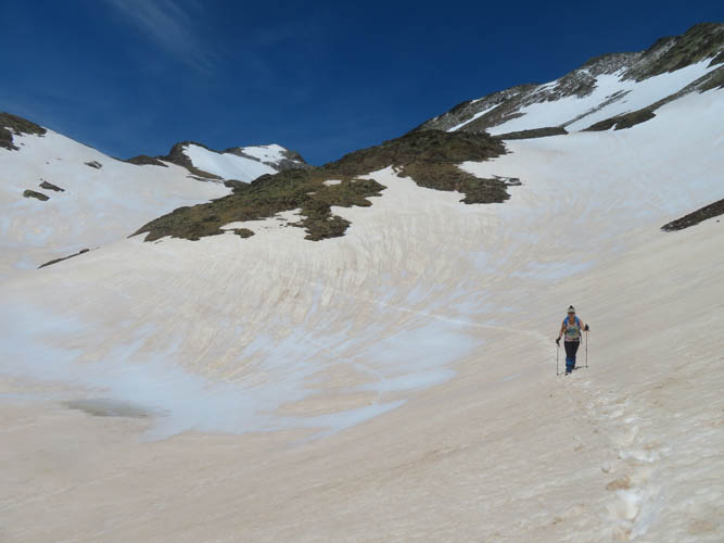
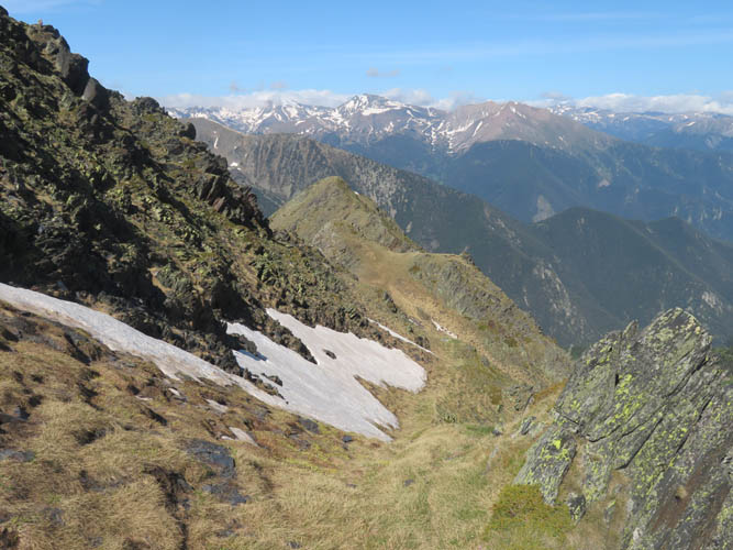
It’s a really nice approach hike to get into the upper valley.
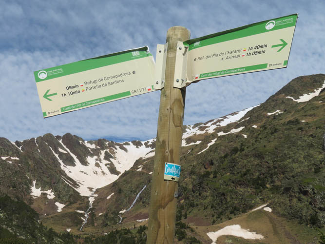
Trail sign close to the Refugi de Coma Pedrosa hut.
This is where we crossed the creek (hopping) to get to the southern slopes of Coma Pedrosa.
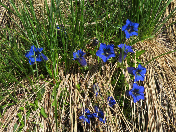
The intense blue of these flowers really struck me.
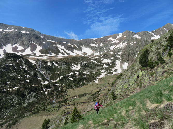
Hiking up the steep grassy slopes of the south ridge.
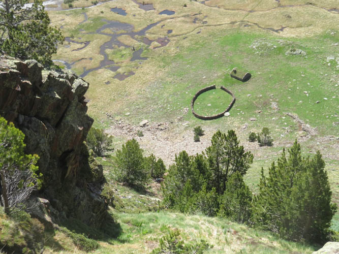
An old shelter in the valley below.
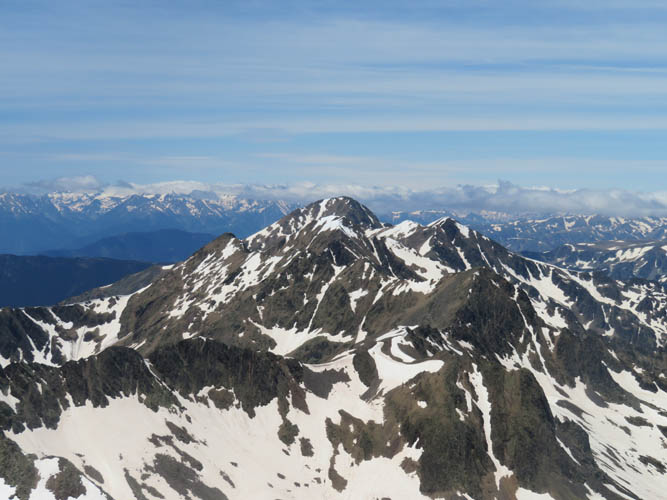
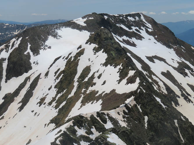
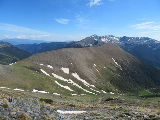
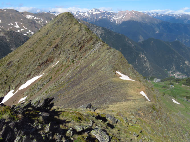
Pic Alt de la Capa (centre). Pic dels Aspres sits on the ridge to the left.
Perfect conditions today!
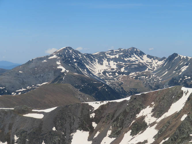
View towards Pic de la Bassera, La Torre de Cabús, and Bassiets (L to R).

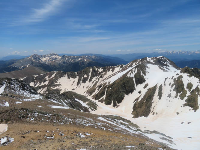
Pic de Sanfonts is the high point on the ridge across the snow-clad valley to the west.
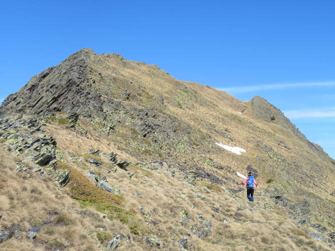
On the summit ridge on a decent trail.

Pic de Baiau
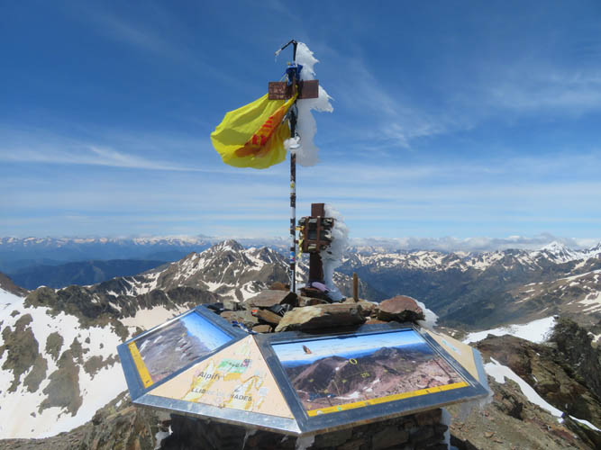
Coma Pedrosa summit panorama! Wind-sculptured ice still clings to the summit poles.
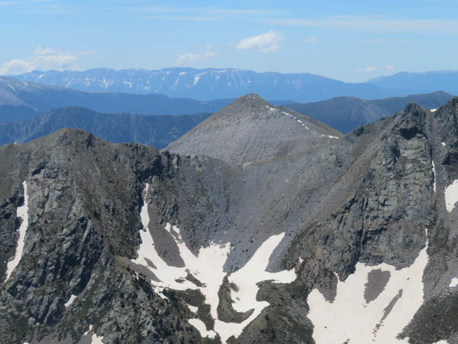
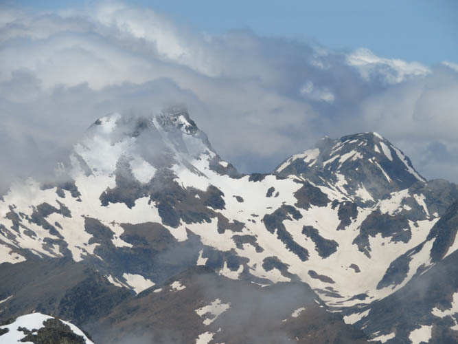
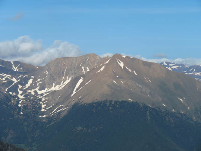
Pic de Monteixò in the centre, already on the Spanish side.
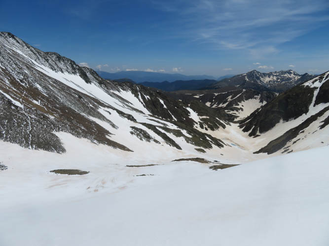
This is looking down our descent valley, with Pic de Sanfonts on the right.
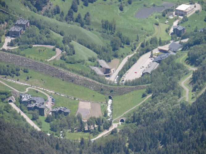
A zoomed in shot of the Arinsal parking lot where we started this morning, 1400 m below us.
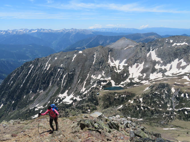
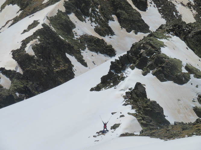
Wen admires the views. Pic de Baiau, the smaller peak in the centre of the photo, is our next stop.
Descending Coma Pedrosa on the north ridge.
Looking back at Coma Pedrosa from half way up Pic de Baiau.
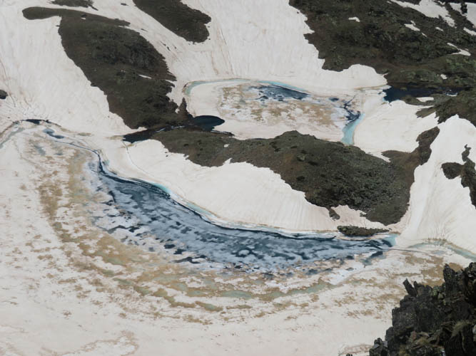
The lakes below us are still mostly frozen.
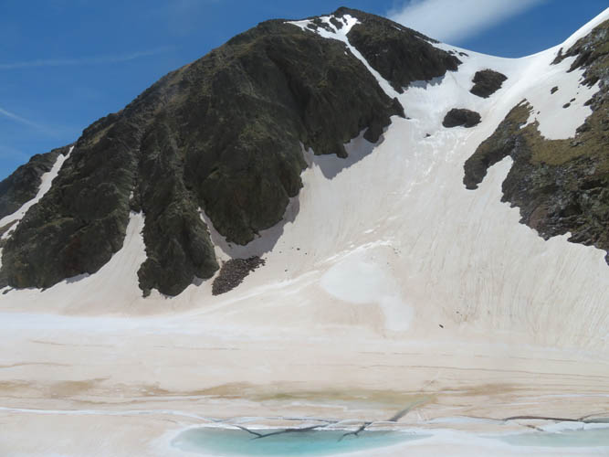
The connecting ridge between Baiau and Pic de Sanfonts – not an option today with all the snow covering the steep slopes.
We seem to be the only people around.
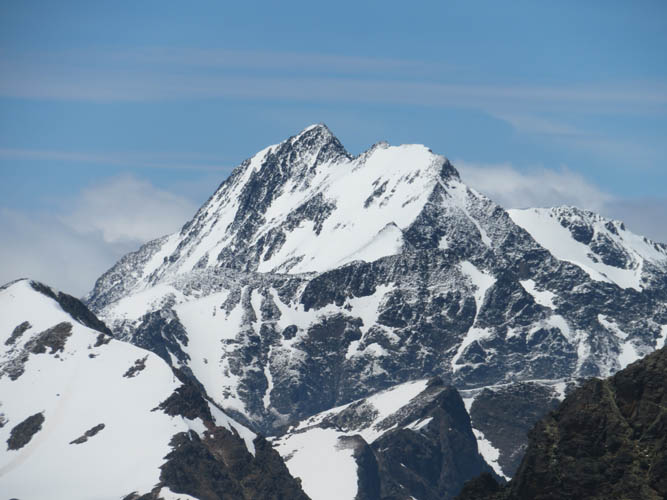
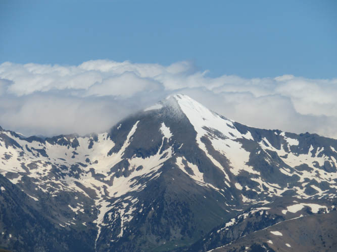
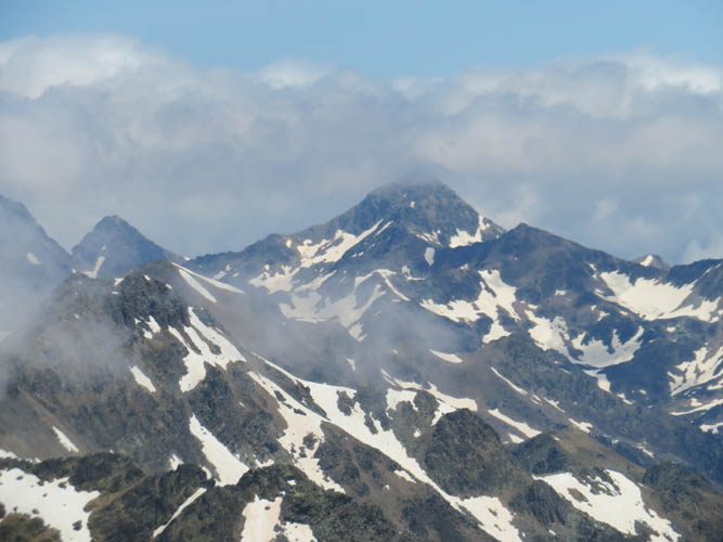
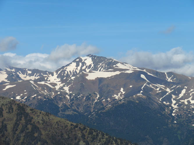
Pica d’Estats (3142 m)
Descent into a valley full of snow.
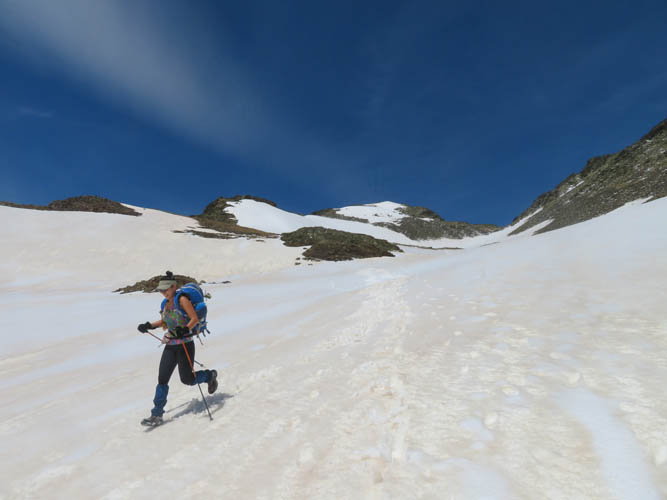
It’s a fun and fast jog down in the soft snow.
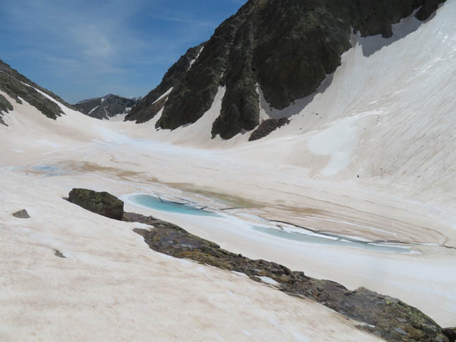
We pass around these frozen lakes on the left.
Black, white and blue
Following the tracks made by the French hikers.
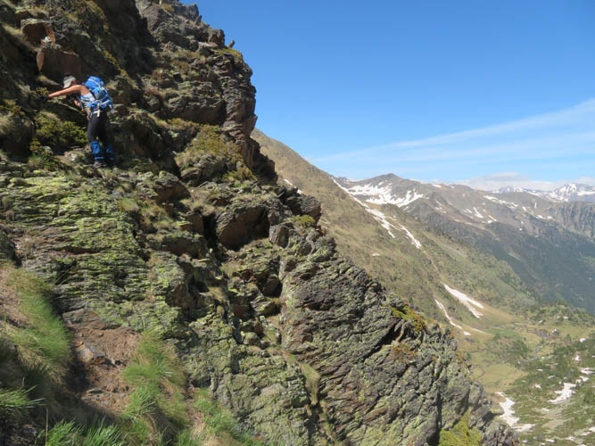
The crux of the trip while contouring around the valley to gain the ridge south of Coma Pedrosa: a short section of difficult scrambling along an exposed ledge.
At the top of the ridge, looking towards Pic de Sanfonts (far right).
And a glance down the valley towards the Refugi de Coma Pedrosa and a lake named Estany de les Truites.
On the other side, south of the ridge, lies the gentle ridge demarcating the boundary between Spain (R) and Andorra (L).
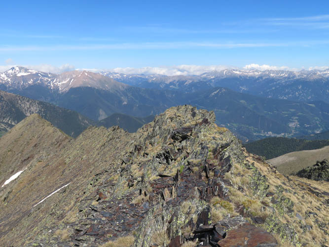
Next destination: Pic del Port Vell along the ridge, an easy hike.
To the north we can see the entire mass of Coma Pedrosa now. Our ascent route approximately follows a diagonal line from near the lake straight to the summit ridge.
The shaly top of Pic del Port Vell.
A convenient grassy dip forms a natural pathway down the east side of the ridge.
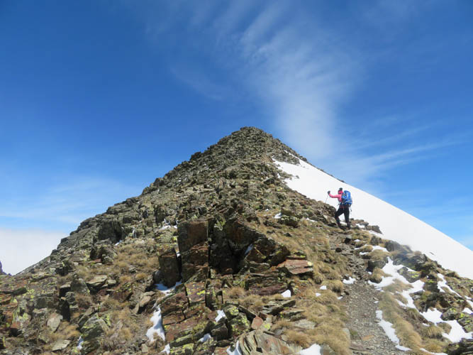
Last stop today: Pic dels Aspres, a moderate scramble that can be done in about 20-30 min (one way) from the saddle below.
Casamanya in the centre of Andorra, as seen from Pic dels Aspres.
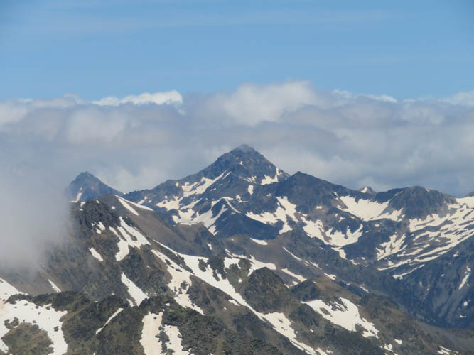
Pic de l’Estanyó to the east, another popular peak to climb in Andorra.

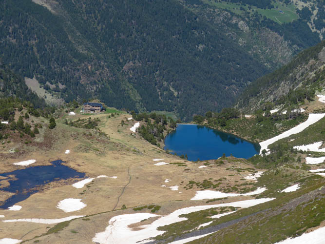
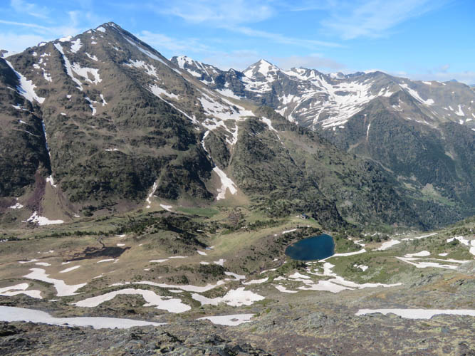
Estany de les Truites, a lovely lake by the Coma Pedrosa hut.
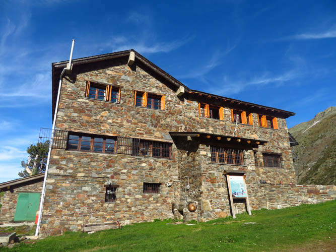
Refugi de Coma Pedrosa