Banff National Park, AB, Canada
18 July 2021
Solo
Possible first ascent of a very challenging peak
After a pleasantly easy surprise on Melanin Peak earlier in the day, my second objective today turned out to be a much tougher nut to crack. Snowflake Peak is one of the highest (the highest?) summits along the massif that stretches south from Prow Mountain between Snow Creek in the east and the Red Deer River in the west. Most of the peaks in this northern part of the Vermilion Range only have informal names borrowed from nearby lakes, with the exception of Prow Mountain which is an official name. As expected, there was no information to be found on any previous ascents up Snowflake Peak.
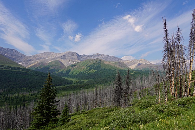
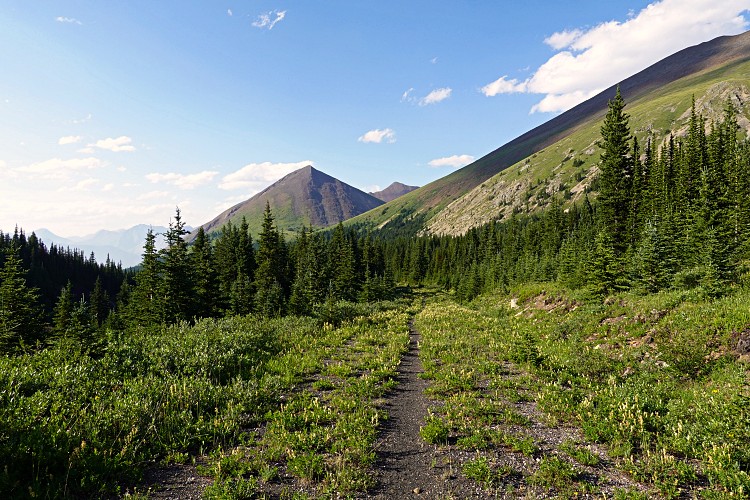
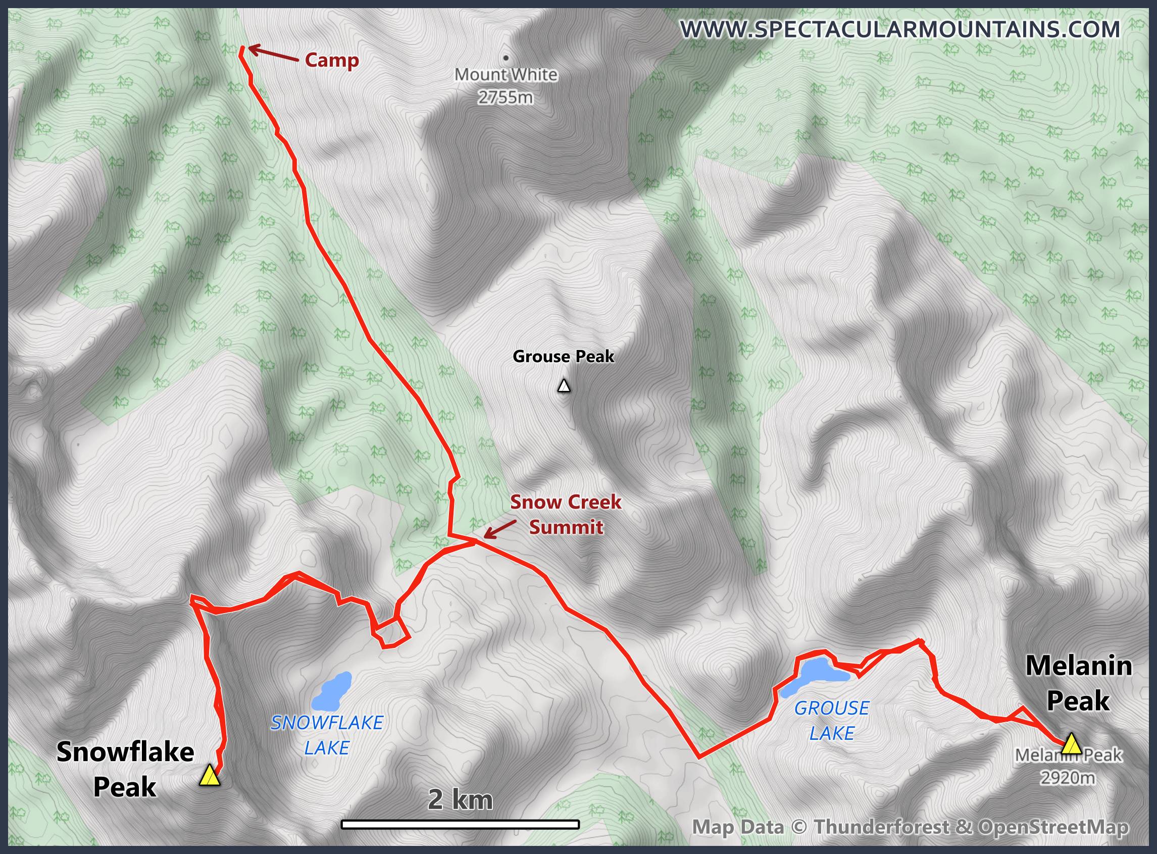
Still full of energy and excitement from my successful morning ascent, I quickly packed up my tent and hiked around the northwest shoreline of Grouse Lake to the drainage that runs down the west side to the Cascade Fire Road. The drainage itself is very bushy but the grassy slopes on its north side are nice and open, with only the occasional deadfall to avoid. At the fire road I turned right and walked up to Snow Creek Summit, which at 2248 m is the highest point along the trail between Banff and the Red Deer River. One can clearly see how this used to be a proper single-lane road, even though it’s hard to imagine that there used to be vehicles driving out here in the middle of nowhere. Nowadays the “road” is mostly overgrown and typically only has a single faint track that sees the odd horse traffic in the summer.
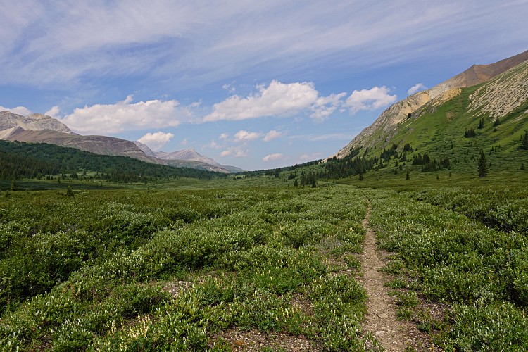
About 2.6 km along the road, only about 100 m after passing Snow Creek Summit, I reached an old wooden sign pointing west with the faded words “Snowflake Lake” written on it. I didn’t really expect a trail here (nothing on my maps) and I only knew that a couple km further north there should be an old trail branching off from the Cascade Fire Road to the lake. I couldn’t really see a trail from where I was but the terrain looked easy so I stashed my overnight gear under a tree and headed west across a broad open valley.
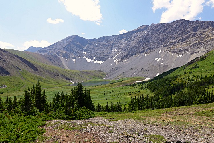
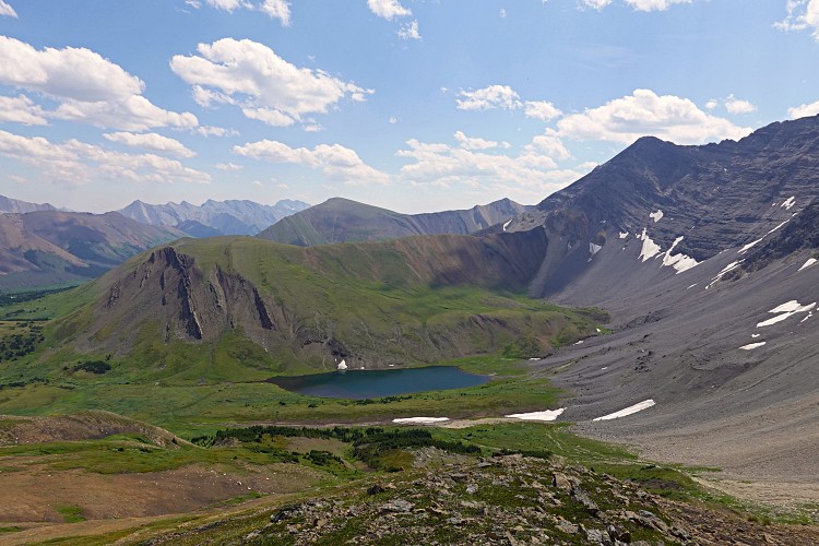
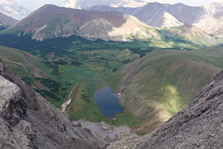
Hiking across meadows and through stands of light forest I eventually crossed the little creek that originates from Snowflake Lake and headed up into the alpine cirque around the lake. The setting is absolutely beautiful up here, although the lakeshore looked a bit muddy.
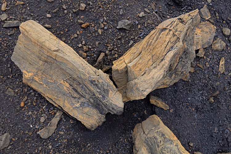
I really had no idea of how to get up to Snowflake Peak, which sits directly west of the lake above a steep escarpment that appears to continue uninterrupted to the north and south. Hoping to find a break somewhere in the cliffs to the north where I could see some rubbly rock and gullies, I hiked up an E-W rib north of the lake. The rib is made up of steeply tilted layers of clastic rocks, including an interval of soft, dark grey mudstone and coal where I stumbled upon a geological treasure: pieces of petrified tree trunks. The light ochre chunks of fossilized wood showed various states of preservation but I could clearly identify tree rings on some of the surfaces. What a neat find, I thought!
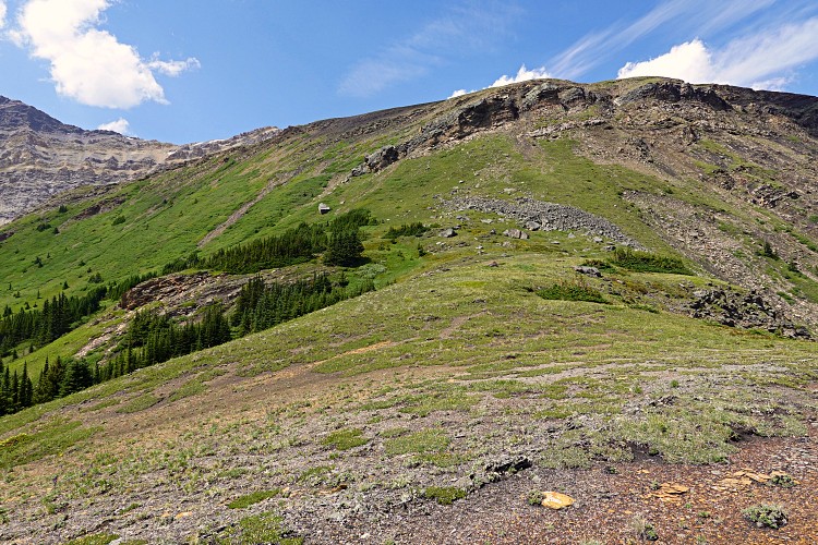
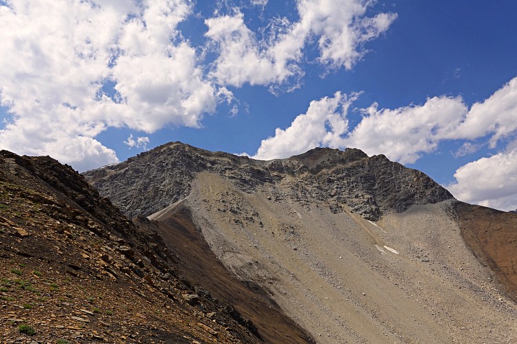
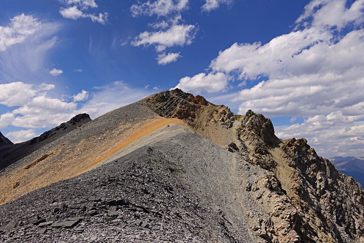
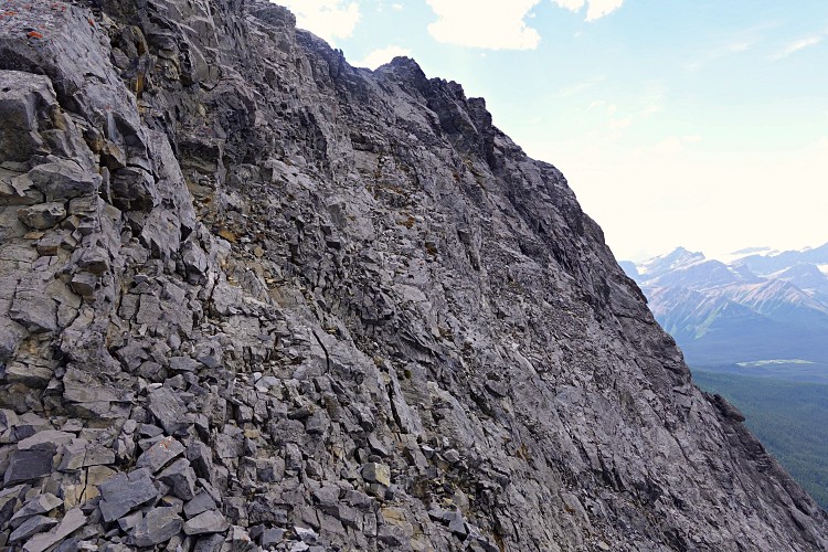
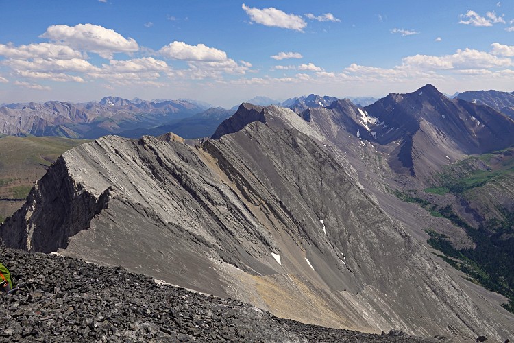
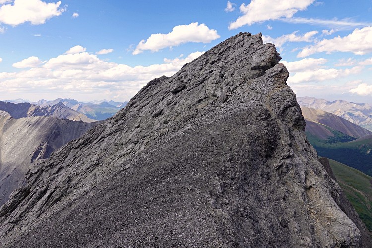
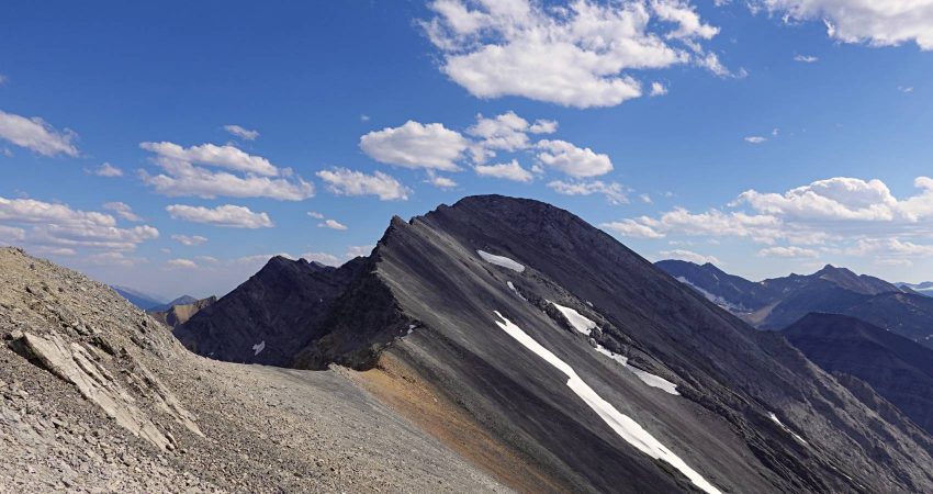
After this pleasant distraction my mind turned to the challenge ahead again – how to break through the daunting looking cliff. I scrambled as high as I could up against the escarpment, then angled right (north) until I managed to find small steps and steep gullies to slowly climb the cliff face. The rock was crumbly and unreliable, and I probably shouldn’t have done this solo, but I just pushed through until I gained the top of the ridge.
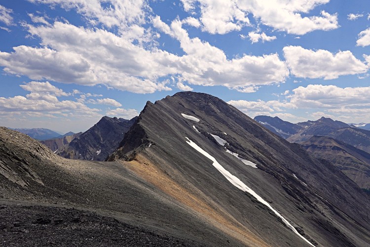
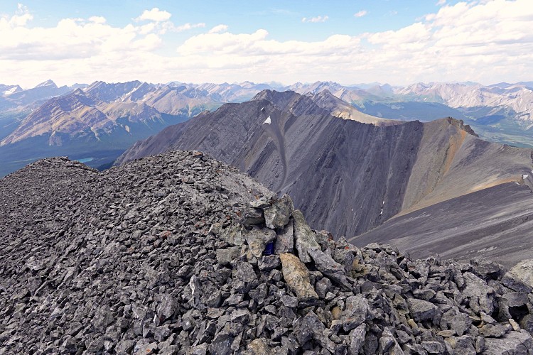
There was still a significant distance to cover from this point to the summit and it took me another hour of easy to moderate but enjoyable scrambling along or just off the ridge crest to reach the summit block. This was the second and more difficult crux of the day: a short section of low 5th class climbing, perhaps 20-30 m high, up a near-vertical cliff at the top of the summit block. I took my time and double-checked every hold and move as there was still quite a bit of loose rock around. Once up the cliff, it was only a few metres to the small rubble summit, which – no surprise – was without the faintest trace of a cairn.
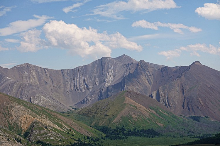
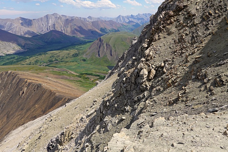
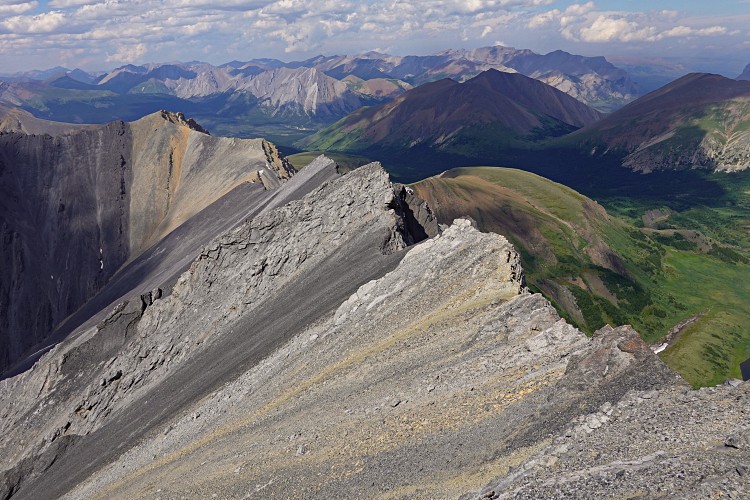
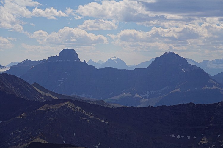
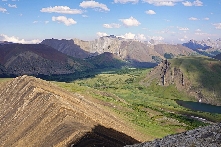
I am so unfamiliar with this area that I had trouble identifying many of the peaks to the south and west. Mount McConnel, Mount Drummond and Mount Douglas were some of the few exceptions. Of course my mind was also preoccupied with thoughts about how to get off this mountain again…
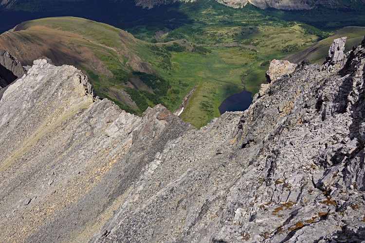
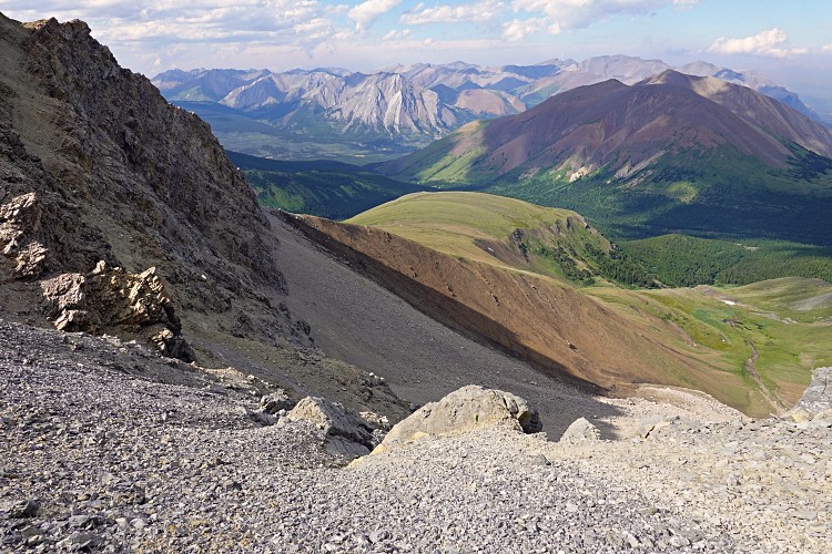
Instead of going down the middle of the cliff face again, I tried to descend along the eastern edge. This wasn’t any easier or safer than the face – it was slightly angled but much more crumbly and with significant exposure. Very slowly I shuffled on my behind as far as I could, then turned into the rock and downclimbed the rest… phew, now the rest should be easy!
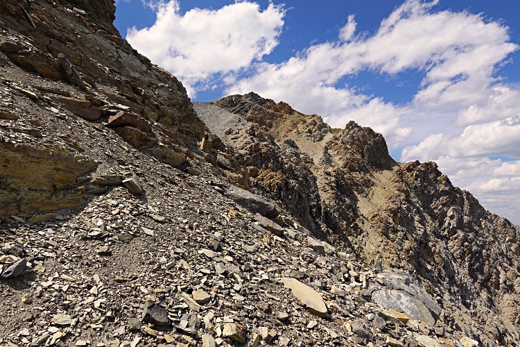
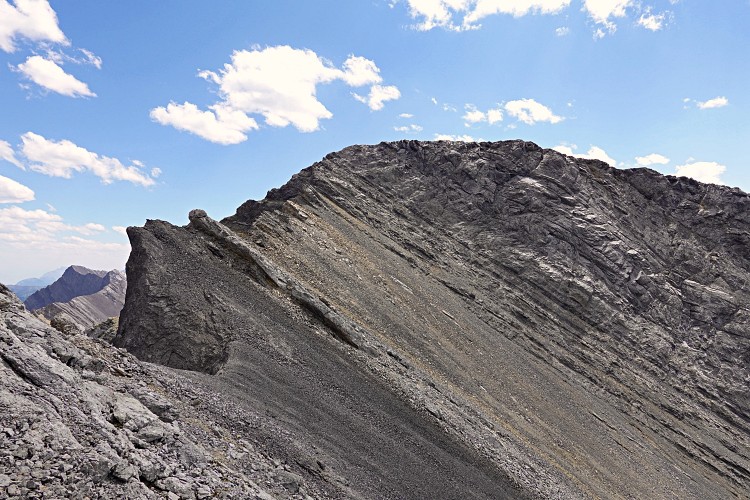
And it was, sort of. After backtracking along the ridge I found a slightly more manageable descent gully a short distance further north. It was mostly scrambling on loose rock, but even here I had to downclimb a few steps to get to safer terrain below the escarpment. From here I simply retraced my steps back to where I had dropped my big backpack. It was a hot day and I had already been out of water for a couple of hours by the time I crossed the creek below the lake. Splashing my face and replenishing my supplies with the cold, crystal clear mountain water felt absolutely heavenly after the long and sweaty scramble I had just completed.
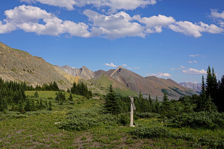
It was already 7 PM by the time I found a suitable spot to camp along the Cascade Fire Road. In fact, it was ideally situated: a small flat area in a bend overlooking the valley and right across from my planned ascent route for Prow Mountain the next day. There was also a little creek with cold water running in a drainage right next to it. I set up my tent, devoured another big pack of freeze dried dinner, hung up my food on a tree nearby, and cozied up in my sleeping bag. The whole night various unidentified critters kept me awake by rustling and shuffling by and under my tent’s fly and footprint tarp… it’s a good thing I stored all my belongings inside, otherwise I’m sure some of it might have been missing or eaten up the next day (as happened to Richard and me on our Mount White trip a few years ago)!
|
Elevation: |
3010 m |
|
Elevation gain: |
890 m |
|
Time: |
6.0 h |
|
Distance: |
10.0 km |
|
Difficulty level: |
Difficult climber’s scramble (Kane), T6 (SAC) |
|
Activity: |
Hiking, Scrambling & low 5th class Climbing |
|
Reference: |
Own routefinding |
|
Comments: |
Stats refer to trip from/to Cascade Fire Road |
|
Personal rating: |
4 (out of 5) |
NOTE: This GPX track is for personal use only. Commercial use/re-use or publication of this track on printed or digital media including but not limited to platforms, apps and websites such as AllTrails, Gaia, and OSM, requires written permission.
DISCLAIMER: Use at your own risk for general guidance only! Do not follow this GPX track blindly but use your own judgement in assessing terrain and choosing the safest route. Please read the full disclaimer here.