Kananaskis, AB, Canada
16 September 2019
With Wen & Sean
Back on Canmore’s most popular trail
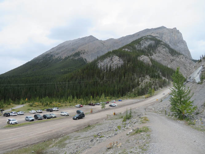
We were sitting at an Asian restaurant in Canmore digesting a satisfying meal and recounting the previous day’s adventures on Mount James Walker… Somehow, half an hour later, we found ourselves at the parking lot for Ha Ling Peak and decided to go for a short afternoon hike. Ha Ling is arguably Canmore’s busiest and most popular trail and was also my first ever hike in the area about 10 years ago. Wen had been up here, too, but for our Australian friend Sean who is new to the Rockies this was a must-do. He only had a week to spare during his holidays and there we were sitting around in Canmore… of course we had to go up Ha Ling!
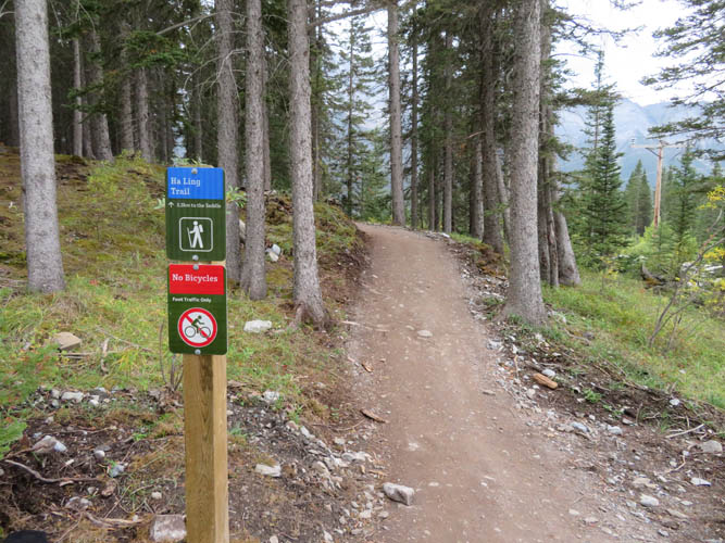
While the route was pretty good and obvious before, now that the trail has undergone extensive improvements over the summer it surely is impossible to get lost here. I guess the intent was to make this a family-friendly hiking trail so that even the most casual day-trippers and tourists can enjoy the hike and make it up to the top, which I think is actually a good idea for such a popular spot. Even if you don’t like crowds and tourists on your trail, there is still an infinite number of other peaks and ridges one can escape to where it’s a lot quieter, even around Canmore (Mount McGillivray, Mount Lawrence Grassi and Wind Ridge are only a few examples).
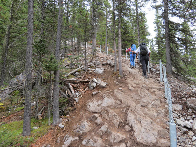
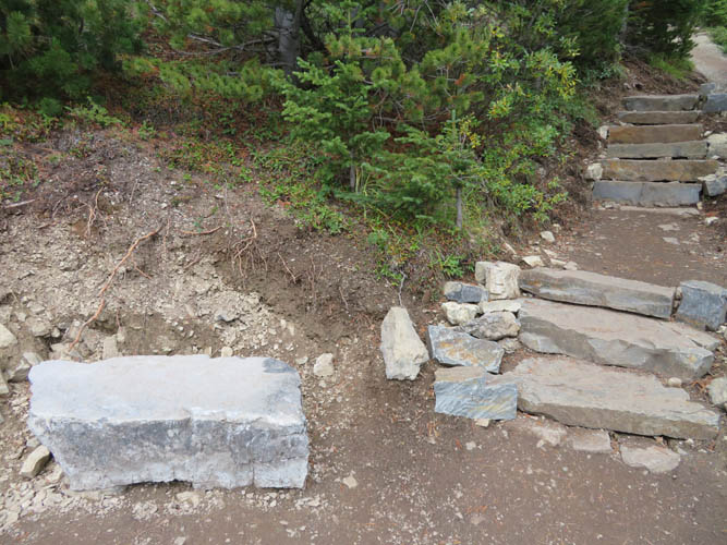
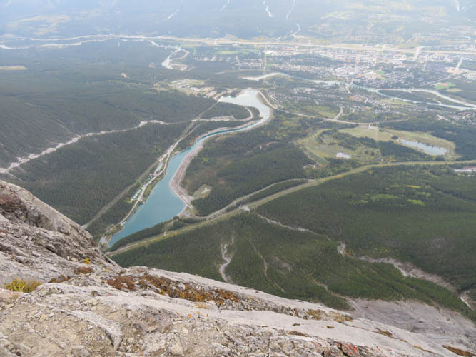
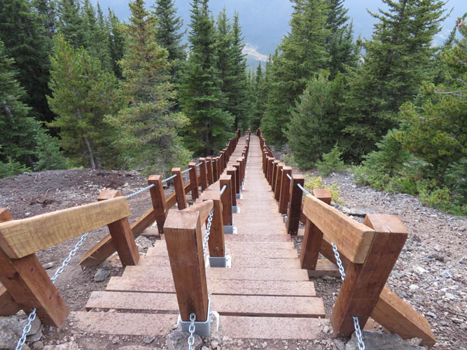
The new trail doesn’t disappoint. It’s pretty wide and features rock stairs and railings in the steepest sections, strategically placed flat rocks to sit on, brand-new signs warning of avalanche slopes, and even two wooden staircases near treeline. A small lookout point with views of East End of Rundle and Whitemans Pond below also seems to be a new addition. Although it was mid-afternoon and threatening to rain soon, the trail was still full of people of seemingly all ages and fitness levels. It’s certainly good to see so many folks come out and enjoy nature and get some exercise!
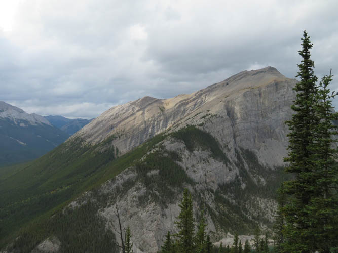
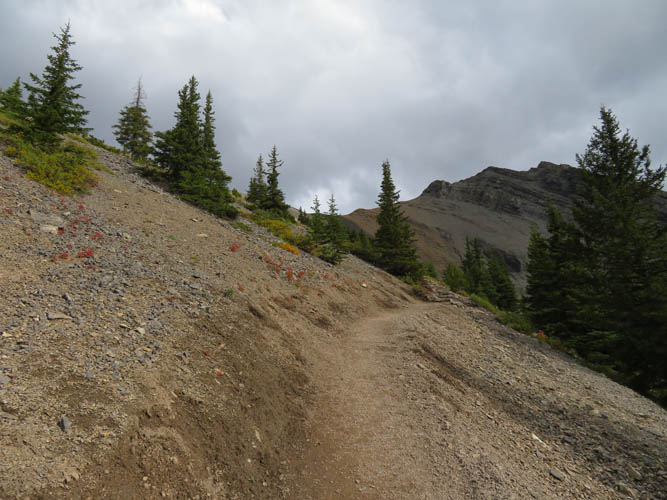
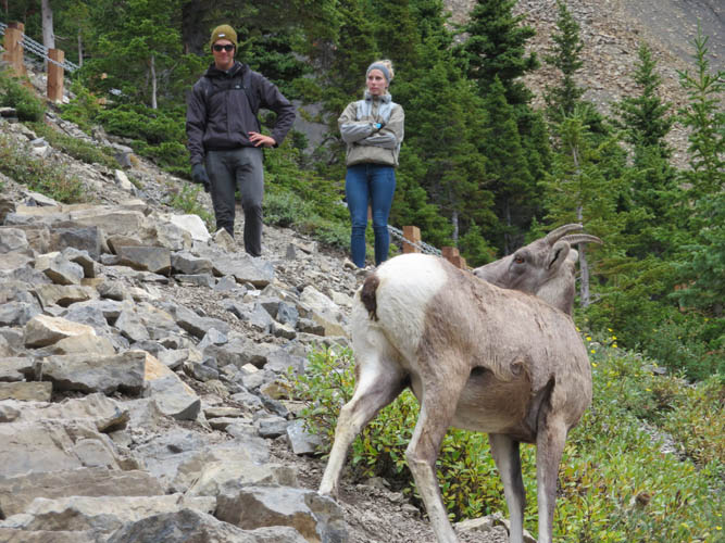
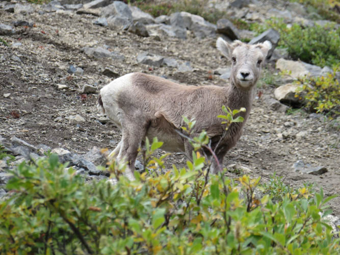
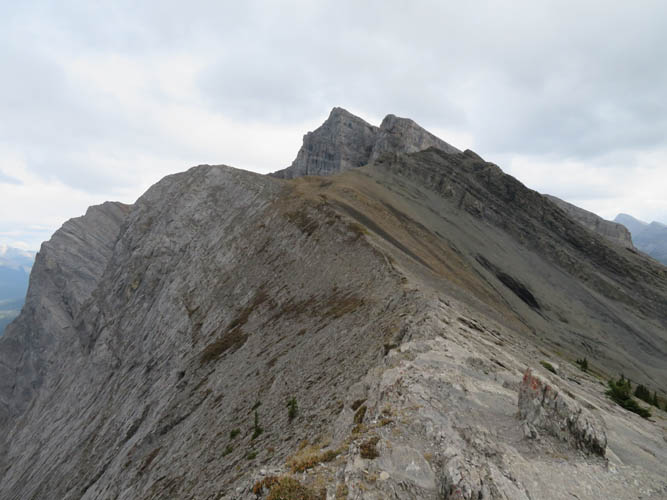
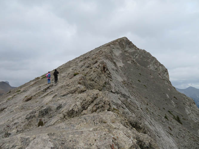
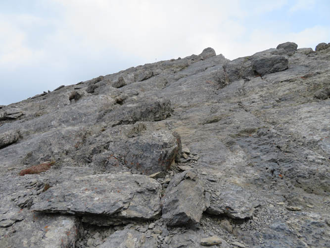
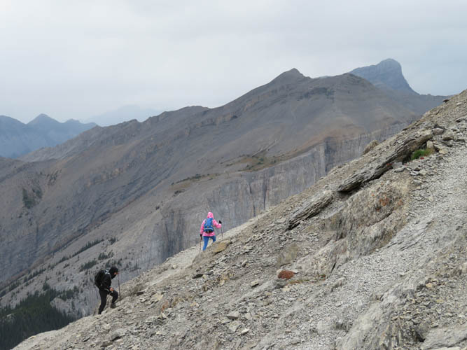
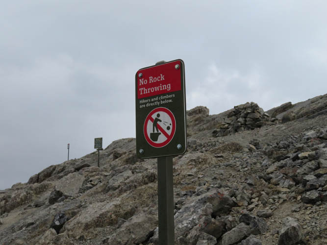
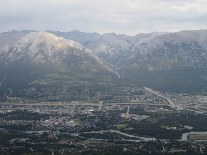
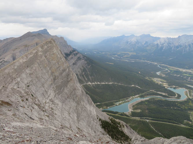
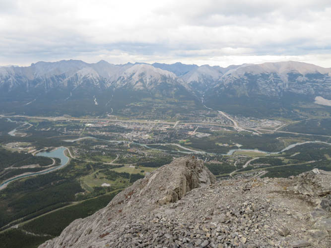
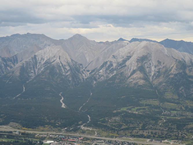
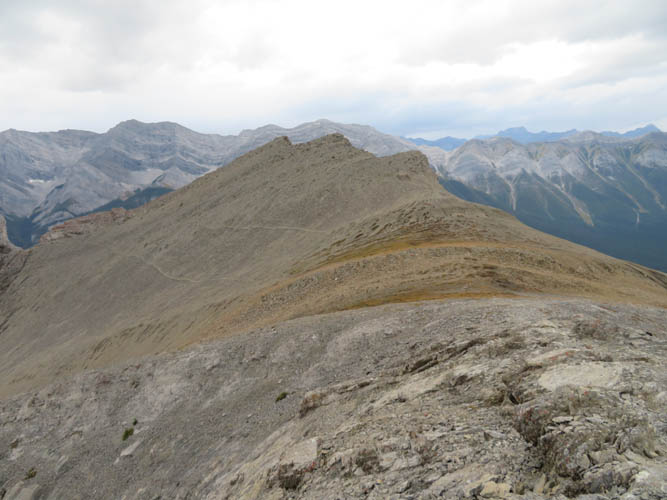
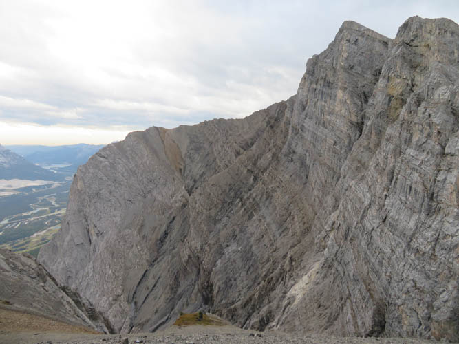
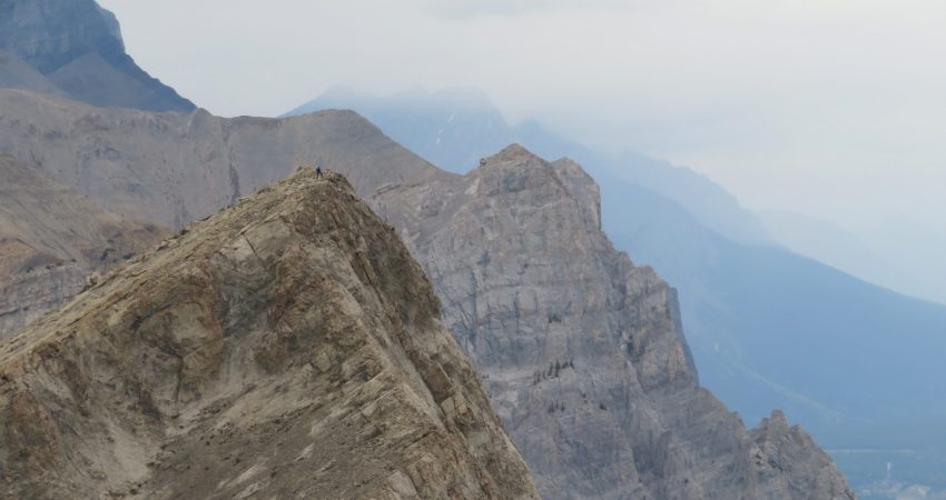
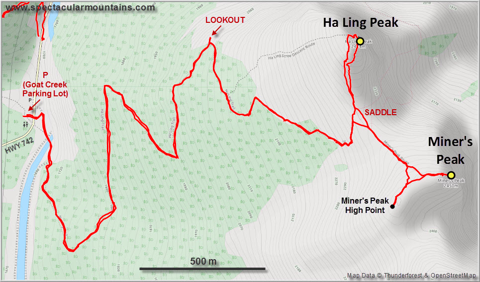
After a pleasant but fairly unspectacular plod through the trees, half chatting and half in auto-pilot mode, we reached the end of the maintained trail at the saddle between Ha Ling and Miner’s Peak where we finally enjoyed some good views. The last bit to the summit of Ha Ling is on a steep, rubbly trail, or you can scramble up solid slabs of rock to the right of the trail (this definitely requires some scrambling skills though). Sean was pretty impressed by the views of Canmore in the valley below and the sheer drop down the east side of the mountain. Hard to believe that rock climbers come up here! Signs warning people not to throw rocks down the cliff have been installed around the summit – a sad reminder that some folks just don’t understand or care about the dangers of rock fall to other people and wildlife.
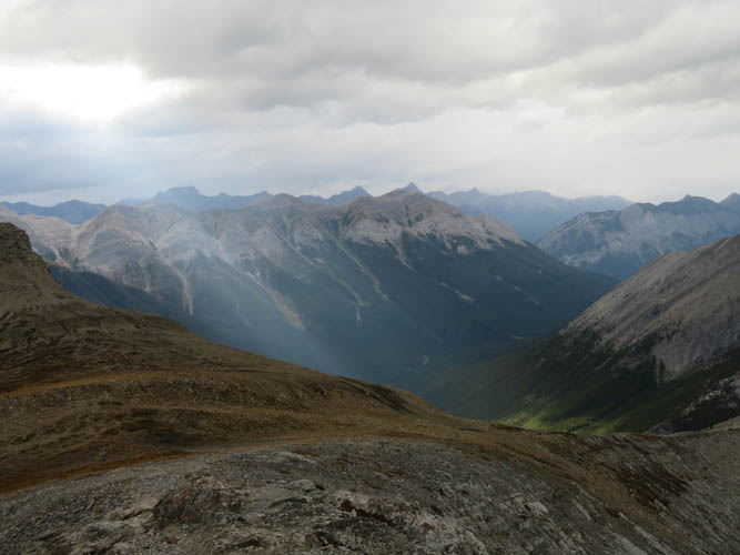
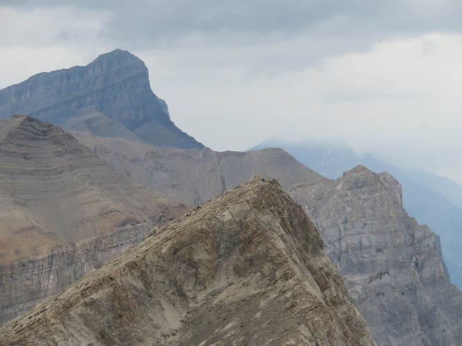
We enjoyed the best views of Ha Ling from neighboring Miner’s Peak, a small bump just to the south that is easily reached via a moderately well-beaten trail from the saddle. I think it took us just 15 minutes from the saddle to the top, so this detour is definitely worth it. From the official summit of Miner’s Peak I scrambled over to a cluster of three craggy outcrops a couple hundred metres to the west, which appeared to be slightly higher in elevation. It turns out it is – by a mere 5 metres according to my GPS (highest elevation recorded at 2477 m). Apparently these outcrops are locally referred to as The Three Miners. Note that tagging these involves easy scrambling on loose rock, so a bit more than just a hike.
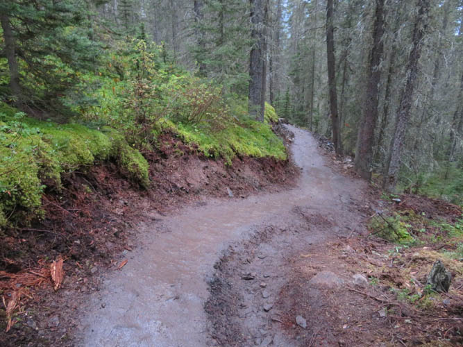
After descending back to the saddle it started raining, so we put on a good pace to get back down to the parking lot as quickly as possible. My only complaint about the main trail is that it is covered mostly with mud, which turns into a slippery mess when wet. Thank goodness for those grippy soles on our hiking boots!
Note: The official summit elevation of Ha Ling Peak appears to be significantly lower than what I measured with my Garmin GPS device. This is an interesting discrepancy given that almost all online sources quote 2407 m, while a few sites and maps (but not the official ones) show a value more similar to mine. Recent measurements carried out by UofC professor Gérard Lachapelle and his team using sophisticated geomatics equipment (a Trimble R10 GNSS device) resulted in a summit elevation of 2474 m for Ha Ling.
|
Elevation: |
Ha Ling Peak: 2407 m (official), 2465 m (my GPS) |
|
|
Miner’s Peak: 2472 m (my GPS) |
|
Elevation gain: |
940 m |
|
Time: |
3.5 h |
|
Distance: |
9.1 km |
|
Difficulty level: |
Easy (Kane), T1/T2 (SAC) |
|
Reference: |
Kane; local maps |
|
Personal rating: |
3 (out of 5) |
NOTE: This GPX track is for personal use only. Commercial use/re-use or publication of this track on printed or digital media including but not limited to platforms, apps and websites such as AllTrails, Gaia, and OSM, requires written permission.
DISCLAIMER: Use at your own risk for general guidance only! Do not follow this GPX track blindly but use your own judgement in assessing terrain and choosing the safest route. Please read the full disclaimer here.