
Pyrenees, France
25 May 2018
With Wen
This is one of the most popular hikes in the eastern Pyrenees of France, the Pyrénées Orientales. What looks like a few gentle hills from a distance actually holds more challenge than you’d think at first: it’s more than 1200 m elevation gain and 18 km round-trip after all!
After taking a month long break from hiking, driving half across Europe visiting city after city from Greifswald to Berlin to Amsterdam and Luxembourg, we were finally able to switch to “mountain hiking mode” again. Puig Neulós is the highest peak of the Albera Massif, which represents the eastern extension of the Pyrenees stretching from highway A9 all the way to the Mediterranean coast. There are numerous trails leading up to the summit, including one from near our campsite in the lovely French village of Sorède. Although the official elevation is only 1256 m, Sorède sits all the way at the foot of the mountain range near sea-level, so it’s still quite a bit of work to hike to the top!
We started from Sorède village centre and hiked up the main road to the trail head, which was easy to find (there’s also a parking lot here). Initially a bit confusing, the trail turned out to be pretty straightforward to follow, with the occasional sign post at various trail intersections. There are a lot more trails on these hills than we could see on Gaia (our hiking app), which makes me wonder how much more there is to explore here. Sorède or Laroque-des-Albères or any of the other small villages in French Catalonia would make for a great base to spend a week or so hiking your heart out here.
The main trail we followed was almost entirely in the forest, with only a few clearings where you had any views at all. We were surprised to see how little used the trail seemed to be – no other foot prints, no people at all. It was only until near the top where we encountered a few other parties that had come up on some of the other paths.
A large cairn built in 1886 marks the summit and the border between France and Spain. An old, dilapidated border fence stretches out along the ridge but neither the hikers here nor the many cows grazing on the lush, green mountain meadows seemed to care. Although it was a bit hazy today, we could still see parts of the sun-bathed French and Spanish coastline to the east. In stark contrast to that were the views of the much higher Pic du Canigou (2785 m) to the west, which looked fairly daunting with its rough, snow-covered slopes jutting into the clouds above. We will leave that one for another day!
Instead of heading back the same way to Sorède, we stuck to the advice of a French hiker we met at the summit and descended via another, more well-trodden path down to the village of Laroque. As on the hike up, it was mostly through lush, beautiful forest and once again there was no one else around until we came close to the village. A small fresh water spring called “Fonts dels Ocells” at the entrance to Laroque provided a welcome refreshment after nearly 7 hours of sweaty hiking! From Laroque it was a leisurely 2 km walk back to Sorède.

DISCLAIMER: Use at your own risk for general guidance only! Do not follow this GPX track blindly but use your own judgement in assessing terrain and choosing the safest route.
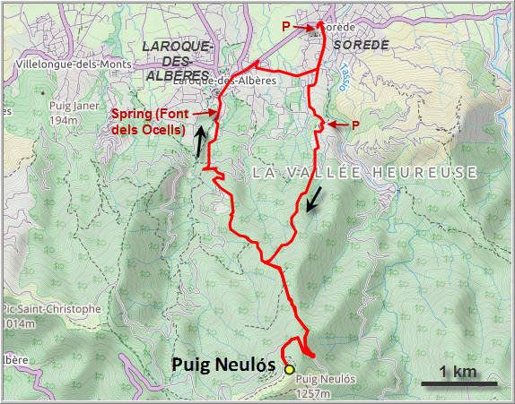
The “Roc du Midi”, a rocky outcrop on the north ridge leading to the summit of Neulós, from our camp site the evening before our hike.
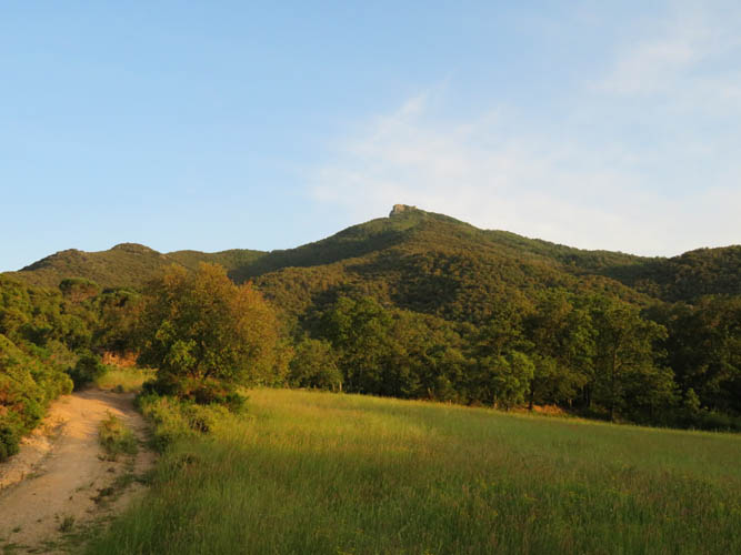
Close-up of the Roc du Midi in the morning.
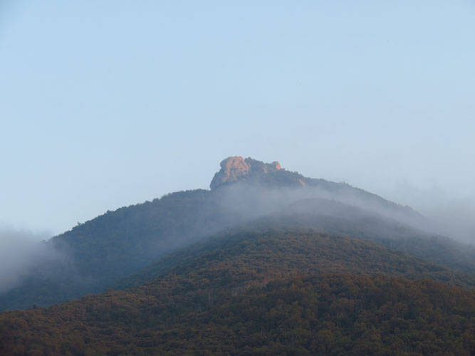
The charming village of Sorède, our starting point.
Trailhead just up the road ouside of Sorède. There’s also a small parking lot here.
Hiking into the forest on a great trail.
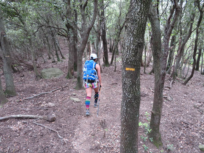
Yellow markers on trees and rocks are everywhere.
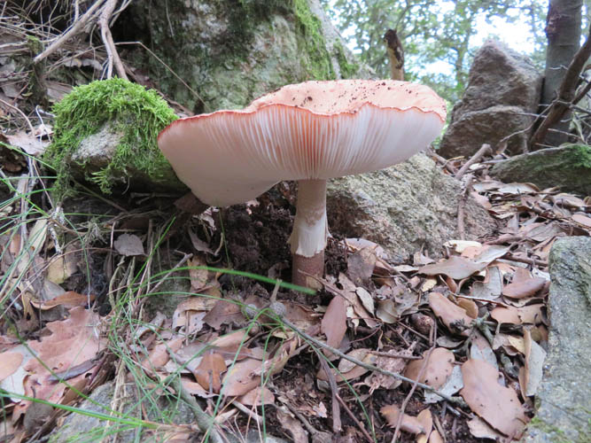
Mushrooms seem to thrive in these forests at this time of the year.
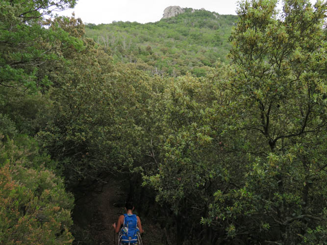
In parts, the trail is like a tunnel in the forest. Roc du Midi above.
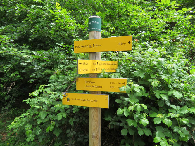
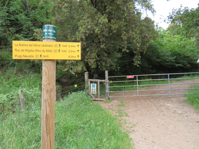
Lots of options at this trail intersection! Typically, times are posted for each destination, but these can’t always be trusted.
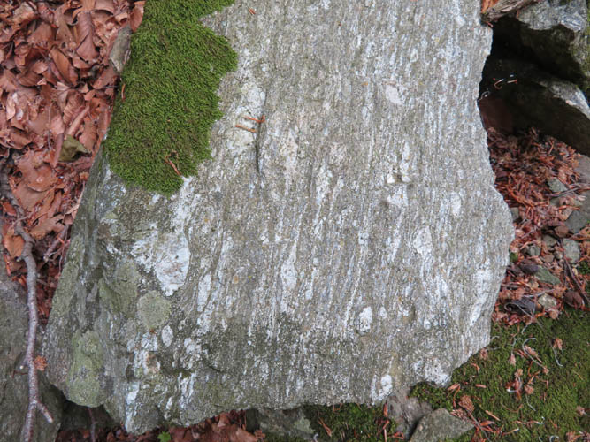
A nice piece of gneiss – metamorphic rock that makes up a good part of the mountain range in this region.
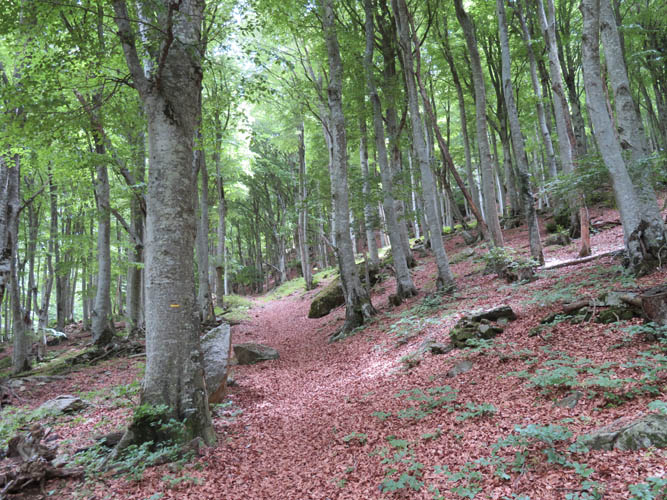
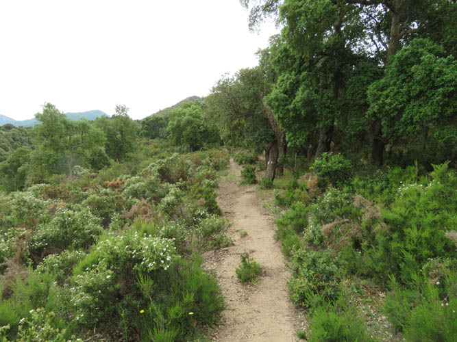
Easy hiking through beautiful forest.
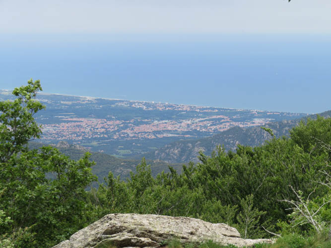
Finally a view out of the forest! This is the coastal resort town of L’Argelès-sur-Mer on the Mediterranean coast.
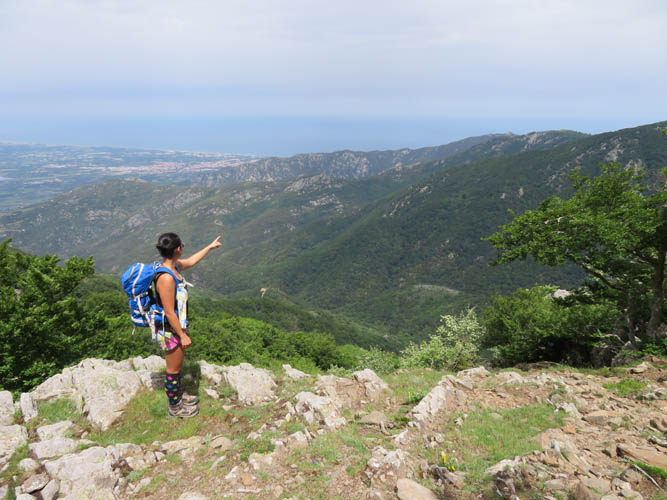
Is this going to be our next hike over there? Yes, probably!
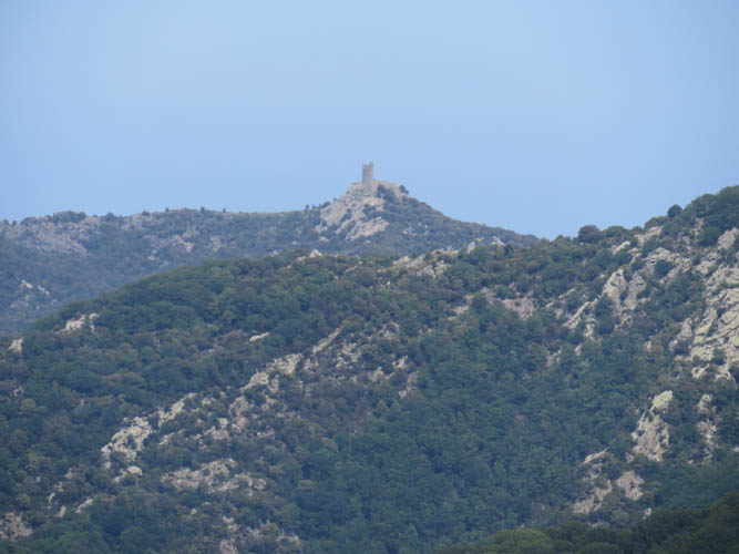
One of them is Tour de la Massane, the Massane Tower, which is spectacularly perched on a narrow ridge near the sea.
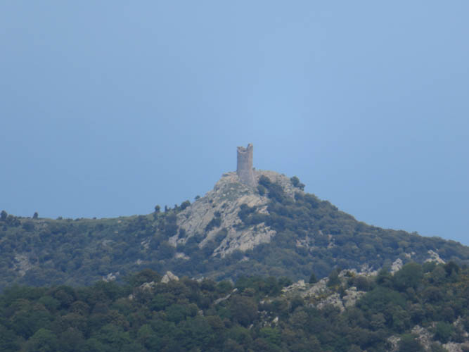
Close-up of the tower.
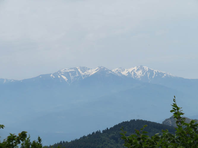
Far to the NW is Pic du Canigou (2785 m), still snow-clad at this time of the year.
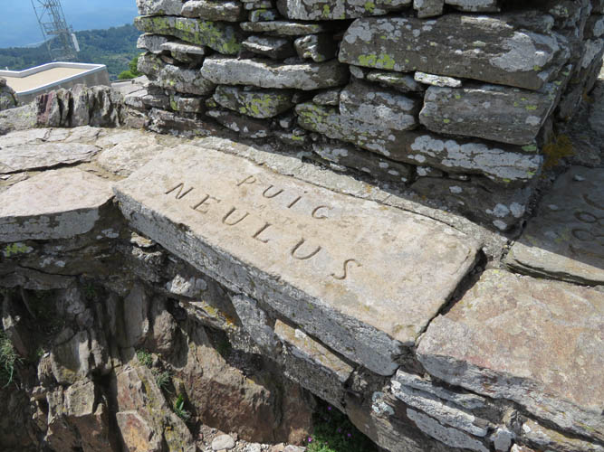
At the summit of Puig Neulós, which sits at the border between France and Catalonia/Spain. “Neulus” seems to be an old spelling variation.
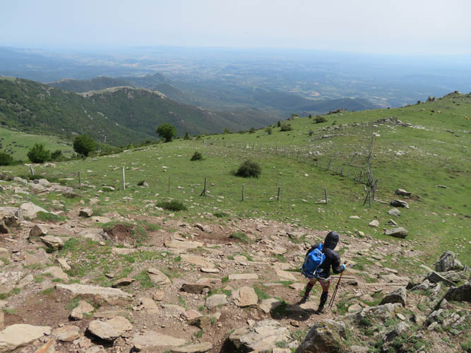
Looking down the Spanish side to the south.
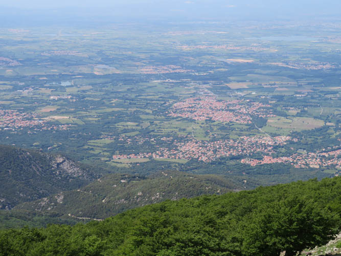
Down in the plains to the north is Laroque-des-Albères, where we are headed next.
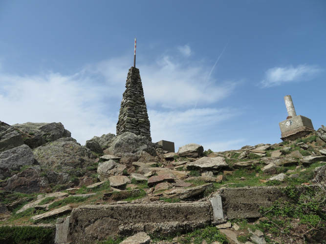
Another shot of the summit cairn. The concrete post on the right marks the official border point.
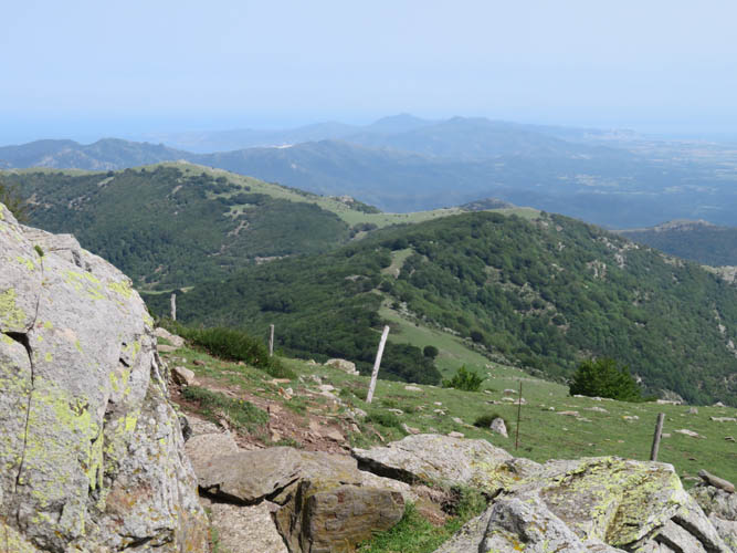
The Pyrenees are quite gentle and rounded near the coast here. The grassy high point on the left is Puig de Pradets.
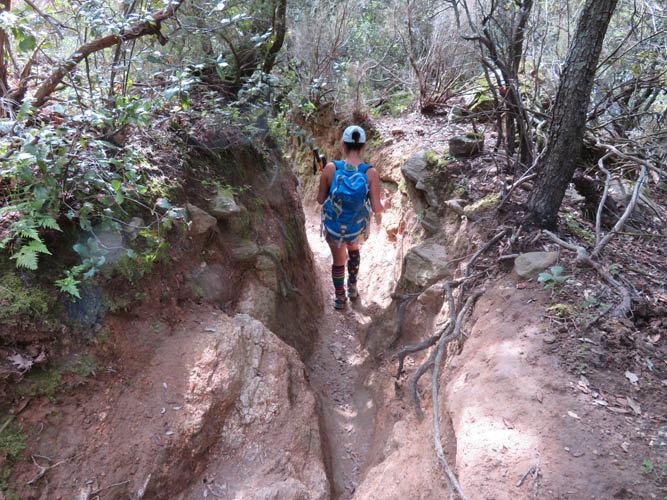
A water-worn section of the trail on the way down to Laroque.
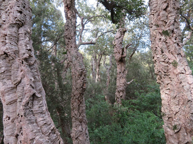
Cork trees. The bark of these oak trees is a natural source of cork that can be harvested every 9 years.
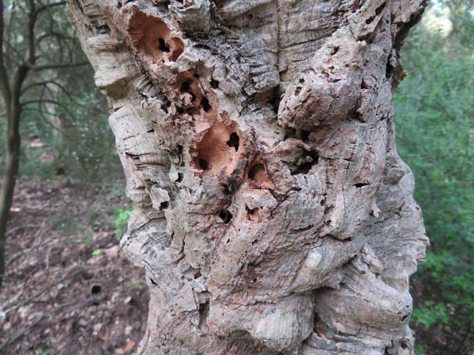
Close-up of the cork bark, which feels soft and light to the touch.
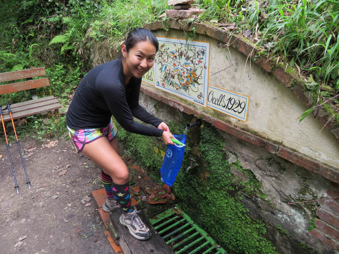
Font dels Ocells spring near the end of the trail – wonderfully refreshing!
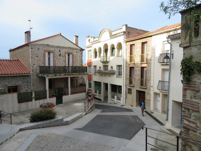
Laroque is another very picturesque and neat little French town worth a visit.