Kananaskis, AB, Canada
3 December 2021
Solo
Beautiful winter ridge walk
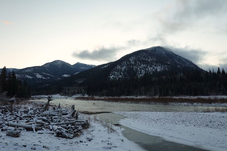
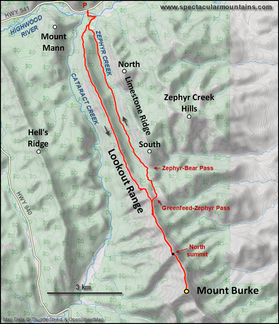
For years I’ve been wondering how feasible and enjoyable a walk along the long, long north ridge of Mount Burke would be. Trevor and I had done a nice scramble loop to the main and south summits of Mount Burke before, but the much longer north ridge of the mountain was a big unknown to me and there don’t seem to be any other trip reports around. This is known as the Lookout Range on official Canada topo maps. It stretches in an almost perfectly straight N-S line all the way from the Highwood River by the Sentinel Day Use area to its culmination at Mount Burke summit – a distance of more than 12 km. You can see this steadily rising arrow-straight ridge quite well from highway 22 when driving south towards Longview.
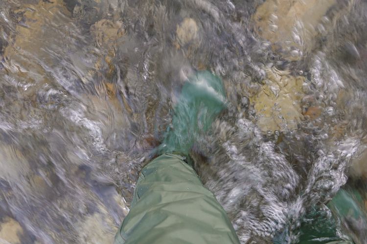
Today I finally got to put my long thought-out project into reality. It was a chilly morning (-14 deg C) when I crossed the Highwood River at the Sentinel Day Use area. My new waders have already proven their worth after a few trips and once again made the knee-deep crossing a breeze.
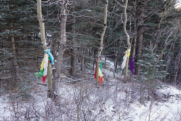
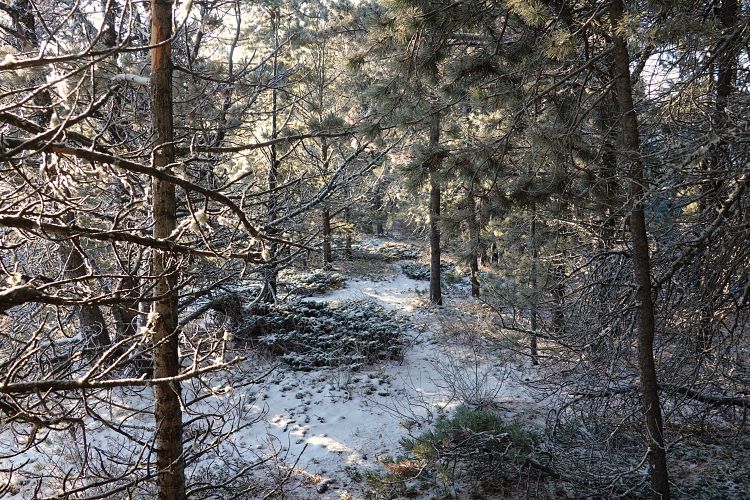
On the other side I picked up the river trail, walked east for a few hundred metres and then took my first right at an obvious junction, just before Zephyr Creek. This wide trail leads to Sundance Lodge Meadows in a short distance where there are some interesting prayer flags in a small stand of trees placed by the local Nakoda people. I crossed the meadows and headed up the lower treed northwestern end of the ridge. There are no trails here but, surprisingly, lots of colourful prayer flags at various spots in the forest.
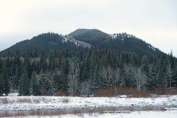
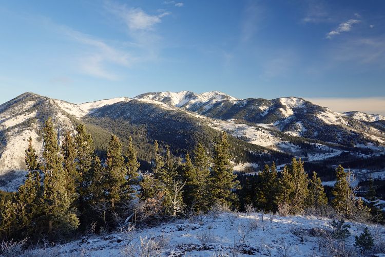
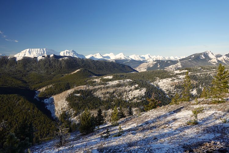
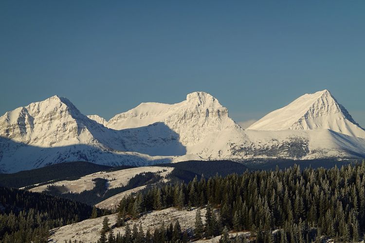
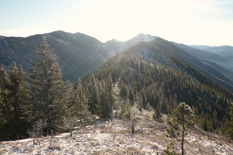
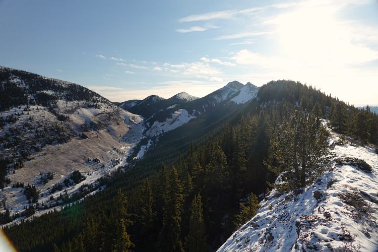
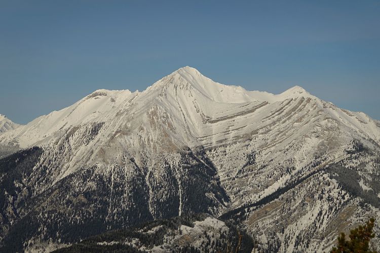
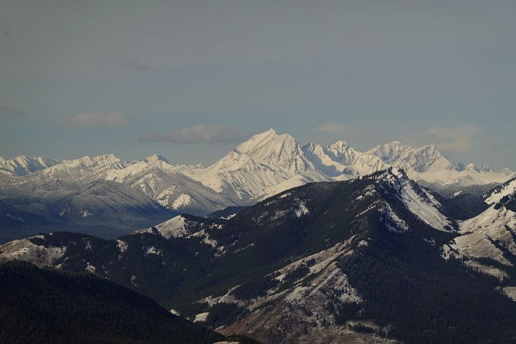
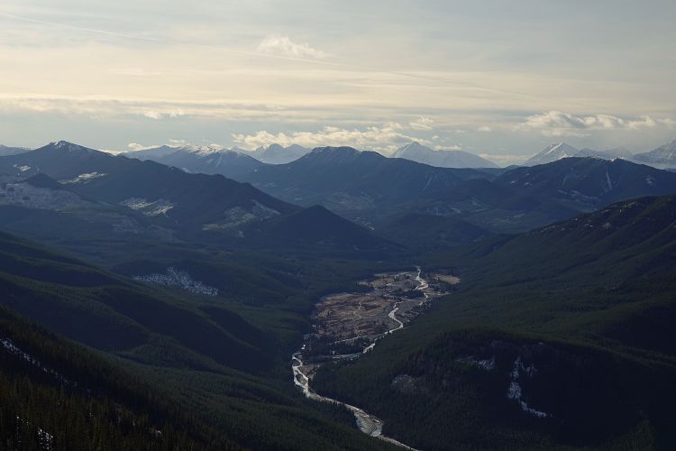
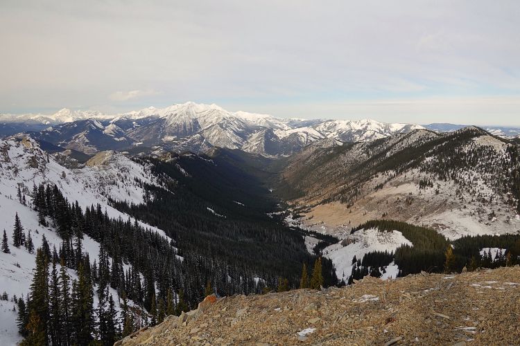
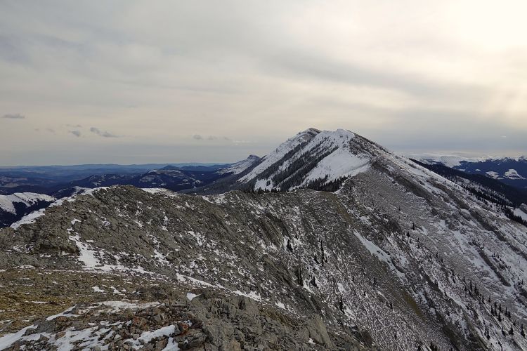
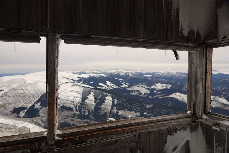
The ridge soon becomes more defined and then slowly rises at a more or less even grade with gentle undulations kilometre after kilometre. Sometimes a faint game trail appears along the crest, which is covered largely with trees and small bushes for about the first half of the way. Mount Mann and its south ridge slowly passed by on my right, with views of the snow-covered Continental Divide peaks and the beautiful syncline of Holy Cross Mountain improving as I gained elevation. Views to the east are mostly blocked by trees, however this changes higher up as you near the end of South Limestone Ridge, which together with North Limestone Ridge parallels the Lookout Range to the east. The eerie sound of a lone howling wolf echoed off the valley down at Zephyr Creek as I stopped to take my first break on this gorgeous sunny and windless day.
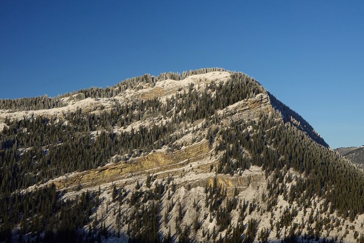
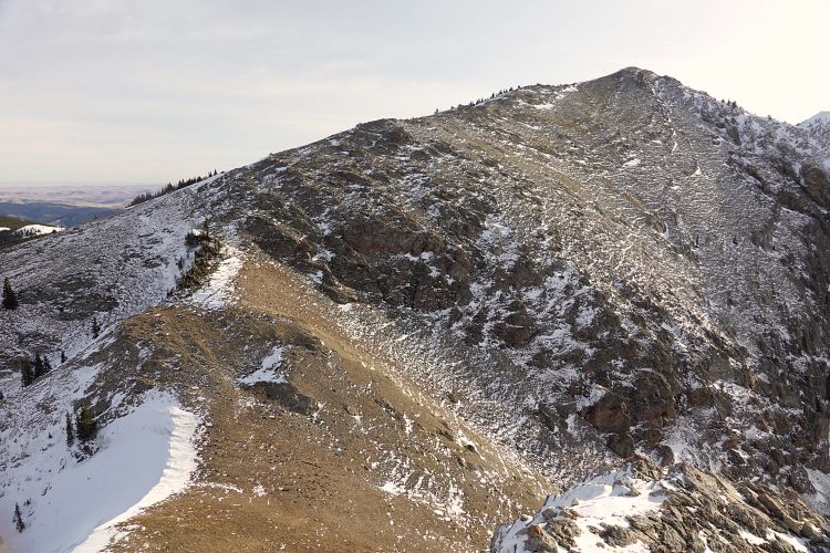
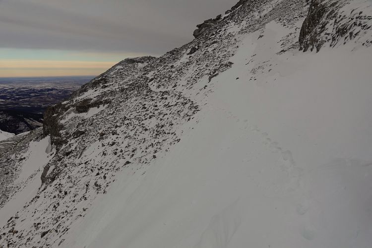
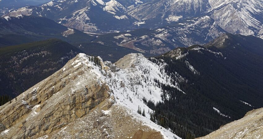
A couple kilometres before the Greenfeed-Zephyr pass, where a wide saddle connects the Lookout Range with the wooded foothills bumps to the east, the ridge drastically changes in character: you leave behind the trees and annoying shrubs and break out into the clean and hard rocks of the alpine. There is even a bit of scrambling to be had now! A sharp drop-off at one of the high points requires a small detour to the right (west) down a scree ramp, then left across talus back to the ridge crest. Nothing difficult, but some route-finding is necessary.
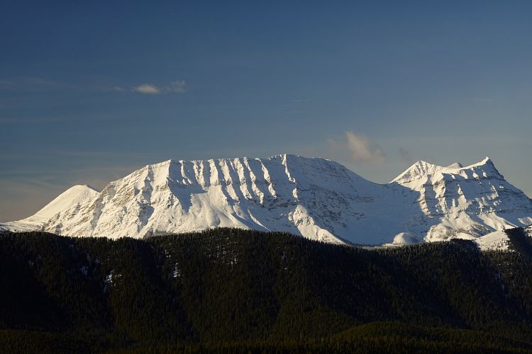
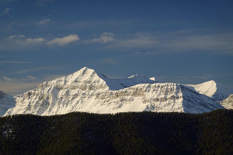
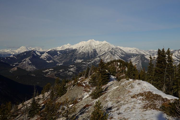
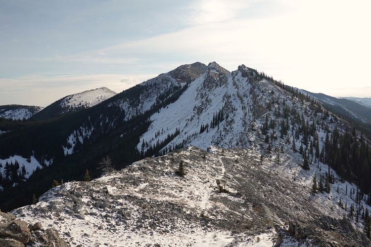
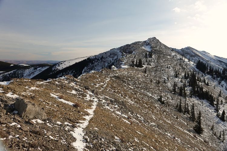
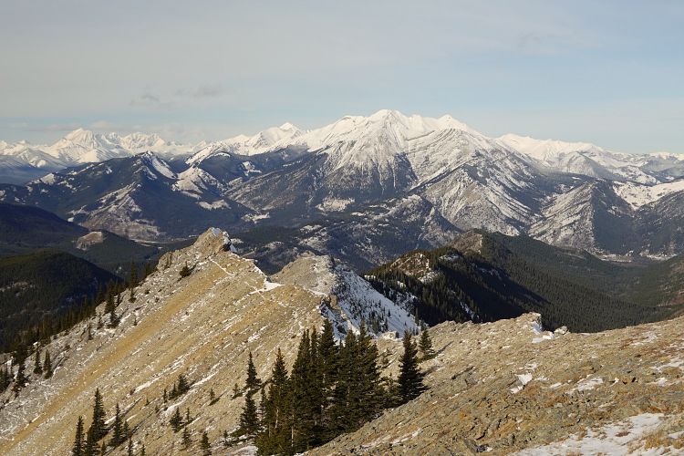
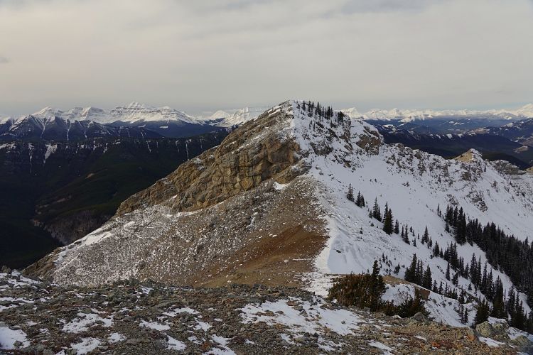
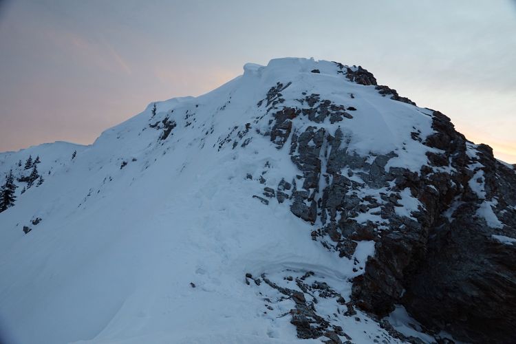
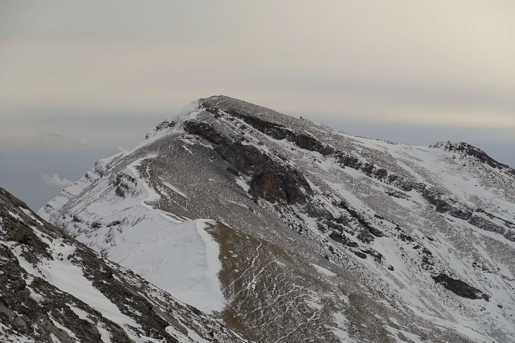
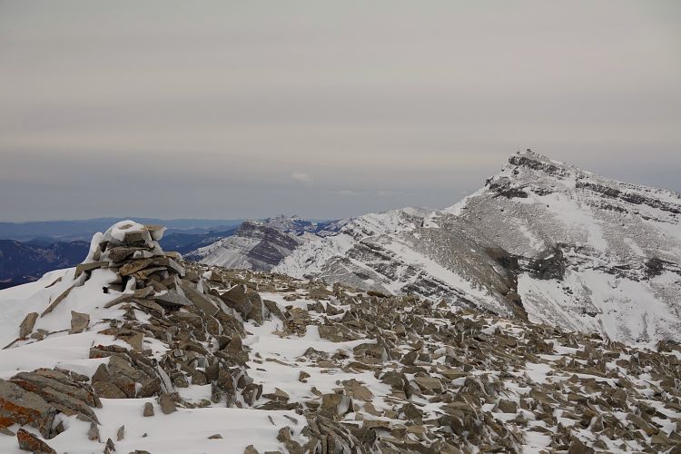
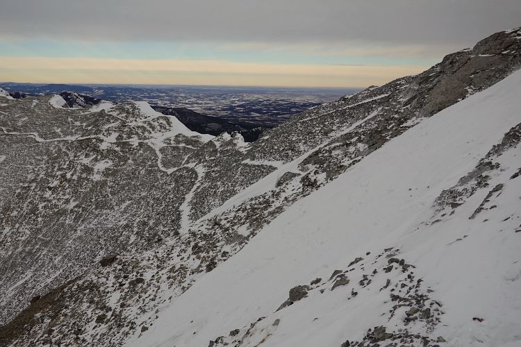
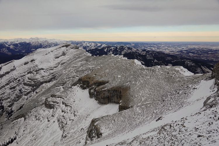
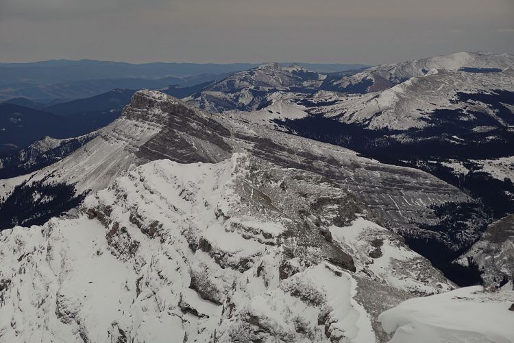
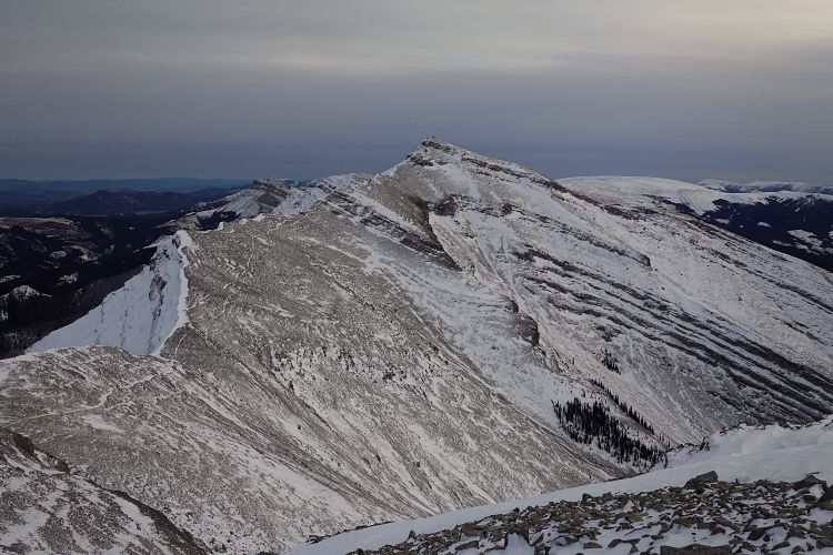
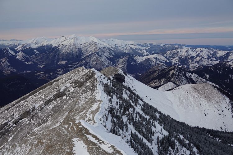
I thoroughly enjoyed the second half of the ridge, now free of trees and with terrific views on all sides. There are lots of ups and downs and two of the ridge high points required moderate scrambling to overcome short rock bands. The first offered a break on the east side of the ridge and the little snow I had was not an issue. The second, however, was a little trickier as the best route along the spine of the ridge was completely covered in snow with few holds sticking out. Wherever possible I followed game trails, which appear to be quite abundant up here and make the hiking easy and fun. After a few more ups and downs I reached the big cairn of the north peak, at 2510 m only 15 m lower than the main summit. The north peak has become quite popular as part of a loop route since there is apparently a good trail up the west side (see Bob’s report).
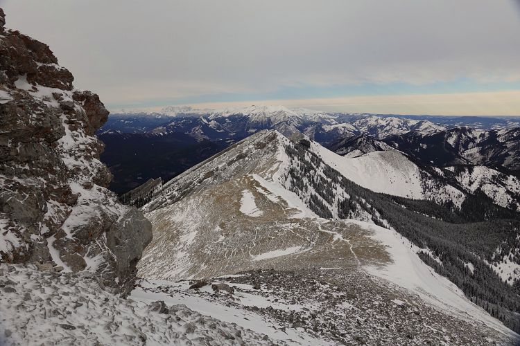
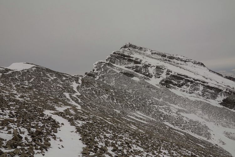
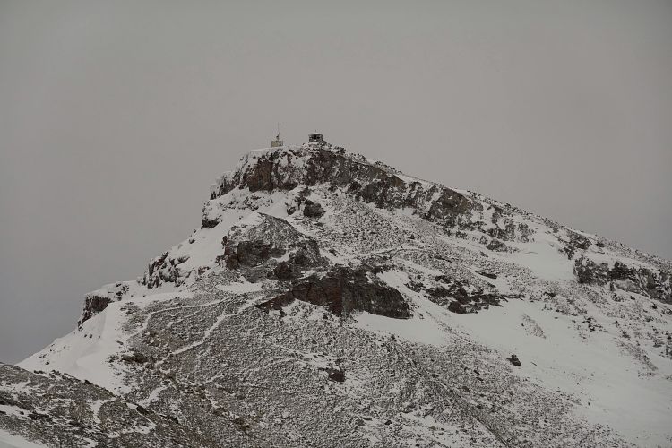
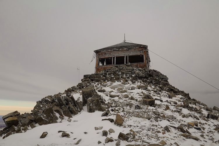
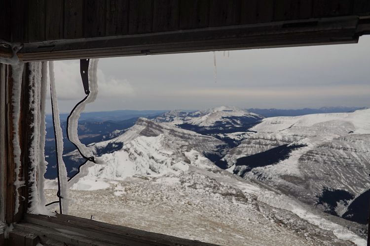
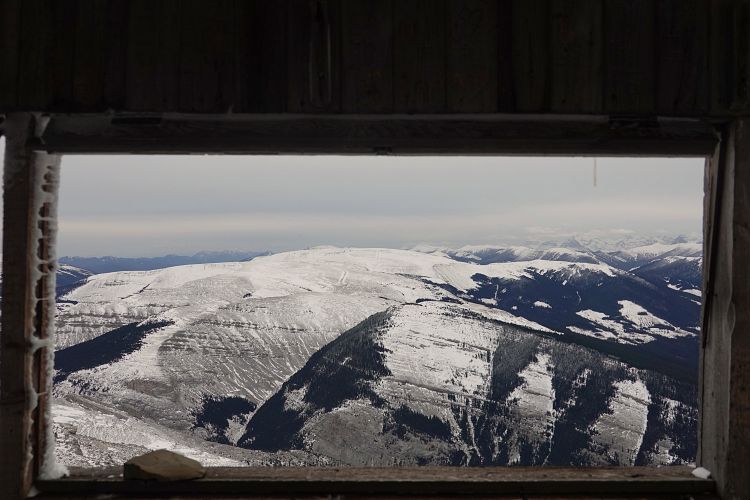
From the north peak I still had about 45 minutes to go to reach the old wooden lookout building on the summit of Mount Burke. This last part of the traverse was also super fun. Two cliff bands, one right below the summit, offered a challenge with snow covering breaks in the cliffs. Thankfully, the snow was soft enough to kick-step through so I didn’t have to pull out my ice axe all day. As Vern mentions in his report, if the snow cover is thick or hardened then ice axe and/or crampons may well be required here.
Once through the last cliff band, a short plod up scree brought me to the summit where discovered fresh boot prints from someone who had just been up here. Surely, I thought, their trip was much faster than mine!
I snapped some photos, wolfed down a few cookies, and returned to the cliff to start my long journey back. It was already 3:30 PM and my aim was to get to the trail in the upper valley of Zephyr Creek by sunset.
Retracing my steps along the ridge was easier now that all I had to do was follow my boot prints in the snow to find the easiest way across the various rock bands. After more than 7 hours on the go I was getting tired, though. And it was cold, too! It was around sunset when I stumbled down the east slopes of the ridge to the wide saddle at Greenfeed-Zephyr pass. Unfortunately, I couldn’t find the trail that I knew existed somewhere here and that should’ve taken me directly down to Zephyr Creek – it was too well-hidden under the snow. Just when it got completely dark my headlamp gave up on me as I was bushwhacking through the forest, trying to find the elusive trail. Deep snow in creek beds and side gullies made for some pretty miserable wallowing, but all bad things have an end. I managed to find my spare batteries for the headlamp and shortly after stumbled across the trail – order re-established!
As per what I had read in Daffern’s Kananaskis Country Trail Guide (Vol. 5), the trail nicely led me down to Zephyr-Bear pass. From here I followed a good trail that curves north into the valley and runs north along Zephyr Creek back to the Highwood River, a trail Richard and I had hiked earlier this year on our North-South Limestone Ridge trip. All in the dark with some eerie wolf tracks here and there, but a much faster and more efficient way than staying up on the ridge top.
A very rewarding winter trip with a great mix of everything from easy hiking to moderate scrambling to a short (but avoidable) stint of bushwhacking.
Note that if you’re in a group and have two cars you could shorten your day significantly by simply coming down the main trail from Mount Burke summit to the trailhead near Cataract Creek campground. A bike drop-off would work too, of course, but then you’d still have about 20 km to bike on a rough gravel road. Lastly, you could also return along Cataract Creek in the valley on the west side of the ridge; there’s a trail here but it seems to be not very well-used, at least in the middle part.
|
Elevation: |
2535 m (Mount Burke) |
|
Elevation gain: |
1840 m |
|
Time: |
11.0 h |
|
Distance: |
27.3 km |
|
Difficulty level: |
Moderate (Kane), T4 (SAC) |
|
Comments: |
Requires crossing of the Highwood River – do not attempt when water levels are high (spring/mid-summer). |
|
Reference: |
Own route finding |
|
Personal rating: |
4 (out of 5) |
NOTE: This GPX track is for personal use only. Commercial use/re-use or publication of this track on printed or digital media including but not limited to platforms, apps and websites such as AllTrails, Gaia, and OSM, requires written permission.
DISCLAIMER: Use at your own risk for general guidance only! Do not follow this GPX track blindly but use your own judgement in assessing terrain and choosing the safest route. Please read the full disclaimer here.