Davos, Switzerland
18 July 2018
Solo
Scree, a tough ridge scramble, and more scree
I had some unfinished business to deal with on Hoch Ducan (also known as Piz Ducan). Last year, in September 2017, I made an unsuccessful attempt when I left the trail in the Ducan Valley too early and ended up getting stuck in the sharp, steep cliffs on the mountain’s north side. With the weather turning that day, I decided to abort and simply head back into town for a nice cold beer instead – a good idea at the time.
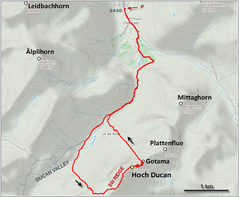
Now it was time to return and complete the mission. With more detailed information in hand, I hiked from the small hamlet of Sand in the Sertig Valley almost to the end of the Ducan Valley this time, then turned left to gain the huge talus slope that comes off the main ridge between Chlein Ducan and Hoch Ducan. It was a tedious slog, but made access to the ridge top pretty easy.
There is a faint trail on the southwest ridge of Hoch Ducan that leads to the first crux, a short, slightly exposed inclined rock face with a steep gully below and a narrow ledge to tiptoe across. The rest was a moderate scramble to the lonely summit, which doesn’t appear to see too many visitors according to the few entries every year in the register. I’d think that the long, unattractive scree slog probably keeps the masses away.
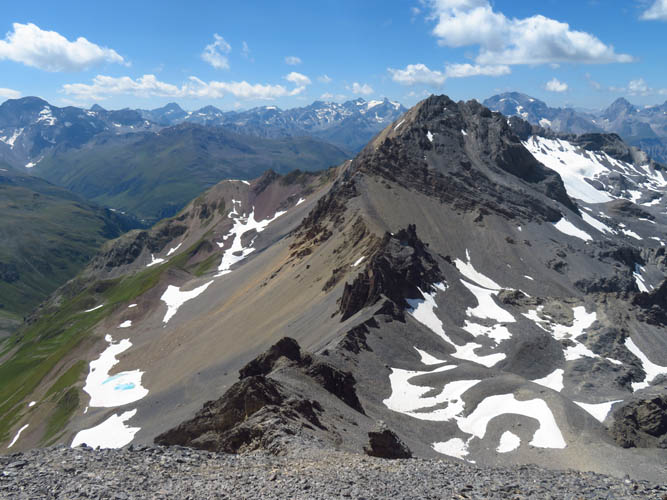
As one of the highest points in the Albula Range the Hoch Ducan offers sweeping views over the surrounding valleys and peaks. You can look down the whole length of both the Ducan Valley and Sertig Valley, while the Älplihorn (3006 m) features prominently behind. Bigger objectives such as Piz Kesch and Piz Ela also show up nicely on the horizon. Further along the ridge to the NE sits the imposing Plattenflue with its characteristic arrangement of stacked layers steeply dipping to the south. I had noted the Plattenflue as a possible second objective for the day, but now looking at its steep and jagged access ridge, I was less sure about it.
My Plattenflue idea completely evaporated on the descent down Hoch Ducan’s exasperating NE ridge. I only had a very vague description of the route from the SAC Guidebook, which was both confusing and contradictory in parts. In general, the proper route basically follows the ridge crest, with several downclimbs on either the left or the right side whenever a vertical drop-off is encountered on the crest. However, it is exactly on the question of whether to go right or left where the confusion is.
Right after leaving the summit a steep downclimb needs to be overcome on the left (NW) side of the ridge down a muddy couloir, but it is full of loose, crumbly rock and poor holds. Rockfall is definitely a huge risk here and I’m really glad I was alone, not crashing any rocks on people below me. Once I was back on the ridge I soon ran into the next cliff, which I tried to bypass on the left again – wrong move! After losing some 40 to 50 metres on the exposed and crumbly NW face, the terrain started getting dangerously steep, with no way around the cliff on the ridge crest. I had no choice but to climb back up and try my luck on the other (SE) side of the ridge, which consists of a series of downsloping slabs interrupted by step-like cliffbands. The name of the game now was to zig-zag along these slabs up and down, trying to find a break in the cliffbands that could be scrambled down, then hop onto the next slab to find a crack or ramp down the next cliff and so on… The tricky part was that the slabs tend to steepen the further away from the ridge you get, while closer to the ridge crest they tend to narrow and sometimes peter out. A searching game, thus, and an unnerving one since the whole time I wasn’t even sure whether I was on the right track or whether I might have to climb all the way back up to the summit again.
It took a long time but eventually I found my way down and back to the ridge crest, albeit not without several challenging scrambles. A few more tricky downclimbs on the pointy crest followed to get down to a couloir that bypasses the last bit of exposed ridge immediately before a small col.
By now I was pretty exhausted and simply didn’t have the strength of mind anymore to tackle crazy Plattenflue, especially since I was solo. I was just glad I had made it down to the col which permits a relatively easy way down the NW slopes back into the Ducan Valley. Before heading down, there was one last minor objective – a small peak between Hoch Ducan and Plattenflue called Gotama. A consolation prize, so to speak. It’s a short moderate scramble on steep slabs, a mere 5-10 minutes from the col to the shiny summit cross containing a beautifully adorned book. I’m not sure why this little sub-peak deserves its own name and register, after all it’s only about 50 m higher than the col. Yet some people seem to come up here just for this one summit from the more gentle south slopes as is evident from the register.
I enjoyed my last summit break staring at the impossibly steep SW ridge of Plattenflue, then headed down scree, snow and more scree from the col back into the Ducan Valley. After all the scree that had shaken my knees today and the very challenging traverse of Hoch Ducan, I was certainly glad to be back on the valley trail and thoroughly enjoyed the walk back to the restaurant at Sand.
Note: If doing the full traverse, I’d highly recommend doing it the other way round (i.e. in a clockwise direction). This way, tackling the tricky NE ridge of Hoch Ducan is done on the ascent, which is probably slightly easier than descending it. A helmet is a must.
| Elevation: | 3063 m (official), 3061 m (my GPS) |
| Elevation gain: | 1370 m |
| Time: | 9.0 h |
| Distance: | 12.9 km |
| Difficulty level: | Normal route (SW ridge): Moderate (Kane), T4 (SAC) |
| NE ridge: Difficult climber’s scramble (Kane), T6 (SAC) | |
| Reference: | Local maps |
| Comments: | Rockfall danger on NE ridge – helmet highly advisable! |
| Personal rating: | 2 (out of 5) |
DISCLAIMER: Use at your own risk for general guidance only! Do not follow this GPX track blindly but use your own judgement in assessing terrain and choosing the safest route.
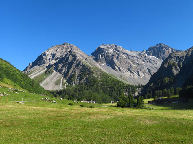
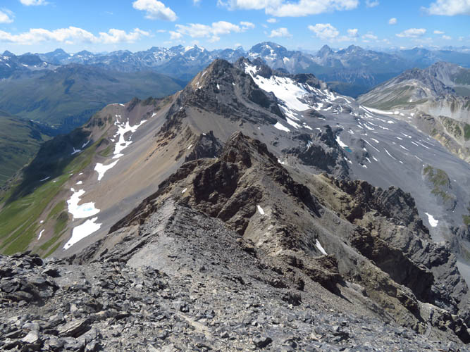
Left to right: Mittaghorn, Plattenflue, Hoch Ducan. A minor peak called Gotama that sits on the right side of the saddle between Plattenflue and Hoch Ducan appears as a small light grey cliff.
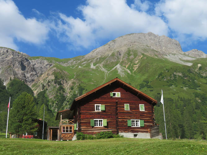
A typical Swiss wooden country home. In the background is the Älplihorn, one of my first ever scrambles in Switzerland.
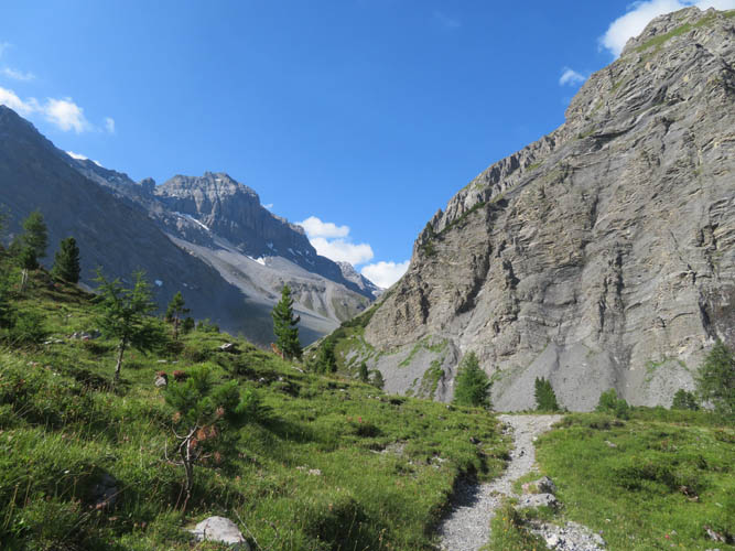
Heading into the Ducan Valley. Hoch Ducan appears on the left.
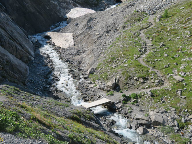
A small wooden bridge leads over the ice cold waters of the Ducanbach.
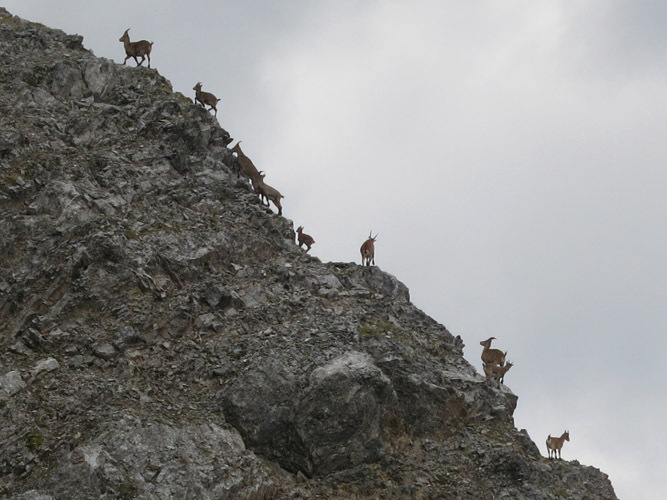
Mountain goats dancing on a ridge. I took this photo on my first attempt in September 2017.

The upper Ducan Valley – a peaceful and quiet place. I only met one other group of hikers.

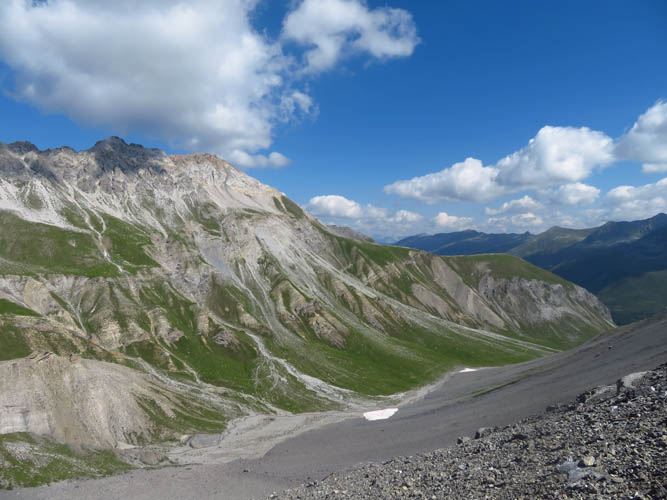
A long, tiresome scree pile leads up to the ridge via the gully left (east) of the Chlein Ducan (the pointy peak on the left side).
Half-way up the scree slope I take a breather to enjoy the view over the Ducan Valley.
Almost on the main ridge. This is looking east towards the main summit mass of Hoch Ducan. You could tramp straight up these scree slopes or follow the ridge on the right as I did.
A view of Hoch Ducan’s SW ridge, with Chlein Ducan’s black summit mass on the right.
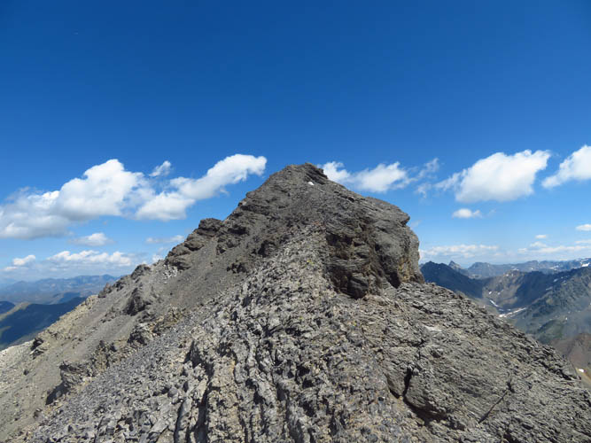
On the final stretch of the partially exposed summit ridge.
In one spot I discovered a sling tied around a rock, probably left behind during a winter ascent. The ridge was a bit exposed here, but protection is really only needed if snow or ice are present.
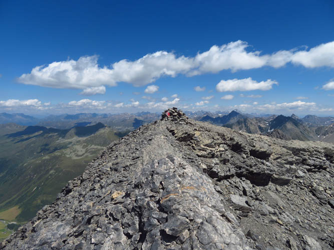
Hoch Ducan summit.
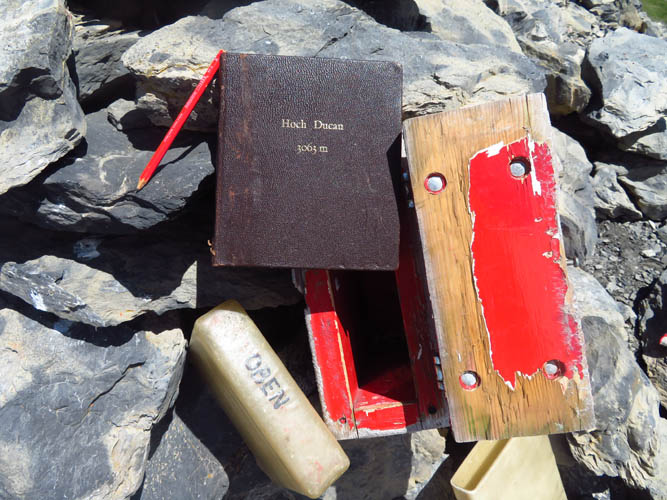
There’s a solid summit book protected by a plastic casing that’s kept inside a pretty robust wooden box.
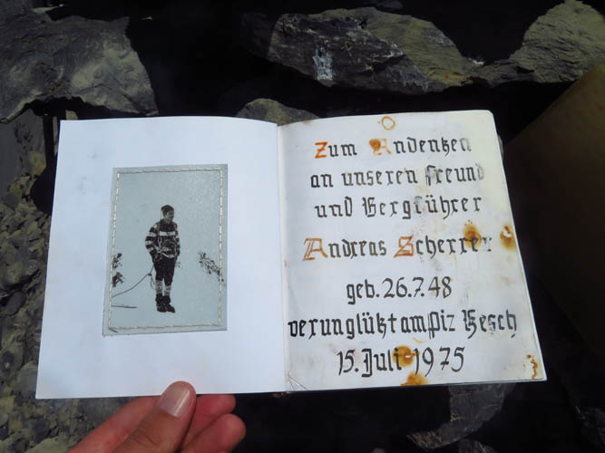
This register dates back to 1979. The first two pages are dedicated to Swiss mountain guide Andreas Scherrer who died on nearby Piz Kesch on 15th July 1975.
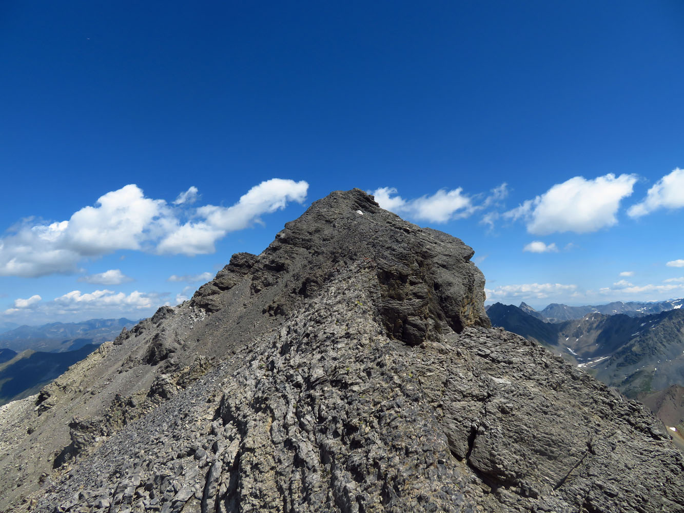
View of the SW ridge from the summit.
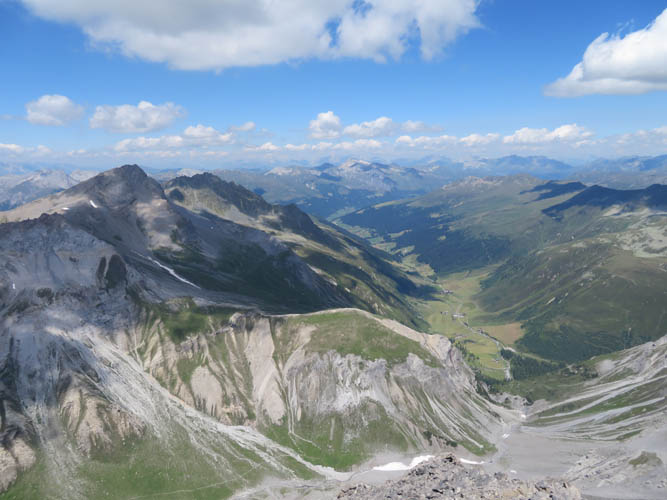
Looking north down the length of the Sertig Valley. The highest peak on the left is the Älplihorn (3006 m).

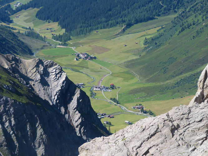
The road up the Sertig Valley ends in the hamlet of Sand, where I started out this morning. The parking lot is right by the red-roofed house in top left.
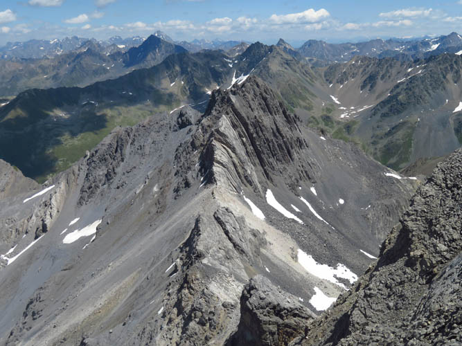
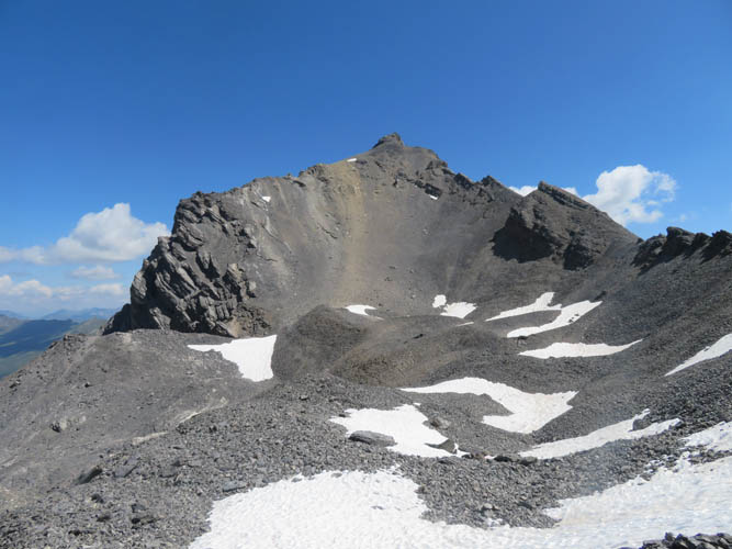
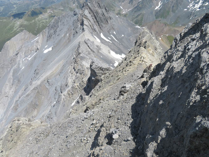
The NE ridge looks daunting! The stacked “deck of cards” in the centre is the Plattenflue.
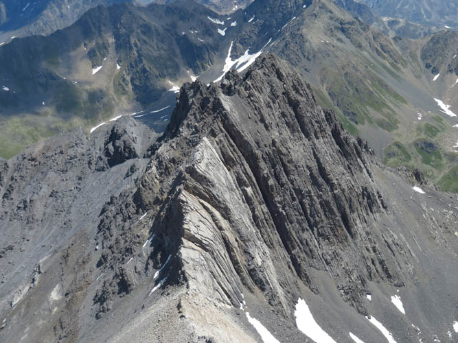
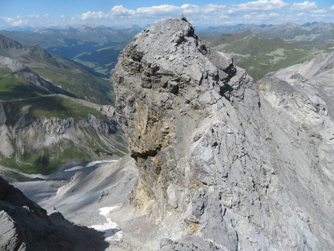
Close-up of the Plattenflue.
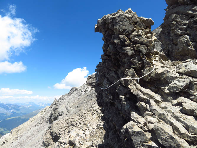
Right after leaving the summit, the first crux is this steep, exposed downclimb with plenty of loose rocks. The picture makes it look a little steeper than it actually is.
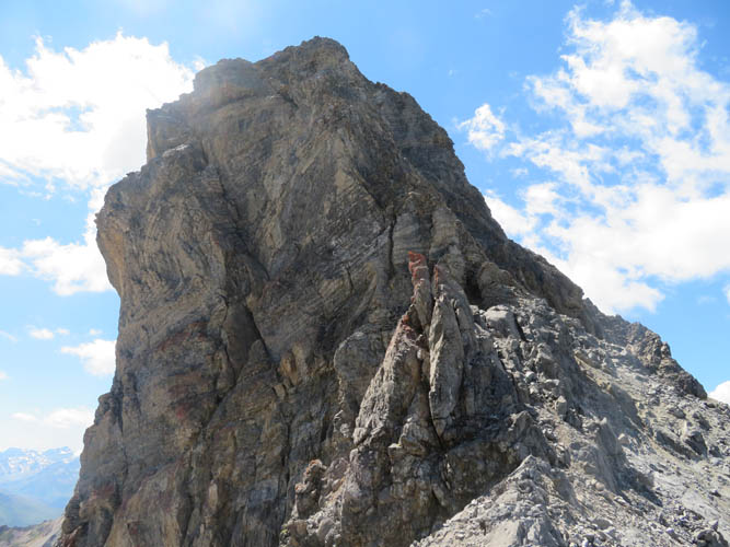
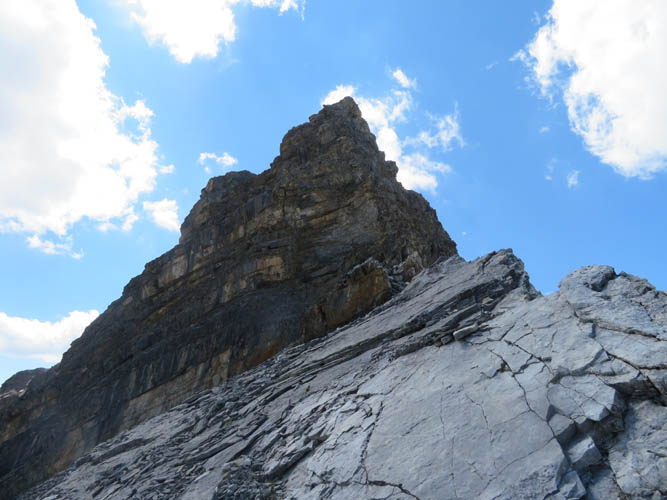
Typical terrain on the NE ridge.
The same downclimb viewed from below, now looking west. The crux is on the right (north) side.
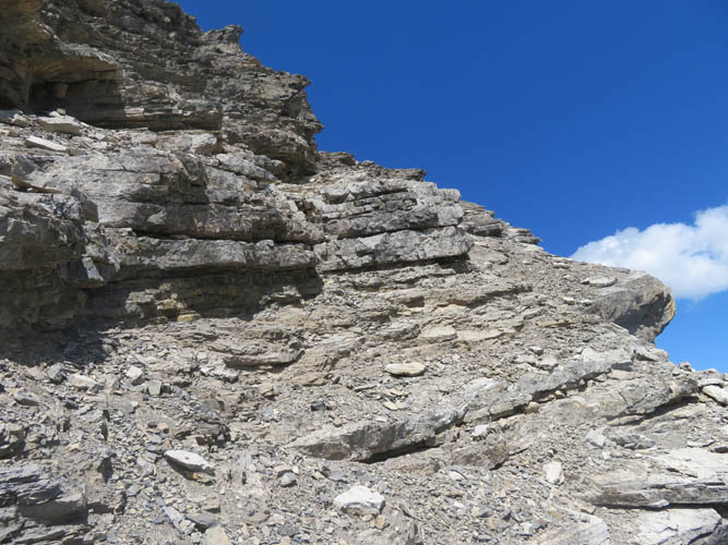
Tons of slanted rock beds on the southern side of the ridge.
Many of these layers are pretty thick, with significant drop-offs that need to be carefully negotiated.
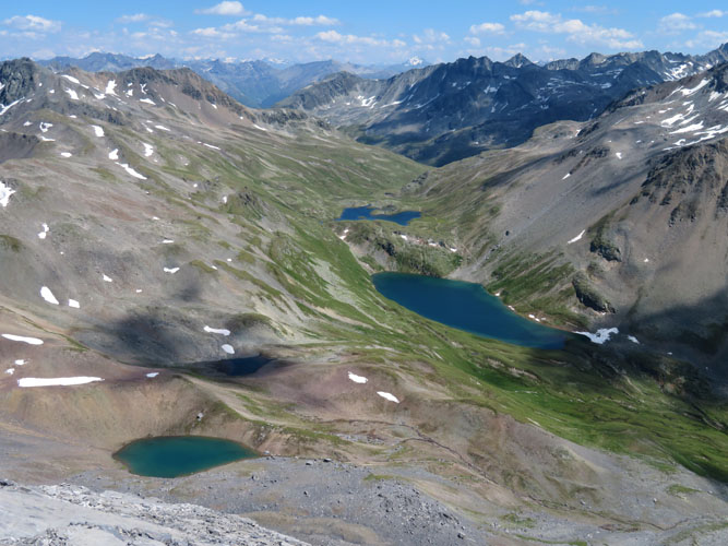
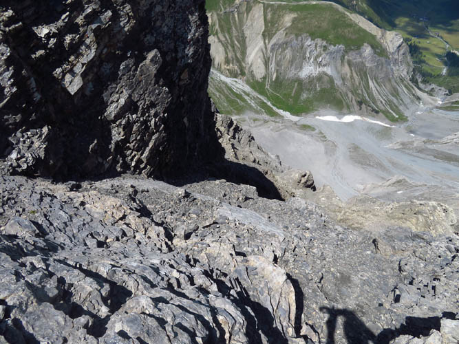
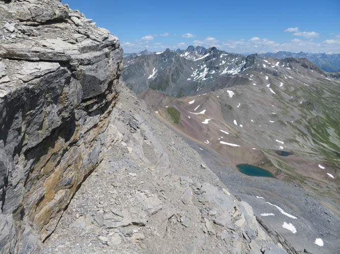
A collection of small Alpine lakes in the valley to the SE.
Looking back along the NE ridge at one of the more difficult downclimbs.
Finally at the saddle and a small overhanging peak called “Gotama”.
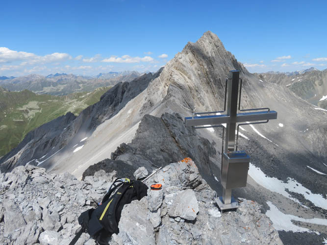
Gotama has one of the fanciest summit crosses I’ve ever seen!
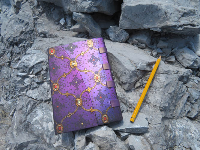
As well as one of the prettiest registers :).
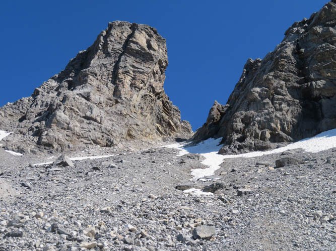
The descent gully on the north side of the ridge, with Gotama on the left.
A final glance down the Sertig Valley below.