Ascension Island
2 January 2015
With Tilo
Ascension Island’s green oasis
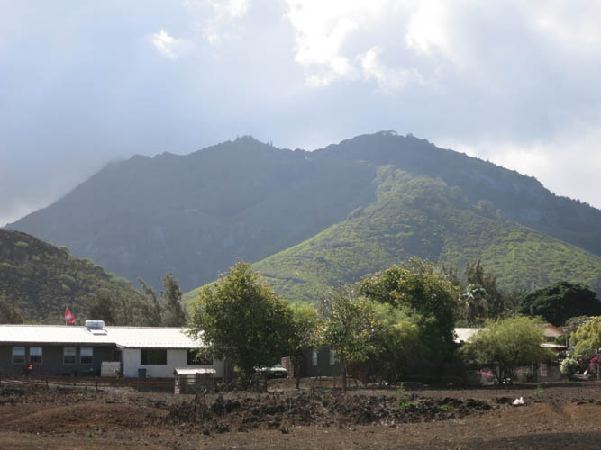
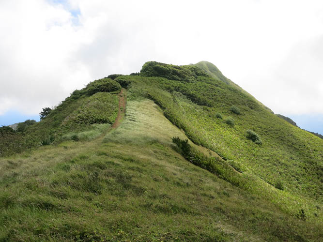
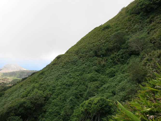
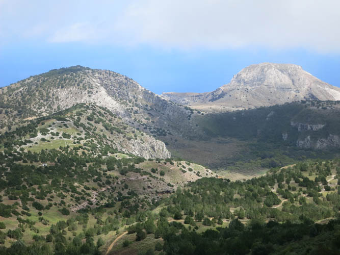
You can’t visit Ascension without going up Green Mountain, aka “The Peak”. It’s the highest point on the island and literally verdant green in colour because of its lush tropical vegetation that covers the upper half of this mountain which has been designated a National Park. The topmost portion is actually treed – a bamboo forest was planted here more than 100 years ago to provide construction material for the ships that landed.
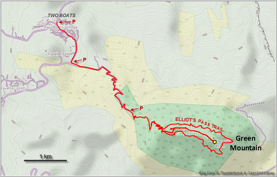
In the annual “Dew Pond Race”, arguably the most challenging race in the South Atlantic, competitors run from Georgetown on the coast to Dew Pond near the summit of Green Mountain, often in less than 2 hours. Tilo and I had no such ambitions and decided to drive half-way up to the village of Two Boats and start our leisurely hike from there.
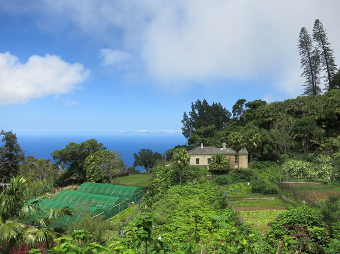
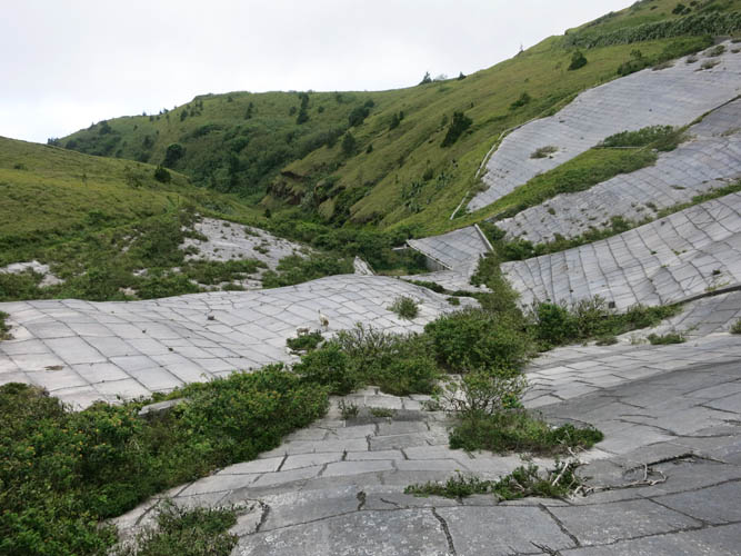
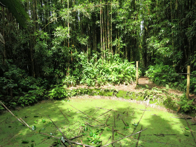
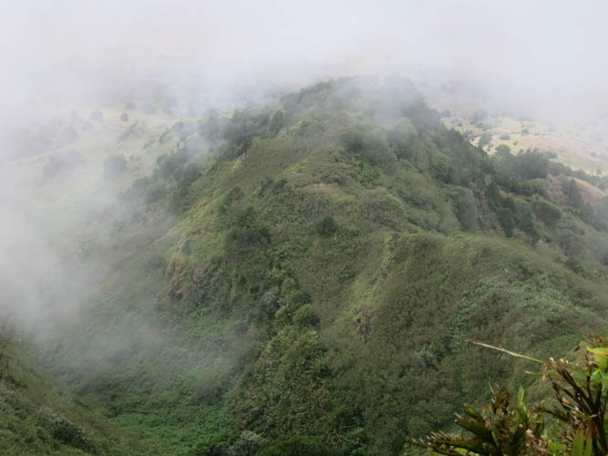
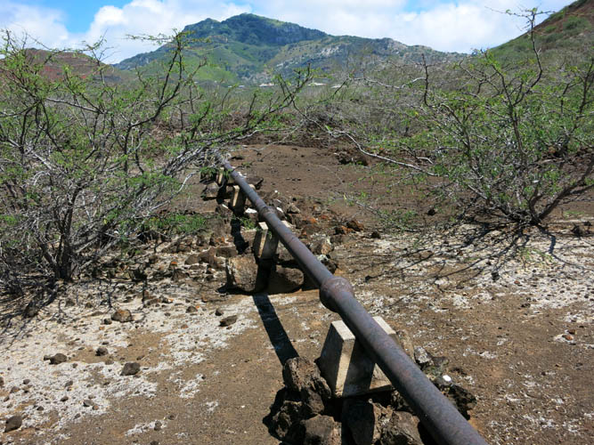
A narrow paved road climbs in switchbacks to the nursery, one of the few places on the island where fresh vegetables are grown. Compared to Two Boats, this place is already noticeably cooler and wetter, with the upper part of the mountain usually shrouded in clouds that move in from the west and tend to cling to the green slopes here. The vegetation helps to trap moisture from the clouds and a water catchment area at the top – Dew Pond – used to provide drinking water for Ascension Island’s “capital” Georgetown, funneled downhill via a pipeline.
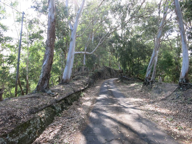
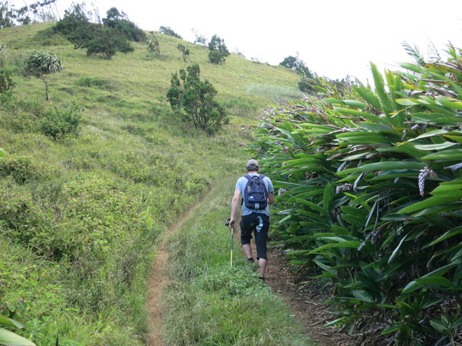
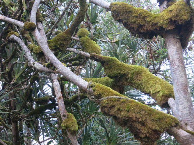
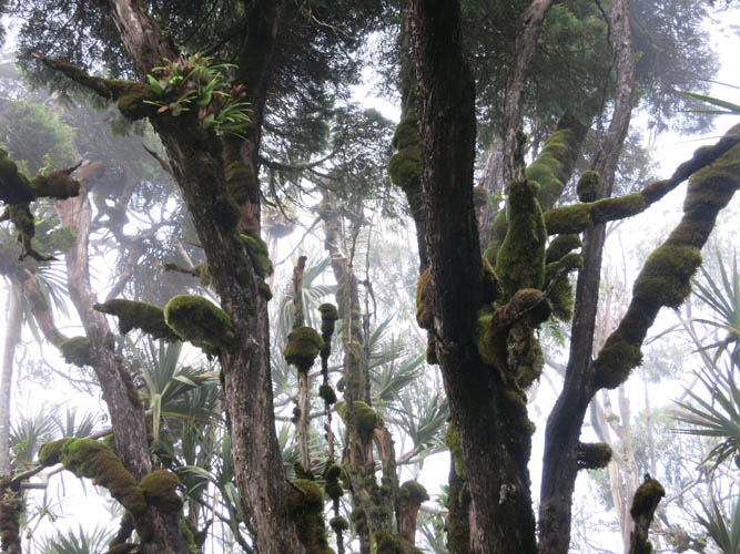
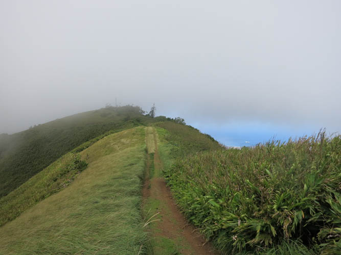
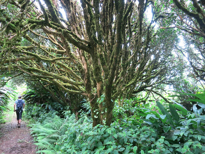
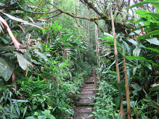
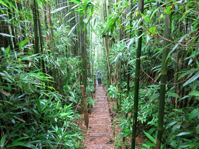
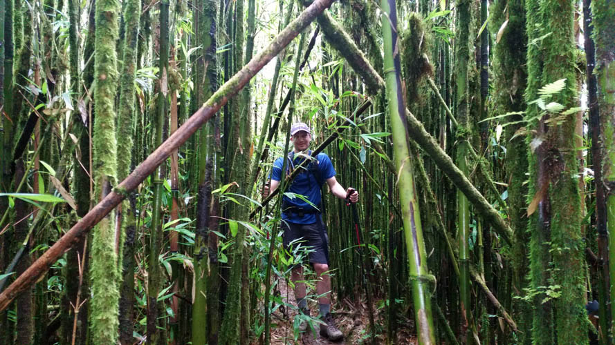
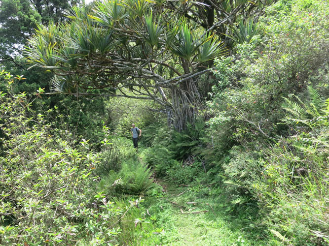
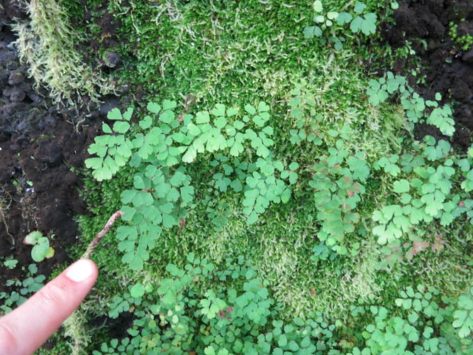
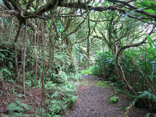
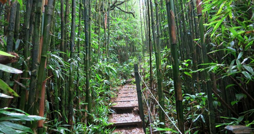
From the nursery there’s a track that goes up through open slopes of grass and shrubs, the vegetation gradually getting denser the higher you climb. Once on the main ridge top, there are some really neat patches of trees covered in all kinds of mosses and ferns, some of which are endemic to the area. With all the mist wafting around the tree branches, it feels like you’re in some kind of enchanted forest here. Higher up on the ridge the track turns into a narrow footpath built on wooden planks and eventually the bamboo forest is reached. It’s a unique experience to be hiking through this dense “sea of matchsticks”, an area so completely different to the dry and barren land that covers the rest of the island.
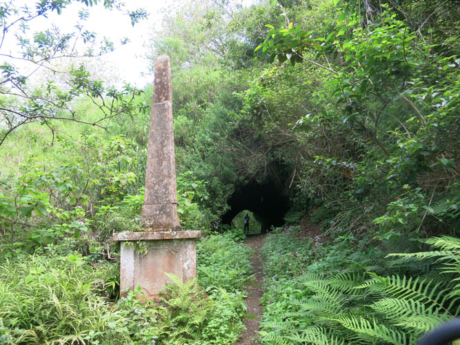
Before we knew it we reached Dew Pond where the “Letterbox” is located. Green Mountain is among some 30 “Letterbox Walks”, a fabulous idea devised by some British expats a while ago where people can follow established routes to various destinations on the island where a letterbox is located. You sign the register and then apply a stamp, unique to each destination, in your own logbook as proof of your visit.
The true summit of Green mountain is a few metres higher behind the pond, but you can’t actually see anything around you except bamboo trees! You can venture a short distance further through the bush to an overgrown viewpoint, but the views aren’t stellar and the trail ends here.
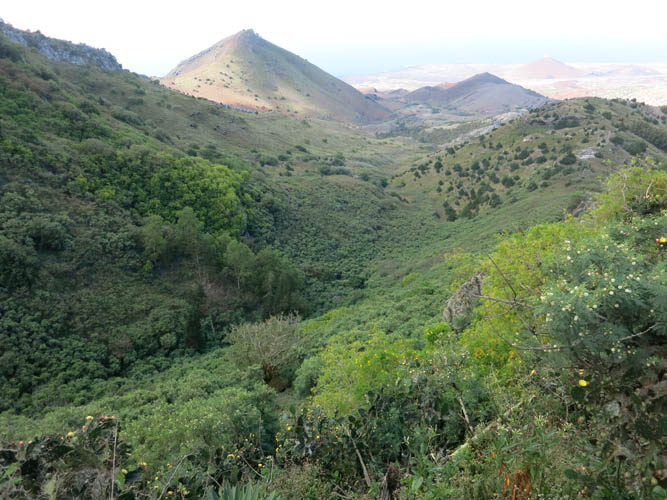
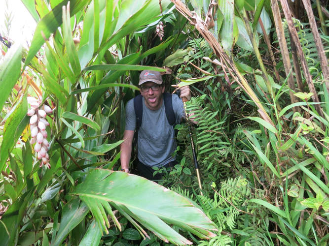
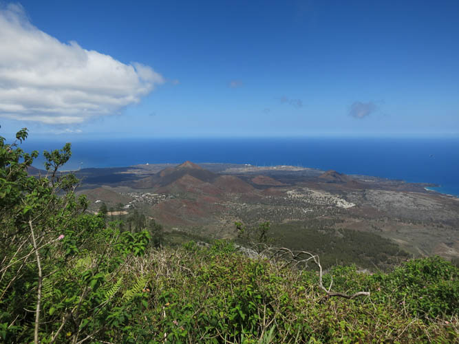
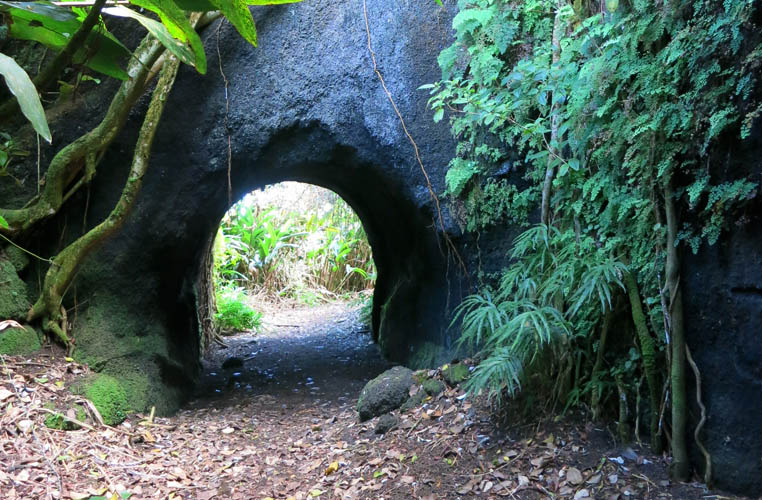
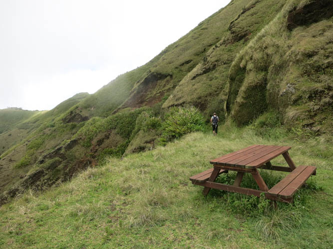
The best views we had on a slightly lower trail that contours around the mountain at the same elevation: Elliot’s Pass, another Letterbox walk. We did this short extension right after coming off the summit and we were glad we did! It was a really enjoyable hike through dense foliage, narrow tunnels cut into the volcanic rock, and along open slopes of the mountain granting spectacular vistas of the entire island.
|
Elevation: |
859 m (official), 864 m (my GPS) |
|
Elevation gain: |
690 m |
|
Elevation loss: |
250 m |
|
Time: |
4 h |
|
Distance: |
10.2 km |
|
Difficulty level: |
Easy hike (Kane), T1 (SAC) |
|
Reference: |
Letterbox Walks |
|
Personal rating: |
4 (out of 5) |
NOTE: This GPX track is for personal use only. Commercial use/re-use or publication of this track on printed or digital media including but not limited to platforms, apps and websites such as AllTrails, Gaia, and OSM, requires written permission.
DISCLAIMER: Use at your own risk for general guidance only! Do not follow this GPX track blindly but use your own judgement in assessing terrain and choosing the safest route. Please read the full disclaimer here.