Anatolia, Turkey
16 October 2018
Solo
A beautiful hike across Anatolia’s grassy hills with a short and sweet scramble
Warning: As of October 2018, the area around Delikkaya Dağı, Mount Köse and beyond is officially a restricted military zone that’s off-limits to visitors as is the case with many other mountainous regions of eastern Turkey. We were initially not aware of this and, since there are no checkpoints or warning signs, were able to drive into the area and camp undetected for three days before running into Turkish soldiers who escorted us out. Apparently the PKK is active here (Kurdistan Workers’ Party, an outlawed Kurdish militant and political group considered a terrorist organization by the international community) and the Turkish military regularly conducts training exercises and patrols. See epilogue below.
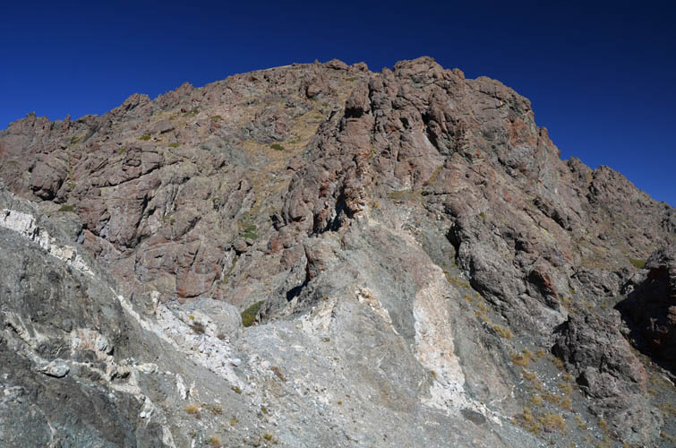
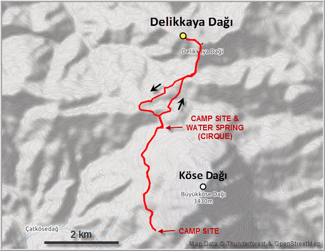
After spending the second night at our lonely wild campsite high up in Anatolia’s mountains we awoke to a beautiful day clear of any of the haze we had experienced the day before on Mount Köse (Köse Dağı). In October the nights tend to be very chilly at this elevation (2550 m) and we were glad to have puffies, long underwear and down sleeping bags to keep us warm in our pop-up roof tent.
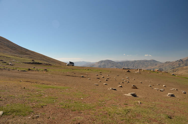
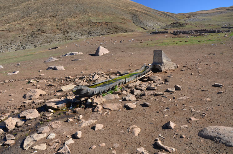
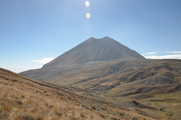
Wen wanted to have a day off and relax at the campsite, so I set out alone for a short day hike. My objective: a small peak called Delikkaya Dağı sitting about 5 km north of Mount Köse. After a solid breakfast of muesli, nutella bread and coffee, I was on my way hiking north along the dirt road that after some 3 km ends in a small grassy cirque sheltered on one side by a low-lying ridge and on the other by the 3430 m Mount Köse, an extinct volcano with half-collapsed crater. Scattered across the cirque were a handful of rudimentary animal enclosures and stone walls, but there wasn’t a soul around. Presumably this area is used by local shepherds in the warmer summer months when the grass is a lot greener up here. To my delight, there was also a fresh water spring with cold, clear and tasty water pouring out of a pipe in a constant flow. This would definitely be a great place to camp, it’s quiet, secluded and even has water!
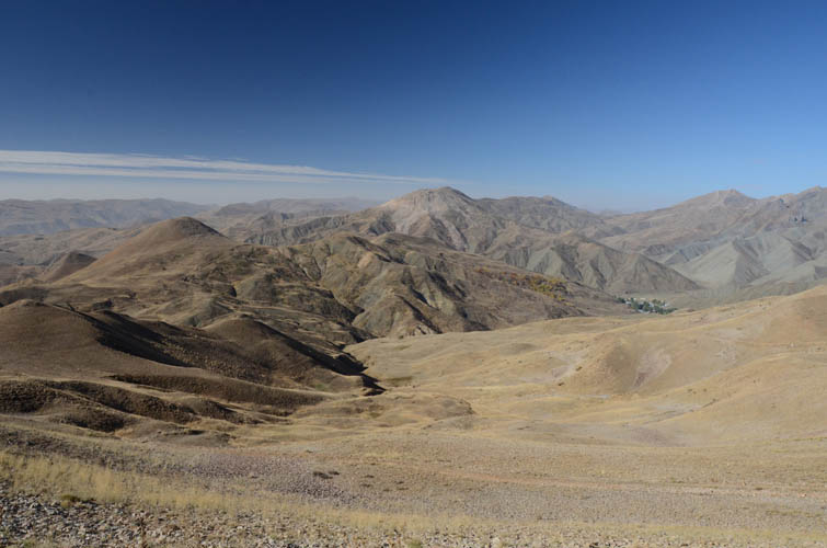
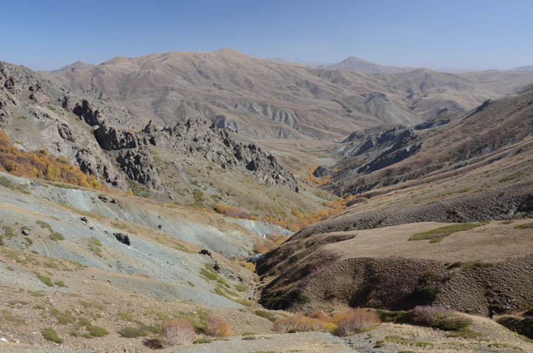
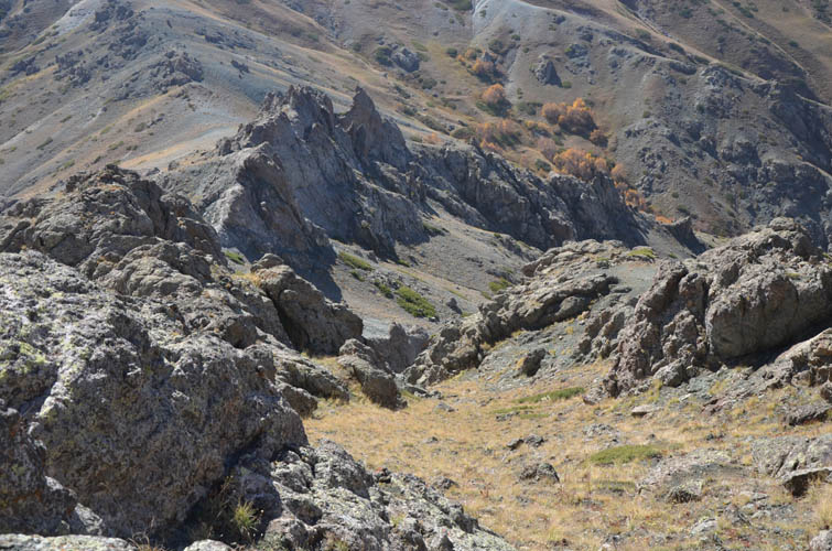
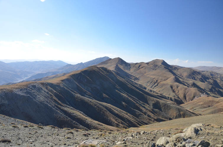
Leaving the cirque, I followed an animal trail a little further north to a small col along the low-lying ridge. I could now see my destination for the first time in the distance. It wasn’t far away, but there were no more trails and the terrain was a bit confusing, with several rolling hills and valleys in between me and the mountain. I basically just headed straight for it, which involved several elevation losses and regains. Fortunately, the landscape here is treeless, the slopes are gentle, and the surface is mostly grass, which makes for pleasant hiking.
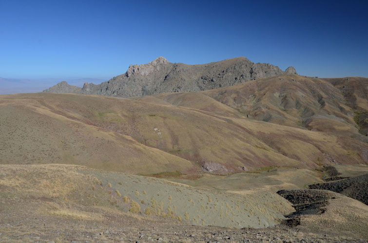
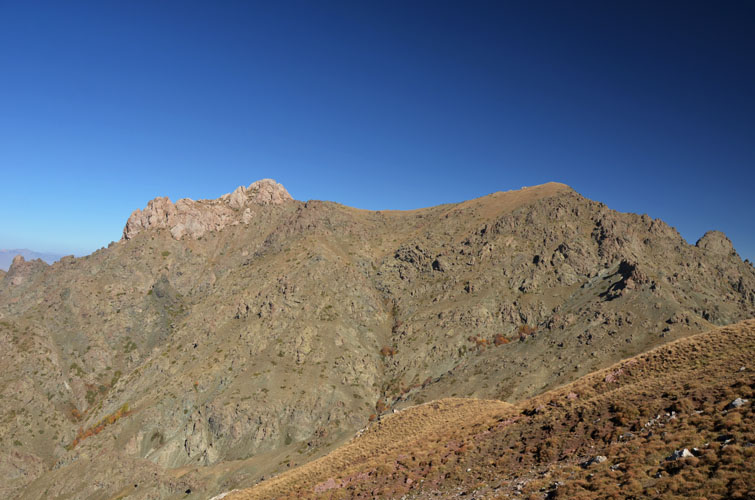
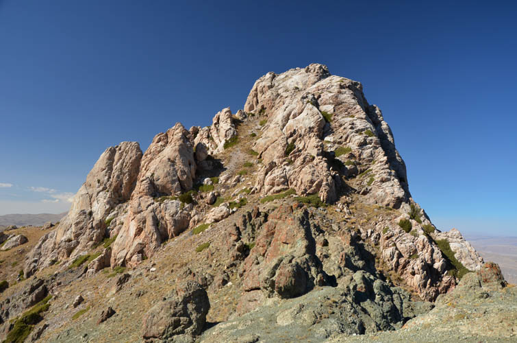
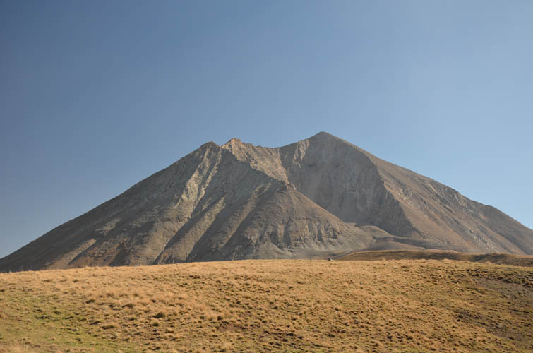
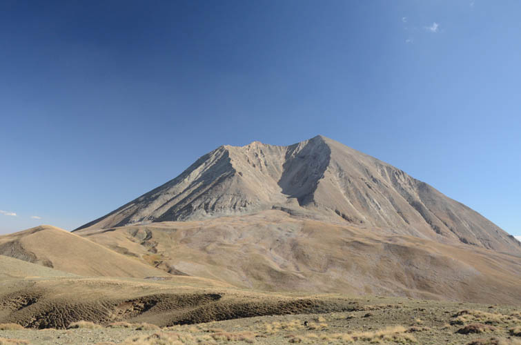
After about an hour I passed the last hill and arrived at a small, muddy col. I now had a full view of Delikkaya Dağı in front of me. This rather low-lying mountain has a double summit connected by a short, mellow ridge. The eastern summit looks easy, covered only in grass, whereas the western summit consists of craggy white rock steeply falling off to all sides. They both looked about equal in elevation from here (GPS readings I took on the ridge eventually showed that the western summit is about 10 m higher). The entire summit ridge is flanked on the south side by rocky volcanic spires and fins that seem difficult to penetrate at first sight, but as is so often the case when you put your nose into it you can break it down into easier steps. From the col I climbed straight up towards the eastern summit, bypassing the steepest fins on the right, then heading up a grassy gully in between steep rocky slabs. All in all pretty easy scrambling up to this point.
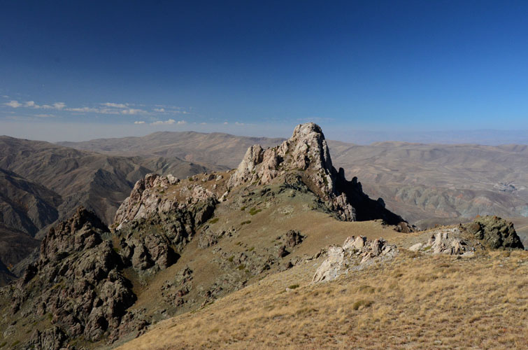
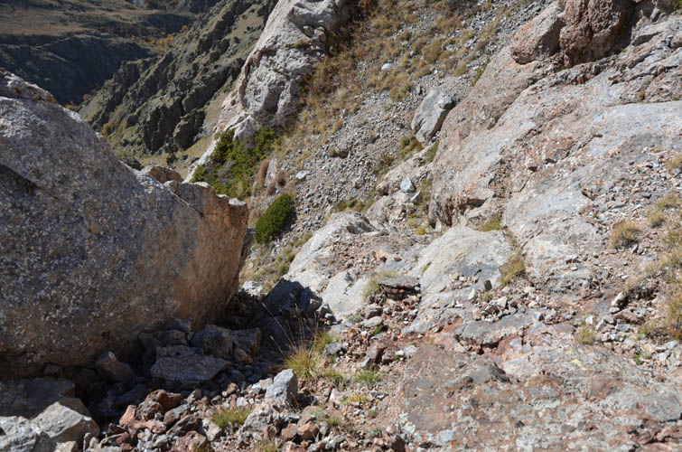
A small man-made rock circle adorns the eastern summit. The craggy western summit looks particularly impressive from up here – no doubt I had to check it out, too. A short, 15 minute hike took me directly below its steep rocky summit mass. A scree ramp on the left (south) leads to a ledge on the right that can be scrambled up (moderate difficulty, some exposure), and a few minutes later I was standing on the true summit of Delikkaya Dağı.
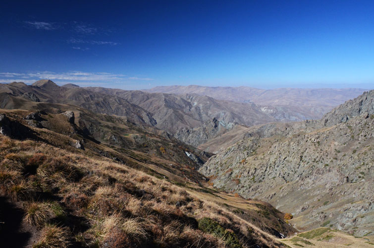
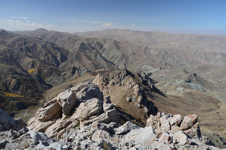
In an effort to avoid getting lost in the confusing south slopes of the mountain I simply retraced my steps via the eastern summit on my way back. After the muddy col, instead of going up and down the various hills and valleys again, I took a slightly longer but more scenic route along the ridge top that runs SW and then swings around to the east back to the grassy plateau.
Compared to Mount Köse I enjoyed this hike a lot more. Part of that was obviously the nicer weather today – no haze at all – but I also found the grassy ridges more enjoyable to hike and the scramble up the western summit was a fun challenge.
Epilogue
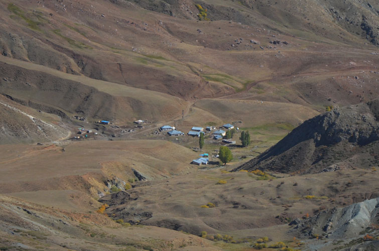
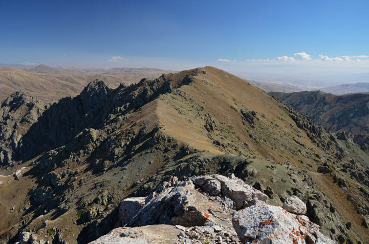
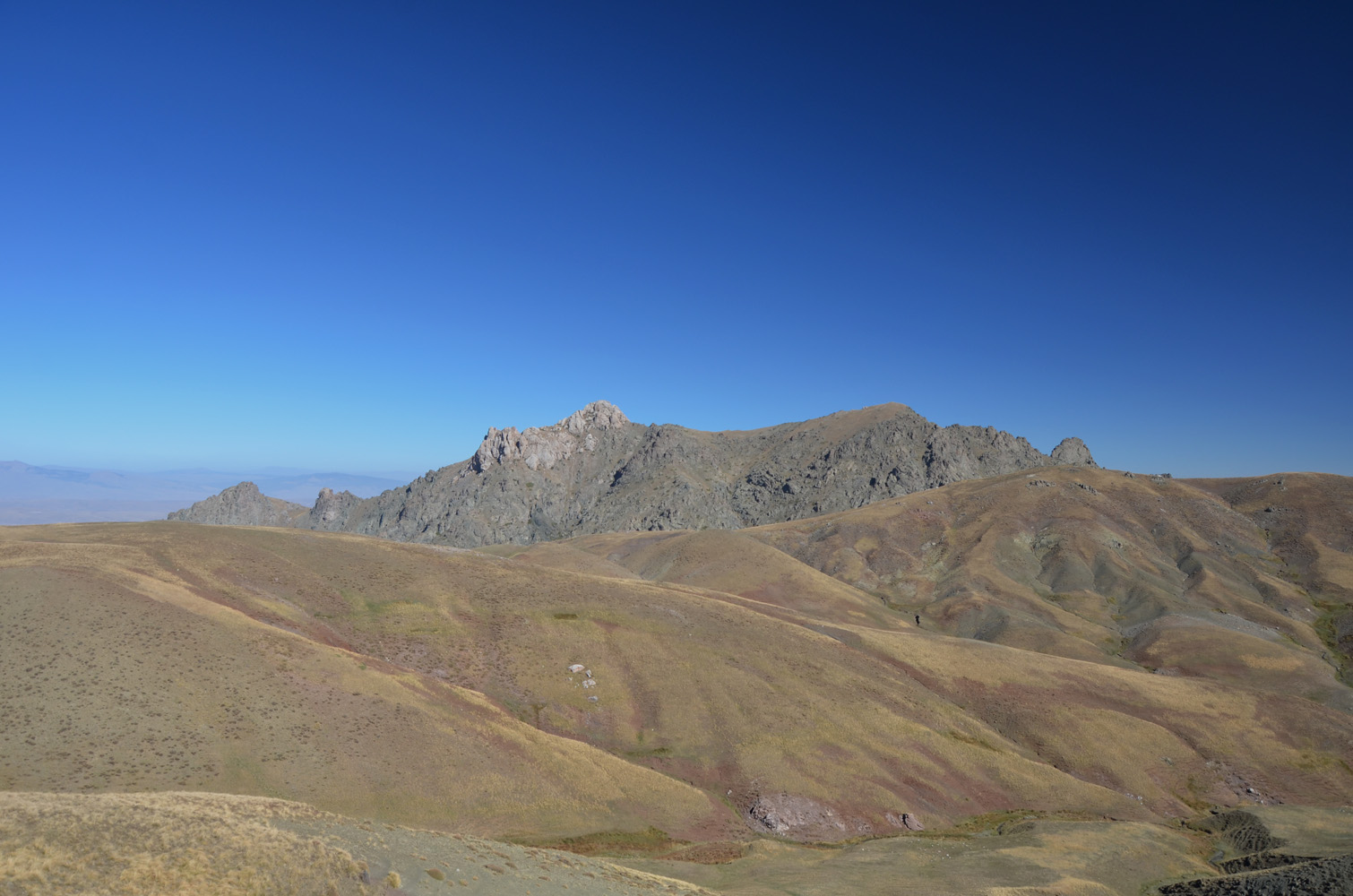
The day after my Delikkaya Dağı hike, I set off to explore the long E-W ridge extending west from the northern end of Mount Köse. I didn’t get very far. We had moved our van to the grassy cirque to be closer to the fresh water spring and Wen made herself comfy in our camping chairs to relax in the sun, while I started hiking up the ridge. When I got close to the first highpoint (the same bump I had passed on my return route the day before), I noticed some people on the top… Local shepherds perhaps? No, they were soldiers and they motioned to me to come to them. It turns out there were 20 of them, half of them still asleep in bulky sleeping bags and army fatigues, the other half sitting on the ground and looking a bit tired. They had been dropped off the evening before and spent the night on the ridge for some kind of exercise or patrol.
After exchanging the usual greetings and polite banter, their leader got straight to the point. What on Earth was I doing up here? Where’s my passport? Am I alone? Lots of questions, followed by a polite but stern order to immediately leave the area and go back to my car. He also notified his colleagues in the valley below by radio. I wasn’t entirely sure what the deal was – their English was limited – but I realized I wasn’t supposed to be here. All of them were very polite and friendly, however, and they even offered me some soft drinks and wanted to have their picture taken with me. I apologized for intruding into their area, gifted them a bag of peanuts I had brought, and left for our van without further delay.
About a minute before reaching our campsite – I already had the van in full view with Wen chilling in front of it – I saw it rumbling up the dirt road from the valley below: a huge armored military vehicle complete with revolving machine gun tower on top. Almost out of breath, I started running towards her in an effort to warn her (she was facing the other way and had her headphones on), but I was too late. The black monster roared up and came to a grinding halt right in front of Wen’s camp table, whirling up the dust in her face. I watched her lower her shades, jaw dropping, and freeze… Just as I arrived the doors opened and about ten heavily armed soldiers jumped out and formed a circle around us. Their weapons were pointed outward, towards the mountains, not at us thank God.
Evidently, these guys had been sent by the soldiers I had just run into on the ridge. After overcoming that initial moment of paralysis, I just walked up to them with a smile, stretched out my hand to greet them, and laid out our passports in front of them. Once again the same questions were asked and our van was searched, but it became pretty clear to them very quickly that we weren’t a threat, but just an odd pair of tourists in an odd place. Just like the other group of soldiers, these guys were very polite and professional. It was more like they were here to protect us from some outside threat. They also seemed a bit nervous and wanted us to pack up as quickly as possible. Because of “terrorists hiding in the mountains”, they said. We hastily threw everything in our van while the soldiers crawled back into their vehicle, then the armored vehicle escorted us out.
We followed them to the military headquarters in the town of Eleşkirt where it was now the commander’s turn to interrogate us. An English teacher was brought in from the local high school to translate, since none of the military people spoke English. We spent about two hours with the commander and his team, all in a fairly relaxed atmosphere, drinking tea and answering their many questions. Why are you guys here? What were you doing up there? Why exactly up there? How did you find the road? What’s your profession? Is there any gold or petroleum to be found on this land? Did you see anyone during your hikes? … Many understandable questions and perhaps some rather odd ones as well. An attempt was made to search our van one more time, but when they saw our messy kitchen and stinky clothes, they quickly lost interest and told us to please close the doors again. I have to say both Wen and I were pretty impressed with how courteous and professional the commander and his soldiers were. In the end they even apologized for the inconvenience caused (although it was us who had been inconveniencing them of course!), before wishing us a good journey and releasing us in the late afternoon.
As we drove out from Eleşkirt towards Ağrı in the east, we couldn’t help but marvel how lucky and blissfully innocent (or stupidly blissful) we had been with our experience of absolute solitude for three days high up at the foot of Mount Köse. And, of course, how abruptly it all changed when we ran into those soldiers. Although I doubt that falling into the hands of the PKK would’ve been much of an issue for foreigners not involved in this conflict, a much bigger potential problem is indeed being mistaken for an enemy or a spy by either party when strolling around in these mountains, a place where your mere presence will arouse suspicion.
Now that this epilogue is longer than the trip report itself, I can only conclude that until things have calmed down in the armed conflict between the Turkish State and the PKK, it’s better to avoid venturing into unknown terrain in mountainous Eastern Turkey for now. While there are some mountains that are completely safe and where tourists are allowed to hike (e.g. Nemrut near Lake Van, or Kemerli Tepe), others have been completely closed (Mount Ararat, Turkey’s highest mountain at 5137 m) or are only doable with a mandatory guide (e.g. Mount Süphan, 4058 m). The best advice is thus to check with the local authorities in the closest town to see what’s possible and what isn’t.
| Elevation: | 2849 m (my GPS) |
| Elevation gain: | 880 m |
| Time: | 6 h |
| Distance: | 16.0 km |
| Difficulty level: | Moderate (Kane), T4 (SAC) |
| Reference: | No route info was available to me prior to trip |
| Personal rating: | 5 (out of 5) |
DISCLAIMER: Use at your own risk for general guidance only! Do not follow this GPX track blindly but use your own judgement in assessing terrain and choosing the safest route.