Davos, Switzerland
19 July 2018
With Wen
A fantastic trip with superb views of multiple glaciers
After the demanding scramble along Hoch Ducan’s NE ridge the day before, I was ready for something a bit more relaxing. The Scalettahorn, situated at the end of the Dischma Valley, was the perfect answer.
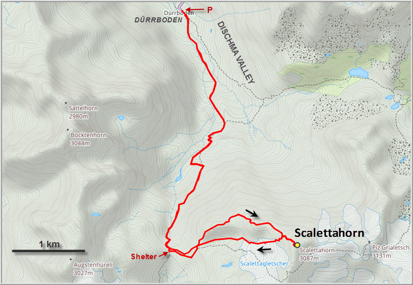
A popular trail goes up from the hamlet of Dürrboden, where the road ends, to the Scalettapass at 2600 m elevation. Tons of people were out and about on this gorgeous sunny day, many hiking down the other side of the pass to overnight in one of the mountain huts around Piz Kesch, or to do a big loop into the Sertig Valley. Some were even heading up by mountain bike.
There’s a small emergency shelter at the pass and the area around it serves as a nice and busy picnic spot. Leaving the trail behind us at the pass, we headed up the rocky west ridge that curves around to the summit. There are one or two sections requiring moderate scrambling, and one area where large chunks of lichen-covered black rock need to be crossed, the rest is an easy hike on the broad ridge. Along the way we came across some scattered bullet shells, the same type I had found on the neighboring ridge between the Bocktenhorn and Augstenhüreli. They are blanks used by the Swiss military on their annual training exercises in the area, apparently harmless ammunition that is cleared up off the mountains every once in a while.
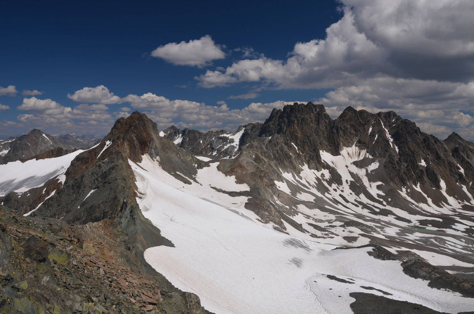
A faint trail appeared on the ridge shortly before the summit; most people don’t take the ridge but come up the small depression to the south where the terrain is gentler and the route is more direct. We really loved the views from the summit, especially looking at the jagged ridge going east to Piz Grialetsch (3131 m) and Piz Vadret (3221 m), flanked by glaciers on both sides. You can also see down the entire length of the Dischma Valley, almost to the town of Davos.
On our way down we followed the trail along the normal route, with a short detour along the edge of the small piece of the Scaletta Glacier that remains in the basin to the SW of the summit. It’s quickly melting along the edges and really thin, with rocks poking through here and there, so there certainly was no danger of falling into crevasses.
It took us about an hour and a half from the summit to the pass, and an additional hour back to our car. What a lovely day out! A great mixture of on-trail hiking and off-trail scrambling, with relatively little effort required to get some fantastic glacier views.
| Elevation: | 3068 m (official), 3063 m (my GPS) |
| Elevation gain: | 1140 m |
| Time: | 7.5 h |
| Distance: | 12.7 km |
| Difficulty level: | Moderate (Kane), T4 (SAC) |
| Reference: | Local maps & own routefinding |
| Personal rating: | 4 (out of 5) |
DISCLAIMER: Use at your own risk for general guidance only! Do not follow this GPX track blindly but use your own judgement in assessing terrain and choosing the safest route.
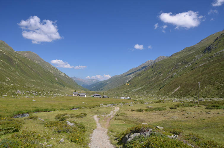
Start of the trail at Dürrboden.
A good trail, part of an ancient route through the mountains, leads up to the Scalettapass.
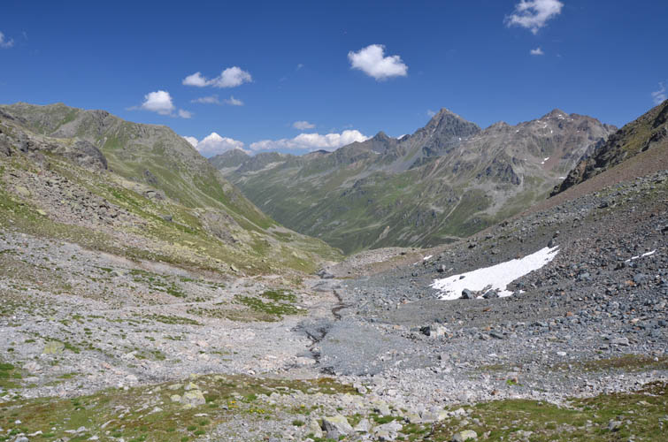
Looking back down into the Dischma Valley.
Views south from the Scalettapass. The big mountain in the distance on far right is Piz Kesch (3418 m).
A closer look at Piz Kesch from higher up.
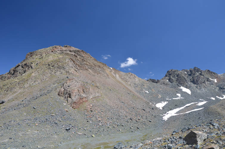
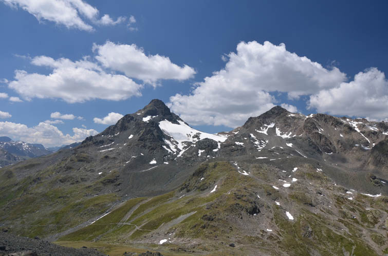
To the west is a long ridge that culminates in the Chüealphorn (3078 m) as its highest point on the left.
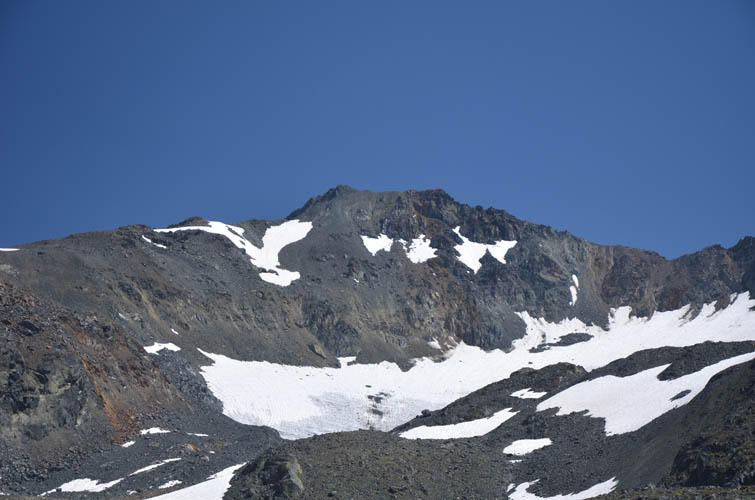
The Chüealphorn has a small glacier on its NE side.
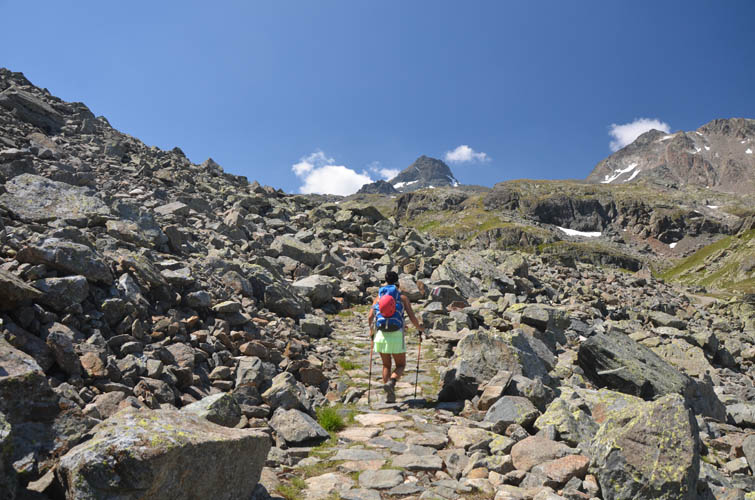
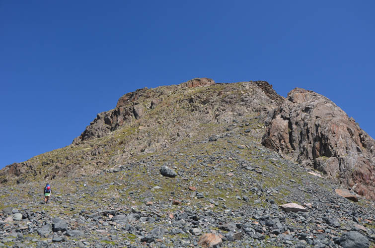
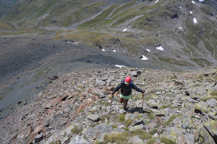
The SW ridge of the Scalettahorn mostly involves trail-less hiking mixed with a few spots of easy to moderate scrambling.
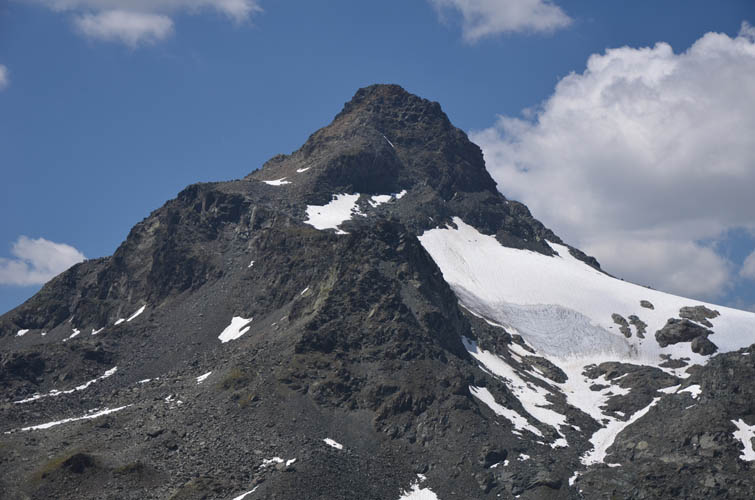
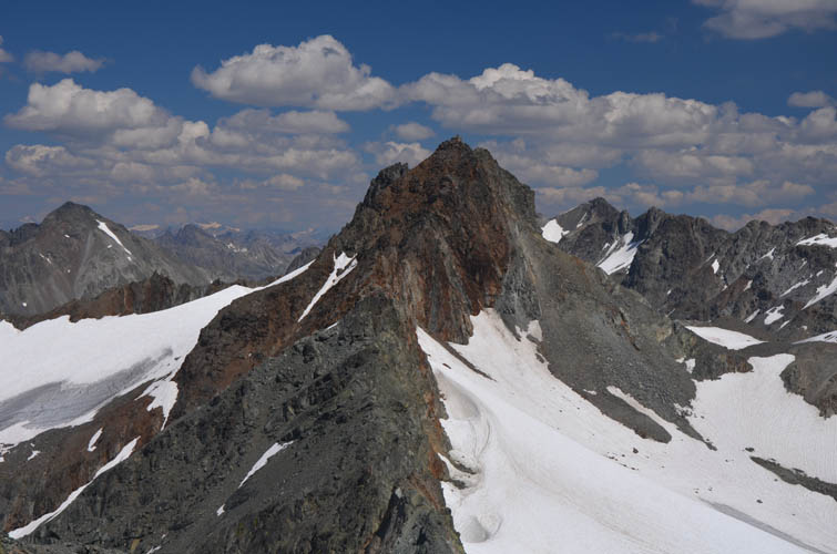
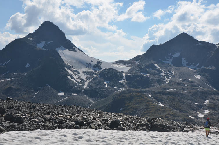
Scalettahorn summit mass, flanked by a small receding glacier on its south side.
Heading up the SW ridge.
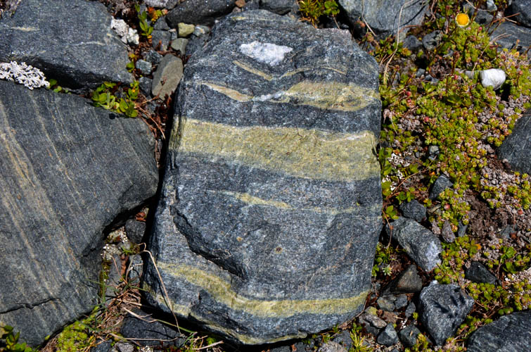
Interesting metamorphic rocks here, including this green and blue-grey gneiss.
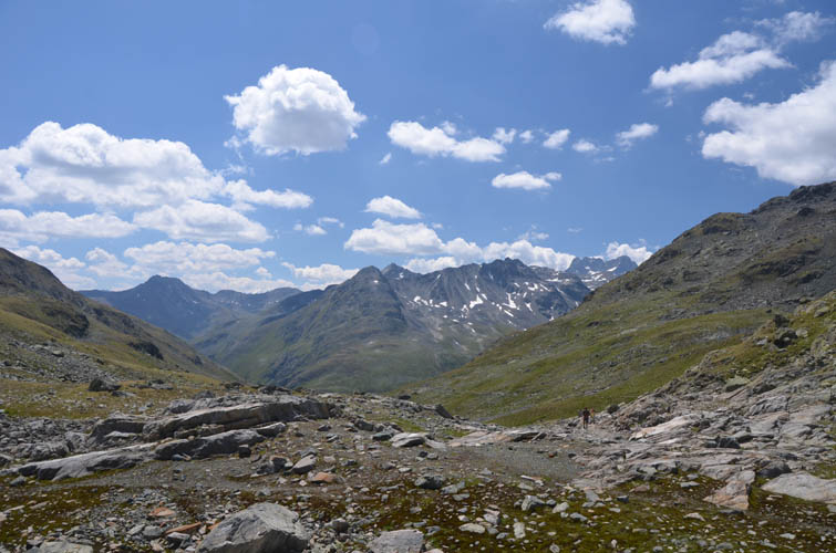
The trail leading over the Scalettapass can be seen below.
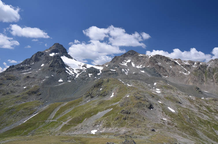
Chüealphorn (L) and Augstenhüreli (R).
The Bocktenhorn is also across the valley to the northwest.
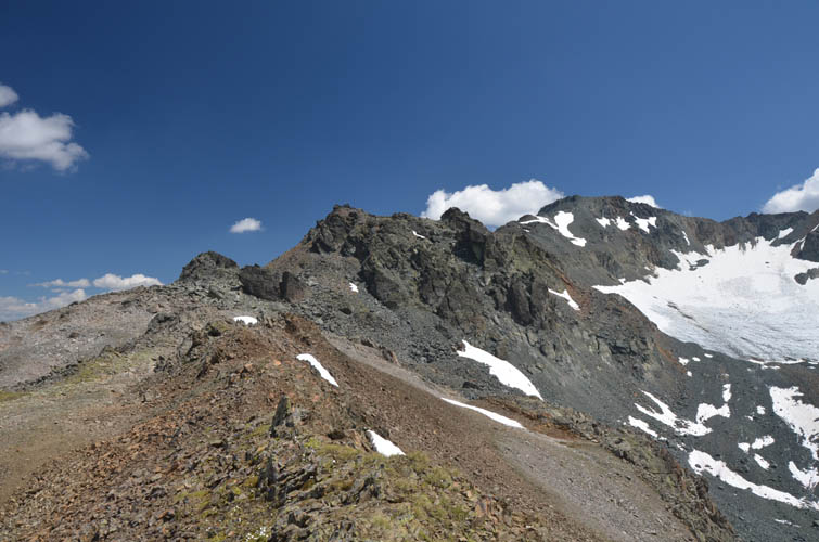
Much of the hike along the ridge is quite pleasant, with few exceptions. Scalettahorn summit in the distance to the right.
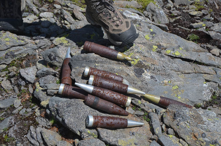
Blanks used by the Swiss military in their annual shooting exercises. They are pretty big and heavy but completely harmless.
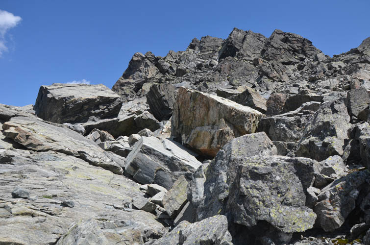
Blocky terrain along the ridge.
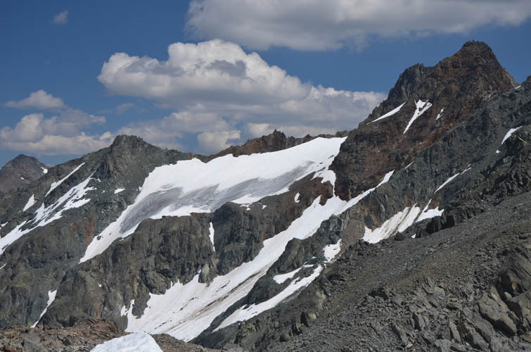
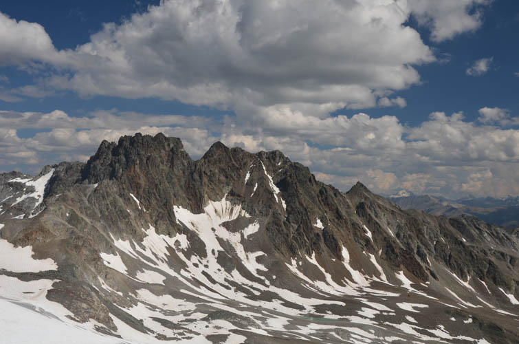
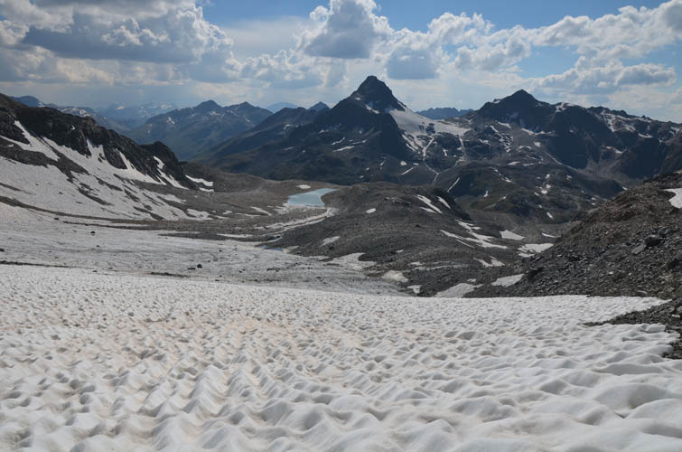
Great views of the Grialetsch glacier open up to the NE. Piz Grialetsch (3131 m) on the right.
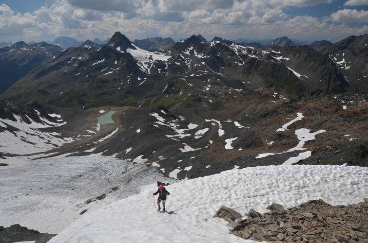
Almost at the summit! The snow offers a nice break from all the rubble.
View of Piz Grialetsch from the summit of the Scalettahorn.
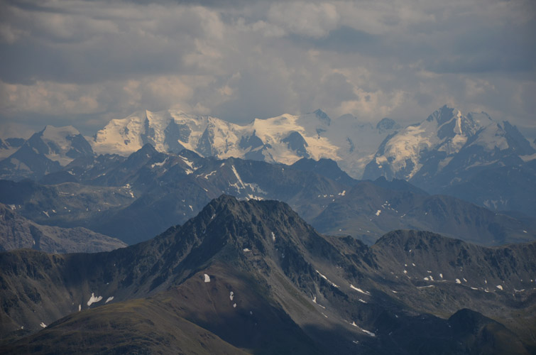
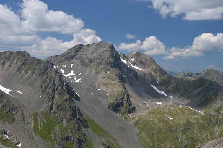
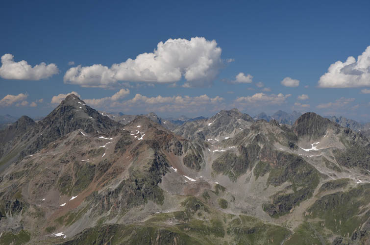
Bigger and higher mountains loom in the distance to the south.
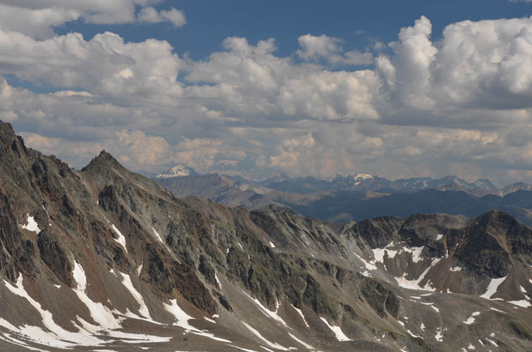
Fantastic views all around.
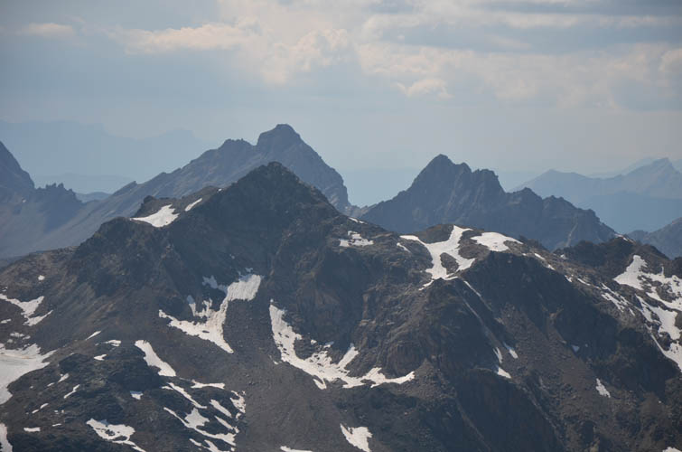
Piz Vadret (3221 m) is apparently a much more difficult objective.
The Schwarzhorn (far left) is a straightforward hike, while Piz Radönt (far right) is a difficult scramble.
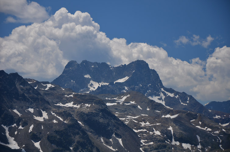
Close-up of Piz Radönt’s impressive south face.
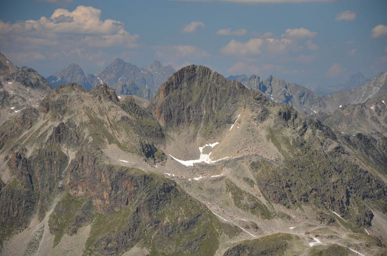
Hoch Ducan (L) and Plattenflue (R) in the distance, with Augstenhüreli in front.
Quick descent down the edge of the fast-melting Scaletta Glacier.
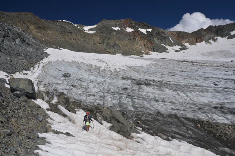
The ice cover is so thin, you can literally see it melting in front of your eyes.
What a fantastic day!
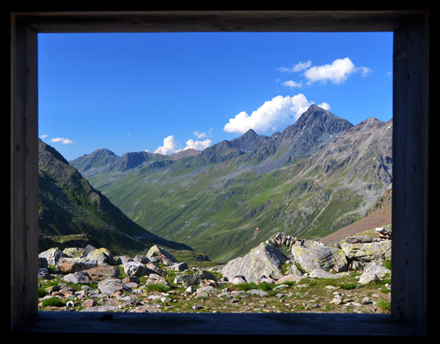
The wooden shelter at the Scalettapass offers an opportunity to frame a parting shot.