Graubünden, Switzerland
27 August 2017
Solo
The weather forecast looked variable today with a chance of afternoon rain, so I decided to do something “shorter” along an established trail. The Flüela Wisshorn, also shown as Flüela Weisshorn on some maps, is the lighter coloured sister to the more famous Schwarzhorn (“black horn” in German) across the valley.
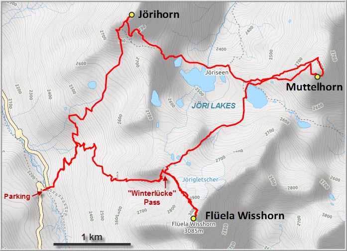
An excellent trail goes up the eastern slopes of the Flüela Valley, crosses over the “Winterlücke” pass at 2500 m, and then descends into a broad plain replete with beautiful alpine lakes in various shades of blue. Excited to be out again, I put on a good pace and was up at the Winterlücke in a mere 50 minutes. It was Sunday and the trail was teeming with people as the lakes are an enormously popular hiking destination in the area.
Near the pass I met Rolf, a Swiss hiker who had come all the way from Wintershall (a 2.5 h drive) to do the Wisshorn scramble for the day. We got chatting and he turned out to be a very pleasant and experienced companion, so we decided to go up the mountain together. From the pass, we basically followed the north ridge on a faint trail. Following the crest was more exposed and involved some exciting moves, while easier options were always available via bypasses on the right or left. About half way up small cairns point towards a groove on a steep, slabby wall to the left – this section is the first crux (moderate to difficult scrambling) and takes you to the east ridge, which is easily followed to the first and false summit. A register on the false summit allows hikers who’ve had enough by now to leave their mark, while those willing to take on the second and more difficult crux will enjoy views from the slightly higher true summit complete with a big wooden cross. Getting there involves either a very airy scramble/bum shuffle across an exposed knife-edge ridge, or a slightly less exposed scramble on good holds on a short bypass around the south side. Both sections are very short and quite enjoyable I thought.
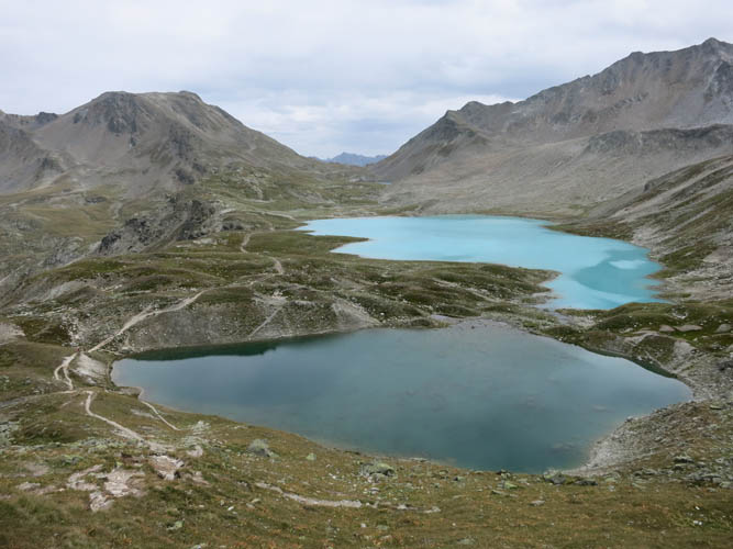
The descent was about as challenging as going up, at least up until the Winterlücke where we joined the throngs of day hikers again on our way down to the Jöriseen (Jöri Lakes). It’s clear why there are so many visitors on the trail here – the area is simply stunning. Lush green meadows surround the handful of lakes that each sport a different beautiful hue, from dark blue-grey to aquamarine blue to an almost unnatural turquoise. A lone angler was trying his luck in the biggest lake, while most hikers took a lunchbreak, leisurely ambling along the lakeshore and lounging in the soft grass.
Across the biggest lake my eyes caught the attention of a small peak that looked quite pretty, easy to access, and with the summit cairn visible to top it all off. Too tempting! Rolf decided he’d had enough of scaling peaks for today, so I headed up the grassy NW slopes of the Muttelhorn alone, as this mountain is officially named on maps.
The entire way up only took about 30 minutes from the lake and was a pleasant hike on sometimes steep grassy slopes interspersed with patches of scree and angular boulders. At the top there is a broad plateau that provided great views of mighty Piz Linard to the east and a sea of other peaks all unknown to me. The two summits both boasted large cairns, but I didn’t find a register on the higher summit (I was too lazy to walk over to the slightly lower one).
A rapid 15-minute descent, partially helped by a nice soft scree chute, brought me back to the trail, which was still surprisingly busy considering it was late Sunday afternoon and grey clouds were slowly moving in. The whole day had been mostly overcast, with the sun peeking through here and there, but I had fortunately been spared the forecast rain. The people I met on the trail were a mixed bunch: there were families with dogs, lots of elderly couples, groups of young 20 and 30 somethings, and also a few solo hikers but these were definitely in the minority.
I quickly made my way up to the second pass on my anti-clockwise loop, re-gaining a full 250 m of elevation in the process. The Jöri Pass sits between the ridge leading south to the Winterlücke and a minor peak to the north, the Jörihorn, which of course I couldn’t skip. It’s just about 150 m higher in elevation and only a short hike away from the pass, although the last few steps to the actual summit are slightly exposed on a short, narrow part of the rocky ridge. What a great vantage point to enjoy sweeping views of all the lakes below just as the sun came out again! Despite being so close to the main trail, I had this magic spot all to myself while several groups of hikers passed by below me.
The clouds eventually closed in again and the winds picked up, so I started to rush back down to the trail to complete the loop. A slight drizzle at the end made me speed up even more, and after about 7 hours and 3 peaks I was back at the car.
The peaks-for-effort ratio is one of the best I’ve seen and the trail is excellent, but what makes this trip truly stand out to me are the many wonderful views of the lakes that the three peaks offer from different angles. This rates as one of the best trips I’ve done in Switzerland!

DISCLAIMER: Use at your own risk for general guidance only! Do not follow this GPX track blindly but use your own judgement in assessing terrain and choosing the safest route.
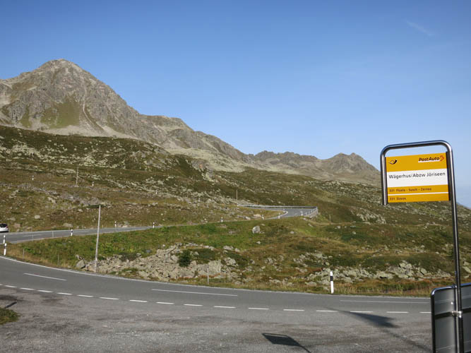
There’s a convenient bus stop at the Wägerhus trail head.
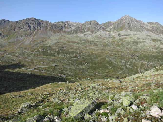
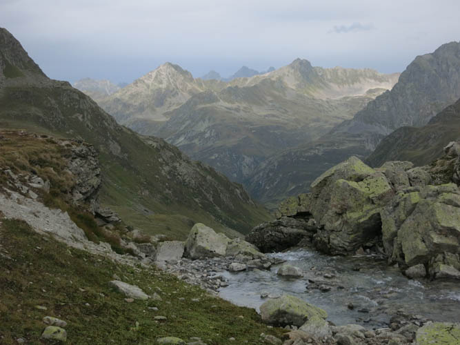
View down the broad Dischma Valley to the west. The peak on the right is called Sentisch Horn.
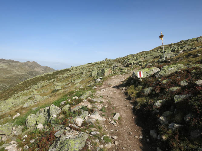
An excellent trail with painted markers and signs leads up the slope.
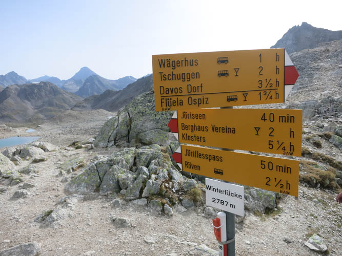
The Swiss like to measure hiking distances in time! Plenty of options at the Winterlücke pass.
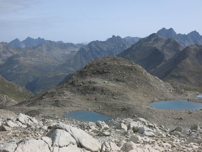
A first glance at the Jöri Lakes.
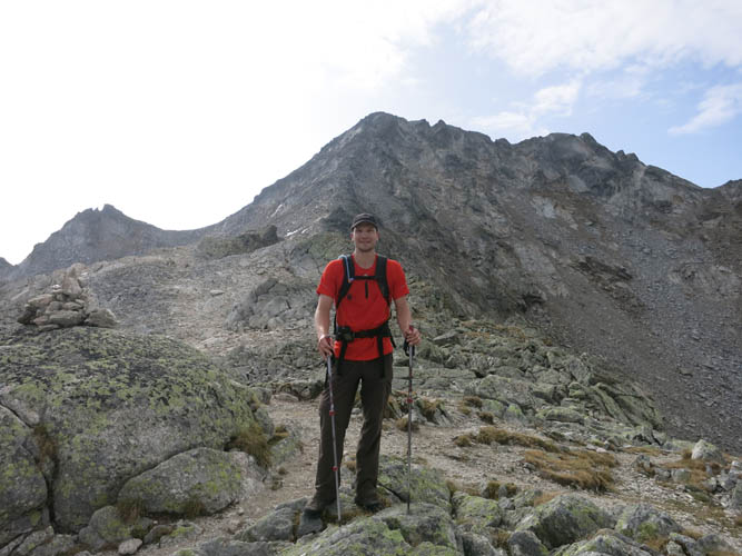
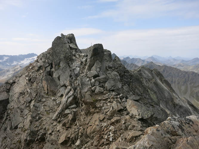
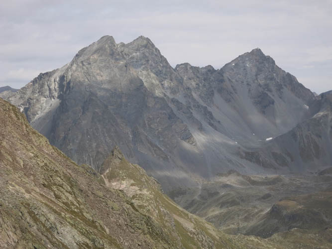
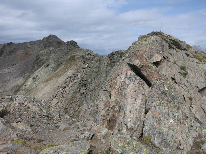
Leaving the trail on the right to the south, the route takes me into scrambling terrain up the Wisshorn. The summit is what looks like a lower peak on the right.
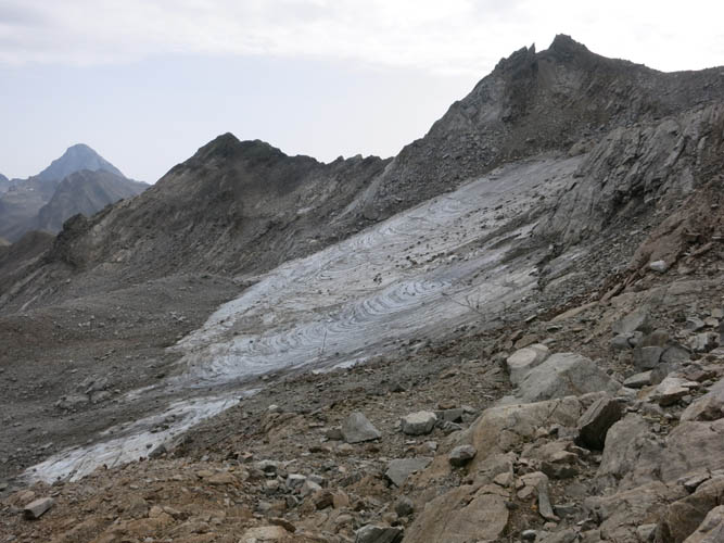
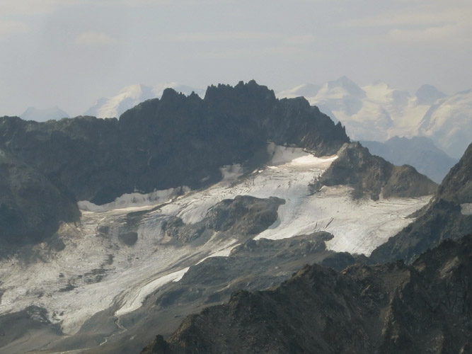
There is a small patch of remnant glacier on the northeastern slopes of the Wisshorn.
My Swiss hiking companion Rolf coming up the ridge.
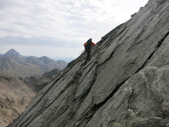
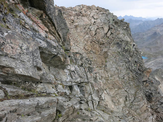
Crux #1: the crack in the slabs.
Steep and a bit exposed, but very good holds and firm rock.
Crux #2: a narrow and exposed ridge from the false summit (vantage point) to the true summit.
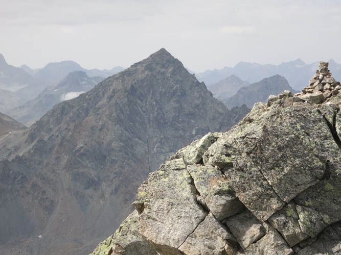
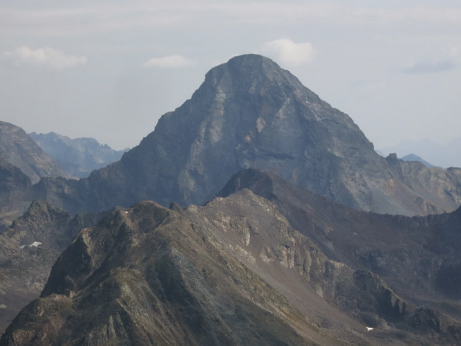
True summit in sight, Schwarzhorn in the background.
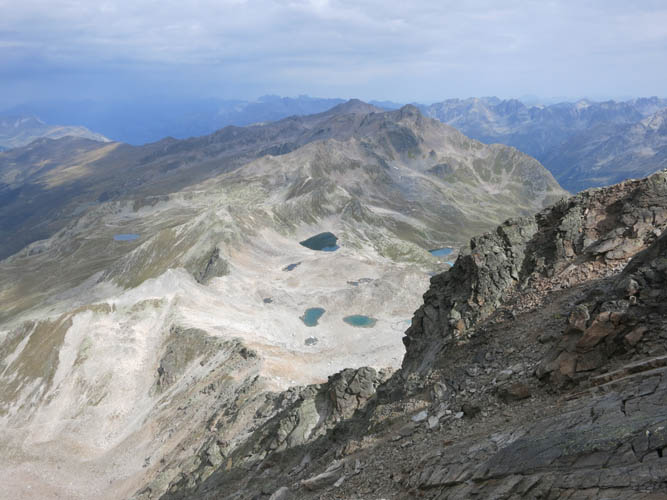
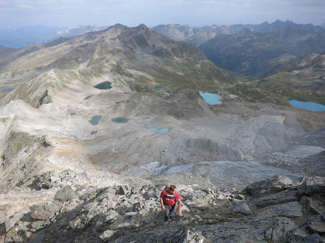
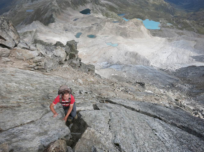
It’s a steep drop down the north side from the summit ridge. Some of the Jöri Lakes can be seen below.
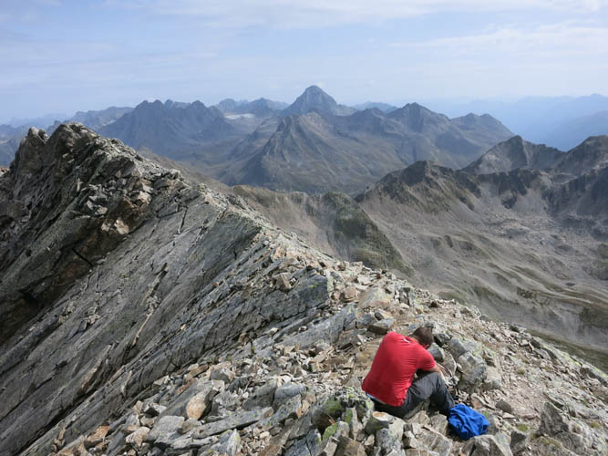
At the true summit, looking back along the ridge. Mighty Piz Linard dominates the horizon in the back.
Close-up of Piz Linard (3410 m).
The views from here are simply breathtaking.
On the way back to the false summit, bypassing the knife-edge ridge on the south side.
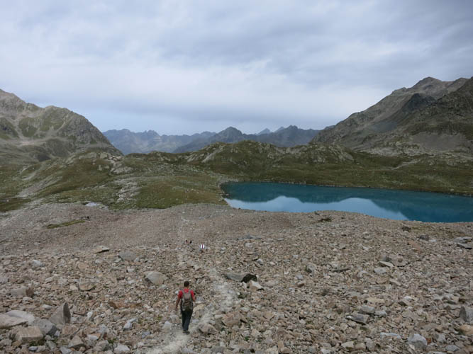
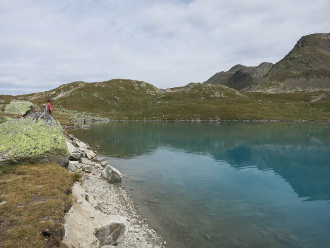
Descending towards the first of the Jöri Lakes.
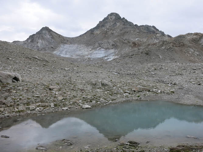
Looking back at the Wisshorn from the lakes.
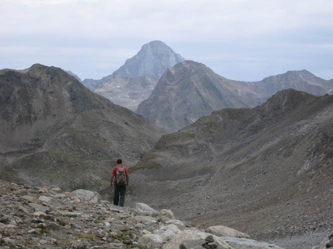
Rolf heads down to the bottom of the broad valley, with Piz Linard in the background.
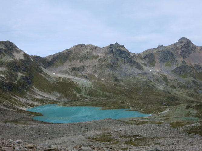
The main trail goes around the right side of this beautiful turquoise lake, then climbs back up to the saddle on the left. Jörihorn (centre) and Gorihorn (right) can also be seen from here.
The path goes through a talus field before reaching the southernmost lake.
Perfect place for a rest stop!
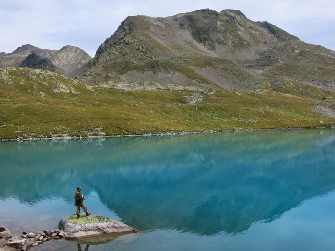
A lone angler at one of the beautiful Jöri Lakes, its deep blue waters holding a dreamy reflection of the Muttelhorn behind. I wonder what kind of fish he is trying to catch?
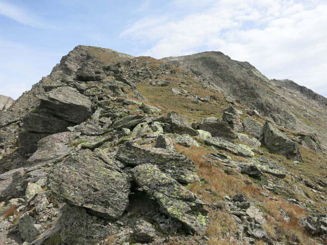
Heading up the easy SW ridge of the Muttelhorn.
I turn frequently – these lakes are just too attention-grabbing!
Promising future scrambling somewhere in the distance :).
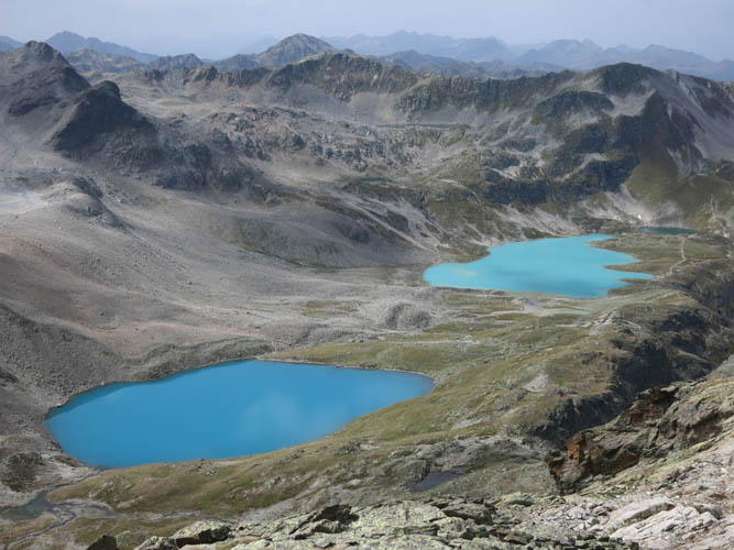
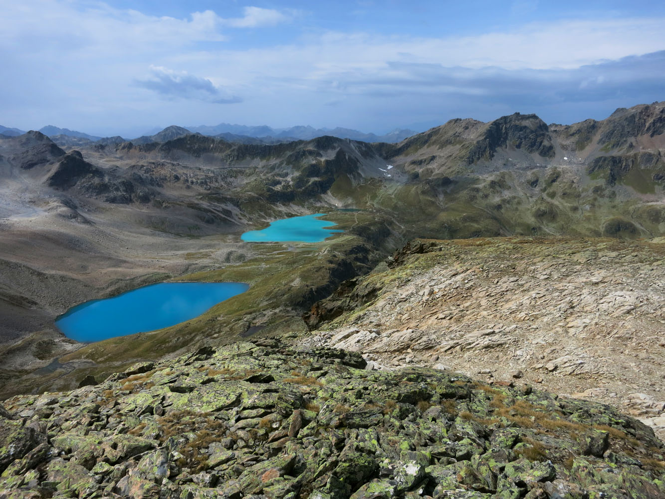
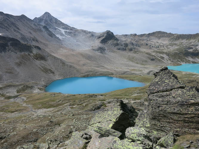
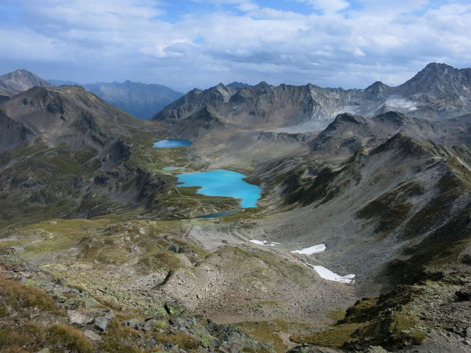
My favourite shot from the top of the Muttelhorn. I love the different shades of blue that make the lakes look almost unnatural in their grey and barren surroundings.
Jörihorn (L) and Gorihorn (R).
It’s been overcast almost all day, but thankfully the rain remains elsewhere.
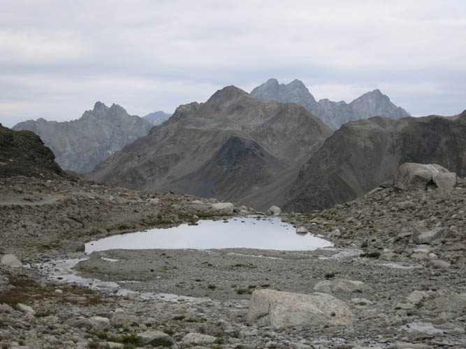
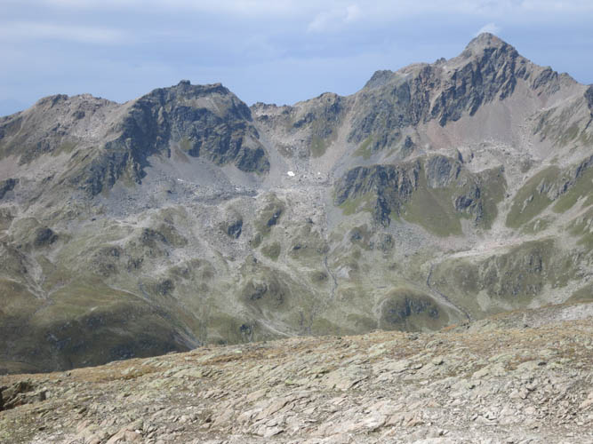
Near the end of my anti-clockwise loop around the lakes. looking back at the Muttelhorn (L) and the eastern extension of the Flüela Wisshorn (R).
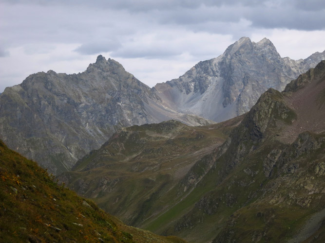
There are some dramatic peaks in the area. So much to discover!
Nearing the summit of the Jörihorn.
What a reward! The sun briefly appears, and with it some brilliant sweeping views of the lakes below.

The lakes look like a splash of paint from here!