16 June 2017
With Richard
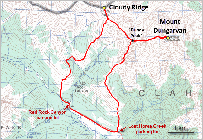
What a trip! We had planned to climb Dungarvan only, but then added on Cloudy Ridge “while in the area” since the weather was so poor in the morning and gradually seemed to improve later during the day. After all, this is an area that should be explored when the sun is out brightening up the colourful rocks that Waterton is so famous for. Although the weather forecast had predicted sunny skies, we had to settle for a rather dreary ascent in clouds and light rain.
The suggested “scenic” route to Mount Dungarvan according to Nugara’s scrambling guidebook is along the creek bed from the Lost Horse Creek parking lot. Unfortunately, the creek was running high so we tried the alternative bushwhacking option on the left bank of the creek instead. The thick, wet bush was so nasty that we gave up within the first 5 minutes!
Thankfully, we remembered a third option for reaching Dungarvan, a route described on the Waterton Scrambles blog. From the parking lot, we hiked up gentle grassy slopes to a ridge that extends south and southeast from the connecting ridge between Dungarvan and Cloudy Peak. Despite a constant drizzle and more and more clouds rolling in, we quite enjoyed this lovely ridge walk.
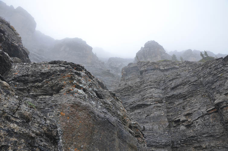
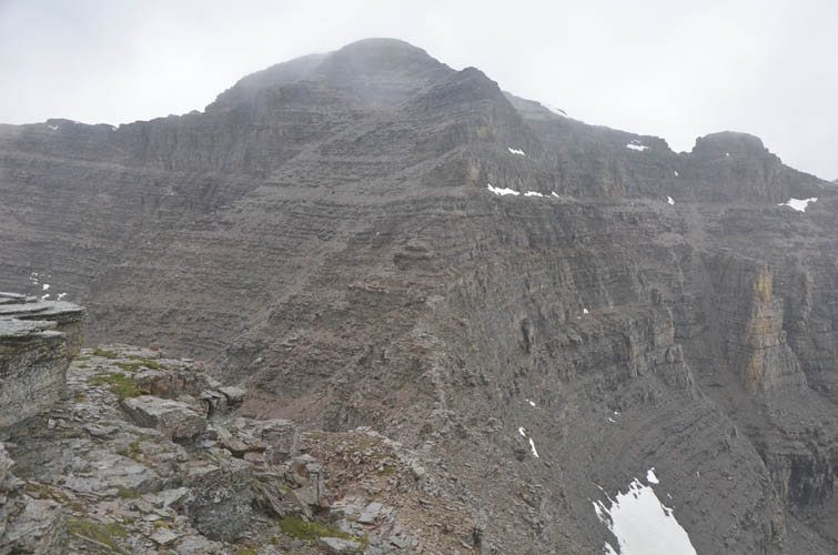
About two thirds of the way up, a huge vertical cliff face stands in the way. Here, we traversed right (east) to the second prominent gully that appeared to offer a moderate scrambling route back up to the ridge top. There are nice solid rock steps lower down, but higher up we found ourselves in more demanding terrain with definitely some difficult scrambling to overcome several cliff bands that we couldn’t bypass. We were glad to have our helmets as there’s quite a bit of loose rubble in this section. Once we were up on the ridge and looked back down, we realized that it would’ve probably been easier to traverse further to the right and take one of the subsequent gullies up (but we’re not 100% sure about that).
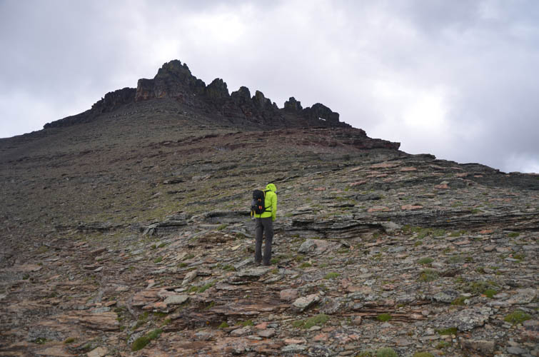
An easy ridge walk took us to the intermediate high point between Dungarvan and Cloudy that Nugara calls “Dundy Peak” (although to be honest I’m not sure if this bump really deserves a name J). By now the clouds had accumulated to the point that we couldn’t even see our objective ahead anymore; this is where that GPS unit comes in really handy!
The descent off the high point to the east required some interesting route finding but was never really difficult. A rather annoying sidesloping slog under Dungarvan’s south cliffs brought us up to the summit tower. The rain had now turned to light snow and the wind was pounding us… not the best conditions, especially with all the lichen covered rock getting really slippery. In spite of the weather, we actually didn’t find the crux to be overly challenging. The views at the top were basically non-existent and our hands were freezing off now that our fleece gloves were completely soaked. I was glad I had another pair with me, while Richard was toughing it out for the rest of the day with his one pair of wet gloves.
After coming off the summit and past the crux, the weather improved slightly and the sun even came out. Re-ascending the ridge to the intermediate high point was more enjoyable now that we could actually see the rock! By the time we reached “Dundy”, it was still windy but we decided we might as well head over to Cloudy Ridge and then descend from there. As long as we were moving we were comfortably warm, and we still had some energy left to go for a second summit.
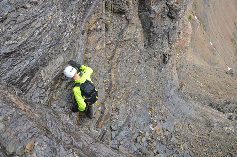
The ridge walk from Dundy to Cloudy was fun and entertaining. There are a few ups and downs, with a few bypasses around steep cliffs thrown in as well. Rain and fog appeared again, making the ridge with its dark, lichen-covered rocks look like a fantasy world. When wet and misty, this area feels more like the Scottish highlands or the Lake District than the typical Rockies we’re used to! Just below the summit tower of Cloudy Ridge, a moderate to difficult traverse leads right (north) around a vertical cliff to the backside that can easily be scrambled to the summit. Again, not overly difficult but wet rock and lingering snow made things tricky in a few spots.
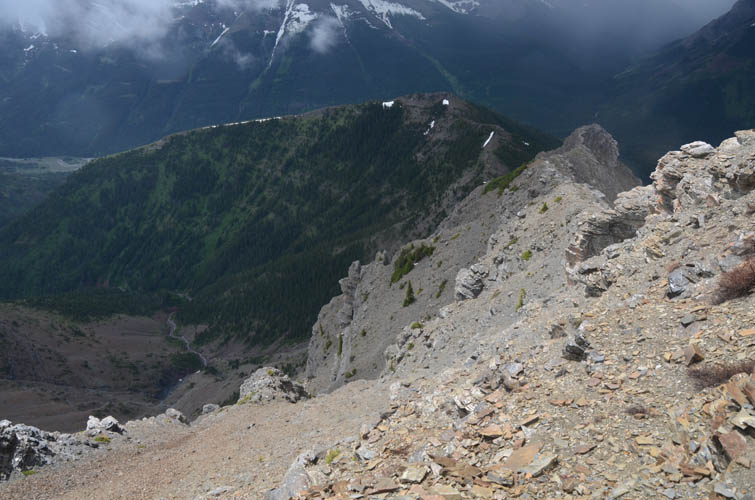
After another rainy summit stay with virtually no views, we had enough of the miserable weather and decided to head back as quickly as possible. We retraced our steps to a minor bump along the Dungarvan-Cloudy ridge (about 550 m south of Cloudy Peak) and then followed its long southwest ridge down towards Red Rock Canyon. Instead of following the canyon down to the parking lot, which is supposedly quite tricky and slow with many bypasses around narrow waterfalls, we stuck to Nugara’s recommendation and ascended the small ridge that lies directly north of the Red Rock Canyon parking lot. It’s too bad that this route necessitates a significant elevation loss and re-gain (about 200 m), otherwise it would probably be the preferred ascent route for both Dungarvan and Cloudy. It’s a steep hike back up this small ridge and there’s some bushwhacking, but thankfully it didn’t take us long to reach the open grass slopes on the south side.
We were quite tired when we reached the Red Rock Canyon parking lot – we definitely had not expected a 2300 m elevation day! At least, all that was left now was an easy plod back along the road to our car at Lost Horse Creek. We had also not expected such miserable weather, with 70% of our day spent in a drizzle. Regardless, it turned out to be an exciting trip with lots of enjoyable scrambling in an area that deserves many more future visits.
Note (Dec 2017): Sadly, large parts of Waterton National Park and surrounding areas were destroyed by the Kenow wildfire in late summer 2017, including most of the vegetated areas south of Mount Dungarvan and Cloudy Ridge. Many of the official and unofficial trails, as well as sections of the routes described here (below treeline), are affected and therefore may have become impassable or very difficult to navigate. Area closures may also be in effect.

DISCLAIMER: Use at your own risk for general guidance only! Do not follow this GPX track blindly but use your own judgement in assessing terrain and choosing the safest route.
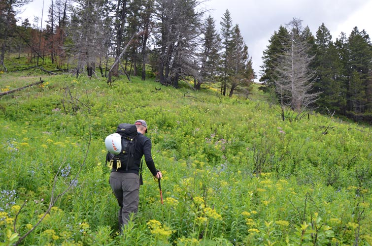
An easy start through lush grassy slopes.
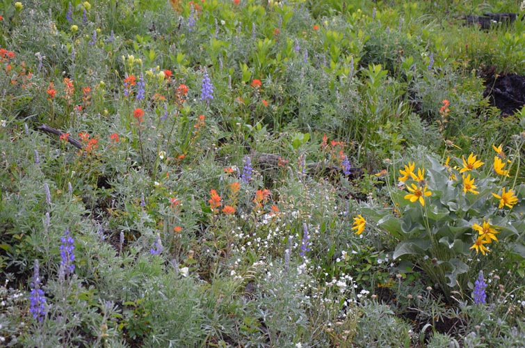
It’s mid-June, a great time to see flowers in bloom.
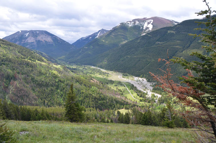
This is the open slope we hiked up from Lost Horse Creek.
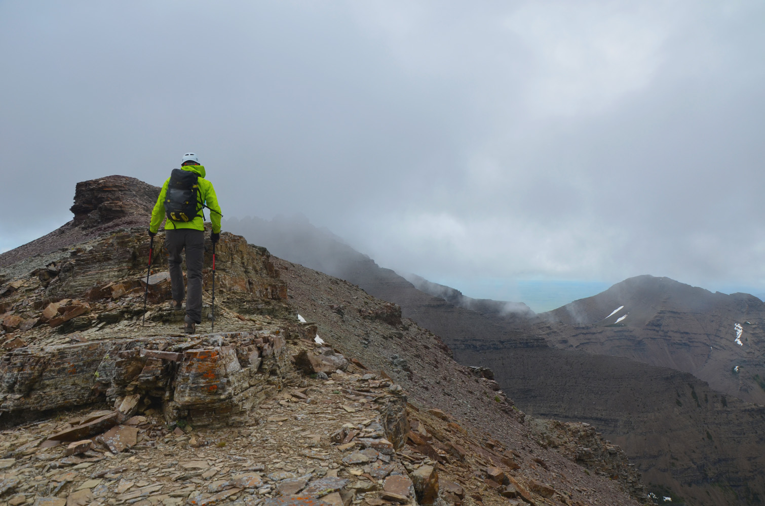
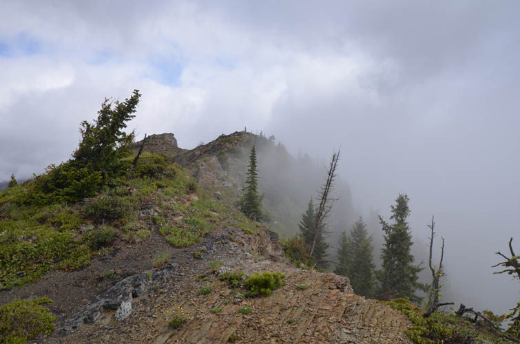
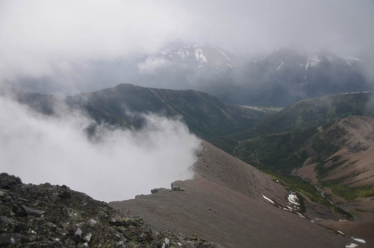
The craggy summit ridge of Mount Dungarvan can now be seen through the clouds in the distance.
Lots of clouds moving in from the west – not what we had expected!
One of the rare moments the sun came out!
Stunted trees and krummholz along the ridge.
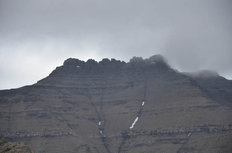
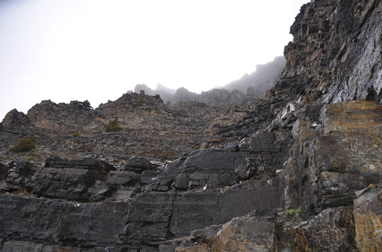
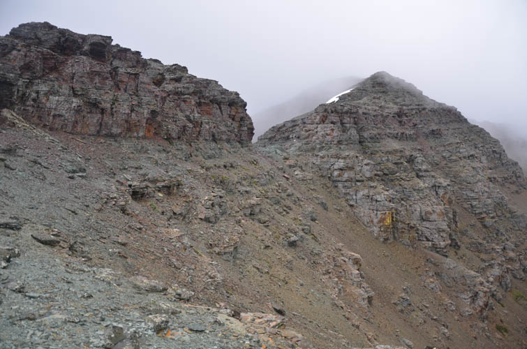
A huge vertical cliff bars the way. There’s a difficult scrambling route that goes around the right side.
Close-up of this impressive cliff face. We went up the gully that goes diagonally up and to the left from the small snow patch.
Easy step-like terrain in the lower part of the gully.

It quickly gets steeper.
The rock is pretty solid with lots of steps and ledges.
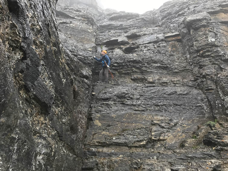
One of the more exposed sections.
The wet rock made things trickier than they should be and we had to move slowly and carefully here.
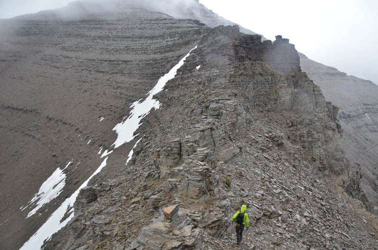
Looking back down the ridge we just climbed. We came up on the left side (as seen in this photo), just right of the small grey nub.
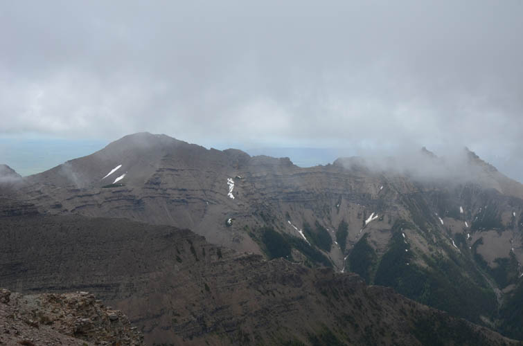
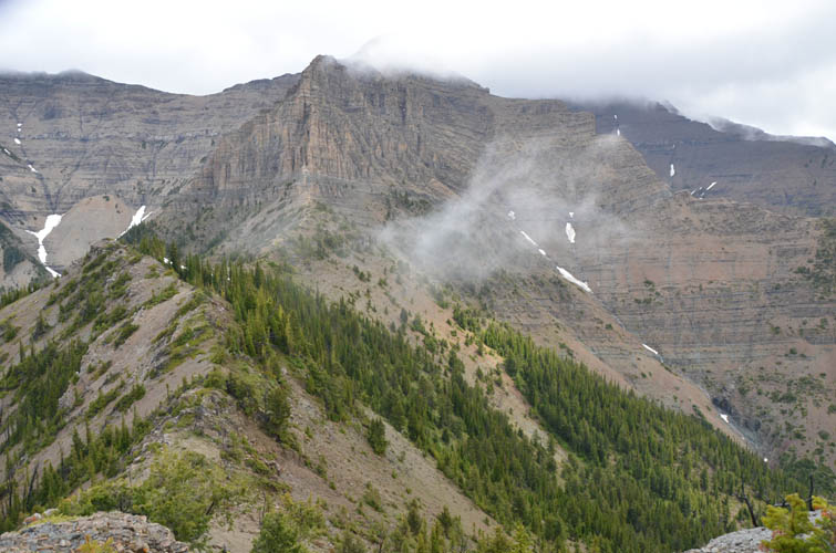
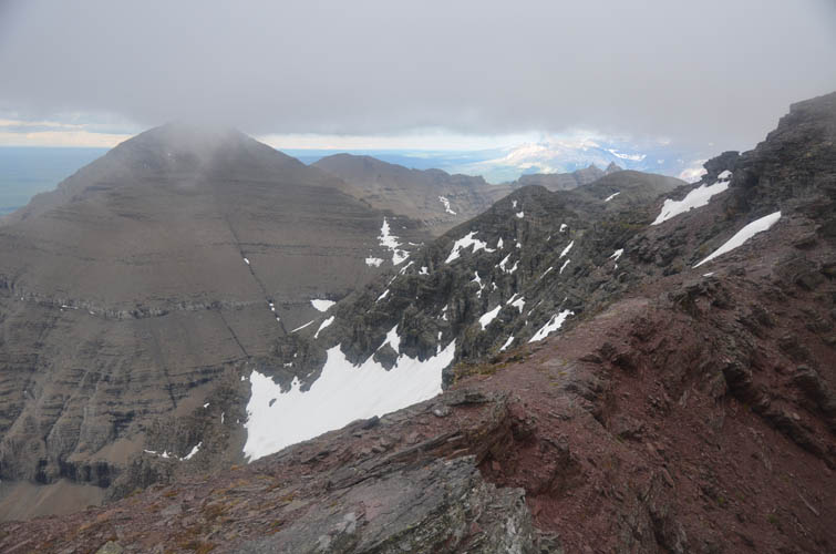
To the east are Rogan Peak (also called Dunwey Peak) on the left and Mount Galwey, which is mostly shrouded in clouds.
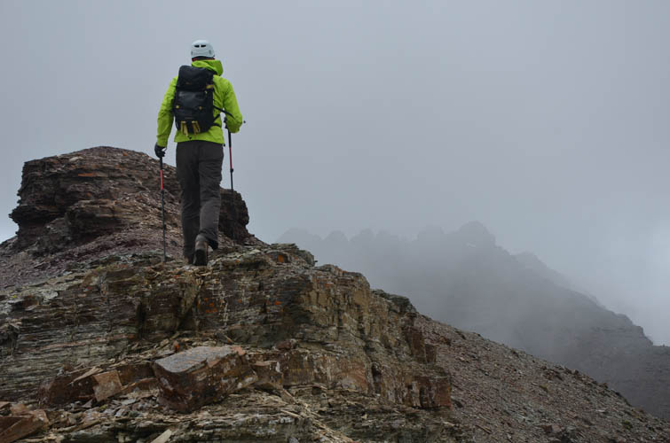
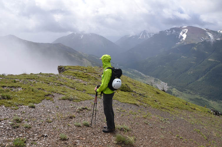
Richard heading up to the intermediate high point between Cloudy Ridge and Mount Dungarvan, which is hiding behind a thick veil of clouds to his right.
Looking at Dungarvan from the intermediate high point.
Lots of fun scrambling here, mostly in the moderate realm.
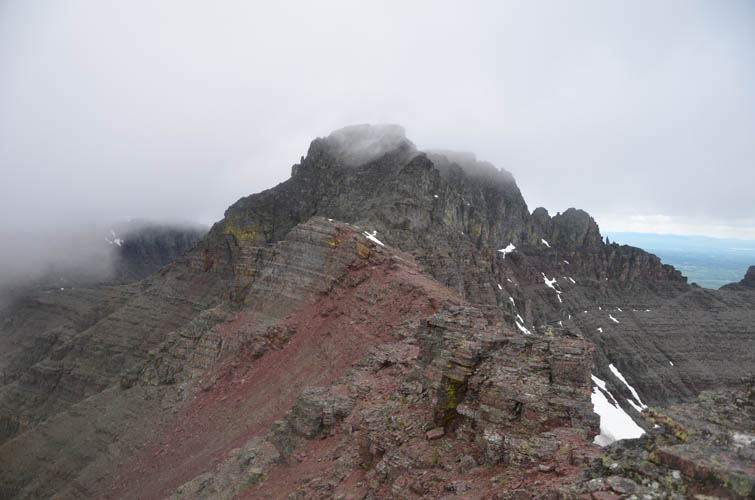
Looking back at the intermediate high point, which Nugara calls “Dundy Peak”.
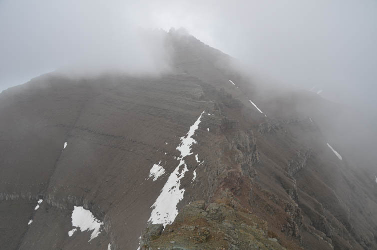
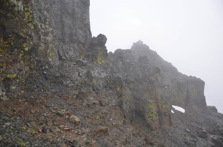
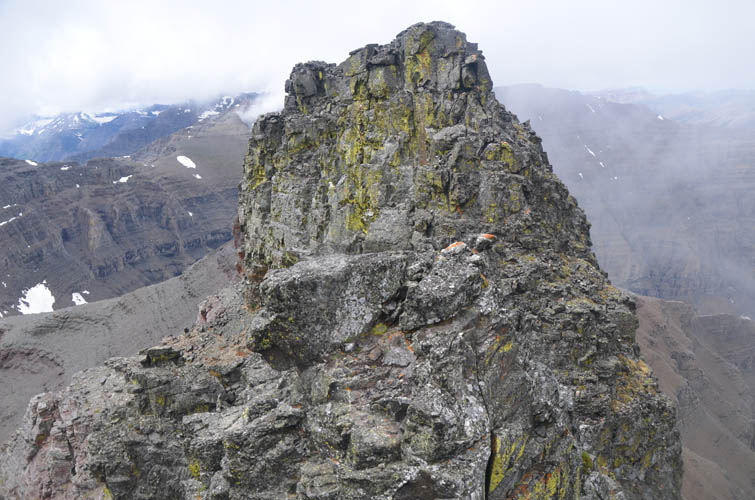
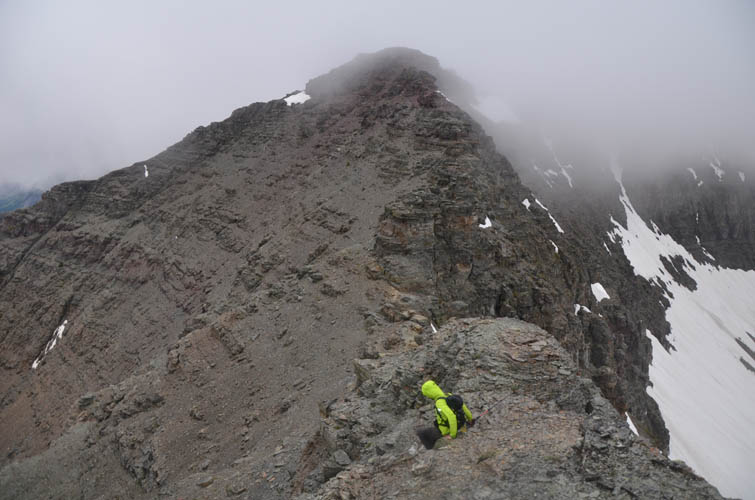
The wind gets stronger as we approach the crown-like summit ridge of Dungarvan.
Wet, lichen-covered rock forms the summit mass.
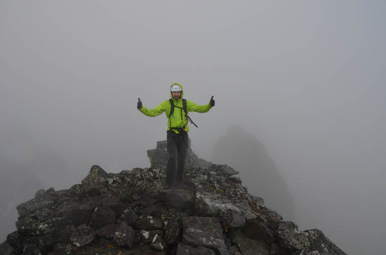
Dungarvan’s summit: what a great view!
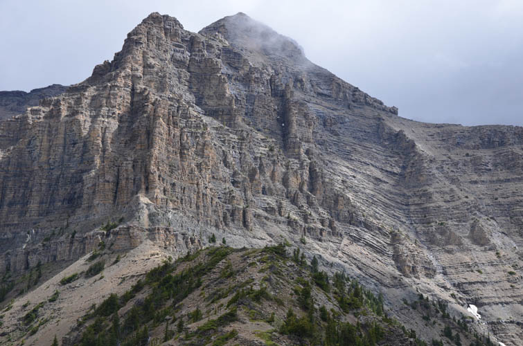
The normal route to Dungarvan’s summit goes up along the south ridge.
Coming off the summit across the crux.
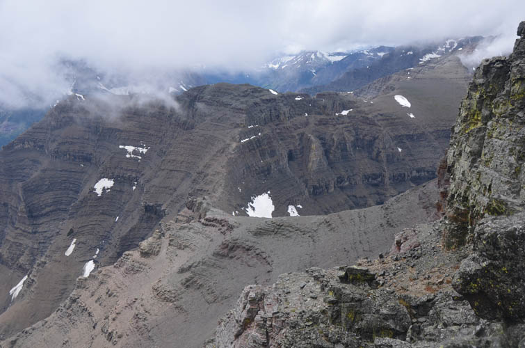
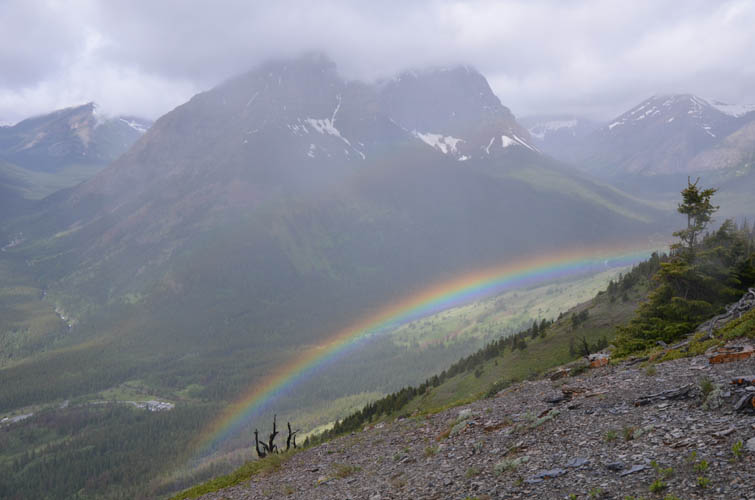
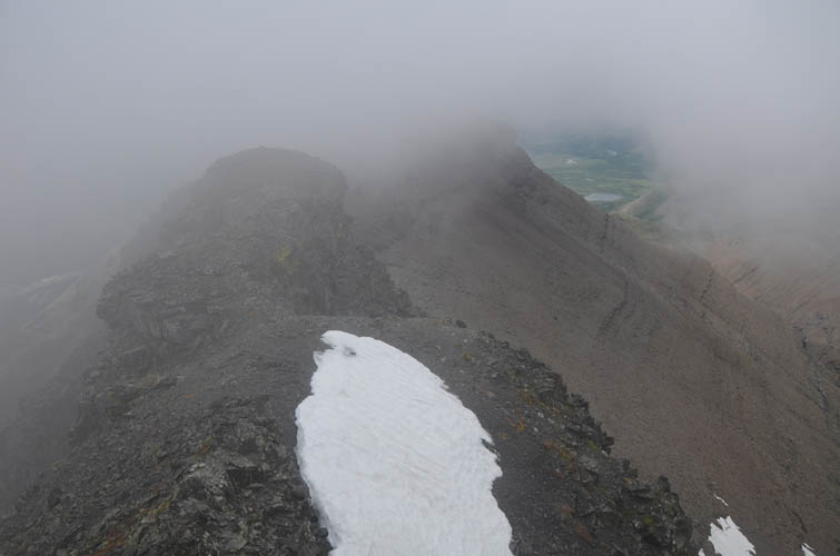
Looking back towards Dundy from near the summit of Dungarvan. Finally, the clouds seem to clear up…
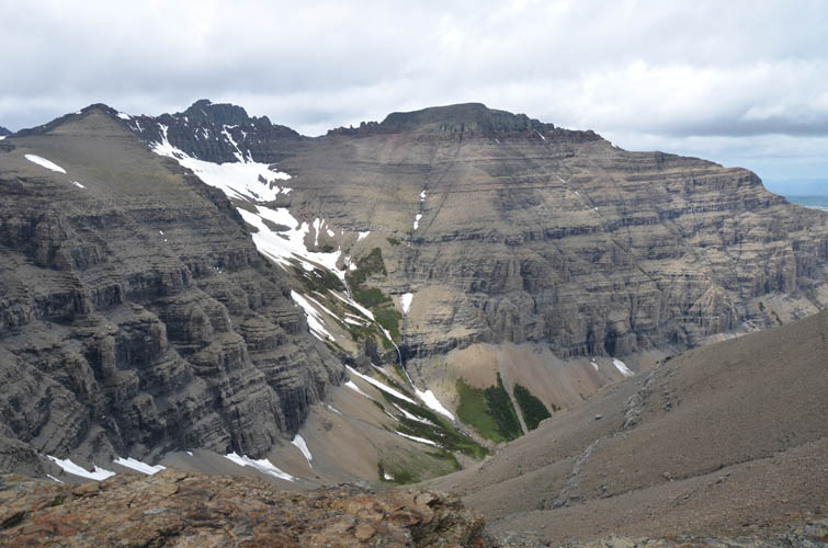
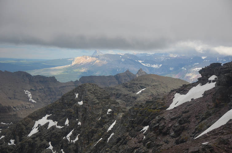
The summit of Cloudy Ridge still looks far away – seen here on the left above the snow.
As we start the traverse from Dungarvan to Cloudy, it gets…. cloudy again, how fitting! 🙂
Fun scrambling along the ridge (mostly of easy to moderate difficulty).
The normally colourful ridge, now wet and enveloped in clouds, appears sombre and mystical.

Richard at the crux just below the summit tower of Cloudy Ridge.
Socked in summit views from Cloudy Ridge once again.
On the way back, the sky appears to open up a bit to the east. Mount Dungarvan is on the left.
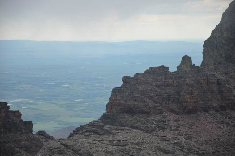
A peak at the prairies beyond the jagged mountain ridges of Waterton.
Far to the SE, Sofa Mountain enjoys some real sunshine, with Chief Mountain behind.

From our descent ridge we can see the parallel ridge we came up in the morning. The cliff band we had to avoid (centre) doesn’t look that steep from this perspective.

Looking back along our descent ridge: it’s a nice stroll over easy terrain. My camera is now clearly suffering from the all-day exposure to clouds and rain.