Livingstone Range, Canada
26 March 2017
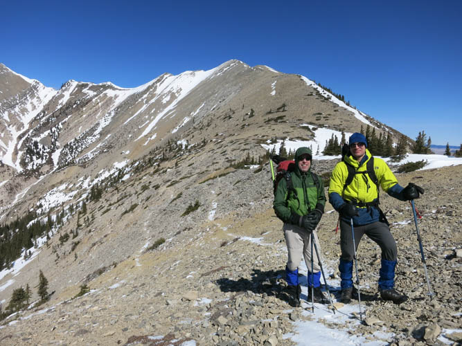
With Trevor
Great winter hiking
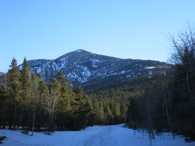
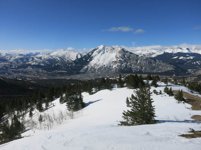
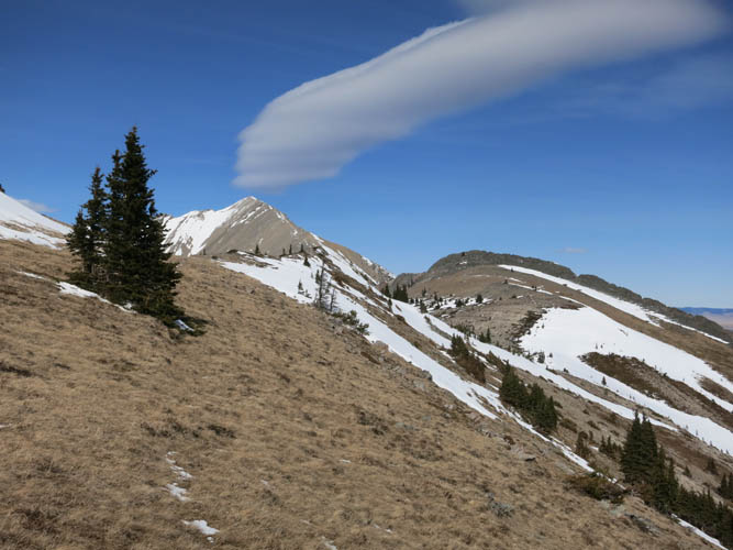
The Livingstone Range represents the easternmost part of Alberta’s front ranges between Kananaskis in the north and the Crowsnest area in the south. As the name implies, South Peak (or Livingstone South Peak) forms the southernmost high point along this mountain range, together with a small sub-peak locally named “The Dog”. The area offers interesting winter hiking and is typically in condition early in the year when other Rockies peaks are still inaccessible. The south-facing ascent ridge is often swept clear of snow by the incessant winds in the area, so avalanche risk is usually lower than elsewhere.
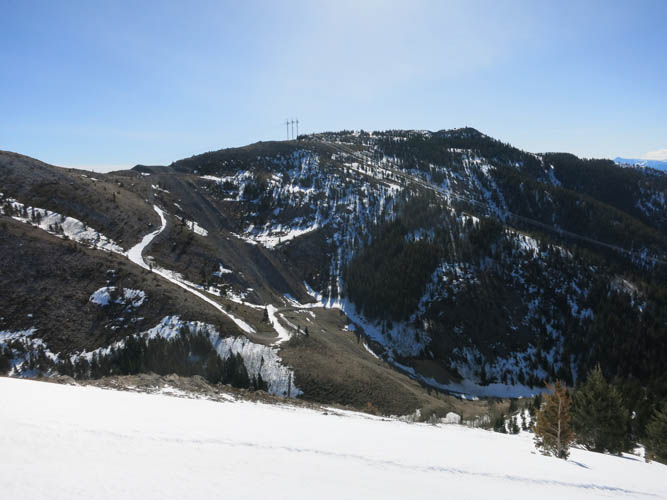
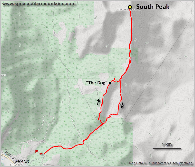
We parked by the information sign for the Livingstone Chert Quarries and headed up a series of tracks to the southern end of The Dog (elevation 2052 m), where we left the main trail and slogged up steep forested slopes. Trevor and I both wondered why this insignificant bump has a name (see peaksandstreams.com for that) – and why we even bothered ascending it. It barely stands out with only some 50 m of prominence, but I guess the views from the top were nice enough and it was easy to include is as part of a loop route for this trip.
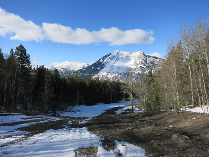
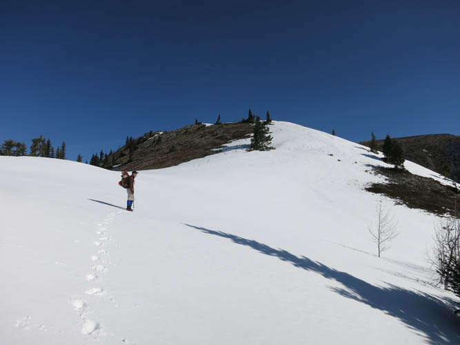
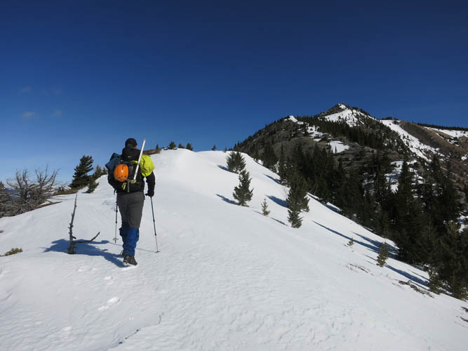
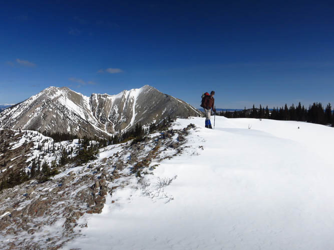
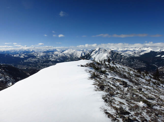
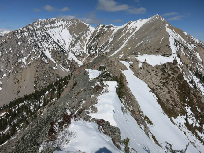
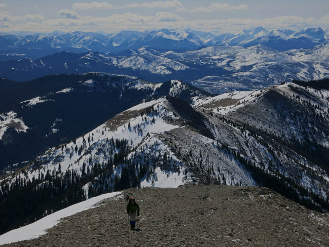
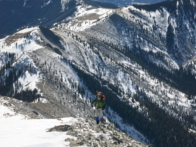
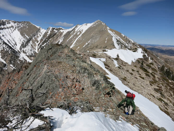
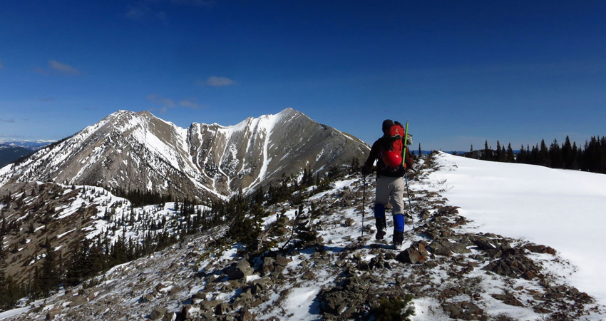
From The Dog we hiked along the broad ridge north, sometimes through soft patches of snow. Several times we considered donning our snowshoes, but in the end we just waded through the deepest parts. The narrow north-south trending ridge leading up to South Peak is a really enjoyable hike with beautiful vistas all around. To the right the vast flat plains of the prairies, to the left the snow-clad cliffs and crags of bigger peaks like Crowsnest Mountain and the Seven Sisters. There were a few spots of easy to moderate scrambling along the ridge, the rest was simply a walk.
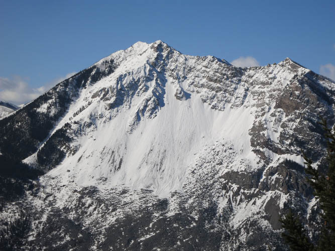
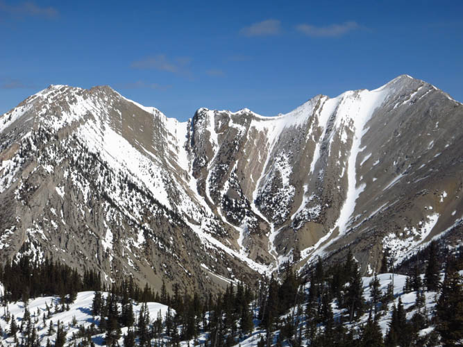
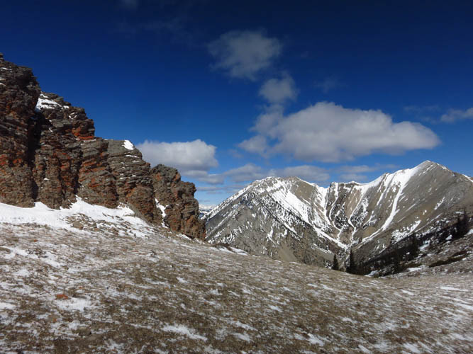
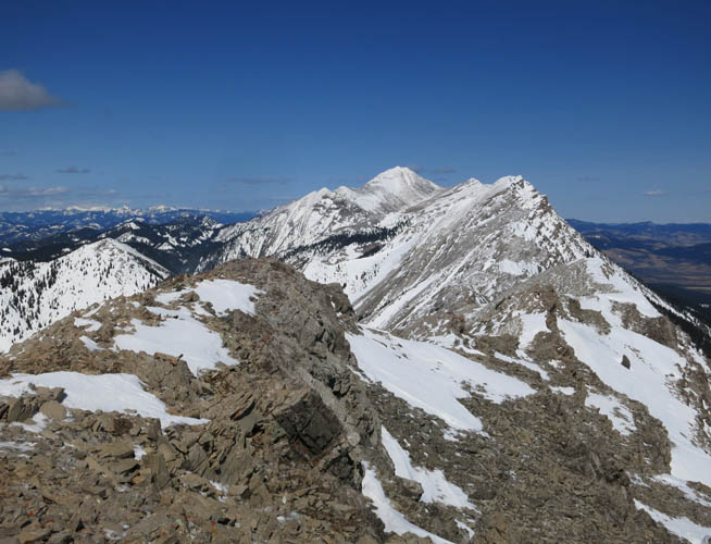
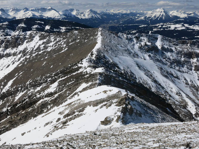
Centre Peak and Caudron Peak in the middle of the arrow-straight Livingstone Range can be seen nicely from South Peak’s summit. I always wonder how a traverse across this entire range as done by Rick Collier in 2004 would be so much fun. Perhaps one day I’ll have to do it! Immediately west of South Peak is another small high point called Morin Peak. While I initially thought about the option of traversing to that summit as well on the same trip, it became quite clear during our ascent that this wasn’t going to be easy: there is at least one steep, near-vertical drop-off along the small ridge connecting the two peaks as we could observe from the south. Of course it’s conceivable that there’s some way through once you’re up close, but we didn’t feel like exploring that today.
Other than one solo hiker we met on the way up, we seemed to be the only people on the mountain today. This certainly isn’t the most popular area for hiking and chances are you’ll have the area all to yourselves. I think it was well-worth the three hour drive from Calgary and I would definitely do this trip again!
There are apparently a number of small chert quarries in the area that were used by members of the Pelican Lake culture some 1500 to 3000 years ago, perhaps even as old as 8000 years as described on an information sign near the trailhead. Chert, a form of cryptocrystalline quartz, was mined in small pits for use in arrowheads, knives and other sharp tools. Layers of chert up to 30 cm thick are interbedded with limestone and probably represent the concentrated remains of siliceous sponges and other fossils. While we didn’t come across any of these ancient pits today, it would be interesting to explore the area further to see where and how the chert was mined by ancient peoples such a long time ago. I find it fascinating to ponder on the fact that exploitation for natural resources is not just a manifestation of modern times and limited to coal and petroleum, but has been pursued for thousands of years by mankind’s most distant ancestors.
|
Elevation: |
2297 m (my GPS) |
|
Elevation gain: |
1350 m |
|
Time: |
6.5 h |
|
Distance: |
15.8 km |
|
Difficulty level: |
Easy to moderate (Kane), T3/T4 (SAC) |
|
Reference: |
Local maps |
|
Personal rating: |
4 (out of 5) |
NOTE: This GPX track is for personal use only. Commercial use/re-use or publication of this track on printed or digital media including but not limited to platforms, apps and websites such as AllTrails, Gaia, and OSM, requires written permission.
DISCLAIMER: Use at your own risk for general guidance only! Do not follow this GPX track blindly but use your own judgement in assessing terrain and choosing the safest route. Please read the full disclaimer here.