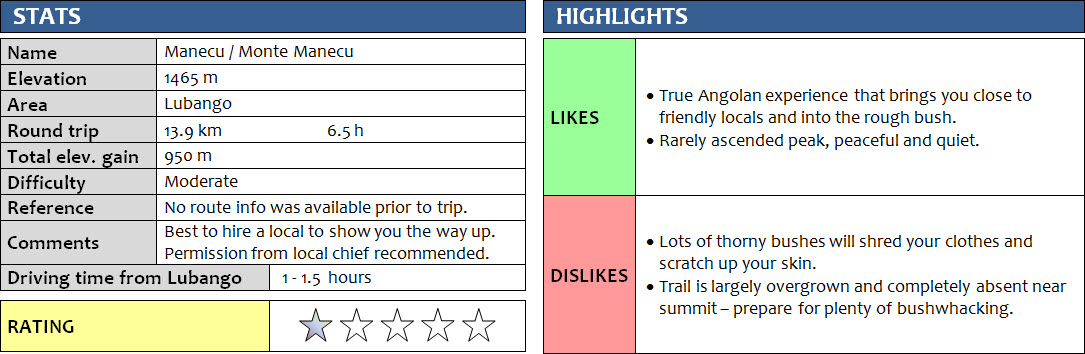
Serra da Leba, Angola
20 January 2018
With Linu
Morro Maluco – Portuguese for “Crazy Mountain”– was my original objective for today. Pictures of the three craggy summit towers surrounded by steep forested slopes had caught my eye, and since I was visiting the nearby city of Lubango in Angola’s south I thought I should give it a try. Maluco is easily recognizable from viewpoints on the Great Escarpment, including Tundavala, a spectacular vertical drop of 1000 metres that grants magnificent views of the plains and peaks to the west. Standing at the edge of this iconic precipice the day before and looking at Maluco in the distance made me want to climb it even more. However, as is the case with most mountains in Angola, there was absolutely no information to be found on how to get there, even when I asked around in Lubango.
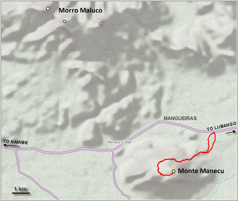
Louis, the same taxi driver who took me up Tundavala the day before, again drove me some 60 km west down the famous Serra da Leba switchbacks to Mangueiras, the village closest to Maluco along the highway to Namibe (EN280). We quickly found the local village chief, who referred us to the Grand Chief (“Soba Grande”) of the area to obtain permission to hike to Maluco. After some calling around the Grand Chief showed up half an hour later in a battered pick-up truck, loud Angolan music blasting from a huge speaker in his cab. Bad news: it turned out that Maluco appears to be a bit more involved, after all it’s about a 15 km hike from the main road one-way. With my very limited Portuguese I had some difficulties understanding the Chief, but the message he got across was that it’s apparently not a straightforward climb, with potentially some technical problems requiring ropes near the summit. And a guide would certainly be required, but he didn’t appear to know anyone off the top of his head who had been there before.
Fortunately, I had a backup plan: the much more innocent-looking little peak directly south of Mangueiras, which locals told me goes by the name of Manecu. It would have a much shorter approach and wasn’t quite as high, and the Grand Chief seemed much more comfortable with letting me run up that hill instead. A crowd of some 20-30 people had gathered around us in the village by now, everyone eager to know what this tall foreigner was doing in their area. When the Grand Chief asked if anyone had been up Manecu before, only one person came forward – a young lad by the name of Linu. As I had noticed elsewhere, the locals usually have no aspirations and – quite understandably – no reason to scale the mountains surrounding them, even if they live right next door. Linu claimed to know a trail up Manecu, so the Chief assigned him to be my guide for the day and even drove us a couple of km east to the trailhead. I thanked him for his time and payed him a small fee for his time and efforts. Before he let me go he asked me to please call him once I was off the mountain again to make sure we were back safely.
Linu didn’t speak any English of course so we communicated with smiles and gestures, and the few Portuguese words I knew. He was a quiet and likeable guy. Thin yet athletic and far more agile than me, I had some serious trouble keeping up with him! Perhaps it was the age difference (he’s 13 years younger!), perhaps the stifling heat that was getting to me, or maybe I’m just not fit enough… After an hour of trying to follow him through the bush on the lower slopes of the mountain, I asked for a break and sat down, breathless and drenched in sweat. Linu, on the other hand, was still wearing his jacket! Plus a cotton t-shirt, shorts, and shoes made of a car tire. A car tire! I couldn’t believe he was going through the bush with these simple home-made rubber sandals that pretty much had no tread at all. Other than that, all he had was an empty water bottle and a thin stick to ward off any snakes we might encounter.
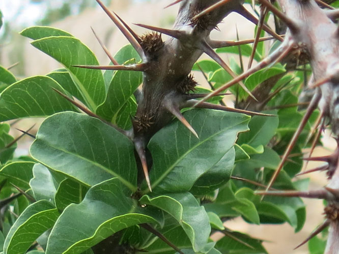
The “trail” that Linu said we were following wasn’t really a trail at all. Most of the time I wondered what he was following because all I saw was perhaps a minor gap in the bush here and there, not a beaten path. An open area with smooth, gently inclined rock slabs provided a welcome change from the thorny bush below. But soon we entered the bush again, consisting mostly of lowly shrubs and trees, many with nasty thorns and hooked spikes that did an excellent job of shredding my clothes and scratching up my skin. It was very rough and unpleasant hiking, even with my long pants and long-sleeved shirt. The thorny bushes just seemed to love my baggy nylon clothes – perhaps jeans and some sort of thick overall would’ve been a better choice for this type of bush.
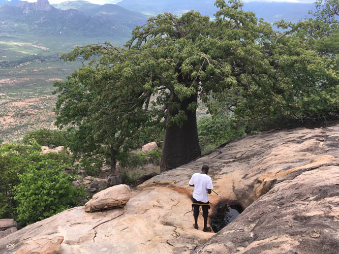
About half-way up, right by a beautiful fat baobab tree, Linu stopped at a puddle that had formed in the rock and filled up his bottle. The water looked pretty murky and unappetizing, but of course the locals are used to drinking it and Linu didn’t seem fazed at all. I had offered to buy him some bottled water before we started the hike, but he had refused explaining that there’d be water available to him on the mountain. We continued to push our way through the bush along what could perhaps be regarded as a very faint trail now. Clearly, not many people had been up here in a long time. I was struggling more and more as we approached lunchtime, it was just getting unbearably hot and humid, making me feel sluggish and dazed. Suddenly, as we were trudging along, Linu came to an abrupt halt and motioned to me to stand still… He had his arm raised high, stick in hand and ready to strike, but instead of a snake it turned out to be just an innocent lizard – a large one, nevertheless, measuring about 60 cm in length. I came about 2 metres close before it shuttled away disappearing into the undergrowth.
On the upper part of the mountain we reached a small open plateau of rounded rock slabs. Another opportunity for Linu to fill up his water bottle from puddles teeming with tadpoles. I asked where the path went from here, but Linu just shrugged. It turned out that this was the end of the “trail” and Linu had never actually been to the top. The summit was only few hundred metres away, a short distance but one that took us plenty of time and effort to overcome since it was all forest. There were no game trails or openings anywhere, so we had little choice but to bushwhack our way through. Exhausted and covered in leaves and scratches, we arrived at the summit mass, a collection of huge boulders measuring between five and 30 metres in diameter. At first there seemed to be no way up these precariously stacked granite boulders with gaping holes in between, but after some searching we found a route. Arriving at the cairn-less top, we were relieved to have made it but also quite tired of all the effort it had taken us to get here. “Is it really worth all the suffering?” – a question I’ve asked myself too many times, one that many mountain lovers are all too familiar with.
Of course the answer depends on when that question is posed. At the time we were at the summit, that brief moment of exhilaration, it was definitely worth it. On the way up and on the long, long way back down, it definitely wasn’t. And now that I’m sitting in the comfort of my home with a nice cup of coffee in front of me, the answer is… it probably was worth it. Because now it’s over and all I have is the unique recollection of a long adventurous day with a fabulous local guide on some unknown Angolan peak. And these memories are definitely worth more to me now than the short-lived physical discomfort I had to go through then, even if I can’t recommend this hike to anyone else :).
Notes on costs, logistics and security:
- There is no risk of landmines in this area, but always double-check before going off the beaten track in Angola.
- Cost of a private taxi from Lubango to Mangueiras: ca. 10,000 kwanzas (22 euros) one-way. I just hitchhiked back to Lubango in the afternoon.
- Permission to hike the mountain should to be obtained from the local Soba Grande (Grand Chief).
- Cost of a guide to hike Monte Manecu: ca. 5000 – 10,000 kwanzas.
- Lubango, Novo Hotel: 12,000 kwanzas (25 euros).
- Daily buses go from Luanda to Lubango and take about 1.5 to 2 days.
DISCLAIMER: Use at your own risk for general guidance only! Do not follow this GPX track blindly but use your own judgement in assessing terrain and choosing the safest route.
Evening view of Manecu (left) and Maluco (right) as seen from Tundavala looking west, the day before the climb.
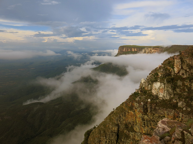
The Great Escarpment at Tundavala, a dramatic vertical cliff that separates the plains of Namibe from the high plateau of Lubango.
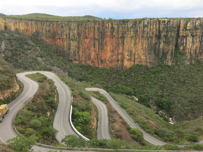
The famous switchbacks at the Serra da Leba Pass that cuts through the cliff. The road was built in 1970 and is considered one of the biggest feats in Angolan road construction history.
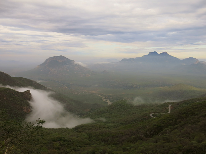
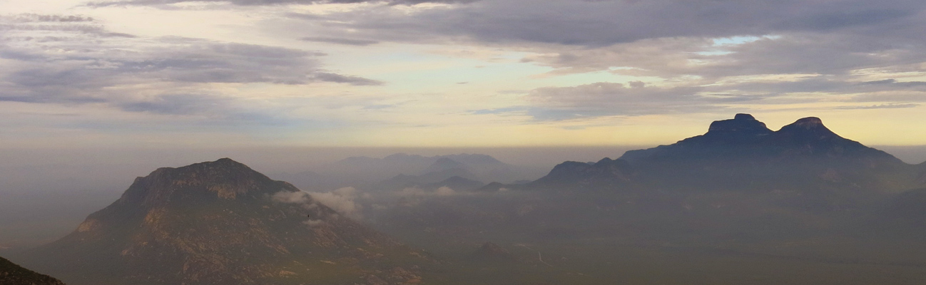
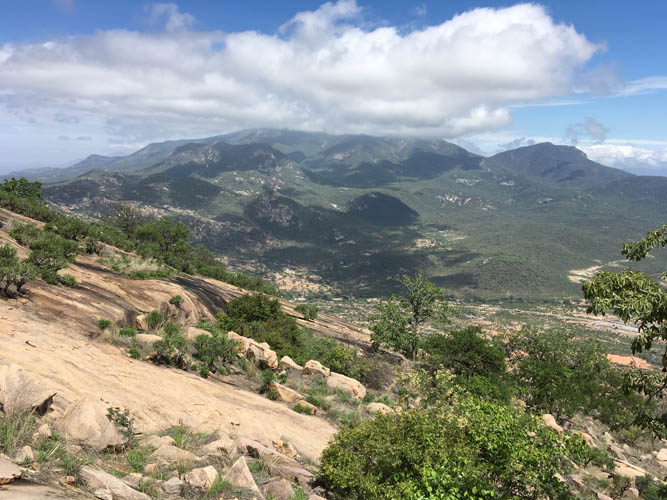
Morning view of Monte Manecu (left) and Morro Maluco (right) from the pass.
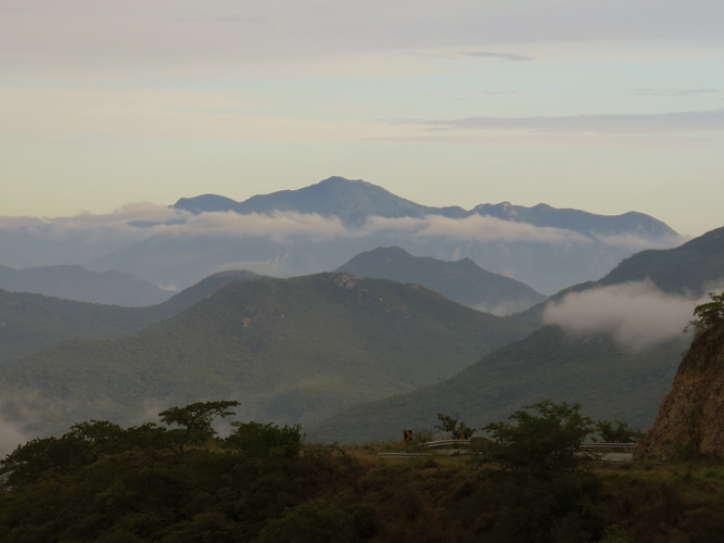
Breathtaking scenery with plenty of peaks to explore.
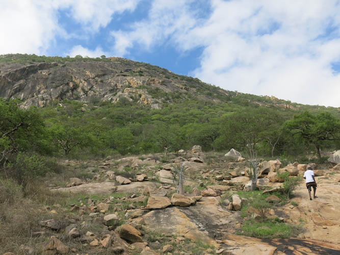
Manecu looks innocent at first, but has a few tricks in store: thorny shrubs, steep rock slabs, and some difficult routefinding through thick bush near the top.
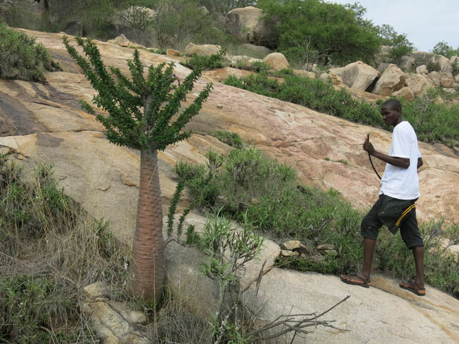
My guide Linu from the local village of Mangueiras.
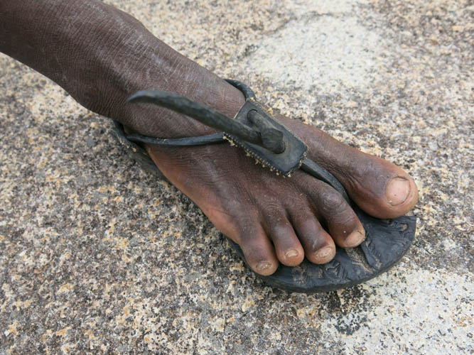
His rubber sandals are hand-made from car tires.
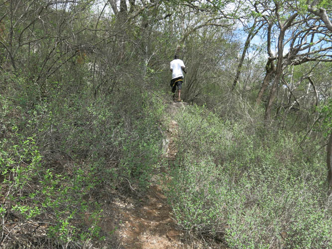
The “trail” leads through lots of nasty shrubs.
No wonder my clothes were in tatters after the hike!

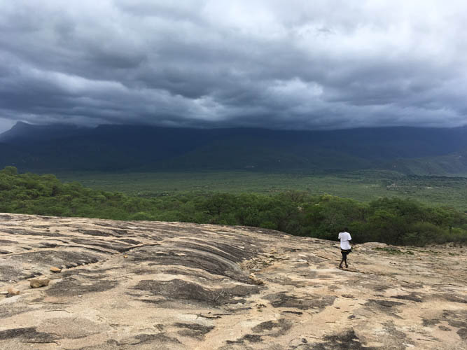
One of the nicer sections on open rock slabs.
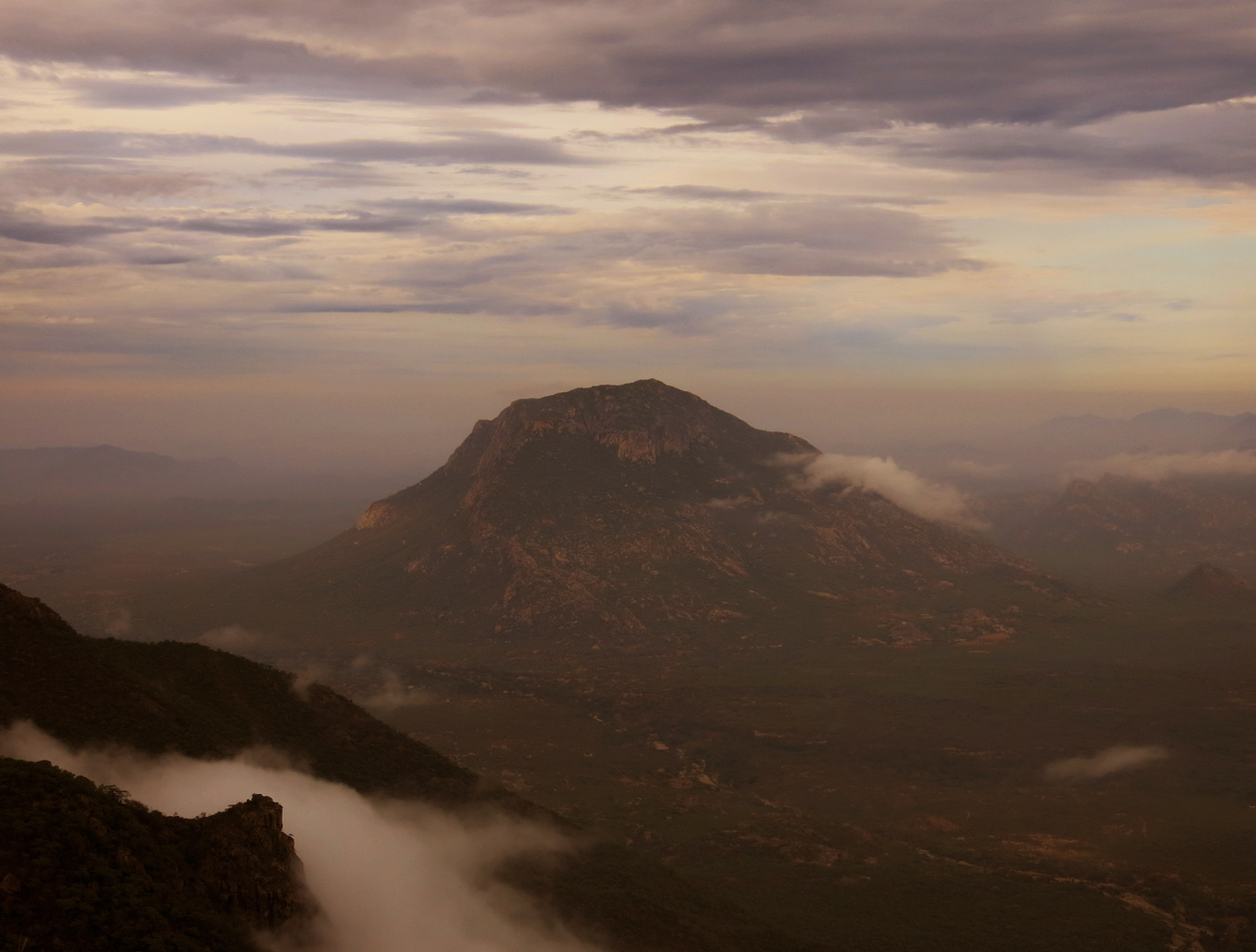
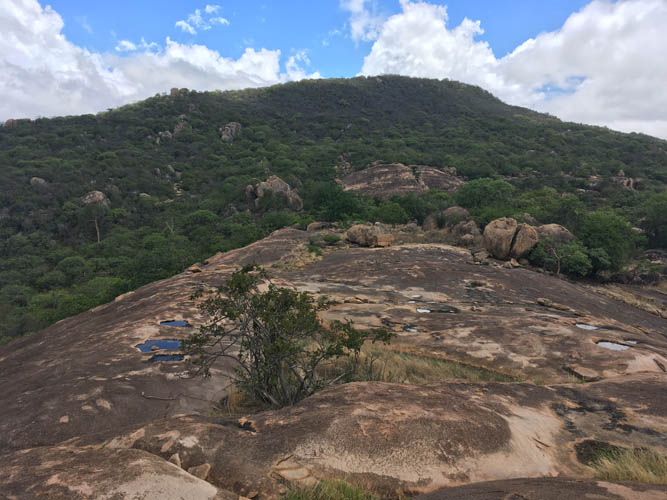
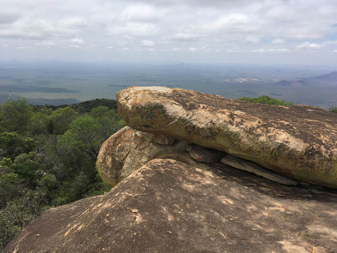
Clouds surround the top of Morro Maluco in the distance.
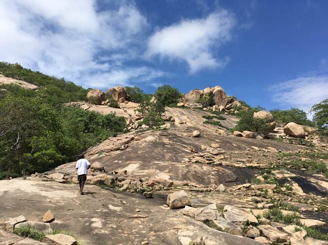
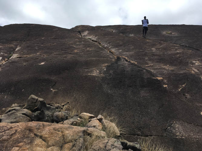
This is the easy part – good grip on solid granite.
The heat is stifling and we try to find a shady spot whenever we take a break.
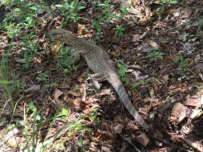
A large lizard, ca. 60 cm in length.
Smooth slabs lead up to a small open plateau before the summit.
The summit can be seen from the plateau, but unfortunately there is no more trail in the intervening forest. Note the two small water puddles, the last source of water on the mountain.
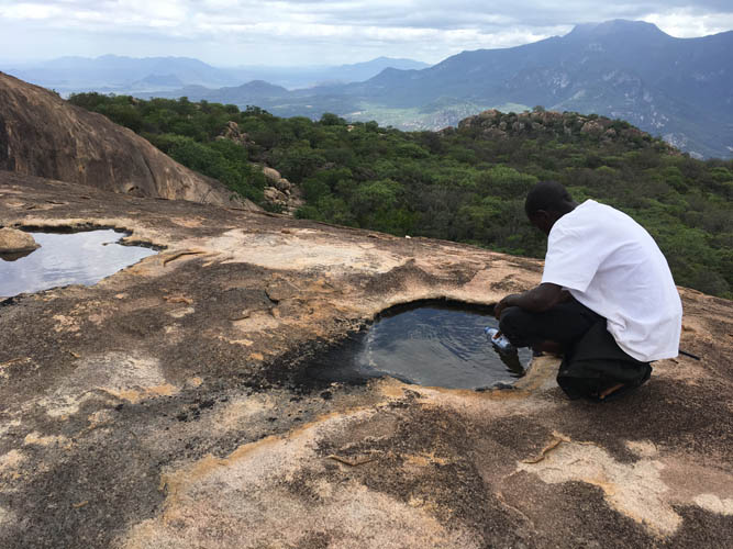
Linu uses his water bottle to drink from a puddle. It’s amazing how little water he required compared to the 5 litres I consumed on this hike.
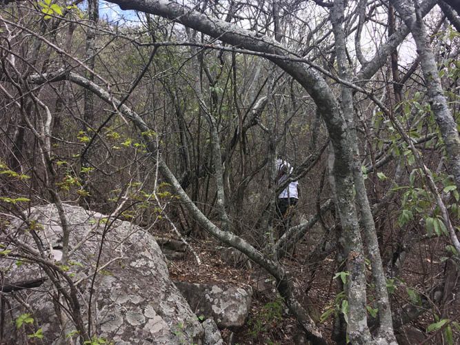
Bushwhacking through the last section of forest.
Large round boulders make up the summit mass.
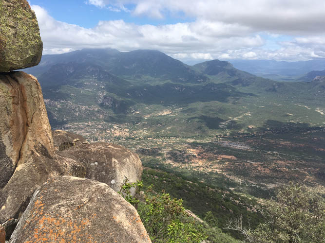
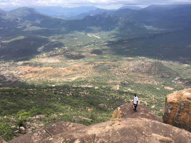
Below is the village of Mangueiras where we started this morning, with Morro Maluco behind.

Linu waits below while I check out a route to the summit.
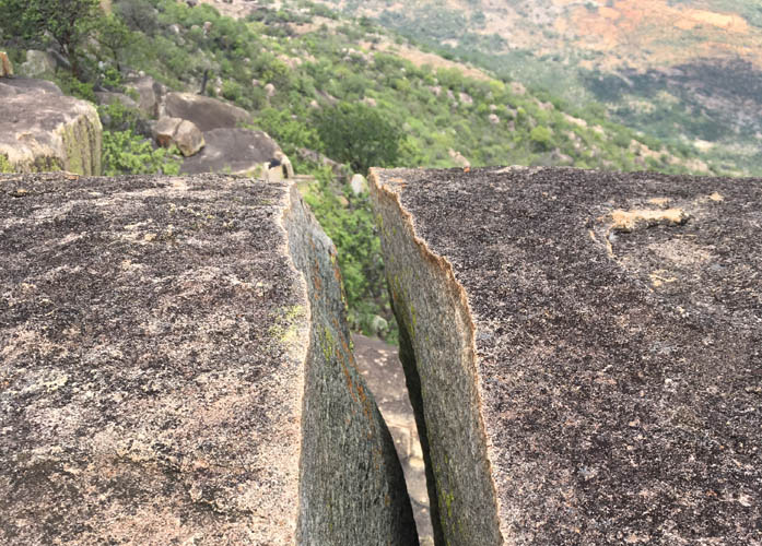
Cracked granite.
The true summit.
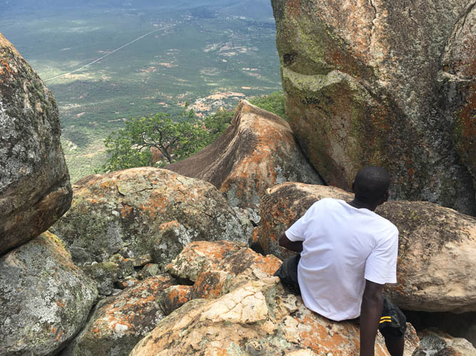
Linu stands near the summit and looks at his village below.
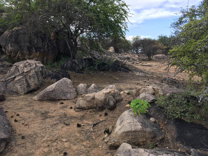
On the way back, we stop at the lower water hole again.
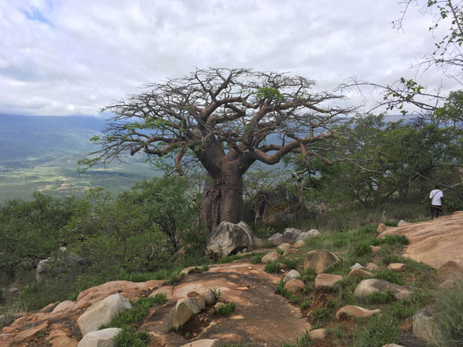
A beautiful baobab tree.
I’m glad the hike is almost over, not least because dark clouds are now moving in from the escarpment to the east.