Ascension Island
30 December 2014 / 3 January 2015
With Tilo / Solo
A work-out hike with nice views over Ascension Island’s barren moonscape
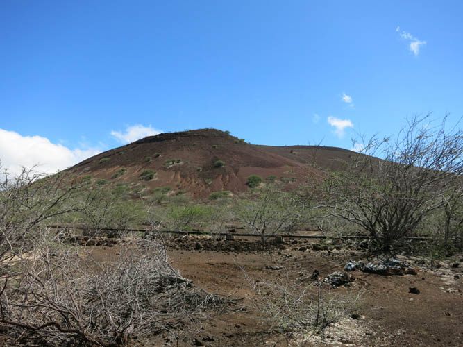
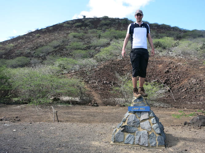
Lady Hill is hardly a mountain – it’s literally just a hill of volcanic rubble. In itself nothing special really, if it weren’t for the interesting views this high point affords of Ascension Island’s barren western plains and volcanic cones. It’s also fairly close to the Obsidian Hotel in Georgetown, which is the only hotel on the island, so it’s the perfect trip when time is short or energy limited but you still want to get out for some exercise.
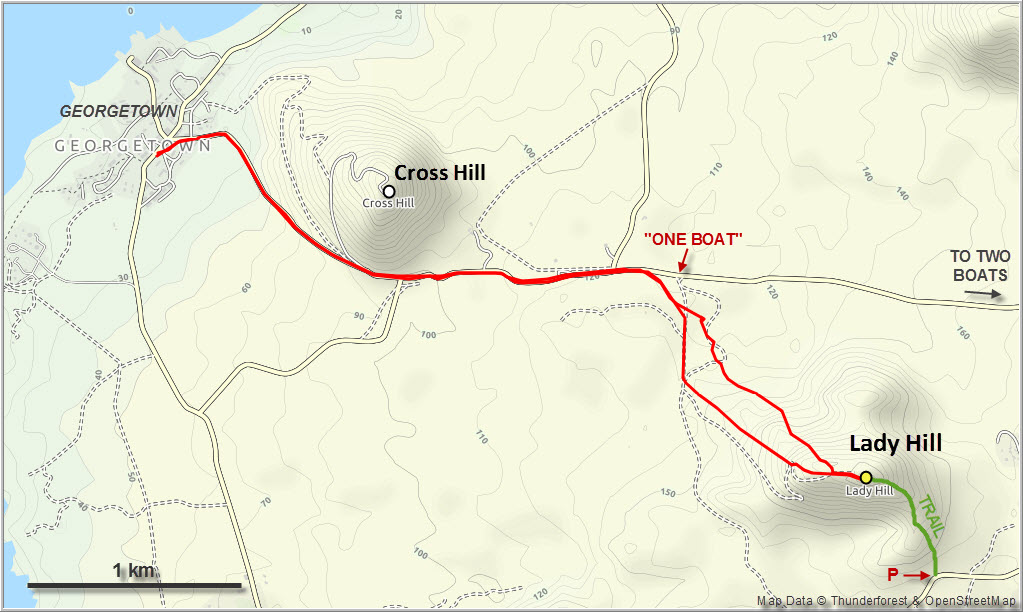
I did this outing twice, first with Tilo on our way from Georgetown to Two Boats, the only other settlement up in the hills near Green Mountain (we hitchhiked back from there – Ascension Island is probably the easiest and safest place on earth to hitchhike). The second time I went solo for a quick work-out hike, there and back the same way via the NW slopes. The route is dead easy: follow the narrow road eastwards from Georgetown in the direction of Two Boats, then turn right at a place called “One Boat” (yes, there’s a boat by the road here!) and continue on dirt tracks either all the way up to the summit or off-trail straight up the hillside.
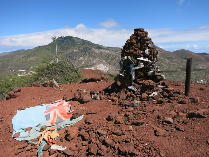
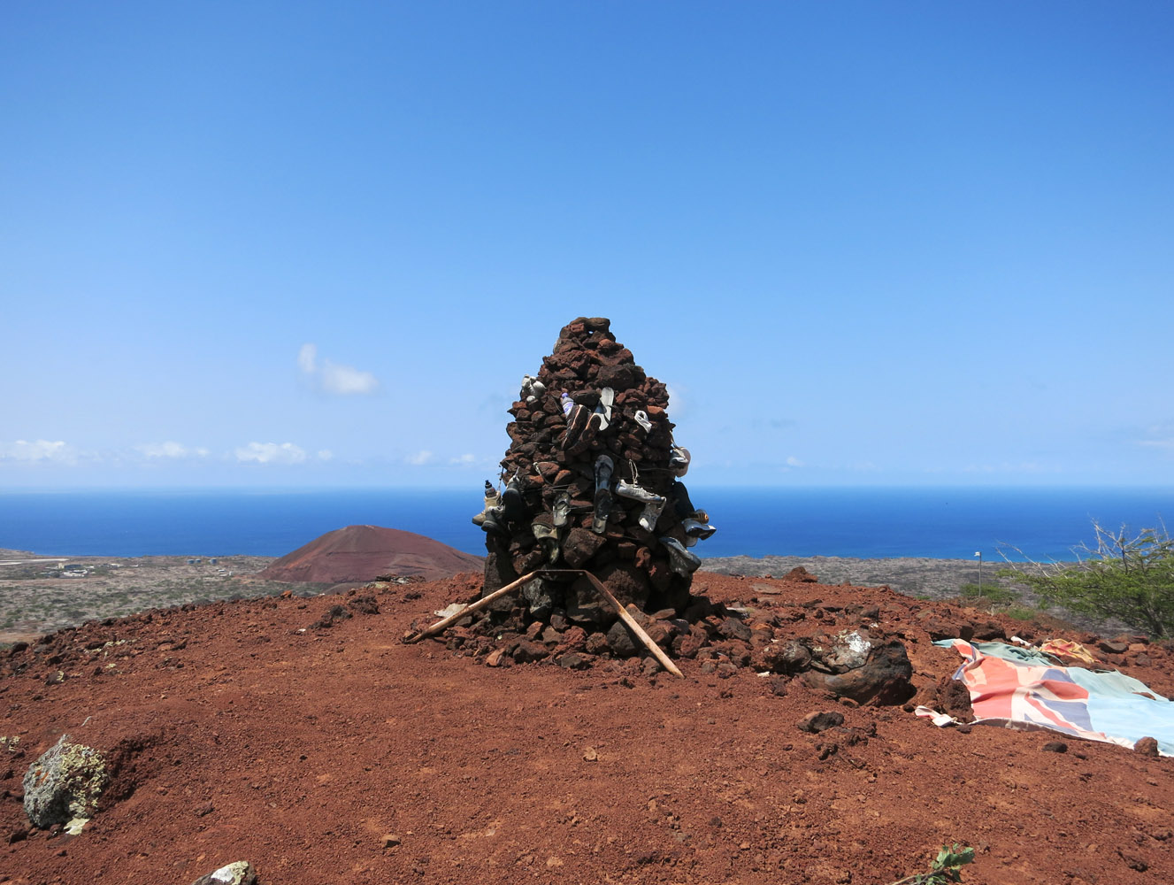
The summit cairn is unexpectedly large, but what’s more interesting is the collection of random shoes and t-shirts surrounding this pile of rocks. Apparently, it’s become a tradition for people to hike up here and leave an old sneaker behind, I’m not sure. Since Tilo and I weren’t willing to part with the shoes we were wearing, we placed a rock on top instead (perhaps that explains why this cairn has grown so large!).
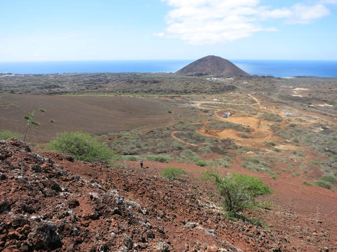
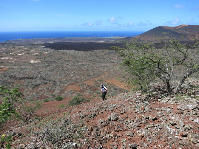
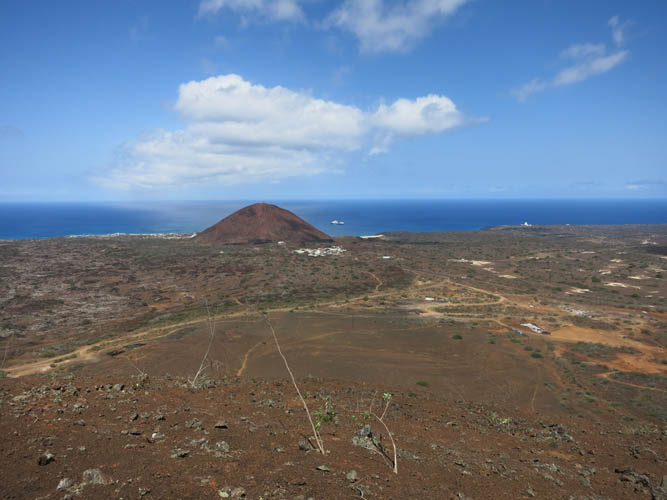
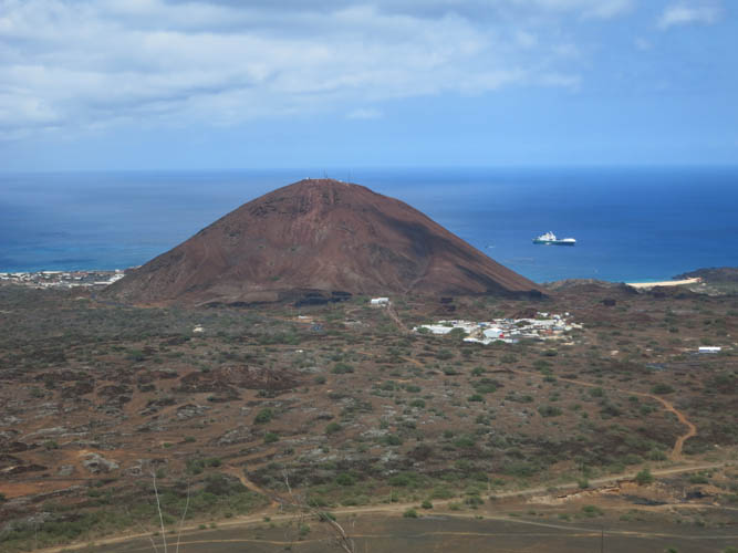
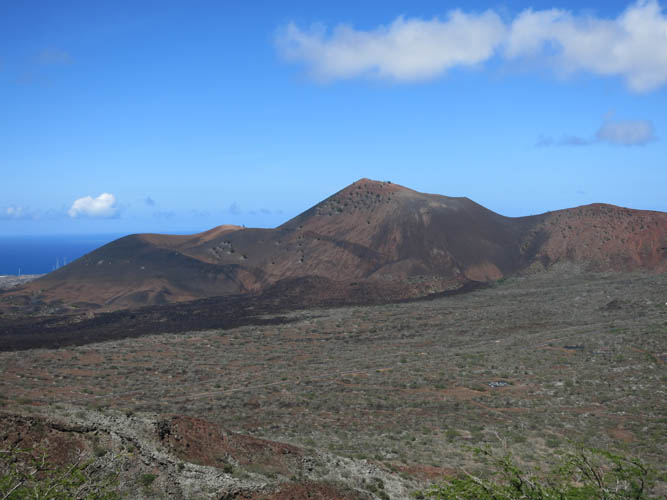
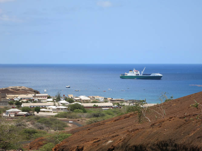
The views from lowly Lady Hill are often better than from the much higher Green Mountain because this place is usually cloud-free. It’s nice to sit here and let your eyes wander across the dry, red plains and volcanic hills towards the coastline. Georgetown and Long Bay can be seen quite well from here, right behind the distinctive Cross Hill. To the north, Sisters Peak looks very different with its black talus slopes, while Green Mountain to the east is so lush and densely vegetated, it appears as if it doesn’t even belong to this island.
To get back down we took a good trail that descends on the SE side of the hill through patches of cacti to the official trailhead (with stone pillar) at the New Mountain Road near the RAF base. On my second visit to Lady Hill I used the soft scree on the NW slopes for a quick descent to the plains below where I came across Ascension Island’s car scrap yard… free Ascension Island license plates as souvenirs!
|
Elevation: |
329 m (official), 340 m (my GPS) |
|
Elevation gain: |
400 m |
|
Time: |
2 h |
|
Distance: |
8.6 km |
|
Difficulty level: |
Easy (Kane), T2 (SAC) |
|
Reference: |
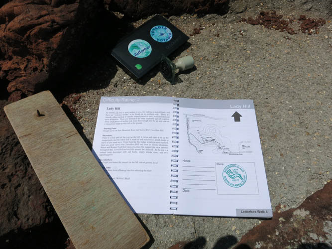
Letterbox Walks |
|
Personal rating: |
2 (out of 5) |
NOTE: This GPX track is for personal use only. Commercial use/re-use or publication of this track on printed or digital media including but not limited to platforms, apps and websites such as AllTrails, Gaia, and OSM, requires written permission.
DISCLAIMER: Use at your own risk for general guidance only! Do not follow this GPX track blindly but use your own judgement in assessing terrain and choosing the safest route. Please read the full disclaimer here.