Svaneti, Georgia (Caucasus)
30 September 2018
Solo
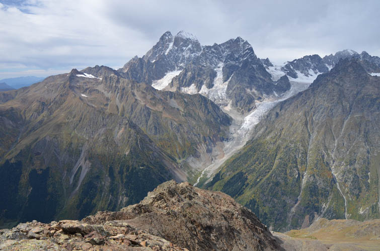
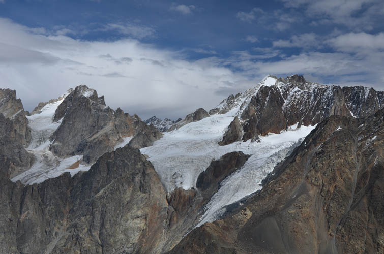
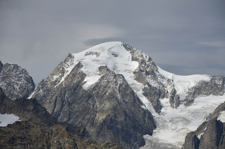
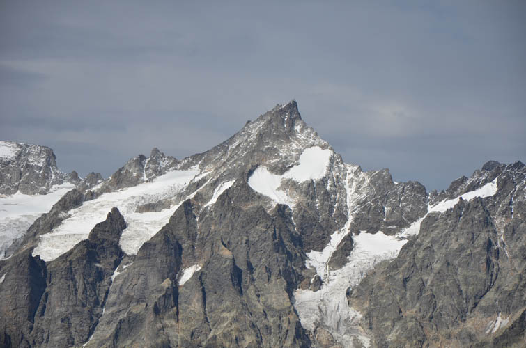
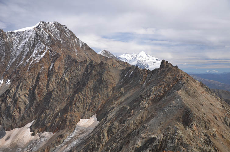
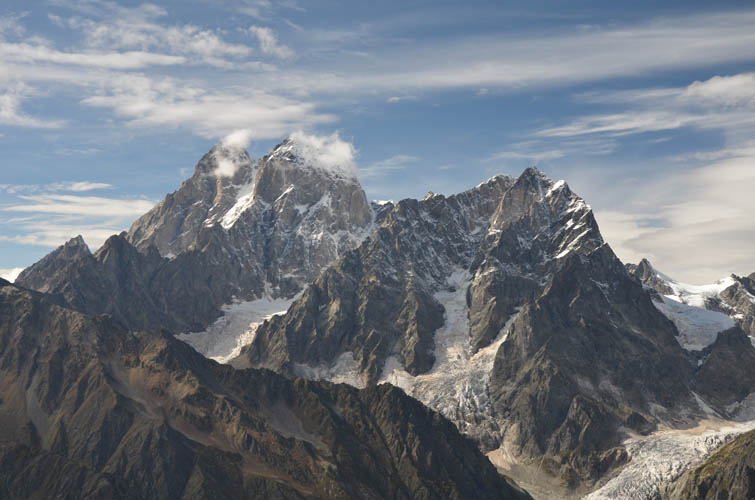
Sublime views of Caucasus glaciers and giants
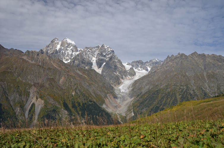
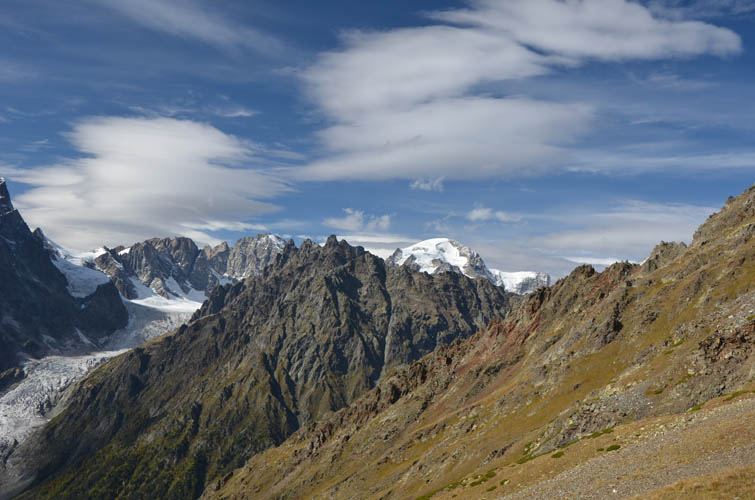
Latraldashi sits at the western end of the Gvalda Range and can be readily seen from the town of Mestia below. Dwarfed by its bigger and more impressive neighbor Banguriani (3838 m), it still sits at a respectable 3370 m and makes for a solid day trip. I had very little information on Latraldashi other than that it’s doable as a scramble from Mestia and features good views of the surrounding mountains and glaciers. Now that I’ve done the trip I can say with full assertion that “good” is a huge understatement. They were absolutely breathtaking, some of the best I’ve seen during our time in the beautiful Georgian mountains!
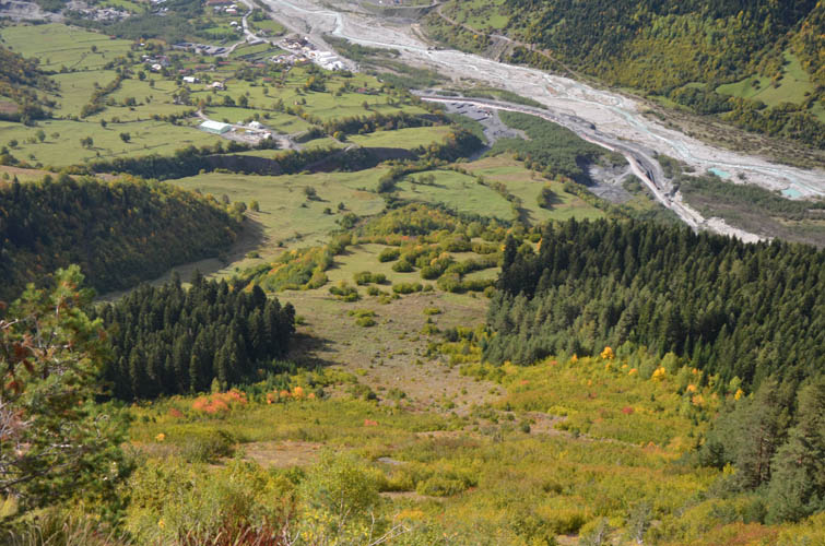
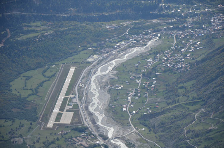
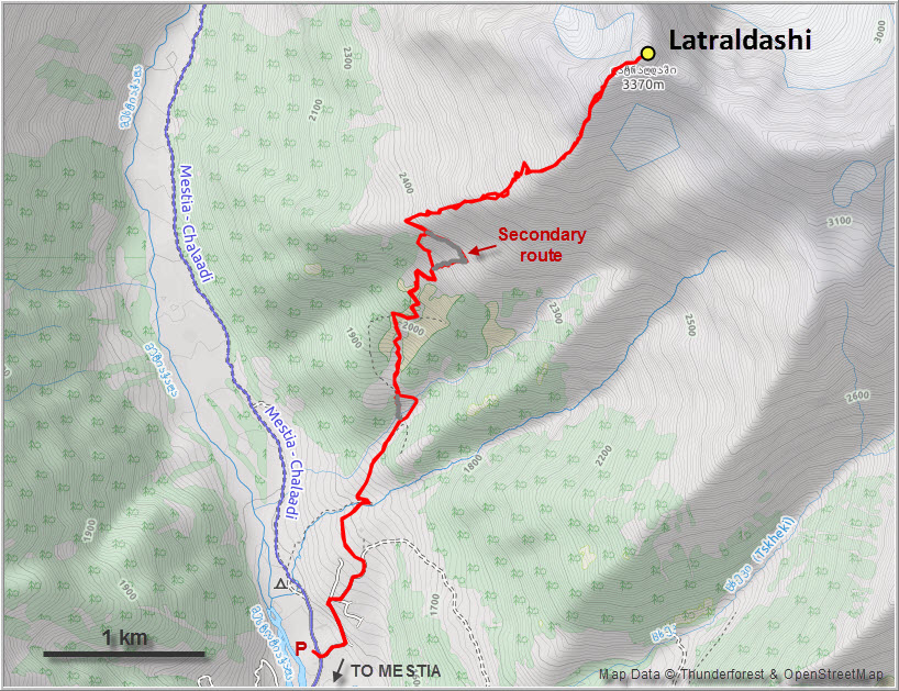
Having a car in a place like this is definitely a plus. No taxi or long approach walk needed to get to the base of the mountain. To get to the trailhead I drove out about 4 km from the town centre on the main road past the airport towards the NE. I parked by the Mestiachala River near a big construction site for some hydro pipeline project and headed up a narrow dirt road through a small village, loosely following a route I had mapped out in my navigation app.
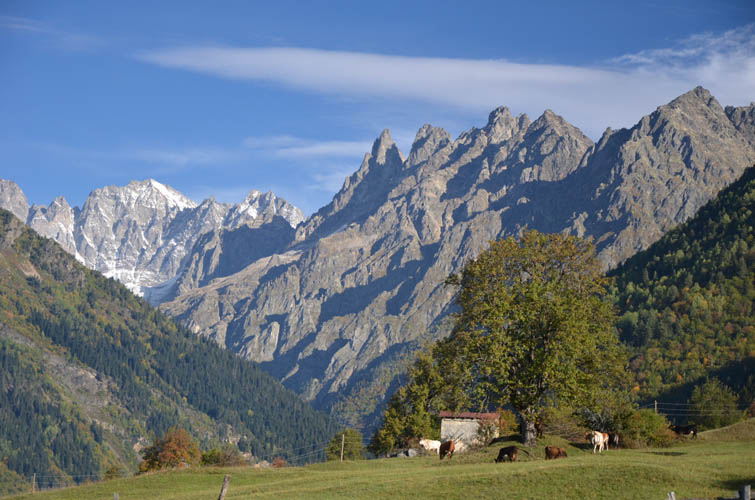
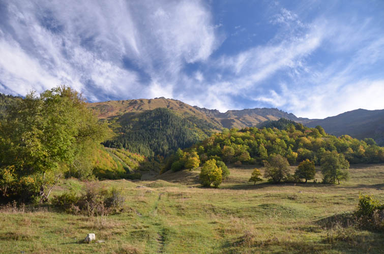
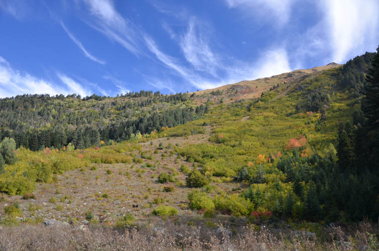
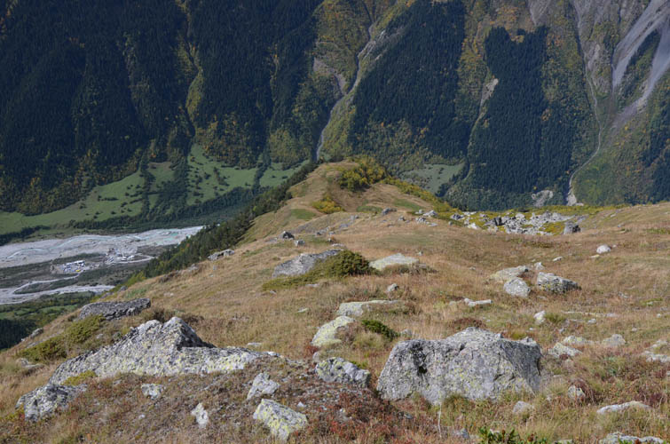
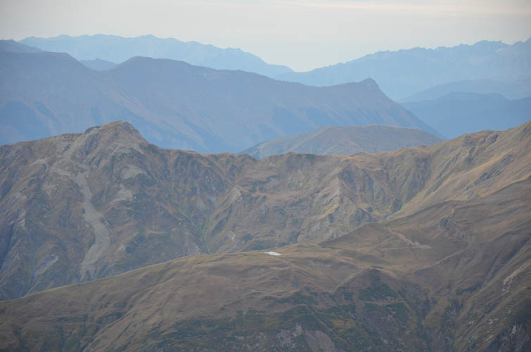
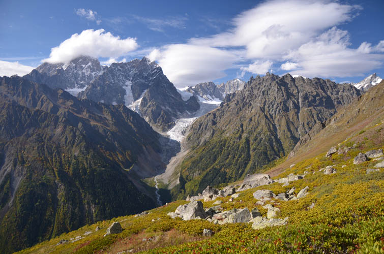
As soon as I had left the last houses behind me I was alone for the rest of the day. A faint trail passes through a grassy valley, crosses a small stream on the left up to a meadow near a couple of abandoned huts and grazing cows. It then heads up the hillside in lazy switchbacks, passing through thorny shrubs and small stands of trees along the way. I was extremely pleased to have stumbled upon this trail and managed to follow it all the way to the crest of the SW ridge. This is how I love approaches, when you simply let an unexpected trail guide you up, which seriously alleviates any thinking you have to do!
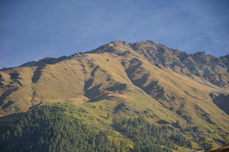
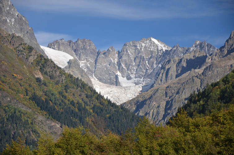
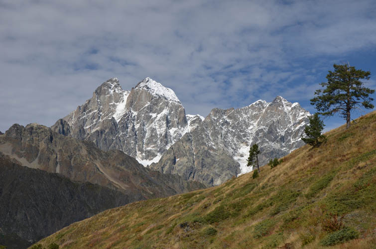
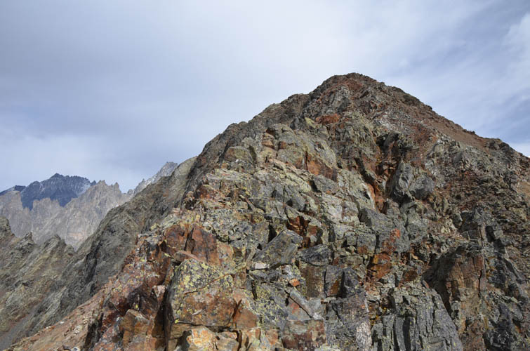
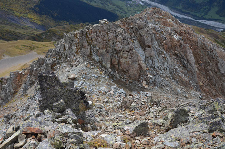
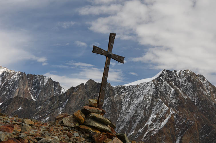
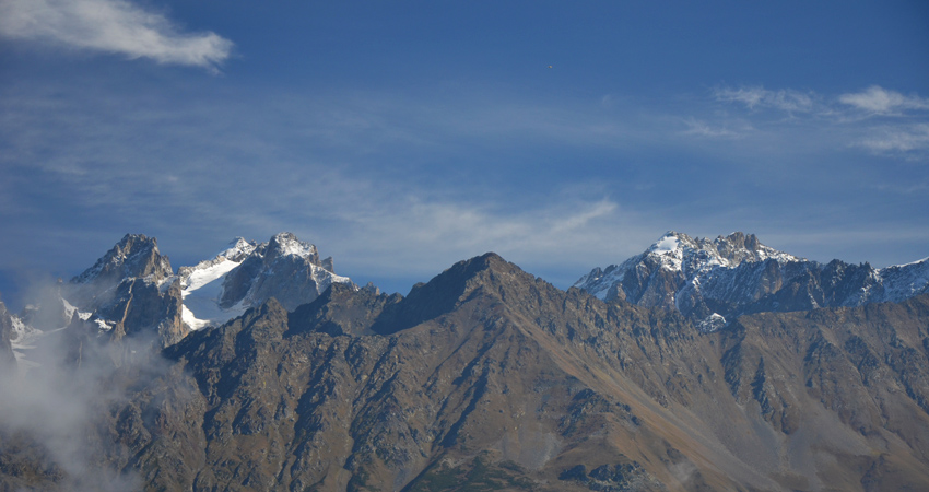
The open ridge is a great spot to take a breather and have a second breakfast. From here on the route was obvious: I simply followed the ridge crest, skirting a few rocky outcrops on the left, all the way to the top. In the last 200 m the terrain suddenly becomes more serious. The ridge is quite narrow here, but the most exposed parts can be bypassed on the left (west). The crux, however, is not avoidable. It’s a short climb, perhaps 10 m up, requiring some easy to moderate scrambling moves (cairn on top). After this it’s an easy scramble to the summit cross. Magnificent views of massive snow-clad peaks, glaciers and craggy ridges open up – so worth the 1900 m of elevation gain to get here!
The return was straightforward – I just followed the same route back, with small deviations in the lower part where I found a better path. Most trails here are animal trails anyway, so sometimes there’s various route options but all are pretty easy. All in all this was a fabulous trip, I really enjoyed both the hiking and routefinding on the approach as well as the scrambling on the upper ridge. And on top of that, I had this beautiful little corner of the Caucasus to myself all day!
Note: If conditions are snowy or icy then this is not a scramble anymore but could potentially turn into a mountaineering trip where ropes, ice axe, etc. might be needed. Even in dry conditions this is a serious hike that requires a good level of fitness, surefootedness, and some basic scrambling skills. Hiking poles and a helmet (for rockfall) are highly recommended.
| Elevation: | 3370 m (official), 3372 m (my GPS) |
| Elevation gain: | 1910 m |
| Time: | 8 h |
| Distance: | 13.8 km |
| Difficulty level: | Moderate (Kane), T5 (SAC) |
| Reference: | None |
| Personal rating: | 4 (out of 5) |
DISCLAIMER: Use at your own risk for general guidance only! Do not follow this GPX track blindly but use your own judgement in assessing terrain and choosing the safest route.