Kananaskis, AB, Canada
16 August 2022
With Allan & Liam
Beautiful glaciers and two very different scrambles
Allan suggested this one and Liam and I were super happy to join – it turned out to be one of the best this year yet! Long and tiring for sure, but worth every drop of sweat.
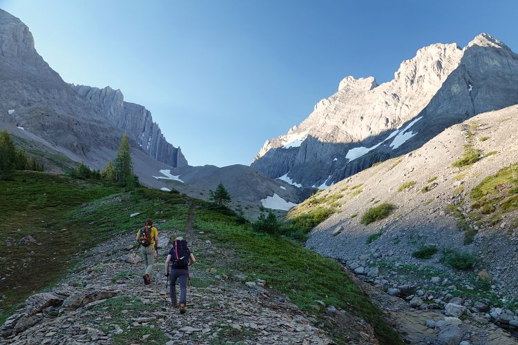
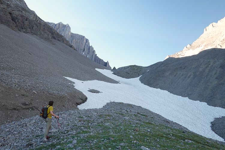
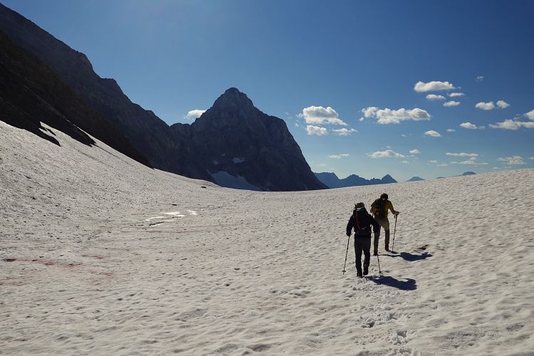
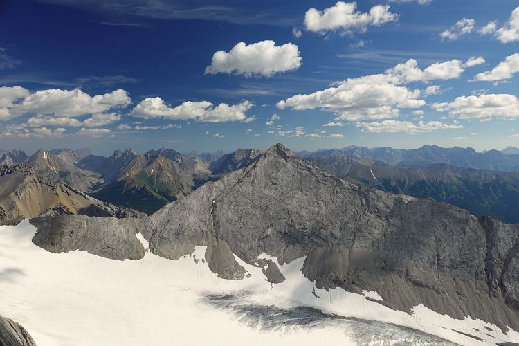
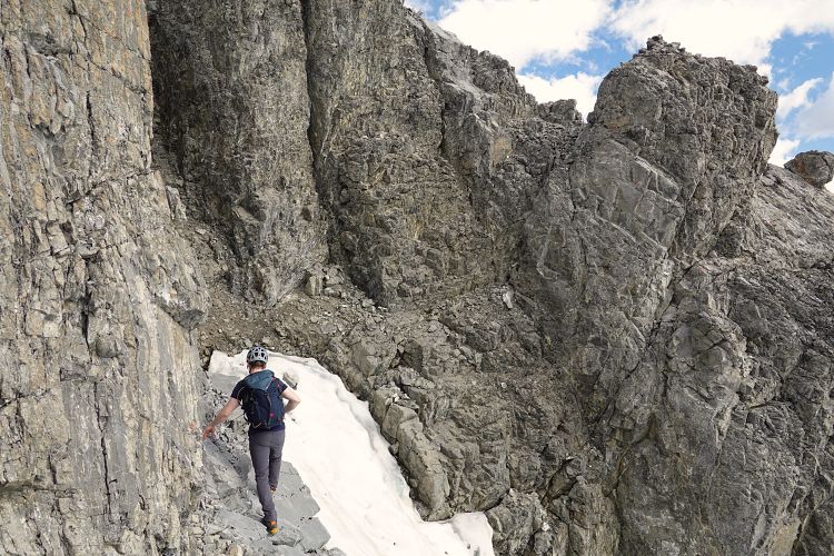
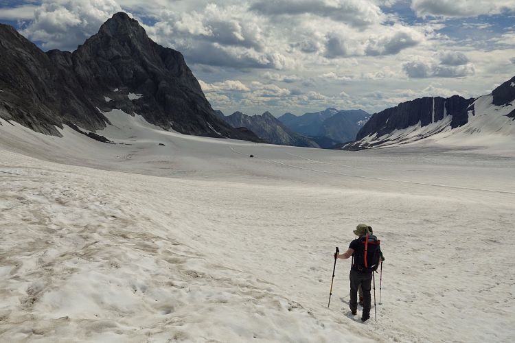
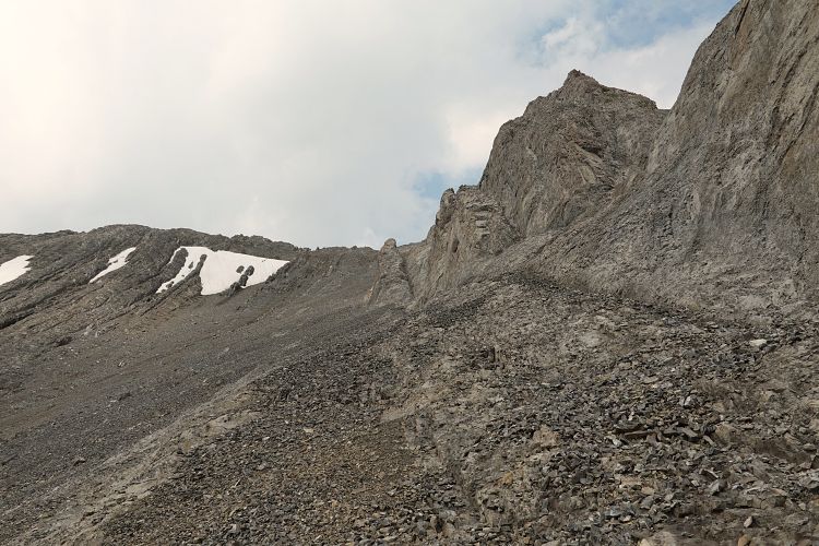
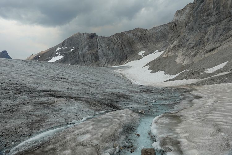
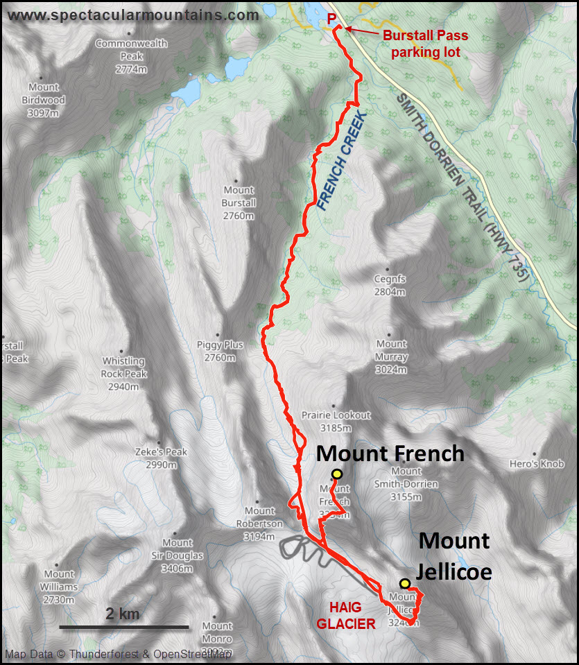
The approach up French Creek is on a good trail and there was little to no bushwhacking and also no washouts for us to deal with. It’s quite a long approach, though, and talking about food, beer and world events certainly made time go by much faster. The benefits of great company on a long day out! The small remnant glacier in the upper valley was pretty tame with no need to use crampons or worry about crevasses. Much of the ice was very thin and we were able to avoid large parts of it on rubble along the left (east) side.
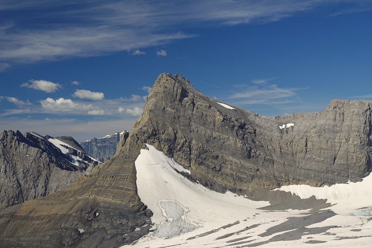
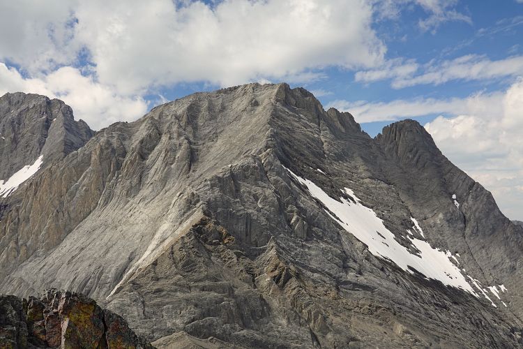
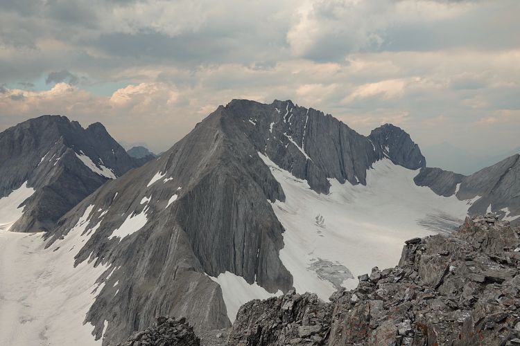
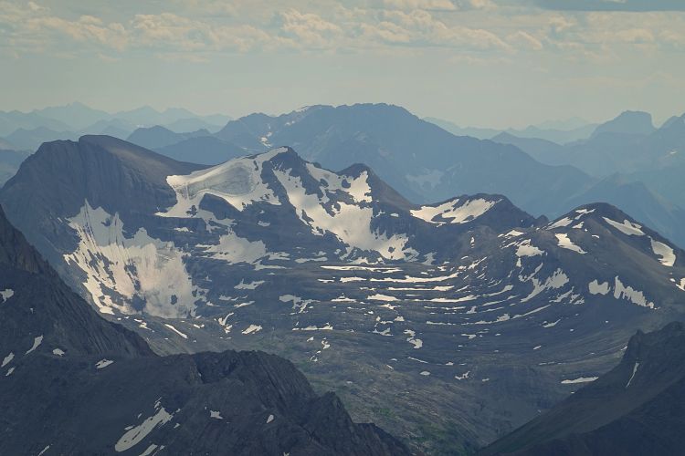
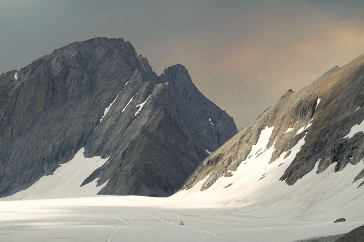
We reached the col between Mount French and Mount Robertson after about 3 hours and took a much needed break in spectacular surroundings. Views of two glaciers and already at >2700 m elevation! It almost felt like most of the work was already done, but of course we still had the actual climbs of the mountains ahead of us.
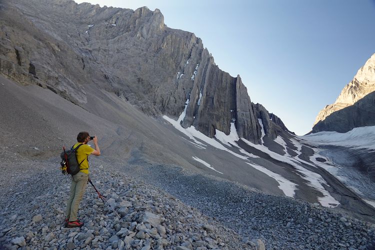
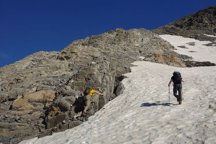
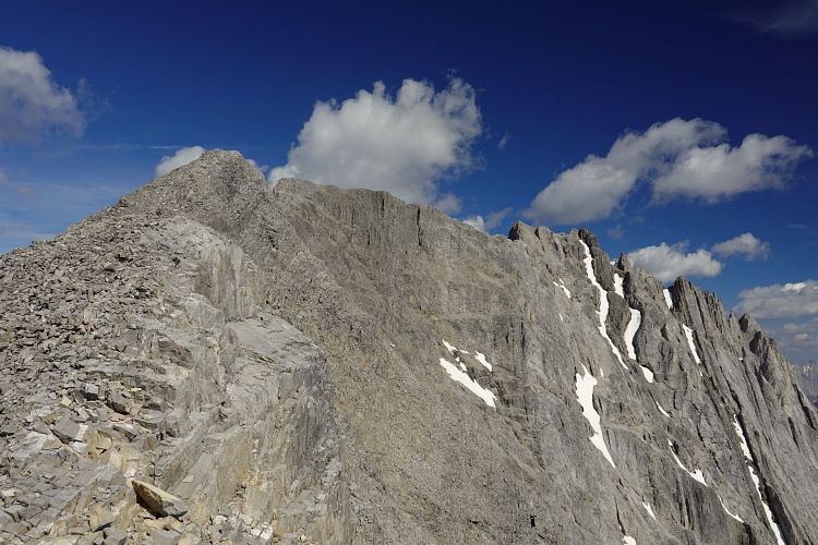
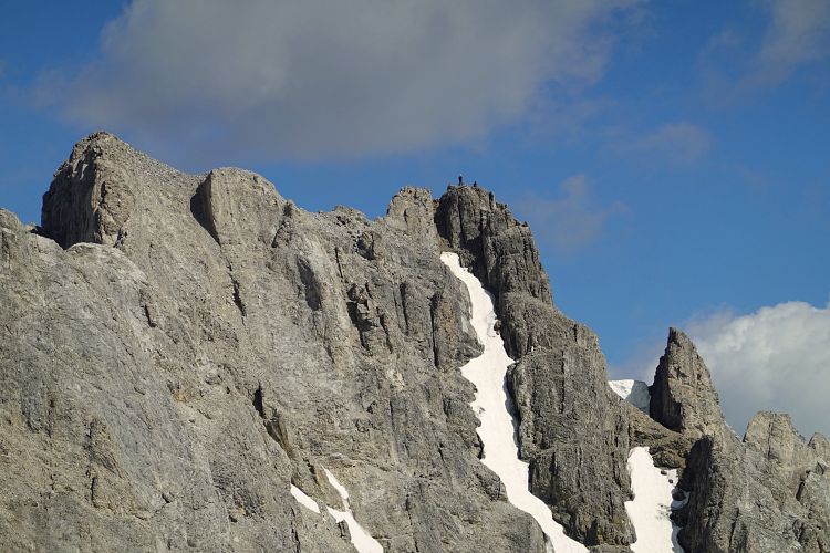
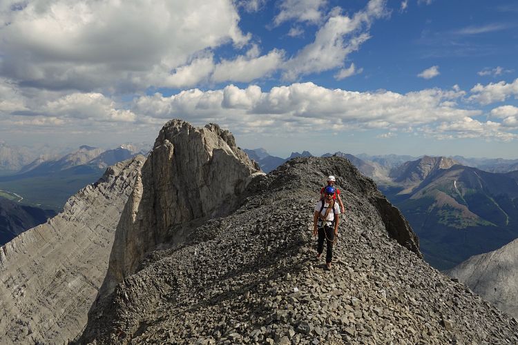
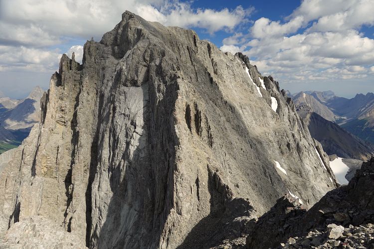
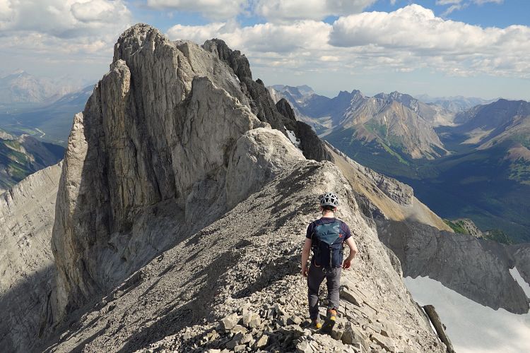
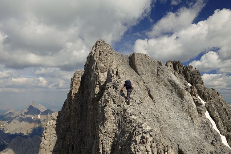
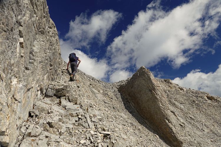
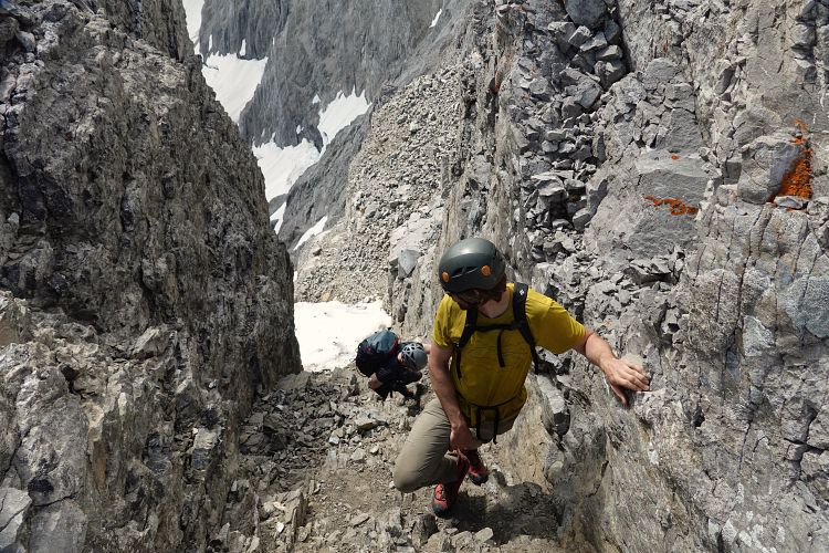
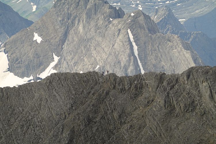
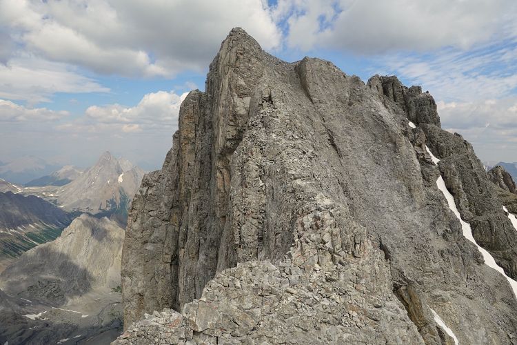
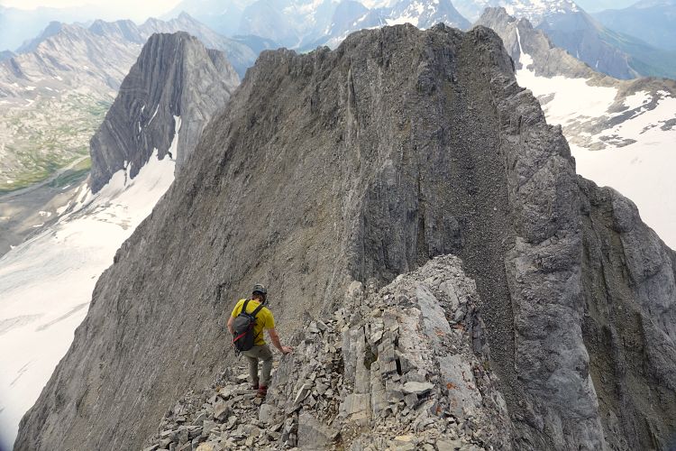
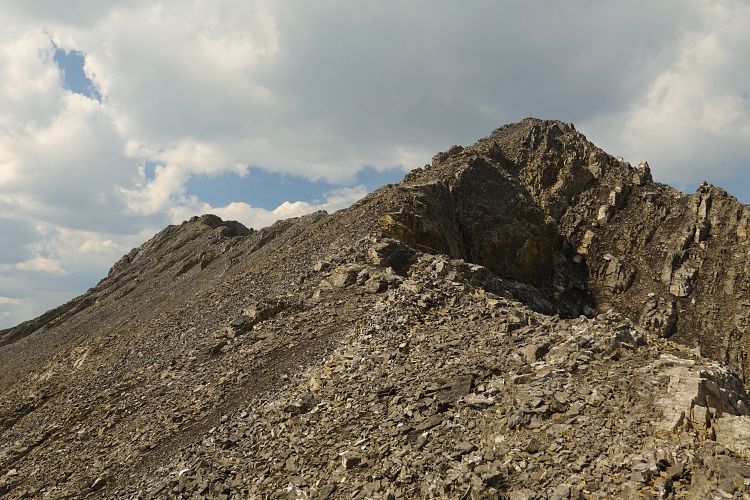
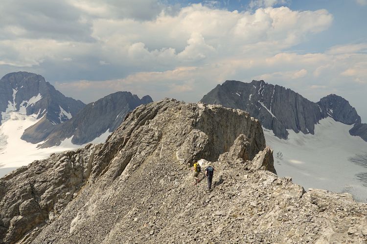
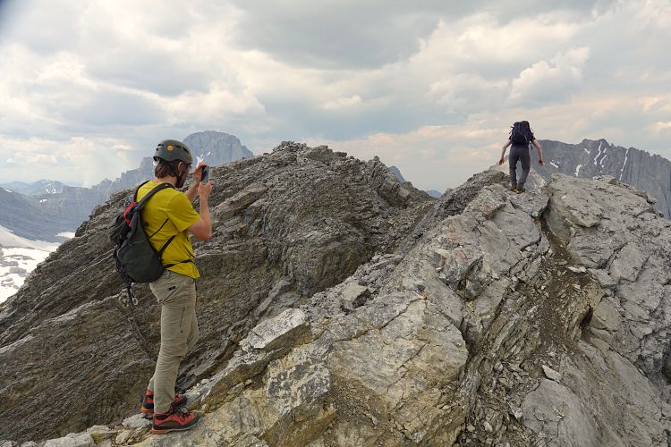
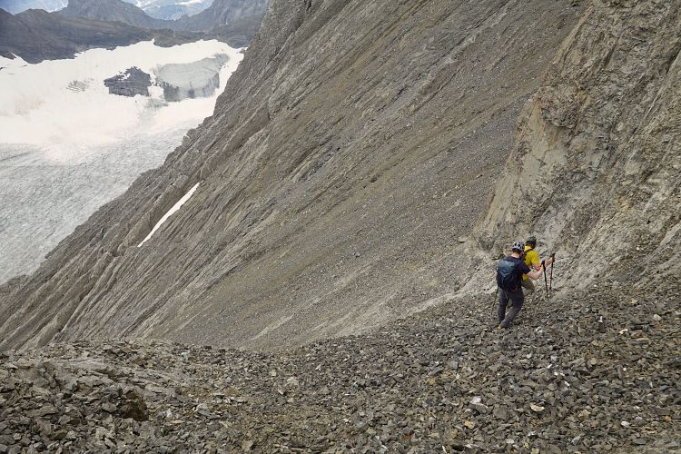
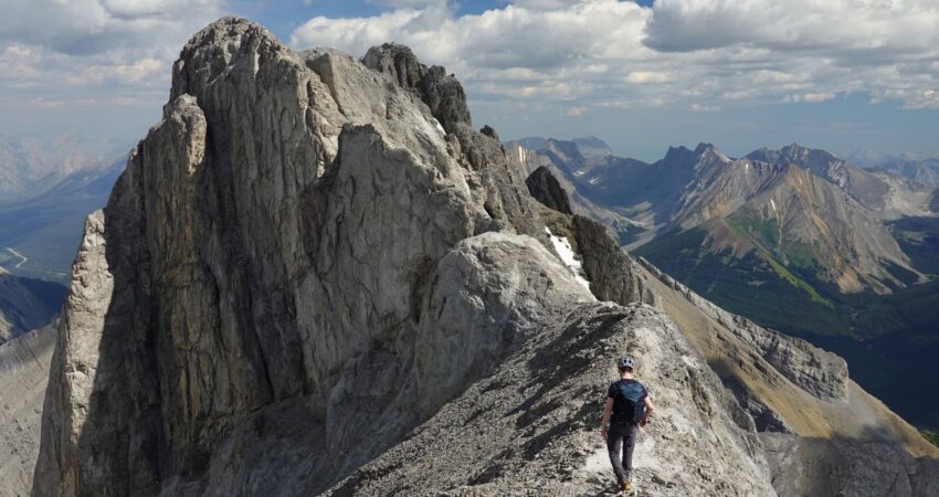
Mount French was definitely our favourite between the two peaks. The climb up the southwest side is straightforward and includes a mix of solid rock ribs starting at the glacier, a decent trail in softish scree, and a highly enjoyable ridge scramble with quite a bit of exposure. The so-called “French guillotine”, a short section of knife-edge ridge, was less challenging than we had anticipated, but then again it’s all about expectations and what kind of picture you have formed in your mind before doing the actual thing. Some of the reports we had read made it sound quite difficult. All three of us are quite comfortable with exposure so perhaps this is why we didn’t think it was that bad. For those who don’t like airy ridge walks this one is probably not a good choice.
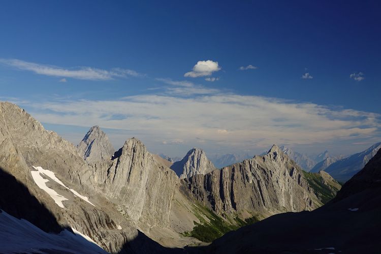
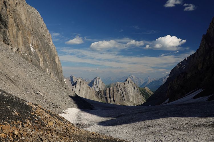
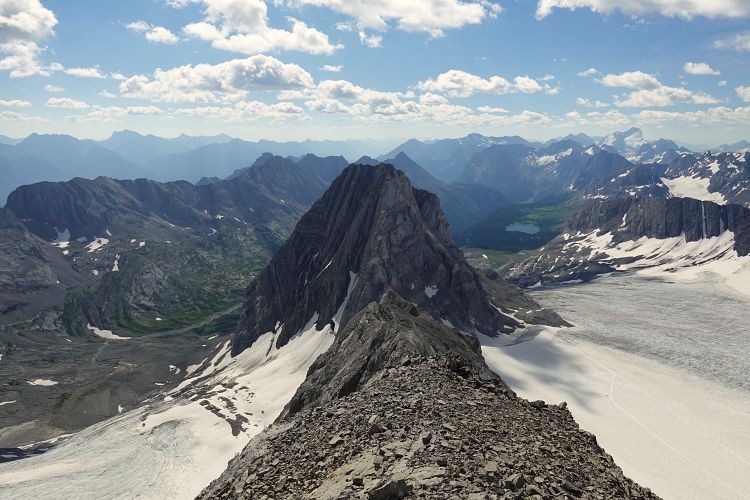
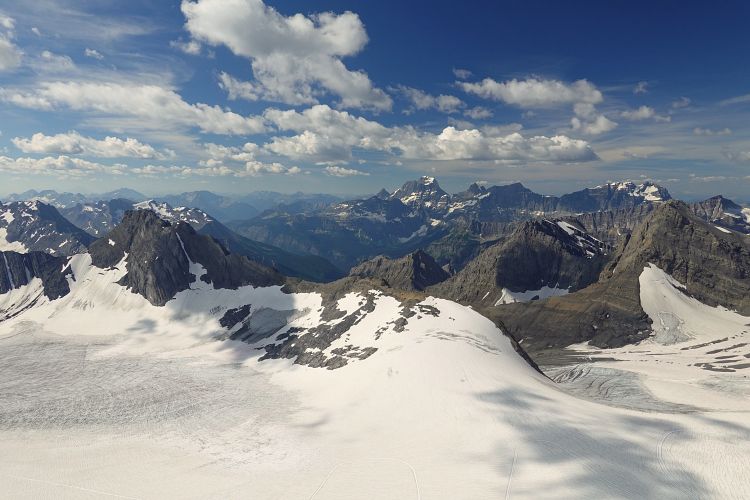
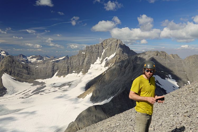
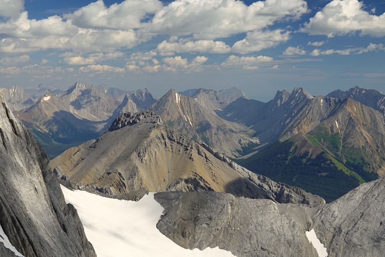
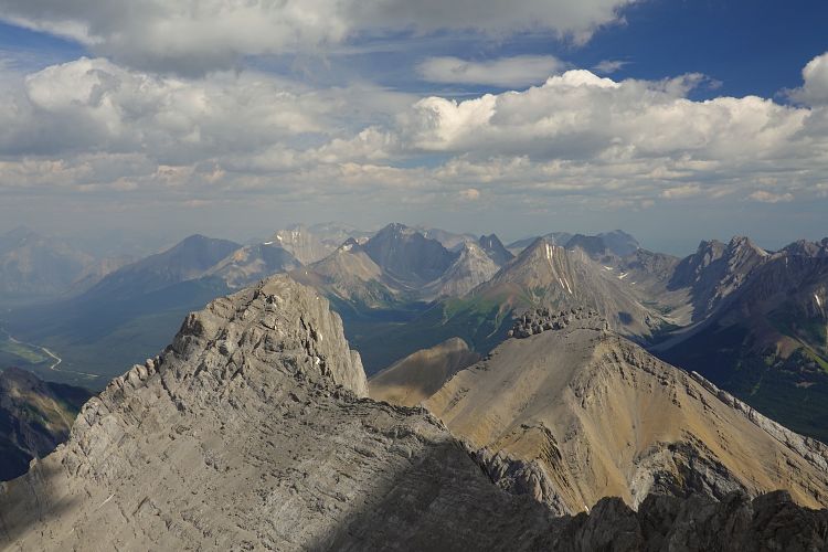
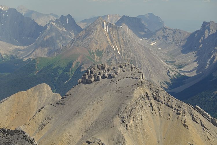
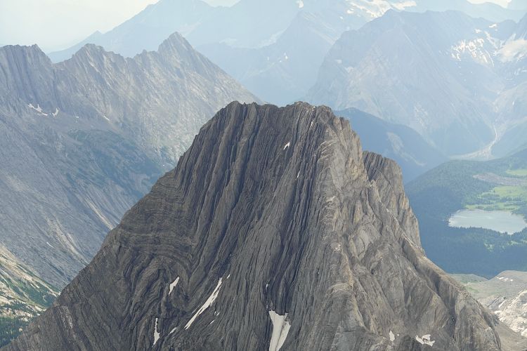
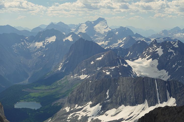
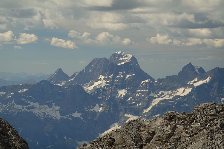
Shortly after the guillotine the route led us into a short gully on climber’s right. It was filled with hard snow and ice only in the lowermost few metres, which made for a few awkward moves. I’d say this was the crux for us – a slip would’ve resulted in a slide down the steep, snow-filled couloir below. The upper part was dry and there were good holds to climb up (and down again). Right above was the true summit, which at 3251 m elevation offers some pretty amazing views all around! Most striking were the flat limestone slabs of Mount Smith-Dorrien to the east and of course the vast ice fields of the Haig Glacier to the southwest.
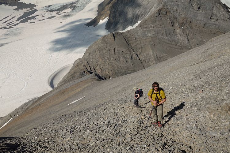
After a short celebration of our first summit and much-needed refuelling, we made our way back along the ridge, which was about as difficult as on the ascent. The trail in the scree down to the rock rib was convenient and fast. We skipped the lower part of the rock rib by stepping on the snow just to skier’s left where we were able to safely plunge-step down.
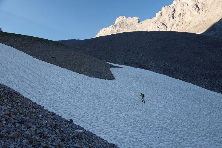
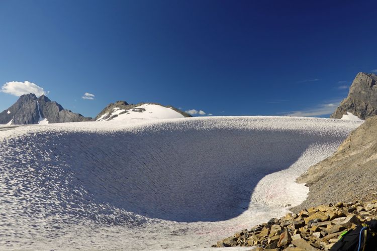
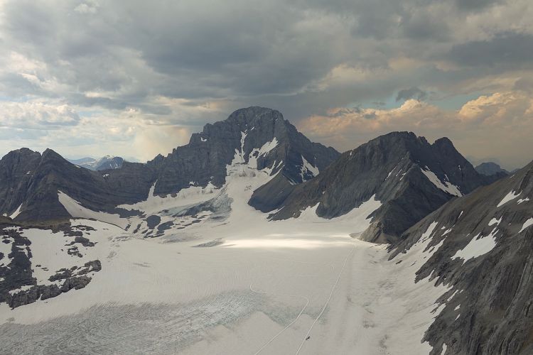
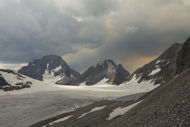
Part of the appeal of this trip is that you can experience a glacier walk with relative ease. There was no evidence of crevasses, snow bridges, or hidden holes on the glacier on our trip, so we felt safe without ropes and didn’t even need our crampons all day. Note that commonly accepted glacier travel protocols would require you to rope up as conditions can change from year to year and even within one season. Do your own risk assessment and don’t rely on this or other internet reports alone!
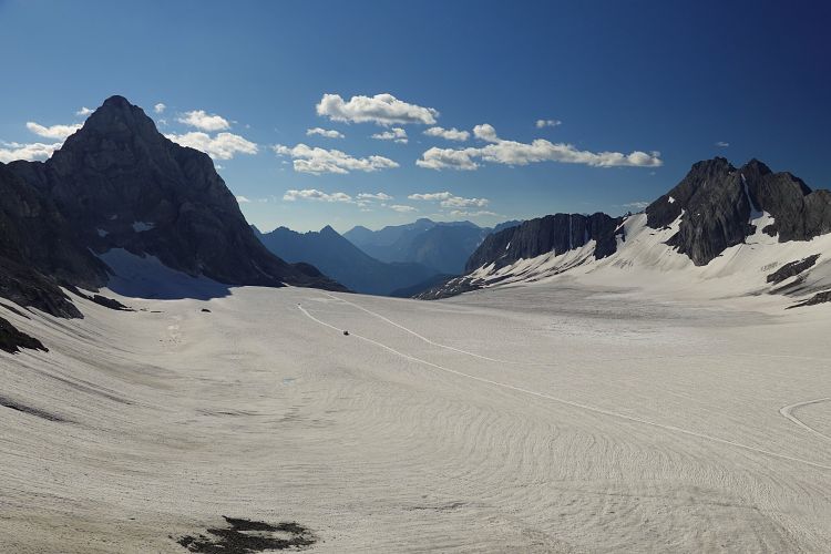
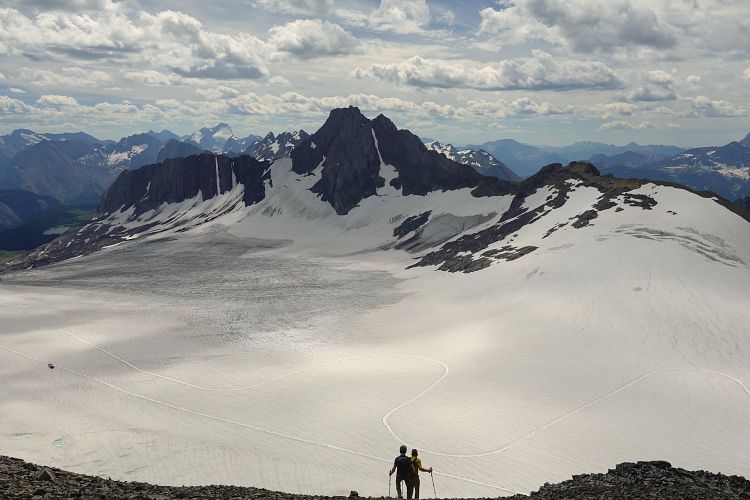
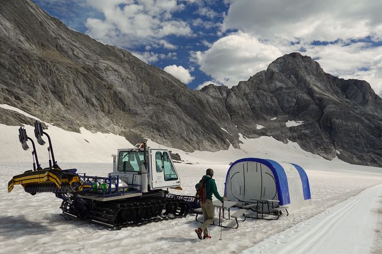
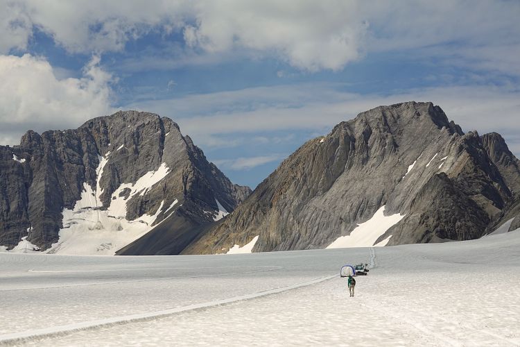
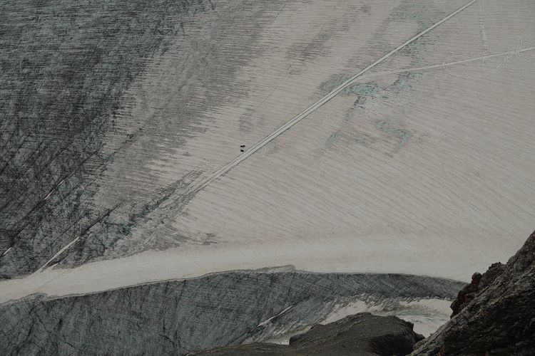
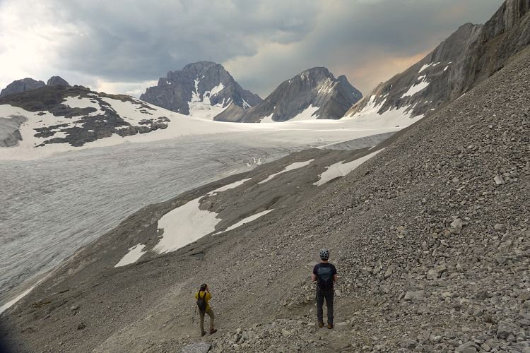
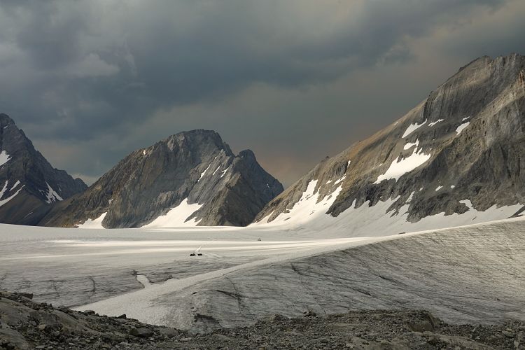
After completing the Mount French climb, we set our eyes on neighboring Mount Jellicoe. The normal (and easiest) route up Jellicoe goes up the south slopes. To get there, we first had to walk across the vast expanse of the Haig Glacier, an experience in itself! The relatively flat and benign glacier is used by Canada’s national cross country skiing team for training in the summer. There is a groomed track that makes several loops on the glacier, plus a small tent, a snowmobile, and a grooming machine. A lone athlete was doing his rounds while we were up on Mount French; he was picked up by helicopter later so when we crossed there was nobody around.
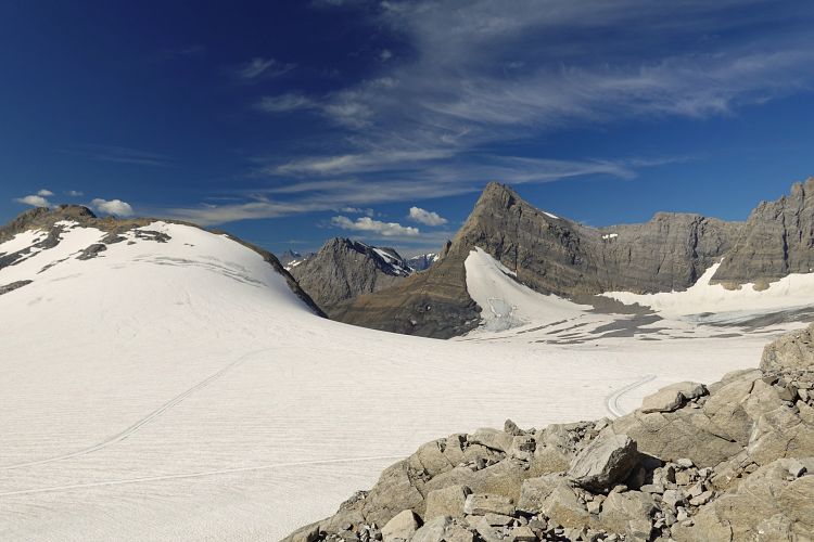
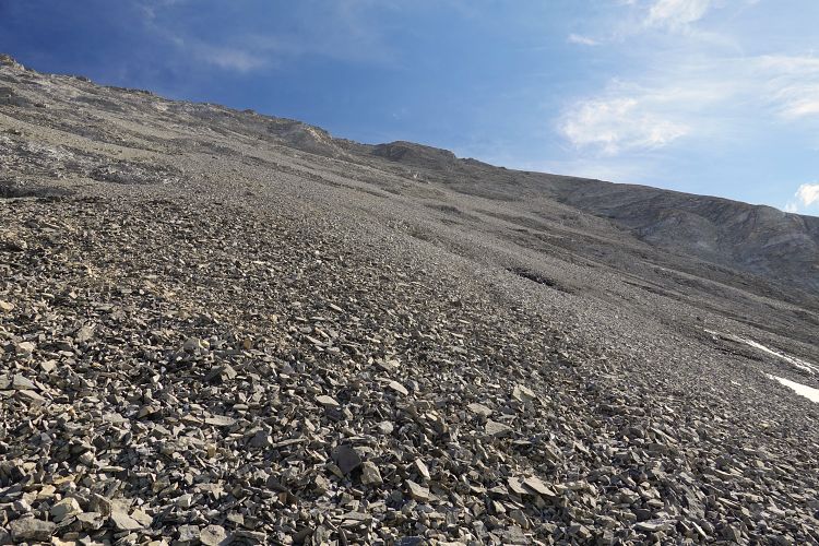
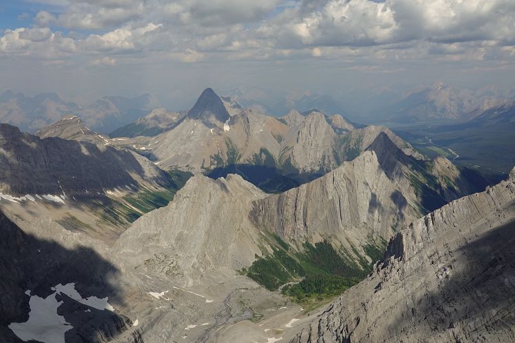
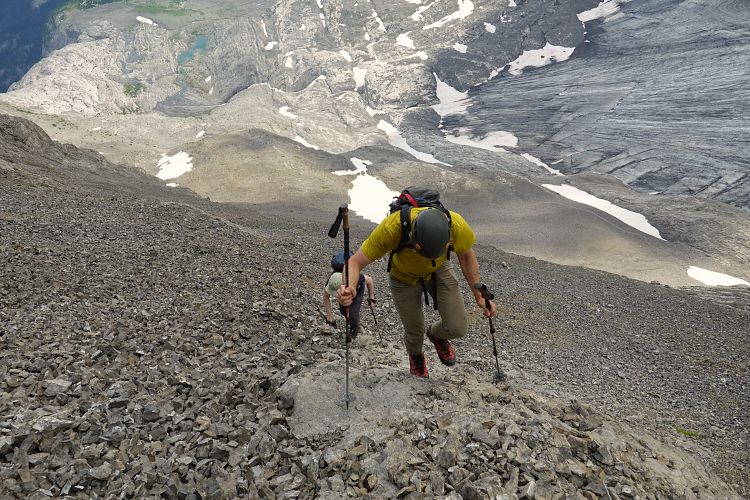
Making sure not to walk on the groomed track, we trudged across the ice to the far end of Jellicoe where you could already spot a trail and several large cairns in the scree. This trail appears to lead down into the Turbine Canyon Valley. After a few hundred metres we left the trail and headed up the rubbly south slopes of the mountain. It was unrelentingly steep and full of the worst kind of loose choss – absolutely miserable! Although Jellicoe is the easier of the two peaks, there was no trail to be found on this one. After a lot of suffering we finally made it up to a ridge flanked by a cliffband, then the going got easier as the angle abated and we were able to cross more rubble towards the summit ridge. The summit ridge is relatively short and has a few sections of exposure, but nothing as severe as on Mount French. The views from the top were equally stunning and we thoroughly enjoyed our second lunch here before heading down.
The descent was faster but still not exactly enjoyable with all the chunky debris moving underneath your feet at every step. Back down at the trail, we knew the main work was basically done for today… Now all we had to do was walk back across the glacier to the saddle, descend down the moraines to the trail, and follow it out to French Creek and the parking lot. It was actually still quite a bit of work and we were all fairly tired by the time we reached our car and were able to celebrate a successful day with chips and cold pop.
|
Elevation: |
Mount French: 3228 m |
|
Mount Jellicoe: 3051 m |
|
|
Elevation gain: |
2250 m |
|
Time: |
12 h |
|
Distance: |
29.2 km |
|
Difficulty level: |
Difficult (Kane), T6 (SAC) |
|
Comments: |
Route crosses several glaciers that may have crevasses. |
|
Reference: |
Kane |
|
Personal rating: |
4 (out of 5) for French, 2 for Jellicoe |
NOTE: This GPX track is for personal use only. Commercial use/re-use or publication of this track on printed or digital media including but not limited to platforms, apps and websites such as AllTrails, Gaia, and OSM, requires written permission.
DISCLAIMER: Use at your own risk for general guidance only! Do not follow this GPX track blindly but use your own judgement in assessing terrain and choosing the safest route. Please read the full disclaimer here.