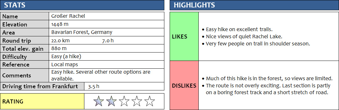
Bavarian Forest, Germany
26 April 2018
With Wen
The Großer Rachel, or simply Rachel, is the third tallest peak in the Bavarian Forest (“Bayerischer Wald” in German). These mellow, undulating hills rise up to a maximum elevation of 1460 m at the Großer Arber, so it’s not exactly true “mountains” that you can expect here. Instead, the Bavarian Forest offers easy-going hiking on an extensive network of excellent trails mostly in – you guessed it – the forest.
This hike plus the walk up the Großer Arber the next day were an experiment of sorts. We were trying to see if camping in our “new” VW California van near or at the trailhead would work out, with all its little problems, pitfalls, and unexpected shortcomings when camping overnight somewhere new… In the end, the experiment was largely a success. We had brought pretty much everything to 1) drive safely to the destination, 2) cook a delicious dinner and prepare a satisfying breakfast, and 3) sleep with relative comfort in our own van for the first night. “Relative”, because we were super cold the first night in our Westfalia pop-up roof, but our thick MEC down-filled sleeping bags did the trick on the second night.
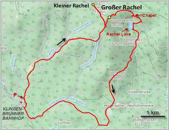
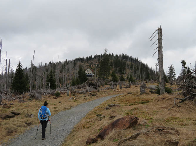
We camped about a 15 minute drive from the trailhead at Klingenbrunner Bahnhof where we started our hike the next morning. There are plenty of signs showing the way up the Großer Rachel, which makes this hike a mentally completely non-committing outing as there is basically no route-finding involved at all. After a couple of hours hiking along good forest trails we came to an area of dead stunted trees (probably due to an infestation of pine beetles) and, shortly after, the Waldschmidthaus hut. This is the perfect rest stop for weary hikers, with its dozen or so picnic tables placed around the hut and a nice lookout over the Rachelsee lake some 100 m away. Too bad the hut was closed when we visited, so it was smoked sausage and bread for lunch instead…
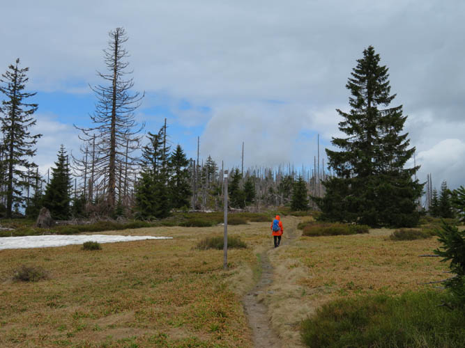
At the hut the trail splits – the main branch goes straight up to the summit, whereas a smaller path traverses west towards the smaller side summit called “Kleiner Rachel” (1430 m). After this short and enjoyable detour we rejoined the main path to climb the last, steep section to the main summit. While we had not seen a single soul so far, our summit experience was rather “crowded”: we had to share the top with 5 other people!
The quickest way to get back to our car would’ve been to simply go back the same way, but we were in the mood for more so we descended down the E and SE side. The Rachelkapelle, a small chapel overlooking the Rachelsee lake, is a beautiful place of solitude that nobody else was interested in on this day it seemed. The lake itself was also completely quiet, as was the rest of our hike back to the parking lot. Much of that hike was, once again, in the forest on well-maintained but empty trails. Easy, comfortable hiking, but nothing too exciting. Near the end there was a long, boring stretch along a forest track designated as a bike path, plus a short section of asphalt road, then we were finally back at the car.
A nice outing with lots of forest hiking and very limited views. Not exactly one that I would hasten to repeat.
DISCLAIMER: Use at your own risk for general guidance only! Do not follow this GPX track blindly but use your own judgement in assessing terrain and choosing the safest route.
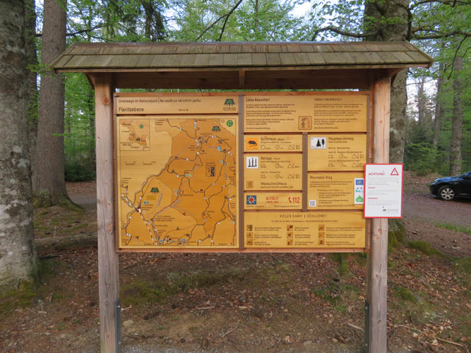
Trailhead with brand-new map carved in wood.

Lots of different trails start here, many of them loop routes.
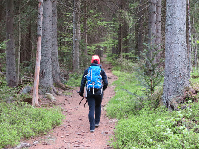
Into the Bavarian Forest!
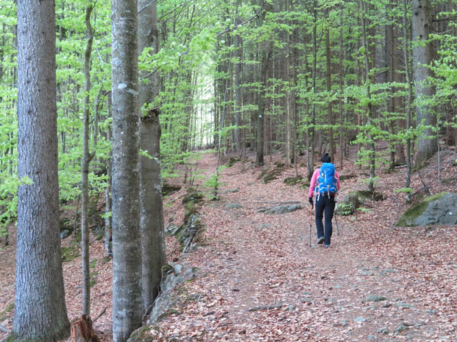
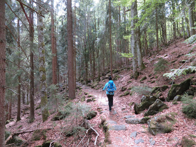
Pleasant and easy hiking here.
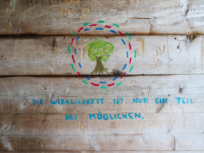
Someone wrote this on the wall of a small hut along the way. “Reality is only one part of what’s possible.”
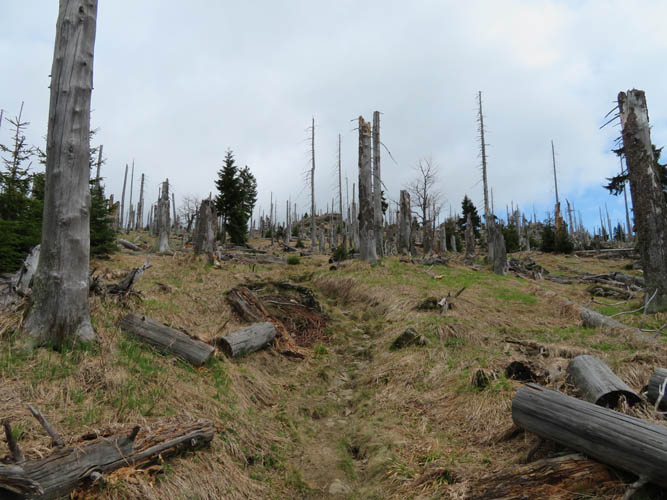
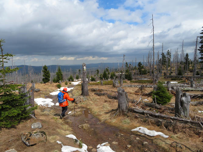
The trail leads through an area of stunted trees.
Approaching the Waldschmidthaus, summit behind.
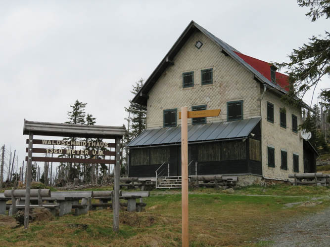
The Waldschmidthaus. Normally a restaurant serving local food and beer, it’s still closed as it’s too early in the season.
Towards the Kleiner Rachel.
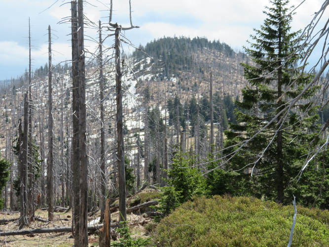
Summit of Grosser Rachel from Kleiner Rachel. The north side of the mountains (left) still holds quite a bit of snow.

Grunting up the last stretch to the summit of Grosser Rachel.
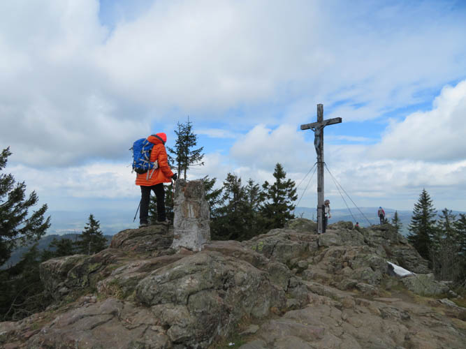
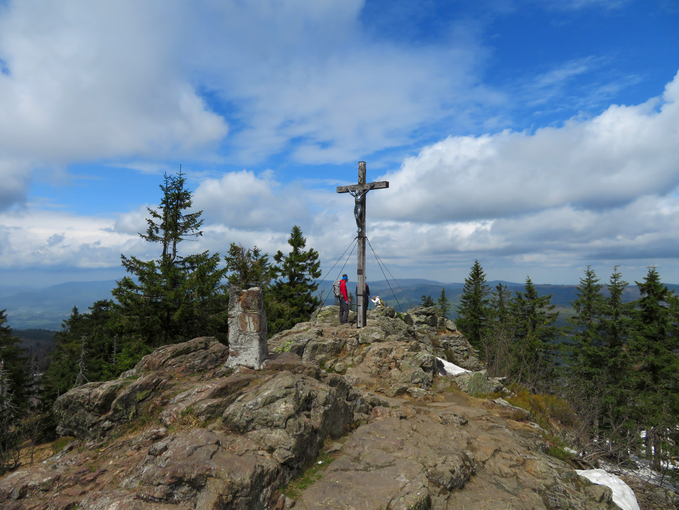
The summit of the Grosser Rachel has the only rocky outcrop of the whole route.
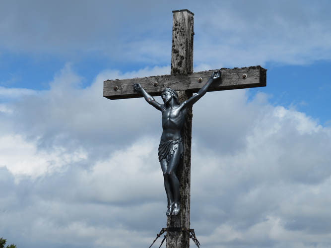
Close-up of the summit cross. In conservative Catholic Bavaria, these are often religious symbols such as crucifixes.
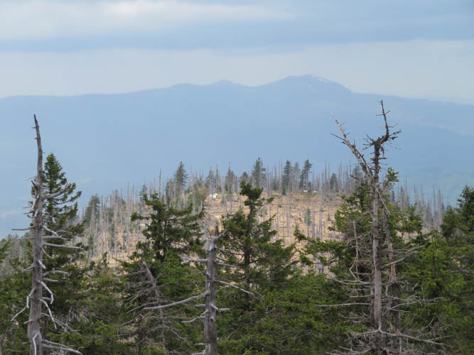
The Grosser Arber, the highest peak of the Bavarian Forest, can be seen in the distance to the NW.
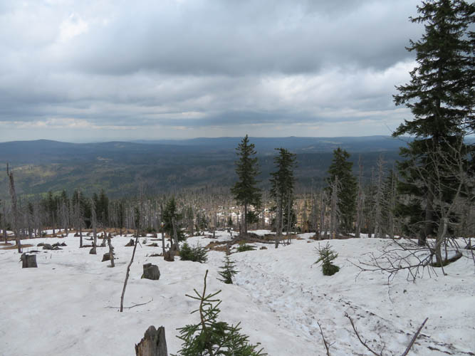
Descending on snow-covered paths on the north side. The land in the distance is part of the Czech Republic.
Short appearances of the sun briefly brighten up our day.
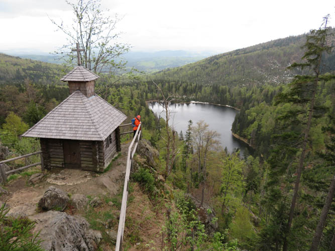
The tiny Rachelkapelle (chapel) overlooks a secluded lake called Rachelsee.
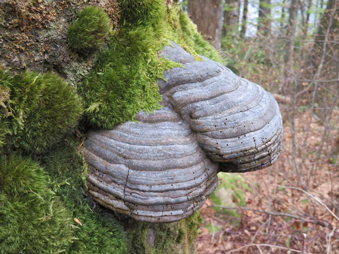
Hoof fungus on tree trunks is very common in this area.
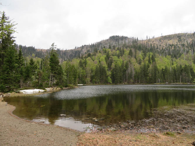
The Rachelsee.
It’s a long way back to the car. Good trails, but fairly mundane views.