Svaneti, Georgia
1 October 2018
Solo
A walk through a charming Georgian village and an easy ridgehike
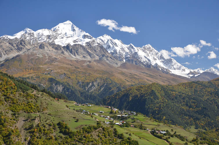
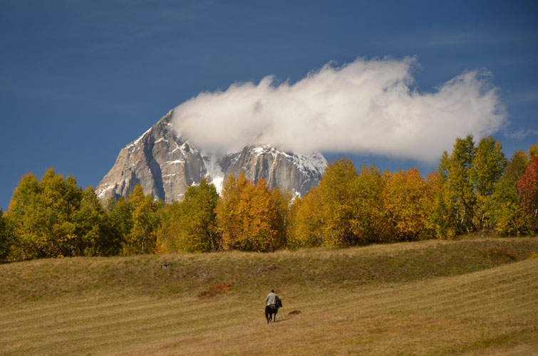
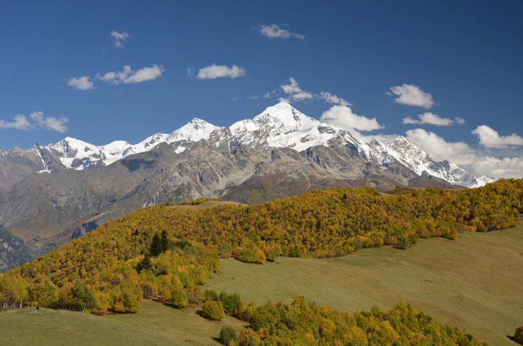
With easy access from Svaneti’s main town of Mestia, this is a wonderful short ridgewalk that affords terrific views of local giants Ushba (4710 m) and Tetnuldi (4858 m).
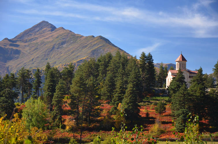
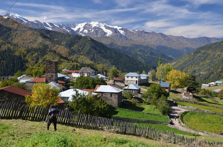
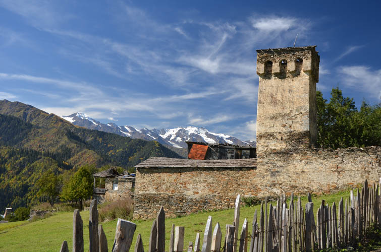
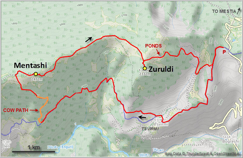
I parked my car close to the main road linking Mestia with Ushguli (ca. 18 km from Mestia town centre) and started walking down the dirt road to Tsvirmi, a lovely little village very typical of the Svaneti region. Contrary to Mestia, there are hardly any tourists here (I didn’t see any today), but they do have a couple of guesthouses where multi-day trekkers can stay. People are very friendly here and a greeting from a stranger is always returned with a smile. There is a picturesque church sitting on a small hill just outside the village that makes for some great photo opportunities.
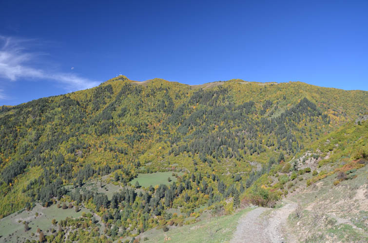
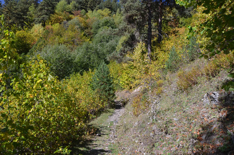
After walking through Tsvirmi I followed a good trail that contours around the southern slopes of the Zuruldi Ridge at around the same elevation with several minor ups and downs. It’s mostly in the forest, so there’s not much in terms of views, and the trail can be a bit overgrown in places.
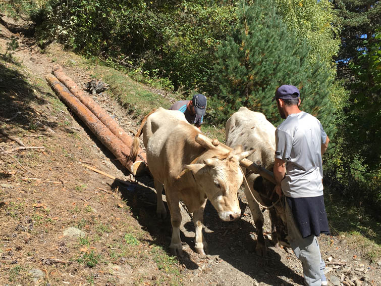
Directly south of Mentashi, the high point of the ridge that features several radio towers, a rough cow trail goes straight to the top. I had not met a single person along the trail and was all lost in my thoughts when I started to heard a loud rumbling sound as I was slogging up the cow trail in the shade of the trees. Now this is a muddy, worn-out path that’s deeply eroded into the ground like a giant ditch with steep sides. The sound grew louder and suddenly I saw a farmer with two cows pulling several giant logs coming down towards me… I intuitively jumped backwards and took the first opportunity to get out of the “ditch” while the whole assemblage rumbled past me. At least now I knew why this trail was so worn! Higher up I ran into another pair of lads that were attaching heavy logs to a pair of cows; they were taking them down to the nearby village of Ieli in the valley below, where they’ll be trimmed and cut for use as building materials.
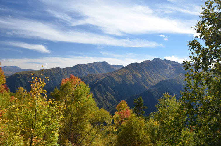
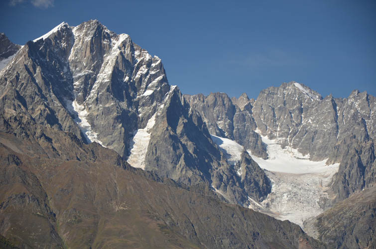
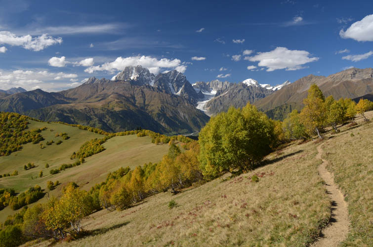
The cow trail emerges on a large meadow near the ridge top. I crossed the meadow towards the trees and found a dirt road that goes directly to Mentashi summit, which is almost completely built up with radio towers. There were a few groups of hikers who had walked up directly from Mestia, and even a jeep had made it up on the rough road. Most people come to admire the wonderful views of the valley to the north with Ushba (4710 m) and the Gvalda Range as a backdrop. The latter includes Latraldashi (3370 m), Banguriani (3838 m) and Ahalgazrdoba/Komsomol (3702 m).
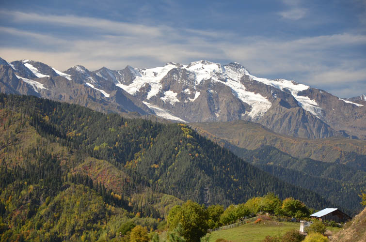
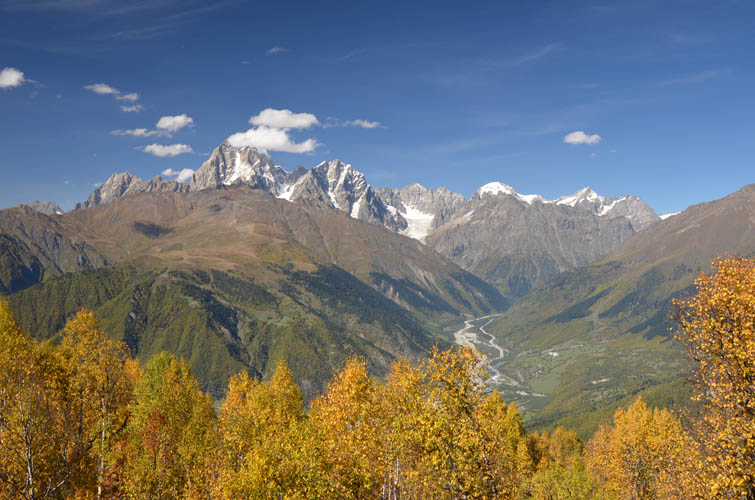
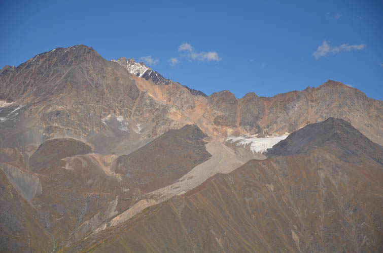
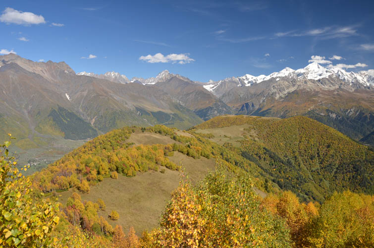
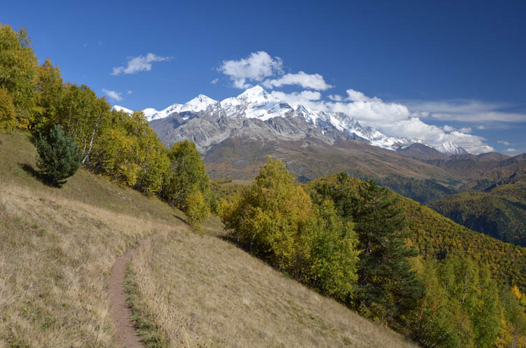
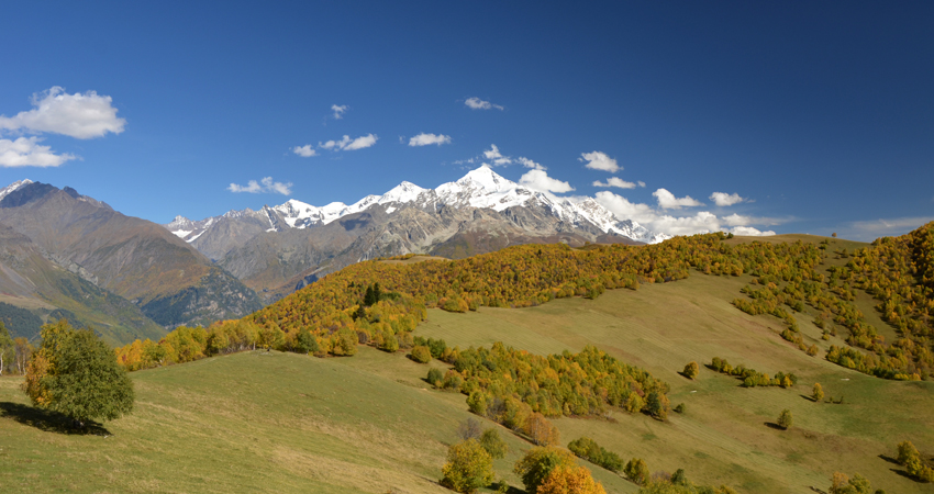
The ridgewalk from Mentashi to Zuruldi was the best part of the day. Immediately after leaving the radio towers I got myself stuck at a steep drop-off where the trail has partially been washed away. I backtracked a few metres and took another trail branching off further to the right (south), which was still steep in places but much easier to handle. The rest was a pleasant stroll with grassy plains on the right and forest on the left. Throughout there are awesome views of Tetnuldi’s massive snow pyramid in the distance.
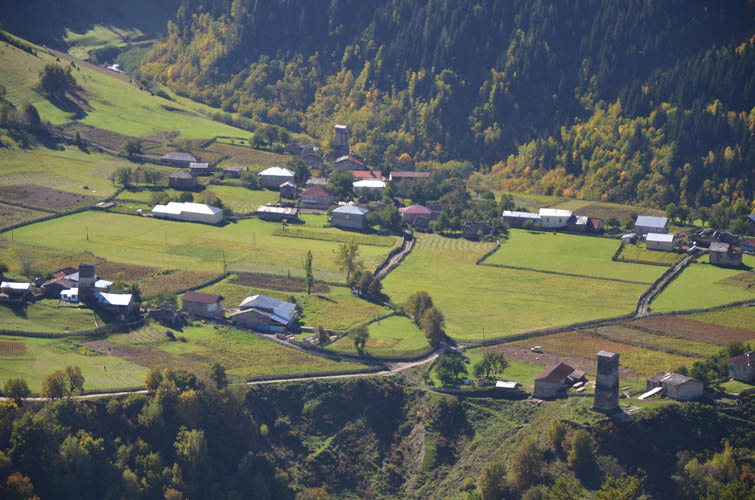
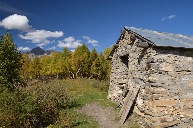
A small, empty chapel sits right at the summit of Zuruldi, overlooking the village of Tsvirmi below. It’s a nice and quiet spot to sit down, take a break, and admire the views of the rarely visited peaks and ridges to the south.
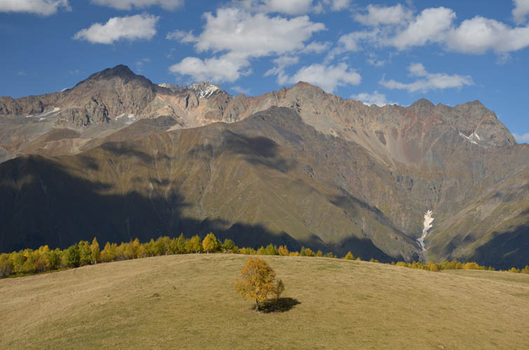
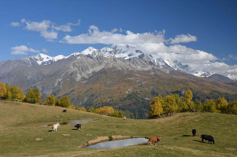
On the way down the east side of the ridge the trail passes two small ponds surrounded by rolling meadows. Another lovely place – no crowds of tourists here, just a few cows grazing nearby. The decent trail was pretty decent and I was back at the dirt road and my car in no time.
| Elevation: | Mentashi: 2472 m (official), 2463 m (my GPS) |
| Zuruldi: 2332 m (official), 2347 m (my GPS) | |
| Elevation gain: | 950 m |
| Time: | 5.5 h |
| Distance: | 17.0 km |
| Difficulty level: | Easy (Kane), T2 (SAC) |
| Reference: | Local maps |
| Personal rating: | 4 (out of 5) |
DISCLAIMER: Use at your own risk for general guidance only! Do not follow this GPX track blindly but use your own judgement in assessing terrain and choosing the safest route.