Svaneti, Georgia (Caucasus)
25 September 2018
Solo
A long, challenging day in Georgia’s remote Svaneti mountains
What an adventure! A long day full of enjoyable hiking and scrambling, and one of those true exploratory trips that I haven’t done in a while. I pretty much had no information available on this route and on the three peaks I wanted to climb other than the fact that there’s a good approach trail for the first 800 m height gain. For the remaining 1200 elevation metres I had to find out for myself, which is the most exhilarating part of such trips!
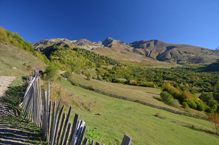
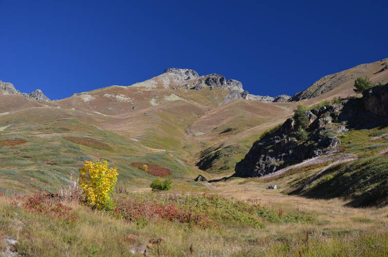
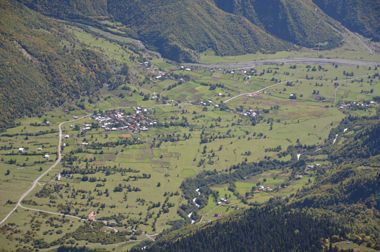
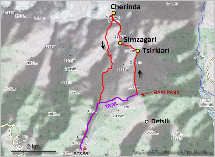
The day before, when Wen and I had hiked up neighboring Detsili, we had noticed a good track in the valley below us. This track runs from the village of Barshi (community of Etseri at the main road) up a gentle valley and turns into a trail before it reaches Baki Pass at 2416 m. I was able to drive up to the last collection of houses in the settlement at 1670 m elevation and park my car in a narrow alley after checking with some local farmers and informing them about my plans. They were all very friendly and even offered to guard my car while I was gone.
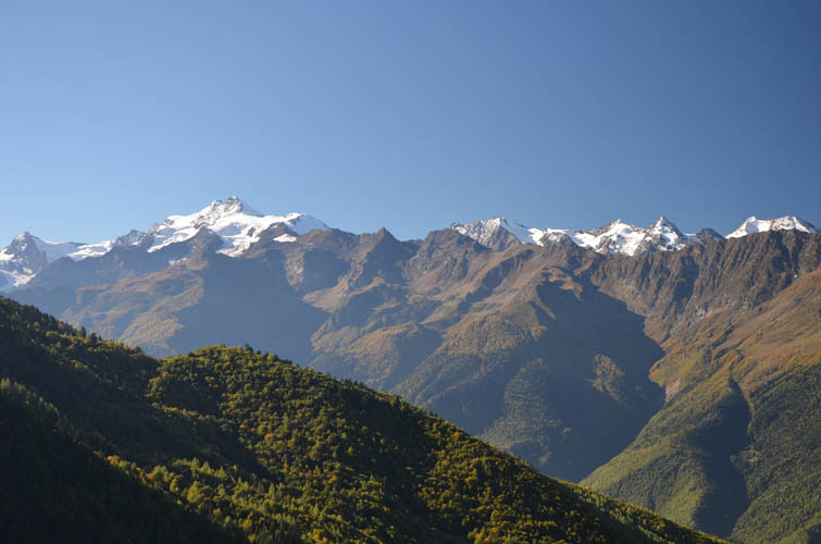
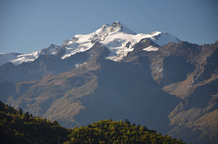
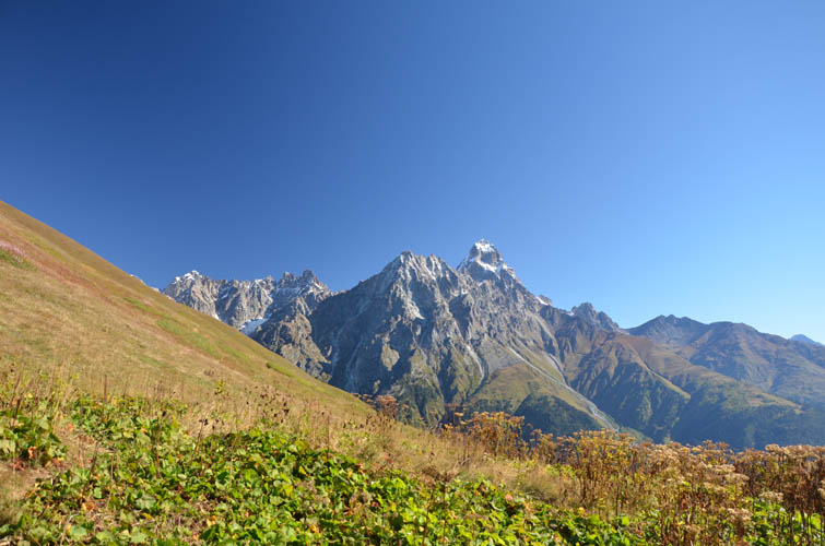
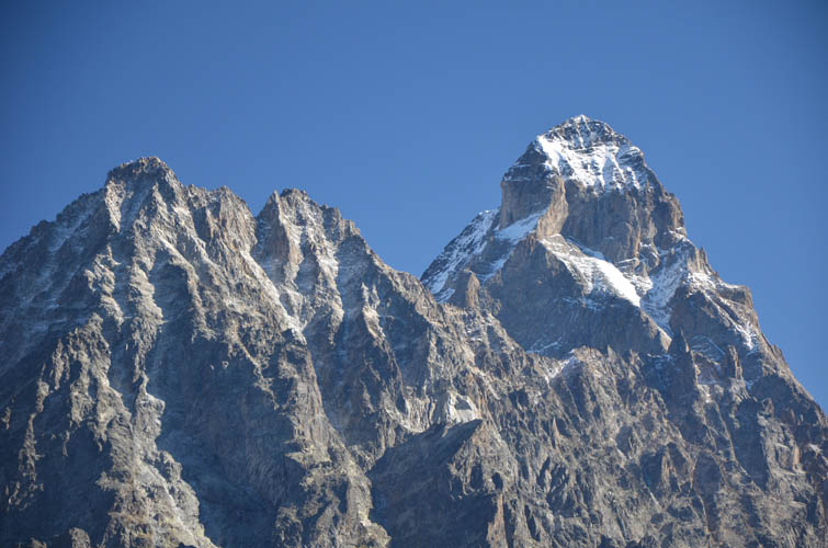
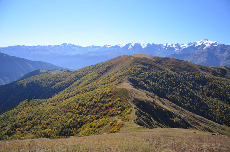
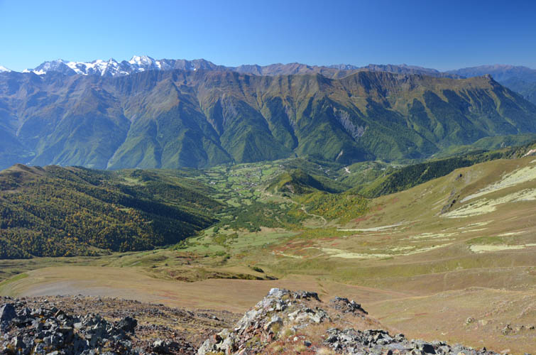
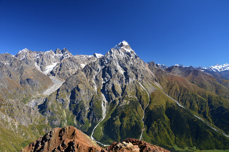
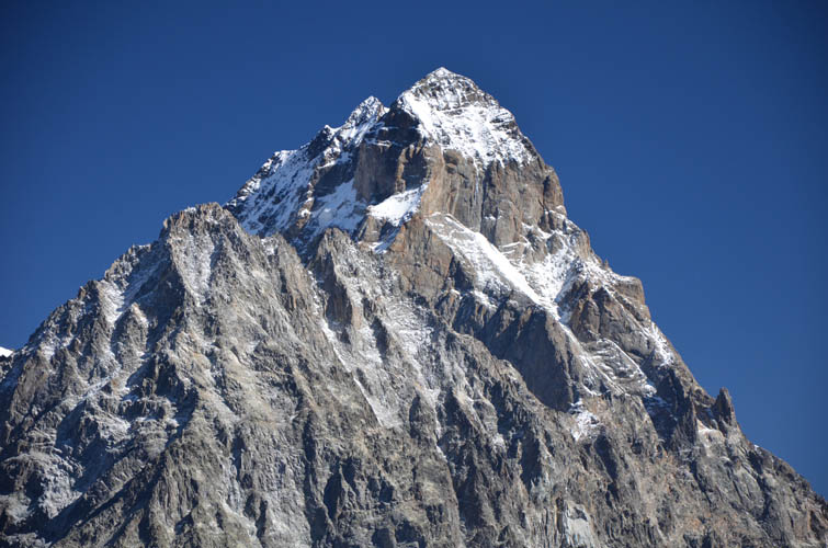
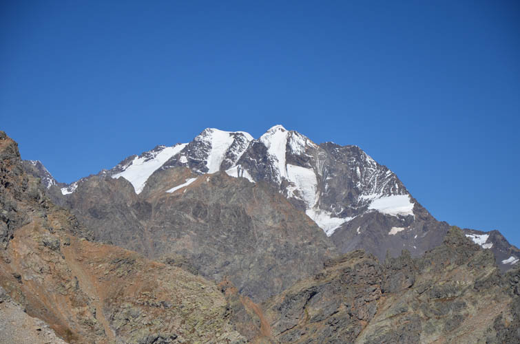
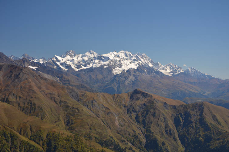
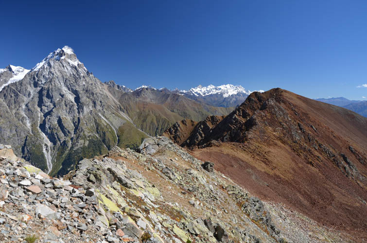
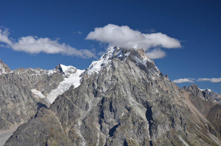
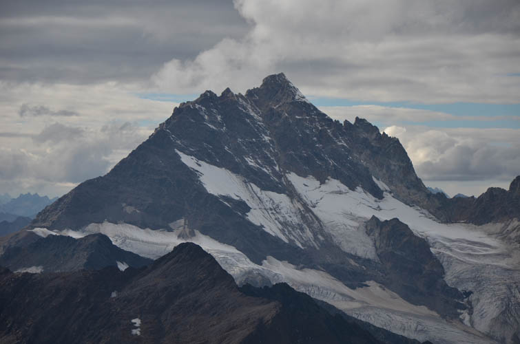
The initial hike up to the pass was an easy walk through the open valley and a good warm-up for what was to come. There were even sporadic trail markers – Indonesian flag style with horizontal red-white stripes. Luckily, it was a perfectly cloudless day with amazing visibility in all directions. When I arrived at Baki Pass, the sight of Mount Ushba across the valley – the Crown of the Caucasus, as it’s often called – simply took my breath away. With its steep, forbidding pyramid-shaped summit tower rising up to 4710 m, Ushba is not only one of the most esthetically pleasing mountains to look at, it’s apparently also one of the most difficult to climb in the mountaineering world. It doesn’t happen often that you get such a clear view of the entire mountain and I was fortunate indeed to have Ushba as my giant companion for almost the whole day.
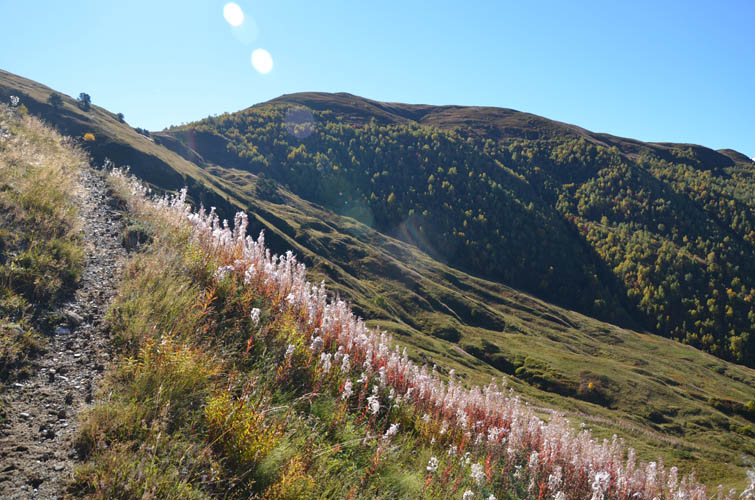
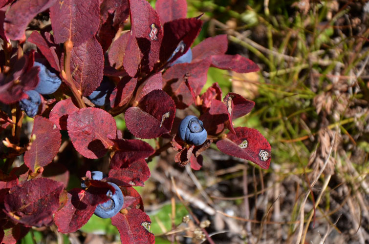
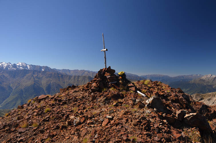
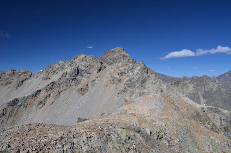
My first objective was a peak called Tsirkiari, also referred to as Mount Bak. It was an easy, straightforward hike on the long, grassy ridge from Baki Pass to the rocky summit. There were bushes of juicy blueberries all over the lower part of the ridge and a small group of cows were still grazing up to the 2600 m level. Although the entire ridge was without a trail, I was surprised to find a lonely signpost next to the summit cross. It’s labelled “Mt. Bak, 3286 m”, which is apparently a typo as my GPS was showing me an elevation of 3203 m and a paper map I found later states the official height as 3206 m.
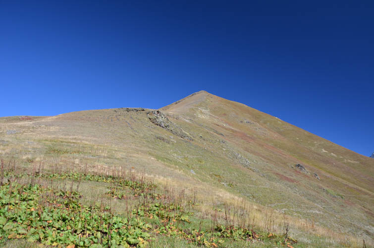
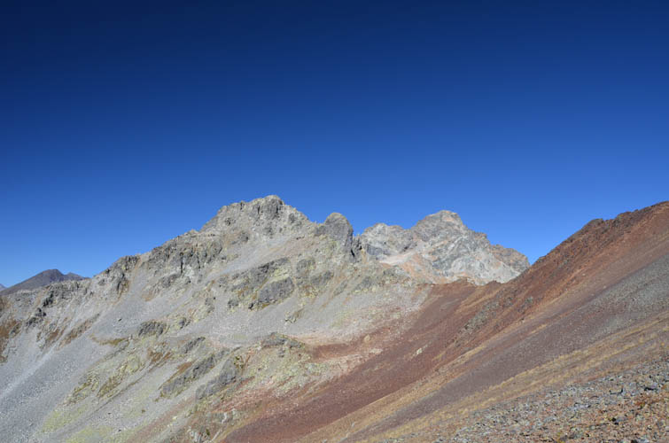
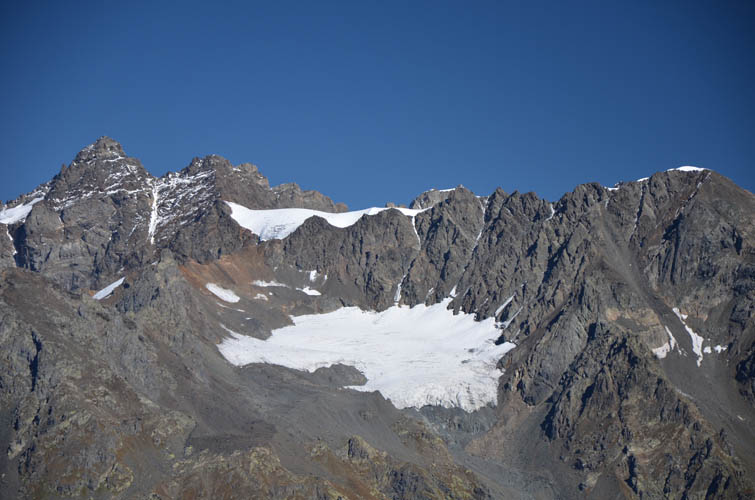
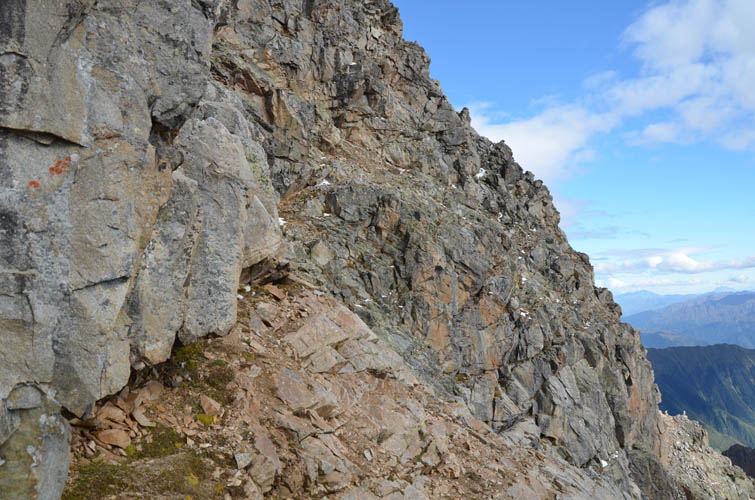
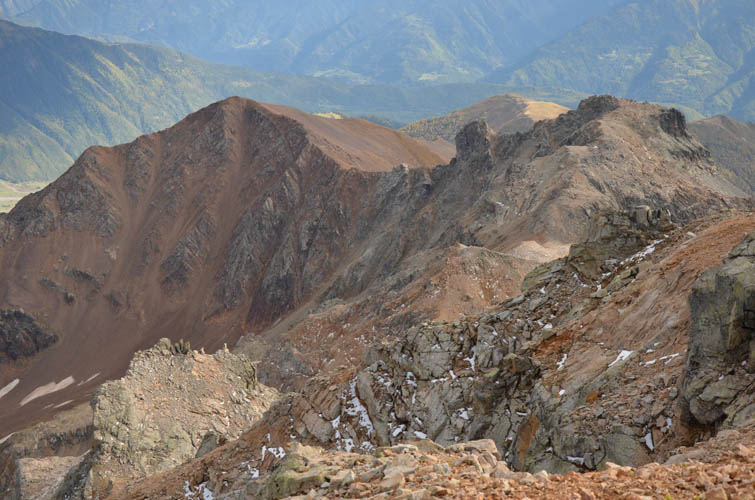
After soaking in the views of Ushba and the many other giants to the north along the Russian-Georgian border, it was time to turn my attention to the second objective: Simzagari (3317 m). The connecting ridge from Tsirkiari looked pretty rocky, but not overly difficult, and it turned out to be just that. The summit mass of Simzagari itself was a little more complex. An impressively steep rock buttress bars further progress along the ridge crest. I bypassed this vertical cliff on the left (south), contouring around until scree-covered rock slabs allowed me to gain elevation and reach the ridge top again. A short moderate scramble took me directly onto the summit, where surprisingly no summit cairn was to be found (perhaps destroyed by weathering or lightning).
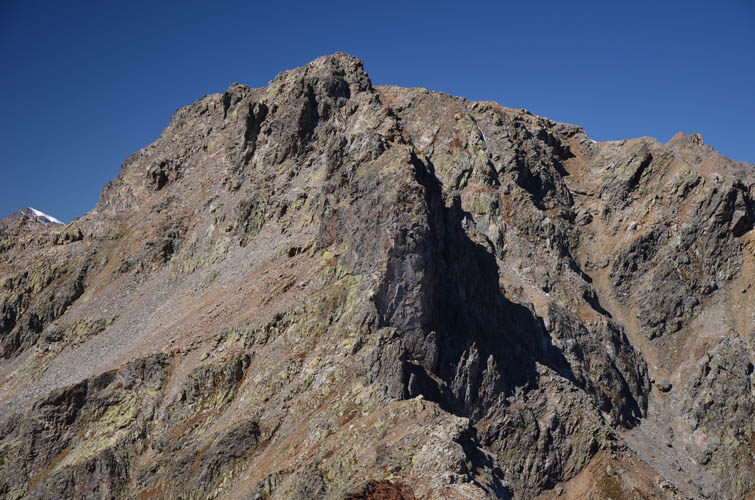
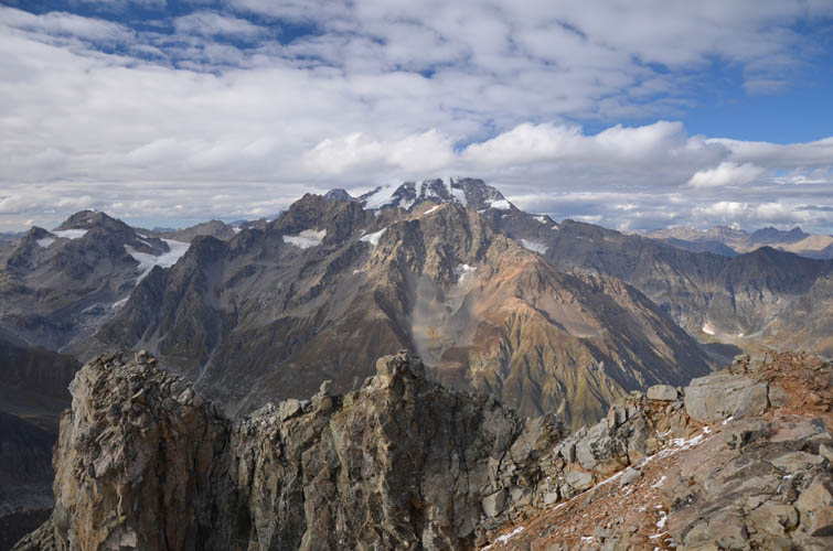
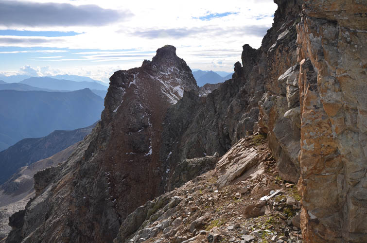
It was 13:30 now, just over four hours after I had started off in the morning. I looked over to my final objective, Cherinda (also spelled Charinda), and its imposing 3600 m summit tower. From my vantage point I couldn’t see an obvious route up, the uppermost ridges leading to the summit looked too sharp and jagged while the south face looked quite steep. And, of course, there was still a lengthy ridge of uncertain character between me and Cherinda. At this point I was quite doubtful I would make it up this last summit. But then again, why not at least try!? After all I had enough energy and time left to give it a go and was thoroughly enjoying myself on this gorgeous sunny day.
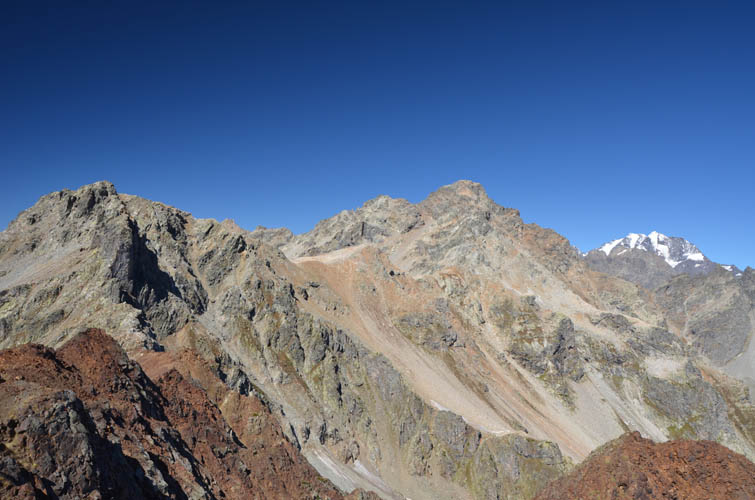
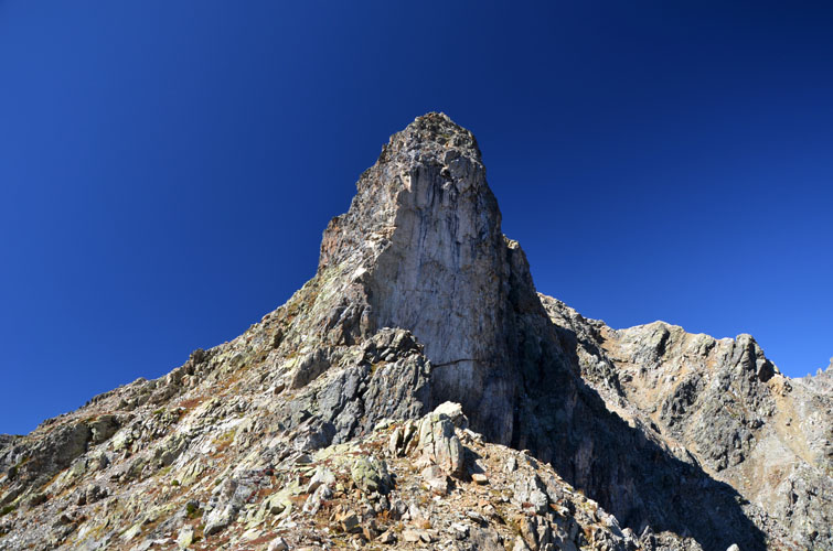
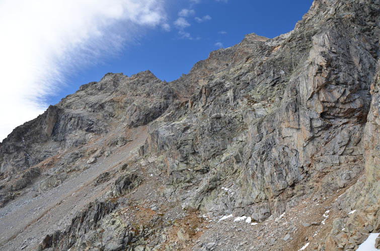
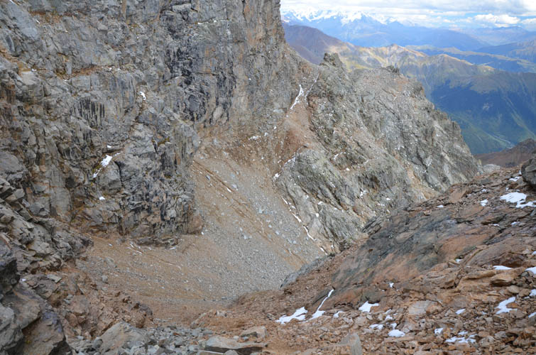
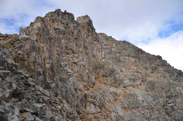
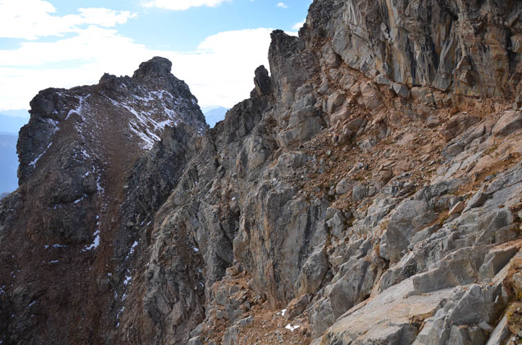
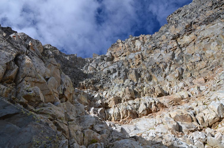
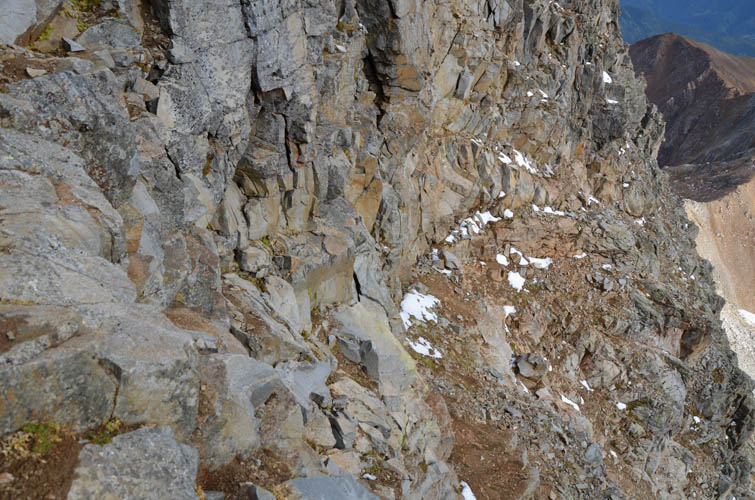
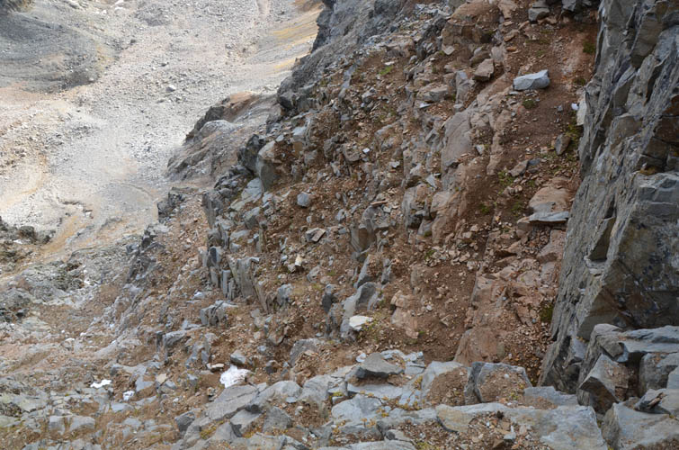
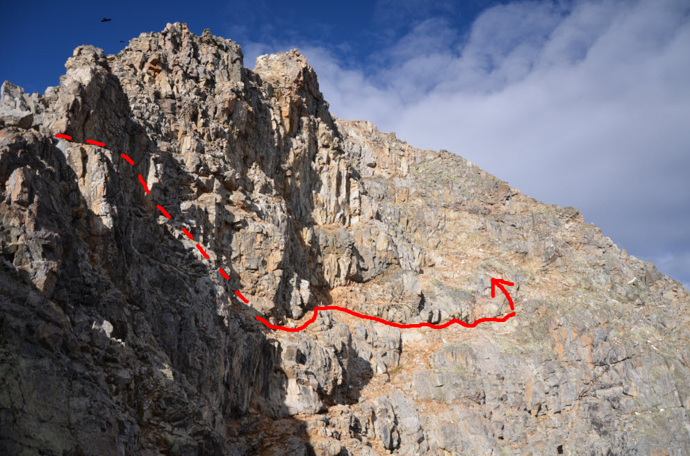
The ridge between Simzagari and Cherinda turned out to be pretty easy but more energy-draining than I had expected. There were quite a few ups and downs that slowed me down. Arriving at the summit mass, the ridge suddenly turned into very steep and dangerous terrain, which I once again avoided by going around to the left (west). I traversed underneath a series of black cliff bands along more or less the same elevation for about 20 minutes until I reached a wide scree apron that I had to slog up to get to the steep south face. At first glance, I thought for sure this is the end of the road for me here… The wall in front of me looked too steep, too daunting, too complex. I climbed a little higher via a narrow couloir full of brown mud and loose rocks on climber’s left and then looked at the wall again: the huge face is broken up by a series of cracks, ledges and sills – all potential “helpers” to find a route through this mess. After climbing out of the couloir onto the ridge, I immediately left the ridge again after a few metres and stepped onto a narrow ledge. The latter runs horizontally and slightly downward across part of the south face, involving some very exposed difficult scrambling, and into a steep rock gully. The gully didn’t look too hard at first, but turned out to be way more challenging than I anticipated! Some 30-40 m of steep, exposed, difficult scrambling finally got me to the summit ridge where it was an easy walk to the top of Mount Cherinda! Thankfully I had neither snow nor ice on the entire route, which no doubt would make it a whole lot more difficult, if not impossible. Also, as a warning to others: test each hold carefully as the rock can be unstable and rock quality varies significantly. If snow prevails or in rainy conditions this is not a scramble anymore, and even in perfect conditions a rope might be a good idea.
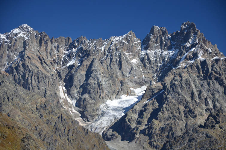
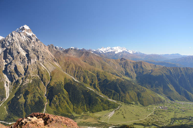
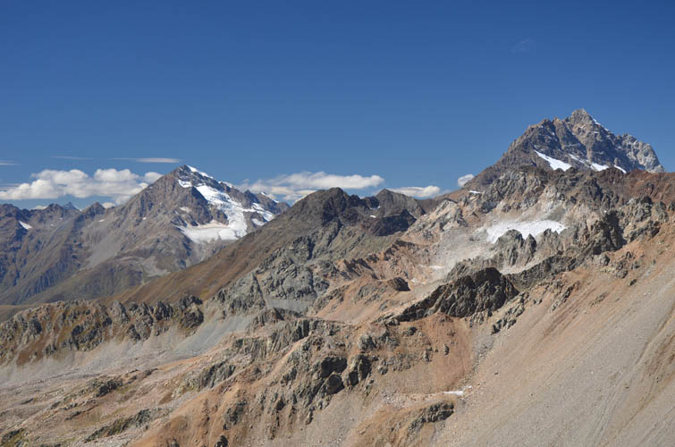
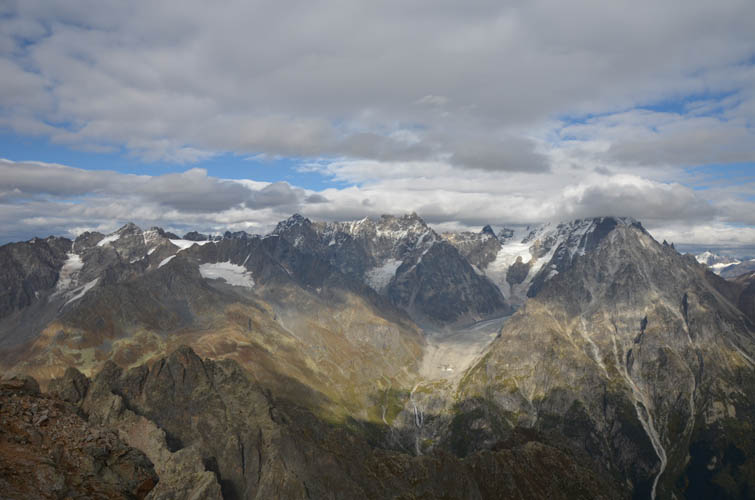
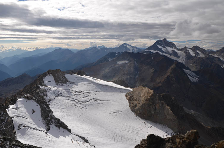
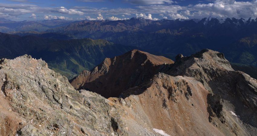
At the summit there was a small cairn but no register. I felt so elated to be here and really enjoyed just sitting down and soaking in the scenery around me. The views on this day were nothing short of stunning: a sea of dramatic peaks, craggy ridges, glaciers and remote valleys can be seen to the north where Georgia ends and Russia begins. The magnificent south peak of Ushba (4710 m) is no doubt the prime eye catcher, but there were also good views of Donguzorun (4454 m) on the Georgian-Russian border.
It was already past 4 P.M. by now so my summit break didn’t last long. I briefly contemplated an alternative descent down the southeast ridge, but because I couldn’t really see what lay below me – perhaps some nasty cliffs? – I opted for the same way back. I kept wondering whether there might be an easier route up and down this mountain, and there may very well be. But the safest option was definitely to just retrace my ascent route. Breaking it down into small steps, I slowly and carefully scrambled down the steep gully and along the ledge back to the brown mud couloir. It wasn’t easy and I felt quite relieved to put the crux behind me.
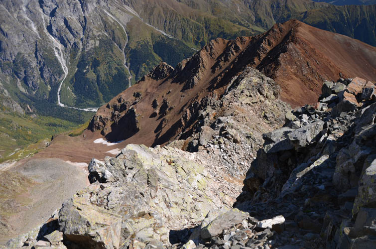
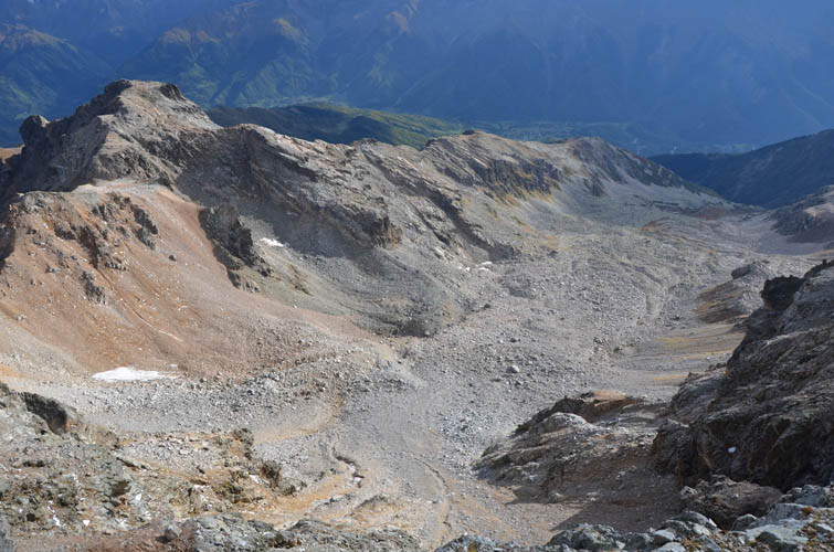
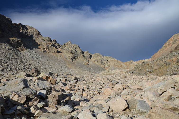
The quickest way back to my car I figured was to head straight down the wide scree apron south of the peak, traverse over a couple of small ridges, then walk down the open grassy slopes to reach the valley trail again. This all worked out, but was a lot more time- and energy-consuming than it looked from above. I had to cross several large talus fields with unstable boulders that were a pain to navigate. Perhaps a more pleasant descent would be going back to Simzagari and head down the west ridge from there, but this of course would add even more elevation gain to an already long day. By the time I reached the trail again it was already dark and I hiked the last hour with my headlamp on.
An awesome adventure with gorgeous views and a wide variety of terrain and difficulty levels that’s worth every minute of this long and strenuous day!
Warning: If conditions are snowy or icy on Cherinda, or if the rock is wet, then this is not a scramble anymore but becomes a technical endeavour, i.e. a mountaineering trip where ropes etc will be needed. There may also be significant avalanche hazard in the area. Even in dry conditions this is a serious outing with significant exposure that requires good routefinding and climbing skills. A helmet is a must (for rockfall), hiking poles are highly recommended, a rope might be a lifesaver. For those looking to do this with a guide, Misha of SvanAlp can be recommended.
| Elevation: | Tsirkiari: 3206 m (official), 3203 m (my GPS) |
| Simzagari: 3311 m (official), 3317 m (my GPS) | |
| Cherinda: 3579 m (official), 3582 m (my GPS) | |
| Elevation gain: | 2260 m |
| Time: | 12 h |
| Distance: | 18.3 km |
| Difficulty level: | Tsirkiari: Easy (Kane), T3 (SAC) |
| Simzagari: Moderate (Kane), T4 (SAC) | |
| Cherinda: Difficult climber’s scramble (Kane), T6 (SAC) | |
| Reference: | No info on this route was available to me prior to trip |
| Personal rating: | 5 (out of 5) |
DISCLAIMER: Use at your own risk for general guidance only! Do not follow this GPX track blindly but use your own judgement in assessing terrain and choosing the safest route. Please read the full disclaimer here.