Svaneti, Georgia (Caucasus)
7 October 2018
With Felix
One of the highest scrambles in Georgia’s Svaneti region
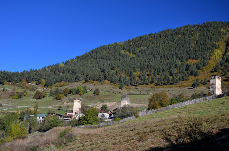
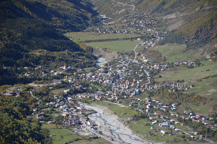
There are few peaks above 3500 m in the High Caucasus that can be ascended without any technical gear. Ahalgazrdoba in northern Georgia is one of them, although this difficult scramble is not without its challenges. Ahalgazrdoba is the official Georgian name of the mountain that translates to “youth” in English, but the peak is also still widely known by its former name Komsomol. Either way, it’s a prominent landmark above the picturesque town of Mestia, the main community in Georgia’s Svaneti region. It forms part of the Gvalda Range along with its bigger and more impressive neighbor Banguriani (3838 m) as well as Latraldashi (3370 m) to the west.
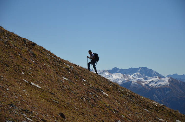
My new friend Felix, a young German backpacker who’s on a two year around-the-world hitchhiking trip, joined me for this adventure. Although he had never climbed a mountain before, we figured we could at least hike up the beautiful Chkhuti Ridge together, which really is a destination worthy of a trip in itself. Felix turned out to be a natural – the 2000 m plus elevation gain didn’t faze him in the least. Nor did the first scrambling sections along the ridge which he tackled with ease, all while having fun at it, too! It’s always nice to have good company, especially on such lengthy trips.
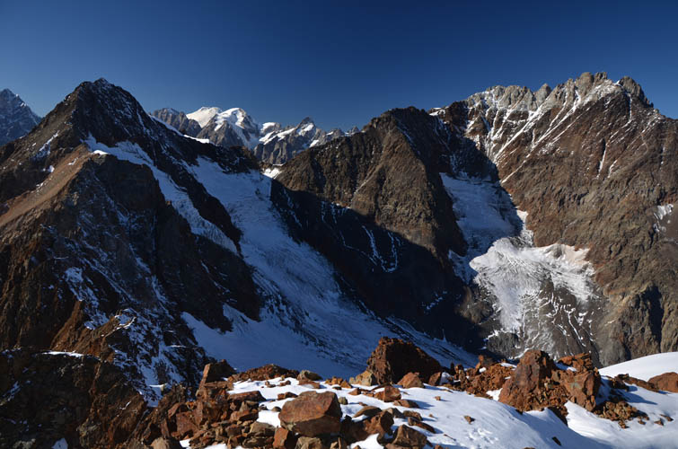
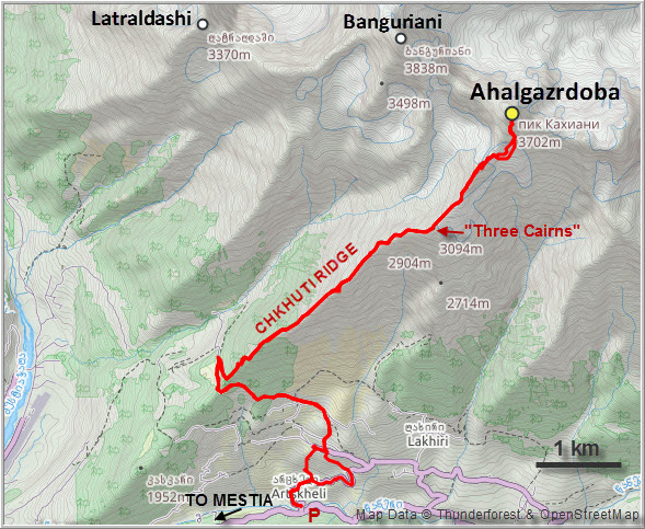
Banguriani and Ahalgazrdoba are typically climbed over two days from Mestia below, with a camp set up in the meadows below the summit mass. We were blessed with prime conditions today – not a cloud in sight all day and most of the snow had melted – so we went for a single day push.
In order to reduce some of that elevation gain we tried to park in the village of Murshkeli a little higher up the valley, but my van didn’t make it! The road was just too rough and steep at the beginning. No choice but to park it down by the river and hike up – oh well, what’s another 300 m when you have 2000+ ahead of you already?
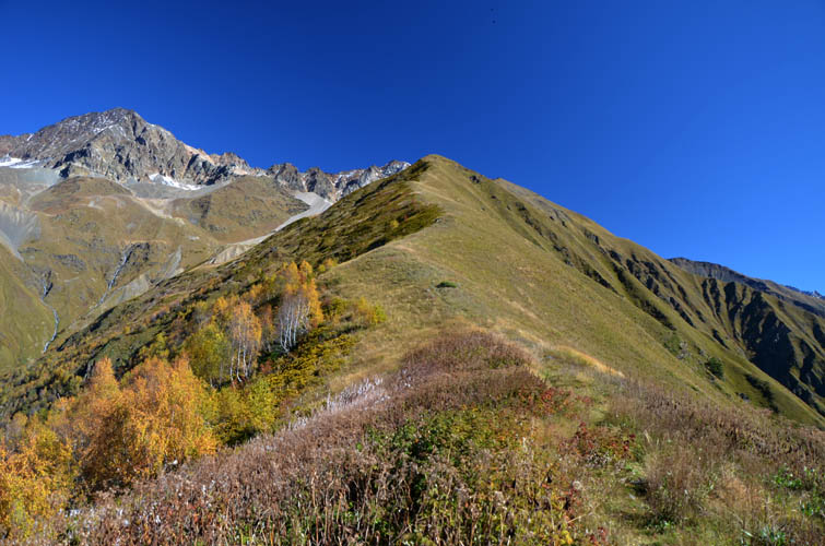
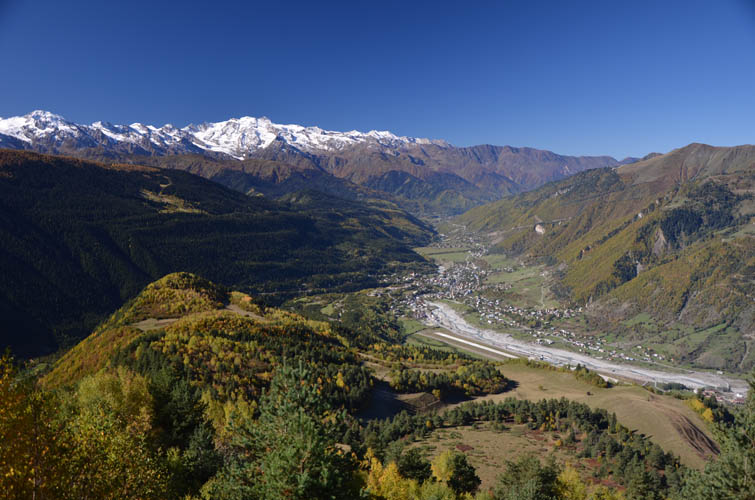
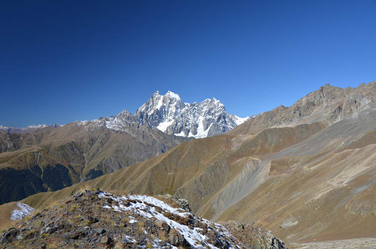
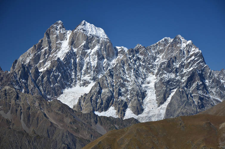
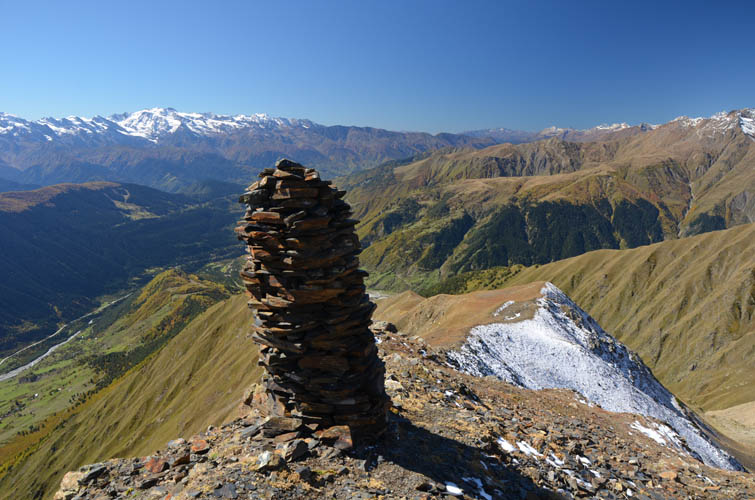
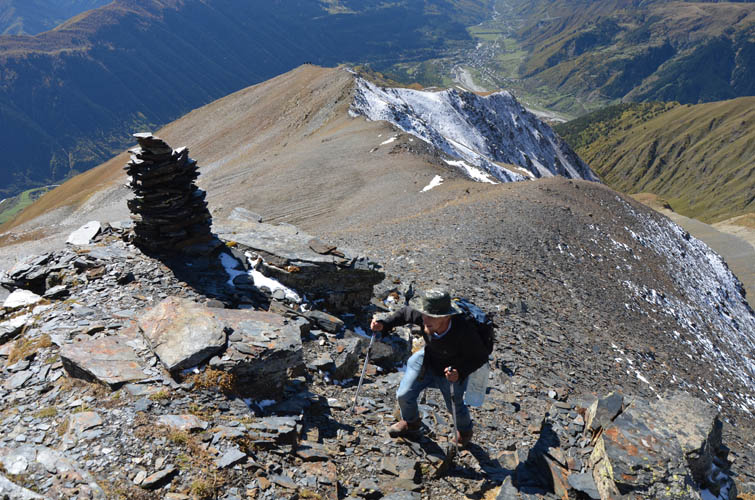
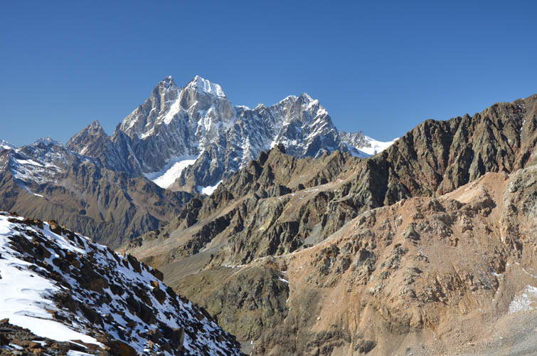
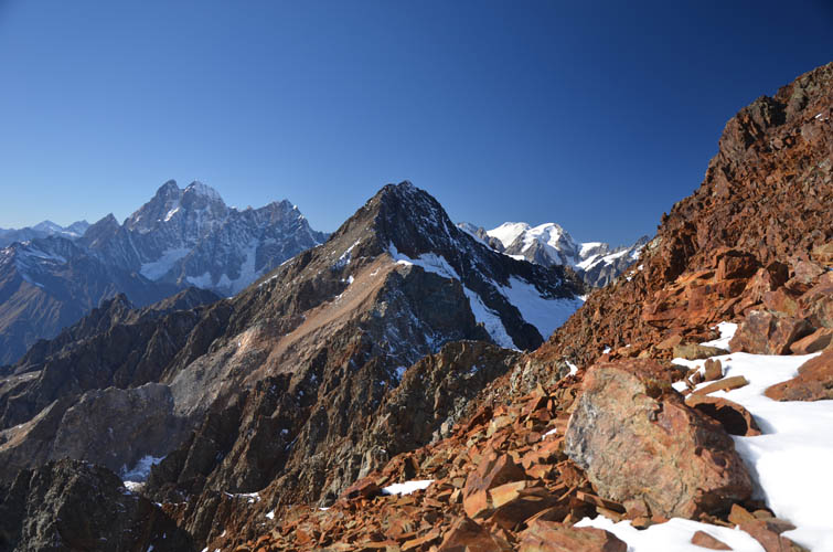
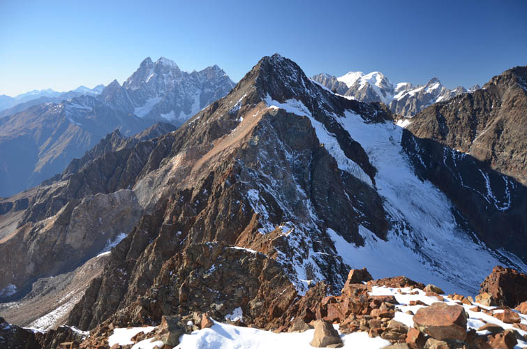
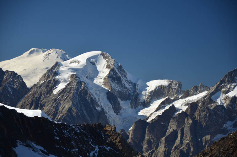
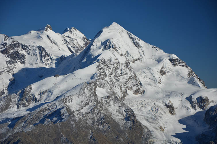
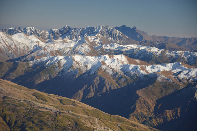
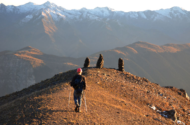
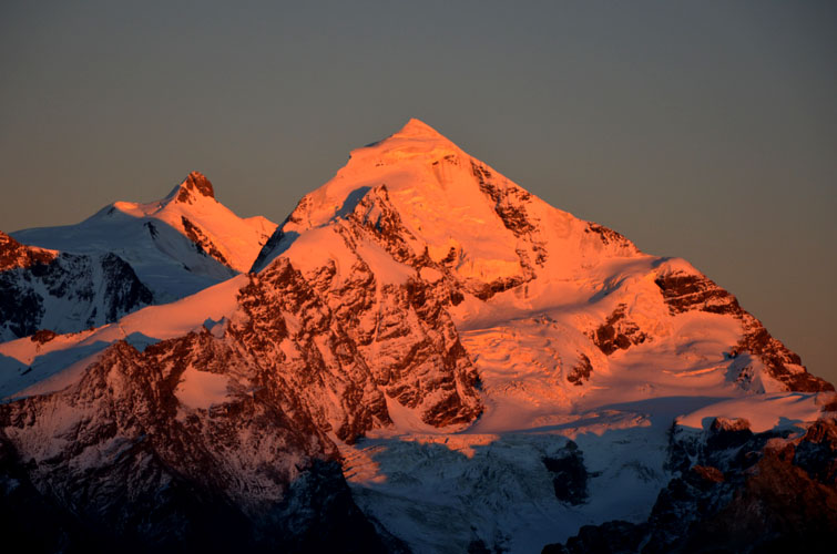
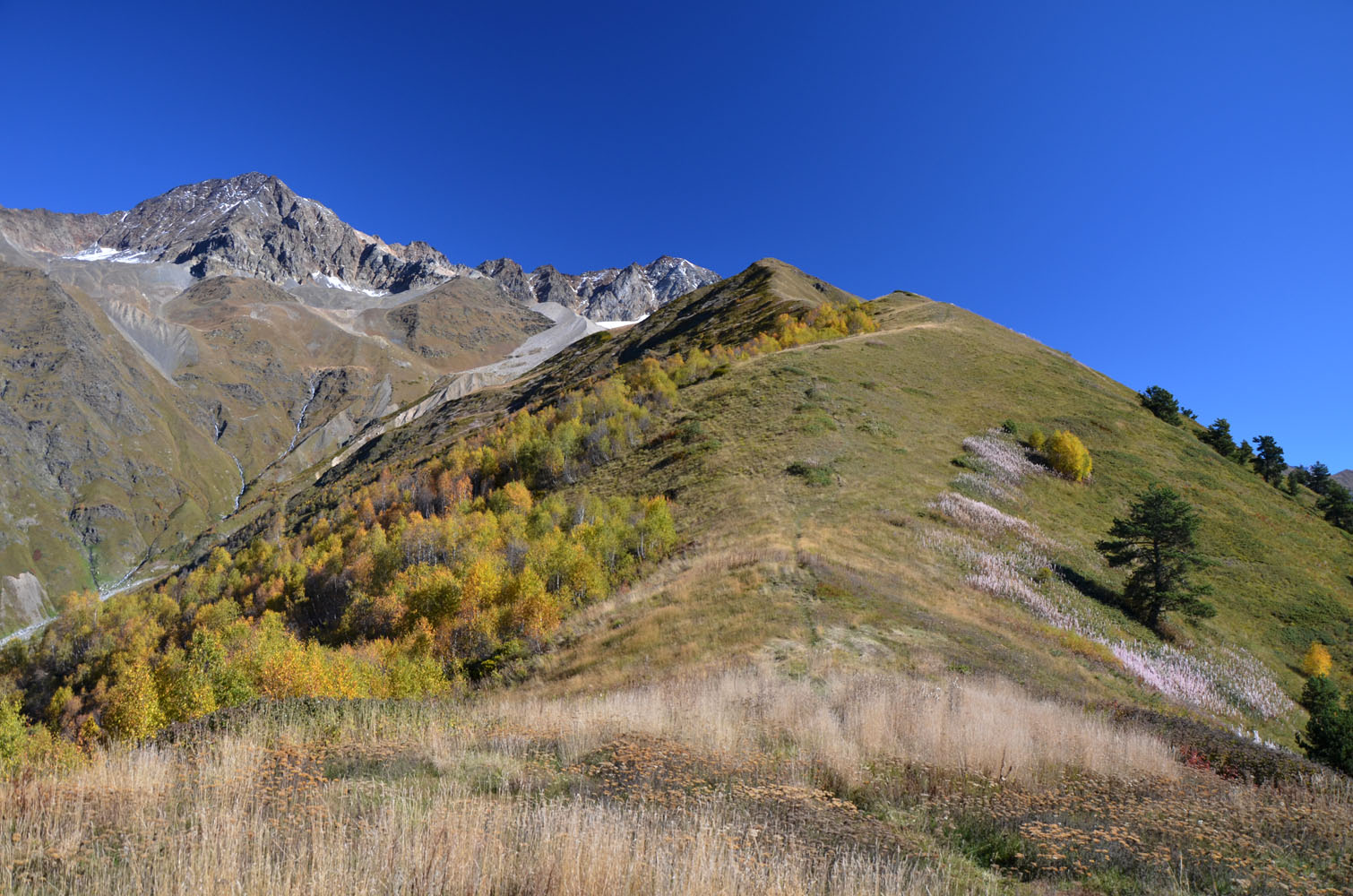
Our route took us through the village and across cow pastures to the lower, treed part of Chkhuti Ridge. Here, a good trail runs almost along the entire length of the ridge to a prominent marker at 3100 m: the Three Cairns, three large stone columns that mark the end of the regular Chkhuti Ridge hiking route. The views were gorgeous throughout, with the impressive Ushba (4710 m) on the left and equally beautiful Tetnuldi (4846 m) on the far right.
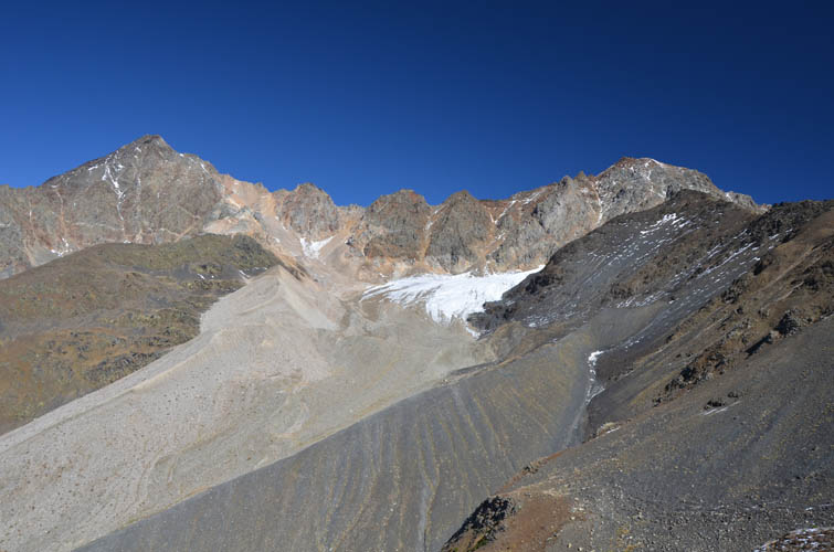
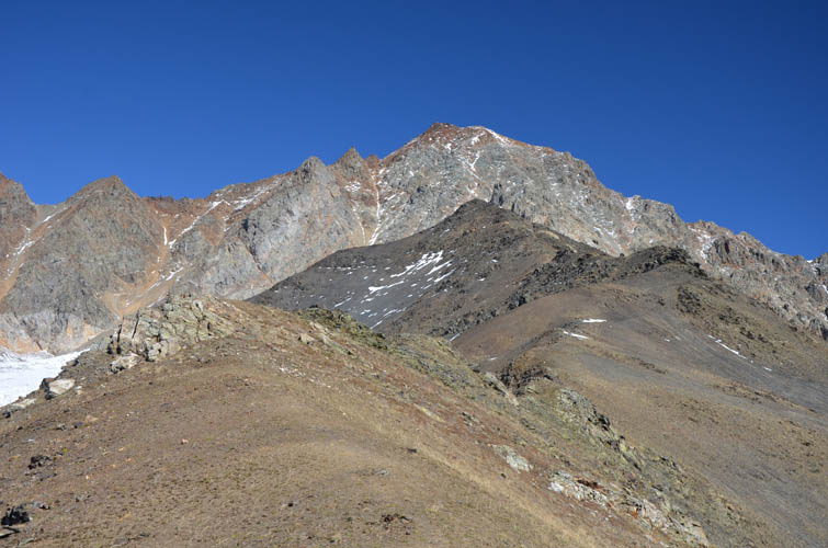
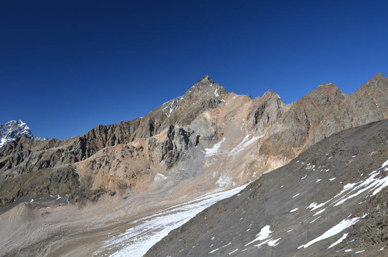
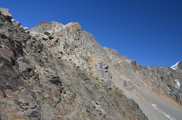
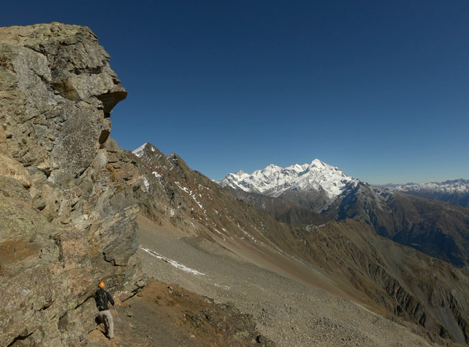
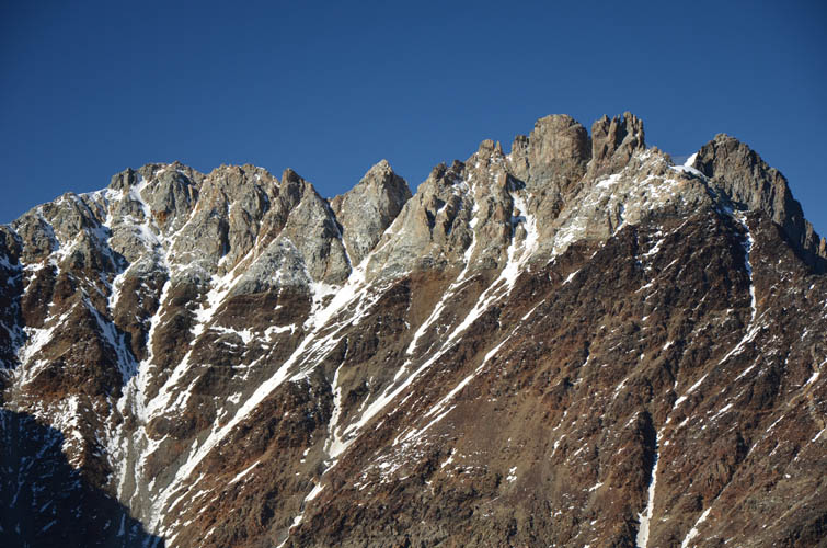
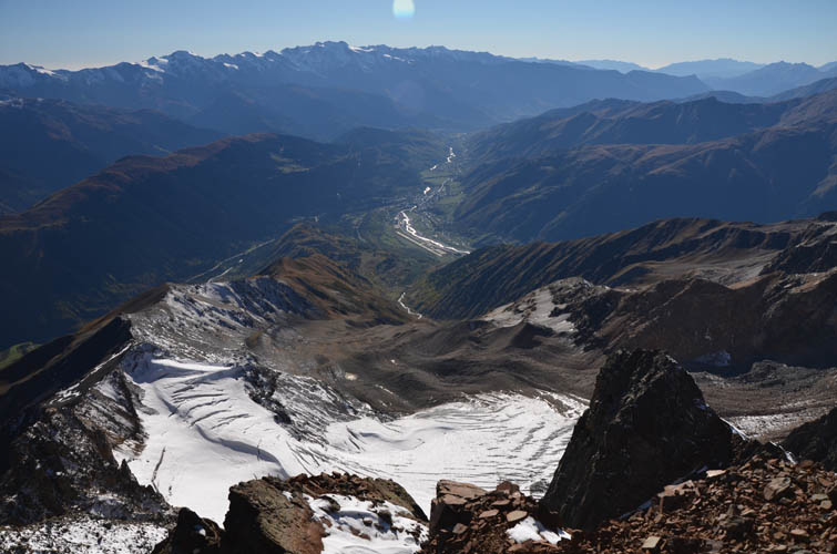
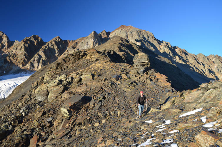
We took a short break, wolfed down our cakes and meat pies from the hostel, and continued our plod up the ridge. Not too many people seem to venture past the Three Cairns as evidenced by the fading trail ahead of us. It leads to one last single cairn standing guard on a nub, but then disappears completely. A noticeable change in terrain may be the reason – the ridge is now made up of dark shale and features several narrow, moderately exposed spots. Higher up, well past that last cairn, we came to a big roadblock. A vertical cliff with cracked rock slabs and jagged gendarmes prevented any further progress on the ridge top, forcing us onto a very narrow game trail on the right (east) that descends into a small talus basin. It’s not overly difficult, but the slope is angled, full of loose mud and shale, and exposed. A fall most certainly wouldn’t end well. We put away our hiking poles, donned our helmets and scrambling gloves, and carefully followed the faint path until we reached the talus basin below.
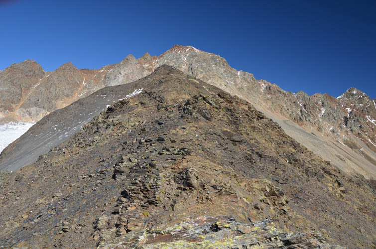
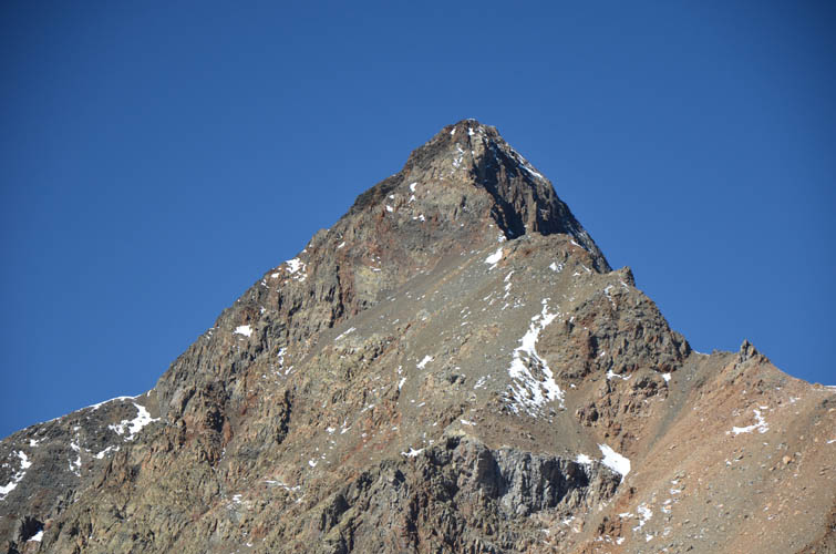
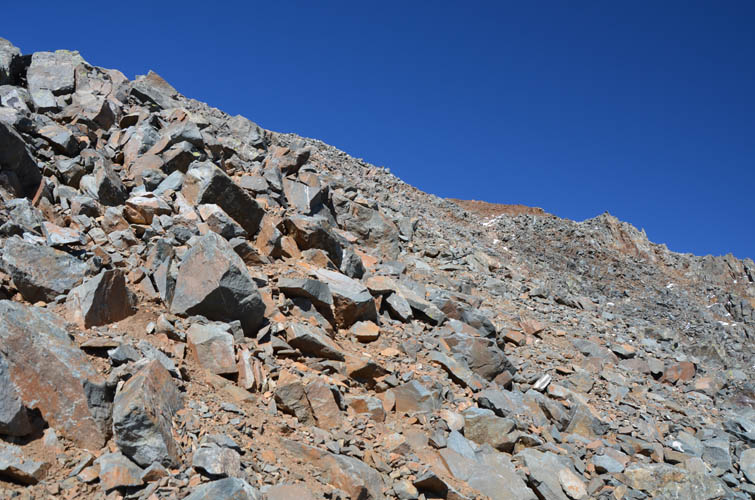
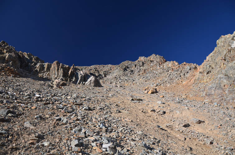
We were now at 3300 m, roughly 400 m below the summit. Looking up at the summit mass, the way ahead didn’t look pretty: lots of unstable boulders and loose rock chunks, with a gully in the middle filled with more loose rock and scree. Unpleasant terrain to say the least, and demanding scrambling terrain with significant rock fall hazard – the kind of place where it’s easy to get in trouble if you’re not used to it. As much as I would’ve loved to see my friend celebrate his first mountain summit, we decided it’d be safer for him to wait in the basin below. Felix was a really good sport about it and found a nice rock to lay on and listen to his podcast instead. In the meantime I started grovelled up the scree chute to gain the south ridge, where more crumbly rock awaited. The upper ridge is full of sharp blocky rocks that are barely held together by a matrix of soft brown mud. Near the top the angle eases on slightly more stable reddish rock where the south ridge joins the main E-W summit ridge. There were a few slightly exposed spots along this ridge to the summit cairn, especially with snow covering parts of it, but overall it wasn’t too bad.
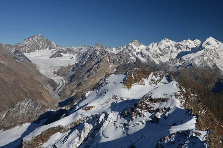
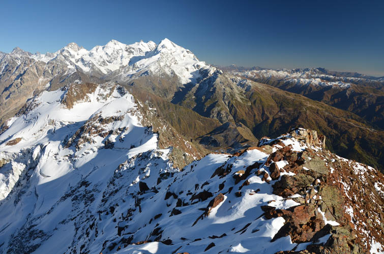
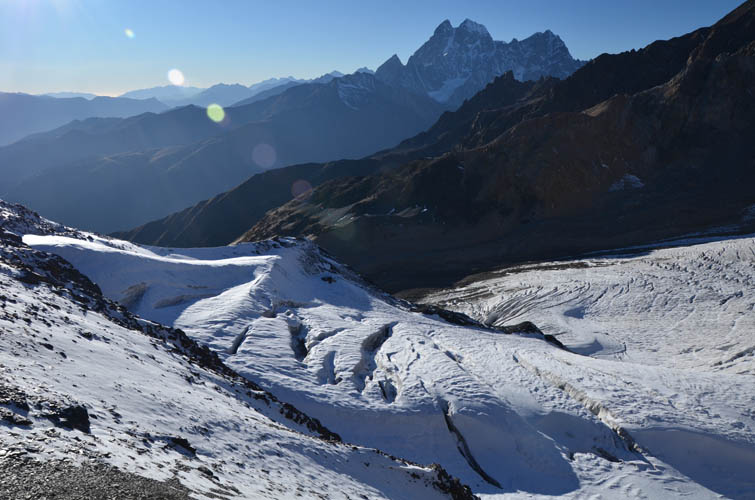
Incredibly, there was absolutely no wind up here at 3700 m! Just sun, blue sky, and an amazing panorama of glacier-filled valleys and mighty peaks all around me. A very special place indeed, one that simply makes you feel in awe of mother nature.
The descent on the summit ridge and down the scree gully was just as cumbersome as on the way up. The biggest danger here is rock fall, both natural and human-induced, so the key is to move very carefully while watching potentially crumbling rocks above you, and then to get out of the gully as quickly as possible. This can get tricky if several people are moving around here and I’m sure glad no one was coming up below me – they would’ve been showered with boulders and pebbles!
Back in the basin Felix was patiently waiting for me. He had scouted out potential routes back up the ridge meanwhile, but there seemed to be no alternatives as the ridge slopes were quite steep on all sides around the basin. We were left with no choice but to go back to the game trail that sneaks around the jagged gendarmes and then scrambled back onto the ridge crest.
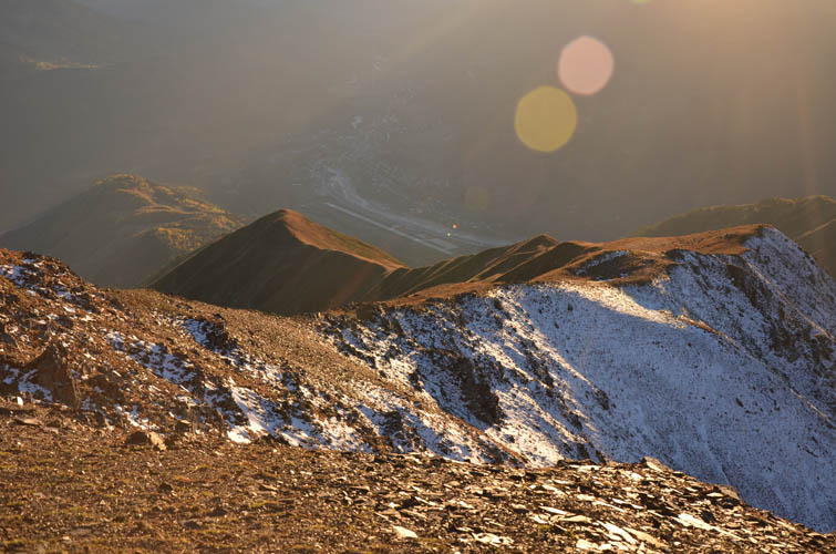
The descent on Chkhuti Ridge, though long, was relaxing and even more enjoyable than the ascent as we watched the sun set behind the mountains to the west. We had had this magical place to ourselves, without a soul around all day. A long, but hugely satisfying day in the splendid mountains of Svaneti. Thank you Felix for the wonderful company!
For those looking to do this with a guide, Misha of SvanAlp can be recommended.
| Elevation: | 3702 m (official), 3698 m (my GPS) |
| Elevation gain: | 2430 m |
| Time: | 12 h |
| Distance: | 21.0 km |
| Difficulty level: | Difficult (Kane), T5 (SAC) |
| Reference: | SvanAlp on Summitpost.com |
| Personal rating: | 4 (out of 5) |
DISCLAIMER: Use at your own risk for general guidance only! Do not follow this GPX track blindly but use your own judgement in assessing terrain and choosing the safest route. Please read the full disclaimer here.