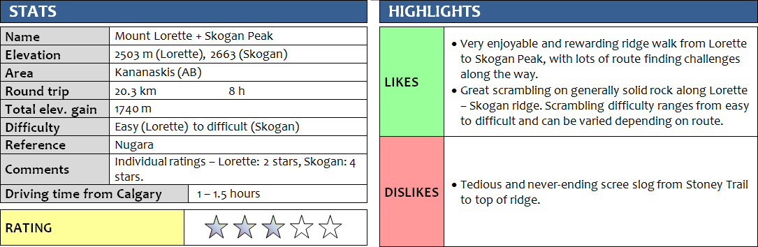
19 June 2017
Solo
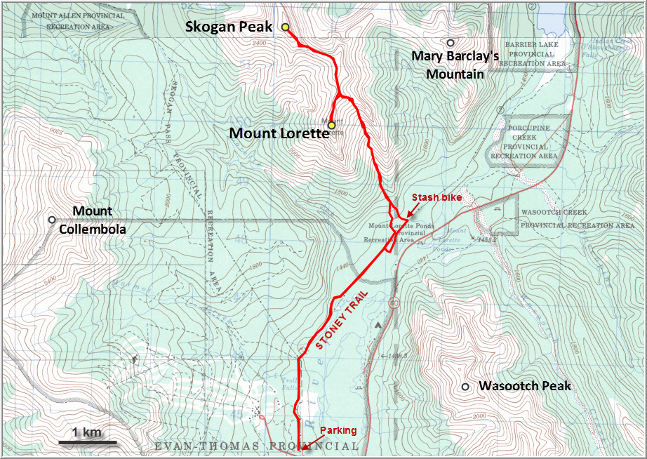
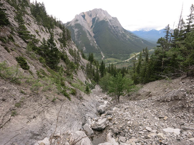
There is no denying it, the hiker’s/scrambler’s approach up Mount Lorette and its neighbour Skogan Peak is simply a terrible scree slog. While climbers appear to enjoy good, solid rock along Lorette’s south ridge (YDS up to 5.4 and lots of exposure), an easier and certainly much less elegant way of getting up there is to take the large drainage that comes down the southeastern side of the mountain and almost spills onto Stoney Trail. The route is well described in Nugara’s More Scrambles book.
Using a bike approach from the parking lot near the Nakiska ski resort, I thought I had made some good progress on the first 5 km along Stoney Trail, which is perfect for cycling… only to undo all my work by making a stupid mistake right at the beginning. I locked my bike to a big tree near the trailhead, and seconds later realized I had forgotten the key to the lock in the car. So I had no choice but to add on an extra 10 km walk at the end of the day, which wasn’t a pleasant thought to carry around while climbing the mountain for the next 8 hours. Well, some bonus exercise in beautiful Kananaskis, I told myself, so it wasn’t that bad.
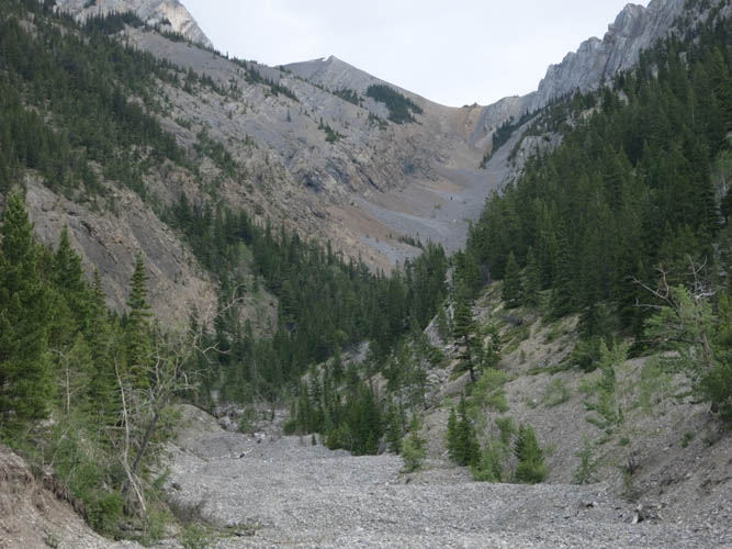
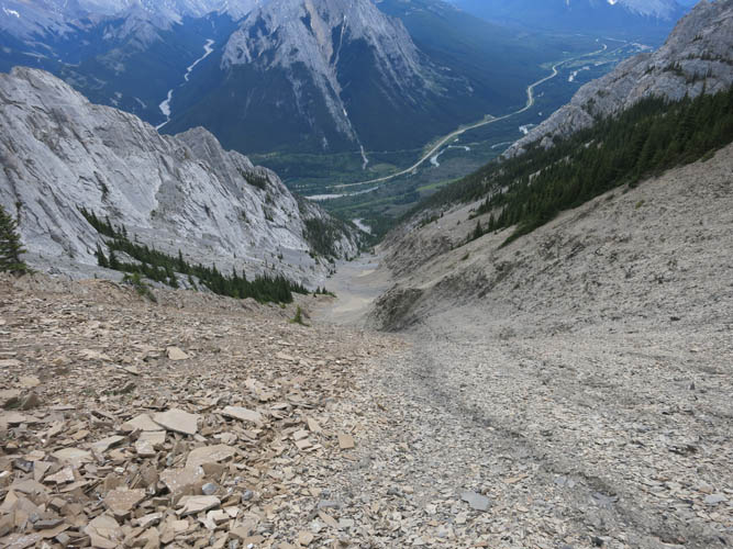
The approach in the drainage took much longer than I had expected. If there is a definition of foreshortening, this is it! There is a decent trail that has formed in the rubble, so all you have to do is put your head down and trudge on. Nobody else was around on this Monday morning so I switched to autopilot mode and just kept on tramping up. It gets steeper and looser near the top of the col and on to the first high point, but it’s really just an easy hike on unpleasant terrain.
From the high point to the summit I stuck to the ridge as much as possible and quite enjoyed the hands-on scrambling that some of the narrow sections and nubs offered. There is a beaten trail just below most of the ridge crest that avoids any narrow or exposed sections, which to my surprise would actually put the entire route into the easy category – contrary to Nugara’s “moderate” rating. You barely need your hands if you stick to the paths that have developed, it’s simply a walk along a moderate incline covered in solid rock, some scree and some grassy bits. After a short summit stay, I chose the easy route back to the high point.
The highlight of the day was definitely the traverse over to Skogan Peak. It looks a bit intimidating from a distance with its steep south face and craggy ridge, and it’s also 160 m higher. The ridge walk starts off easy, but soon becomes more demanding where the ridge crest narrows. There’s lots of room for variation and I really enjoyed the route finding and scrambling challenges along the way. There were a few cairns that helped and I built a few of my own to facilitate my return, but the terrain is complex and there’s lots of ups and downs over small bumps and inclined ribs and gullies. Much of the rock is very solid and a joy to climb over, other parts are full of loose rubble strewn over slanted slabs of limestone that require slow and careful movements. Once up on the false summit, the hardest parts were over and it was an easy scramble over to the true summit. Needless to say, the views are gorgeous here as Skogan is one of the highest peaks in the area. It also offers a unique perspective of Heart Mountain/Grant MacEwan Peak, the Twin Towers and Mary Barclay’s Mountain to the N and NE.
The return trip along the ridge was at least as enjoyable as the ascent. I stayed a little higher in some sections, trying to stick to the ridge crest whenever I could unless the overhangs or drop-offs got too serious. The cairns certainly made it easier, although there’s lots of different ways to tackle this terrain and good route finding skills are definitely a bonus.
After the long trudge back down the scree drainage and along Stoney Trail to my car (and back to my bike again!), I could only conclude that Skogan Peak is what really made this trip interesting and worthwhile. Mount Lorette on its own is hardly anything special and really didn’t stand out to me. If you have the energy for a longer day and are interested in more demanding scrambling, then combining Lorette with Skogan is definitely the way to go.
DISCLAIMER: Use at your own risk for general guidance only! Do not follow this GPX track blindly but use your own judgement in assessing terrain and choosing the safest route.
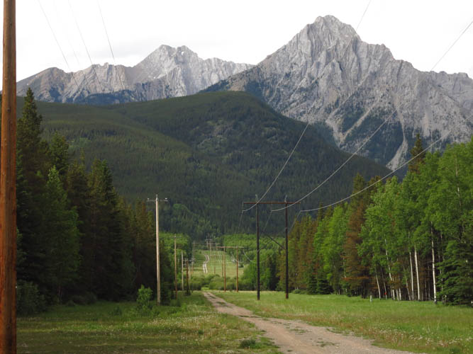
From the parking lot, both Mount Lorette (R) and Skogan Peak (double summit on L) are visible. Stoney Trail follows the power line in the valley.
The approach drainage on Lorette’s SE side.
Wasootch Peak on the other side of the valley is a neat little scramble that starts right from Hwy 40.
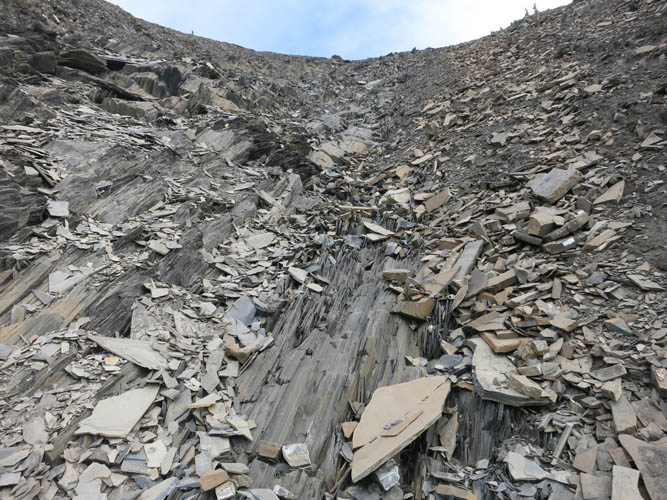
Shale – the reason for the abundance of loose scree in this drainage.
After a couple of hours, the endless scree drainage is finally behind me.
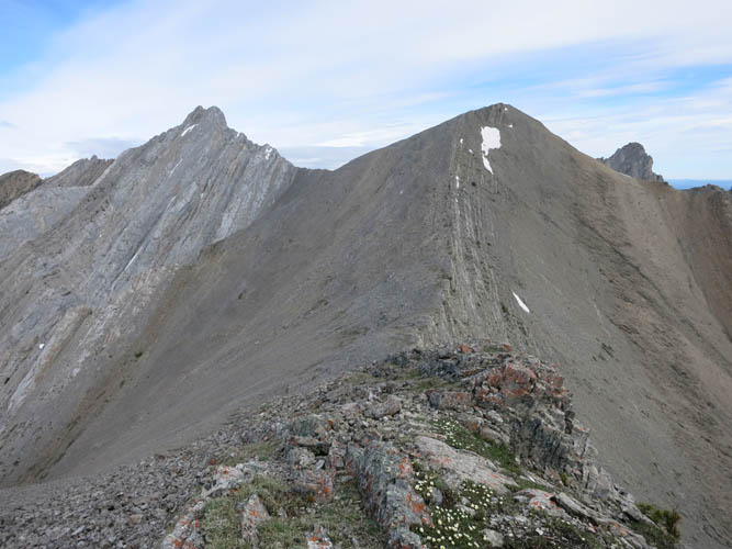
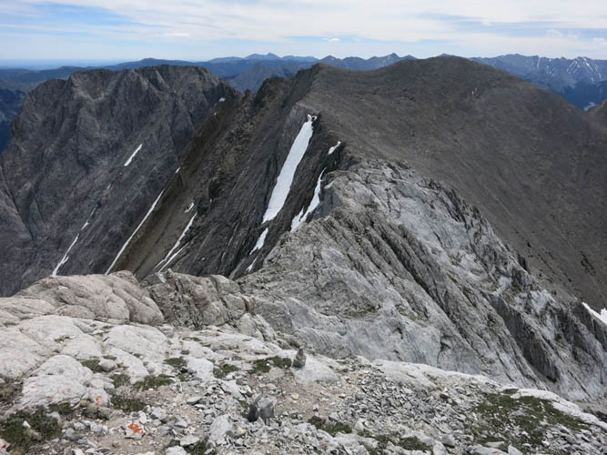
From the high point on the ridge Skogan Peak can be seen on the left.
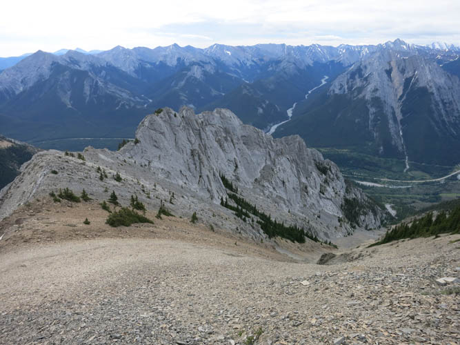
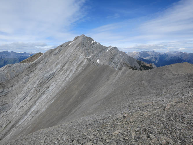
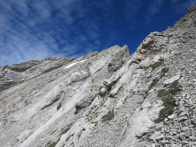
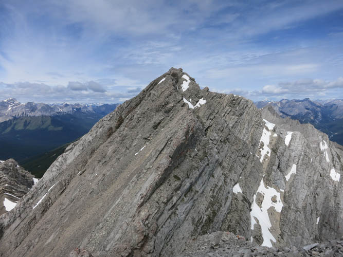
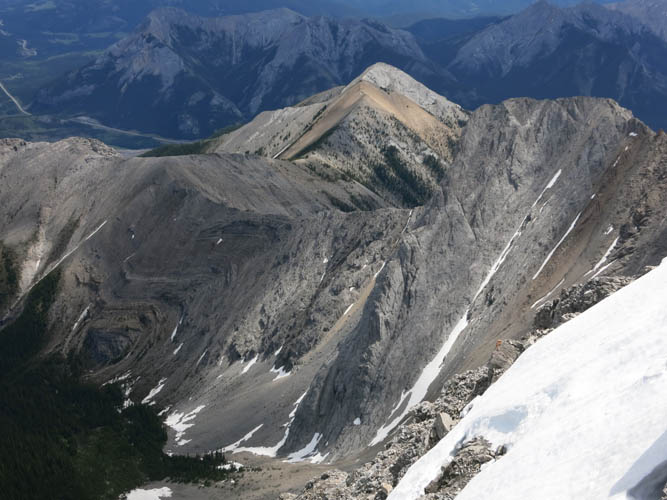
To the south is Mount Lorette. It looks much more challenging than it really is.
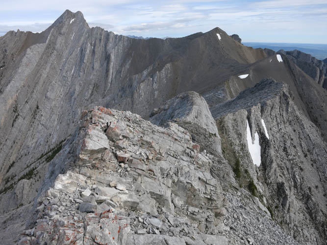
Sticking to the ridge crest, there are some fun challenges here between the high point and Mount Lorette. Easier options exist just off the crest where faint trails exist on the western slopes.
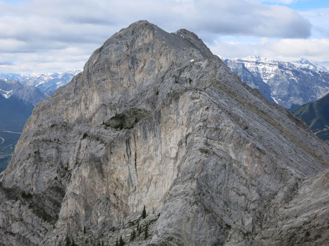
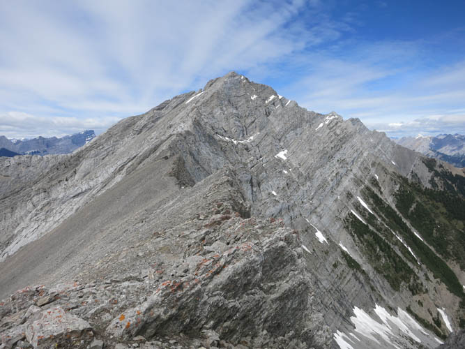
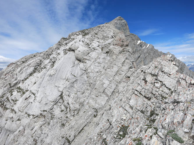
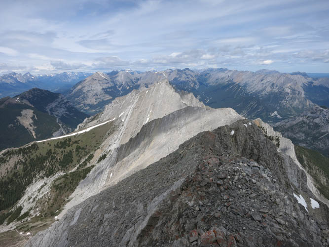
Looking over at the two “ears” of Skogan Peak from the summit of Mount Lorette.
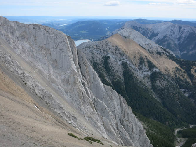
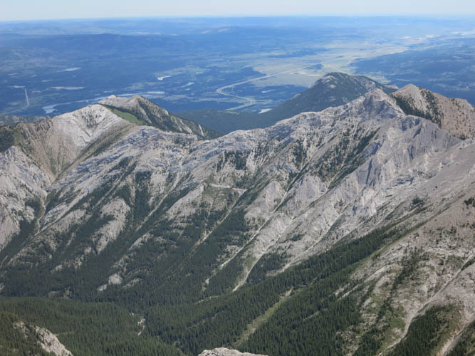
Much of Lorette’s east side features a steep drop. Barrier Lake is just about visible; the peak with the brown shale to the right of the lake is Mary Barclay’s Mountain.
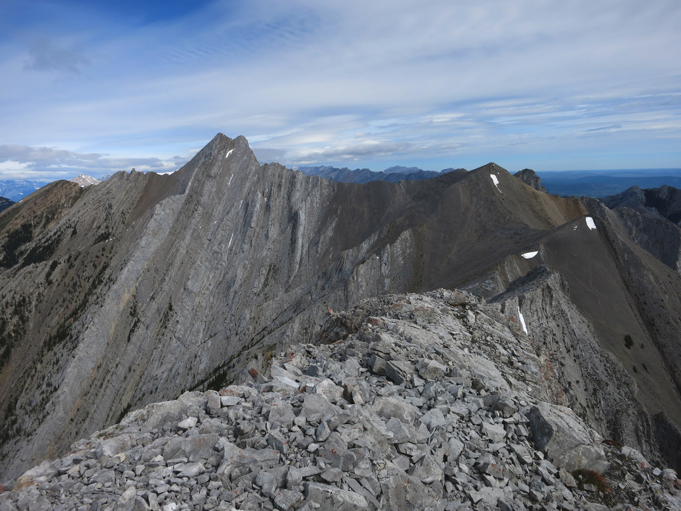
On the connecting ridge from Lorette to Skogan.
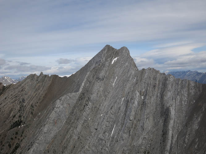
Most of this ridge walk is fairly easy, but the closer you get to Skogan the more demanding the scrambling.
Skogan is a great scramble! Wherever the ridge crest gets too hairy, scrambling down the slabs on the left (south) opens up detours and bypasses around the obstacles.
The rock is mostly solid and grippy.
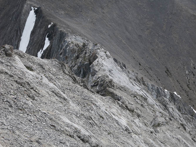
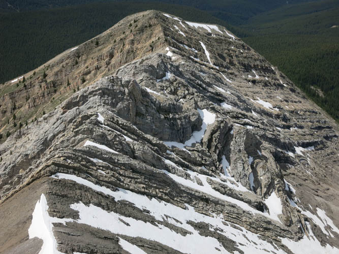
A look back along the ridge. The challenges really appear with the change from brown shale (background) to light grey limestone/dolomite (foreground). This is the typical pattern in the Rockies: soft brown = brittle and gentle, resistant grey = steep and solid.
Steep slabs mixed with rock ribs and scree slopes.
Parts of the ridge here are quite exposed.
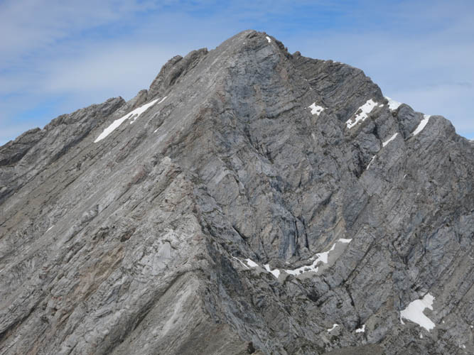
Almost there – the summit of Skogan Peak.
Further north along the ridge is Mount McGillivray, with an unnamed peak in between.
The four summits of Mount Lougheed (I to IV from R to L), II being the true summit. The wide brown ridge in the foreground is part of Mount Collembola with its summit on far left.
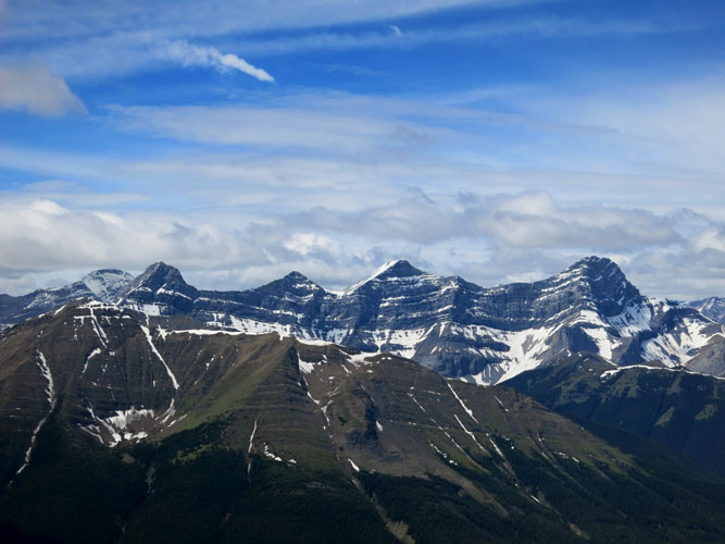
The Three Sisters near Canmore (L to R): Little, Middle and Big Sister.
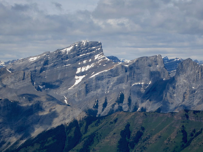
Grant MacEwan Peak at Heart Mountain looks more like a flat ridge on the left of this picture. The Twin Towers on the right see much less traffic than Heart, but offer more serious scrambling.
One of Skogan’s side ridges that extend down into the valley to the south exposes intensely folded beds.
More folding can be seen in the valley to the north. The peak with the brown shale is Mary Barclay’s Mountain.
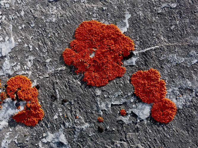
Colourful lichen provide a nice contrast to the grey rock.
The scree in the approach drainage makes for a relatively fast descent.
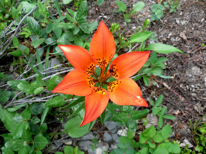
A western red lily by the Stoney Trail. This is Saskatchewan’s provincial flower.