Graubünden, Switzerland
29 August 2017
With mum & dad
The Jakobshorn is the Hausberg of Davos – the closest hill located right at the doorstep of town and hugely popular with tourists and locals alike. A gondola takes up the hordes in summer to a restaurant complete with viewing platform, and the “adventurous” ones can even walk another couple hundred metres directly to the summit. In winter time, the slopes around here are busy with skiers and snowboarders, but the gondola operates year-round so you’re almost guaranteed to see other people up here at any time of the year.
With that in mind, I mentally prepared myself for a shoulder-rubbing tourist plod on this beautiful sunny day. To my delight, my fears were unfounded. Yes, there were a few dozens of people in the vicinity of the Jakobshorn summit bump, but the crowds quickly disappeared as soon as one ventures along the long and easy N-S ridge that connects the peak to the Jatzhorn.
Instead of taking up the gondola like my parents, I decided to hike up from the small village of Teufi in the Dischma Valley to the east. There are perhaps a handful of established hiking trails that go up to the Jakobshorn from Davos and surroundings below, and the path from Teufi is probably one of the least frequented as it doesn’t start directly from the town. I was all by myself as I walked through forest and meadows on the many switchbacks, slowly gaining elevation. Only cows and horses kept me company at the beginning as I had to cross several pastures. In Switzerland, pastures are almost always surrounded by electric fences to keep the grazing cows from wandering off too far or into a neighbor’s field. Hiking trails often cross these pastures but hooks and latches make crossing the fences easy.
Still some 20 minutes away from the summit, I could already see my parents waving at me from the ridge above. It was a gorgeous bluebird day and although the Jakobshorn is only a minor peak the views were very much worth it.
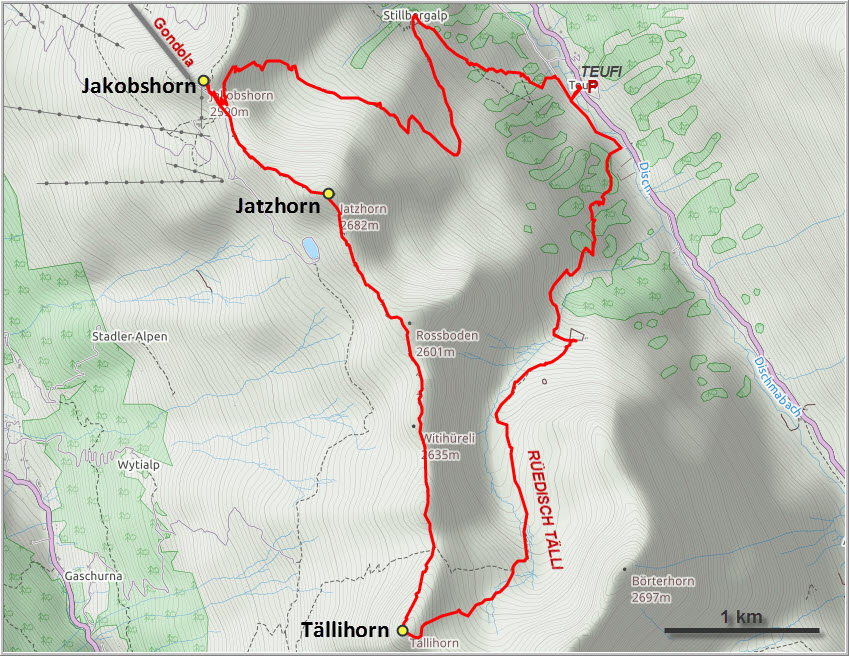
There is a very good trail along the ridge that goes south from the Jakobshorn via the Jatzhorn to the Tällifurgga pass, where one can either descend west into the Sertig Valley or east into the Dischma Valley back to Teufi. My parents had done the ridge walk before, but neither could remember how many ups and downs there were along the way! It was very enjoyable and in the end a bit more strenuous than they had thought – but then again, what pensioners in their 70s and 80s can still conquer mountains and overcome 500 metres of elevation gain, not to mention the 1200 m descent that followed?! They are simply in impressive shape and I am hugely proud of them!!
With an elevation of 2650 m, the Jatzhorn is about 100 m higher than the Jakobshorn, but much, much less crowded. The trail continues over a minor bump called Witihüreli before descending to the Tällifurgga pass. The next peak south is just a short distance from the pass, so while my parents started their descent down to Teufi, I enjoyed some easy to moderate scrambling along the now trail-less ridge to the so-called Tällihorn. A pile of rocks marks the 2670 m summit, which clearly doesn’t see a lot of visitors. Looking south, it probably would’ve been easy to continue on the ridge quite easily to the nearby Wuosthorn, but enough is enough and I really wanted to join my folks again on the way down.
Initially a pleasant stroll through a broad and empty valley called Rüedisch Tälli, the trail subsequently became steeper and much rougher than anything we had seen today. In places, the path resembled more of a washed out creek bed than a hiking trail, and we all took our time to make sure nobody slipped on the many rounded pebbles covering the track. “Slow is smooth and smooth is fast” goes a military saying, and that certainly held true on our descent that seemed to take forever to complete.
With sore feet but happy faces we got back to Teufi and the much-awaited comfy seats of our car. For avid hikers, this loop makes for a nice day trip that takes in two peaks (and a third if you’re up for a short scramble), although the views aren’t quite as impressive as those from other nearby mountain tops.

DISCLAIMER: Use at your own risk for general guidance only! Do not follow this GPX track blindly but use your own judgement in assessing terrain and choosing the safest route.
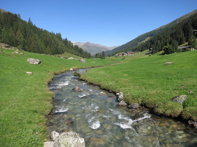
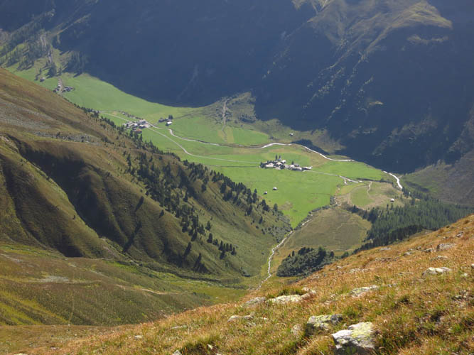
The lovely Dischma Valley.
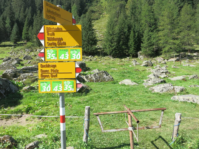
Trail junction for the hike up to the Jakobshorn.
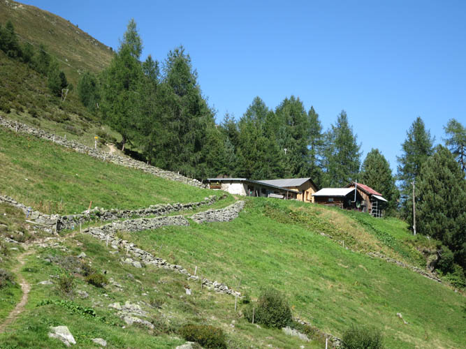
The path passes by the Stillbergalp, a small farm on the mountainside.
Looking back down open slopes towards the Dischma Valley. The prominent peak on the horizon is the Schwarzhorn.
View towards the Seehorn (2238 m) in the north. The craggy ridge in the back includes the Rätschenhorn (2703 m) and Madrisa (2826 m).
Wide open slopes grant an unobstructed view of my first peak, the Jakobshorn (just left of centre).

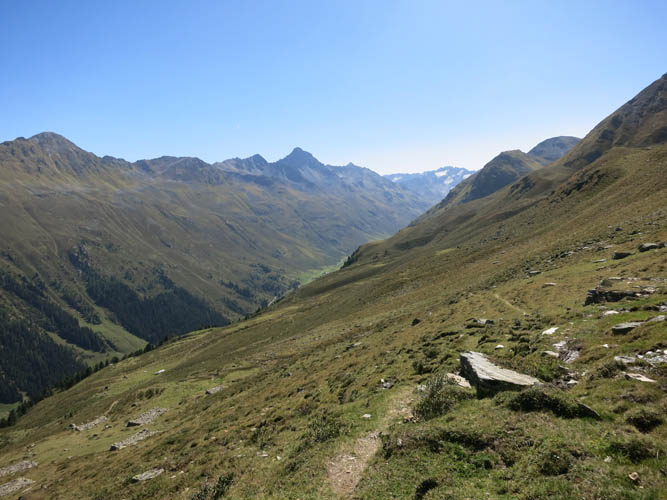
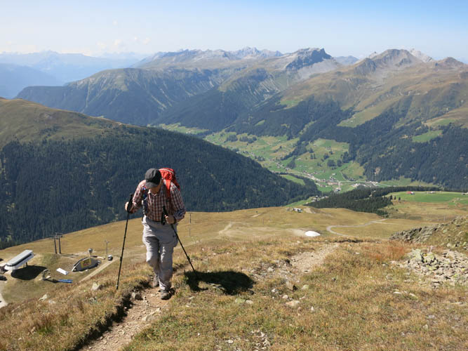
After all the hard work is done, I look back down at the broad valley where I came from.
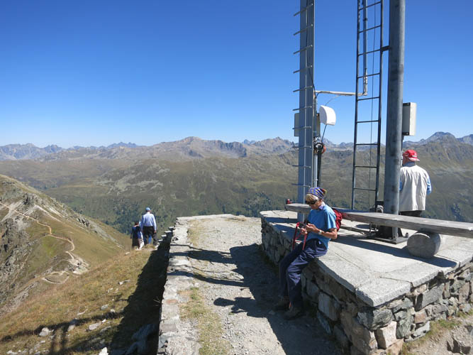
Jakobshorn summit.
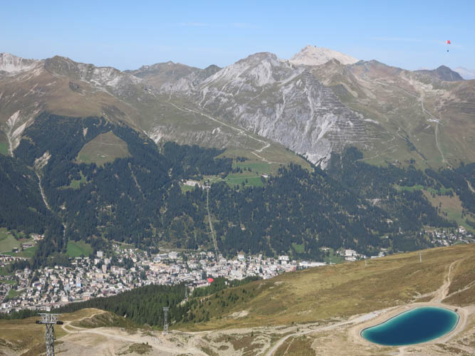
Just down the hill is the town of Davos. Even the paragliders are out on this beautiful day (upper right corner)!
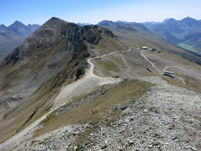
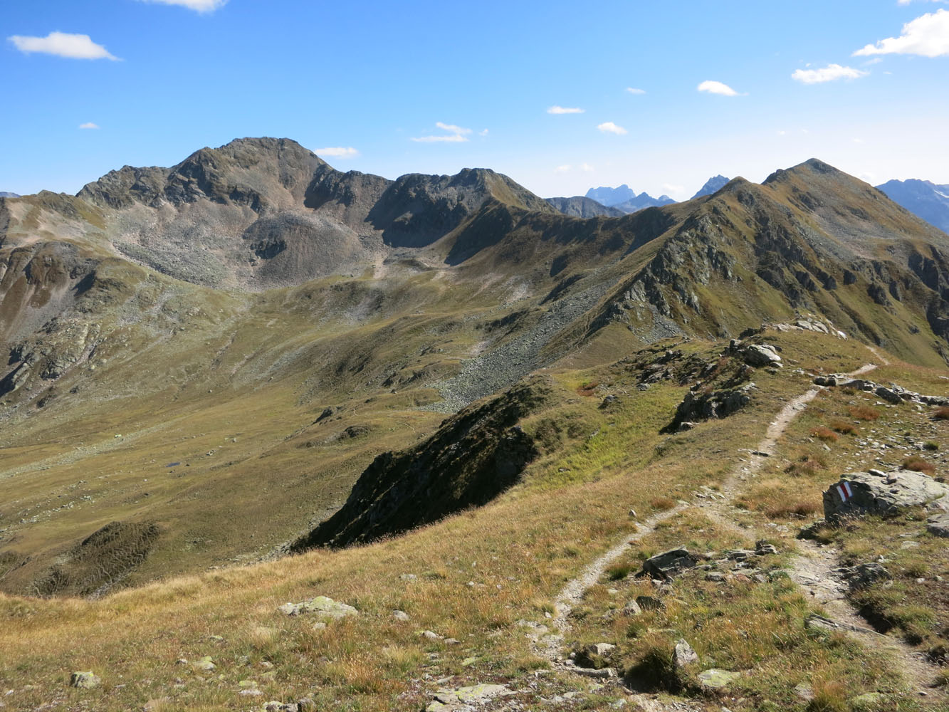
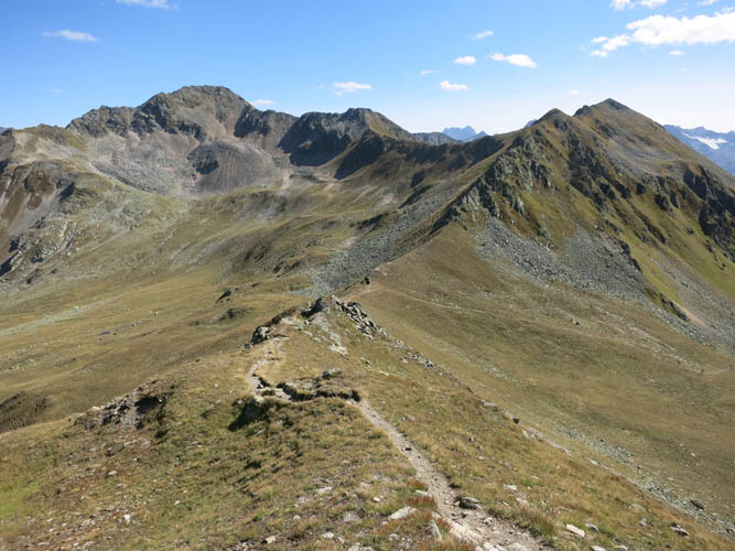
The long ridge ahead towards the south.
My dad along the ridge in perfect hiking weather.
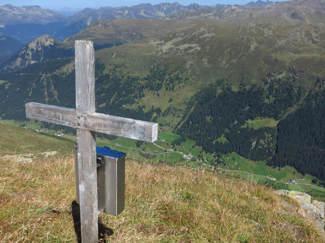
Jatzhorn summit cross, looking down into the Dischma Valley.
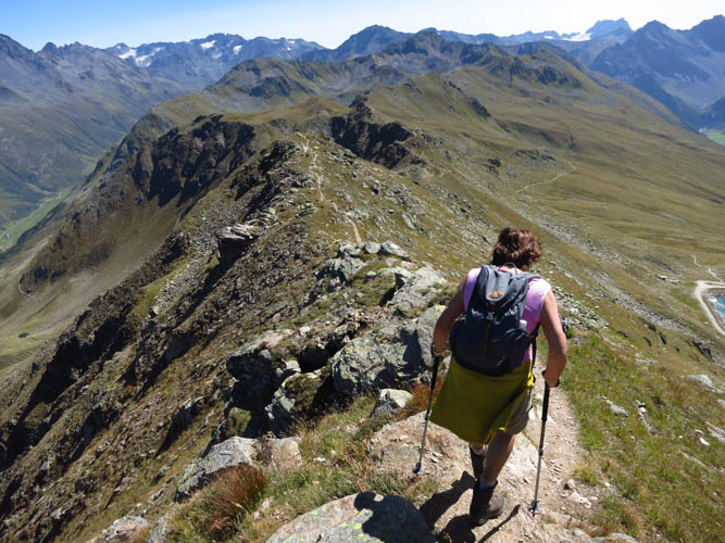
My mum continues on the trail that follows the crest of the ridge.
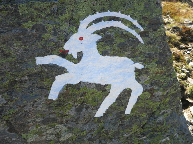
Steinbock (ibex) ahead!
It’s mostly an easy ridgewalk.
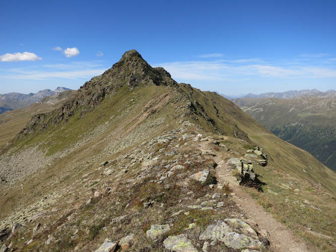
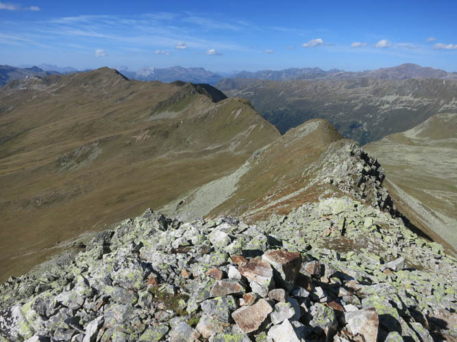
The ridgewalk ends at this saddle, where the trail splits with one branch going down the west side (right) and the other going down the east side (left). Continuing on to the Tällihorn (right peak) is a moderate scramble.
Looking back along the ridge from the summit of the Tällihorn. Quite a few ups and down on this ridge!

There’s no register at the summit, just this small badge tied around a rock in the cairn.

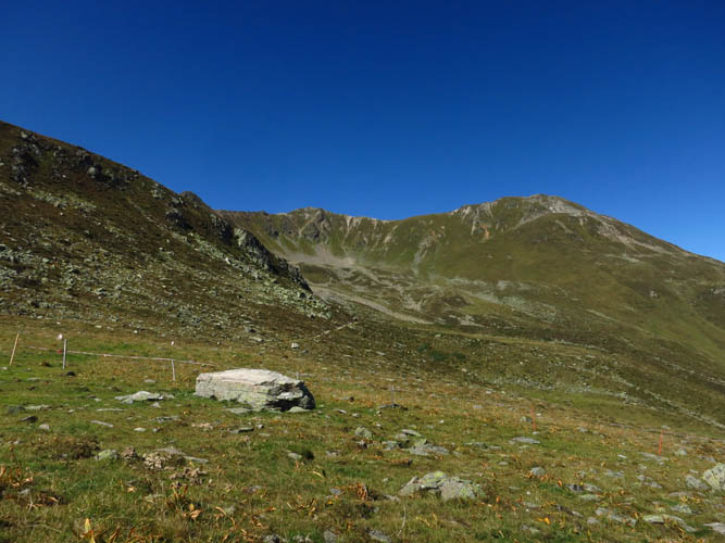
This peak is called the Wuosthorn.
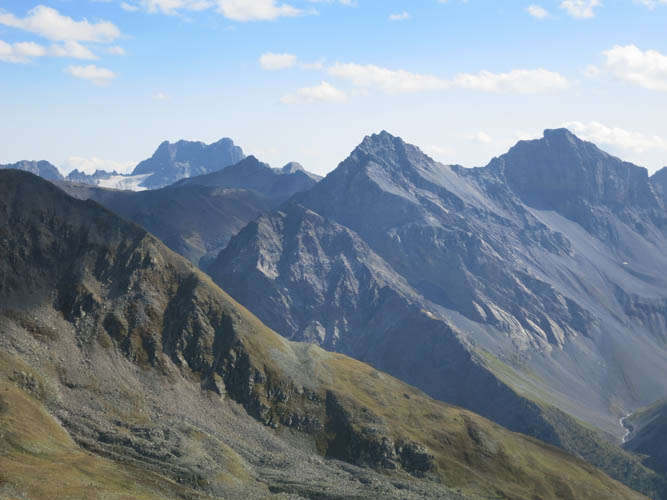
View towards the south: Piz Kesch is the highest at 3418 m (far left).
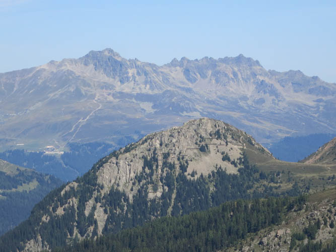
The village of Sertig in the valley to the west.
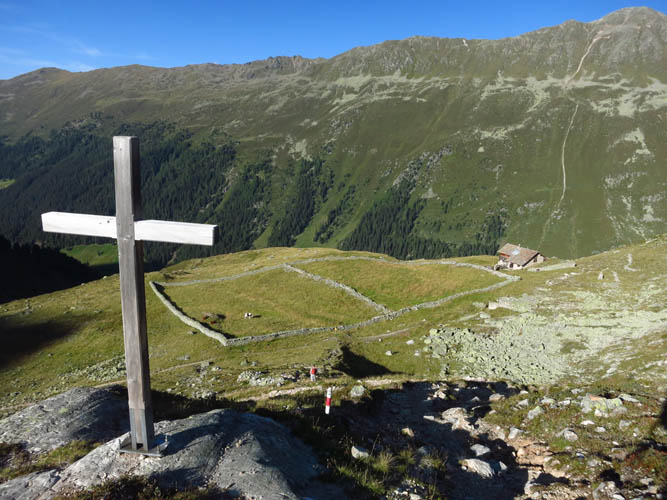
On our descent, we pass by this wooden cross that overlooks the isolated Alp Rüedischtälli farm.