Ghost, AB, Canada
12 + 13 September 2019
Solo
A beautiful trip into the Ghost along Waiparous Creek
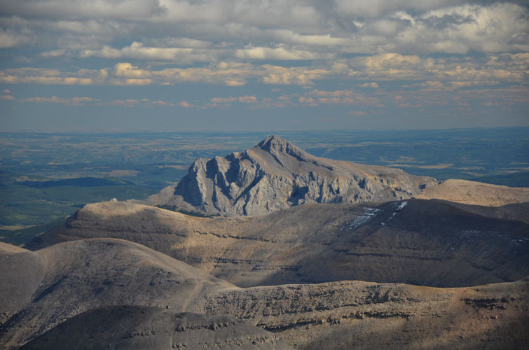
Although clearly visible from Calgary as a major peak, Mount Davidson is rarely ascended due to its remote location in the northern part of the Ghost. I’ve been toying with the idea of hiking into the Waiparous Creek Valley and ascending Davidson for a long time, and my interest got rekindled when I read about a snowshoeing trip by Vern Dewit and Eric Coulthard to a nearby peak which they dubbed “Waiparous Peak” in 2017.
Mount Davidson has a really interesting backstory. It was officially named in 1935 after James Wheeler Davidson (1872-1933), a prominent Calgarian of international stature, but somehow a mistake was made and the name never appeared on government maps. The omission wasn’t noticed until 2003 when a group of Rotary Club members made plans to climb the peak. The Geographical Names Board of Canada was contacted and Mount Davidson was finally put on the map. Rotary Club members and friends led by Robert Lampard subsequently organized a trip up the mountain on August 2nd, 2003 (only a few actually hiked all the way in, most were helicoptered into the upper Waiparous Creek Valley). They built a cairn, placed a capsule with Rotary Club paraphernalia and a summit register, held a formal meeting, and even drank champagne up there! For the full story, see this article on Peak Finder. Note that the first recorded ascent of Mount Davidson was by Frank Campbell and Karl Nagy on October 22nd, 1988.
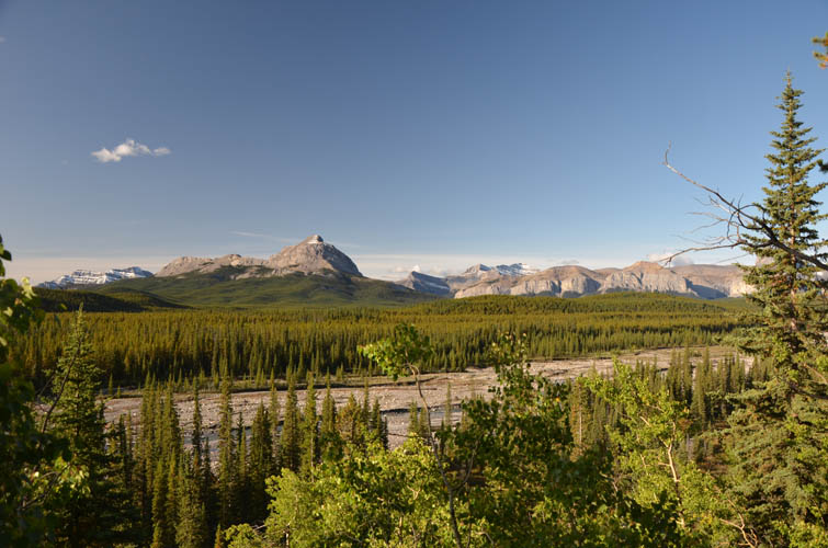
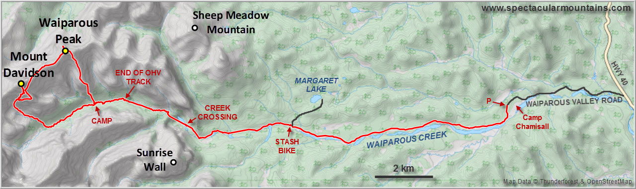
There was no champagne in my pack when I decided to head up Mount Davidson in early September 2019. The problem with getting into this area really is access. It takes about an hour and a half to drive from Calgary to the start of the Waiparous Valley Road, then another 20 minutes or so to go west along this gravel road until the road gets too rough to continue. I was able to drive for about 5 km with my van before puddles covering the road got too big for my liking, so I parked on the side and continued by bike.
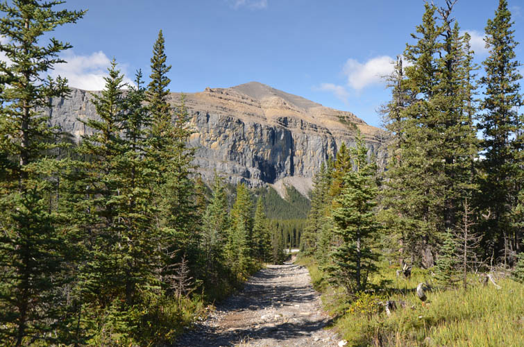
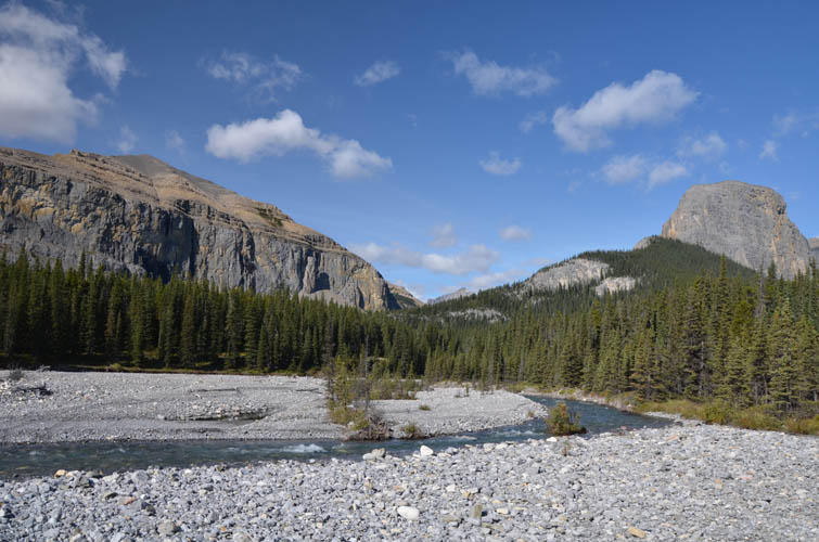
The bike ride west towards Margaret Lake was pretty quick and enjoyable. With a high-clearance 4WD you could probably cover about half of this distance, then there’s a muddy section with deeply carved holes where even jeeps might get stuck. At the turn-off to Margaret lake (13.5 km from the start of Waiparous Valley Rd at Hwy 40) I stashed my bike and continued on foot. There’s an old track that continues west towards the mountains but OHV’s are no longer permitted here and the track is now blocked with berms and ditches. Between here and the start of the mountains the track crosses Waiparous Creek about six times, so there’d be no point in bringing a bike anyway.
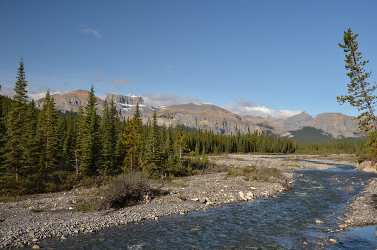
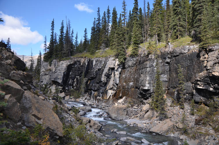
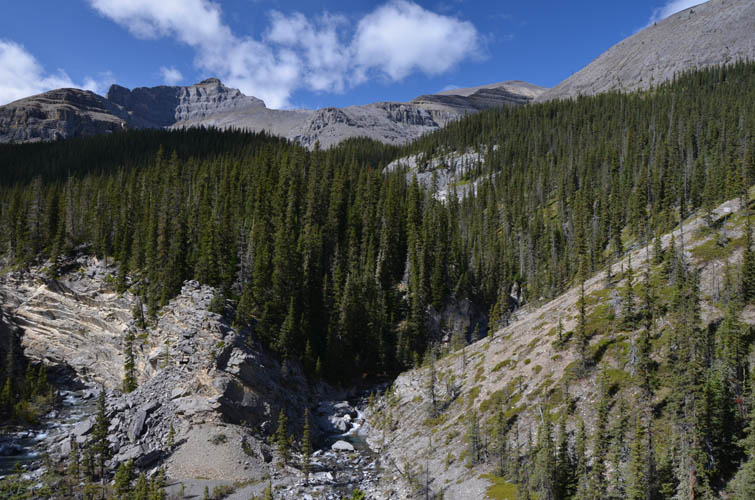
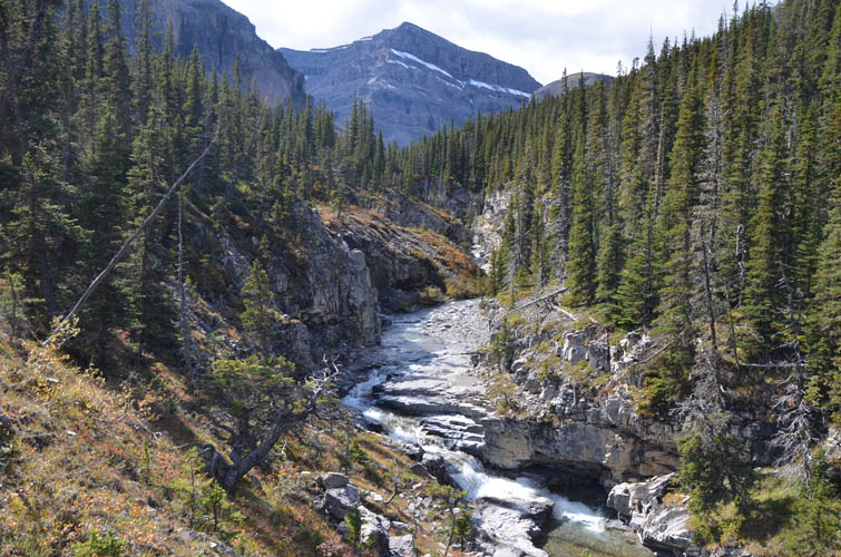
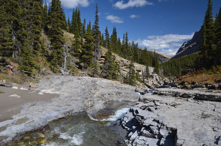
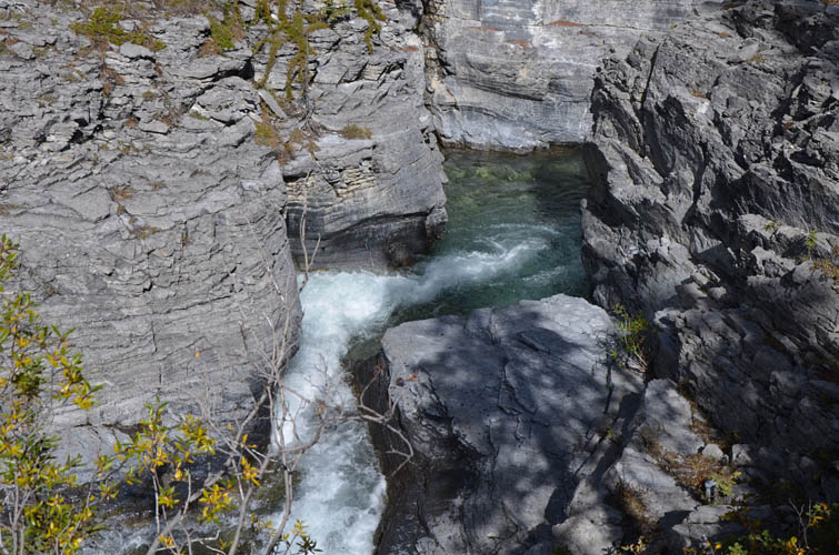
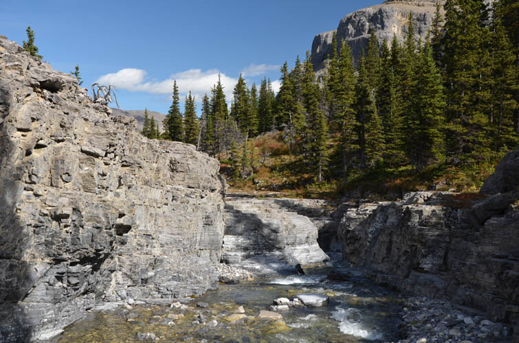
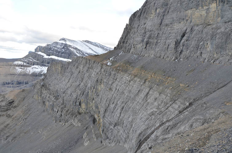
I brought my old creek-wading sneakers but only had to use them for the last crossing. Fortunately, I was able to avoid all other crossings by staying on the northern side of the creek wherever the track crossed south. Sticking closely to the creek worked well, although a couple of times I had to do some light bushwhacking through the forest to avoid steep, rubbly washouts by the water (on the way back I found a more efficient route by sticking even closer to the creek). The final, unavoidable crossing was about calf-deep and only five metres across. Once across the water I easily followed some cutlines for another 2.4 km to the end of the former OHV track. A faint trail continues up the valley, but soon becomes very difficult to follow. Clearly someone blazed this trail a long time ago as evidenced by cut tree branches, however it seems it hasn’t been used in decades. I found that sticking as closely to Waiparous Creek as possible worked best to find any trace of the path because the forest is generally thinner there. It’s a wild and beautiful hike, with plenty of opportunities to stop and admire some really interesting features in the creek that has cut a canyon into the bedrock in many places. There are numerous picturesque waterfalls, pools filled with crystal clear water, overhangs and rock slabs that make this a very entertaining walk. Still, it takes quite a bit of time and energy (and some patience to bushwhack) to reach the upper part of the valley – it’s a long approach!
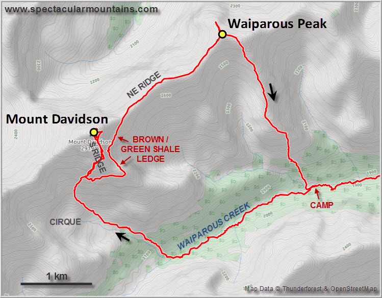
My plan was to scramble up Mount Davidson first, hopefully find a way to traverse over to Waiparous Peak (which lies along the connecting ridge NE of Davidson), and then return to the creek by way of the ascent/descent route that Vern and Eric had used for Waiparous Peak. It was 1:30 PM by the time I arrived at the intersection of my loop route. There was a small grassy bench right by the creek, just big enough for a tent, so I dumped my heavy overnight pack with the intention of setting up camp here by the end of the day.
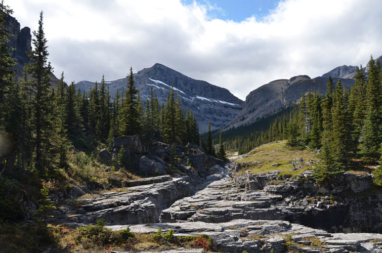
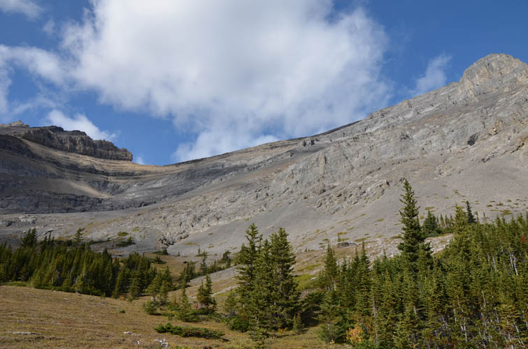
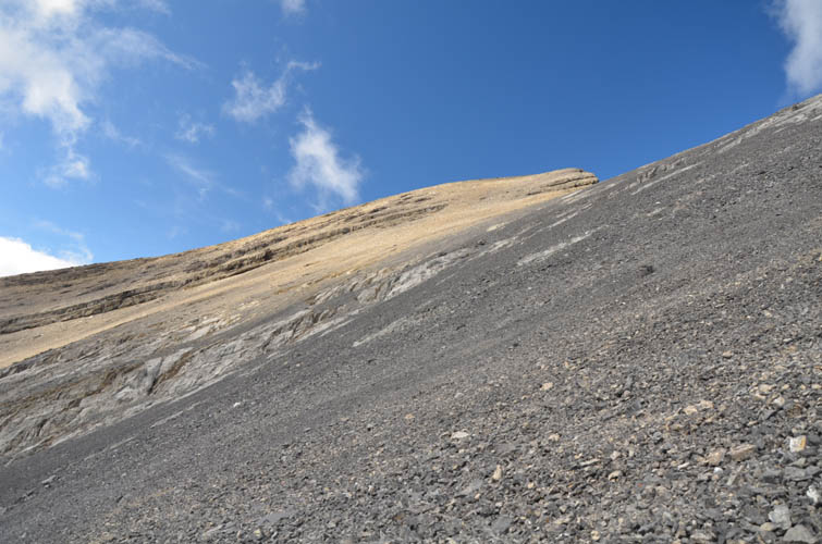
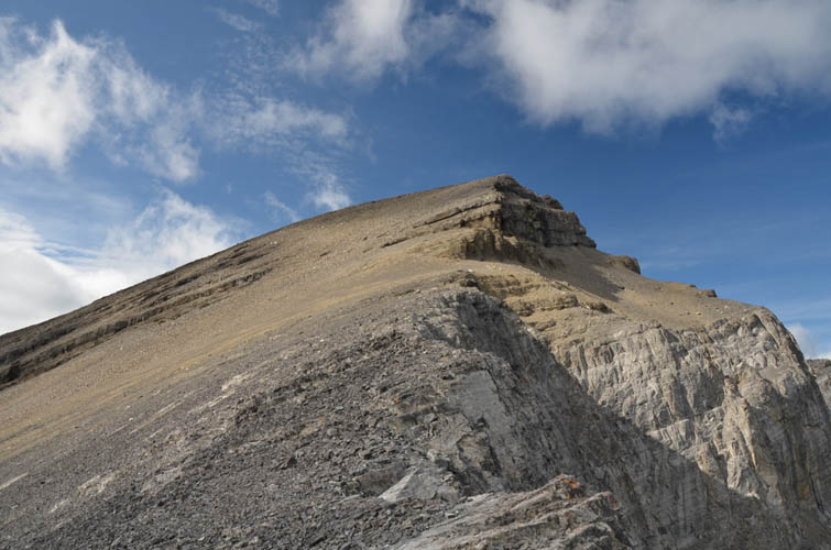
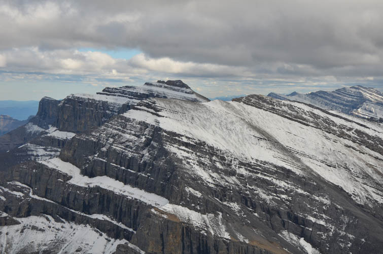
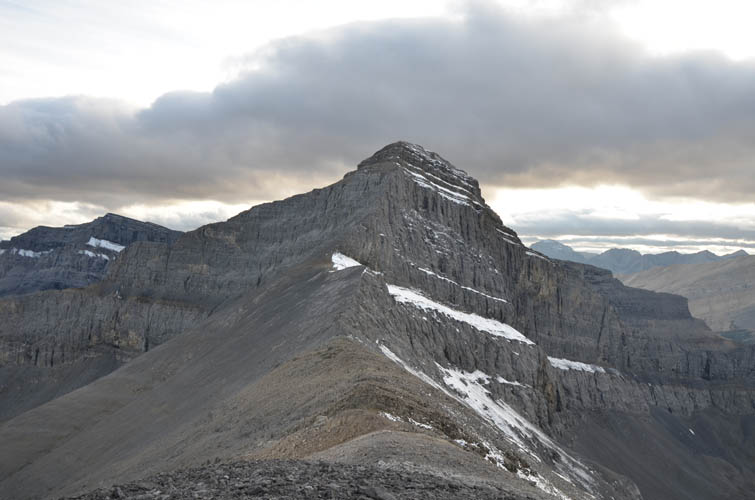
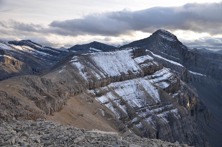
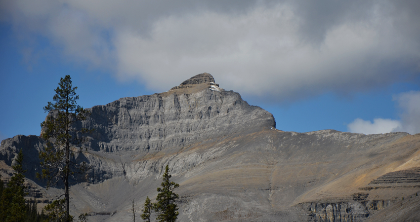
With just a light day pack on my back I made quick progress as I continued up the valley, still sticking to the south side of the creek. There were no more traces of a trail here, but at least the bushwhacking wasn’t too bad. After about 2 km I crossed the stream and headed up a tributary coming in from the northwest, staying on the mostly open grassy right side. Soon the valley opened up and I stepped into a beautiful cirque blanketed in lovely meadows. The route up Mount Davidson was now pretty obvious: continue north towards the first rock band, then angle slightly right up rock steps and scree towards the top of the south ridge. A short scramble leads to the summit. This is probably the most direct route and overall no more than a moderate scramble by Kane difficulty standards.
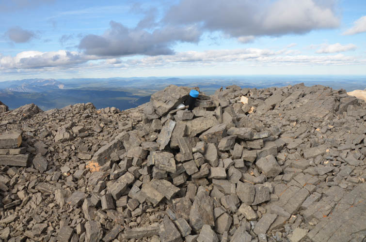
Hidden in the summit cairn was a big plastic capsule that I couldn’t open plus a white plastic Alberta Centennial register placed in 2005 (Jill & Scott Davidson), with only one other entry from 2010 (Alistair Des Moulins). No visits in almost 10 years! Well, given the long approach it wasn’t really a surprise to me.
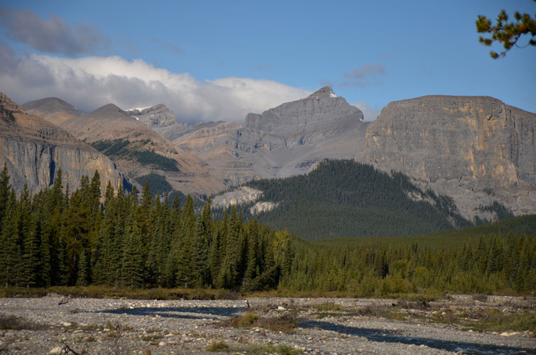
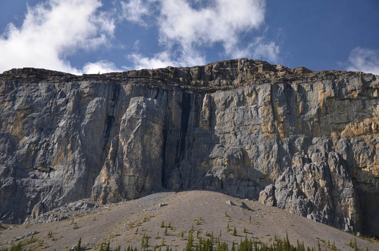
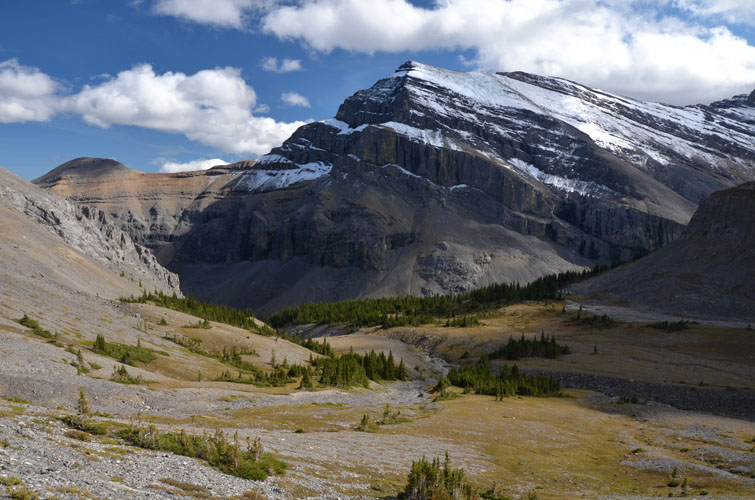
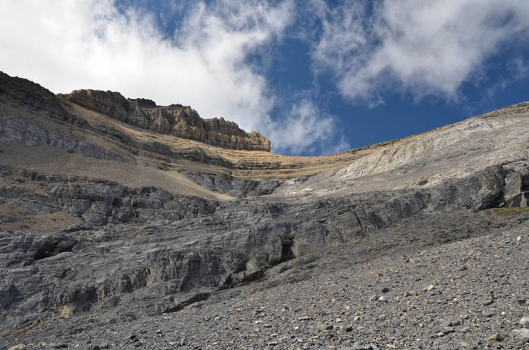
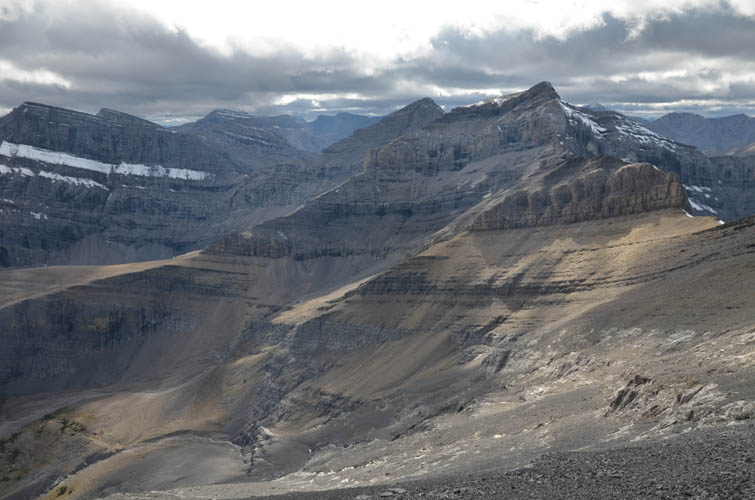
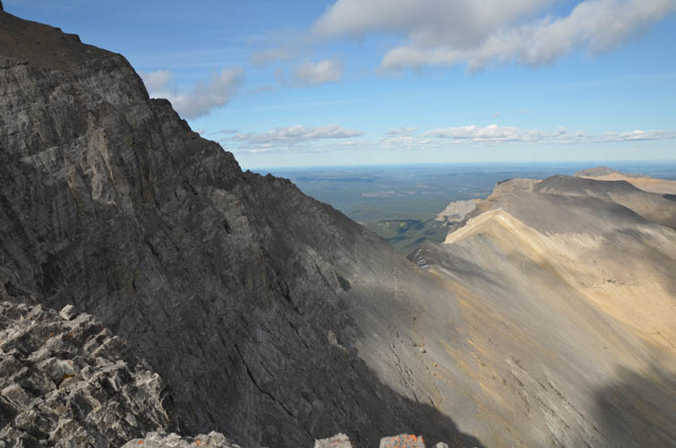
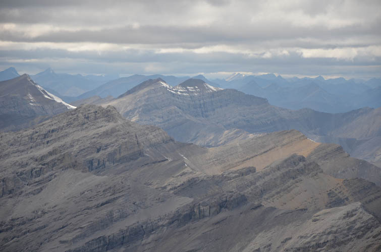
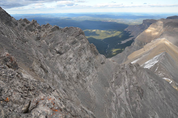
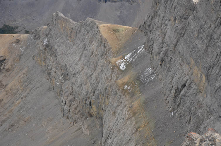
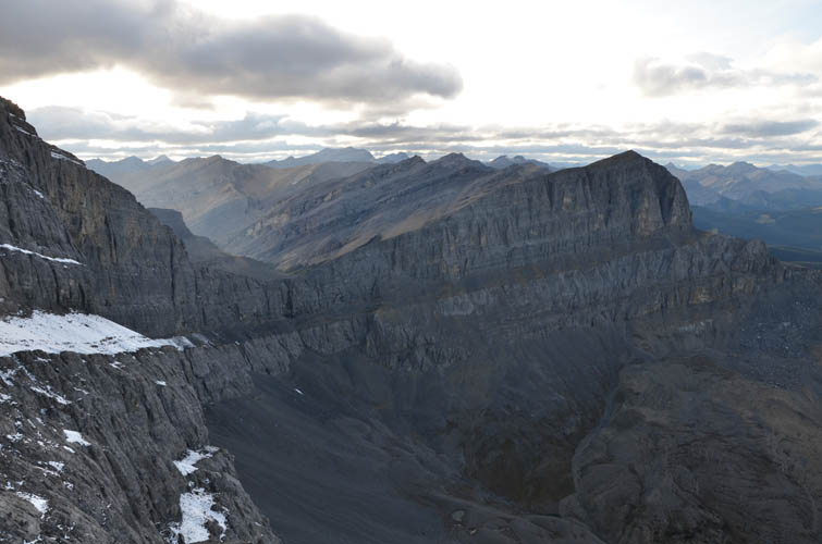
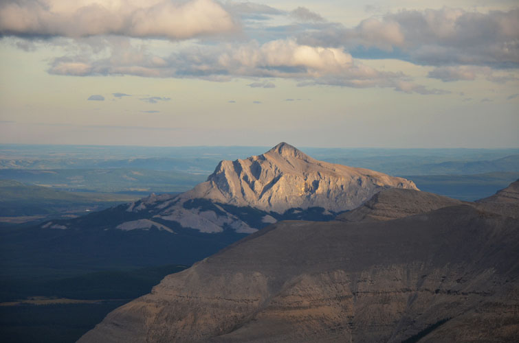
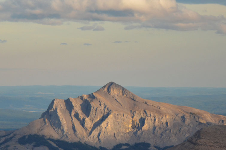
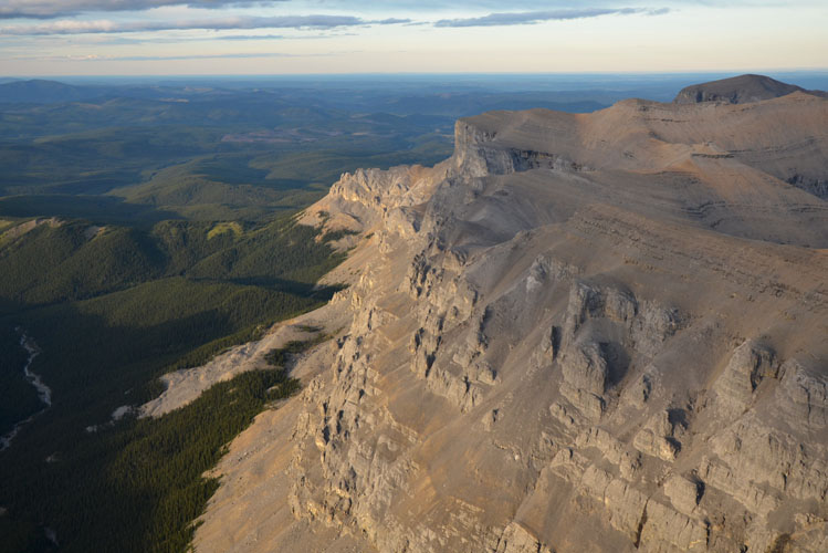
Dark clouds started moving in from the west, very much contrary to what my friendly weather forecast had predicted. Astral Peak and Castle Rock, two other remote but immensely rewarding destinations to the south, look forbiddingly dangerous with their steep, snow-covered cliffs from this vantage point. Of course from the south side both of them are basically just a walk up. I put on my puffy and gloves – time to move on and try the traverse to Waiparous Peak. The northeast ridge of Davidson looks steep and cliffy from below, but you never know if there is a route until you’re actually there so I wanted to give it a shot. After downclimbing a difficult cliffband directly below the summit, I promptly decided to retreat as I could see more vertical rockbands below me. This was definitely not scrambling terrain anymore. My second attempt was to bypass the upper cliffs by descending a short section along the south ridge, then loop back around to the east on a gently slanted brown shale ledge. Again no luck – the terrain below me was definitely technical. From where I stood I had a good look at Davidson’s east face, spotting another ledge of green and brown shale quite a ways below me. This ledge looked like it would connect the south ridge with the Davidson-Waiparous ridge.
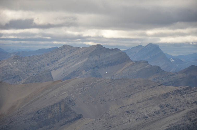
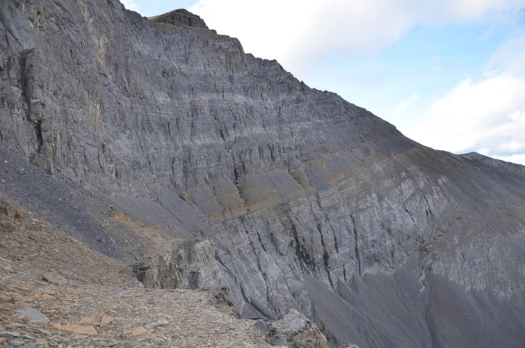
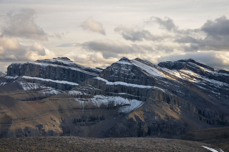
The route worked. After scrambling back down the south ridge and the scree ramp I had ascended earlier, losing a lot of elevation in the process (>400 m), I was able to slog back up some scree to the shoulder where the brown/green shale ledge started. A narrow goat trail runs right on the outer lip of the ledge, with an exhilarating drop down a vertical cliff to the right. The exposure is significant, but the soft shale works well for traversing along the ledge. I felt a great sense of relief when I reached the Davidson-Waiparous connecting ridge. With the exception of a few narrow sections at the beginning, it was now an easy hike along the gently undulating NE ridge to Waiparous Peak.
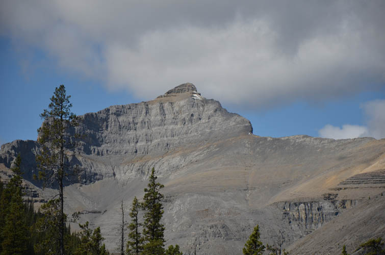
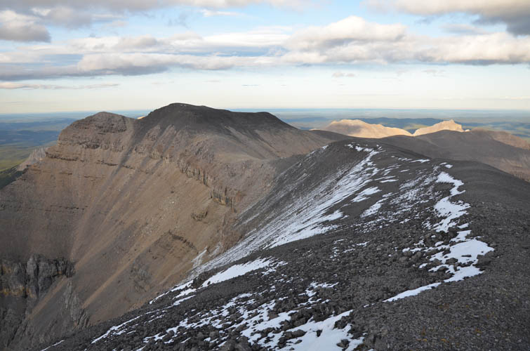
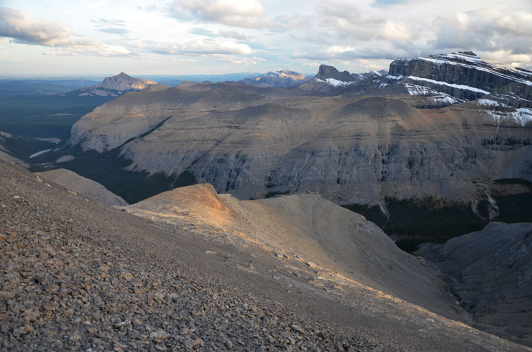
It was just after 7 PM now by the time I reached Waiparous Peak. Views of the steep, rocky cliffs that flank the side of the ridges and mountains connecting Waiparous to Ghost Peak in the northeast were pretty special in the glowing evening light. The sky was still overcast, however, with an uncomfortably chilly wind urging me to move on. I paid a quick visit to the smaller, cairned summit to the north of the main summit, took a few pictures, then started my descent back down to Waiparous Creek following the route taken by Vern and Eric. Soft scree made it easy on the knees in the upper part of the mountain. I then followed the crest of the barren south trending ridge, which lower down became surprisingly steep before mellowing out again in the forest.
It was in those final minutes of twilight when the last remaining light turns a monochrome grey, dimmed even more by the surrounding forest and clouds above, around 8:30 PM when I finally got back to my chosen campsite. There was just enough time to boil some water, set up my tent, and wolf down a comforting warm meal before heading to bed in the pitch black. It had been a long and rewarding day, and it felt great to know that I had managed to combine both objectives into one loop so all I had left to do was hike out the next day.
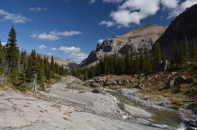
I had a terrible sleep that night, partly because my feet were aching and partly because various unidentifiable animals woke me up when I heard their footsteps approaching my tent… So I got up early the next day, and after a warm breakfast was on my way back. The hike out took me a good hour less than on the way in – it’s almost a 400 m elevation loss down the valley after all, plus I found a slightly more efficient route back along Waiparous Creek.
This was a very enjoyable outing in a wild and pristine area. One could probably do the whole trip in a single day, but this would necessitate a very early start and leave no time to relax and fully soak in the beauty of this remote corner of the Rockies.
|
Elevation: |
Mount Davidson: 2919 m (official), 2922 m (my GPS) |
|
|
Waiparous Peak: 2710 m (my GPS) |
|
Elevation gain: |
2270 m for whole loop |
|
Time: |
15 h total (11.5 h + 3.5 h) |
|
Distance: |
46.2 km (incl. 17 km by bike) |
|
Difficulty level: |
Moderate (Kane), T4/T5 (SAC) for Mount Davidson alone |
|
|
Easy (Kane), T3/T4 (SAC) for Waiparous Peak alone |
|
|
Difficult (Kane), T6 (SAC) for Davidson-Waiparous traverse |
|
Comments: |
The traverse from Davidson to Waiparous via shale ledges on Davidson’s SE face is seriously exposed requiring extreme caution! |
|
Reference: |
Peakfinder (Davidson), Vern Dewit (Waiparous), plus own routefinding |
|
Personal rating: |
4 (out of 5) |
NOTE: This GPX track is for personal use only. Commercial use/re-use or publication of this track on printed or digital media including but not limited to platforms, apps and websites such as AllTrails, Gaia, and OSM, requires written permission.
DISCLAIMER: Use at your own risk for general guidance only! Do not follow this GPX track blindly but use your own judgement in assessing terrain and choosing the safest route. Please read the full disclaimer here.