Ya Ha Tinda, AB, Canada
12 December 2020
With Richard
Easy scenic hike with a frigid river crossing
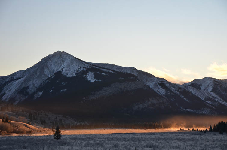
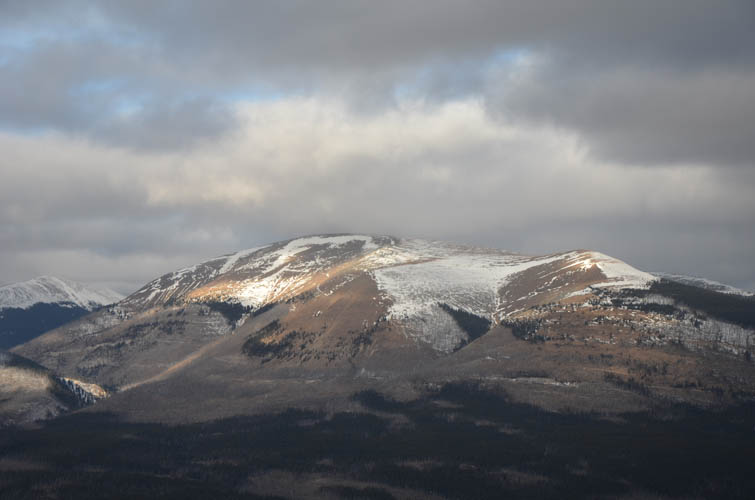
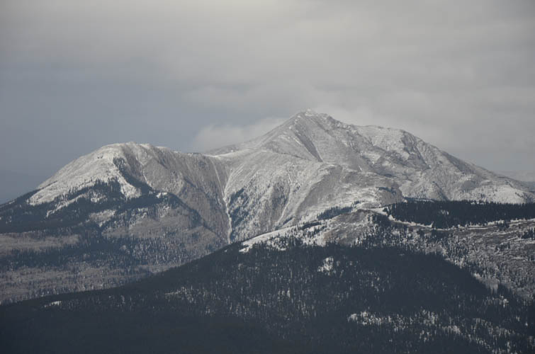
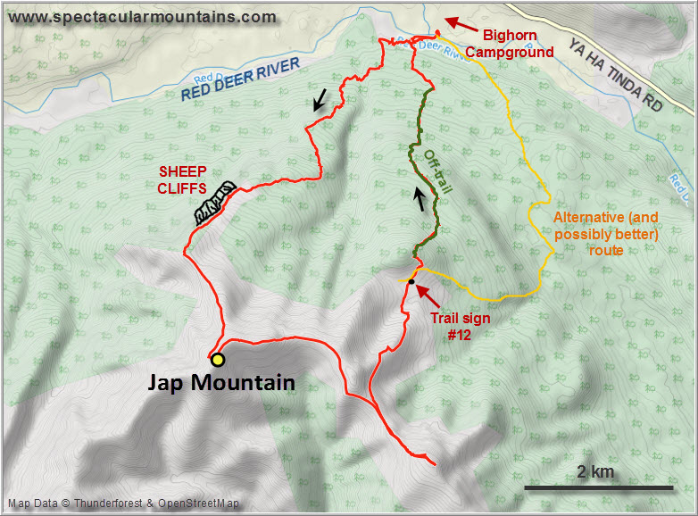
For our last outing of the year before I headed out to Europe for Christmas, Richard and I chose what we always considered a “plan B trip”. It was mostly the crossing of the Red Deer River that stood in the way of making this objective more attractive, but even then the Dogrib is really just a long harmless ridge with several high points extending eastward from Barrier Mountain. Located right in the heart of the Panthers Corner area, Dogrib Ridge is a popular destination for horse riders in the summer. The ridge is also referred to as “Jap Mountain” in the beautiful Bighorn Wildland book published by the Alberta Wilderness Association – a highly recommended read on this area and the entire region. I will stick to the more politically correct Dogrib Ridge, or simply “the Dogrib” as local horse riders call it.
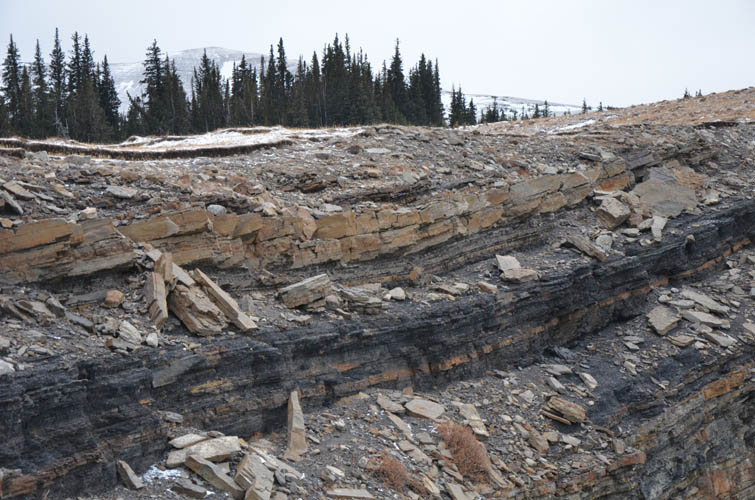
The area was the target of coal exploration in the 1970s and several access tracks were carved into the hillsides. Although coal seams are common in the area and are most apparent at Sheep Cliffs on the mountain’s northern side, efforts to mine coal here were abandoned soon after the roads were built. Today, horse trails follow most of the reclaimed roads and connect the ridge top with the river valley.
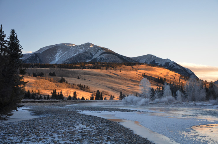
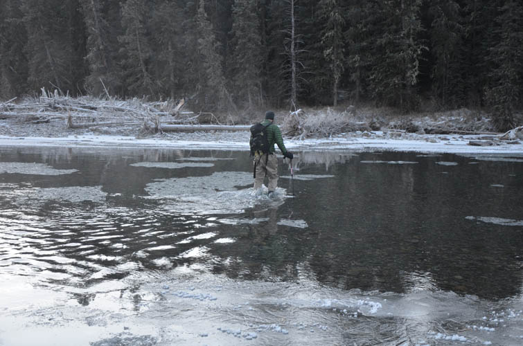
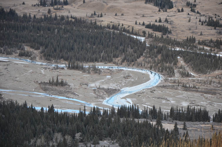
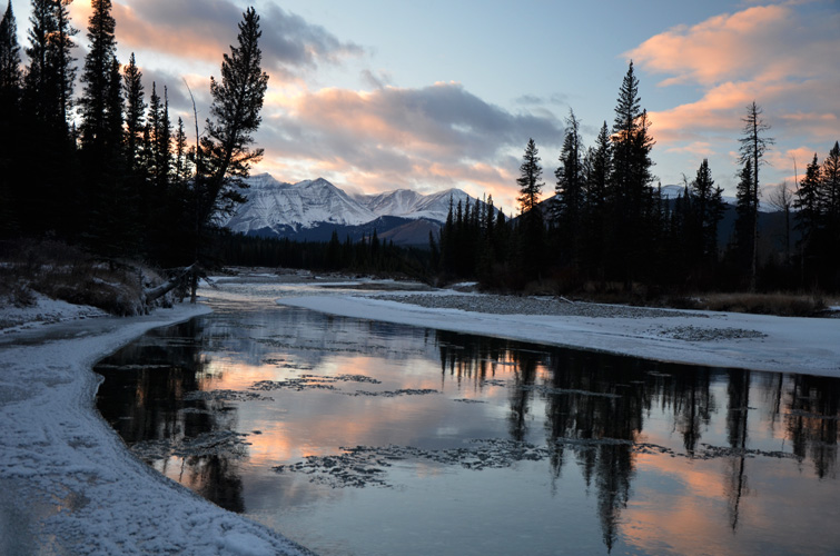
There is no better way to wake up in the morning than crossing a chilly river. And chilly it was! Minus 20°C in the morning and the river had chunks of ice floating on its surface. The trickiest part was stepping off the ice and into the water (and back up on the other side) without breaking through and tumbling in. Next time we should really bring our ice axe to hack an entry point into the water. Richard’s waders once again proved very useful while I was freezing my feet off in my old sneakers, its laces turning into frozen “wires” minutes after I stepped out of the water on the other side.
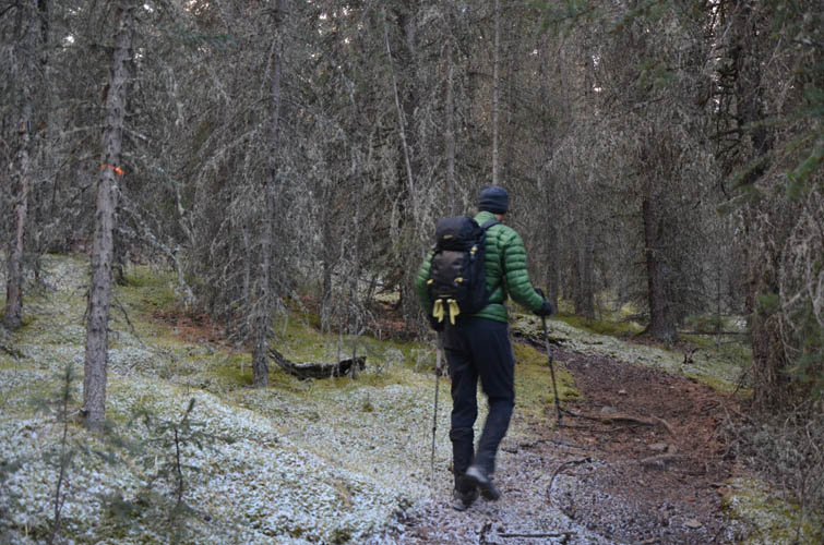
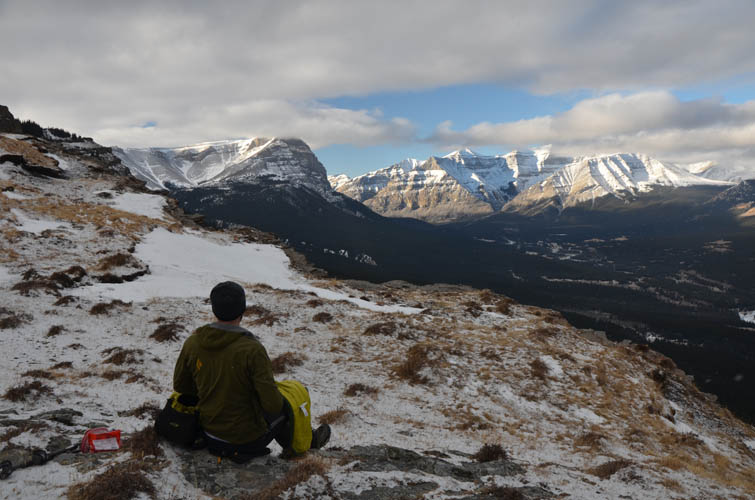
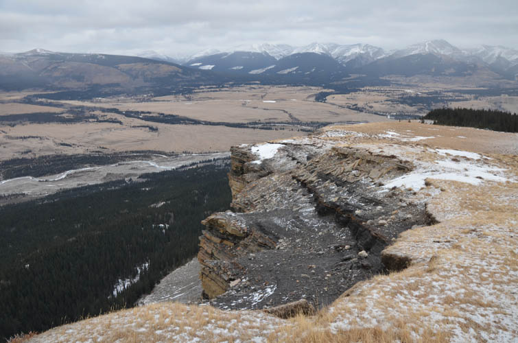
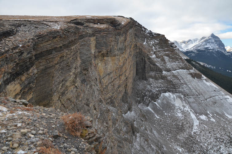
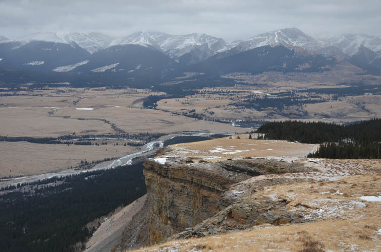
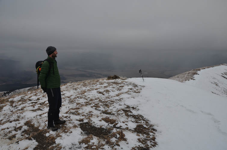
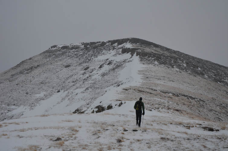
There is a confusing array of horse trails on the other side, none of them signposted, and we had some initial difficulties finding the correct trail up that I had mapped out beforehand. The forest is quite light, however, so it’s never really a problem if you lose the trail. Once on the proper trail up, it was smooth sailing and we quickly reached the open ridge just above Sheep Cliffs. What a fantastic viewpoint! You can look straight through the big gap between Warden Rock and Wapiti Mountain to the northwest, with a vertical wall of sandstone and coal about 30-40 high right below our feet.
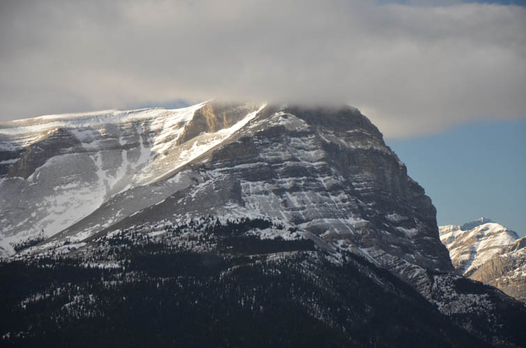
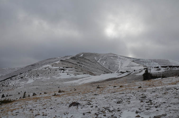
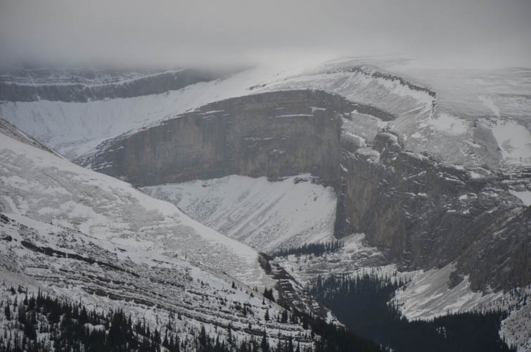
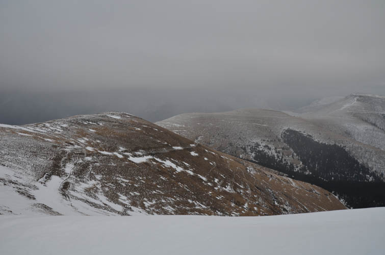
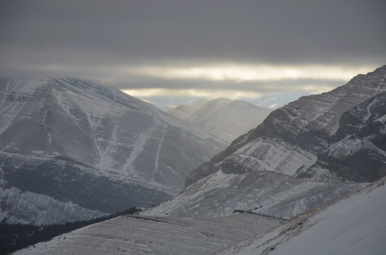
This is also a great picnic spot and after a short rest we continued on, first along the ridge crest then later on a good trail just to the side. This trail leads almost directly to the cairned summit of Dogrib Ridge at 2445 m. By now clouds had overshadowed the sky and unfortunately we were denied any views of Barrier Mountain directly to the west. I had hoped to take a closer look at the east side of this mountain to scope out a potential route up Barrier’s summit from here, which would be significantly shorter than going in via the valley to the NW as Richard and I had done back in 2017. The clouds were too low today, but at least we got a glimpse of the impressive cliffs that surround Prisoner Point Lake just below.
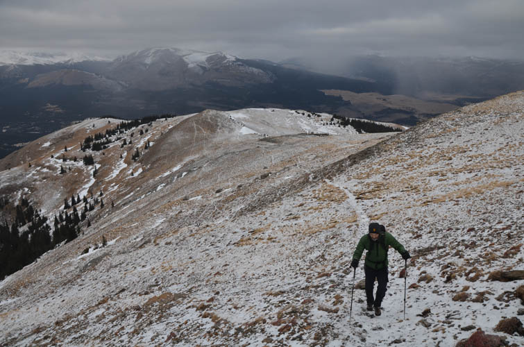
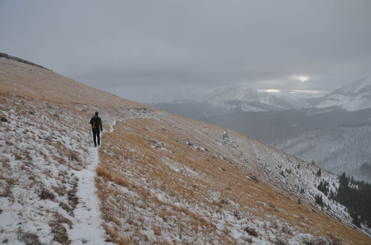
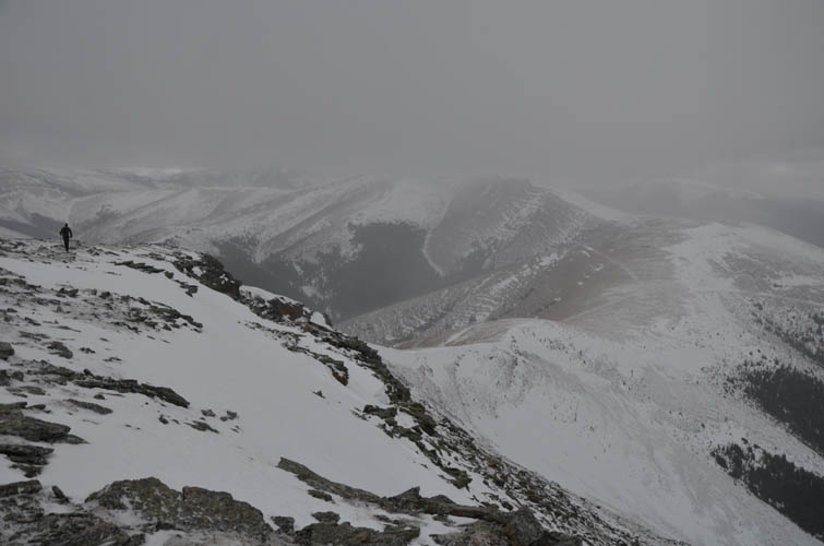
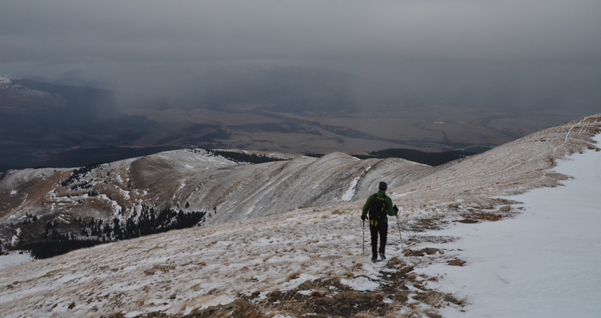
The entire ridge is quite barren and exposed; only the eastern slopes are treed. With an uncomfortably cold wind picking up and the views around us deteriorating, we didn’t dwell long and continued our walk east along the ridge, then turning south to the next high point (also cairned and with a survey marker, but lower in elevation). A few short sandstone cliffs provided a welcome opportunity for some easy but totally avoidable scrambling.
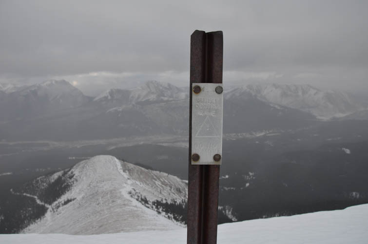
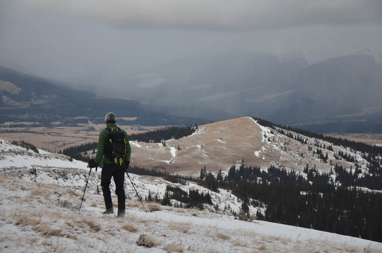
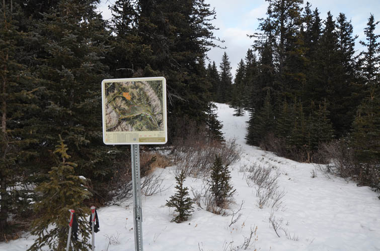
We debated if we should descend directly down the grassy slopes off the east side from this high point to link up with an old exploration road in the forest below (it appeared to be a good option), but in the end decided to simply backtrack along the ridge top to the saddle to the north and then follow a good horse trail downhill from there. The snow was deeper on these east-facing slopes, something we hadn’t really expected and it slowed our progress significantly. There is virtually no traffic on these hills at this time of the year, so none of the trails were broken. At a major trail junction we came upon one of the familiar signs (#12 on the map) that have been placed all across the Ya Ha Tinda area by the Friends of the Eastern Slopes Association. It showed two dashed lines heading back to Bighorn Campground. We chose the more direct route, which turned out to be a poor choice… Soon after leaving the sign behind us we lost the trail and simply couldn’t find it anymore until several kilometres of bush-walking later (thankfully the forest isn’t that bad here). I’m not sure if this is because this particular trail is rarely used or because we were just unlucky. But my feeling is that the other trail, though longer in distance, would’ve probably been easier to follow and thus saved us some hassle.
Eventually we stumbled upon the proper trail again and easily followed it down to the main river trail and back to the fording point where we had left the now completely frozen sneakers and wading shoes. I had brought an extra pair of old boots for the crossing back, while Richard was struggling to get back into his ice-encrusted sandals.
Overall a really nice trip in a remote area that sees pretty much no people in the winter. Perfect for an easy shoulder- or off-season hike provided that water levels in the Red Deer River are low enough to allow for a safe crossing.
For a detailed map of the area, including all existing trails and many possible scramble routes, see the Ya Ha Tinda & Surroundings Trail Map on Avenza (a free mapping app for offline navigation and tracking). The map is also available in print at MapTown or GearTrade.
|
Elevation: |
2495 m (my GPS) |
|
Elevation gain: |
1260 m |
|
Time: |
7.0 h |
|
Distance: |
19.8 km |
|
Difficulty level: |
Easy (Kane), T2 (SAC) |
|
Comments: |
Some slopes on eastern and northern aspects can potentially be avalanche prone in winter! |
|
Reference: |
Own routefinding |
|
Personal rating: |
3 (out of 5) |
NOTE: This GPX track is for personal use only. Commercial use/re-use or publication of this track on printed or digital media including but not limited to platforms, apps and websites such as AllTrails, Gaia, and OSM, requires written permission.
DISCLAIMER: Use at your own risk for general guidance only! Do not follow this GPX track blindly but use your own judgement in assessing terrain and choosing the safest route. Please read the full disclaimer here.