Ya Ha Tinda, AB, Canada
15 November 2020
With Richard
A long way in for a short scramble and sublime views
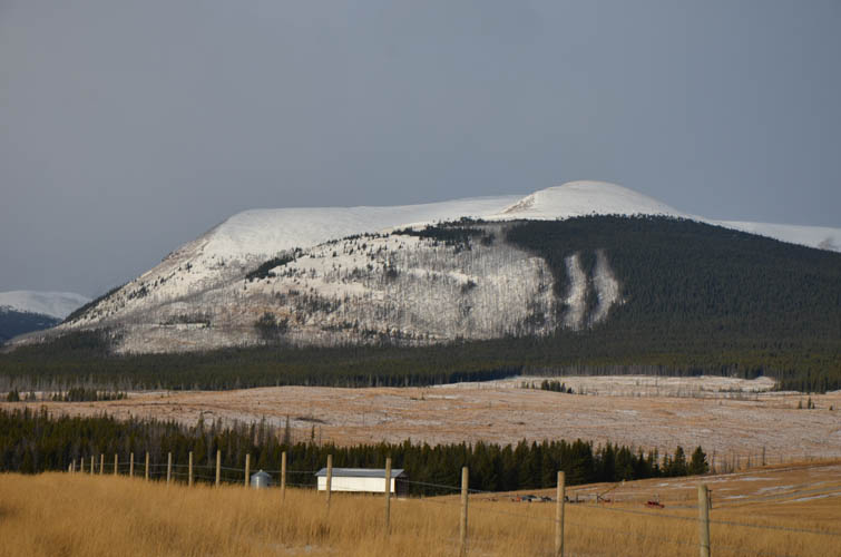
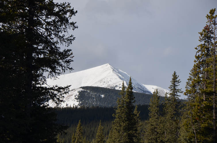
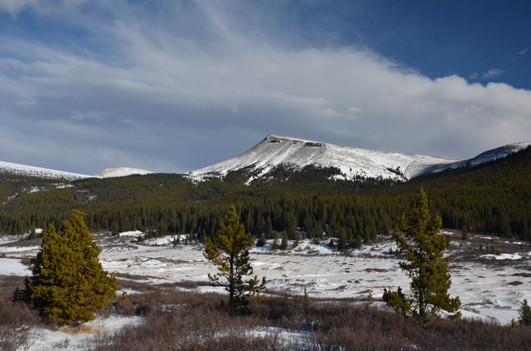
I had never heard of Skeleton Mountain until I met a local outfitter who pointed it out on my hike to Scalp Peak in 2016. Although only a minor peak at just over 2550 m and not shown on any maps that I’m aware of, it nevertheless stands out with its beautiful symmetrical pyramidal shape and can be readily seen peeking out of the valley when viewed from the Ya Ha Tinda ranch.
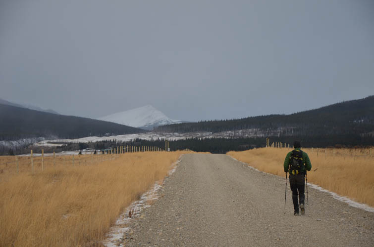
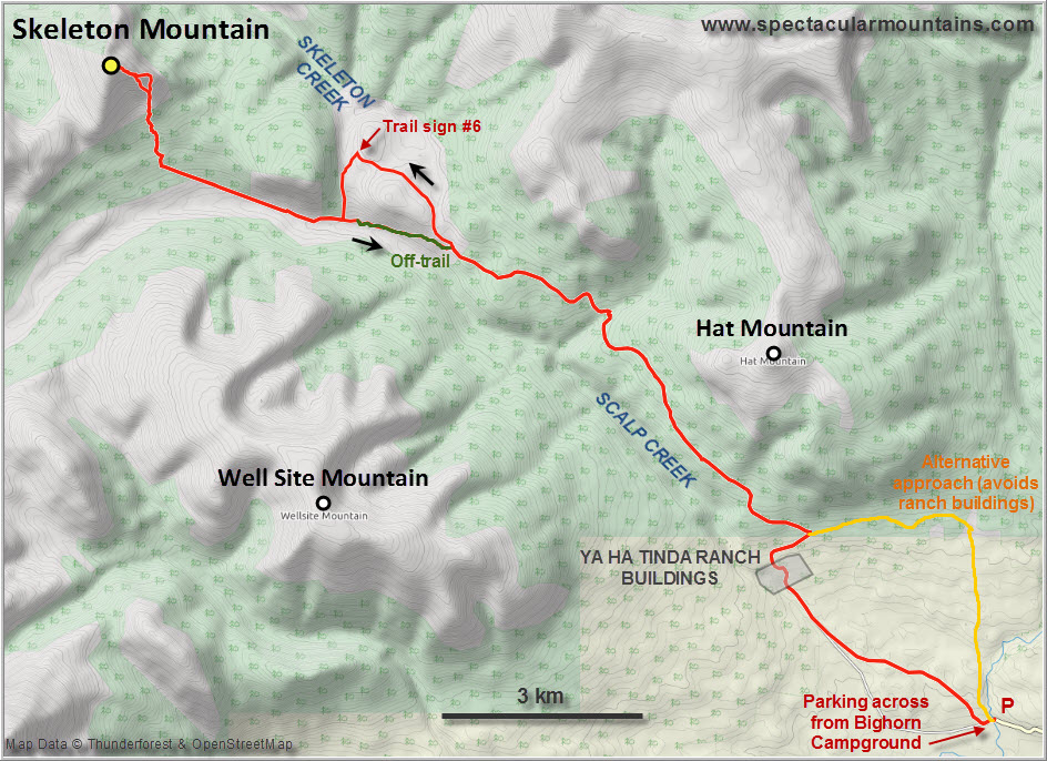
Richard and I knew that this was going to be a long day – some 34 km is what we estimated for the return trek via Skeleton Trail on the west side of Scalp Creek, the most direct route. However, what we didn’t know was that a new fence had been erected along the stretch of gravel road that goes from the Bighorn Campground (the last place where you’re allowed to park) to the ranch buildings. This fence now cuts off several small paths that you could previously take to head west and across Scalp Creek. Instead, there is now a new mud road that starts right behind the bridge near the campground – the route we should’ve taken in order to get to Skeleton Trail.
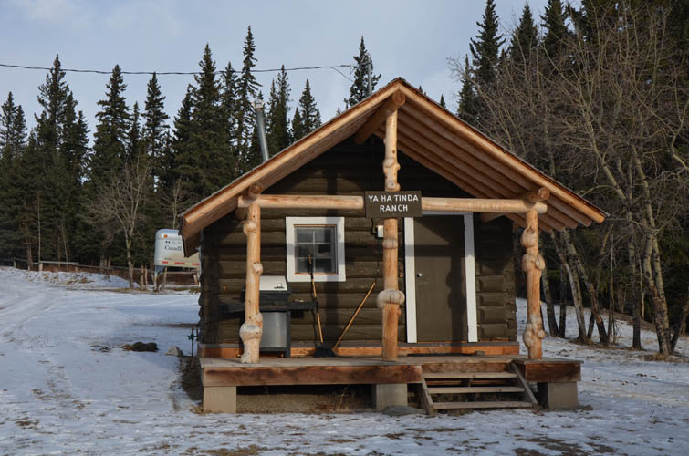
Not being aware of the new routings, we ended up walking all the way to the gate at the ranch buildings where an “Authorized access only – call this number” sign made us almost turn around… Luckily, the ranch manager happened to drive out right at this moment and not only allowed us to cross but also confirmed the name “Skeleton Mountain” during our brief but friendly chat. Right now during Covid times, extra precautions are taken even here in this remote place and spontaneous visitors and hikers aren’t allowed to just casually walk through the ranch complex anymore.
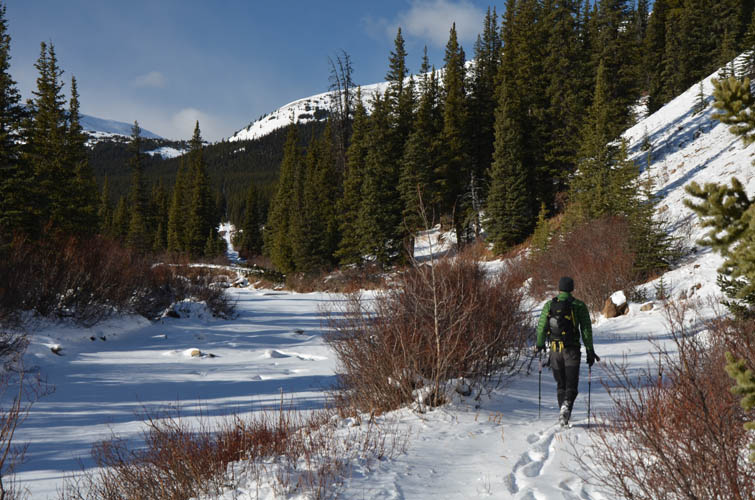
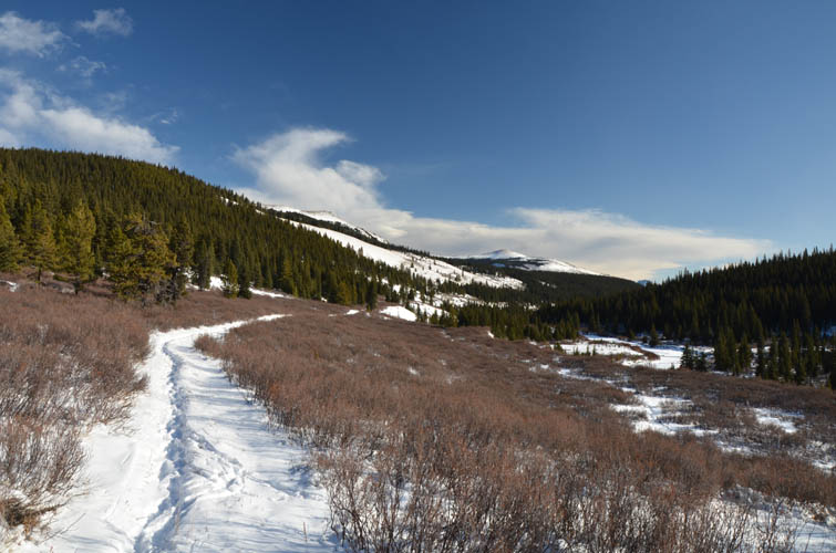
In another fortuitous twist, having missed our turn-offs to get to the Skeleton Trail, we were now forced to do our approach on Scalp Creek Trail (also called the Clearwater Road) on the other side of the valley. Fortuitous because the snow was packed on this trail, at least for the first 10 km or so, which made travel so much easier. As a minor trail I don’t think Skeleton Trail sees much horse traffic during the winter, and with anywhere between 5 and 25 cm of snow on the ground we probably would’ve never made it to our objective today if it hadn’t been for the group of horses that had stomped a path for us. We were doubly lucky today!
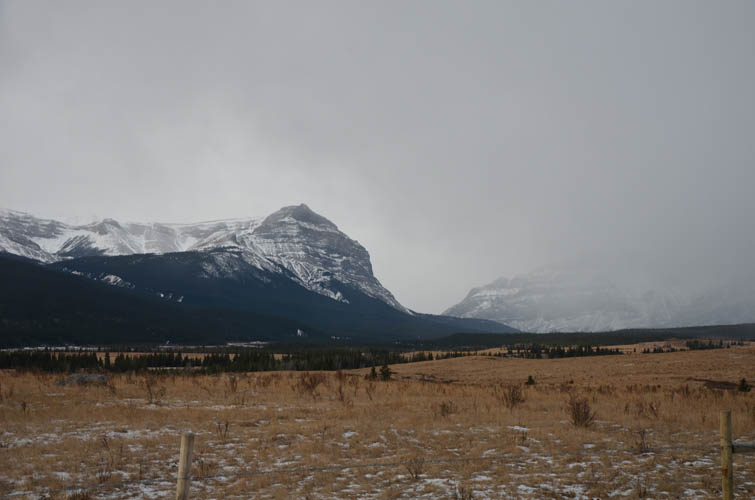
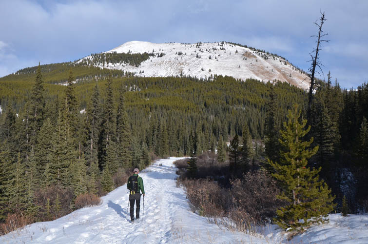
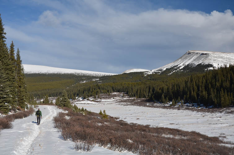
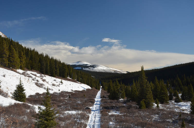
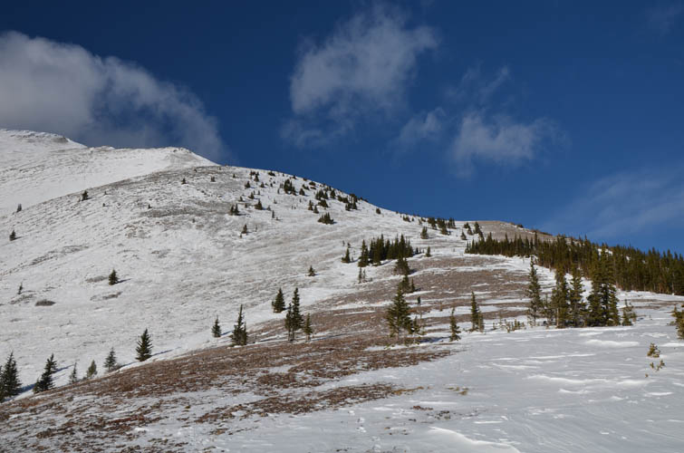
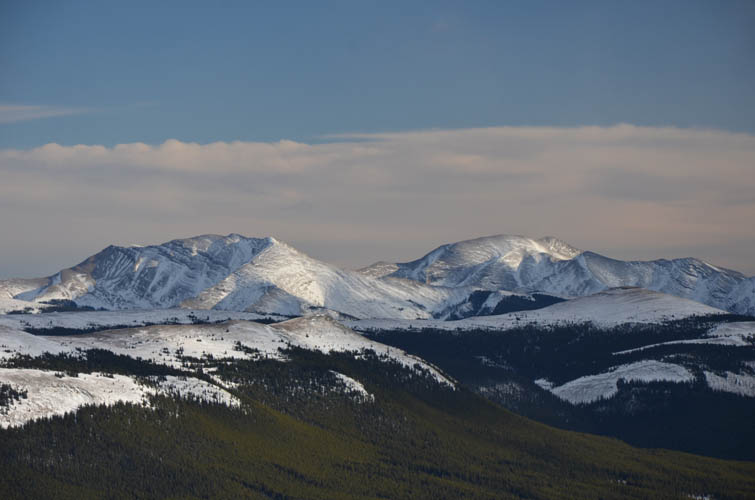
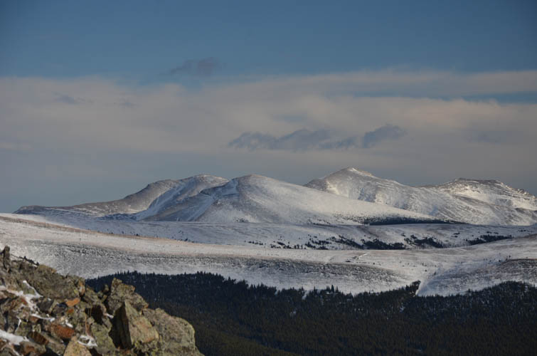
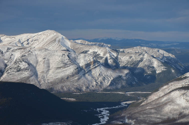
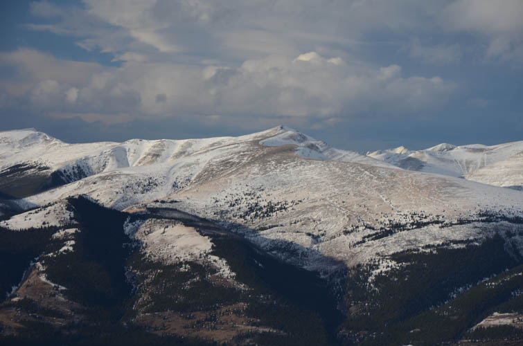
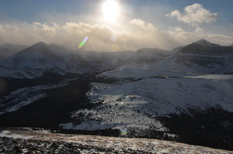
Scalp Creek Trail was just as I remembered it from four years ago. An excellent wide path but also a surprising amount of elevation gained and lost along the way. It’s a rather monotonous trudge in the forest and there are hardly any views until about 2 hours in, when the trail skirts open slopes before heading north towards the Clearwater River. The scenery here is absolutely beautiful, with the northern outliers of Hat Mountain to the right and Well Site Mountain, Tomahawk Mountain and many other unnamed peaks to the left. So remote and so empty here, true serene wilderness.
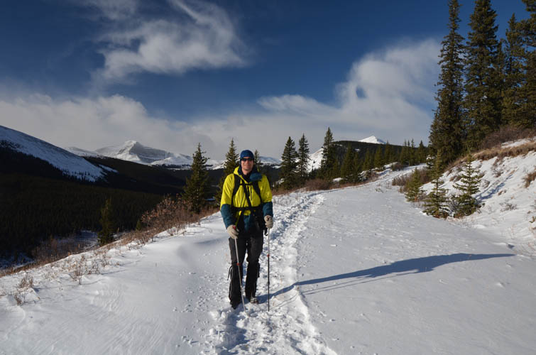
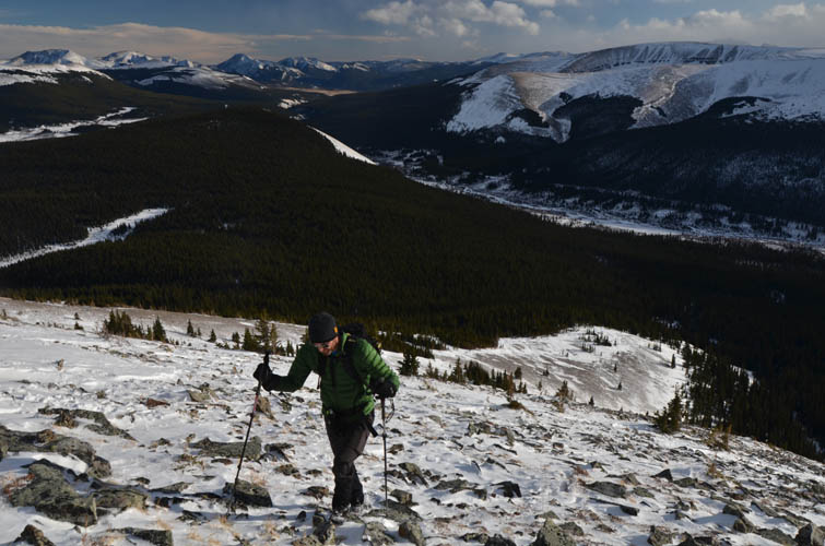
Other than at the ranch buildings, we never met a person all day. The horse tracks were about a day or two old and probably from the same outfitter I had met before – it was the same weekend in November when he usually wraps up for the season and heads back to Sundre. Past the point where his tracks left the main trail, we now had to deal with an unbroken trail for the remaining 8-10 km to get to the base of Skeleton Mountain. On the way in we continued on Scalp Creek Trail, then made a sharp turn south along a former wellsite road to reach the arrow-straight cutline that would get us directly to the south slopes of Skeleton (on the way out we took a small shortcut off-trail that was slightly faster). It was still a long way to hike and by the time we reached the end of the cutline we were quite exhausted – a lot more than we had expected. Both the chilly temperatures and all that stomping through snow had taken its toll.
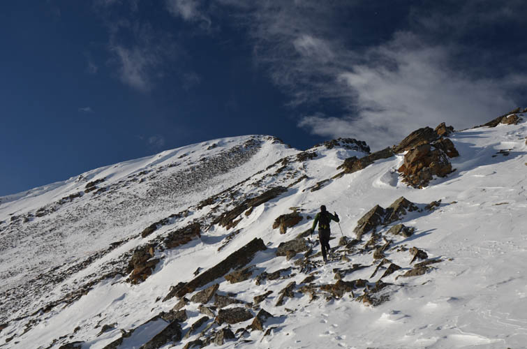
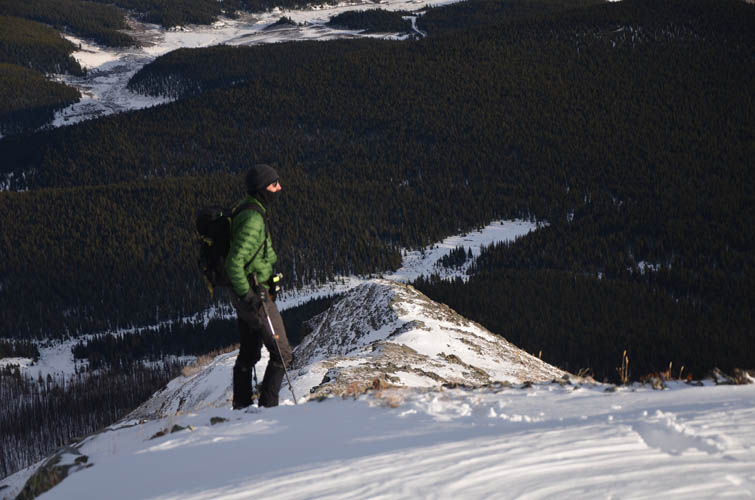
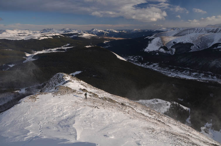
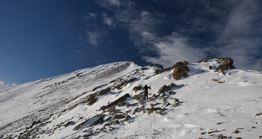
We fuelled up with peanuts, energy bars and chocolate, ready to tackle the mountain itself. After a short stretch of relatively open forest, we finally emerged on open slopes and hiked up steep grass and talus to the south ridge. Somehow it felt excruciatingly slow to work our way up here even though it was only about 500 m of elevation gain from the edge of the forest to the top. The final stretch is on the crest of the south ridge where we enjoyed some easy scrambling, mostly to avoid deep snow patches and cornices.
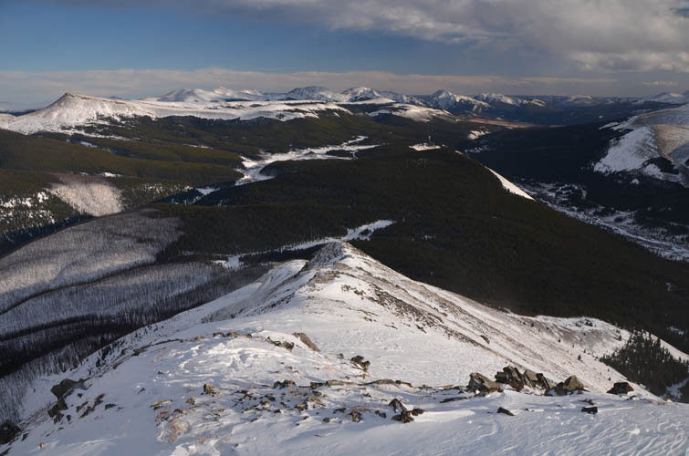
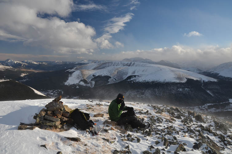
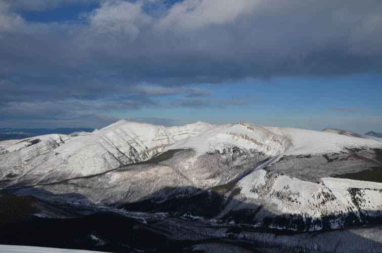
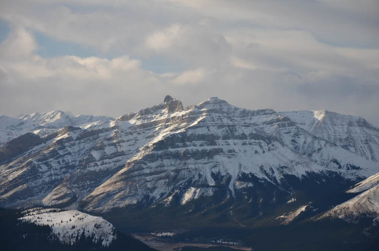
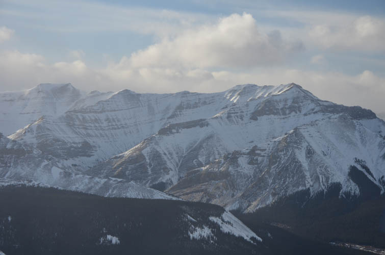
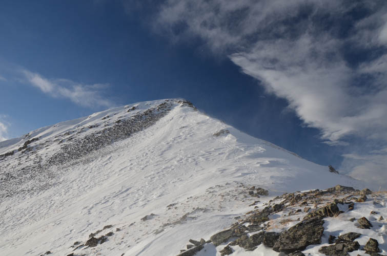
The cairned summit sits at 2558 m, not exactly grand but what a fantastic view point up here! From the Cutoff Creek area to the dramatic organ-like cliffs of Lost Guide Peak towering above the Clearwater River, to the flat plateaus of Well Site Mountain and the Scalp-Hat Mountain ridge. And, of course, not a sign of civilization as far as the eye can see… a feeling of true happiness.
It had taken us 20 km of hiking and almost 6 hours to get here, this cold and windy spot in the middle of nowhere. While most people would never spend that much time and energy to reach some minor peak nobody has heard of, it was more than worth it to us. Yes, it was a tiring trip for sure, but reaching the summit was only part of the reward. Enjoying the privilege of simply being in such an untouched and natural place probably meant even more. It’s a feeling I will never tire of and something that makes me keep venturing out to see more of this beautiful world we call the Canadian Rockies.
Note: Unfortunately, public access to the ranch buildings is no longer allowed. You now have to take the Old Forestry Road to access Scalp Creek Trail (see alternative approach in yellow on map below).
For a detailed map of the area, including all existing trails and many possible scramble routes, see the Ya Ha Tinda & Surroundings Trail Map on Avenza (a free mapping app for offline navigation and tracking). The map is also available in print at MapTown or GearTrade.
|
Elevation: |
2558 m (my GPS) |
|
Elevation gain: |
1460 m |
|
Time: |
10.5 h |
|
Distance: |
38.0 km |
|
Difficulty level: |
Easy (Kane), T3 (SAC) |
|
Reference: |
Own routefinding |
|
Personal rating: |
3 (out of 5) |
NOTE: This GPX track is for personal use only. Commercial use/re-use or publication of this track on printed or digital media including but not limited to platforms, apps and websites such as AllTrails, Gaia, and OSM, requires written permission.
DISCLAIMER: Use at your own risk for general guidance only! Do not follow this GPX track blindly but use your own judgement in assessing terrain and choosing the safest route. Please read the full disclaimer here.