Ya Ha Tinda, AB, Canada
26 January 2020
With Richard
Terrific ridgewalk that ends so close to the summit!
This was an exploratory trip to an area we had never been to before – the Cutoff Creek area with its horse and OHV trails located north of the Ya Ha Tinda ranch. Only a couple of online reports on mountain hikes in the area were known to me – an outing by Eric and Ben in 2016 where they tagged a few unnamed ridges and peaks, plus Ben’s climb of Scalp Peak a year later.
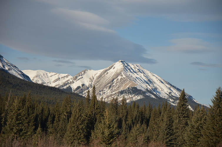
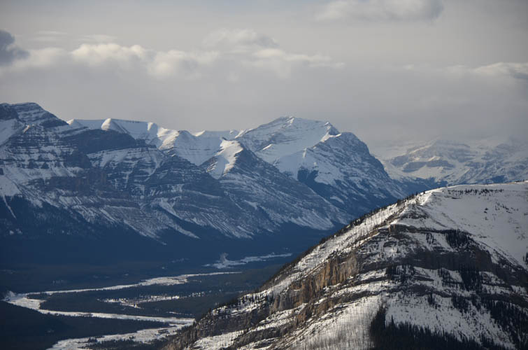
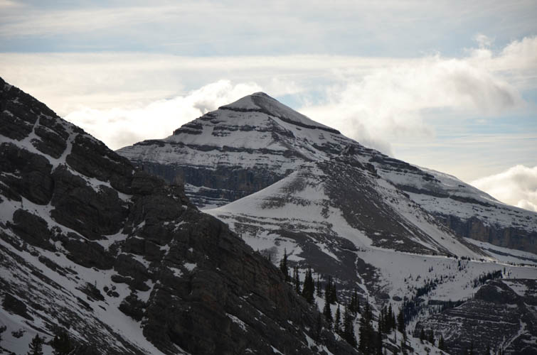
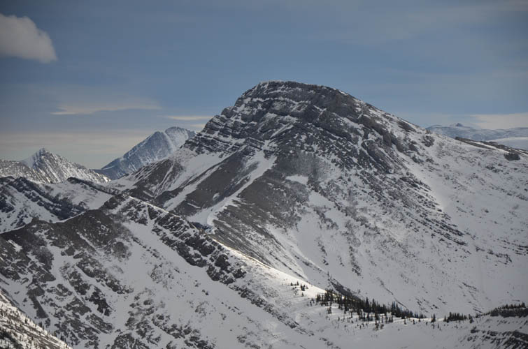
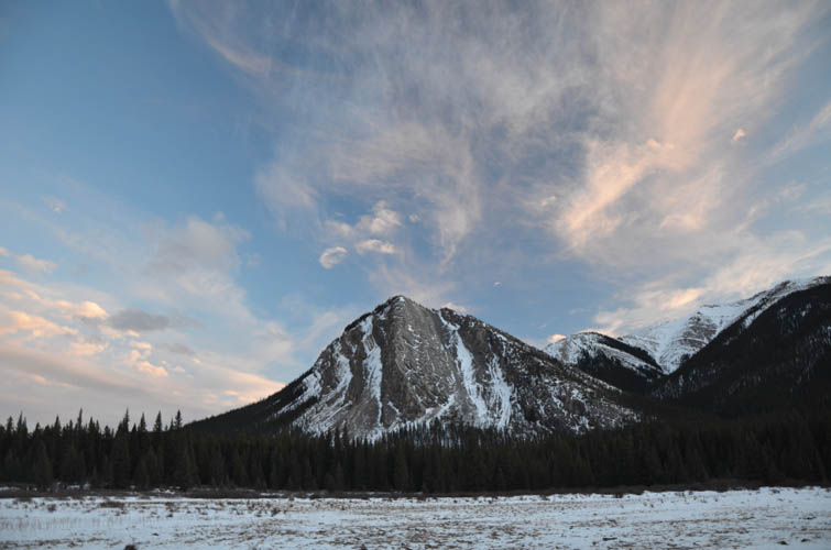
The objective Richard and I had in mind is also unnamed – at least as far as we’re aware. It’s the first “big” peak in the Front Ranges just south of Cutoff Creek and the Clearwater River, hence our informal reference to “Cutoff Peak” for now. At approximately 2300 m it’s not exactly grand, but it does look pretty impressive when viewed from afar, especially its pointy summit mass.
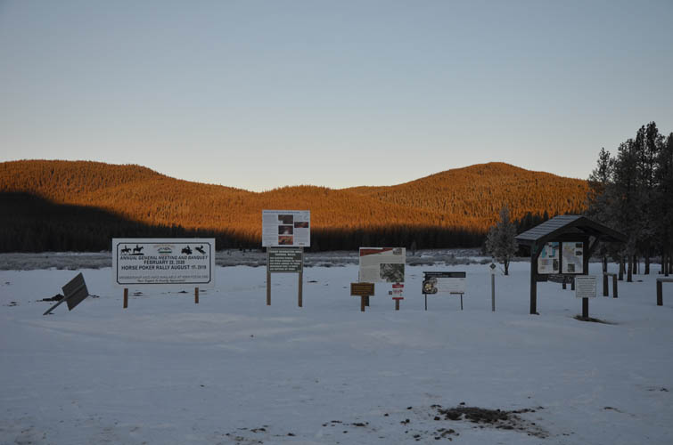
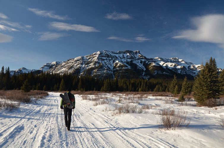
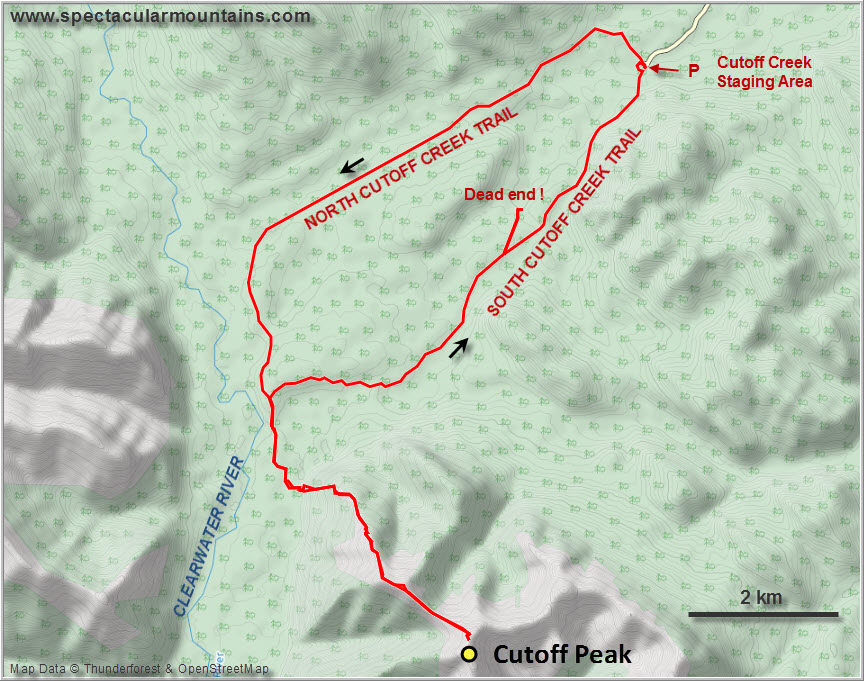
The drive from Calgary was long (3h) with a short stretch of highway 734 not maintained in the winter – although it was driveable with my Honda CR-V, I wouldn’t have been comfortable with any more snow on this stretch. We parked at the Cutoff Creek staging area at the end of a 19 km gravel road (ploughed) off highway 734. One truck was already there and another joined us shortly after, both locals with snowmobiles and side by sides out here to go for a fun ride.
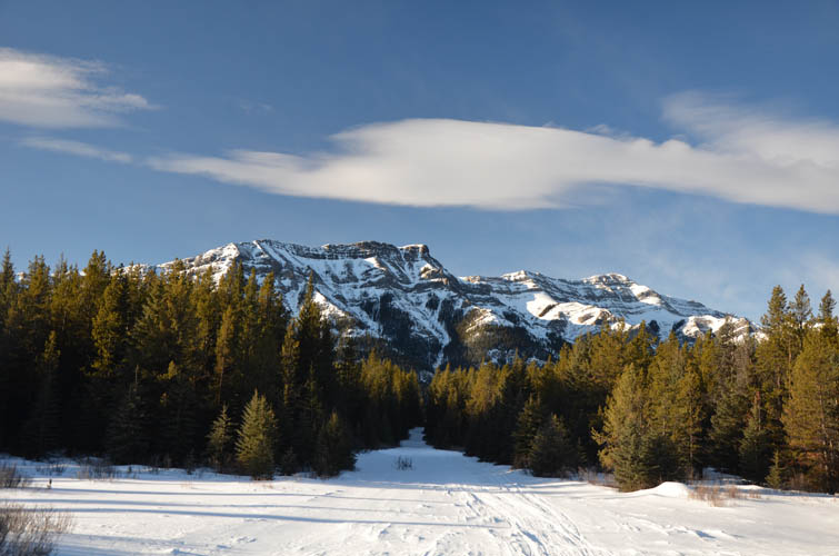
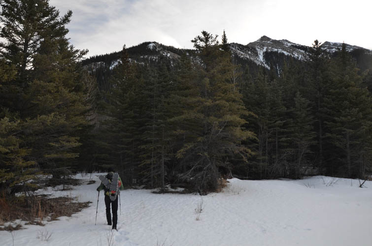
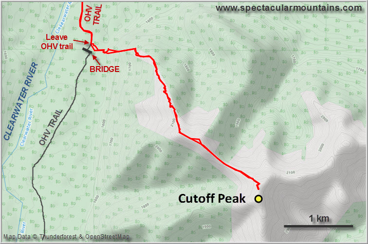
We took the North Cutoff Creek Trail on the way in, a long and boring OHV track that goes through the forest and offers pretty much no views. The first hour was pretty tough – it was -19°C, about 15 degrees colder than forecast and of course we didn’t have our thermal under layers with us. At least the track was well-packed from recent OHV traffic, making it an easy and quick hike.
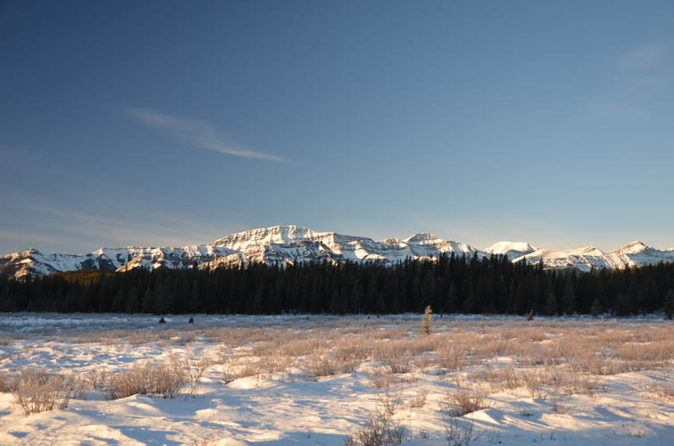
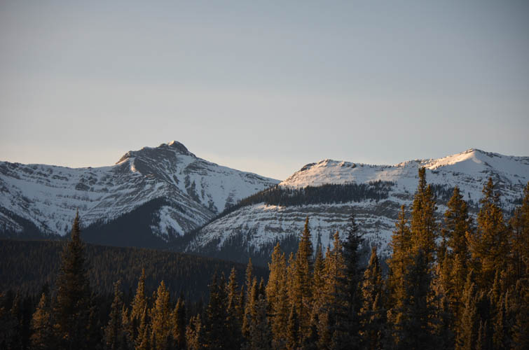
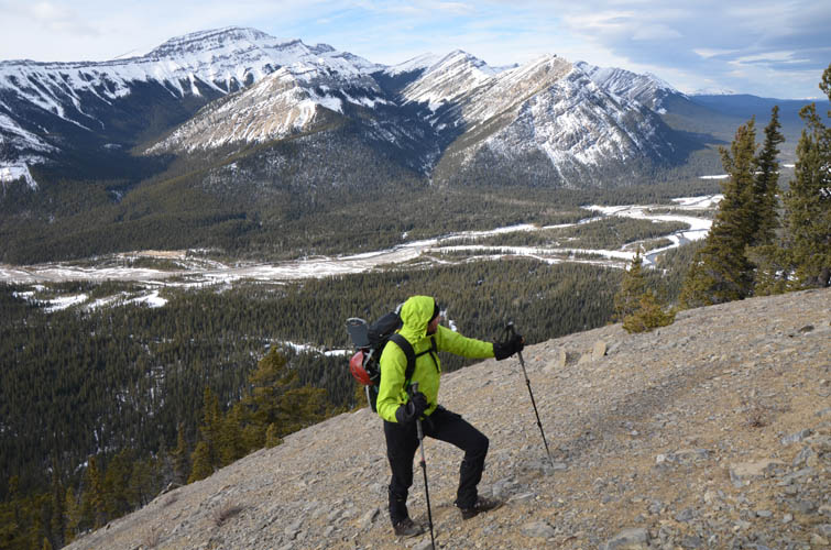
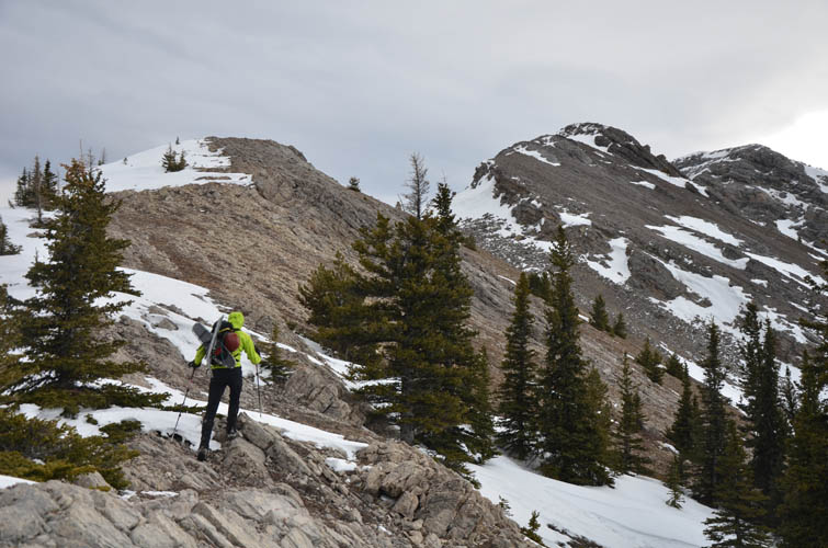
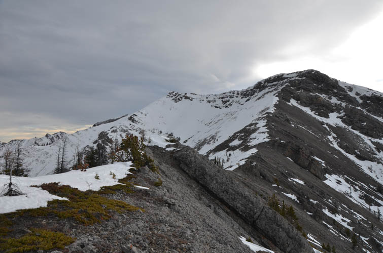
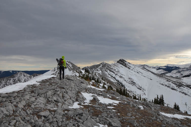
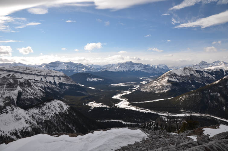
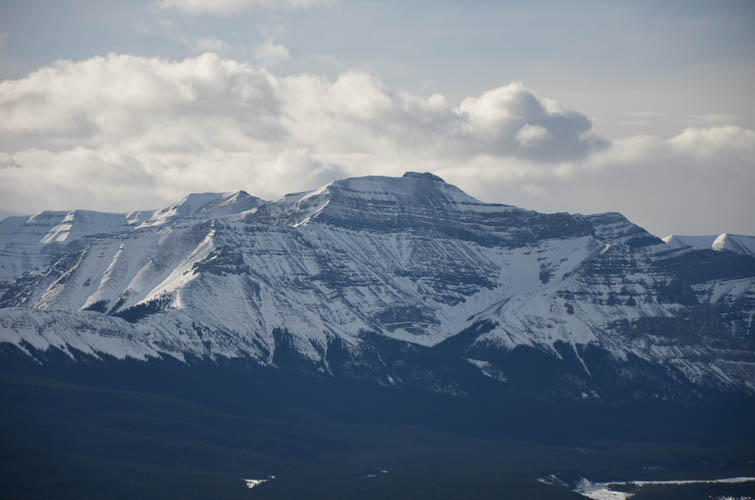
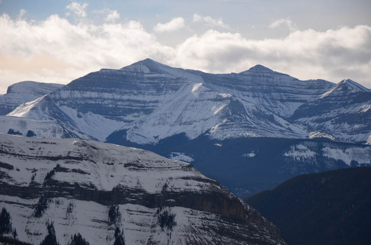
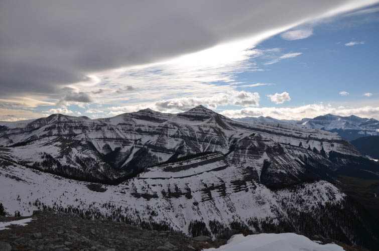
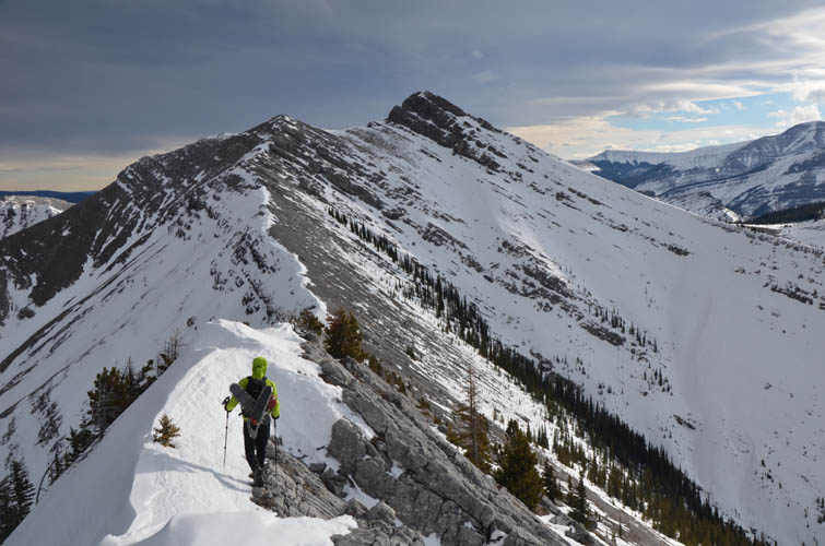
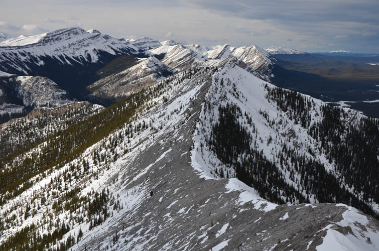
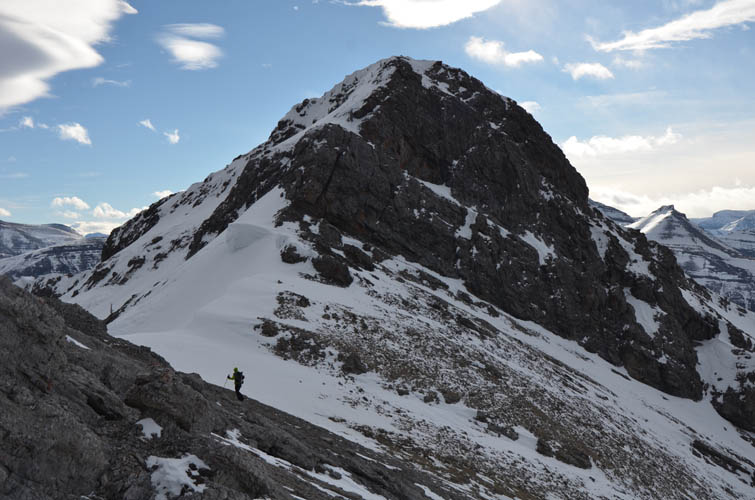
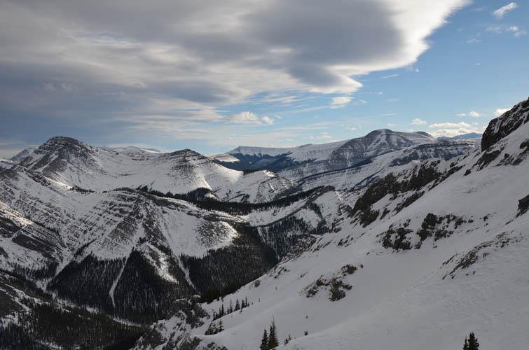
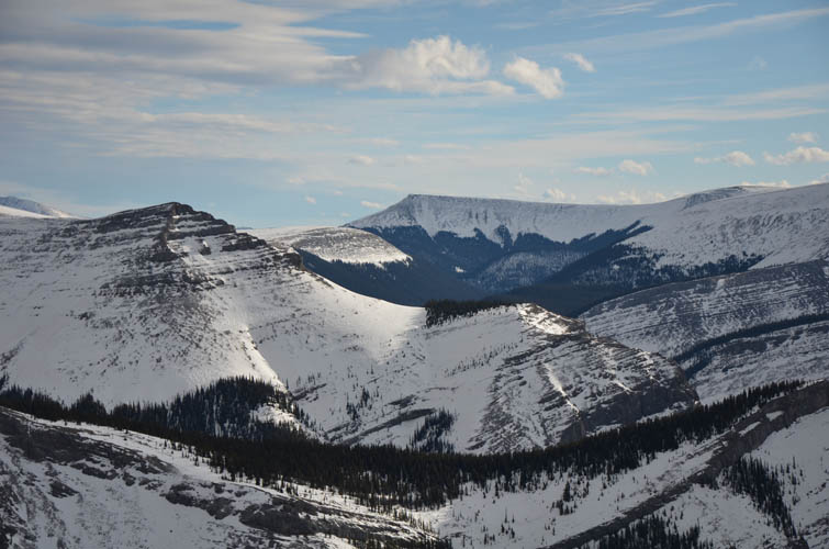
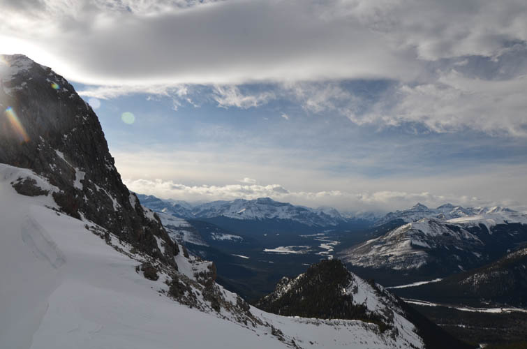
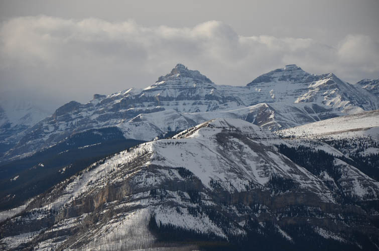
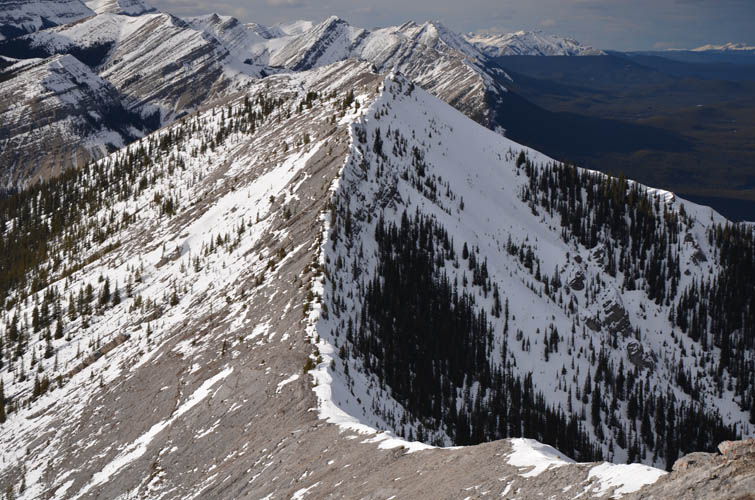
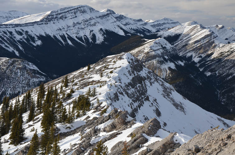
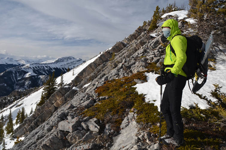
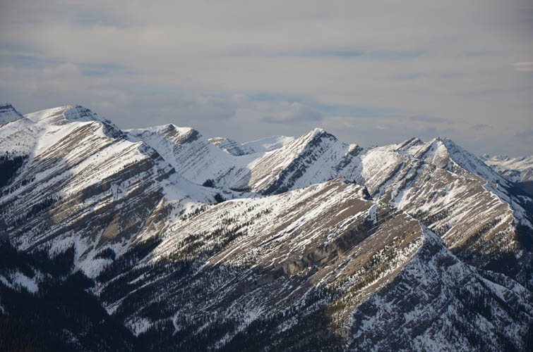
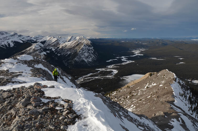
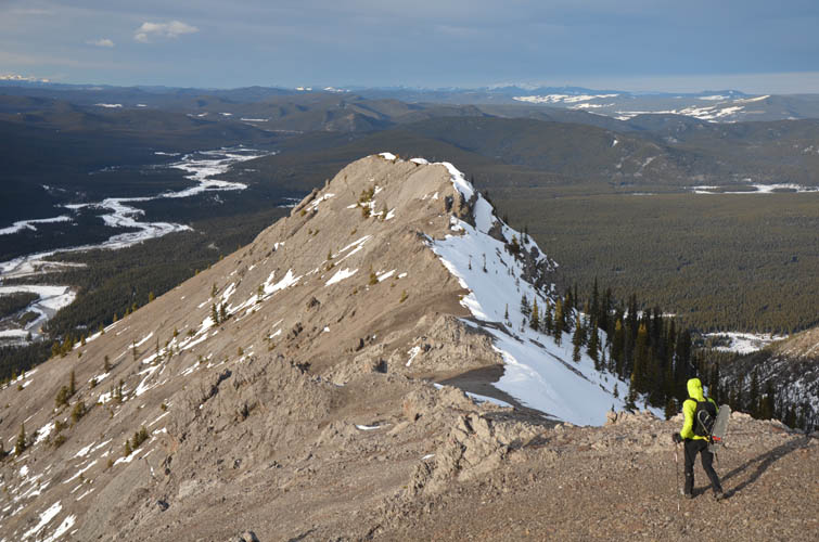
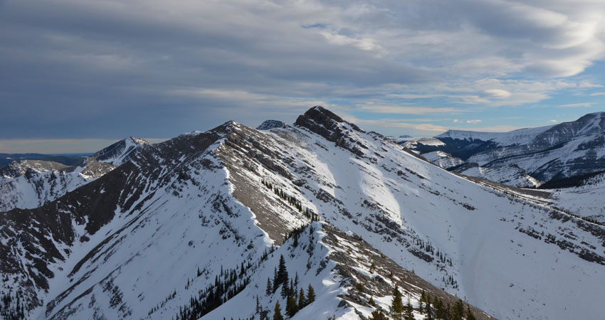
After about 10 km and 2.5 hours of hiking, we left the track just before the first bridge over Cutoff Creek. A short stint of bushwhacking got us to the base of the north ridge, which was the only unpleasant part of the day really. The ridge itself was simply a joy, even the lower treed part was nice due to lots of light forest and stretches of open slopes. Initially the grade is steep and we gained elevation quickly. Once at treeline, the real fun started. There were about four or five rock bands along the ridge that required some easy to moderate scrambling. Some spots were a bit tricky because of snow lingering on north and east facing aspects, but with some zig-zagging they were all eventually resolved. What I really appreciated the most were the wide open views up the Clearwater River valley and the sea of peaks and ridges completely unfamiliar to us. It was like hiking in a different province or country – I don’t think I recognized a single peak around us! Ok, Limestone Mountain directly east of us was one notable exception.
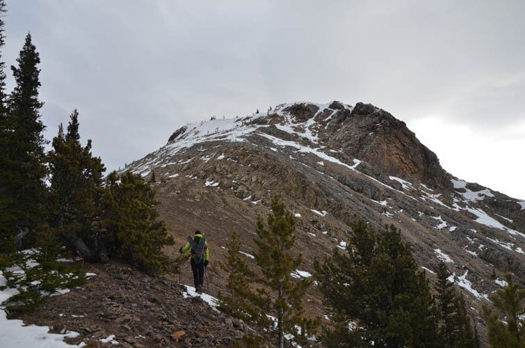
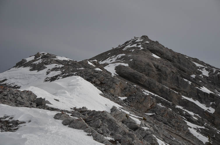
Not knowing the terrain and what it had in store for us after the next hump or cliff was of course part of the appeal. We had no idea how far we could make it along the ridge crest, but fortunately we kept on finding a way forward. There is a minor summit with a very weathered small cairn on top that sits about 1.4 km north of the true summit. Shortly after leaving this subsidiary peak, the ridge narrows, with steeply dipping slabs on the right and a vertical corniced drop-off on the left. Richard expertly led the way here and broke things down into small, manageable steps. It was probably easier than it looked from afar, as is so often the case in the mountains.
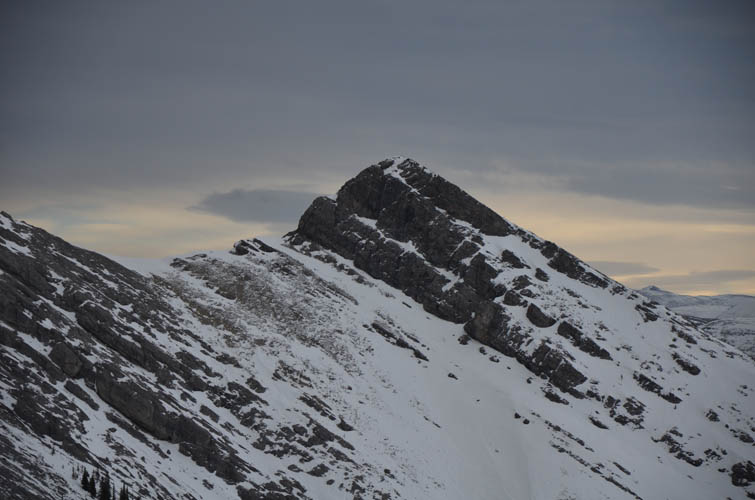
Of course sometimes it’s exactly the other way round – things turn out to be more challenging once you’re up close. And that’s what happened about 50 vertical and 50 horizontal metres before the true summit. Yes, a major roadblock so close to our goal! A serious near-vertical cliff blocks the way here, the impenetrable rock band continuing down into the valley on either side. Perhaps it’s possible to overcome the rock band on the northwestern side in the summer when all the snow is gone, but the conditions we had right now were certainly not favourable. The snowpack looked unstable and there was no way we were willing to mess around on the steep, exposed slopes around the cliffs. It just wasn’t the right time and despite getting so close to the summit we didn’t feel disappointed – the ridgewalk was super enjoyable and we were just happy we had made it this far in the middle of January at all.
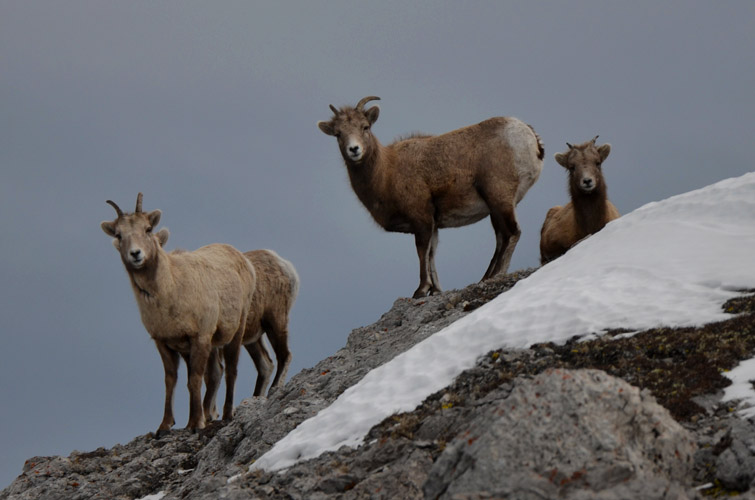
After admiring a group of sheep that were huddling in the lee of a small bump, we returned the same way we came. It was absolutely delightful to scramble along the length of the ridge again, especially now that the glowing afternoon sun was hitting the slopes around us.
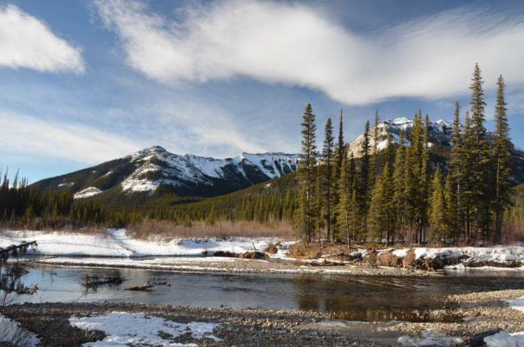
The trip could’ve ended probably at least an hour sooner had we simply stuck to the North Cutoff Creek Trail on our way back, i.e. the same way we had come in. But we got tempted by a smaller side trail that seemed to offer a short-cut back to the parking lot, the so-called South Cutoff Creek Trail. Although it’s without a doubt the more scenic route, it’s also more circuitous and involves lots of small ups and downs. Moreover, this trail is less frequented and we kept breaking through the soft snow pack, so in the end it probably cost us more time. To make matters worse we also got suckered into a side trail that appeared to be another shortcut, only to find ourselves in a cul-de-sac cutline that we had to walk out again. The last hurdle, just metres before the parking lot, was Cutoff Creek itself that stood in the way… luckily, we found a single 3 m wide ice bridge that held our weight and kept our feet dry. What a day!
|
Elevation: |
2300 m (estimated), 2254 m (highest elevation attained) |
|
Elevation gain: |
1280 m |
|
Time: |
10.0 h |
|
Distance: |
27.9 km |
|
Difficulty level: |
Moderate (Kane), T4 (SAC) |
|
Comments: |
Summit attempt. Actual high point of mountain not reached. |
|
Reference: |
Own routefinding |
|
Personal rating: |
4 (out of 5) |
NOTE: This GPX track is for personal use only. Commercial use/re-use or publication of this track on printed or digital media including but not limited to platforms, apps and websites such as AllTrails, Gaia, and OSM, requires written permission.
DISCLAIMER: Use at your own risk for general guidance only! Do not follow this GPX track blindly but use your own judgement in assessing terrain and choosing the safest route. Please read the full disclaimer here.