Pyrenees, France
28 May 2018
With Wen
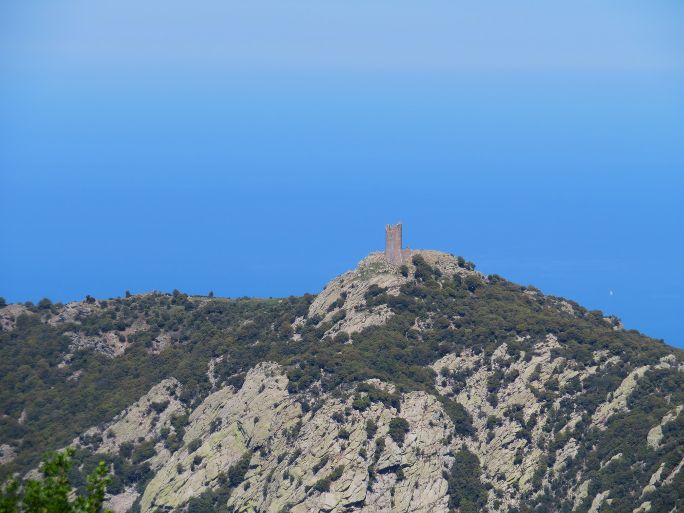
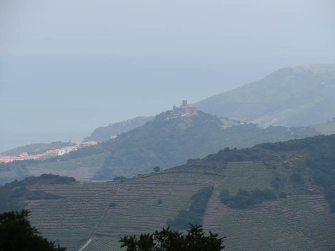
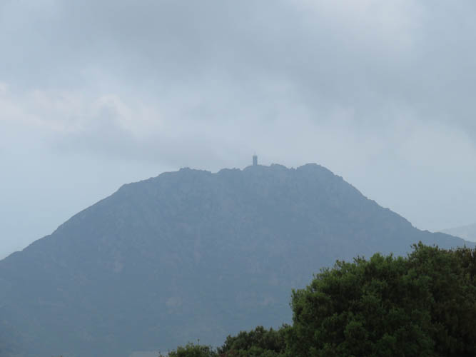
The Massane Tower, or Tour de la Massane in French, is an ancient lookout tower perched high atop a small ridge top overlooking the Mediterranean coast near the French-Spanish border. The structure was built by the kings of Majorca around the 13th century and used as a watchtower for more than 400 years. The location is breathtaking and affords gorgeous views over the surrounding plains, the sea and neighboring peaks of the Albera Massif in the Pyrenees. It’s easy to see why back in the days people used this spot as the perfect vantage point to watch for any intruders approaching by sea or land.
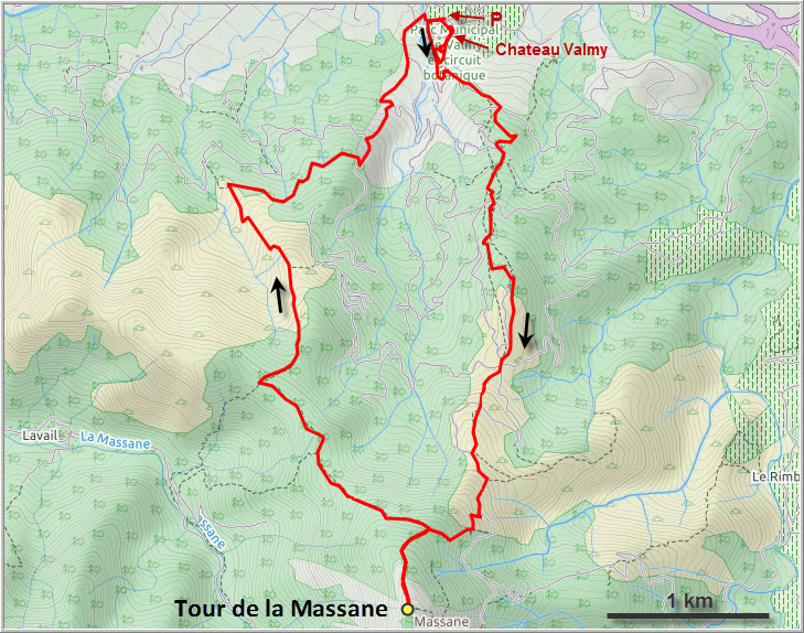
The tower makes for a great short day-hike as it’s only about 840 m elevation gain and 13 km round-trip, the starting point being the large parking lot at the Château Valmy. The castle has its own vineyards and public park and is also worth a visit while you’re in the area.
We spent the first 20 minutes walking around the park trying to find a way out of the castle grounds to reach the main trail, only to realize that there’s another smaller path off to the west of the parking lot that we should’ve taken. This shortcut takes you right to the official route up to the Massane Tower.
The trail is quite rocky and leads through lush, dense forest up the north ridge of the peak. It had been raining lots recently and with the high humidity and constantly changing cloud cover it felt like a tropical outing in an evergreen rain forest today! Yellow markers helped us stay on track, but the sign posts that appear at various junctions aren’t always super helpful – the stated times seem to be off (generally underestimating the required hiking time) and sometimes we weren’t sure where the arrows were pointing.
Wen was in amazing shape today and I had trouble keeping up with her as she raced up the trail, perhaps mindful of the darkening clouds accumulating over our heads. Sure enough, about half way up it started to rain, but thankfully the squalls didn’t last long. By the time we reached the main summit ridge, it had cleared up a bit. Fortunate for us, because seeing the tower appear along the ridge with all the clouds around us was simply an amazing sight! Of course we had the place all to ourselves once again.
The tower is a relatively small structure, perhaps 5 metres in diameter, and there’s nothing but an iron ladder inside behind the locked gate. Through the swiftly changing clouds we could glance at Fort Saint-Elme on another smaller hill to the east, with the Mediterranean forming a spectacular backdrop. Another tower, Tour Madeloc, could also be seen on a neighboring ridge. To the west, Puig Neulós, the highest of all Albera peaks, was all but enveloped in dark clouds. There was an ominous roar of thunder in the distance, which felt quite unsettling up here on this very exposed ridge. We quickly devoured our lunch (which tasted like heaven!) and decided to get out of there before all hell broke loose…
Just as the thunder was getting louder and the rain started again, we came across a solo hiker on his way up. The brave soul seemed undeterred by the worsening storm brewing above our heads, while all we could think about is to hurry down as fast as possible! Soon after leaving the summit ridge, we turned left at a trail marker to follow the loop route that was recommended for an easier descent. The trail was indeed less rocky and, in my opinion, easier to hike now that it was pouring cats and dogs. We were already drenched as we donned our ponchos, only to take them off again half an hour later as the rain abated.
Our second and last human encounter was with a French hunter who had driven up some rough track in his little Suzuki jeep. He had taken his hunting dogs for a walk, both collared and equipped with sensors that were connected to his GPS so he could call them back anytime he wanted. Wild boar are quite common in the forests here, as evidenced by the churned up soil in many places. The hunting season had apparently just ended, with the next season starting again in September. The friendly hunter offered us a ride down to Argelès, but we politely declined – we were completely soaked anyway and figured that we might as well finish the last 30 minutes of hiking now. It was an easy walk back to Valmy on a network of muddy trails that turned into a dirt road lower down.
This was a great little hike that is no doubt even more enjoyable on a sunny, cloud-free day!
DISCLAIMER: Use at your own risk for general guidance only! Do not follow this GPX track blindly but use your own judgement in assessing terrain and choosing the safest route.
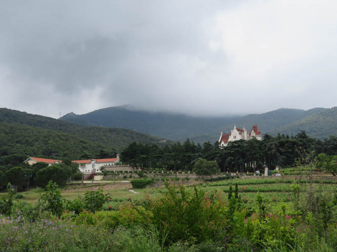
Château Valmy, with the Massane Tower hidden in the clouds behind.
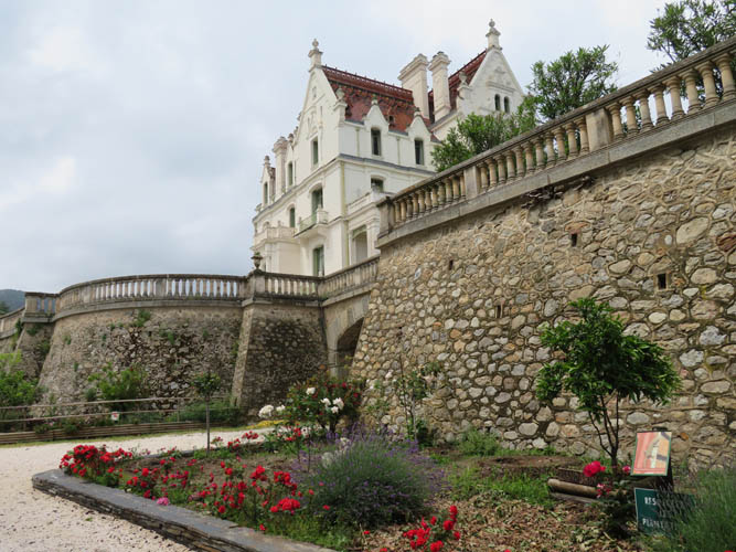
Château Valmy
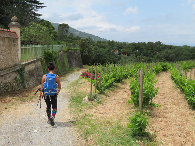
This is the correct start from the large parking lot at the castle. Down the small short-cut past the vineyards to the main trail.
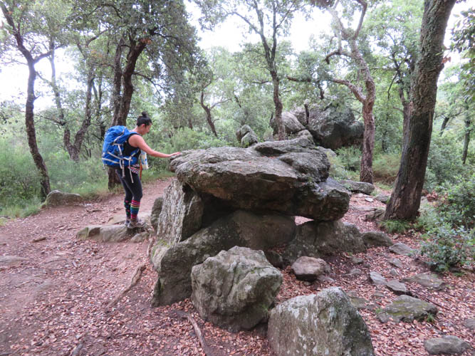
Dolmen – pre-historic rock structures en route to the tower.
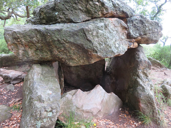
Huge rock slabs form small structures – dwellings or places of worship perhaps.
Fort Saint-Elme to the east.
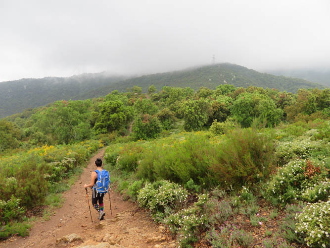
The clouds seem to slowly rise with us as we gain elevation.
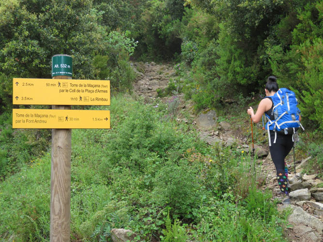
The path is well-signed out.
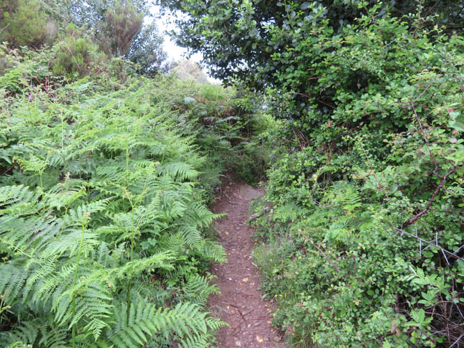
It gets pretty lush – almost tropical now in the rain – near the top!
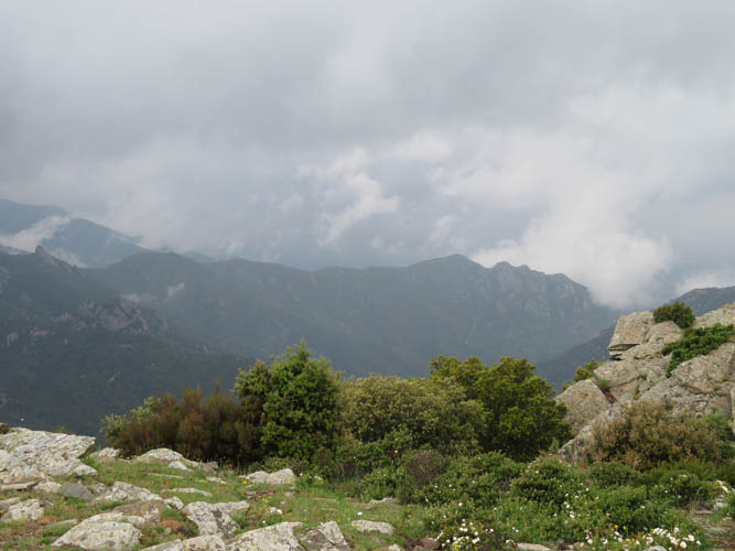
It is unusually wet and stormy for this time of the year.
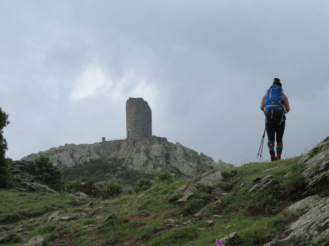
Finally, the Tour de la Massane!
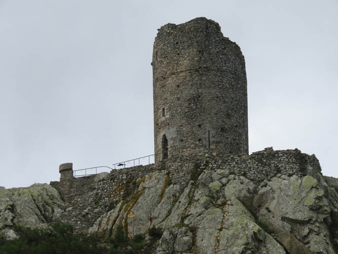
It’s a simple, slender structure built atop a high point of the ridge.
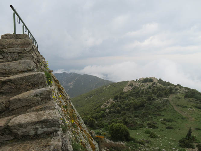
Wonky stairs lead up to the base of the tower.
Tour Madeloc on another peak to the east.
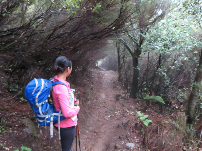
Our descent takes us through some dark, tunnel-like stretches of forest.