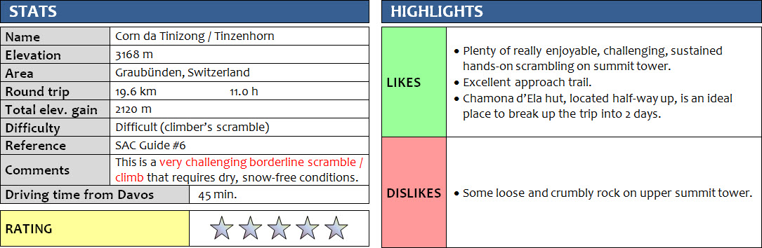
Graubünden, Switzerland
28 August 2017
Solo
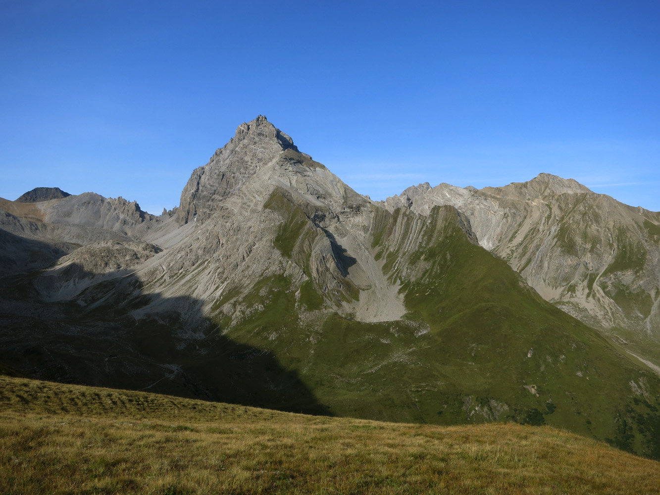
With its tower-like summit mass flanked on all sides by vertical cliffs and its slender yet jagged appearance, the Corn da Tinizong, or Tinzenhorn in German, is one of the most easily recognizable peaks in eastern Switzerland. It’s been dubbed the “Matterhorn of Graubünden” because of its distinctive shape. Graubünden is of course Switzerland’s largest canton or province, well known for many exciting climbs and mountaineering routes.
The Corn da Tinizong is also a prominent marker on the horizon that can be seen from as far away as Davos and even from the living room of our apartment there. Needless to say, I stared at this imposing 3170 m peak from our window more than once, wondering every time if it was possible to ascend it as a scramble. Most of what I found online wasn’t too encouraging… there was talk about ropes, belays, and extremely loose rock with severe rockfall danger. And the comment in the SAC guidebook that “many summit bids on the Tinzenhorn end in failure” didn’t help either! I could only find one online report that claimed that experienced parties could downclimb all difficult sections without ropes, in dry conditions that is. Pictures showed steep cliffs and narrow chimneys, but it was difficult to judge whether this was still a difficult scramble or already an alpine climb. Thankfully, one of our Swiss friends, a former mountain guide and avid hiker, had climbed the Corn da Tinizong many years ago and was able to provide a bit more information…and positive news: he encouraged me to go, under the caveat that I was in for some crumbly rock and lots of steep scrambling.
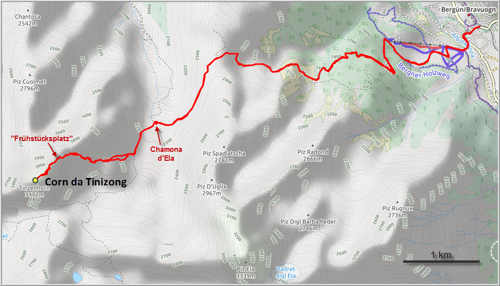
After a 45 min drive from Davos and initial “route finding problems” trying to locate a free parking lot in the small mountain village of Bergün, I managed to be on the trail at 6:40 am. To get to the mountain from Bergün, you first have to ascend about a thousand metres to a broad grassy saddle, then descend 150 m into the Spadlatscha Valley and the Chamona d’Ela (Ela-Hütte), the Ela Hut which is run by the Swiss Alpine Club but not permanently staffed. This approach takes longer than the bike approach from Filisur directly up the valley, but I didn’t have a bicycle with me so I had no choice. Lots of people do the climb over 2 days, with one night spent in the Ela Hut, but one day is easily doable if you don’t mind the extra elevation gain and a longer day.
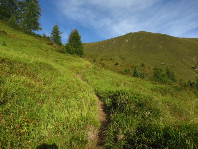
I thoroughly enjoyed the gentle approach on the excellent trail to the saddle. Not a soul was around and I had the peace and solitude of the forest and grassy meadows all to myself. As I arrived at the Ela Hut around 9:20 am, a fellow and his two kids were just waking up and getting ready for the day – the only occupants in the hut. We exchanged some friendly banter and he even offered me freshly brewed coffee – what a treat on an early morning hike! The hut looked pretty well-equipped and comfortable to me: bunk beds, kitchen and three large wooden tables to sit at are clustered in one large room; next door is a narrow corridor leading to the small toilet. There’s a stove and oven, water kettle, pots and plates, even sandals are provided. And the best part: you can buy soft drinks and beer at CHF 3.50 a can, candy and postcards are also available. It’s all based on the honour system and guests are expected drop off the correct change in a small coin box, which apparently works quite well. There is no electricity or running water, but a pipe spurts out fresh spring water right outside the wooden hut.
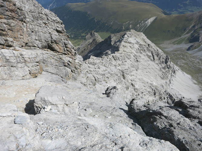
From the hut, I followed another good trail southward to the edge of a small bump labelled Bot Radond on maps, then turned right (cairn) up grass and scree towards the eastern flanks of a broad shoulder that comes down from Fil da Stidier, the long ridge that extends northeastward from the Corn da Tinizong. I soon came across a faint track in the scree that climbs up the shoulder through a confusing network of rubbly ledges and steps, but navigation was easy as there is a plethora of small cairns showing the most efficient route. Thank God for that, because without cairns it would most certainly not have been easy to always find the right break through the steps, which after some time all look the same.
Higher up the track veers more to the left towards the summit tower and eventually links up with the NE ridge right before a yellowish slab called the Frühstücksplatz – the breakfast spot! This is a perfect place to take a break and get ready for the final assault on the summit tower, the most challenging part of the day.
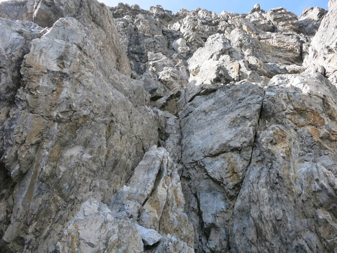
Following a narrow ledge on the eastern side of the ridge, I reached the base of a short cliff with three separate chimneys that can be climbed. While the SAC guide recommends ascending the middle one, I found it quite awkward with one bigger overhang in the middle, so I backed down. Moving to the right (northernmost) chimney turned out to be the better choice for me as a scrambler – the holds were sufficient and the rock solid enough to entrust all my weight. It was actually easier than I had anticipated, but I guess it would still be in the realm of a difficult climber’s scramble since there is quite a bit of exposure and it’s near vertical for about 5 metres. I found a rope slung around a rock anchor at the top, which is mostly used for rapelling back down I assume.
Above the chimney the route got a bit more confusing as the terrain is steep and the way ahead difficult to foresee. There was the odd cairn here and there, not enough to guide me up with confidence though. I veered slightly left up a scree ramp, then ended up in a very steep, slanted chimney with overhang on one side. I really wasn’t sure about the correct route at this point, but figured that simply taking the line of least resistance straight up would somehow spit me out on the summit ridge. After climbing up a narrow gully with plenty of rubbly ledges and loose mud, I did indeed reach the narrow ridge crest and followed it for a few metres until it became easier to continue on the steeply dipping NW face. Some crumbly rock here and quite a bit of exposure, but fortunately this section was short. Back on the ridge crest, a quick scramble along the narrow spine took me to the summit.
I definitely picked a prime day for this outing. The views today from the top were breathtaking! The mighty Piz d’Ela sits right across the valley and looks pretty enticing, but is more than a scramble as far as I’m aware. To the west, Piz Mitgel beckons, which apparently can be done as a scramble with relative ease. It was a fantastic summit panorama to enjoy on a bluebird day. The thick summit register contained more than a dozen entries for 2017 alone, but today I had the entire mountain all to myself.
The descent was a matter of carefully retracing the steps I had taken on the way up. It’s easy to get lost in the confusing NE face above the chimneys and it took all the concentration I could muster to get down the steep, rubbly terrain here. The downclimb of the lower chimney was challenging, but there are plenty of holds so if you take your time searching for the best steps and are comfortable with some exposure it’s fine to do it without a rope.
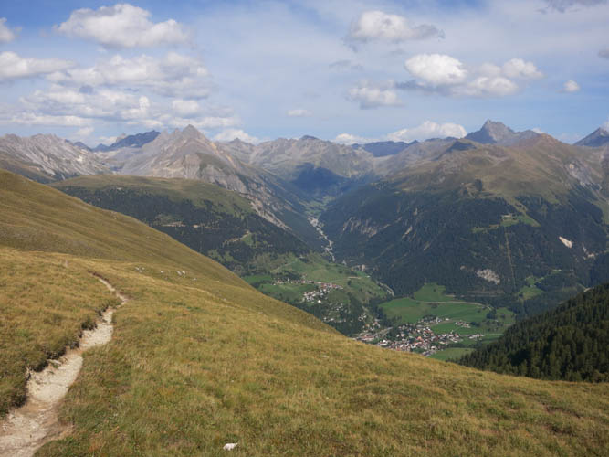
Back at the “breakfast spot”, I retrieved my poles and took another well-deserved break before heading down the NE ridge to the Ela Hut. I thoroughly enjoyed the remaining hike on the trail back down to the town of Bergün, although it was a bit drawn out and after 11 hours of hiking and scrambling I was certainly happy to be back at the car.
A wonderful, thoroughly enjoyable and rewarding trip with plenty of excellent scrambling challenges. I would totally do this one again!
Note: If conditions are less than ideal, then this is not a scramble anymore. Even in dry, sunny conditions it’s a very committing undertaking that’s not to be underestimated. Many people rope up on the summit tower, so if unsure take a rope with you just in case.
DISCLAIMER: Use at your own risk for general guidance only! Do not follow this GPX track blindly but use your own judgement in assessing terrain and choosing the safest route.
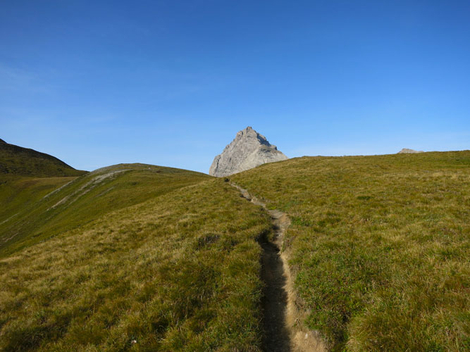
A beautiful approach trail!
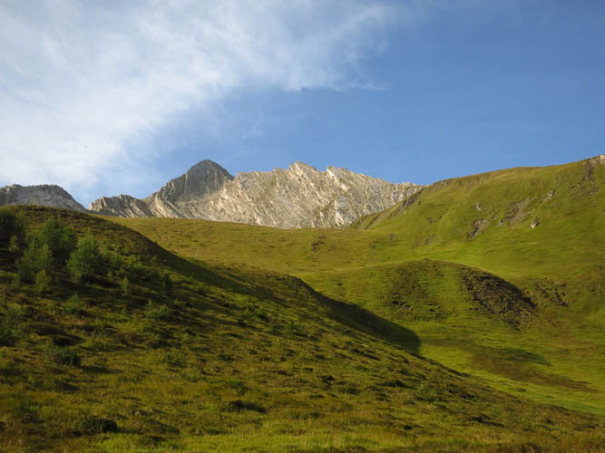
Lovely morning hike through gentle meadows. Piz Spadlatscha in the background.
First view of the distinctive Corn da Tinizong from the saddle between Bergün and the Val Spadlatscha.
Excellent trail, superb weather, no people. A perfect day to tackle the Tinzenhorn!
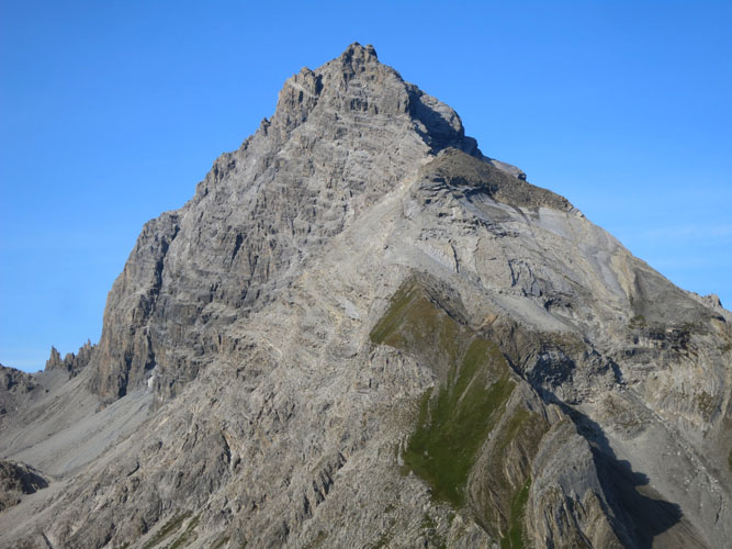
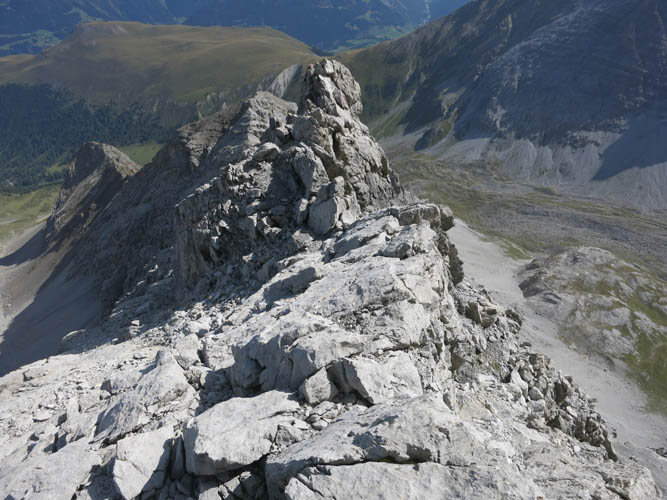
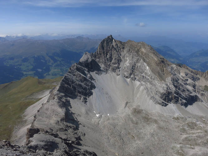
Close-up of the summit tower.
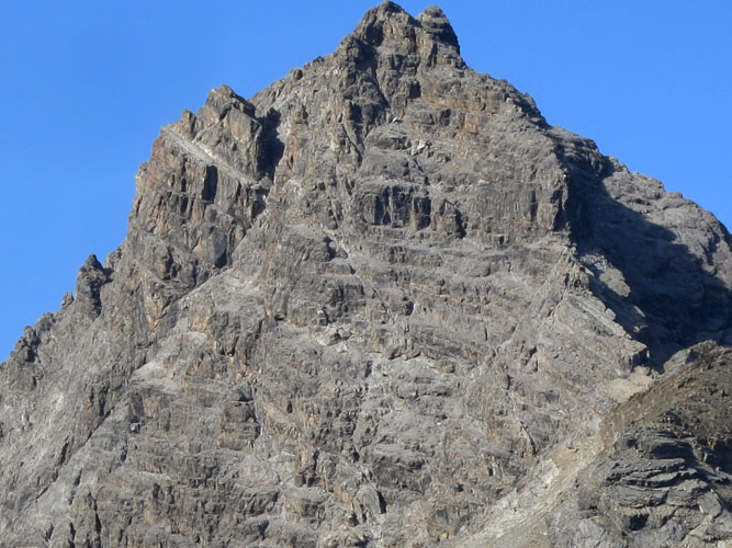
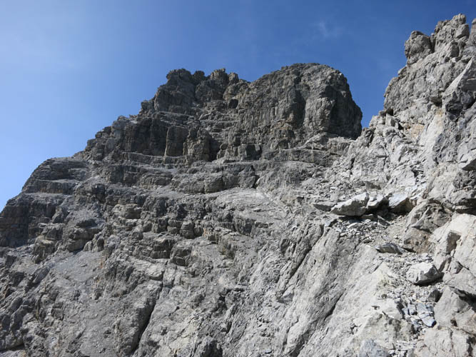
And an even closer look: the normal route goes up step-like slopes in the lower right of the photo to the top of the NE ridge until the big vertical cliff is reached (Frühstücksplatz). It then traverses left to the dark cliff with three chimneys in the centre of the photo, from where it basically leads straight up and slightly left.
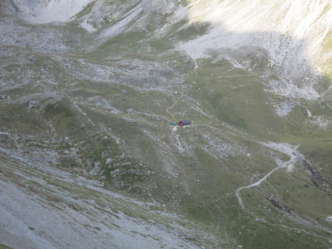
The Chamona d’Ela hut from near the saddle in the Spadlatscha Valley.
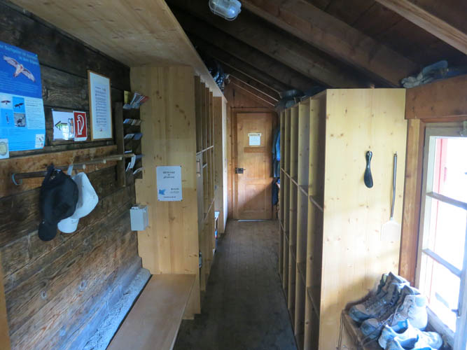
The hut inside: rustic and comfy!
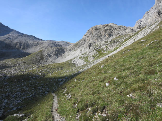
A good trail continues south towards Bot Radond, the bump on the right.
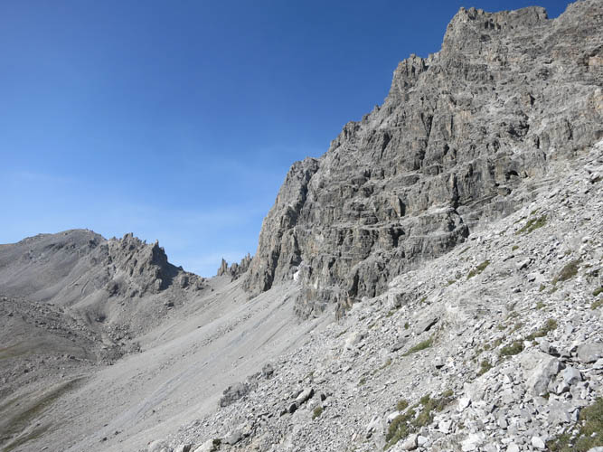
Now the hard work begins – scrabbling up steep scree-covered slopes towards the NE ridge.
Even here the terrain is not without its challenges. Lots of cairns make the routefinding easy, though.

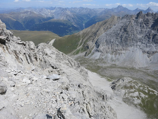
A look down the SE slopes of the Fil da Stidier.
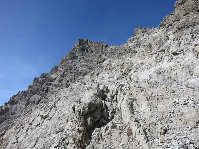
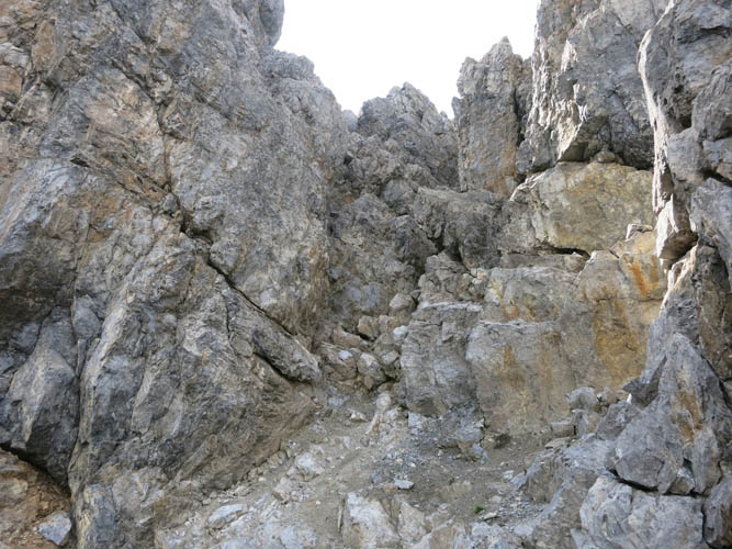
Almost at the crest of the NE ridge. The vertical cliff with the three chimneys can be seen on the left (black).
The Frühstücksplatz (breakfast spot).
Looking down along the spine of the NE ridge from the Frühstücksplatz.
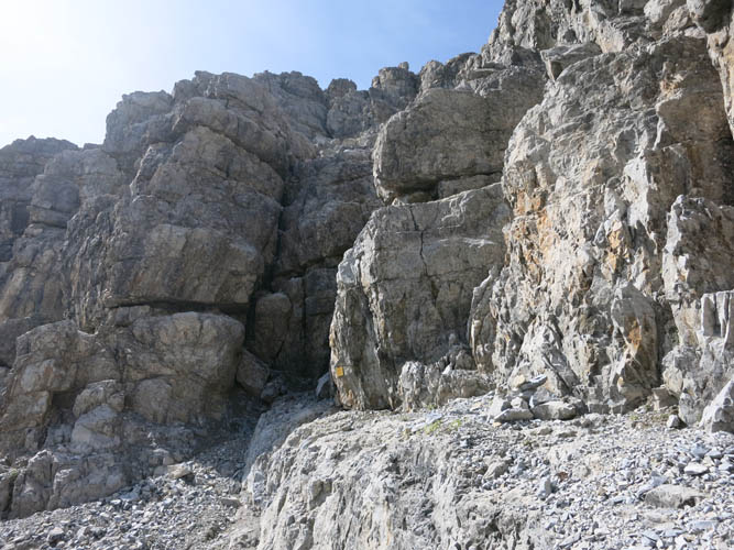
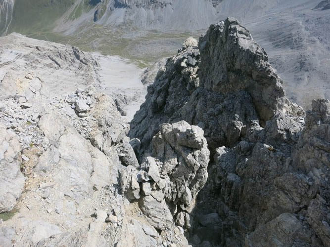
At the main crux, the three chimneys.
Looking up the chimney on the right side.
And a look down from above. There’s a rope tied around a rock here.
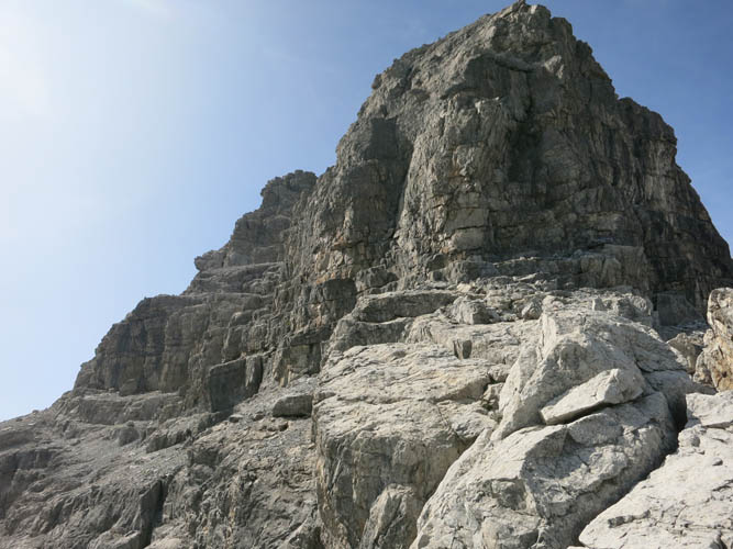
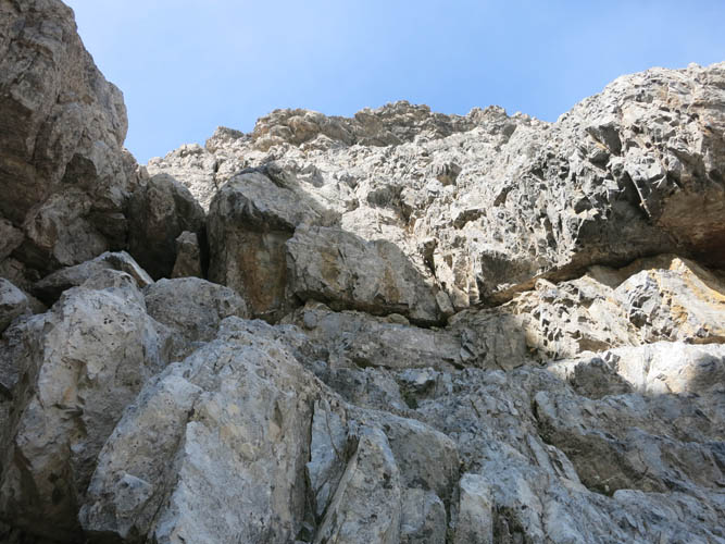
The entire east face of the summit tower is quite steep and interrupted by numerous ledges, ramps and gullies.
Lots of opportunities for good hands-on scrambling, but the rock can be crumbly.
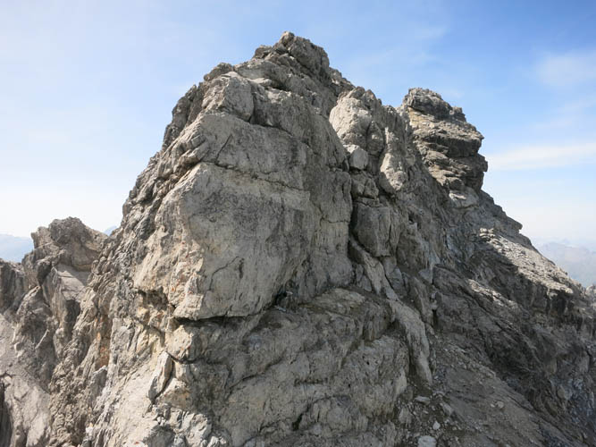
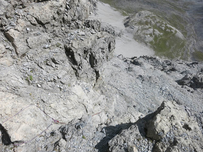
A large gully leads right to the top of the ridge. Here, the route continues on the west side where steeply dipping scree-covered slabs and ledges need to be traversed for a short section before one can gain the ridge crest again.
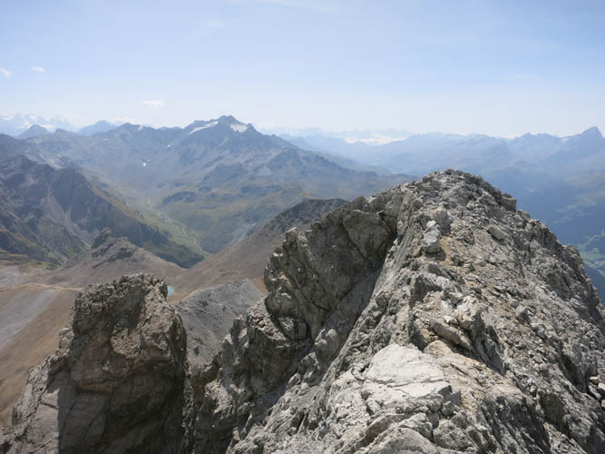
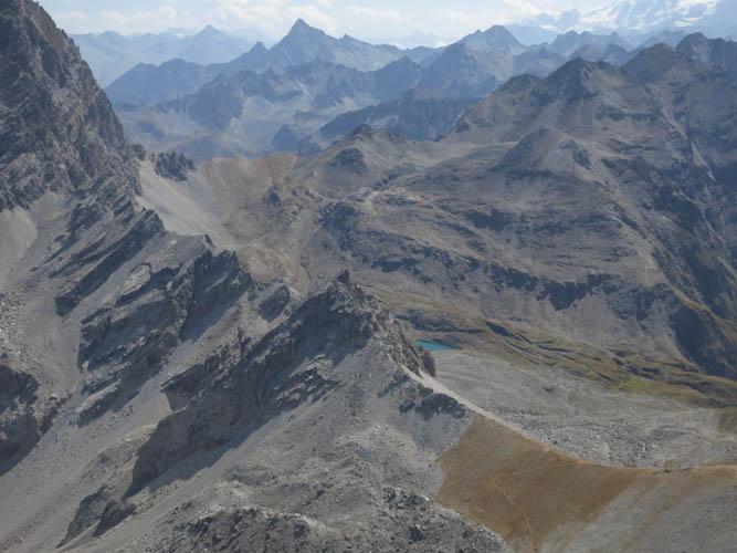
Corn da Tinizong summit ridge. Piz d’Err (3378 m) is the tall peak with the glaciers just left of centre.

It’s a narrow ridge crest with steep drop-offs to both sides!
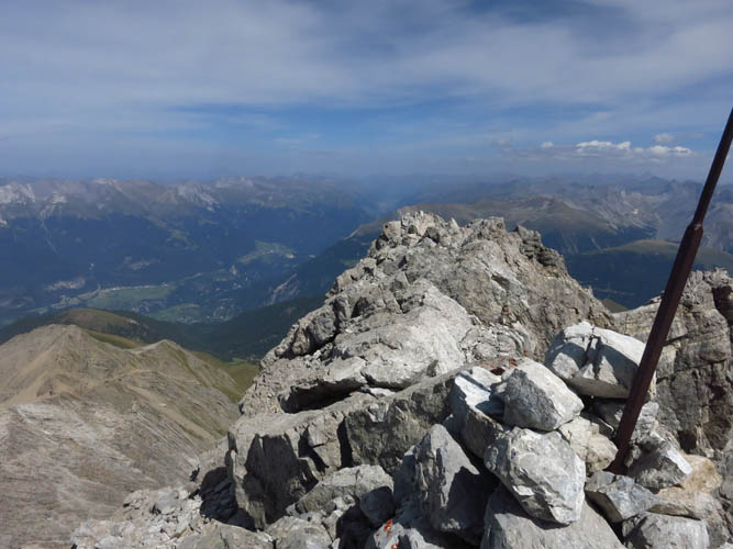
Summit cairn, looking towards the town of Davos.

Davos in the distance.
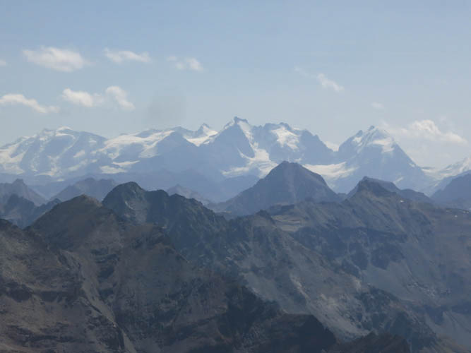
The glacier-covered mountains far to the south are a good deal taller than where I’m standing.
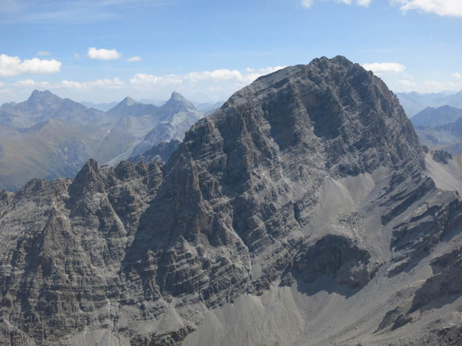
The impressive Piz Ela (3339 m) is right across the Spadlatscha Valley.
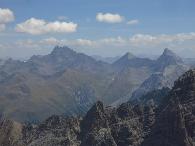
These three beautiful summits far in the distance to the east are (L to R): Piz Kesch (3418 m), Piz Blaisun (3199 m), Piz Üertsch (3267 m).
Piz Mitgel (3157 m) is the immediate western neighbor.
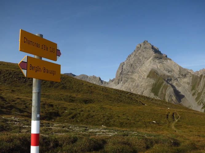
A good trail leads up the meadow at the Pass d’Ela.
Looking down the main gully from the ridge top on descent.
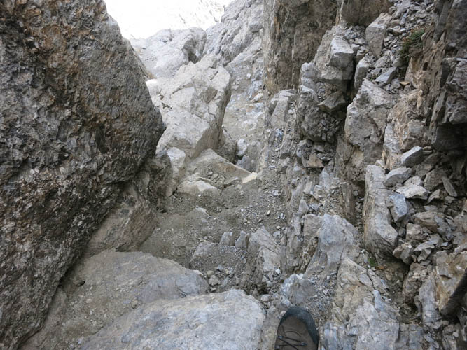
In the gully: lots of rubble and mud.
Looking back up the gully.
Heading back down the NE ridge towards Bot Radond, the little bump on the lower right side.
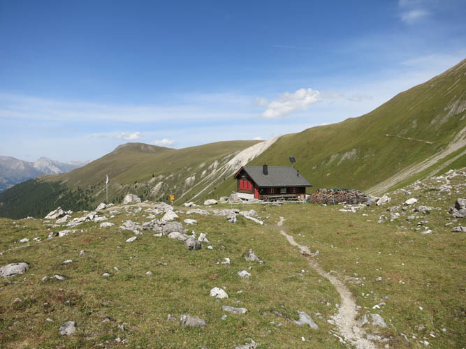
A shot of the pretty Ela Hut in the sun on my way back.
Descending towards Bergün.
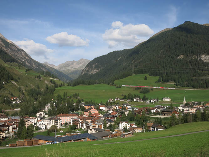
The picturesque town of Bergün.