Banff, AB, Canada
16 September 2023
With Adam
Extremely exposed and sustained hands-on climb
Although this beautiful mountain can be readily seen from Highway 1 when passing through Banff National Park west of Castle Junction, it is rarely climbed and the only account I could find was by climber Peter Nelson who had ascended it via the NW ridge. I had a go at it two years ago but a traverse across a narrow and extremely exposed ledge played tricks with my mind and made me turn around soon after. Thankfully, I found a bypass route on my way back so I didn’t have to tip-toe across the ledge again back then.
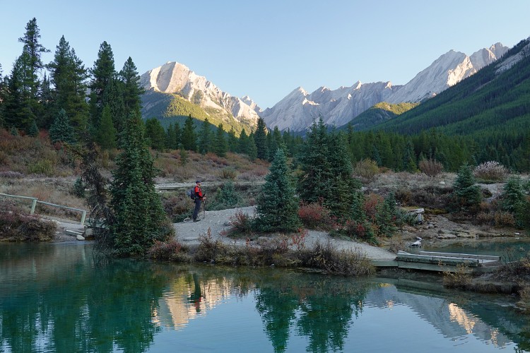
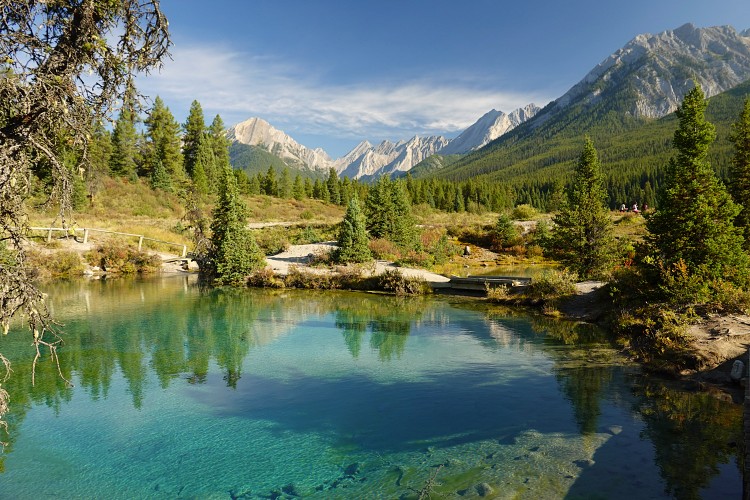
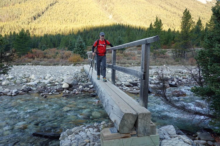
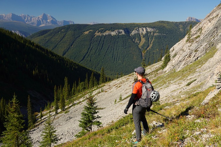
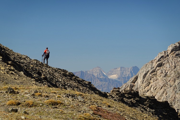
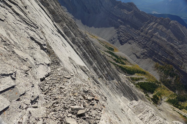
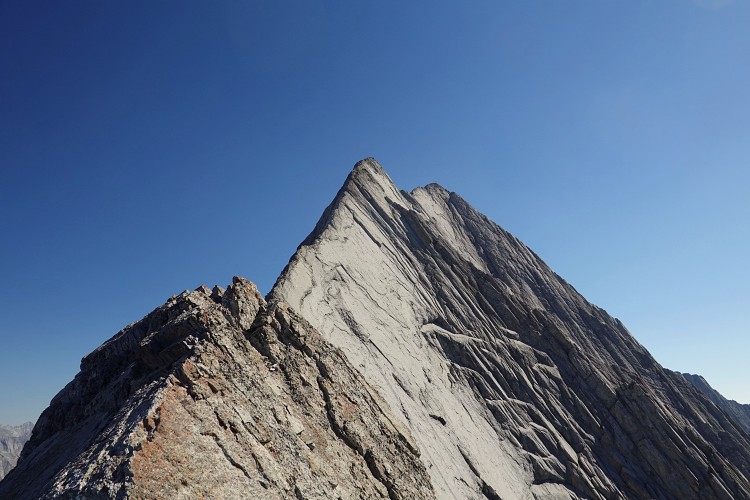
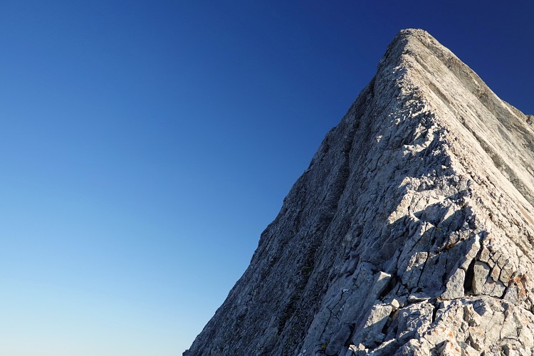
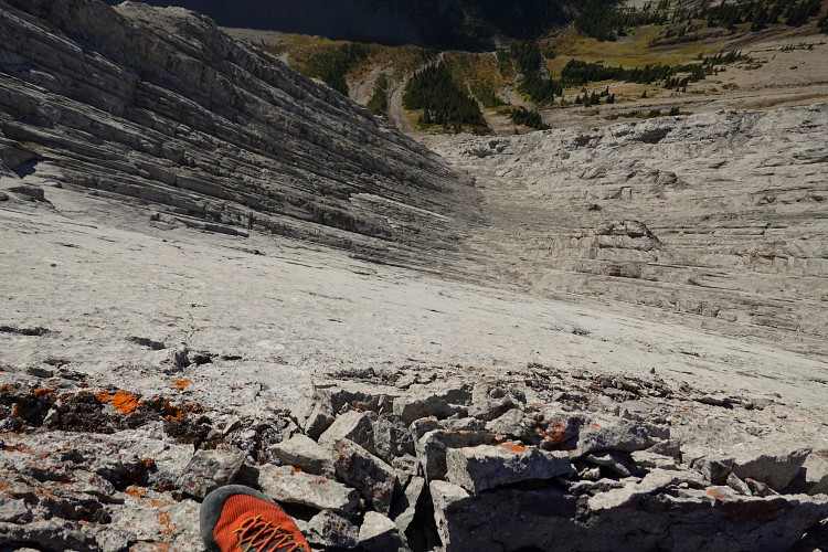
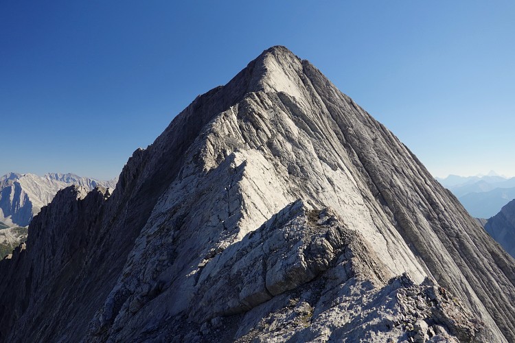
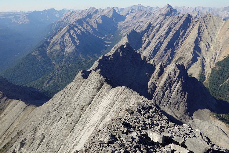
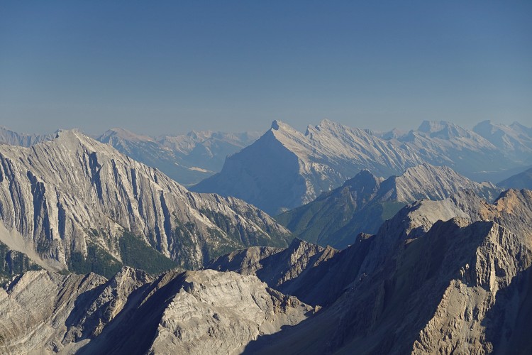
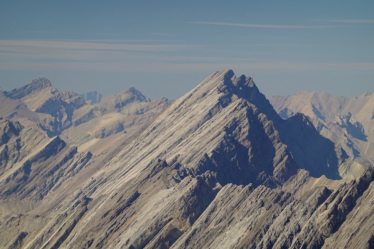
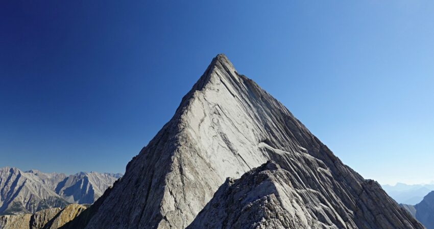
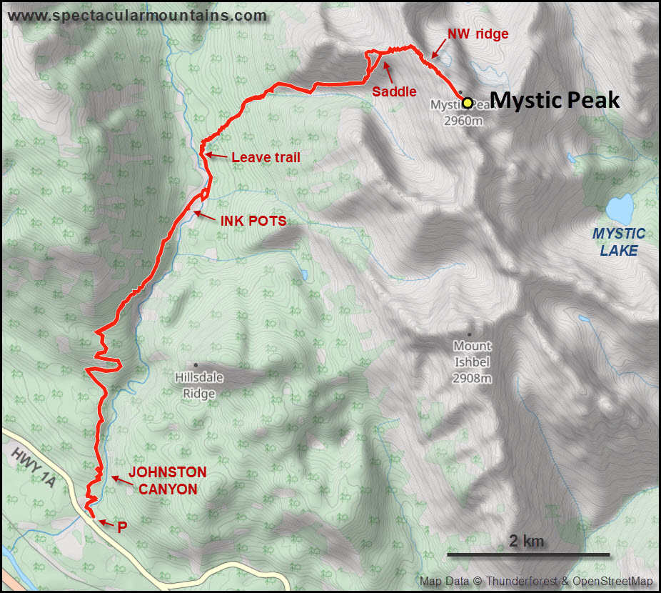
Today was a perfect day to complete the mission and I was thankful Adam joined me on the adventure. We quickly did the hike from the Johnston Canyon parking lot to the ink pots, then continued along the trail for another 900 m before heading right up the access valley through light forest with minor bushwhacking here and there. Mid-way up the valley we found the good goat trail I had stumbled across on my previous outing and followed it to the base of a grassy slope that leads up a rib on the northwest side of the mountain. We arrived at a shaly saddle from where we could see the full splendour of the massive near-vertical limestone slabs that form the entire west side of Mystic Peak.
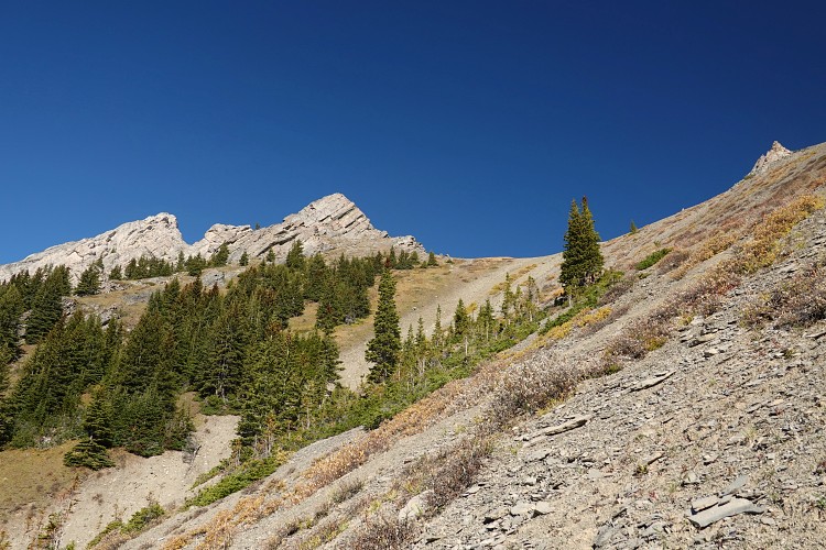
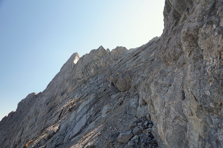
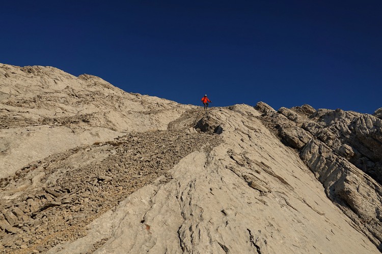
Surprisingly, a few of the cairns I had placed two years ago were still up, which facilitated some of the routefinding to get up to the NW ridge. It gets steep very quickly here – we followed the spine of the rib as far as we could, traversed a short distance to climber’s left and scrambled up a small, v-shaped gully, then a mix of scree and steep rock ribs to the top of the ridge.
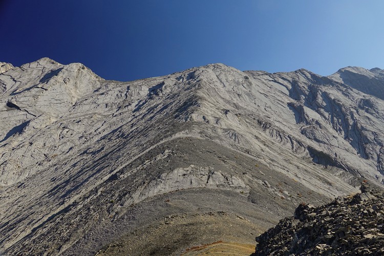
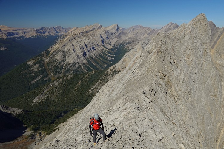
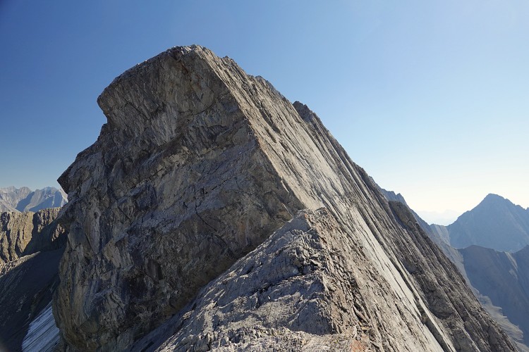
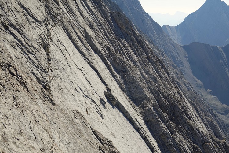
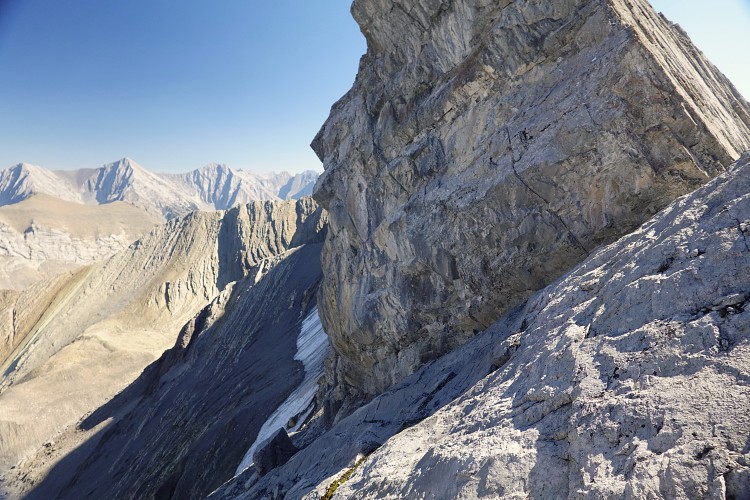
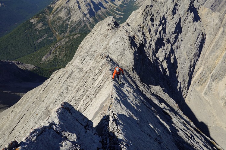
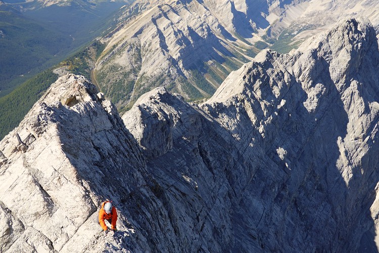
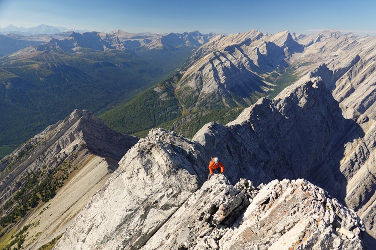
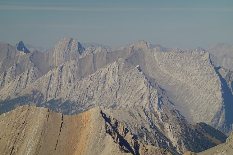
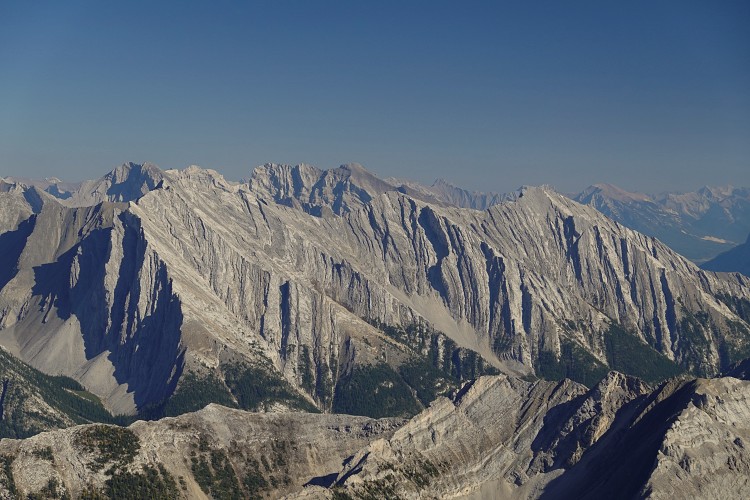
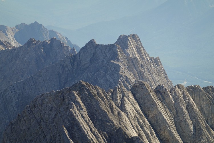
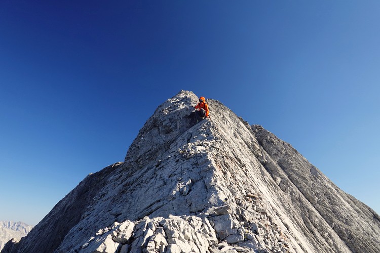
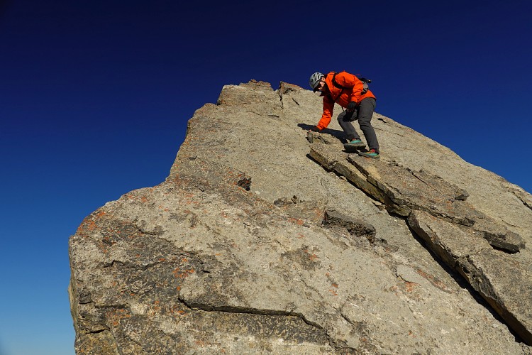
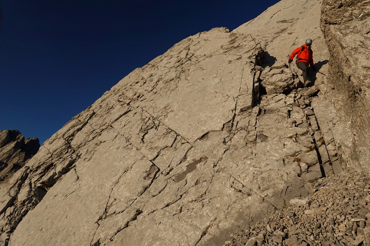
The northwest ridge is both scary and fun, depending on your comfort level. Either way, it’s a long and strenuous affair that requires full concentration the whole way. Right at the beginning there is a big overhang that stands in the way. This is where I previously took the “boot ledge” described by Peter, basically a very narrow and scree-covered crack that runs across steeply inclined and smooth limestone slabs with a ghastly drop down the right side. A much better option is to go around the left side of the overhang – drop down some slabs and shortly after climb a steep step to regain the ridge. It’s still difficult scrambling but the exposure is not as bad.
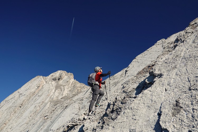
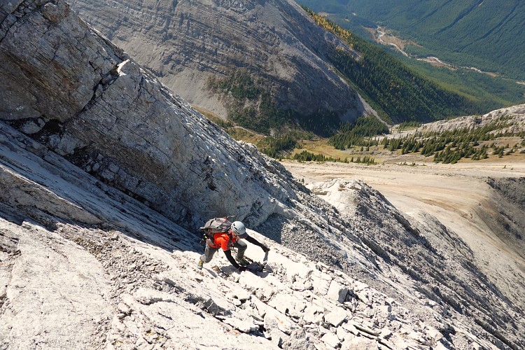
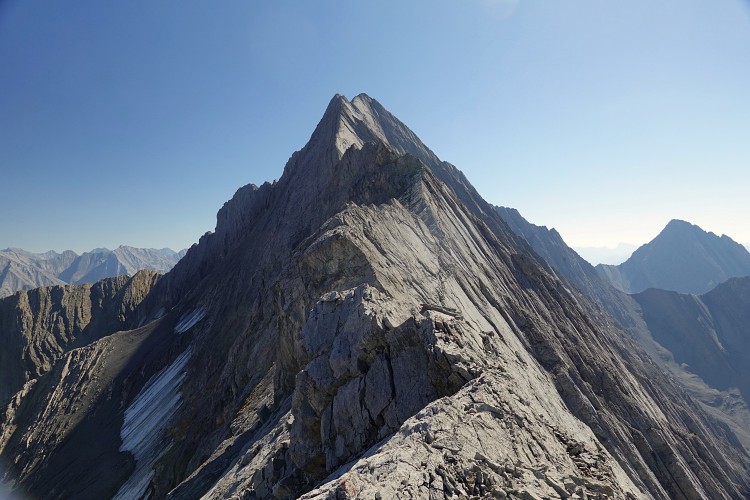
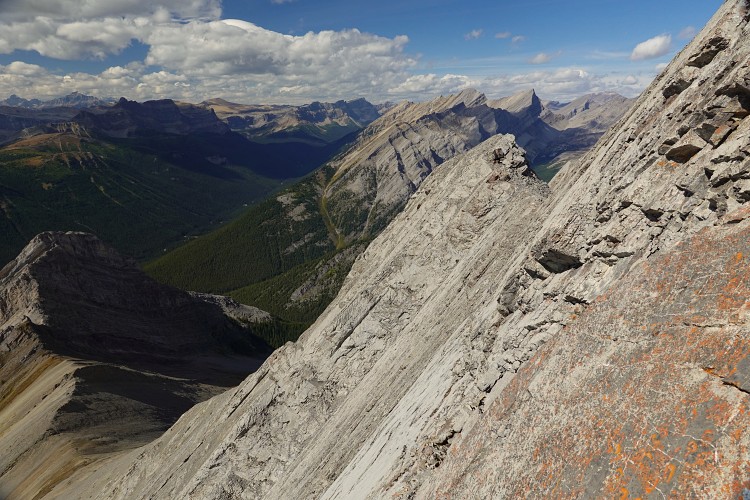
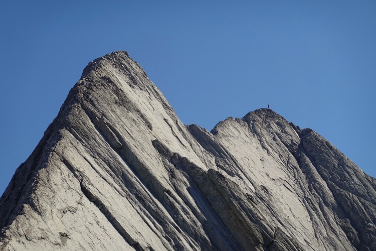
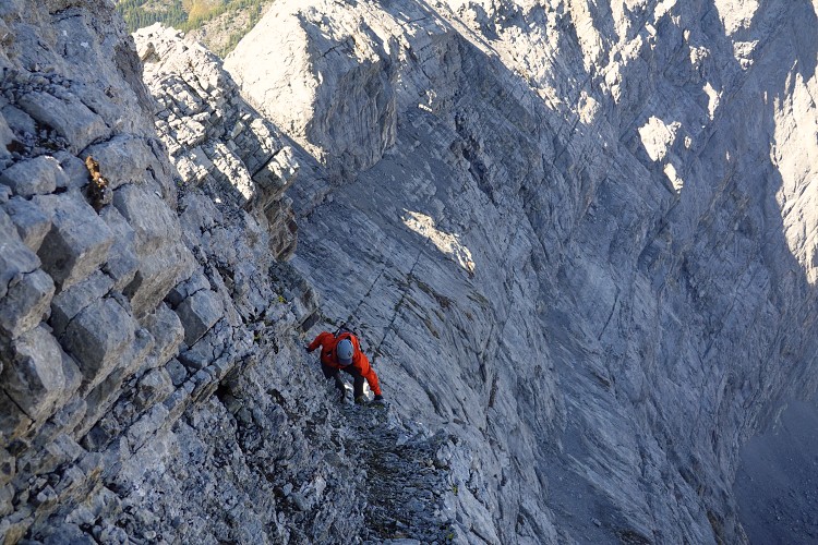
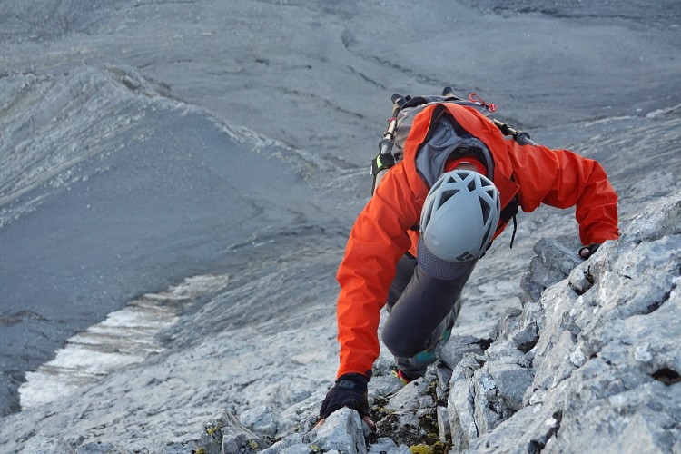
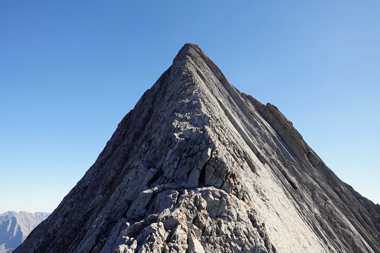
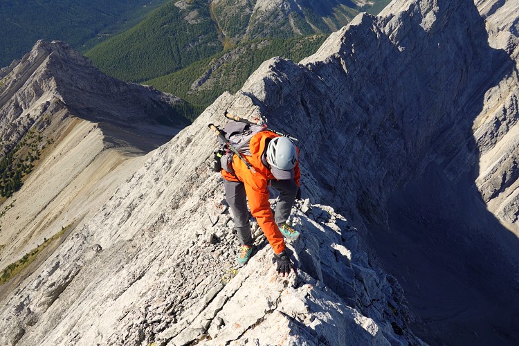
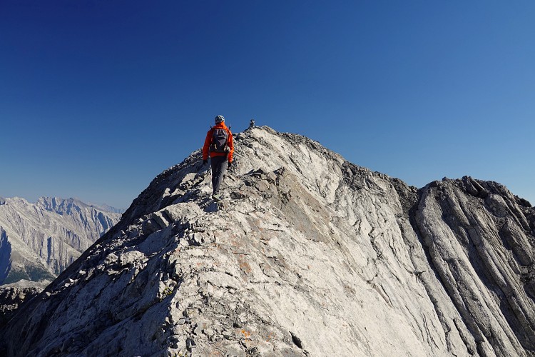
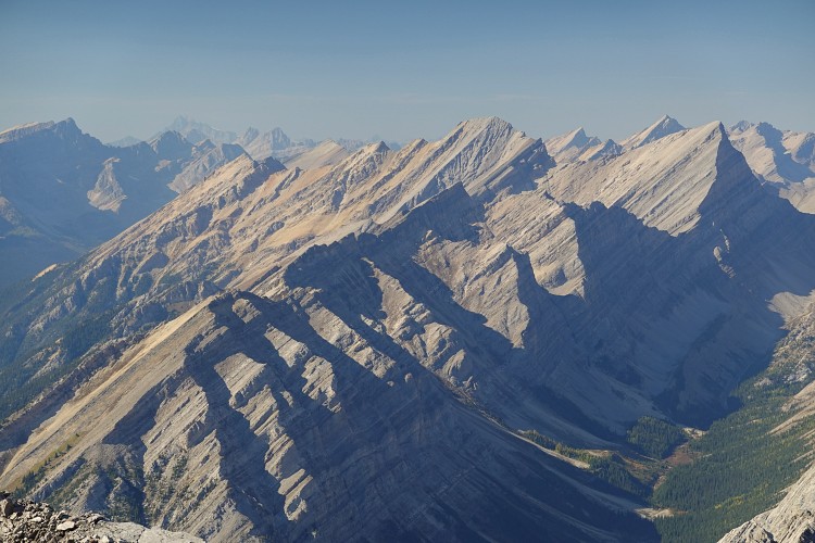
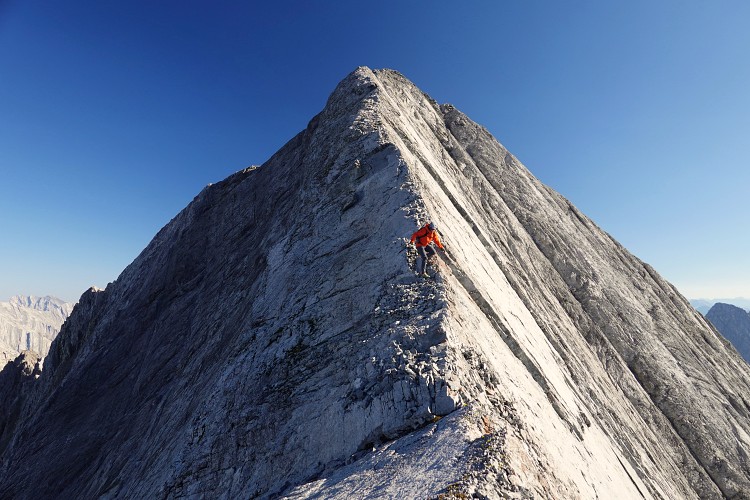
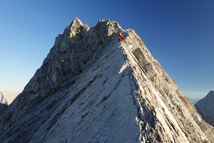
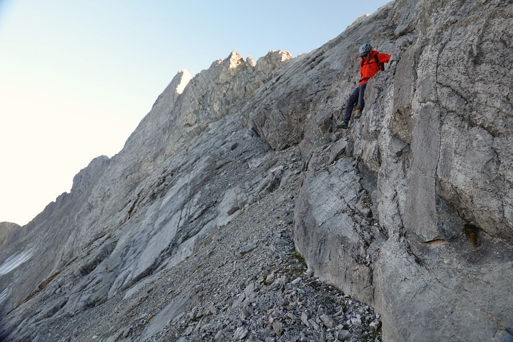
Once the overhang obstacle has been cleared, there is still a long way to go. The ridge entails very serious exposure and sustained, almost non-stop hands-on action all the way to the summit. There is a ton of difficult scrambling and climbing to do, with numerous spots that require up- and downclimbing slabs, notches, and drop-offs. Much of it is on a knife-edge spine that is nice and solid in some parts, and crumbly and loose in others. About half-way along the spine steepens significantly. We didn’t like the look of it and instead chose to go up a narrow ledge that hugs the left side of the ridge for some 50-60 m. The ledge rises at an angle and is covered with rubble, so we had to use our hands a lot to grab small holds on the wall to our side for extra control. Shortly before the ledge ran out we were able to climb back up to the ridge top.
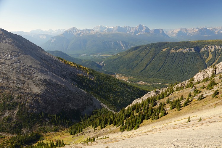
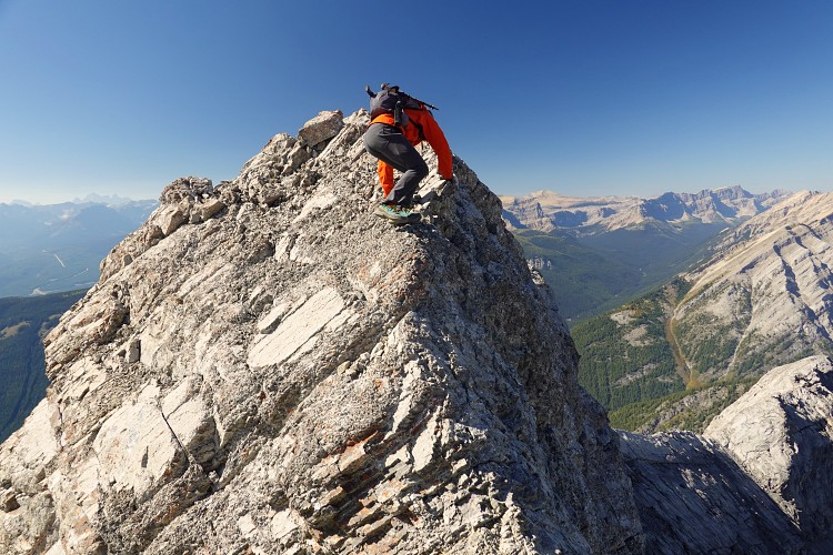
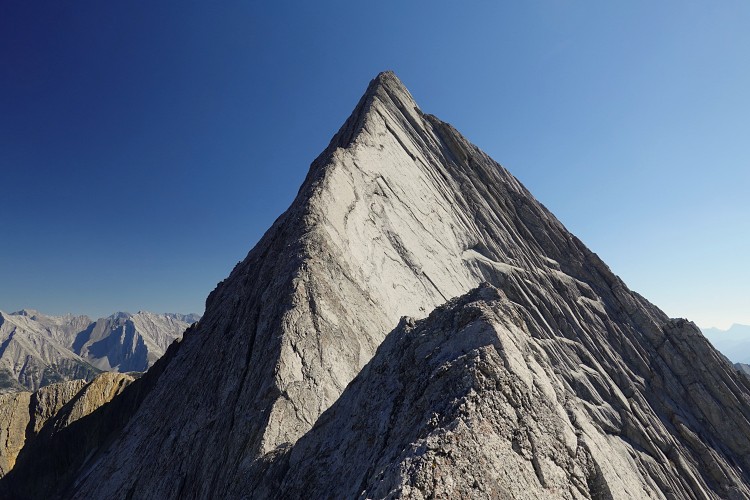
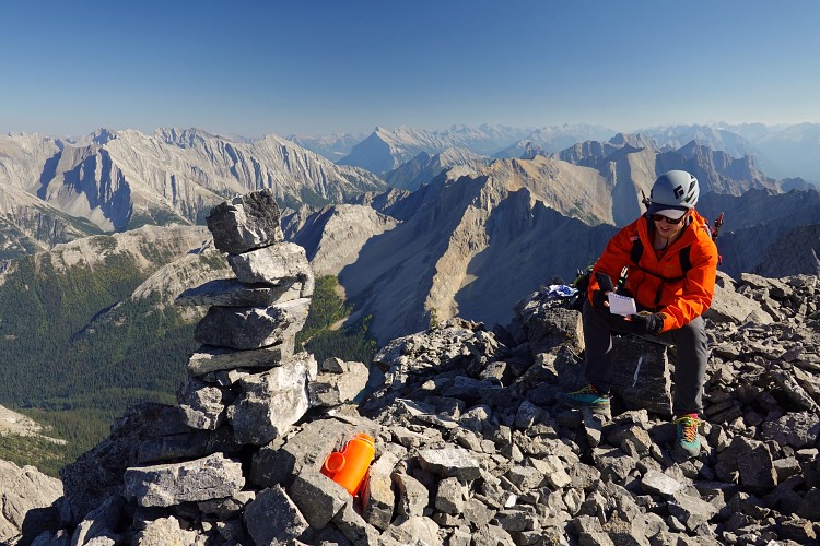
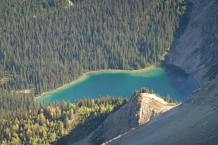
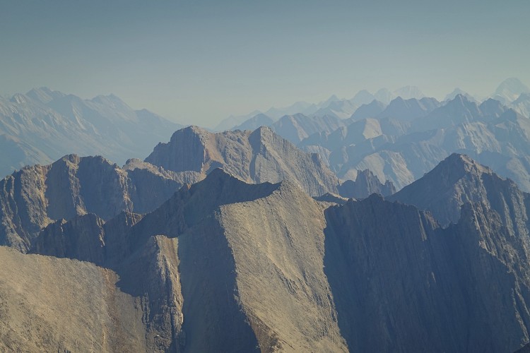
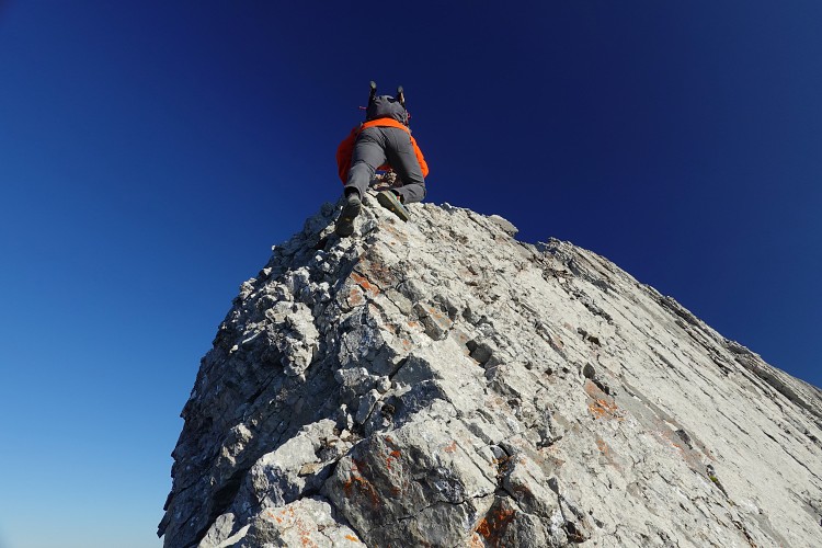
The ridge eases off over the last hundred metres or so and we felt a big sense of relief when we finally reached the summit at 4 pm. It had taken us a full 8 hours from the parking lot, with about half of it spent on the NW ridge! The views were fantastic on this bluebird day and there was even a bright orange Nalgene bottle as a register, placed in 2015 by Dennis Pelletier and Robb Schnell who also came up the NW ridge. Other than that and Peter Nelson’s there were no other accounts, except for an entry by a solo climber who – curiously – had visited the summit just hours before us on the very same day! Haldan Borglum left a note saying he ascended via SE slopes and the E ridge, presumably from Mystic Lake. Sounds like an interesting route with some bold routefinding.
We briefly debated descending down the E ridge and then slabs and ribs on the SW face, which was apparently the route of the first ascentionist John Martin back in 1991. The risk of running into unseen drop-offs and getting cliffed out quickly led to the consensus to simply retrace our steps, no matter how hard the downclimbs would be.
It turned out not quite as difficult as we expected, but took about the same time and at least as much concentration. We just took it step by step and slowly worked our way back. There was lots of stemming action along the bypass ledge and some of the downclimbs and I can still feel my arms the day after :).
A super memorable trip and probably the most challenging either of us have done. This is not a scramble but an unprotected climb in my opinion. I’m not good at rating climbs but would call it at least a 5.5. to 5.6. For seasoned climbers (which I am not!) this is of course pretty low on the difficulty scale, but note that it will be hard to impossible to protect (we didn’t see any pitons) and the rock can be crumbly in places. Needless to say that you wouldn’t want to attempt this if conditions are anything but ideal – dry and not too windy.
|
Elevation: |
2977 m |
|
Elevation gain: |
2180 m |
|
Time: |
14.5 h |
|
Distance: |
22.5 km |
|
Difficulty level: |
5.5 to 5.6 (YDS) plus difficult climber’s scramble (Kane) |
|
Reference: |
Own routefinding |
|
Personal rating: |
4 (out of 5) |
NOTE: This GPX track is for personal use only. Commercial use/re-use or publication of this track on printed or digital media including but not limited to platforms, apps and websites such as AllTrails, Gaia, and OSM, requires written permission.
DISCLAIMER: Use at your own risk for general guidance only! Do not follow this GPX track blindly but use your own judgement in assessing terrain and choosing the safest route. Please read the full disclaimer here.