Svaneti, Georgia (Caucasus)
24 September 2018
With Wen
An introduction to Georgia’s magical Svaneti region
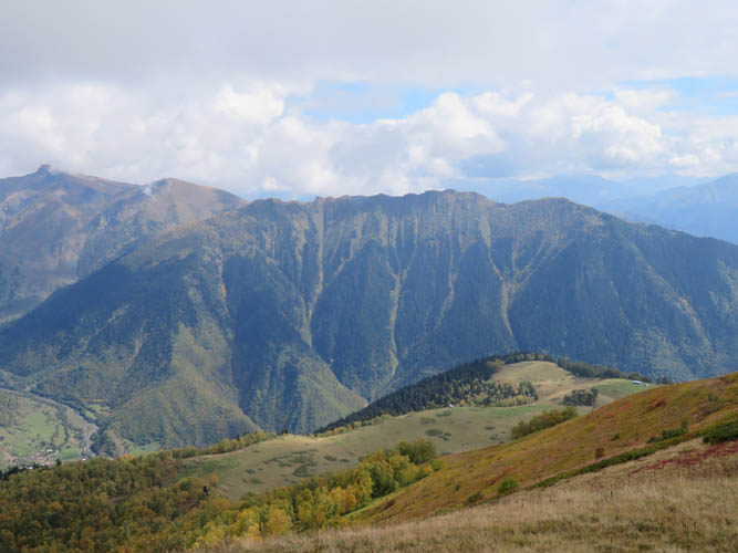
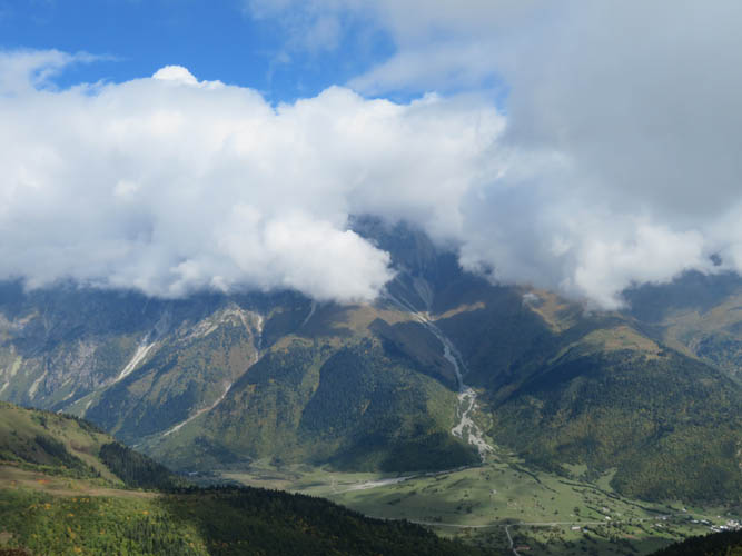
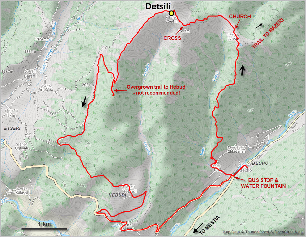
Mount Detsili is really just a big grassy hill, but it’s still 1300 m of elevation gain from the village of Becho in the valley below and a long day if done as a loop via Hebudi on the other side. It’s also a great introductory hike in the Mestia area that’s bound to be quiet and uncrowded. We didn’t see any other hikers the whole day!
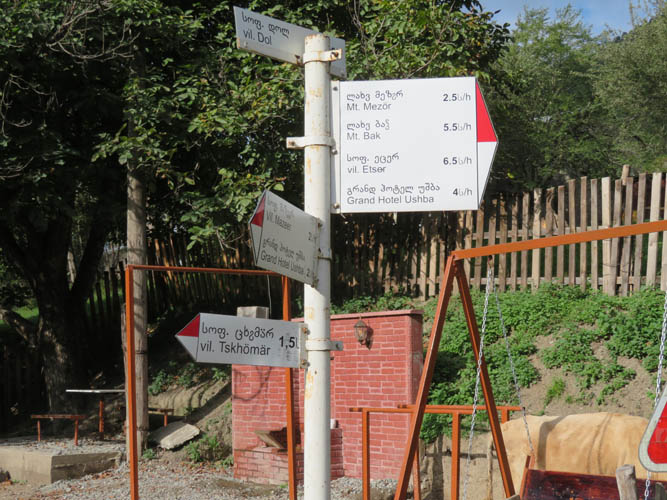
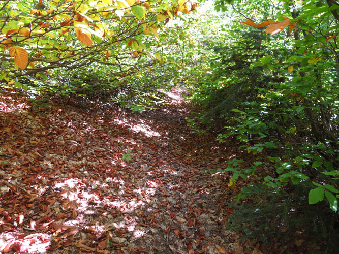
From our guesthouse in Becho (“Hotel Ushba”, not really a hotel but a wonderful family-run homestay with the best food we’ve had in Georgia!) we walked up to the end of the village on the west side where a trail starts up a forested ridge. The trailhead was a bit tricky to locate at first, especially without a GPX track, but eventually we found it just past the last houses above the highest koshki (an old fortified Svan tower). These slender structures were used to defend Svaneti villages from attacks by outsiders and are common all over the region.
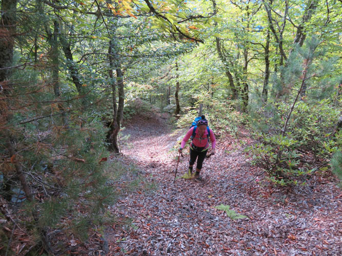
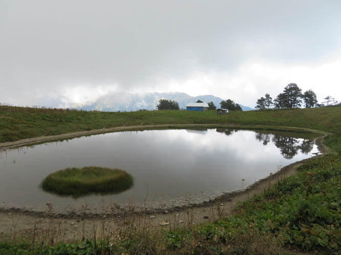
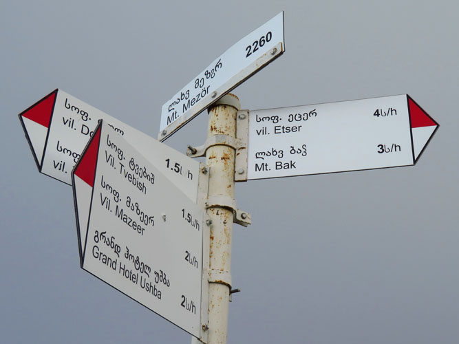
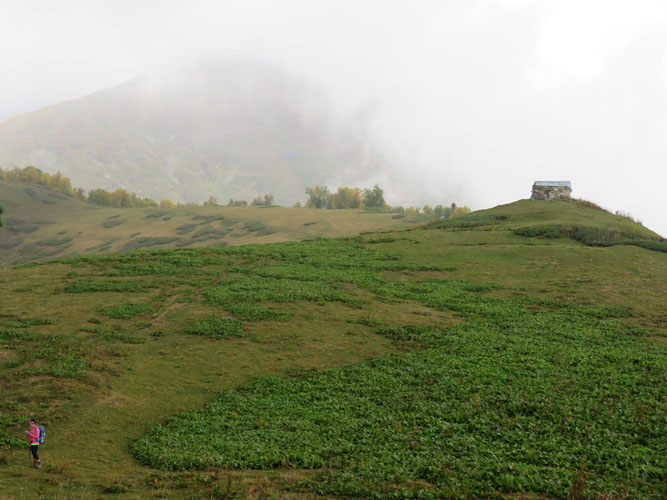
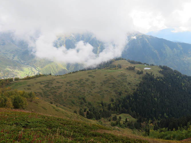
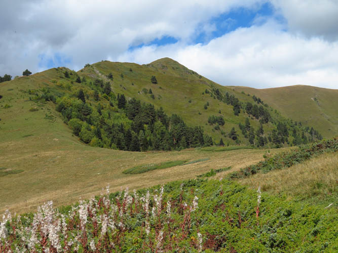
There are the odd red-white paint markers but otherwise the trail – a cow path really – is poorly marked and not very well-trodden. Nevertheless it’s impossible to get lost since it’s just straight up through forest all the way until you come out on a grassy shoulder where a small lake and farmhouse are situated. A bit higher up is an old chapel (called the Meziri Church of the Archangel) near a highpoint called “Mount Mezör” on a signpost at 2260 m. It’s hardly a mountain, though, just a small rise along the ridge that keeps on climbing towards Mount Detsili.
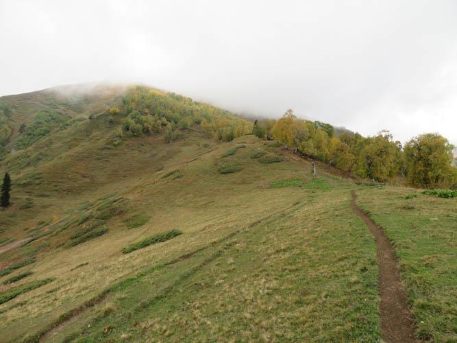
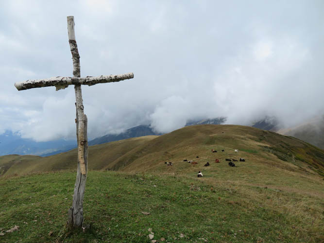
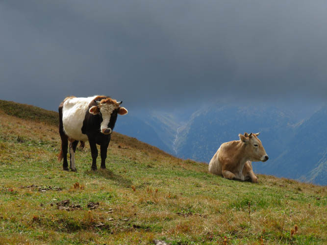
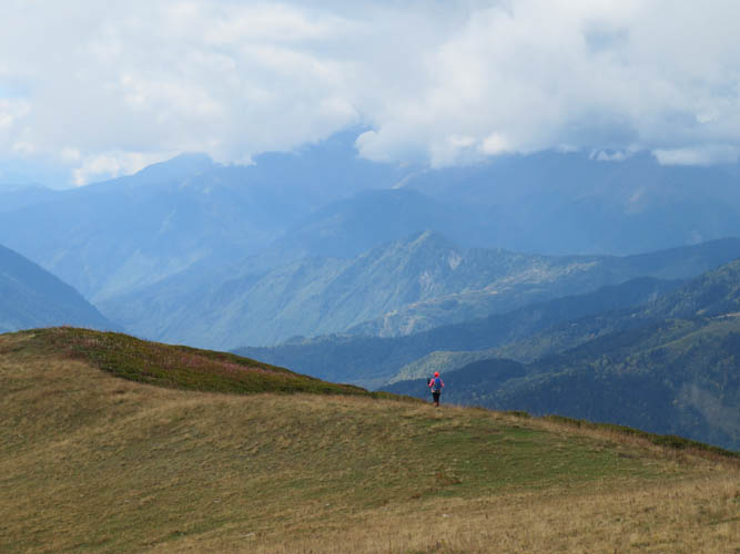
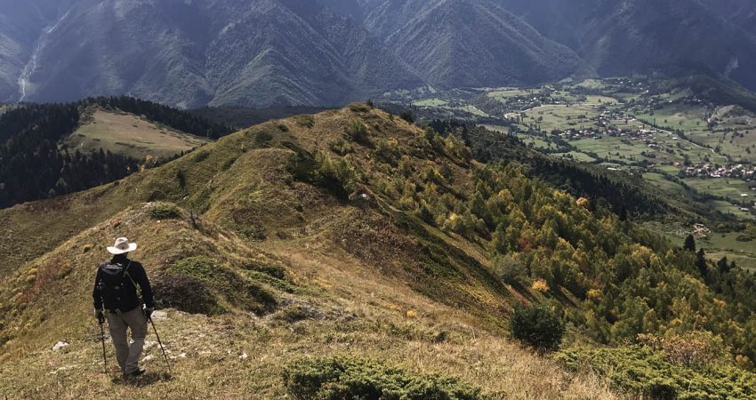
We followed a rough trail west along the open ridge and up a hillside full of blueberry bushes to the first summit with a wooden cross. The true summit is a few metres higher and only a few hundred metres away, but there’s no cairn and it’s a bit anti-climactic to be honest. Everything up here is covered in grass and a favourite hang-out place for the local cows.
The easiest and fastest way to go back would’ve been to simply retrace our ascent route. There is also a marked trail that descends from near the small lake towards the NE to the village of Mazeri. Looking at our navigation app, several trails popped up on the map showing potential loop routes via the ridge or valley to the SW of Detsili, so off we went. It turned out this wasn’t exactly the best option!
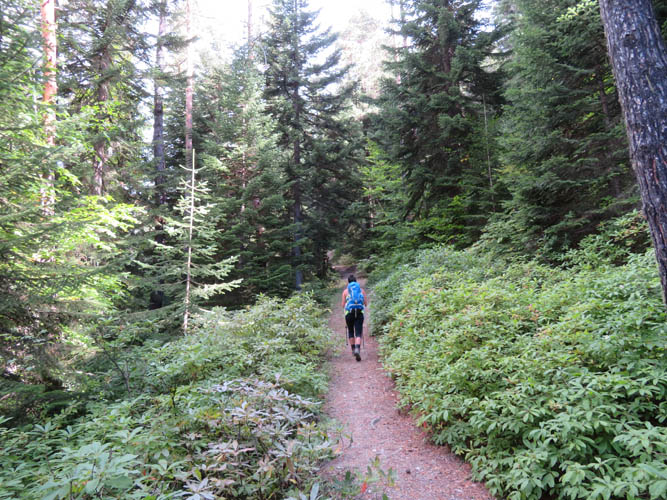
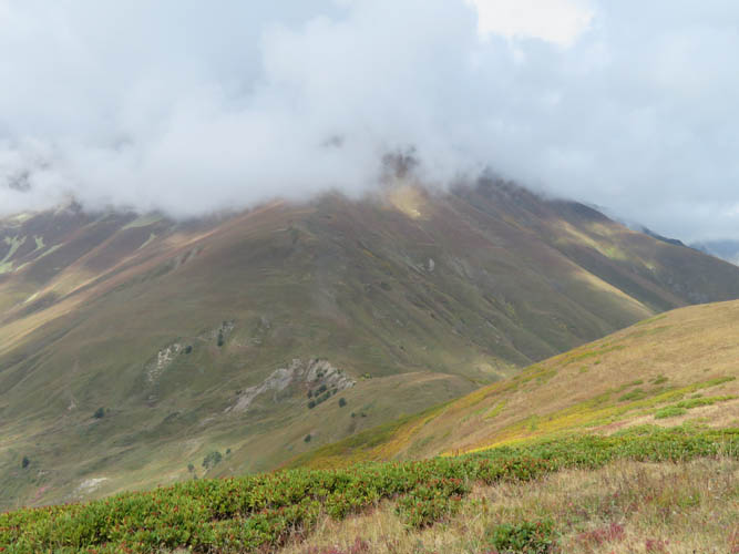
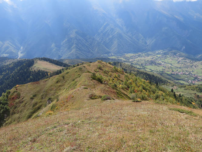
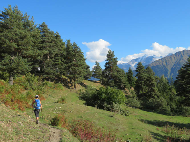
Hiking down the grassy SW ridge from Detsili summit was pleasant enough – there were bits of animal trails here and there and the views were lovely. However, as soon as we hit treeline the trail became much narrower and harder to follow, until it eventually became so overgrown that we gave up and hiked back up to the last big meadow. An open grass slope offered an escape route down to the valley on the west side, where we found a cow trail leading towards the community of Etseri. Instead of going all the way down to the village, we turned left (east) onto another trail towards Hebudi. Once again we were out of luck as it became apparent that this is not a well-used trail, at least not by humans! There were some awful muddy sections and some bushwhacking around washouts – no fun especially at the end of a long day of hiking. It was such a relief to reach the tiny village of Hebudi, where we decided to stop messing around with random trails and simply took the dirt road down to the main road. At this point we still had a mindless 4 km walk back to Becho, a bit boring but at least it was all the way downhill!
Mount Detsili was a great introduction to the area, not a big mountain but it was nice to have it all to ourselves without the crowds that you get on some popular hikes around Mestia. I’d definitely recommend going up and back down the same way from Becho instead of doing our loop. This will cut down the total time from 9 hours to probably around 4 or 5. Another option for a smaller loop would be to go up from Becho and down via the trail to Mazeri, then walk or hitchhike the last 7 km back to Becho on the dirt road.
| Elevation: | 2750 m (official), 2751 m (my GPS) |
| Elevation gain: | 1550 m |
| Time: | 7.5 h |
| Distance: | 16.2 km |
| Difficulty level: | Easy (Kane), T2 (SAC) |
| Reference: | No info on this route was available to us prior to trip |
| Personal rating: | 4 (out of 5) |
DISCLAIMER: Use at your own risk for general guidance only! Do not follow this GPX track blindly but use your own judgement in assessing terrain and choosing the safest route.