Durmitor, Montenegro
21 August 2018
With Andy and Wen
How to turn an easy hike into a difficult scramble
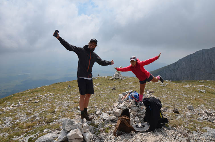
For our first hike in Montenegro’s Durmitor National Park we were joined by our new British friend Andy, whom we bumped into a few days earlier at the trailhead for Subra near the coastal town of Herceg Novi. Andy is hands-down one of the most easy-going people we’ve met so far! He built his own sleek VW T5 supervan complete with solar roof panel and sound-proof walls, a project that took him a whole year to complete.
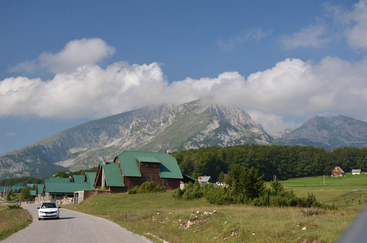
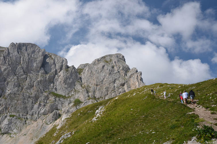
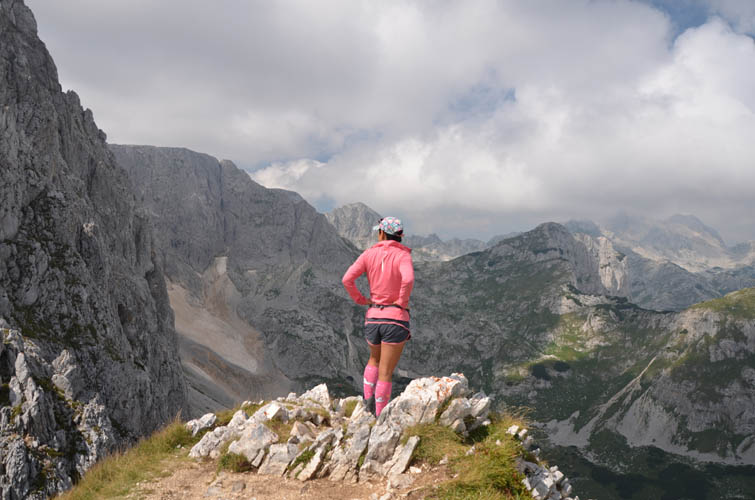
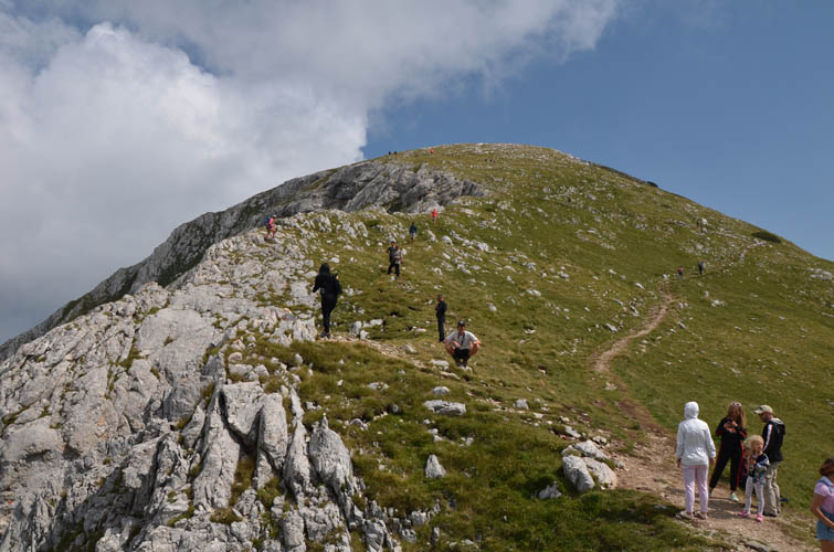
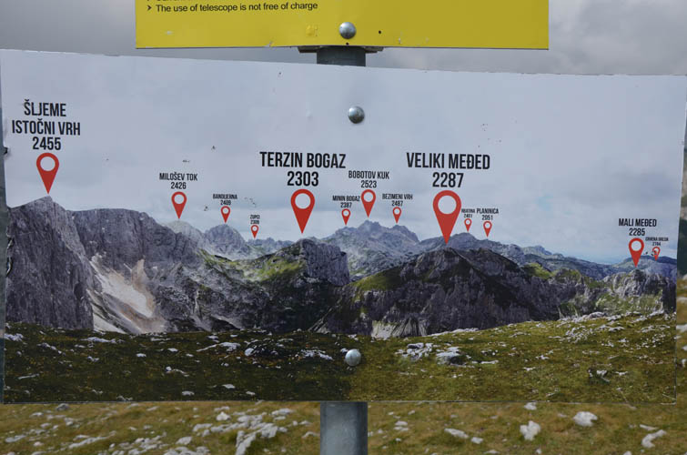
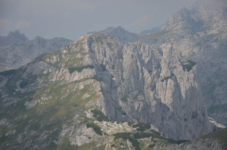
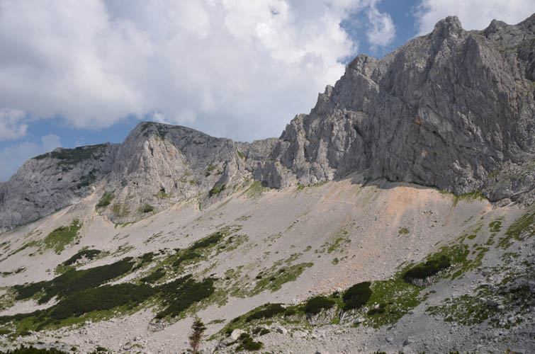
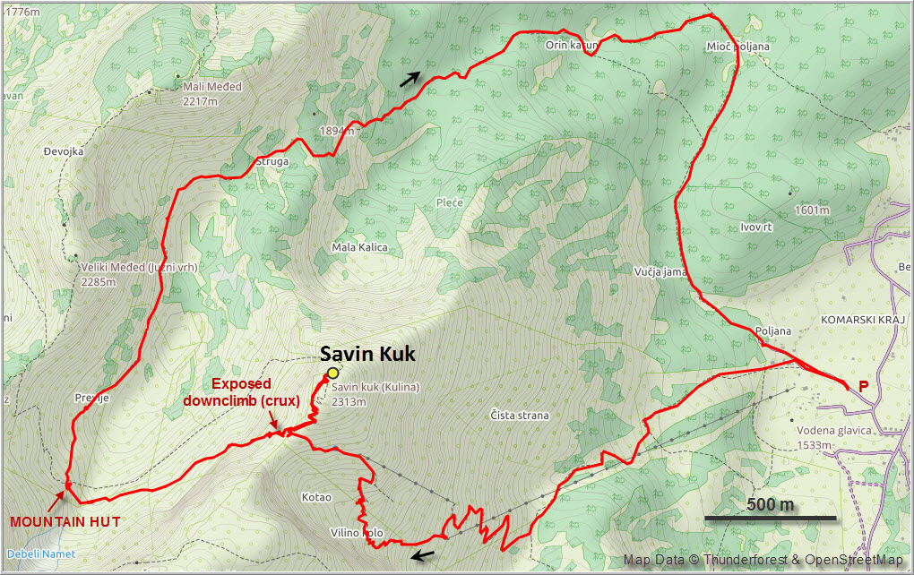
Savin Kuk was perfect for a first hike together in Durmitor. It’s a short drive from the town of Zabljak where we were based. From the parking lot at the ski lift, a wide track zig-zags up the hillside, turning into a narrow trail higher up. While the ski resort installations and ski runs don’t make for the most scenic hiking experience at the beginning, it gets much more interesting once you reach the saddle between Savin Kuk and neighboring Sljeme (2445 m). There is a steep drop-off with gorgeous vistas of the Bear Ridge to the west. Even Bobotov Kuk, the highest peak completely contained in Montenegro, can be seen in the distance.
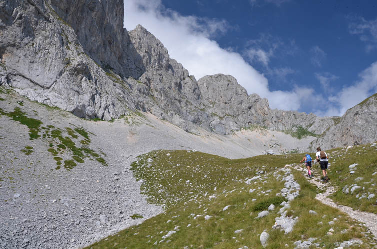
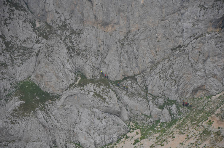
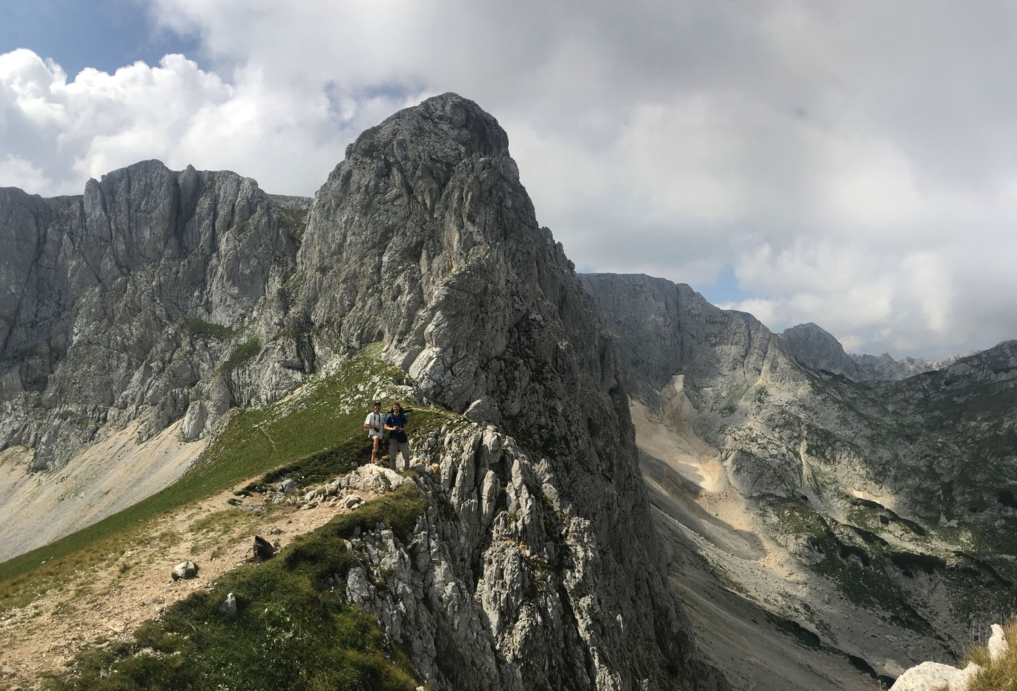
From the saddle it took us a mere 10 minutes to hike the short distance to Savin Kuk’s wide summit area. This is one of the easiest summits in Durmitor and perhaps also the most popular, so it was no wonder we were sharing the mountain with about 50 other people. Lots of Montenegrins out for a nice stroll, a few foreign tourists, and even a small group of mountaineers practising a rescue operation in a nearby gully.
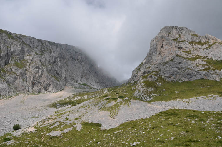
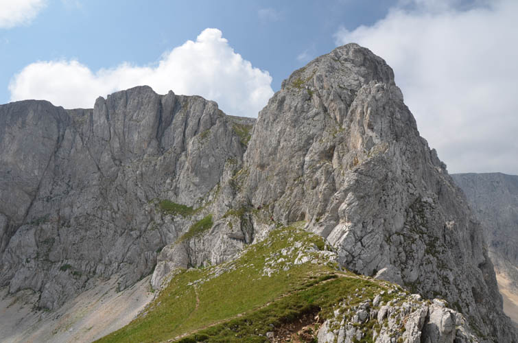
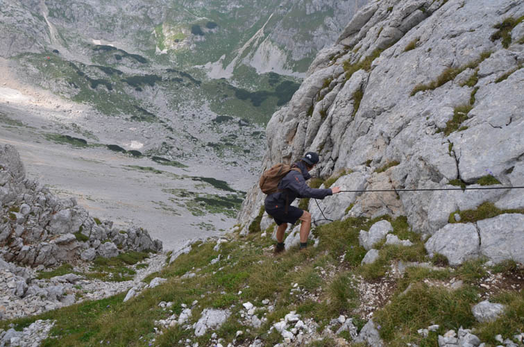
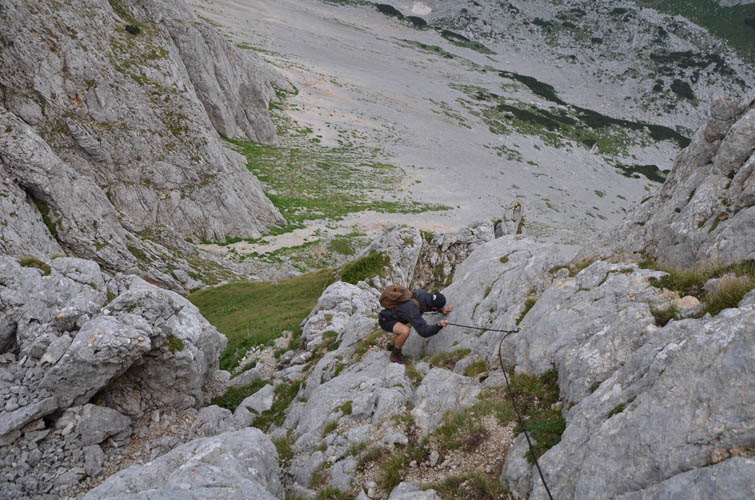
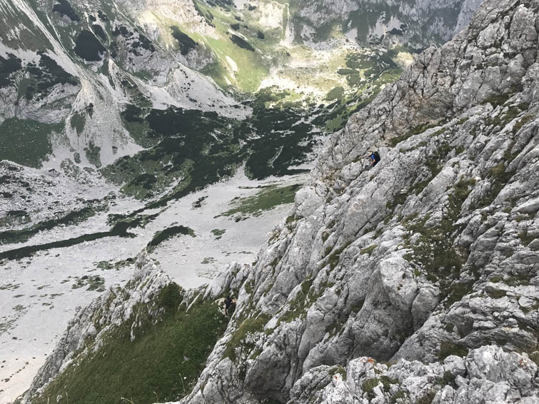
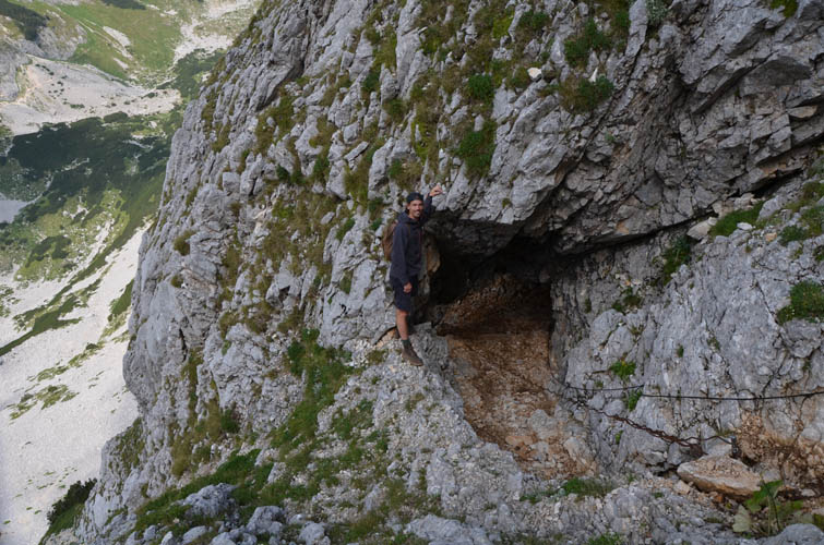
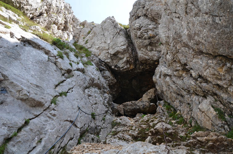
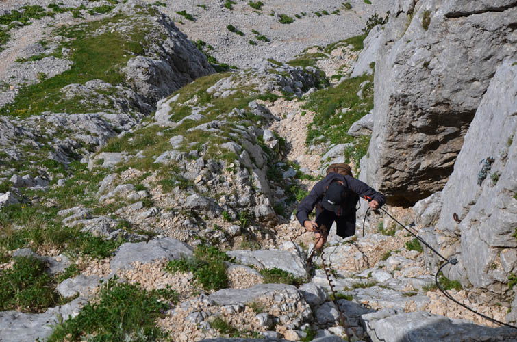
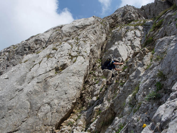
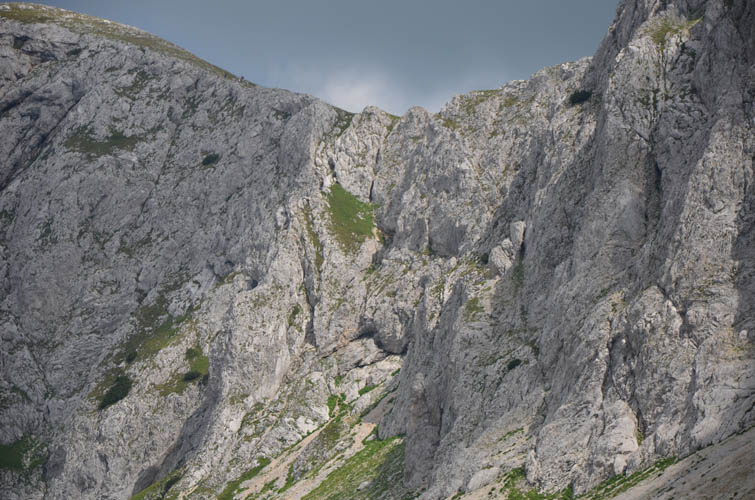
Andy and I had noticed a narrow trail with a fixed cable on the steep west side of the saddle on our way up to the summit. Too tempting not to try it out! While Wen decided to head back the main trail to the car and relax, Andy and I opted for a loop route and headed down the steep trail. What a fun surprise it was: a sort of “via ferrata” with a steel cable in place leading about 100 m down. Although the section was quite short, it was very steep and exposed in places and we had to stick together to minimize the risk of rock fall (lots of loose pebbles; helmets recommended). Half-way down we had to scramble through a short natural rock tunnel, perhaps 5 metres long. The steel cable really helped and allowed us to downclimb slowly but safely.
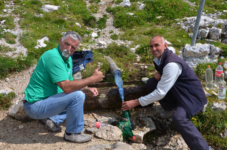
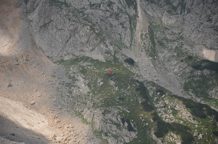
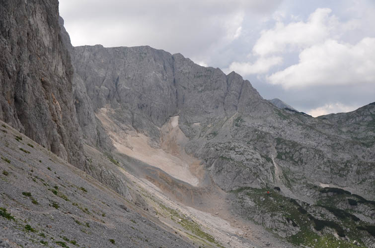
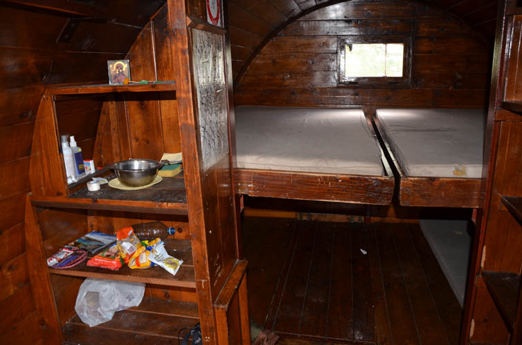
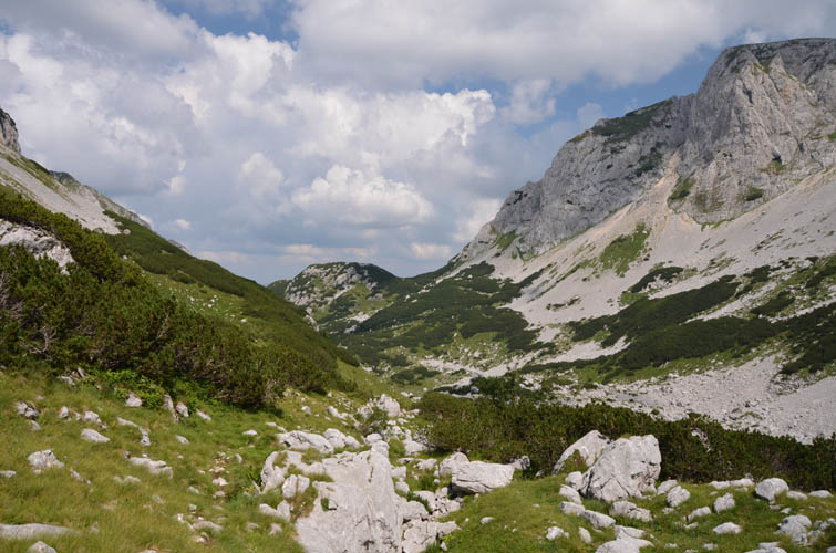
At the bottom of the downclimb we found a trail that traverses scree slopes and leads southwest to a small red mountain hut tucked away at the end of the valley. Just before the hut, the remnants of a small glacier have to be crossed, but there is no danger of crevasses and you could also bypass the glacier quite easily. To our surprise the mountain hut was open and it was quite neat to see what a Montenegrin bivouac shelter looks like: bunk beds sleeping up to 6 people, a small table and chairs next to a wood oven, some basic crockery, and a few leftover snacks and supplies. All in all very cozy and pretty well-kept!
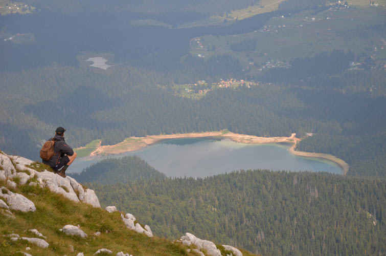
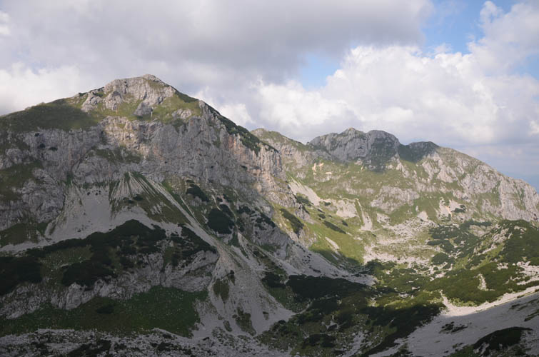
To get back to our car all we had to do now is follow a good trail down the valley, Bear’s Ridge to our left and Savin Kuk to our right. You can simply walk to the famous Black Lake and back into Zabljak town this way, or turn right (as we did) to return to the parking lot at the Savin Kuk trailhead. A fabulous day out!
Note: The alternative descent route down the north side of the saddle (crux) is for experienced scramblers/climbers only. Rock fall is a real hazard here, so helmets are highly recommended. Small groups are preferable – the bigger the group, the higher the risk of someone accidentally launching rocks and pebbles on those below.
| Elevation: | 2313 m (official), 2313 m (my GPS) |
| Elevation gain: | 1000 m |
| Time: | 6.5 h |
| Distance: | 11.9 km |
| Difficulty level: | Normal route: Easy (Kane), T2 (SAC) |
| Loop route: Difficult (Kane), T5 (SAC) | |
| Reference: | Local maps |
| Personal rating: | 3 (out of 5) |
DISCLAIMER: Use at your own risk for general guidance only! Do not follow this GPX track blindly but use your own judgement in assessing terrain and choosing the safest route.