Kananaskis, AB, Canada
15 February 2020
With Richard
Strenuous winter workout
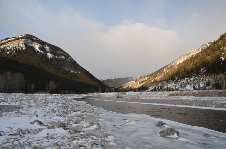
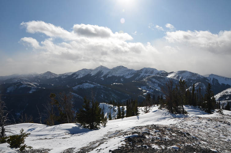
Just like neighboring Mount Mann, the Zephyr Creek Hills (aka Miller Creek Hills) don’t see as much traffic as objectives to the north of the Highwood River because of the frigid river crossing that stands in the way at the beginning (and the end) of the trip. This trip was another good reminder of how a relatively small and easy summer hike can turn into something exponentially more strenuous in the winter. Gusting winds going in seemingly random directions, ice-covered slopes and deep pockets of snow turned this into a more challenging objective than we expected today.
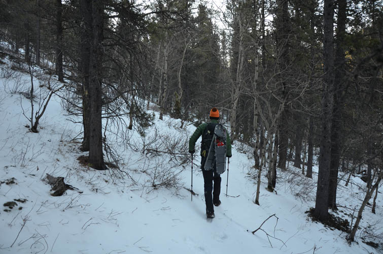
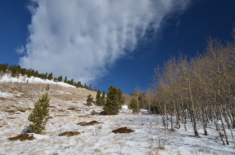
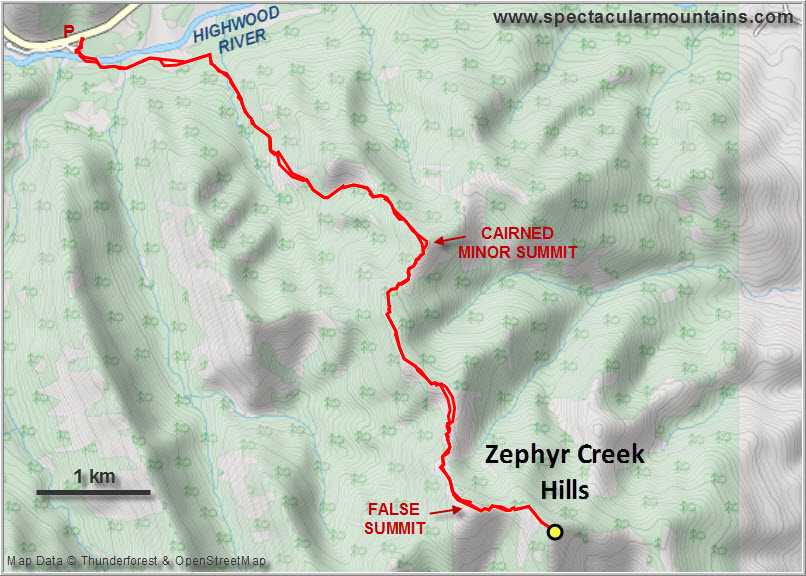
While Richard nonchalantly ambled across the Highwood River in his waders, I suffered two minutes of pain fording the ice cold waters in sneakers. An added challenge was stepping on and off the ice cover on either end without an uncontrolled break through. Once our feet were dry and in our warm boots, we followed Daffern’s #14A route to a small creek. Just past the creek bed a horse trail heads south (route #14D) through light poplar forest and then climbs the gentle west slopes of a long ridge that makes up the northern portion of the Zephyr Creek Hills. We didn’t need snowshoes for this first leg of our trip, but the trail was at times hard to follow with all the snow cover.
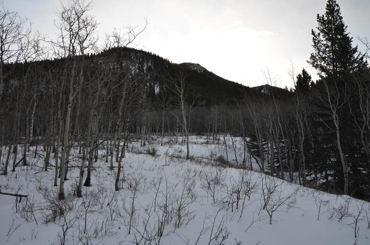
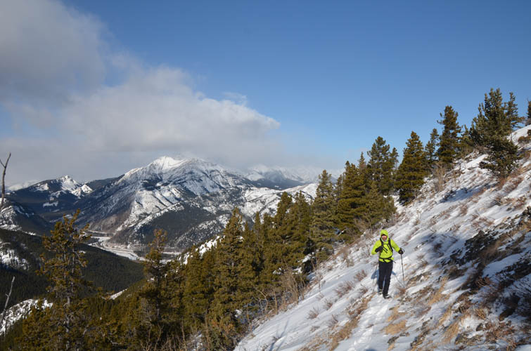
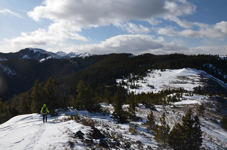
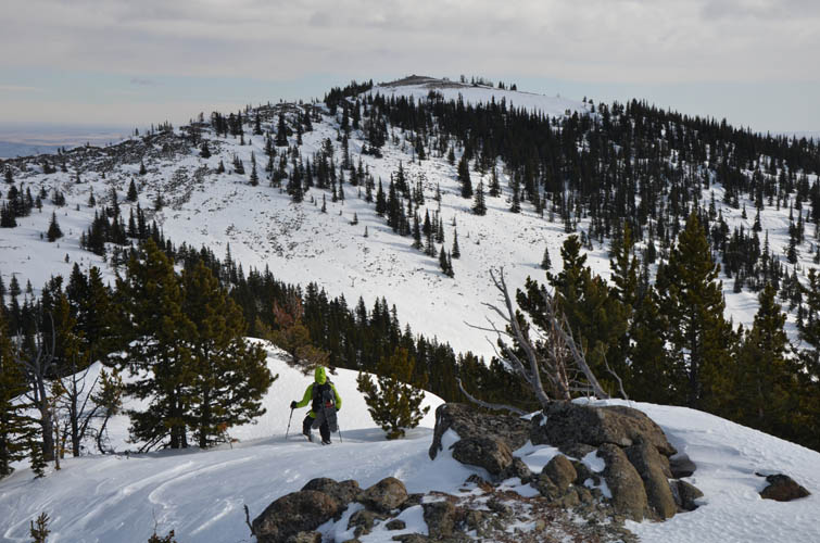
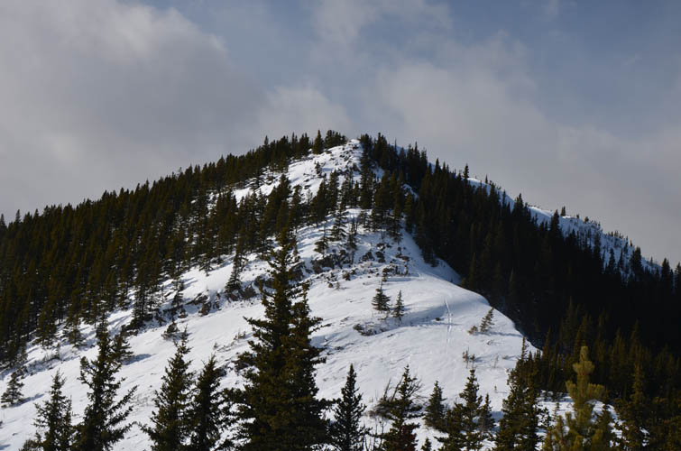
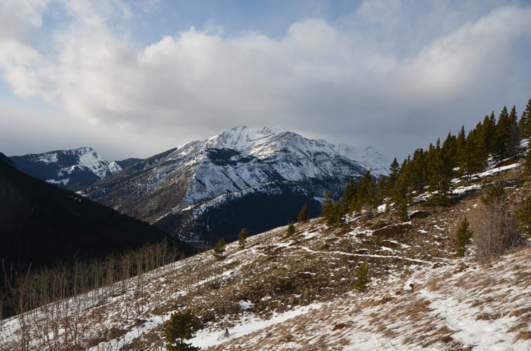
After a few km the trail makes a sharp left and climbs into a lovely little side valley with open meadows and stands of poplars, ending near the ridge top. This is where we had to pull out our snowshoes – the heaps of snow lingering between trees on the ridge were just too deep and unsupportive. We continued past the first high point (big cairn on top here) and across an open saddle to the next high point, at times walking on dry grass but too lazy to switch snowshoes for boots all over again. Wherever the route took us into the trees, snowshoes were the only way to move forward even though we still sank in knee-deep and our progress was slow.
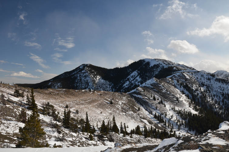
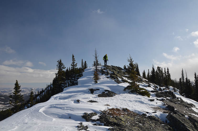
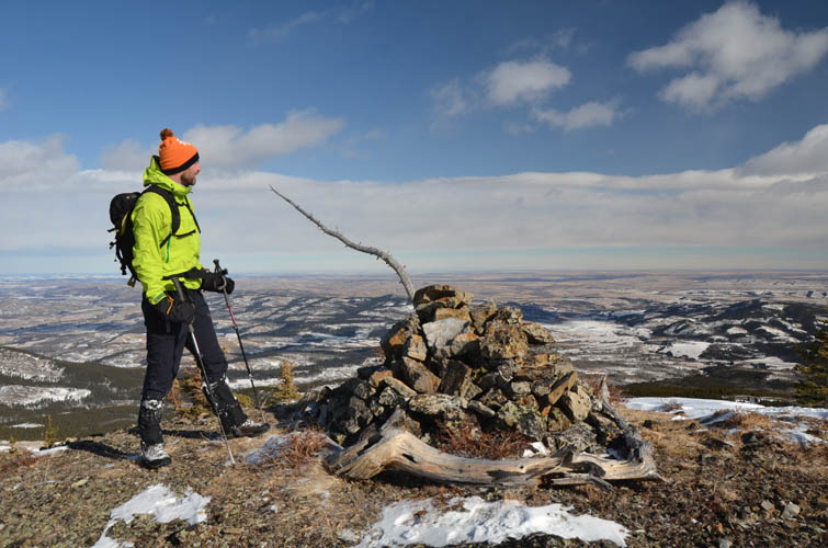
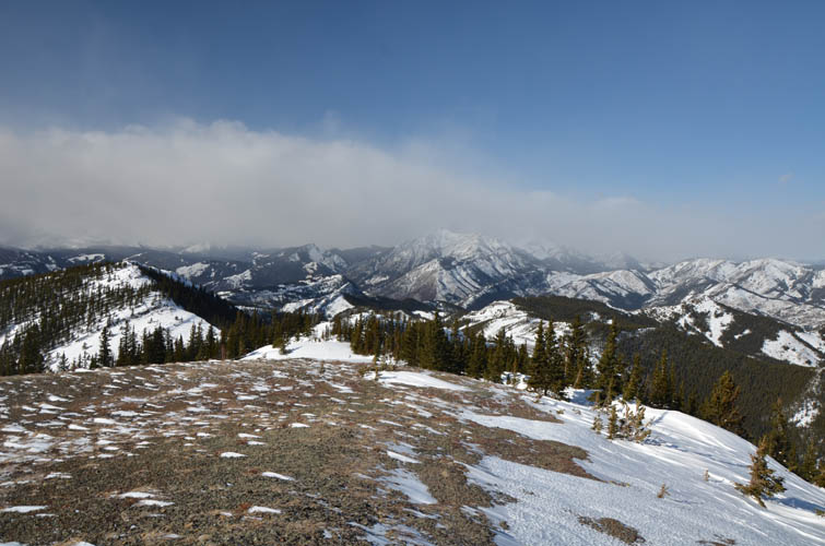
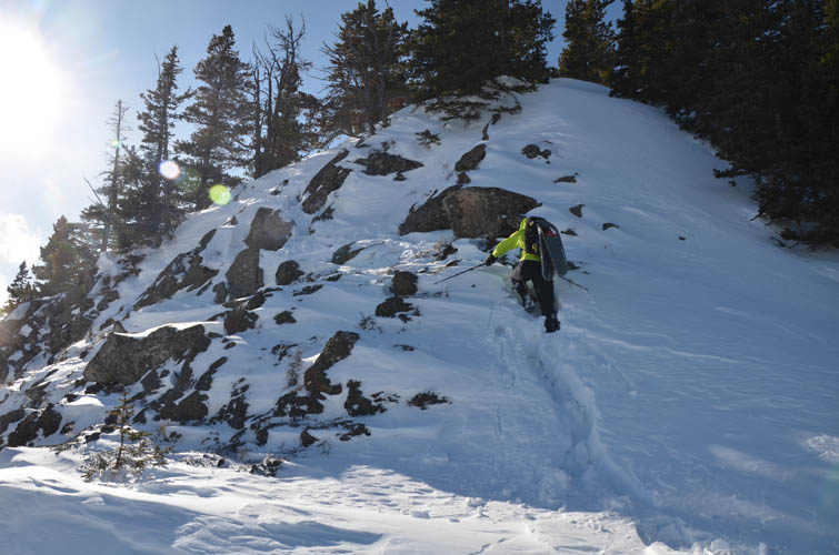
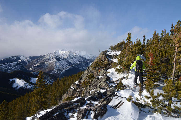
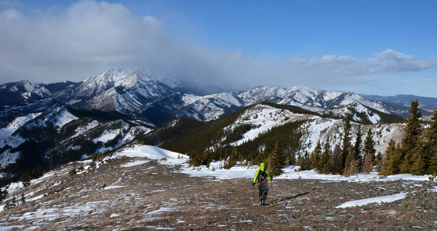
Eventually the ridge widened and opened up, allowing us to hike the remainder of the route to the false summit and then the true summit with its stately cairn on top. There were two spots between the two summits where we had to carefully scramble through some short but steep cliffbands, but in summer these sections probably wouldn’t pose any difficulties at all.
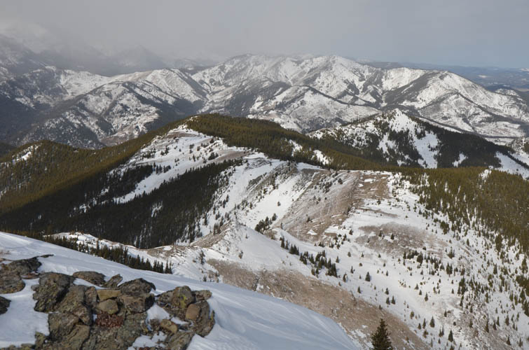
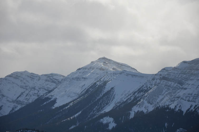
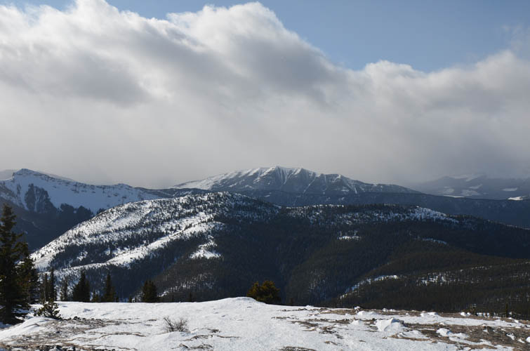
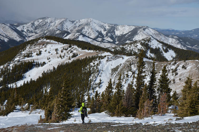
We reached the true high point after almost five hours, tired from the strong winds whipping us around and all the snow slowing us down. After a short break taking in nice views of Mount Burke’s long north ridge behind us, cloud-covered Front Range Peaks further west, and the sunny Prairies to the east, we we were quite happy to turn around and go back the same way. Retracing one’s foot prints in the snow just makes it so much easier, both mentally and physically. A great day, but a lot more work than we had expected.
|
Elevation: |
2213 m (my GPS) |
|
Elevation gain: |
1220 m |
|
Time: |
8.5 h |
|
Distance: |
16.7 km |
|
Difficulty level: |
Easy (Kane), T3 (SAC) |
|
Reference: |
Daffern |
|
Personal rating: |
3 (out of 5) |
NOTE: This GPX track is for personal use only. Commercial use/re-use or publication of this track on printed or digital media including but not limited to platforms, apps and websites such as AllTrails, Gaia, and OSM, requires written permission.
DISCLAIMER: Use at your own risk for general guidance only! Do not follow this GPX track blindly but use your own judgement in assessing terrain and choosing the safest route. Please read the full disclaimer here.