Dukan, Iraq
11 November 2018
Solo
Scrambling through Iraq’s bureaucratic hurdles
Warning: Several sources told me that Kosrat should not be climbed from the east (near Dukan) due to the risk of landmines and other UXO’s dating back to the Iraq-Iran war. The mountains in the area around Dukan have not been entirely cleared. The one safe route to the summit of Kosrat is the route described here starting from the village of Khalakan.
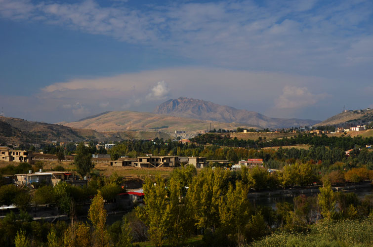
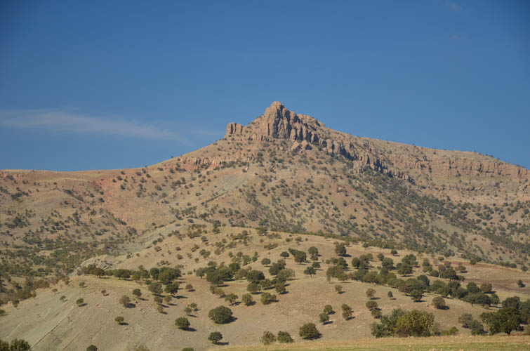
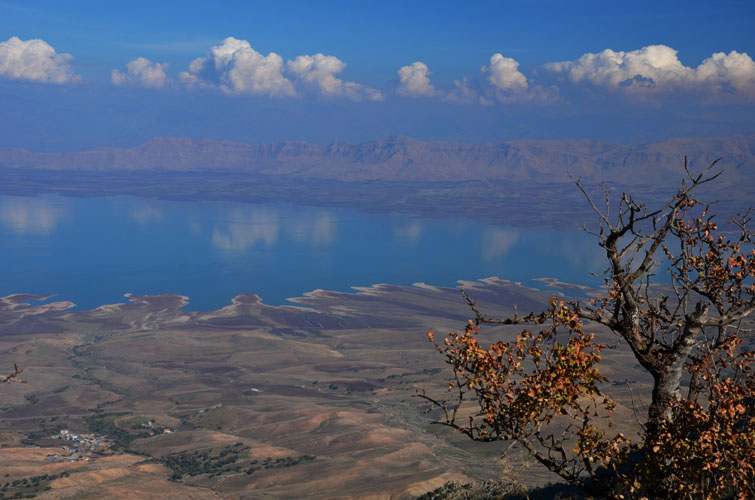
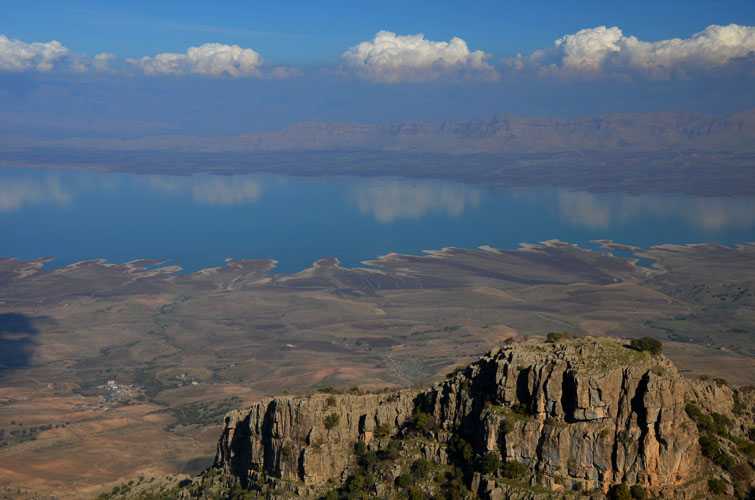
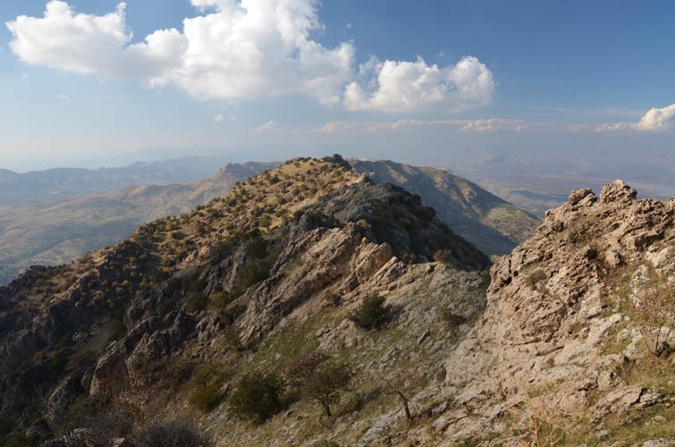
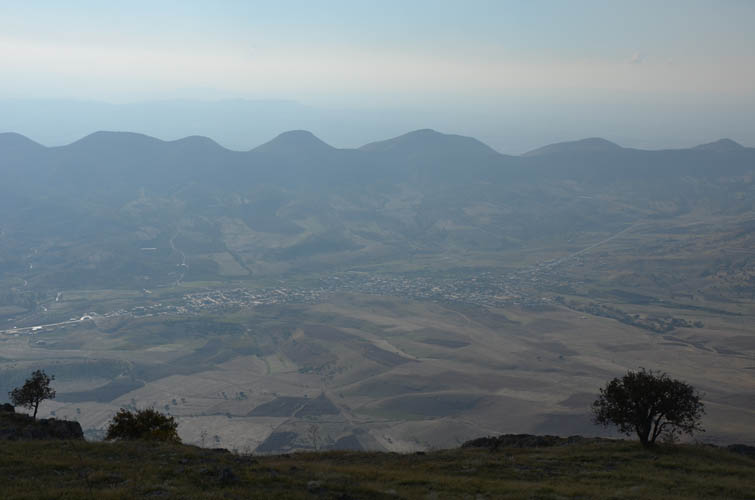
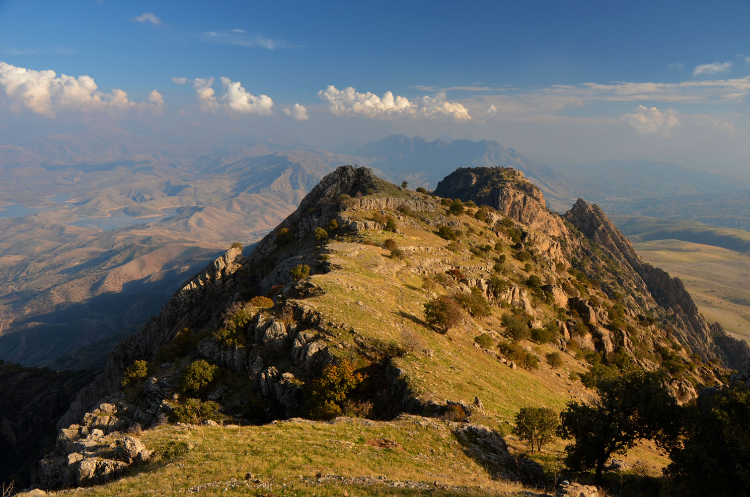
Kosrat is a distinctive mountain overlooking the small town of Dukan and Dukan Lake, the largest lake in Iraqi Kurdistan. Although not even 1600 m high, its steeply dipping rock slabs on the south side and craggy ridge top make it look pretty impressive from afar.
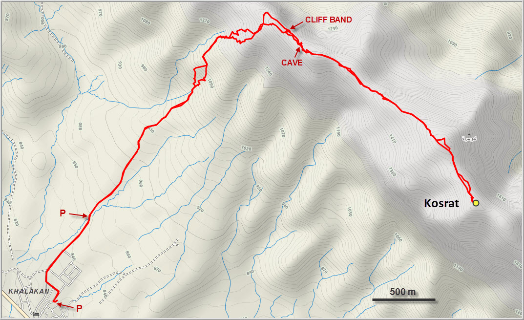
I arrived in the village of Khalakan around 9:30 a.m. and drove to the trailhead at the end of the paved road where there’s a small parking area. Not willing to take any risks, I figured I should double-check with people in the village if my intended route was safe (i.e. free from landmines), so I drove back into town and stopped by the General Directorate of Khalakan, something akin to a town hall. This is where the trouble started – the crux of the day really.
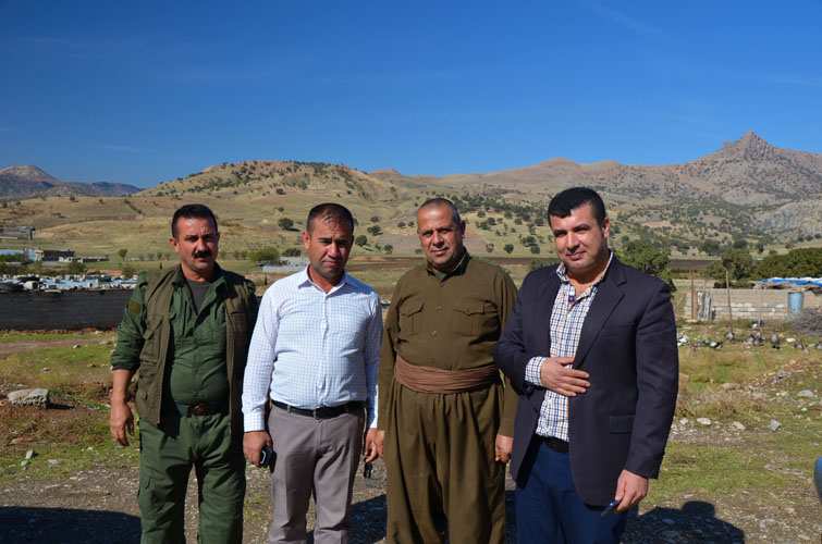
Before I knew it I was surrounded by 20 people, curious what a foreigner was doing in their town. Everyone was extremely friendly, but no one spoke English, so it took a long time for me to explain what I wanted. “Kosrat alone? No, you cannot do this alone, it’s dangerous! Somebody from the village must go with you”, was the general consensus. After an hour of back and forth the local police showed up, then a military truck with armed members of the Asaish (the Kurdish security service). All were polite and friendly, but insisted I must get clearance from some higher office in the city of Sulaymaniyah… This is never going to work… I thought to myself. Eventually a kind man by the name of Nasih from the Directorate appeared, offering his help in pretty decent English. We went inside the town hall and met the mayor, who after a brief chat personally gave his approval for me to hike to the mountain. I thanked him sincerely and offered my apologies for interrupting a town meeting that we had walked into. But the problem with the Asaish still remained. It took another good hour of discussions before they finally agreed to let me go, provided I park my car in their compound and report back in the time I promised, which was about 4 to 5 hours. Game on!
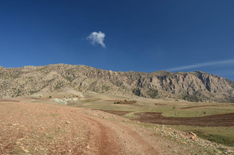
Having already packed up my gear under the watchful eyes of all 20 or so parties involved, I wasted no time and got going at brisk pace. According to my map it was only some 700-800 m of elevation gain and about 12 km return, hence not a long day but of course I had no idea what the terrain was like.
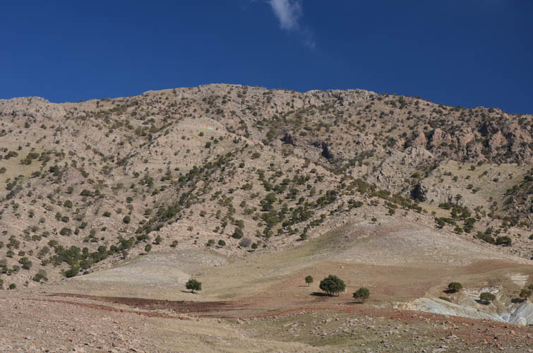
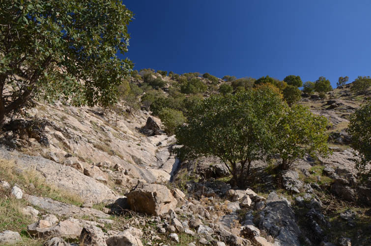
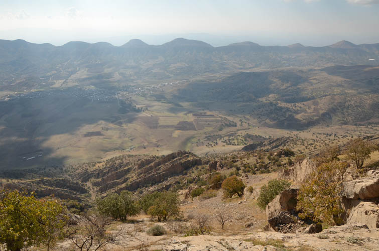
The approach was pretty quick on a track through the fields. Luckily, it landed me right at the start of a small trail that went up a small valley on climber’s left and over a rib to a nice lookout point where I ran into three young Kurdish guys having a picnic. The BBQ chicken and fresh tea they were preparing looked very tempting, especially since I hadn’t had a proper lunch yet. They were excited to meet a lone foreigner on their local hill and eagerly invited me to join them, but I had no choice but to decline. It was close to 1 p.m. by now and with the sun setting around 5 p.m. already, I didn’t want to take any chances.
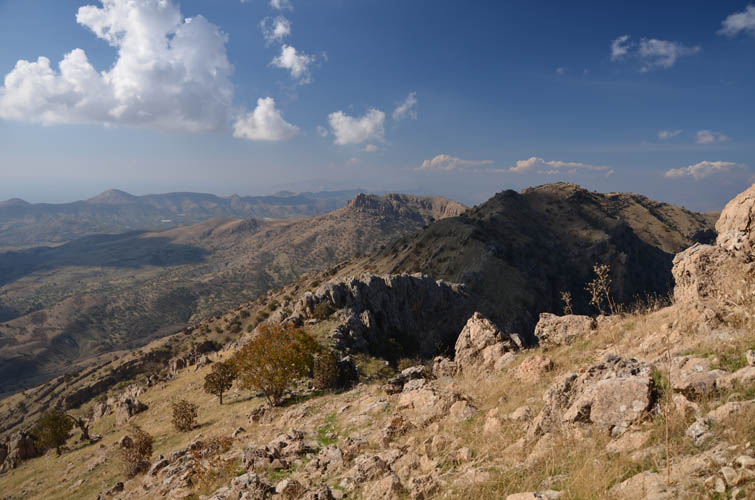
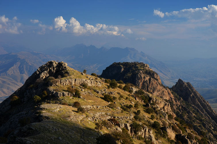
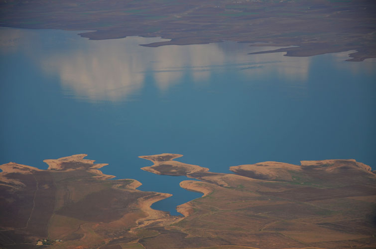
The trail continued higher along another small valley and eventually fizzled out as I reached the upper grassy slopes below the main ridge. Finally I had a sunny and warm day, the first one in my 7 days of climbing in Iraq! Arriving at the top of the ridge, I was instantly wowed by sweeping views over Lake Dukan on the other side. What a sight! Although it was a bit hazy, the snow-capped peaks of the higher Zagros mountains in the north form a magnificent backdrop to the blue waters of the lake. In most other countries this lake would be a major tourist attraction, but not here of course. Dukan is hardly developed, with only a couple of hotels and very little to do for the tourist other than eating fresh fish and maybe some kayaking. And hiking of course!
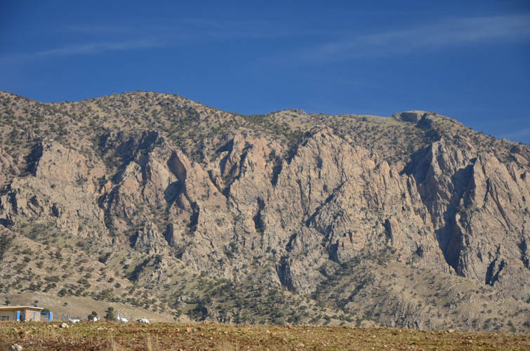
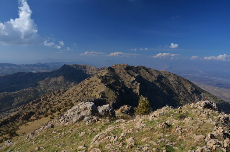
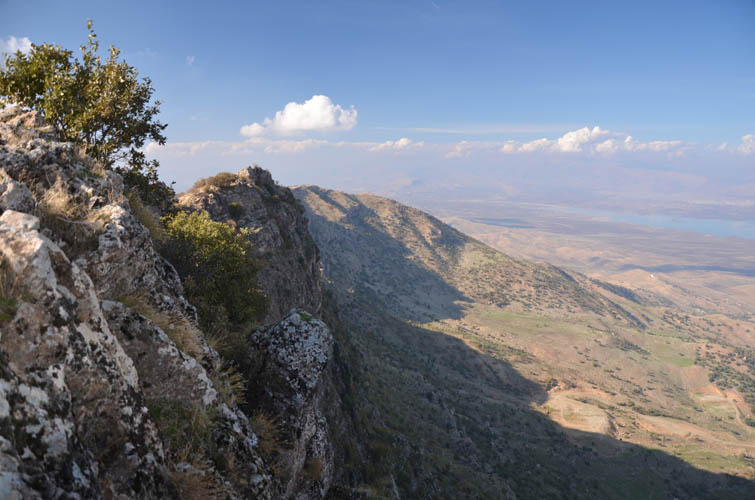
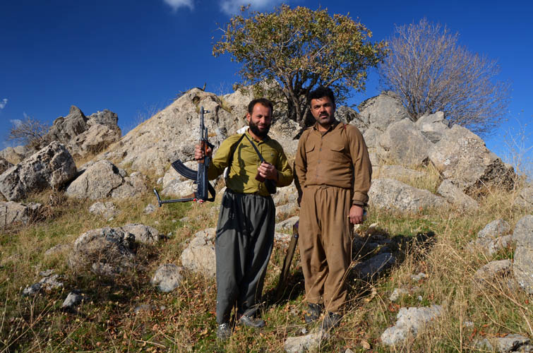
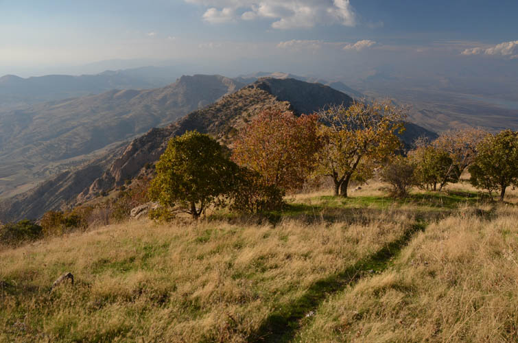
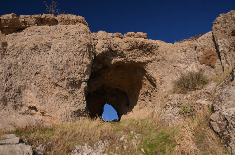
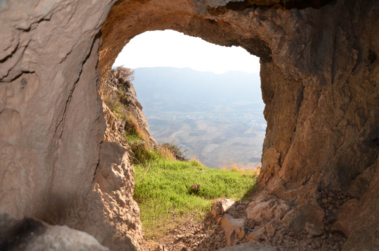
From where I had ascended the ridge, the summit still looked quite far away. I must say I underestimated this ridge! From below it looks fairly tame and easy, but once you’re on it it’s a different story. The north face consists of a steep drop-off and staying on the crest involves a lot of small ups and downs that take time and energy. At one point a cliff band bars the way that requires some elevation loss to overcome and a few steps of scrambling. Not far after the cliff band there is a pretty neat cave feature just below the ridge crest with a “window” looking out to the north towards Lake Dukan. The terrain can be a bit confusing in parts along the ridge and finding the best route isn’t always straightforward. Thankfully, sheep also seem to like this area and have trampled faint trails, usually along the most efficient routes. Half-way along the ridge I ran into two shepherds who proudly showed off their rifle and cell phones – modern necessities in this day and age it seems.
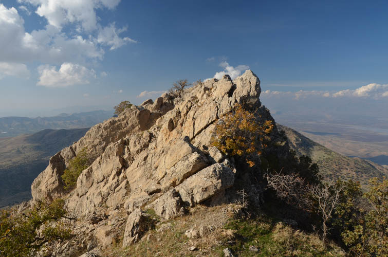
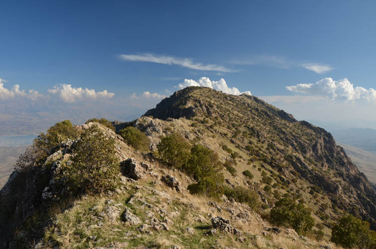
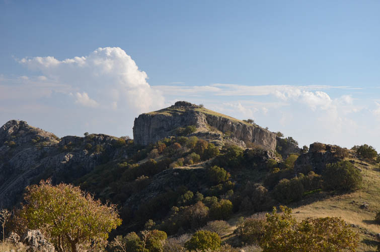
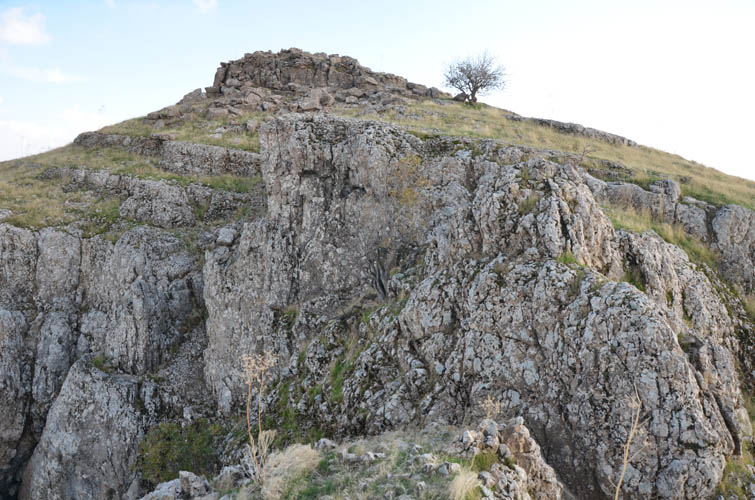
The second half of my ridgewalk was on more gentle terrain where a well-defined path had formed. Finally I could take my eyes off the ground and enjoy the views of the lake a bit more. A vertical rock band guards the summit mass on the west side, necessitating a short moderate scramble up a rocky north-facing gully. The summit is crowned by an old cairn but doesn’t seem to be visited frequently, at least not by mere “tourists” like me.
Following virtually the same route back down, I arrived at the Asaish compound exactly 4 hours and 45 minutes after setting off and was greeted by lots of happy faces. Granted, without someone waiting for me down in the village I would’ve taken more time to complete the trip – perhaps 6-7 hours is a more appropriate estimate for this outing. So instead of asking a lot of questions before heading out, my recommendation would be to just park at the edge of the village and go. You’ll waste a lot less time on unnecessary bureaucracy that way!
| Elevation: | 1579 m (my GPS) |
| Elevation gain: | 980 m |
| Time: | 5 h |
| Distance: | 12 km |
| Difficulty level: | Moderate (Kane), T4 (SAC) |
| Reference: | Local advice & own routefinding |
| Personal rating: | 4 (out of 5) |
DISCLAIMER: Use at your own risk for general guidance only! Do not follow this GPX track blindly but use your own judgement in assessing terrain and choosing the safest route.