Calgary Foothills, AB, Canada
5 May 2020
Solo
Lovely ridge with tons of early-season snow
Another trip to the Foothills. With so much snow around this spring, I figured a lower-lying ridge east of the “real Rockies” would be a safe bet. Wrong!
The provincial parks had just officially opened again after a month-long corona virus-related ban. I was expecting a flood of visitors to Kananaskis so I left quite early to beat the “crowds”. The crowds never showed up on Lusk Ridge – I was the only soul all day.
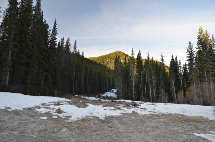
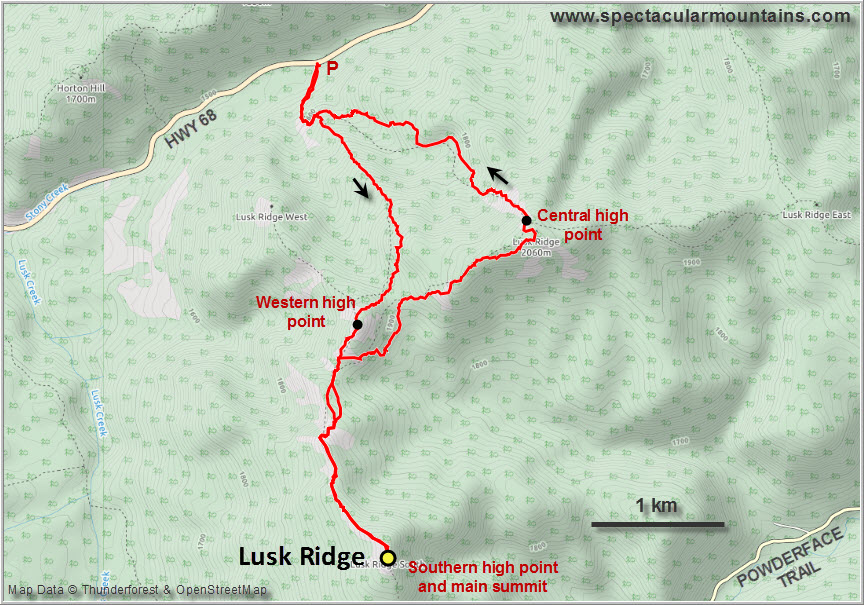
There are several ways to get up the ridge and for this trip I opted for the less popular northern approach (most people seem to come up from the south from Powderface Trail). I parked by the side of the gravel road along Highway 68 (about 2 km east of Hwy 40). Everything looked pretty promising at the beginning: an old logging road serving as the approach line, blue skies, and little to no snow on the ground.
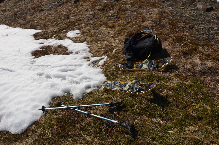
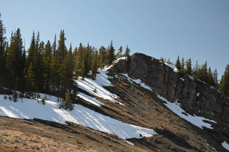
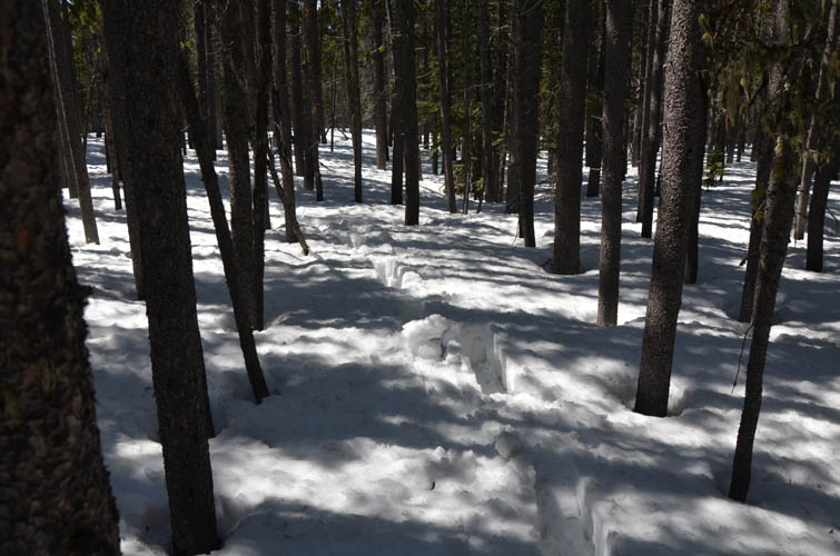
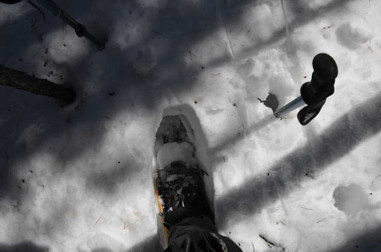
Things quickly changed as I gained elevation on the rudimentary trail which eventually fizzled out at treeline above some cutblocks. No more trail, but more trees and more snow instead. Soon I had to put on my snowshoes as the snow got thicker. Strangely, this was also the place where I found a perfectly intact battery charger on the ground – dry and clean as if it had been placed there yesterday despite the lack boot prints anywhere (contact me to claim it!).
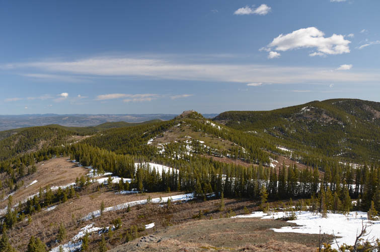
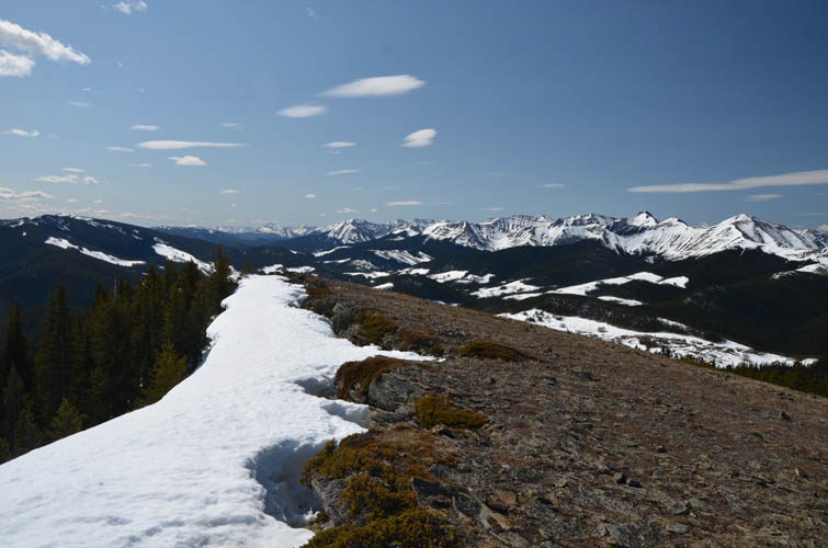
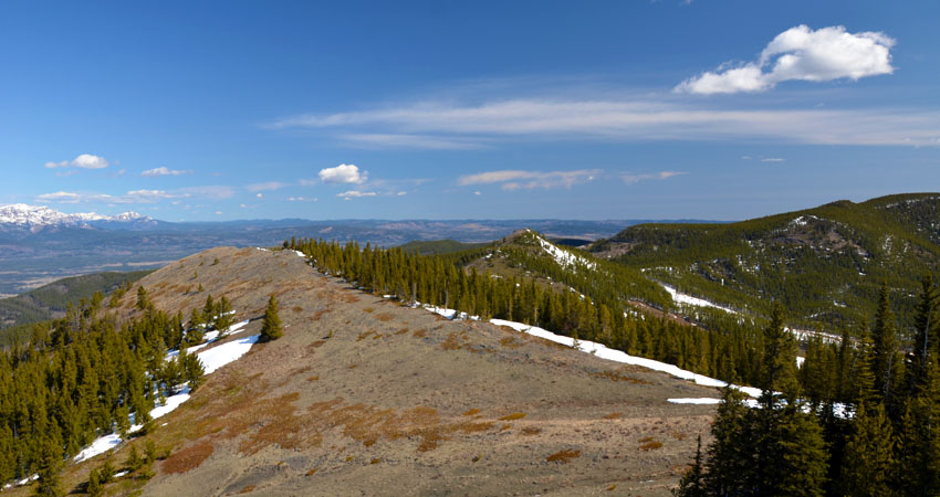
Lusk Ridge – also known as Hunchback Hills – is really a series of rounded hilltops connected in a horseshoe by gently undulating saddles. The highest point appears to be the southernmost hilltop, referred to as Lusk Ridge South on some maps. This was one of my objectives, along with the western and central high points along the horseshoe. By the time I got to the saddle between the latter two bumps, I’d already had to don and doff my snowshoes twice. Another eight snowshoe sections – 16 switches – would follow during the rest of the day.
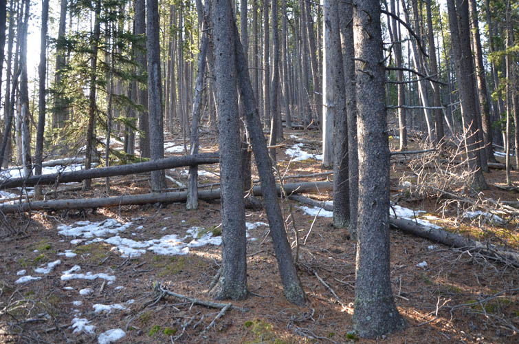
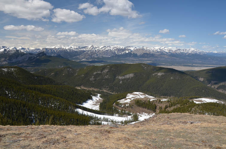
Thick patches of annoyingly unsupportive snow lingering in the forest on the sheltered eastern and northern aspects along the ridge made my life miserable today. Even with snowshoes, it was hard work sinking (swimming) in knee-deep and lifting my legs up in the air with every step. The snow was also quite heavy – no wonder, it was a beautiful sunny day at 18 degrees C and everything was melting fast.
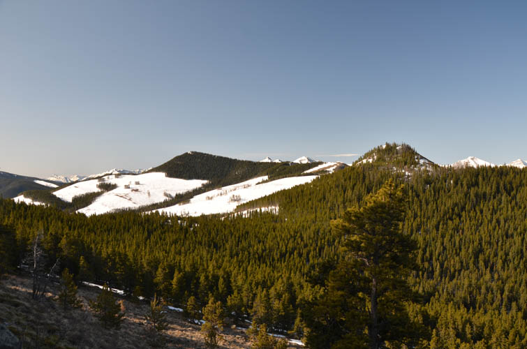
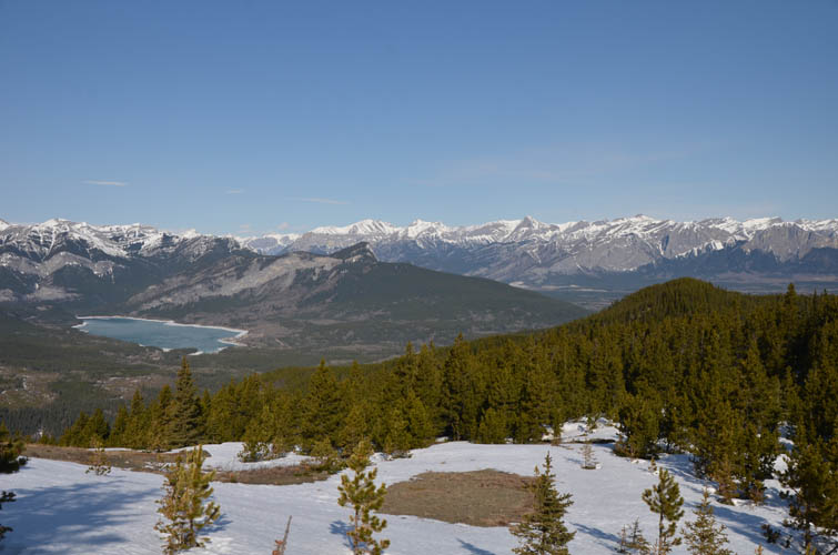
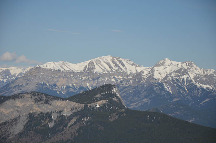
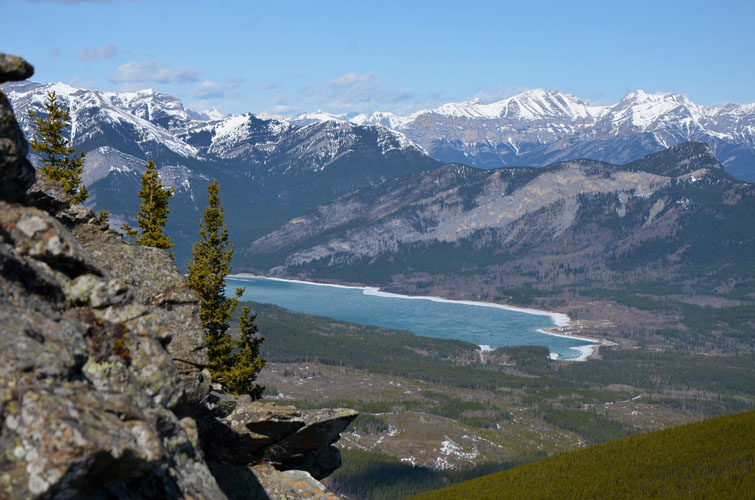
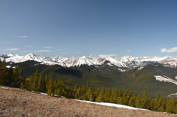
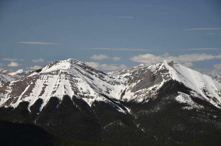
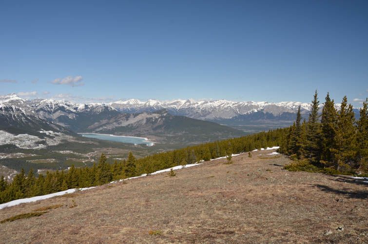
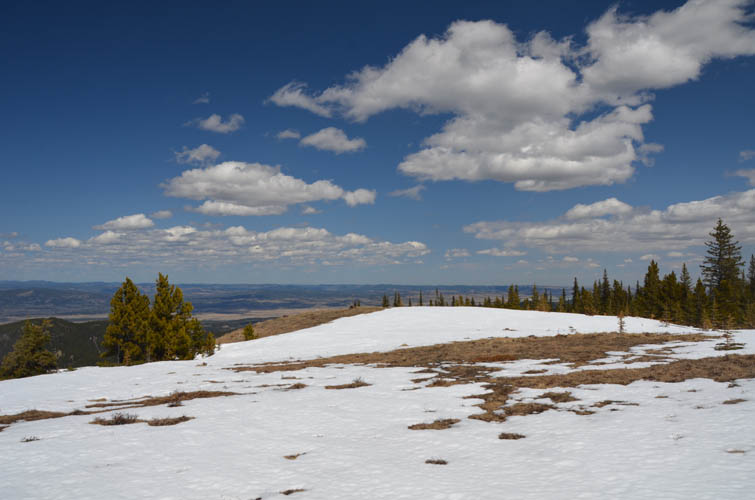
Between the western high point and the main summit I enjoyed a nice stretch of delightful hiking on dry ground. This is by far my favourite part of Lusk Ridge: mostly open slopes with gorgeous views of Front Range peaks immediately to the west. I wondered how many people Mount Baldy or Barrier Lake Lookout would see today, or even Midnight and Midday Peaks.
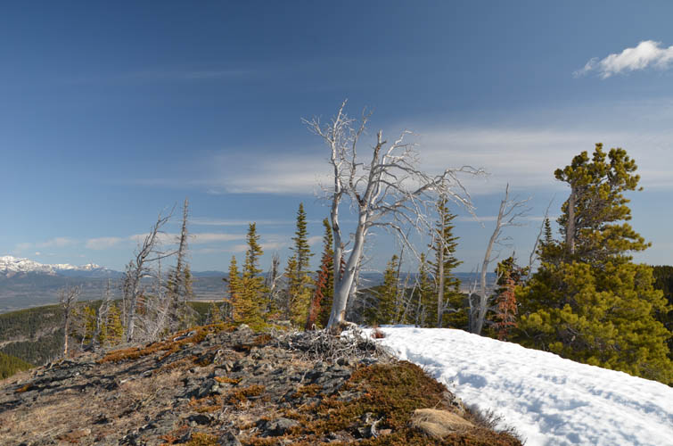
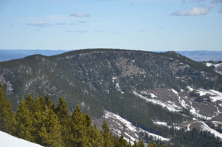
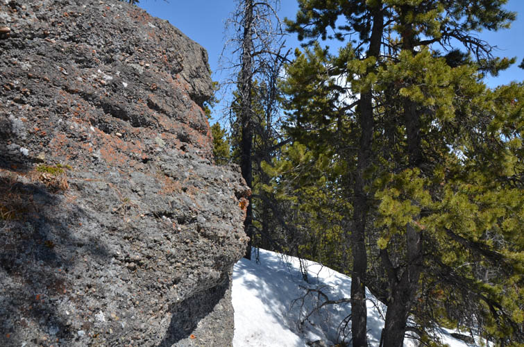
In contrast, the worst section by far was between the western and the central “summits”. I constantly had to switch boots to snowshoes and back and the central summit was… well, there was no summit. It was flat-topped and all in the trees, utter disappointment. Even the “conglomerate wall” – a small outcrop of typical Cretaceous-aged foothills conglomerate mentioned in Daffern’s K-country guidebook – couldn’t lift my spirits. The only consolation were the surprise views on the northern side of this bump down toward Sibbald Creek, Seventy Buck, Deer Ridge, etc.
My descent route was again mostly trail-less but – thank goodness – also mostly on bare slopes and open cutblocks, meaning I only had to contend with two short stretches of postholing through deep snow (I stubbornly refused to put on my snowshoes again!). The many sections of snow and all the switching around left its toll on me today. The whole trip had taken me more than 7 hours and I was pretty exhausted when I got back to my van. All this work for a little ridge like this just shows: timing is everything!
Note: The track shown on the map below (and the corresponding GPX file) tries to avoid snow patches and may not be the optimal route in the summer.
|
Elevation: |
2109 m (my GPS) |
|
Elevation gain: |
1000 m |
|
Time: |
7.0 h |
|
Distance: |
12.7 km |
|
Difficulty level: |
Easy (Kane), T3 (SAC) |
|
Comments: |
In dry conditions total hiking time would be considerably less. |
|
Reference: |
Daffern & own routefinding |
|
Personal rating: |
2 (out of 5) |
NOTE: This GPX track is for personal use only. Commercial use/re-use or publication of this track on printed or digital media including but not limited to platforms, apps and websites such as AllTrails, Gaia, and OSM, requires written permission.
DISCLAIMER: Use at your own risk for general guidance only! Do not follow this GPX track blindly but use your own judgement in assessing terrain and choosing the safest route. Please read the full disclaimer here.