
30 July 2017
With Wen
The foothills and front ranges around highway 532 southwest of Longview are full of easy and accessible hiking opportunities, but strangely they do not seem to see that many visitors. In part, this may be due to the longish drive from Calgary (at least 2 hours), or perhaps because the area is simply not very well-known amongst hikers and scramblers. Another deterrent to keep the crowds at bay could be the access road, highway 532, which is quite rough although it’s perfectly driveable with a regular car.
For our car camping trip this weekend we chose two areas Wen had never been to: southern Kananaskis and Beehive Mountain on the Continental Divide. Both turned out to be amazing trips with beautiful memories; of course having sunny skies on both days greatly helped!
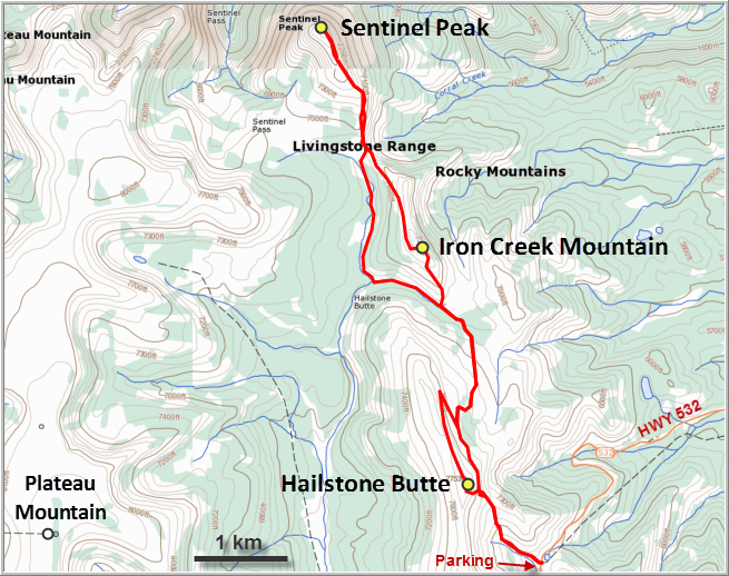
Hailstone Butte and Sentinel Peak are easy day hikes described in detail in Daffern’s K-Country guidebook (Vol. 5). There are several different ways to approach them and we decided to make a loop to combine them both and include a small peak called “Iron Creek Mountain” (on Gaia’s OpenHikingMap) as well.
The nice thing about Hailstone Butte is that it’s so easy to reach from the road and you can look right up the summit almost from the bottom. We started from the small parking lot at the pass on highway 532 at 2000 m elevation, thus leaving only 360 m for us to climb to the top. A good trail goes up a small drainage, then dissipates in the rocky cliff below the summit. The short rock band is easily scrambled, with difficulties being slightly less further to the left (south). A super friendly fire lookout observer greeted us at the small lookout at the top, a meticulously well-kept and fairly modern hut right by the summit. Nearby is a strategically placed bench and picnic table that invited us to have an early lunch with beautiful views over foothill and prairie landscapes to the east. We only saw two other couples below us coming up, otherwise we had this beautiful playground of nature all to ourselves for the rest of the day.
A disused maintenance track leads down the NE side of the summit via a couple of switchbacks and heads north in the direction of Sentinel Peak. We left this track at a small cairned intersection with a much smaller trail where the track turned west. The faint trail went straight north through a wide valley covered in lush green grass. Just about where the trail seemed to peter out we reached the base of the saddle between Sentinel Peak and Iron Creek Mountain. We hiked up to the saddle and then ascended the rocky south ridge. From here, Sentinel’s summit looked like it was still far away… a deceiving sight, as it turned out. We reached it in only 20 minutes from the saddle! The views here are much more interesting than those from Hailstone Butte. The northeast cliffs of Plateau Mountain look craggy and intriguing, while distant Mount Burke looks like a hard-core climb (it isn’t).
After a second lunch break, we headed back to the saddle and then followed a moderately well-trodden game trail that contours around the western slopes of Iron Creek Mountain. This name makes it sound much grander than it is – it’s really just an insignificant little peak sitting between Sentinel and Hailstone. It does offer nice views from the top, though, and we even saw a surprised-looking goat leisurely strolling along the trail. The game trail actually passes below the summit, so we had to leave the trail and hike up a few hundred metres to the cairn at the top.
The second “scrambly” part of the day (after the rock band to gain the ridge of Hailstone) was coming down the south ridge of Iron Creek Mountain. As we descended, the slope kept getting steeper and more light grey rocky ribs and nubs started to appear, but they were all easily navigated and there’s even a short stretch of soft scree at the end. We rejoined the old track for Hailstone and then cut across the eastern slopes of Hailstone to get back to the good trail we had used in the morning, taking us back down to the parking lot. A great loop that combines three easy summits in a wonderful day hike!

DISCLAIMER: Use at your own risk for general guidance only! Do not follow this GPX track blindly but use your own judgement in assessing terrain and choosing the safest route.
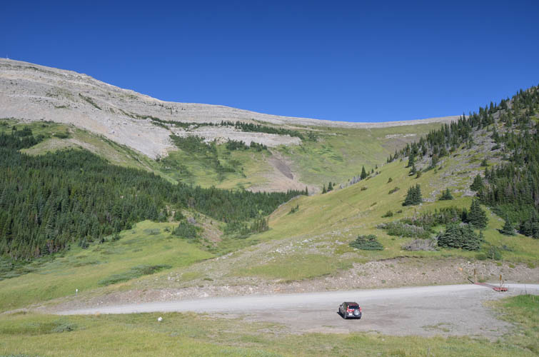
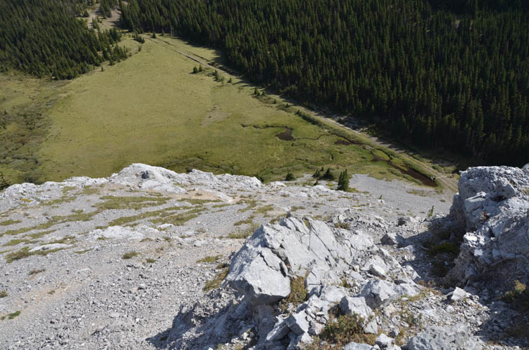
No bushwhacking required when you start at 2000 m elevation! The fire lookout at the summit of Hailstone Butte is barely visible as a tiny white speck on the far right side of the ridge.
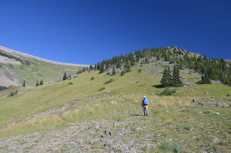
Heading up a good trail in perfect conditions!
Looking back down the drainage, with Mount Livingstone on the horizon.
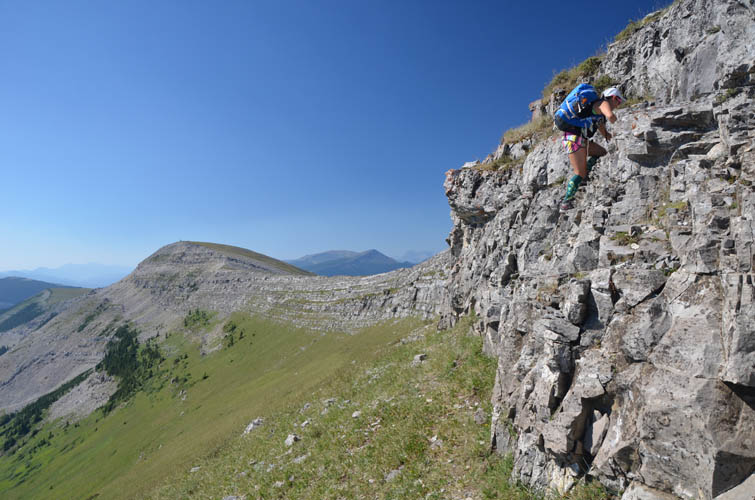
The short, fun scramble up the rock band to access the summit ridge of Hailstone Butte. It looks way more difficult than it is.
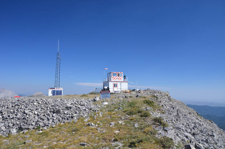
A sleek fire lookout graces the top.
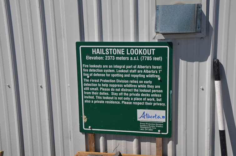
The official height is 2373 m, whereas my GPS measured only 2358 m.
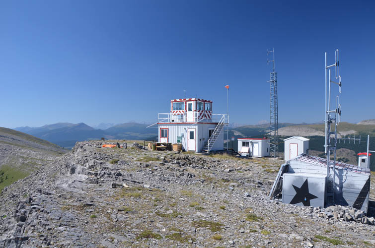
The lookout as seen from the north.
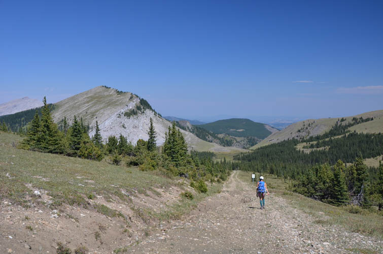
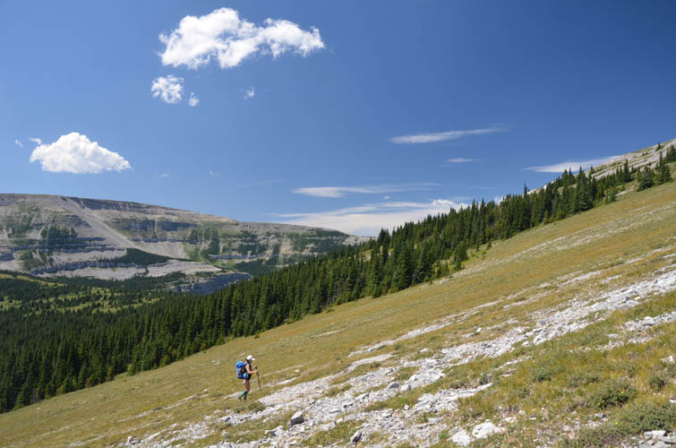
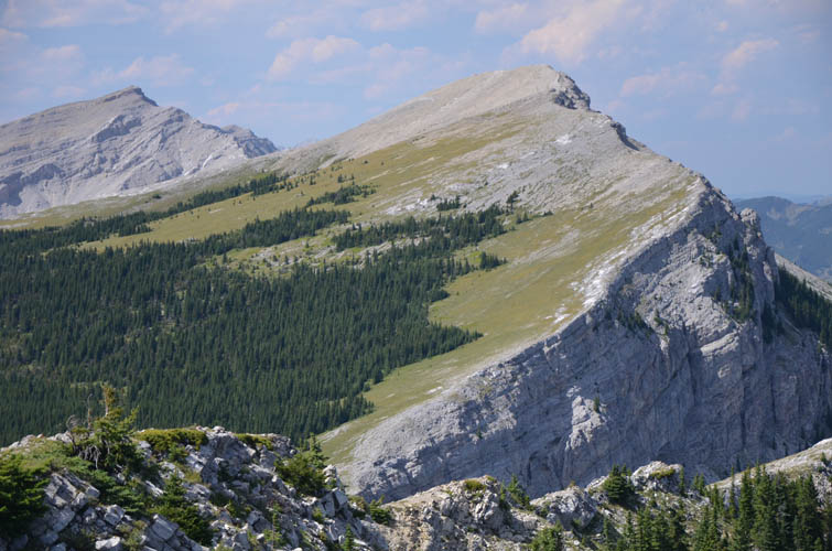
Beautiful easy hiking terrain lays ahead of us: Iron Creek Mountain (small bump just right of centre) and Sentinel Peak (centre). In the distance on the left is Mount Burke.
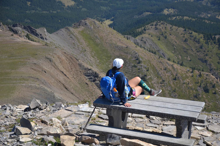
The perfect picnic spot!
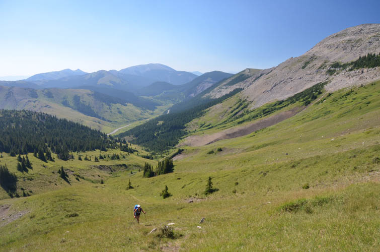
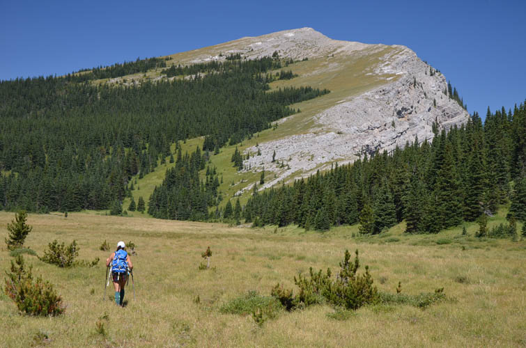
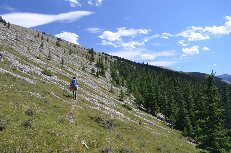
We use a wide track to hike down the valley towards Sentinel Peak.
Lovely green meadows in the valley below Sentinel Peak.
Plateau Mountain is another easy hike just to the west, as seen on the left of this photo.
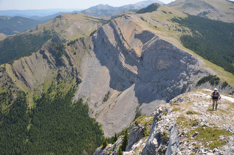
The south ridge of Sentinel Peak. This view is towards Iron Creek Mountain, which has a distinctive fold in its northern cliffs.
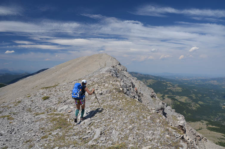
It’s a pleasant ridge walk to the top of Sentinel Peak.
Looking NW towards Mount Burke from the summit of Sentinel Peak. Burke surely looks very inviting!
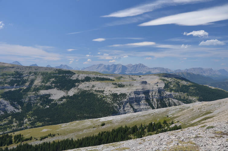
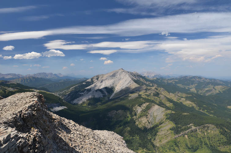
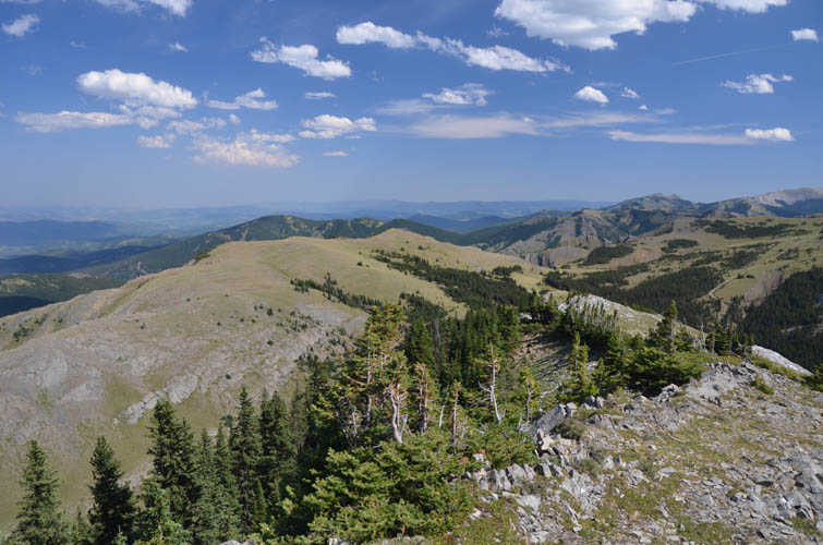
The flat expanse of Plateau Mountain fills much of the view to the west, with higher peaks along the Continental Divide behind. The one with the steep, grooved cliff face just right of centre is Baril Peak.
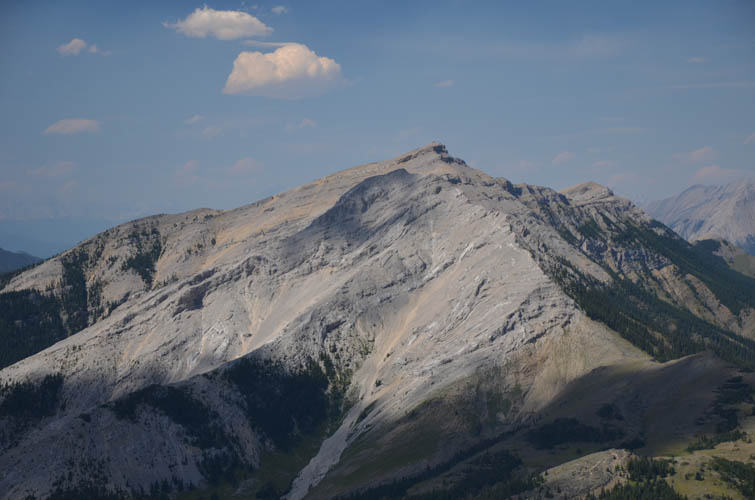
Close-up of Mount Burke. It’s an easy hike up from the west.
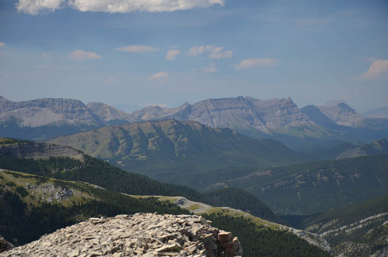
Also in the NW are Mount Armstrong (just right of centre) and Raspberry Ridge (grassy/treed ridge just left of centre).
A less-travelled game trail takes us up the western slopes of Iron Creek Mountain.
Sentinel Peak as seen from Iron Creek Mountain – what a beautiful place!
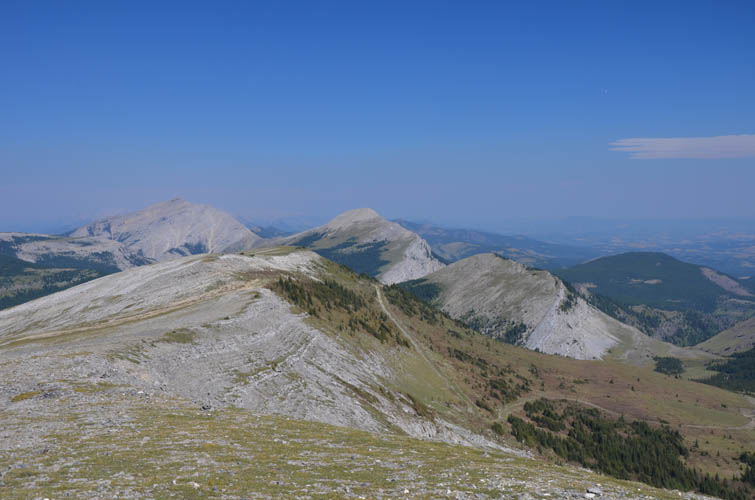
Gentle undulating ridges characterize the transition from front ranges to foothills to the east.
Rock and scree on the south ridge of Iron Creek Mountain.
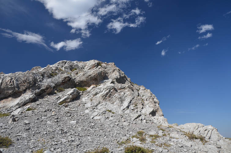
Despite appearances, this section is easy to navigate – scrambling optional!