Pyrenees, France
5 June 2018
With Wen
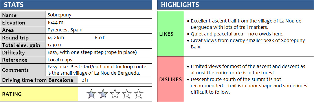
Located near the regional centre of Berga, Sobrepuny is one of those rather obscure little peaks that are not normally on the radar of mountain enthusiasts visiting from afar. We were looking for a nice and easy day hike from our base in the town of Berga and found some trails running up and down the summit on the OpenHiking maps, which would make for a nice loop route it seemed.
“Seemed” because it turned out that the trail we took on our descent was not exactly enjoyable and a poor choice in hindsight. Oh well, that’s how it goes sometimes when you don’t know what you’re getting yourself into in an area unknown to you.
For the locals of the small village of La Nou de Berguedà, Sobrepuny is probably a well-known and often-climbed destination. The main trail to its summit starts here, and there are a few other signed hiking trails that go through the village.
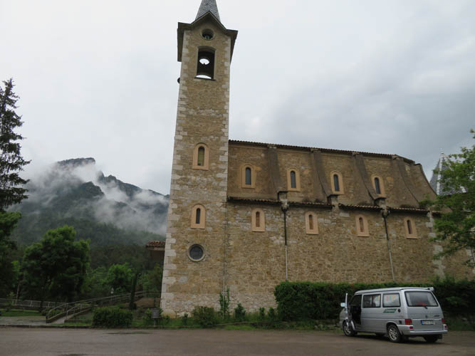
We started our hike about half-way along the small asphalt road between La Nou and the C-26 highway, where two of the local hiking trails intersect. Opting for a clockwise loop, we first walked downhill for a few kilometres on pretty muddy tracks (lots of rain in the last few days!) into La Nou. There is a picturesque church called “Lourde de La Nou” that’s right on the route and definitely worth stopping by.
At the northeastern end of the village, a signed trail steeply rises through thick forest on pretty much the most direct route up the mountain. It’s all in the forest and there are almost no views at all, but it’s still beautiful to walk through the lush forest, and of course it’s a great workout, too! In the upper part, the trail intersects several small logging roads, then leads to a small saddle separating the main summit from a lower peak called Sobrepuny Baix. It’s worth taking the short detour up this minor bump (10 min. one-way) because the views are fantastic – and superior than those from the main summit in my opinion. You can see the village of La Nou right below you and parts of the Llobregat barrier lake in the distance. The steep, almost vertical cliffs on the west side are equally impressive.
Once back at the col, it’s another 20-30 minutes of steep hiking to the summit of Sobrepuny. There’s a summit pole with the Catalan flag and a small diorama with a miniature version of Jesus, Mary and Joseph inside a walnut. We’ve seen such figurines on several summits of the Pyrenees now (e.g. Puig de Pradets, La Creu de Ferro, or Pedraforca), underlining the religious significance of mountain tops as places of worship and pilgrimage, similar to what is so common in Guatemala (e.g. Santo Tomás).
The views were a bit disappointing, but that was in part due to the thickening cloud cover above and around us. After a short break, we headed down on our descent route towards the north and then east. It quickly became obvious that this route was neither popular nor well-trodden. Turn-offs were sometimes difficult to spot, and one particular section of trail that ran parallel to a logging road was so full of thick shrubs and fallen trees (probably from a recent storm), it was no fun to hike at all as we squeezed our way through the wet foliage, under tree branches and past thorny bushes.
Following this nasty section of bushwhacking, we came to a small saddle with several paths leading in different directions. Here, we probably should’ve taken the unmarked trail that seemed to head directly down into the valley. Following the “official” path highlighted on OpenHiking maps and marked by yellow-white paint instead, we ended up on a narrow, even less beaten path that contoured around a rocky ridge, with several annoying ups and downs through thick forest. This kept going for what felt like a long time, and surely this type of overgrown rollercoaster trail was neither efficient nor fast. When the trail finally started to gently descend back down to the valley, we were both pretty tired of this hike.
We eventually reached our car again after just over 6 hours of hiking and somewhat mixed feelings about today’s trip. Visiting La Nou, the ascent trail and the first high point were all speaking in favour of it, but the slow and unpleasant descent had not been a good choice. My recommendation: wait for a sunny day and take our ascent route to go up and down the same way!
DISCLAIMER: Use at your own risk for general guidance only! Do not follow this GPX track blindly but use your own judgement in assessing terrain and choosing the safest route.
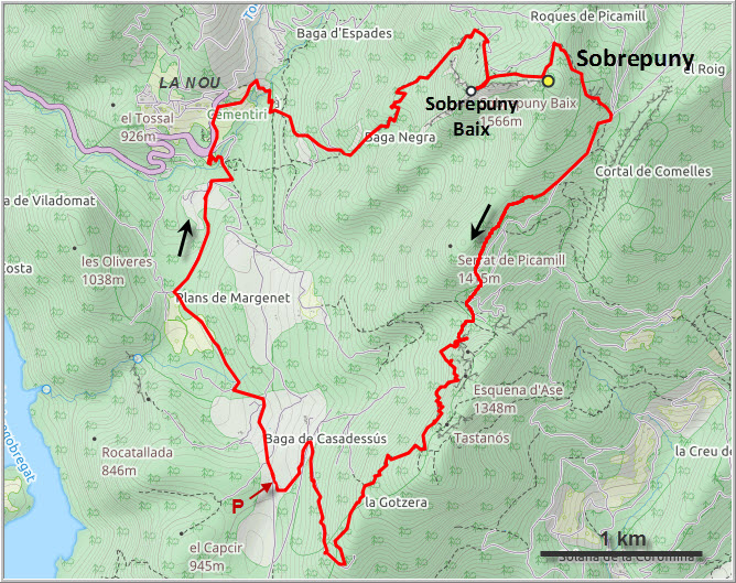
Trail signs near the small asphalt road where we parked.
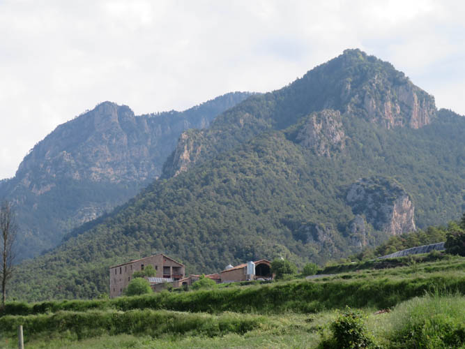
Sobrepuny from our parking spot – the summit is hidden behind the main buttress on the right.
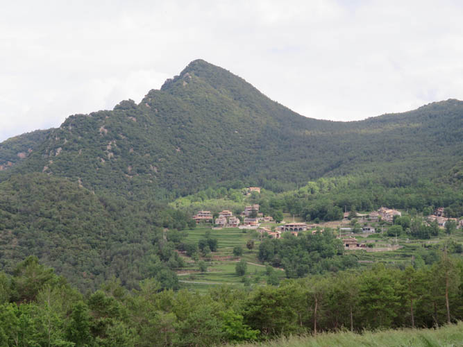
The tiny village of La Nou de Bergueda.
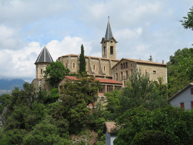
Lordes de la Nou church.
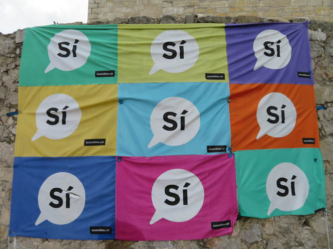
There’s no question of Catalan independence here! These “Yes” posters are still hanging on the walls, months after a controversial referendum on Catalonia’s independence from Spain.
The main trail to Sobrepuny from La Nou.
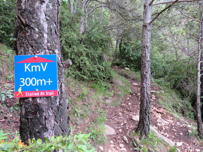
This is the first time I’ve ever seen the elevation gain indicated on signs every 100 m!
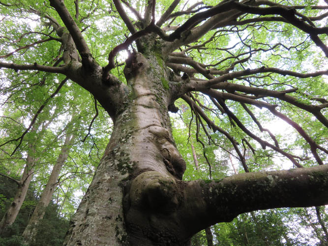
No view, but some beautiful grand trees.

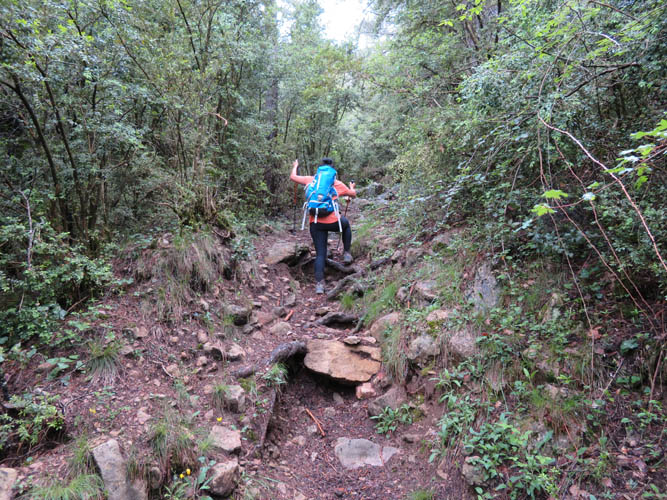
The only “hands-on” section – a steep, slippery rock along the forest trail. The rope definitely helps!
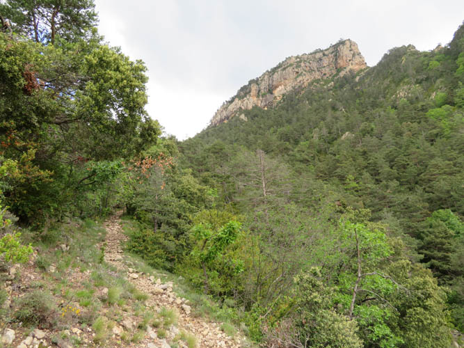
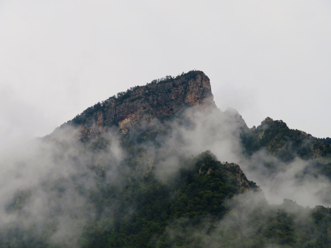
Nearing the top, marked by steep cliffs and buttresses.
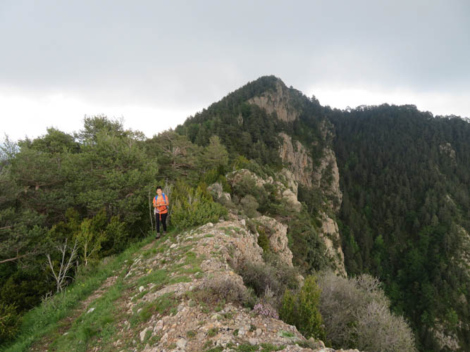
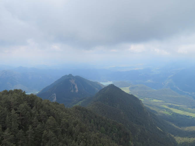
On the ridge between Sobrepuny’s main summit (the high point in the background) and the lower Sobrepuny Baix.
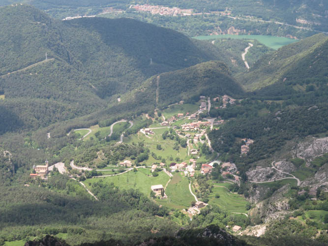
A nice bird’s eye view of La Nou from Sobrepuny Baix.
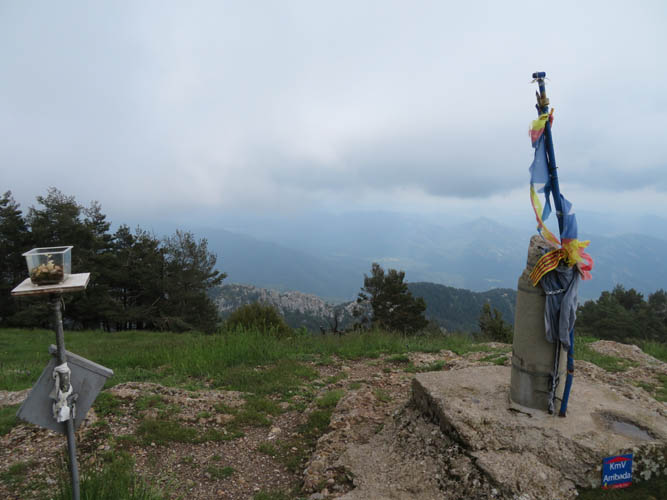
At the summit of Sobrepuny.
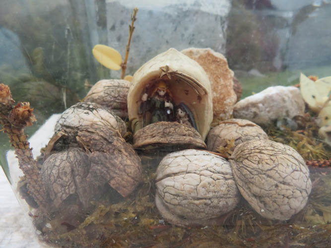
A neat little diorama made of walnuts.
Cloudy summit views to the south.
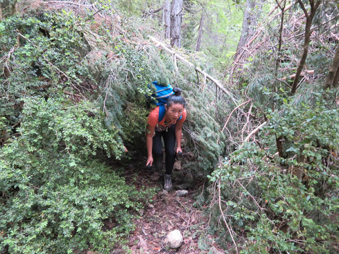
Sections of the descent trail we took had been ravaged by recent storms, requiring us to do some bushwhacking. Oh well, it was a nice reminder of all those shrubby Rockies approach hikes!
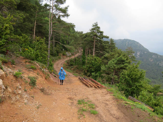
Rainy plod down some logging roads.
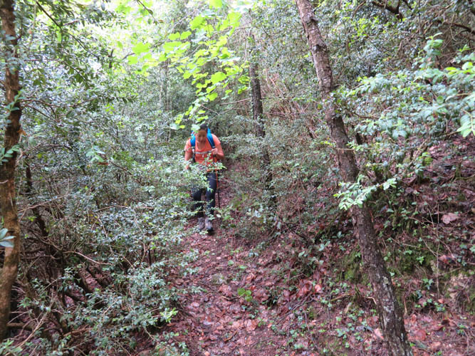
And an overgrown trail at the end… Next time (when is that!?) I’ll just hike up and down the same route from La Nou!
Stopping by the church in La Nou on our way out. Sobrepuny is still shrouded in clouds in the back.