Kananaskis, AB, Canada
21 May 2023
Solo
Awesome ridgewalk close to home
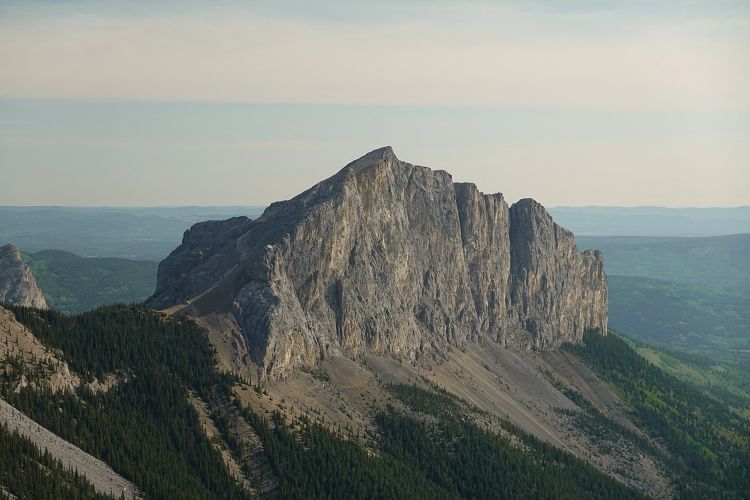
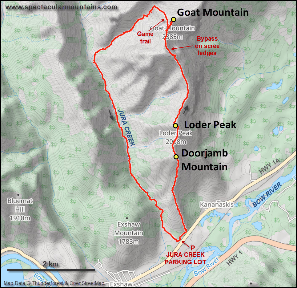
Even after well over 10 years of scrambling in the Rockies from my Calgary home base, I never managed to explore two small peaks near Canmore locally known as Door Jamb Mountain and Loder Peak. They are high points on the south ridge of Goat Mountain, a major peak just west of Mount Yamnuska. While Door Jamb and Loder are frequently visited by day hikers, Goat Mountain is much less popular but routinely done by climbers in an east-west traverse from Yam. I decided to ascend the south ridge of Goat Mountain via Door Jamb and Loder, then descend the valley to the west of Goat and walk back along Jura Creek for a really nice loop that took me approximately 8 hours.
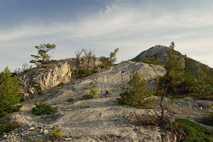
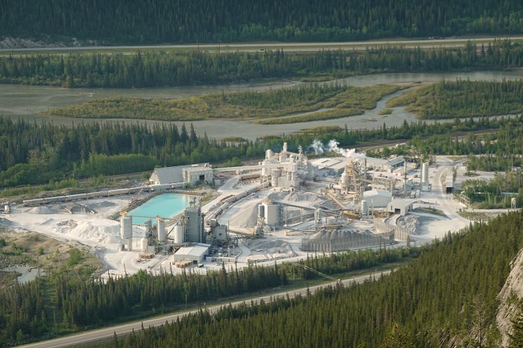
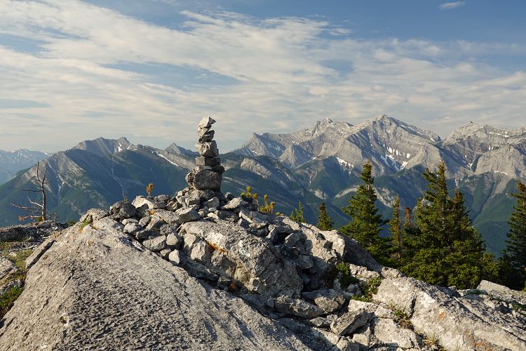
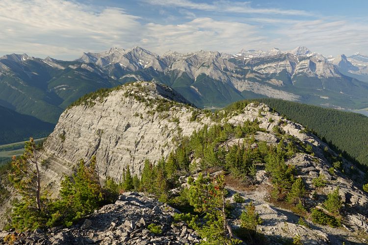
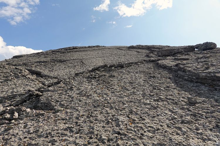
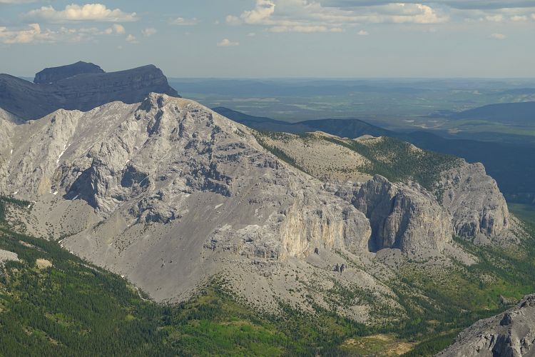
One of the things I loved about this outing is the ease of access. It’s a short drive from Calgary, and then you can start right up the ridge a mere 150 m from the parking lot. I arrived at 7 am as only the second car in the lot. Still a bit out of shape from a long and idle winter, it took me longer than I wanted to reach Door Jamb Mountain, the first minor high point along this ridge. There is a rough trail that’s quite steep in places and minor routefinding is necessary as the trail often splits into several branches, some of which fizzle out or take you to slabby terrain as I found out on one occasion. Still, it’s a fun hike with lots of options for scrambling on or just off the ridge crest. The views are pretty good as well but you can’t help but want to get away from the big cement factory down by the road.
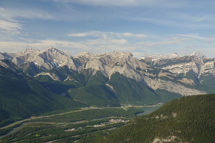
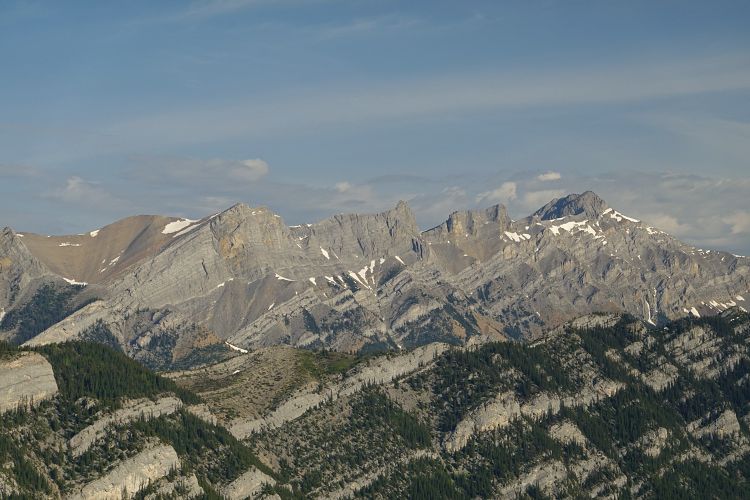
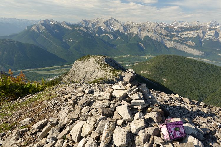
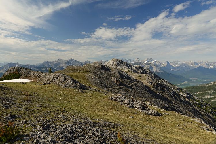
The steepest part is just before the summit of Door Jamb, then there is some minor elevation loss and it’s an easy hike to Loder Peak about 800 m further north. Judging by the number of entries in several notebooks of the register, lots and lots of people visit Loder Peak throughout the year. Numerous famous and familiar peaks line the horizon with especially good views of Heart Mountain just across the valley as well as Mount McGillivray, Gap Peak, Mount Fable and of course Mount Yamnuska.
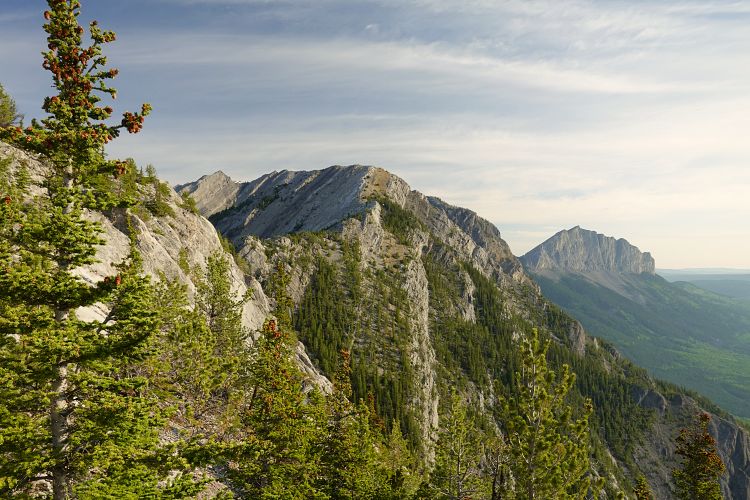
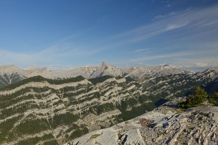
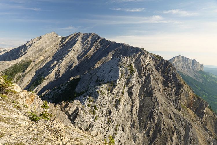
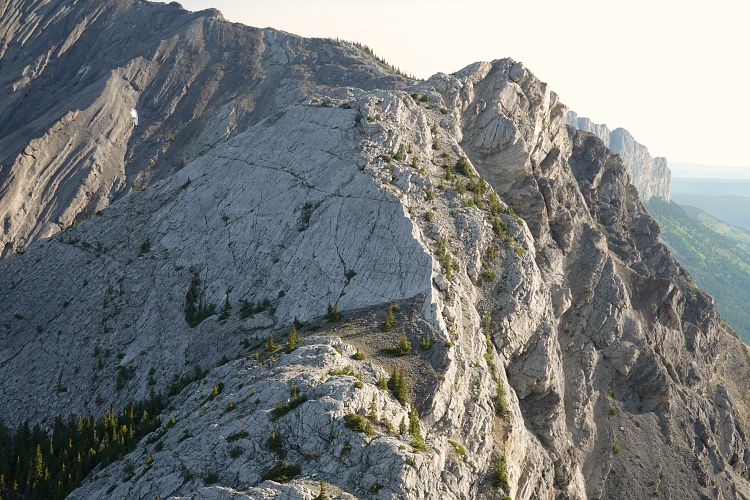
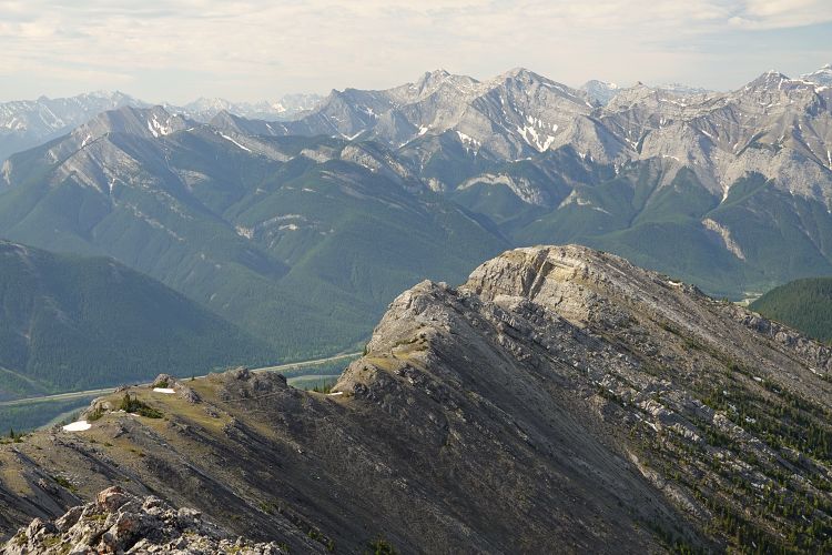
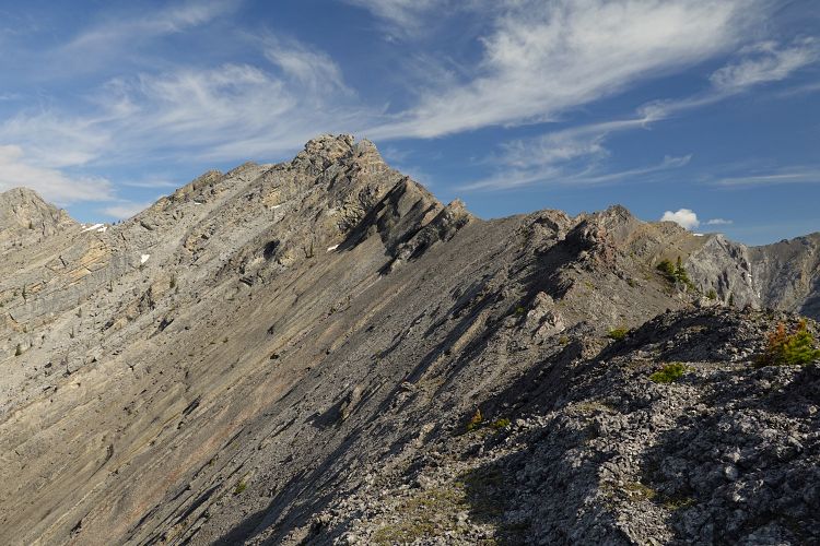
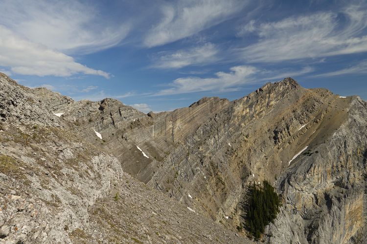
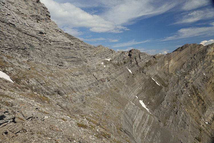
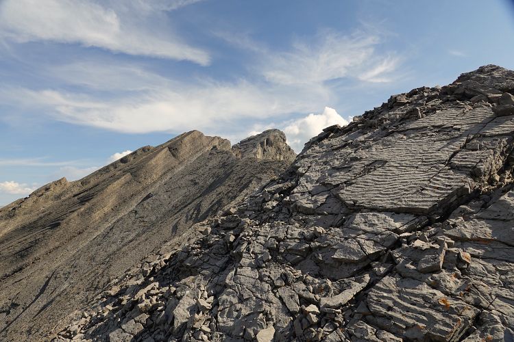
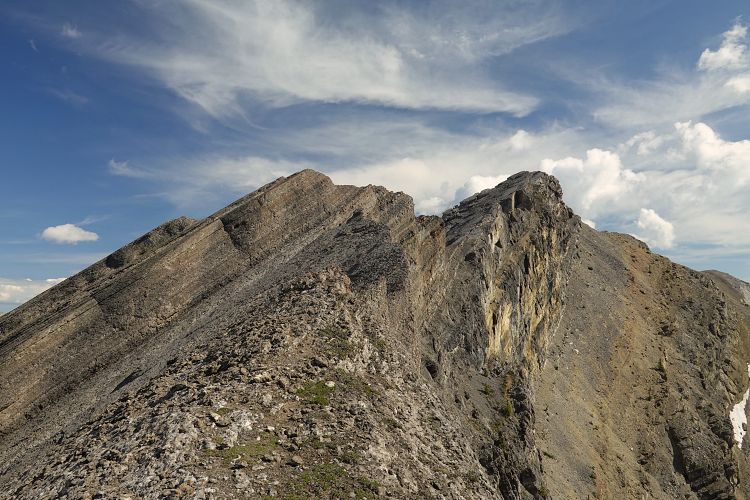
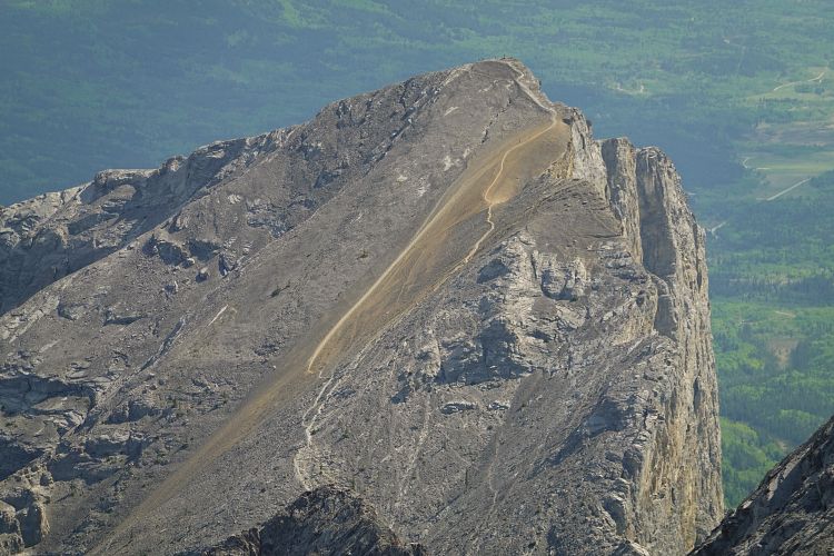
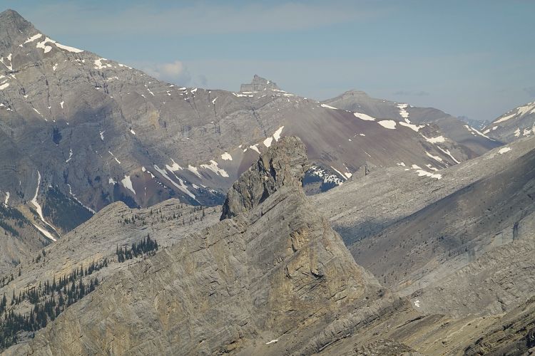
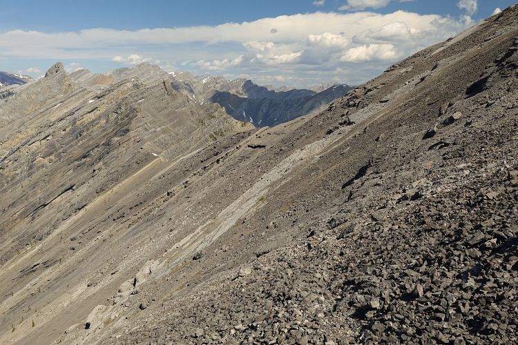
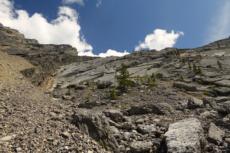
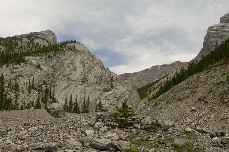
From Loder the trail steeply drops to a col from where some people hike down the west side to Jura Creek. The trail that continues north is now much fainter and crosses a mix of slabs, rocky steps and easy grass and shale slopes with a bit of easy hands-on scrambling here and there. Not far below the summit of an unnamed peak (sometimes referred to as peak #6), the ridge abruptly changes in character with a series of near vertical cliff bands.
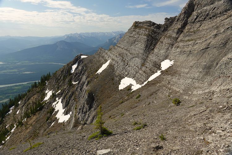
While some people do the difficult climb to stay on or near the crest, thankfully there is a much easier bypass option on grass and scree covered benches on the east side. The existence of a faint trail here makes the routefinding straightforward, but I should definitely point out two caveats:
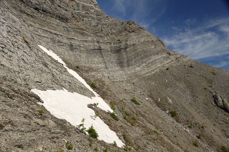
1) Any remaining snow patches could render this route dangerous or impassable.
2) There is considerable exposure on the east side; it’s not severe and didn’t bother me too much, but for those not used to a big drop on one side this may not be a good choice.
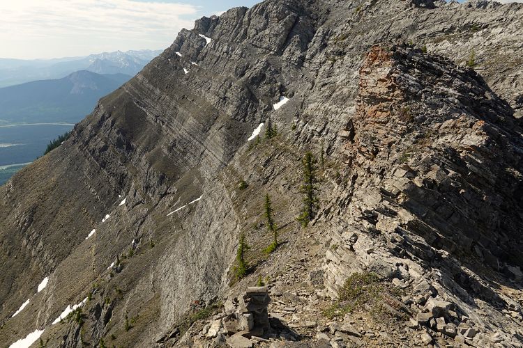
The trail follows the same bench that curves around the side of the mountain, losing and then regaining a little bit of elevation, and emerging back on the ridge crest well past the unnamed summit (large cairn).
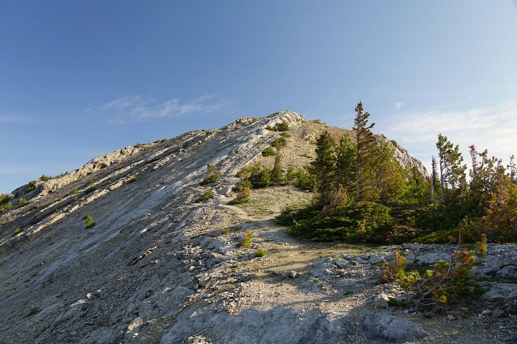
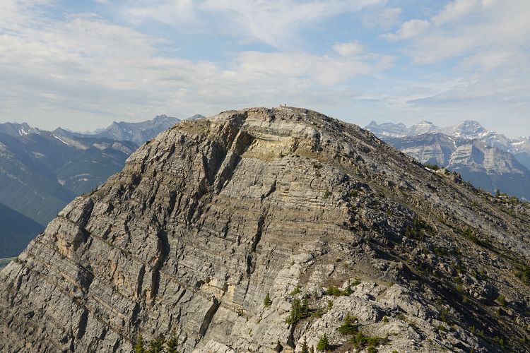
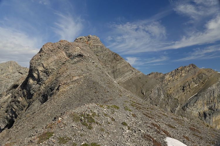
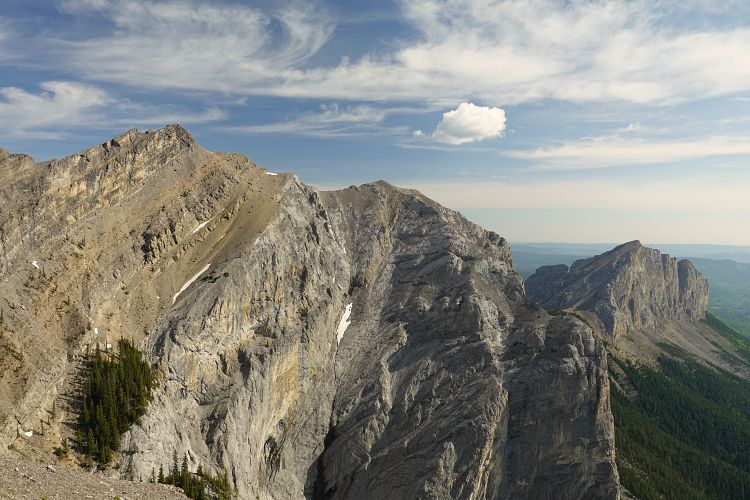
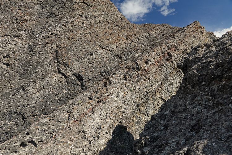
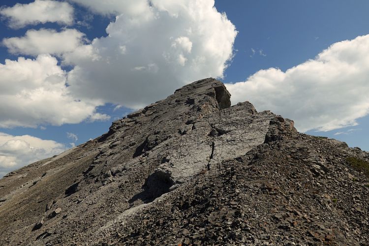
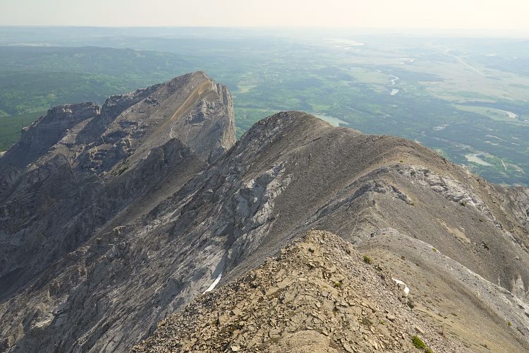
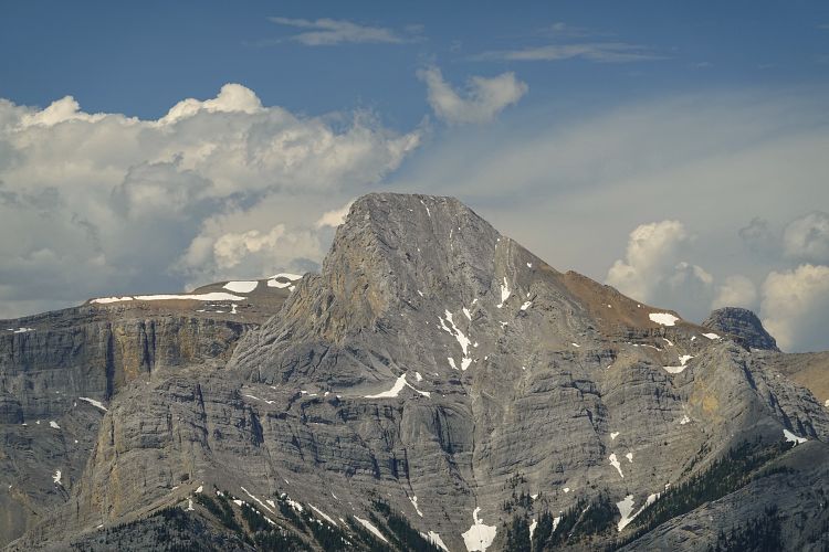
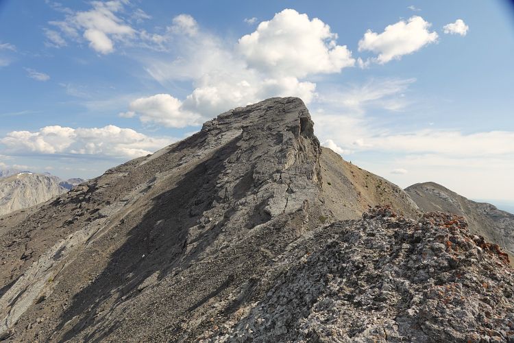
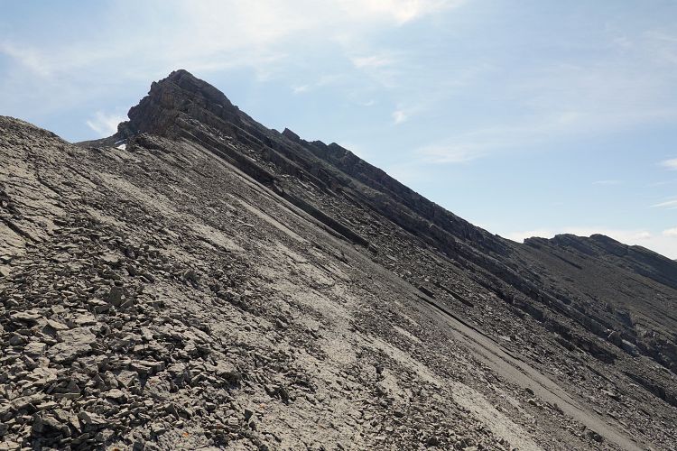
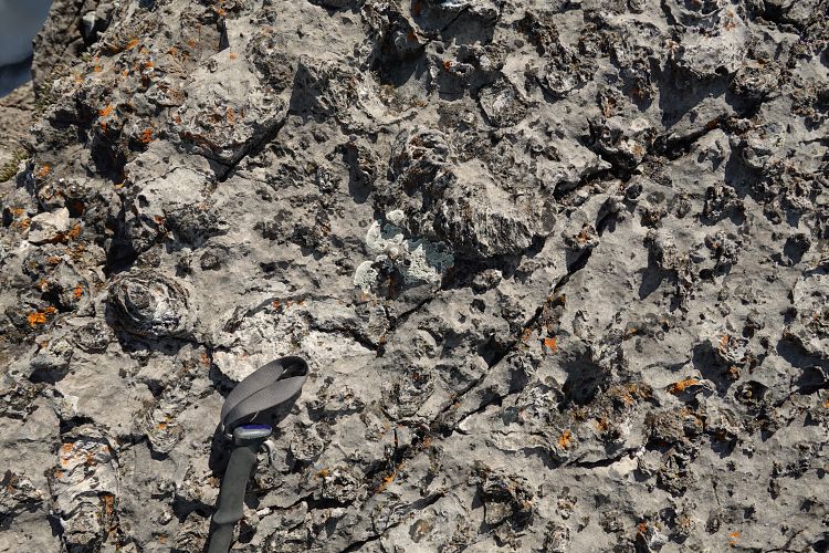
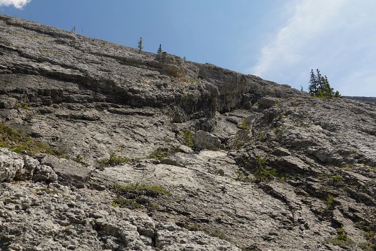
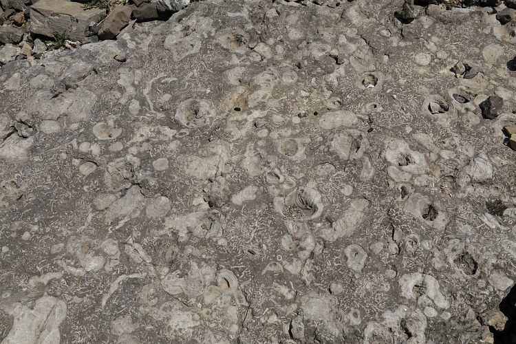
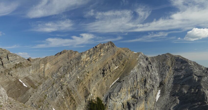
The section from this point to the summit of Goat Mountain had some of the most enjoyable scrambling for me, ranging from a narrow ridge crest to a couple of pinnacles and huge friction slabs on the summit block. The crux is a short climb up a steep cliff band on a very narrow and exposed ledge, shortly after the bench traverse. There are very good holds in the form of solution pockets in this ancient reef block, but the drop is significant so there is no room for mistakes here. The slabs just below the summit are at just the right angle that you can walk right up, using small cracks and fossils sticking out of the rock.
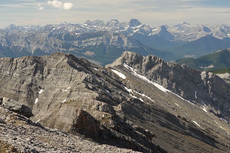
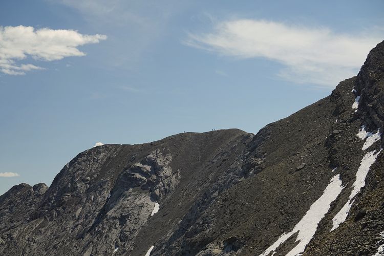
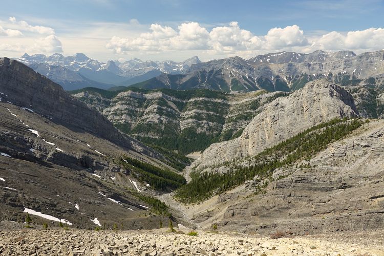
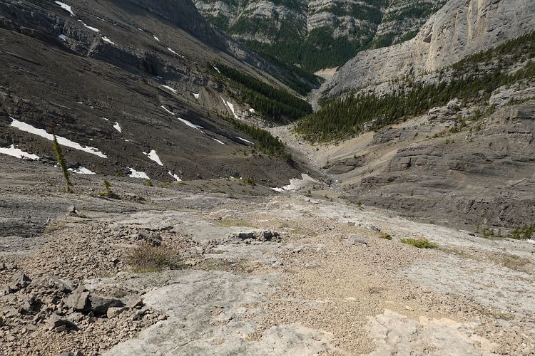
I enjoyed a good break at the summit admiring the empty valleys to the north and observing crowds of people coming down the scree runs on the west side of Yamnuska. For my return, I backtracked about 300 m to near the low point between the summit and peak #6 where I found a decent game trail going north to the saddle between Goat and the next high point to the north. A series of vertical cliff bands would prevent easy passage north of Goat’ summit, but the goats figured it out with their own path that elegantly breaks through each one of them a little lower down on the west slopes. It’s always a great feeling when you find that game trail that just works and takes you to where you want to go!
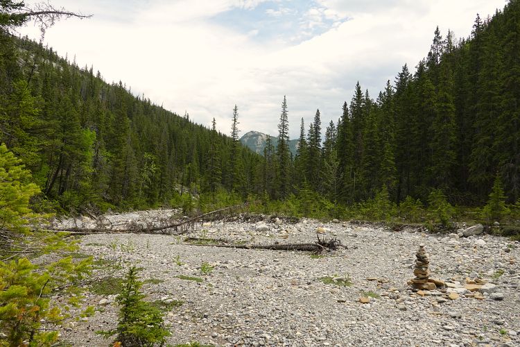
At the saddle between Goat and the high point to the north I found some light coloured fine shale streaks that offered a quick way to descend to the valley to the west. About half way down the slope steepened a little and there were some slabs to negotiate, but I took my time and eventually worked my way down to the rubbly drainage which I then followed out to Jura Creek. From here it was a mere trudge in the wide creek bed back to the parking lot. At the “false fault”, a neat geological feature where black shales of the Exshaw Formation rest directly on top of older Devonian rocks creating a v-shaped incision in the valley, I was joined by dozens of day hikers out to enjoy a beautiful sunny and clear day.
It still puzzles me that Goat Mountain isn’t more popular with the scrambling crowd – it’s an absolutely awesome ridgewalk with fantastic views and a good variety of terrain to keep you entertained. I would rate it as an overall difficult scramble and of course you have to be comfortable with some exposure.
Note: Only attempt this route if the mountain is completely clear of snow!
|
Elevation: |
Loder Peak: 2088 m |
|
Goat Mountain: 2420 m |
|
|
Elevation gain: |
1540 m |
|
Time: |
8 h |
|
Distance: |
14.6 km |
|
Difficulty level: |
Difficult (Kane), T6 (SAC) |
|
Comments: |
Do not attempt if snow lingers on east-facing slopes. |
|
Reference: |
None used for this route. |
|
Personal rating: |
5 (out of 5) |
NOTE: This GPX track is for personal use only. Commercial use/re-use or publication of this track on printed or digital media including but not limited to platforms, apps and websites such as AllTrails, Gaia, and OSM, requires written permission.
DISCLAIMER: Use at your own risk for general guidance only! Do not follow this GPX track blindly but use your own judgement in assessing terrain and choosing the safest route. Please read the full disclaimer here.