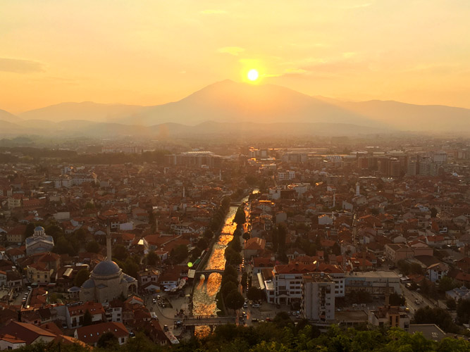
Prizren, Kosovo
9 September 2018
With Wen
A mellow ridgewalk in Kosovo
We hadn’t even expected to visit Kosovo on our Europe trip at all, but then we spontaneously decided to drive through this tiny territory on our way from northern Albania to Macedonia since “we were in the area anyway”. Always a good reason, I think! 🙂
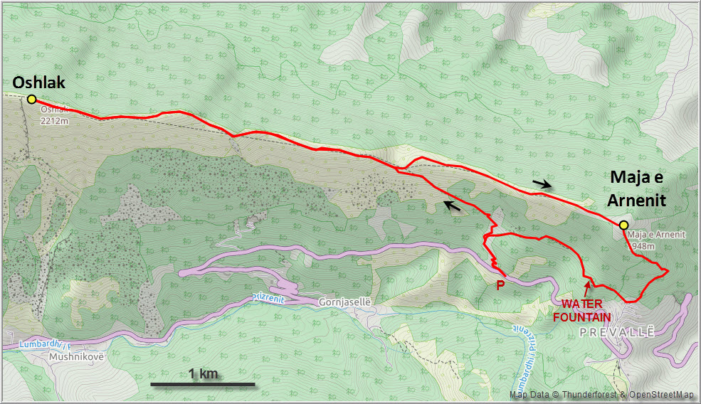
After visiting Prizren, Kosovo’s second city and one of the most pleasant we’ve seen in all of the Balkans, our drive took us east through the Sharr Mountains National Park en route to Skopje in Macedonia. I was scanning through the local maps of my outdoor navigation app just to see what’s around us, and in the process I found the perfect “stop-over hike”: Oshlak Peak. Easily accessible from the main road, a trail all the way up to the summit, and no crazy distance or elevation gain to overcome.
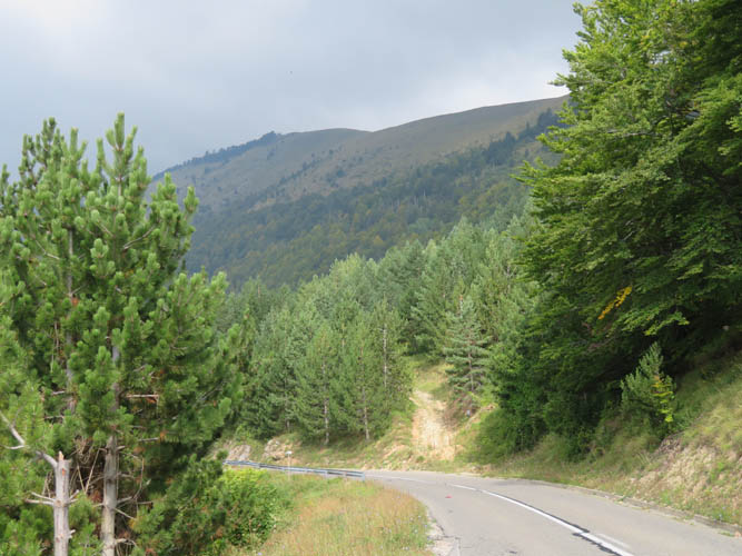
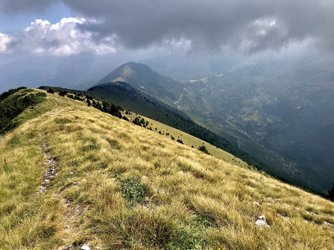
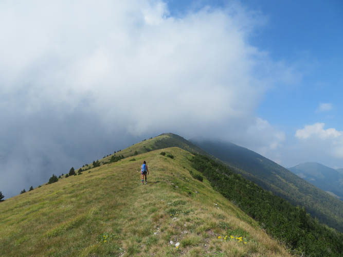
There is a small pull-out on the right side of the road when coming from Prizren, just after an inconspicuous signpost for the Oshlak trailhead. We were surprised to find freshly painted red-white trail markers along the route, although the path isn’t well-trodden and doesn’t seem to see many visitors. The way up first follows an old logging road through light forest, which then turns into a narrow trail across grassy slopes until it reaches the top of the ridge. Very efficient for gaining elevation steadily at an even pace! It was quite hazy when we started in the morning and the views were terrible, so we just put our heads down and trudged up without a break.
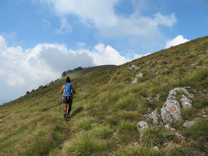
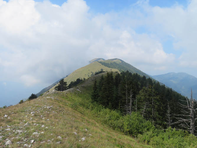
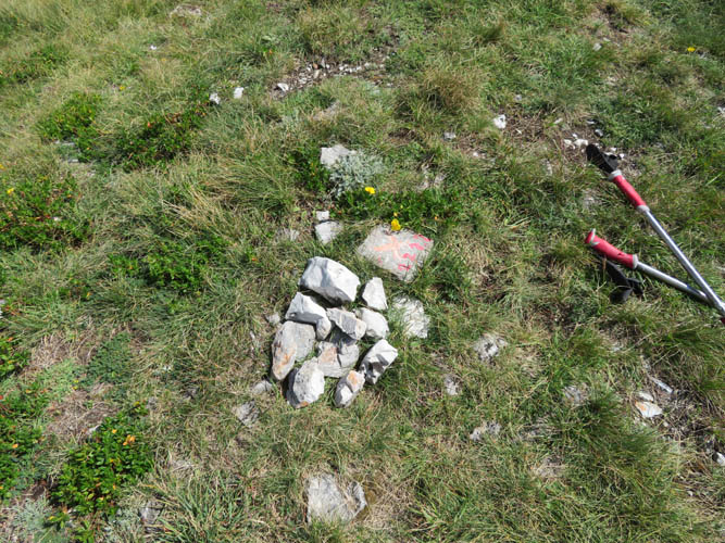
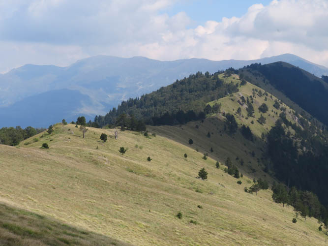
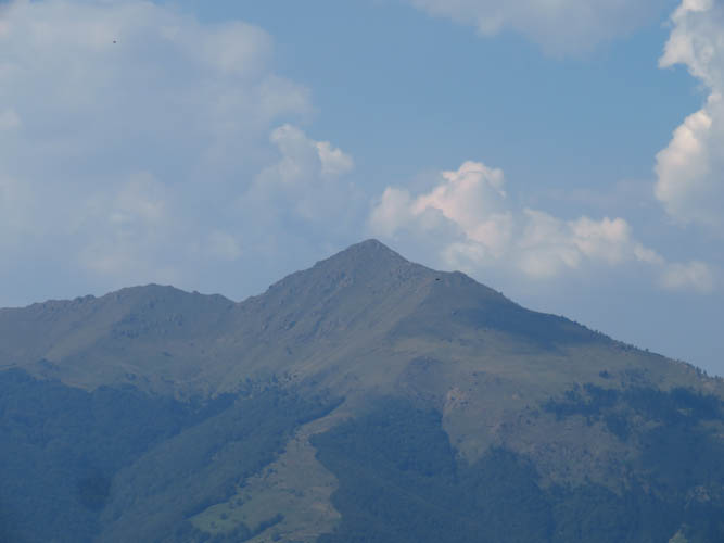
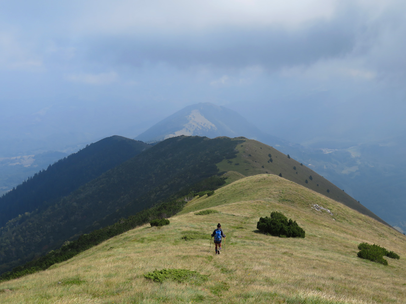
Oshlak is truly a nice, gentle ridgewalk. Once you’re on top of the ridge, all you have in front of you is a gently undulating, broad, grassy shoulder to walk on. Although the summit seemed to be quite far in the distance still, following the faint trail on the ridge crest makes it easy to cover the last 3 km to the top. A tiny summit cairn marks the highest point along the ridge, which continues west and could be followed for another few hours.
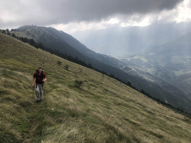
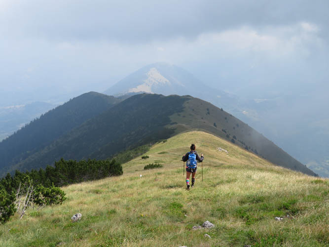
Due to the haze, we didn’t get the beautiful views we were hoping for, but it was still really nice to be up here glancing at the long, gentle ridge with its mixture of golden meadows, shrubs and pine trees. The only eye sore were the pieces of trash we kept coming across along the trail and near the summit. Bits of candy wrappers, empty water bottles, plastic bags, disposable cups, etc… Unfortunately, some people come out here to enjoy themselves in nature, but then end up tarnishing the experience for everyone else who follows – something I will never understand. We did our best to remove some of it, but of course there is always more. Sometimes I wonder if every serious hiker brought a garbage bag and took out a little more trash than they brought in, then our trails would clean themselves up in no time!
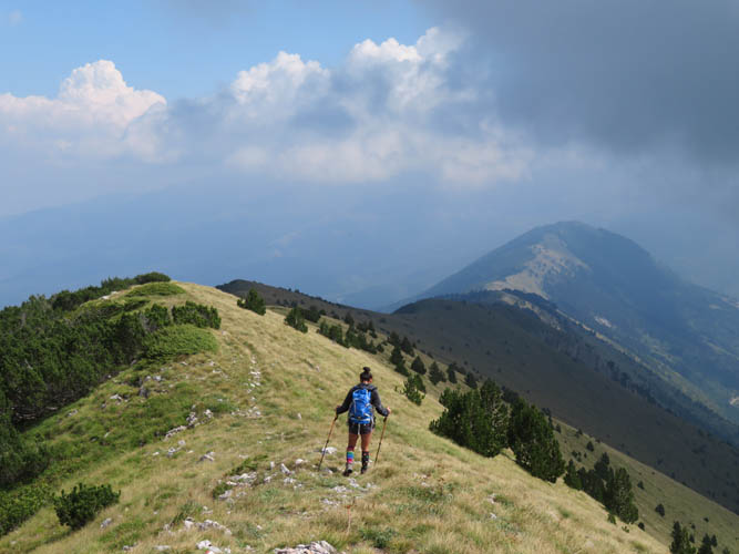
After a relaxing lunchbreak on the summit, we headed back along the ridge towards where the marked trail splits off and descends back into the valley. A faint trail continues east along the ridge leading to another peak called Maja e Arnenit. A nice extension for a little more exploring, I thought, while Wen was happy to return to the car at this point and chill a bit.
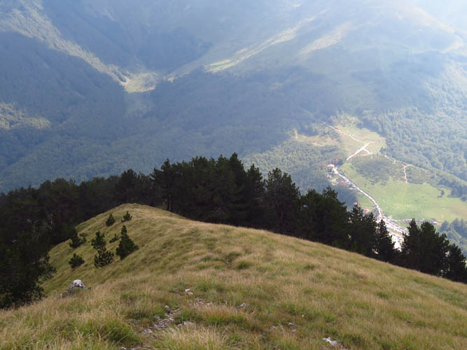
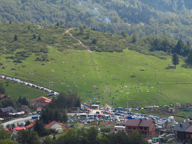
The ridge walk to Arnenit was very similar in nature to what we had seen before, just a nice and easy hike in fairly gentle terrain. I reached the summit about 40 minutes after leaving the turnoff. From here, you could look down to the village of Prevalle to the south. The meadows surrounding the village were teeming with families having picnics and BBQ’s, which is apparently a favourite pastime of the locals on the weekends. Today was Sunday, so the streets were packed with people shopping for local produce and indulging in ćevapi and grilled corn at the many local eateries.
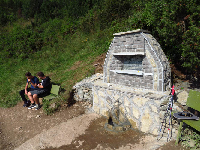
To get back to the car, I followed a very faint path that soon fizzled out on Arnenit’s SE slopes before making a sharp turn west (cairn) through forest and to the edge of Prevalle. A wide walking path, popular with day visitors, starts here and heads further east, past a new drinking water fountain, gradually degrading into a narrow forest trail that eventually leads back to the logging track we started on in the morning.
Although we weren’t wowed by the views today (of course it may be different on a sunny clear day), Oshlak was a very enjoyable easy hike while passing through the area. “The perfect ridgewalk” in Wen’s own words!
| Elevation: | Oshlak: 2212 m (official), 2217 m (my GPS) |
| Arnenit: 1948 m (official), 1946 m (my GPS) | |
| Elevation gain: | 1110 m |
| Time: | 5.5 h |
| Distance: | 15.9 km |
| Difficulty level: | Easy (Kane), T2 (SAC) |
| Reference: | Local maps |
| Personal rating: | 3 (out of 5) |
DISCLAIMER: Use at your own risk for general guidance only! Do not follow this GPX track blindly but use your own judgement in assessing terrain and choosing the safest route.