 Kananaskis, Canada
19 July 2017
Solo
Wonderful off-the-beaten-track scrambling in Kananaskis
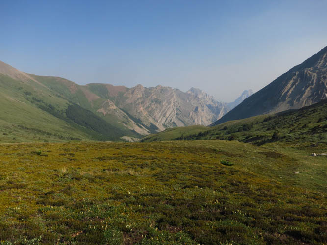
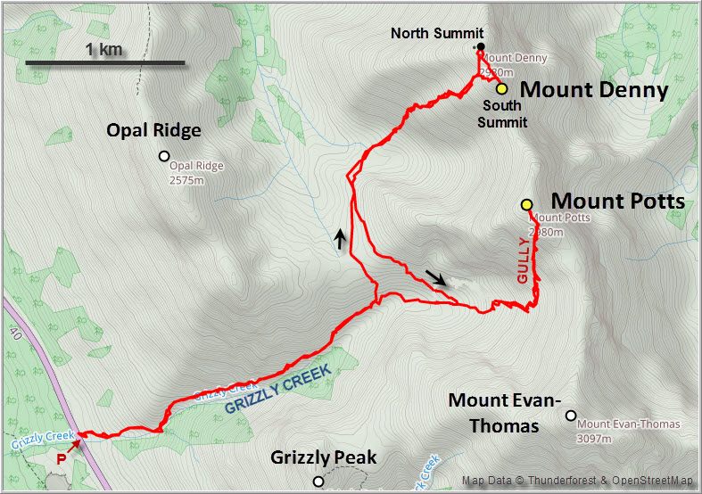
The peaks and valleys along Highway 40 in Kananaskis are among my favourites in the Rockies. Easily accessible with lots of good trails, there is a plethora of scrambling opportunities and beautiful hikes to enjoy. Moreover, it’s only a short drive from the million-people urban centre of Calgary, although that also means that you don’t always have the trail to yourself. A week ago when I was standing on top of Mount Evan-Thomas, I wondered about the peaks directly to the north: Mount Potts, and a bit further Mount Denny. Both are readily described in Kane’s latest edition of Scrambles in the Canadian Rockies, and even Nugara has Denny covered.
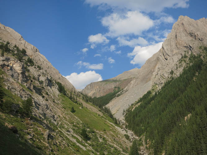
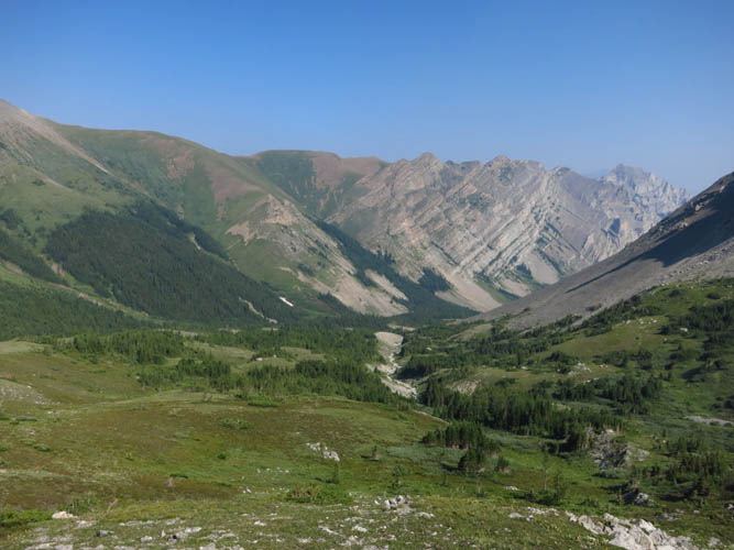
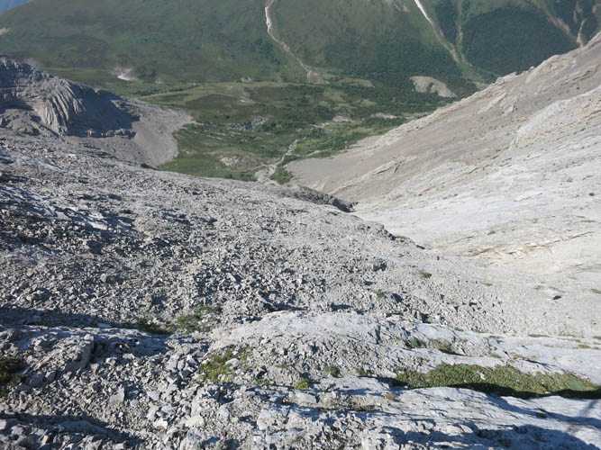
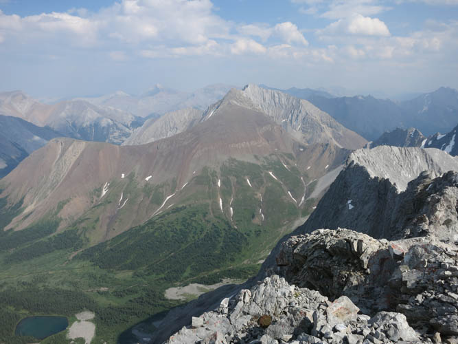
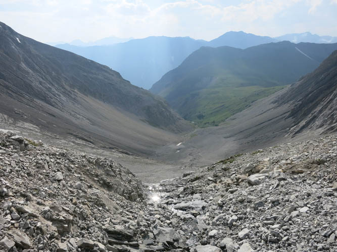
After some initial difficulties locating the faint trail on the north side of Grizzly Creek by the highway, I had no further issues and enjoyed a straightforward hike up the valley. The trail is more well-defined past the power line and fairly easy to follow I thought, quite reminiscent of the Grizzly Peak trail in the parallel valley just to the south. The trail loses itself in the grass as you reach the high valley between Opal Ridge and Mount Potts, a lovely spot for a morning break (or a good afternoon nap!).
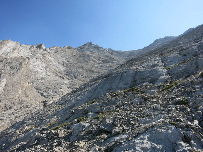
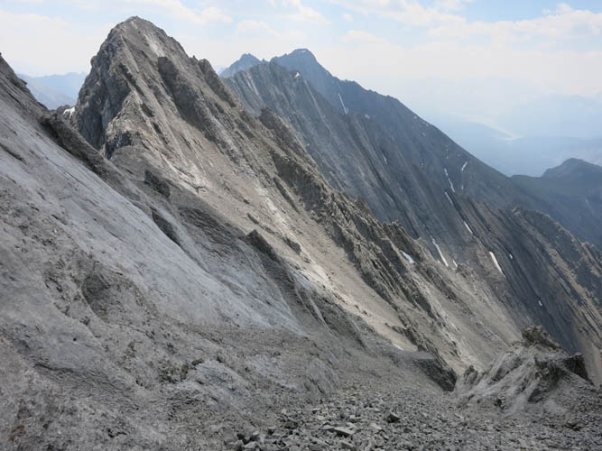
Mount Denny is significantly easier than Potts, perfect for a “warm-up” scramble. I hiked a short distance north through the grassy valley and quickly arrived at the overhang that marks the access point for Denny’s SW slopes. I didn’t enjoy going up these slopes too much, there was just too much rubble for my liking. Occasional cairns and flags made things easier but you can tell that people have gone all over the place. Lots of routes are possible, and if you’re not completely off it’s pretty easy. The “moderate” rating given by Kane and Nugara probably errs on the side of caution – fair enough.
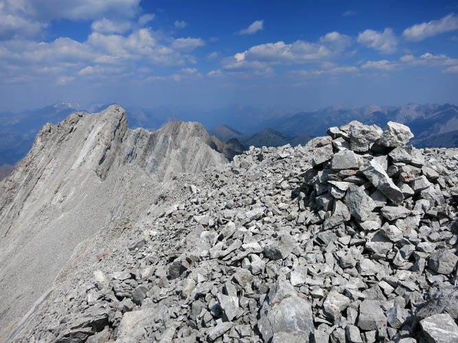
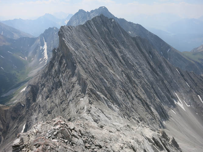
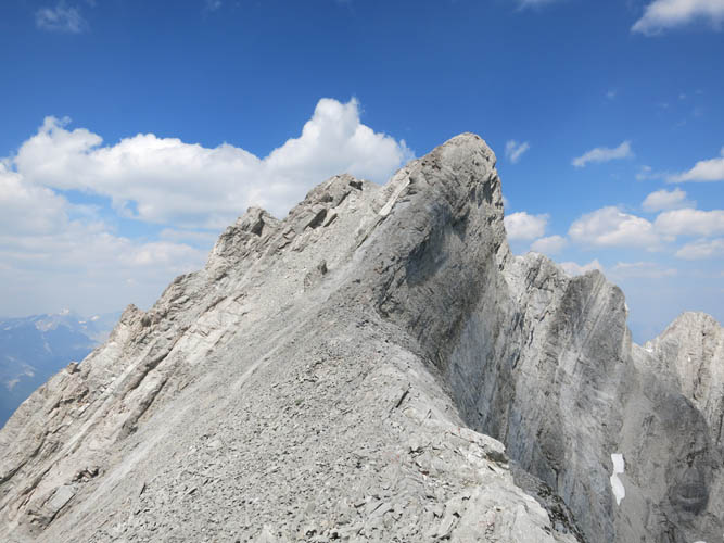
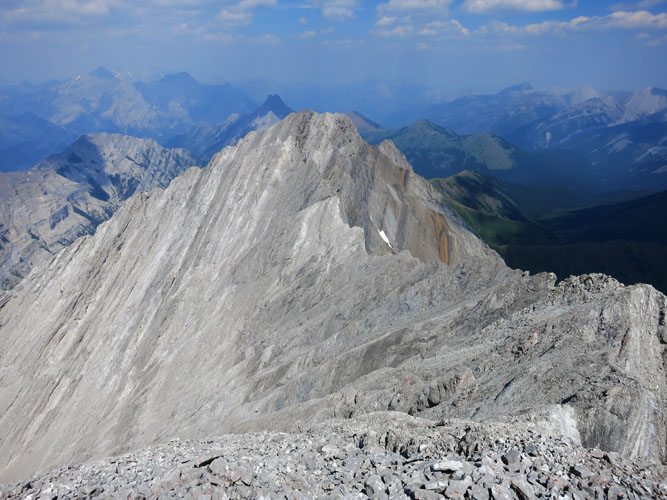
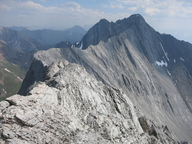
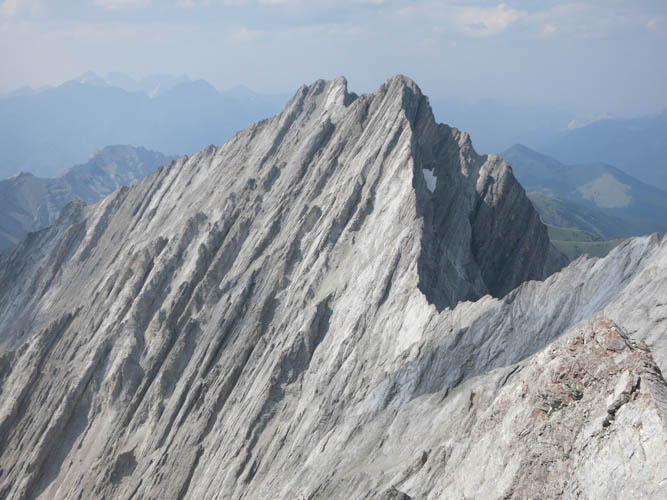
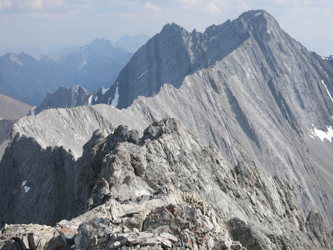
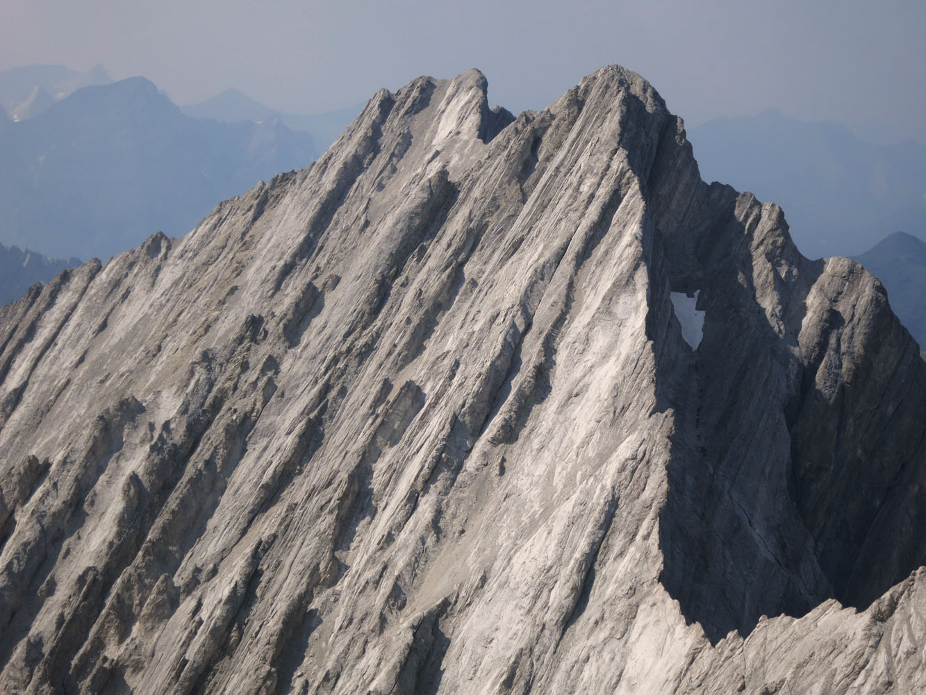
Once on the summit ridge, it’s a short hike to the south summit, which is apparently the true summit as it has a register and surpasses the north summit by a mere 1 metre according to my GPS. After taking in the views I headed to the north summit via a partially exposed ridge (avoidable). From here it was possible to make a direct descent to join up with the ascent route on the SW slopes.
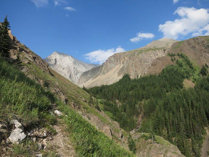
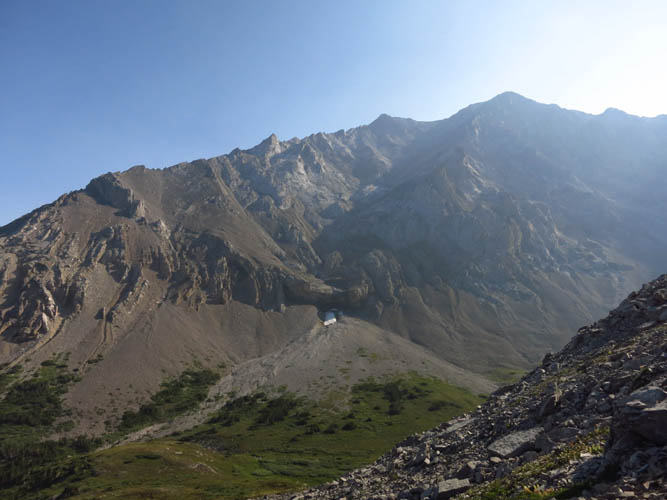
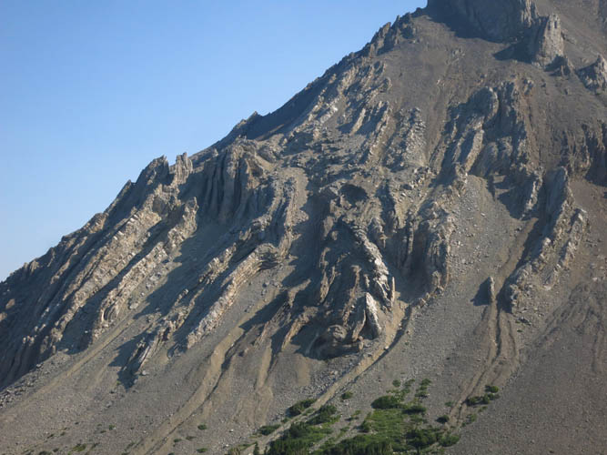
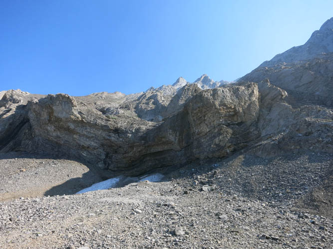
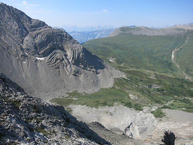
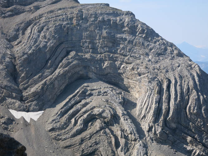
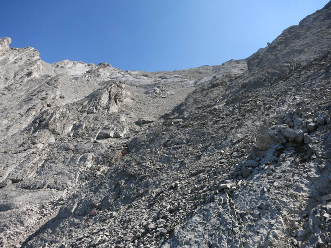
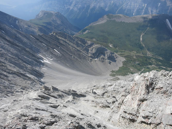
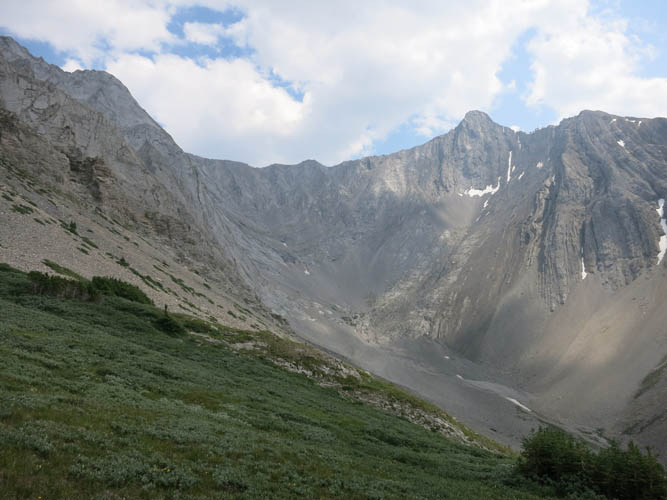
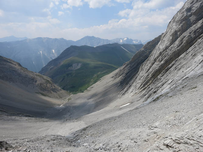
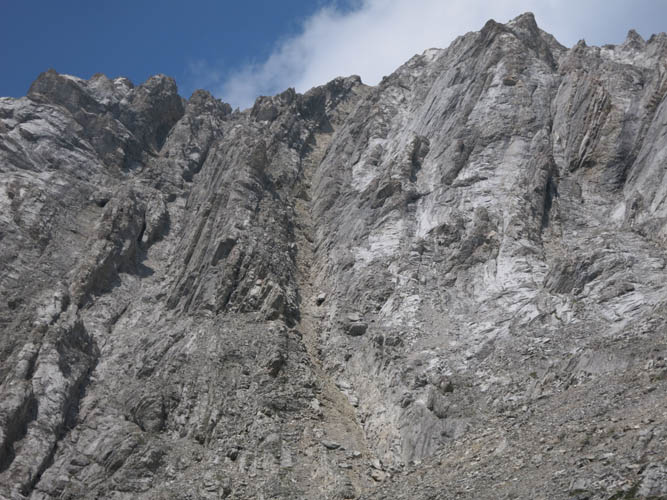
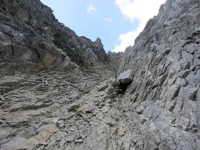
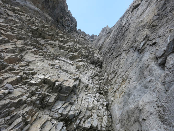
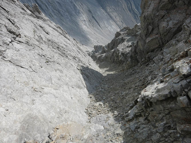
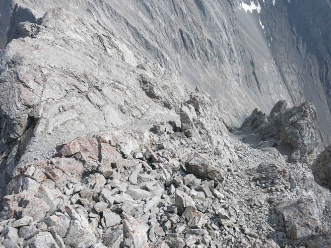
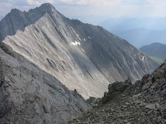
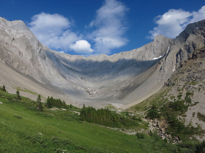
Mount Potts was quite a different affair. First, I went back up the grassy flats and contoured around the left (east) to access the small rocky valley between Potts and Evan-Thomas. Kane’s guidebook talks about a steep brown gully that provides the key to access this mountain, but the picture in the book doesn’t show much detail and I wasn’t sure which one the access gully was. There is a very steep brown gully to the left once you’re past the first big cliffs in the valley, but that gully looked way too serious and not something I really wanted to go up. I continued higher up the valley, past the second and smaller cliffs, where I found the correct brown gully. Initially easy and fun, it gets more challenging and steeper higher up, with several difficult steps to overcome. There are also a lot of loose rocks that are easily dislodged, bombarding whoever else is below you.
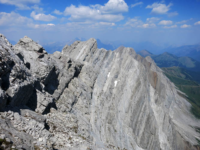
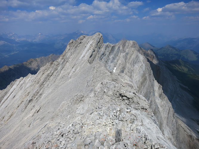
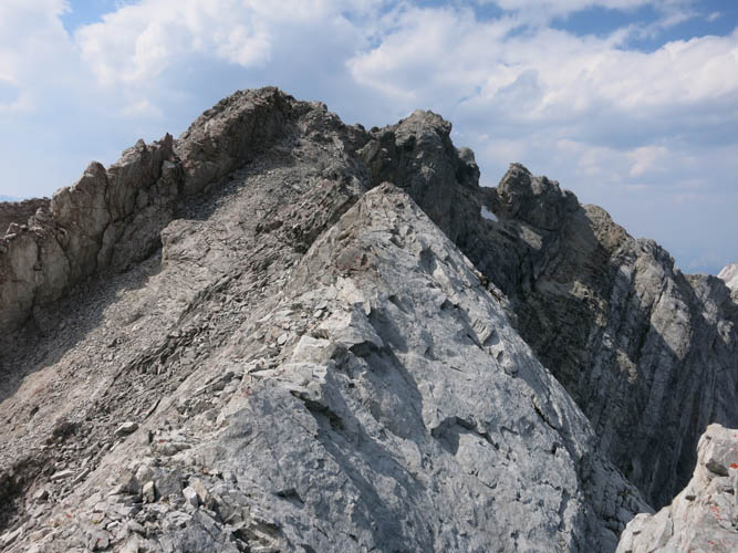
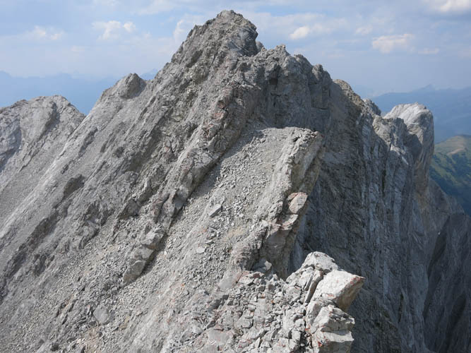
Scrambling up the brown gully took me a long time. It was tricky and required caution, but I was also starting to feel the effects of the cumulative elevation gain on this second mountain today. Once I reached the summit ridge, I turned left and thought I had the summit in the bag… Not so fast! The ridge walk was short, but there was still some demanding scrambling left that required all my concentration. It is also quite exposed in places.
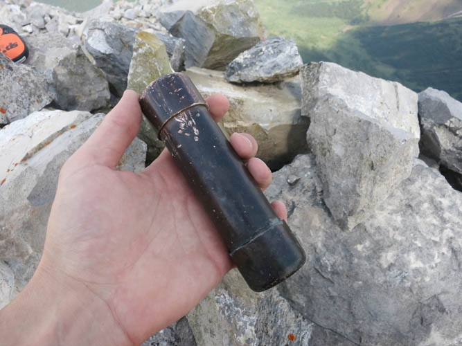
The summit register on Mount Potts is something of a rarity as it’s made entirely of brass. It’s surprisingly well preserved considering it was placed in 1954. Interestingly, the first ascent party of 1954 thought they had ascended Mount Evan-Thomas, which is of course the next peak to the south. Potts isn’t a popular mountain overall. There were only 17 entries to be found in the booklet spanning a period of more than 60 years! 2017 was no doubt an exceptionally popular year: I was the fourth party so far. Clearly, those guidebooks are having a big impact on mountain traffic!
Downclimbing the brown gully turned out to be not as difficult as I had anticipated. Using the stemming technique, I pushed and shoved my way down this v-shaped couloir, knocking off tons of rocks in the process. Rock fall is definitely a serious hazard here and even if you’re solo or in a small group, small rock pieces can come raining down on you from above and there are very few places to take cover. Needless to say that I didn’t linger here and just made my way down as quickly as possible,
People will laugh at me but I had actually brought a second pair of boots just in case the new pair that I was wearing wasn’t working out. I hadn’t broken in my new Mammut boots yet and didn’t want to be left dealing with blisters on a two-peak day, so I took my super-old and completely worn out Zamberlains with me. I had left the boots at the bottom of Mount Potts (and Denny earlier), but now with the difficult scrambling behind me and only scree and a trail left on the way down, I could switch to my old “beaters”.
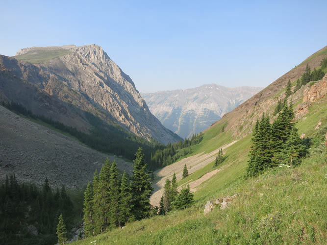
Denny and Potts made for a very satisfying day of scrambling, with a whole range of different levels of difficulty. I really enjoyed this trip and I’m glad I was able to add Potts to my day – the more “interesting” scramble in my opinion.
Note: Extreme danger of rock fall in access gully of Mount Potts! Helmet and small groups mandatory.
|
Elevation: |
Denny: 2980 m (official), 2991 m (my GPS) |
|
|
Potts: 2980 m (official), 2986 m (my GPS) |
|
Elevation gain: |
2200 m |
|
Time: |
11.5 h |
|
Distance: |
15.5 km |
|
Difficulty level: |
Denny: Moderate (Kane), T4 (SAC) |
|
|
Potts via south gully: Difficult, T6 |
|
Reference: |
Kane, Nugara |
|
Personal rating: |
3 (out of 5) for Denny, 4 (out of 5) for Potts |
NOTE: This GPX track is for personal use only. Commercial use/re-use or publication of this track on printed or digital media including but not limited to platforms, apps and websites such as AllTrails, Gaia, and OSM, requires written permission.
DISCLAIMER: Use at your own risk for general guidance only! Do not follow this GPX track blindly but use your own judgement in assessing terrain and choosing the safest route. Please read the full disclaimer here.