Sulaymaniyah, Iraq
4 November 2018
Solo
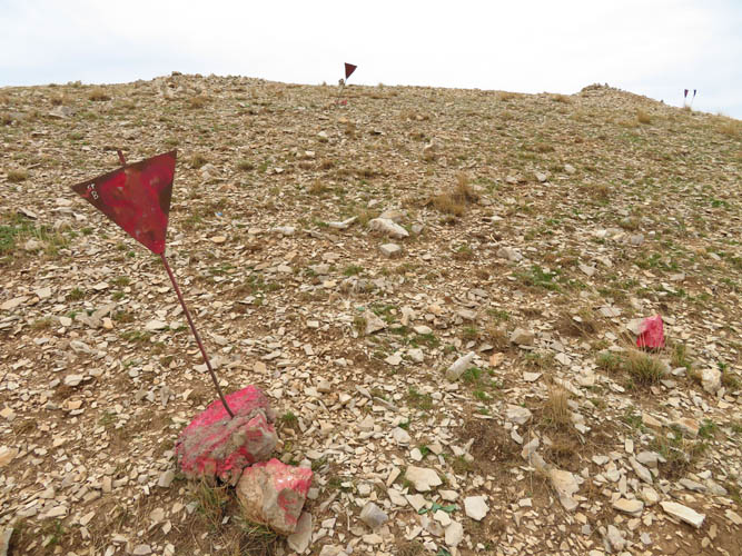
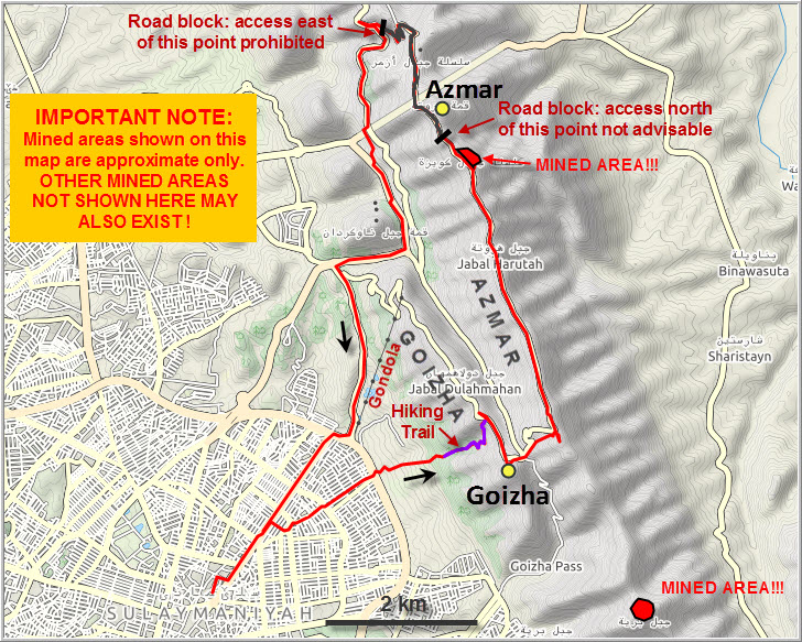
Yet another hike with landmines strewn over parts of the mountain – this seems to become a common theme on my outings in Iraq. Just a few days ago, north of Jabal Mirzah along the same mountain range, I had stumbled upon some minefields near the top of a couple of peaks I had intended to climb. Unlike those fields which had been relatively poorly marked, the area I came across on Azmar Mountain today was clearly demarcated and – fortunately – not directly along the main route.
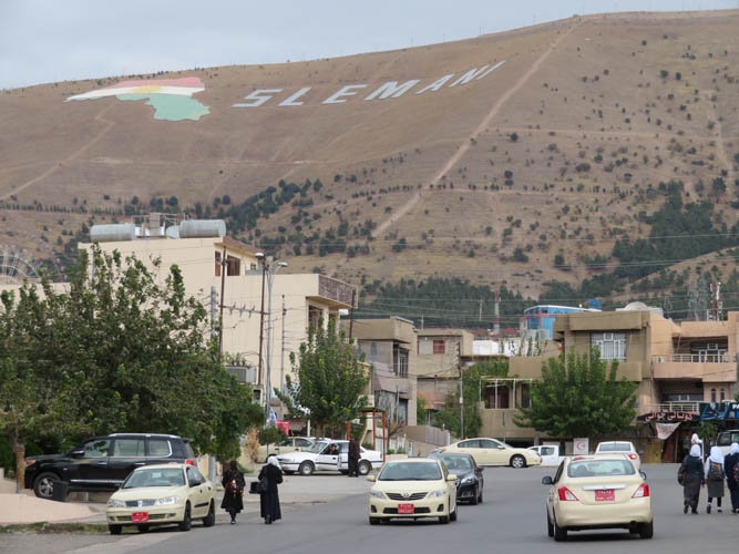
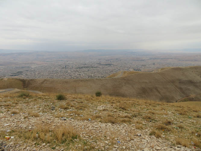
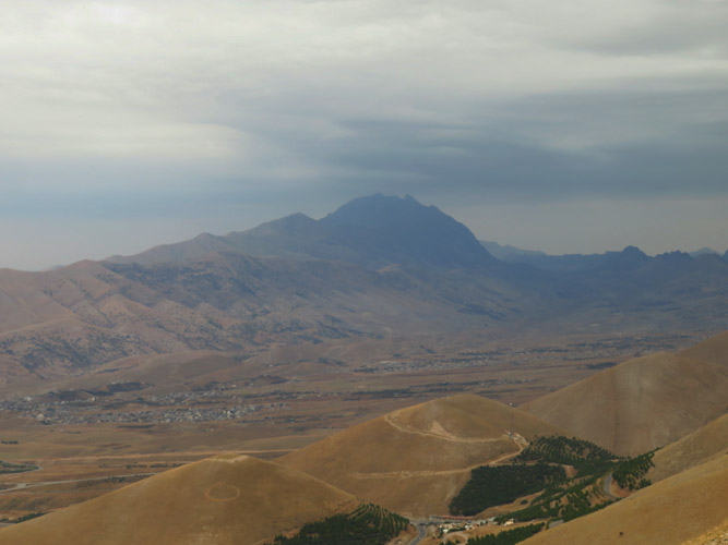
Goizha Mountain is the closest hill outside of Sulaymaniyah and a popular spot for locals to picnic or watch the sunset. The views of this city of half a million people are pretty cool from up here. Too bad conditions were terrible today so the vistas I had were rather dull and obscured by a grey haze of clouds in all directions. On a clear day or evening, however, I can imagine this to be a wonderful place to sit and observe the sparkling lights of Suly.
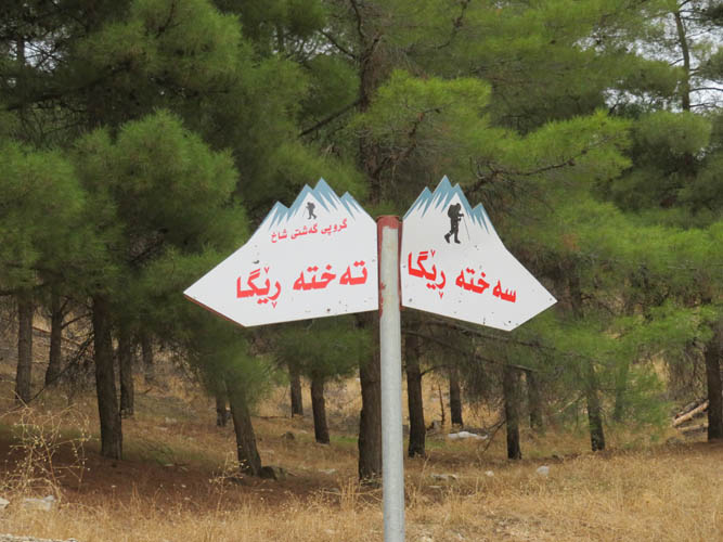
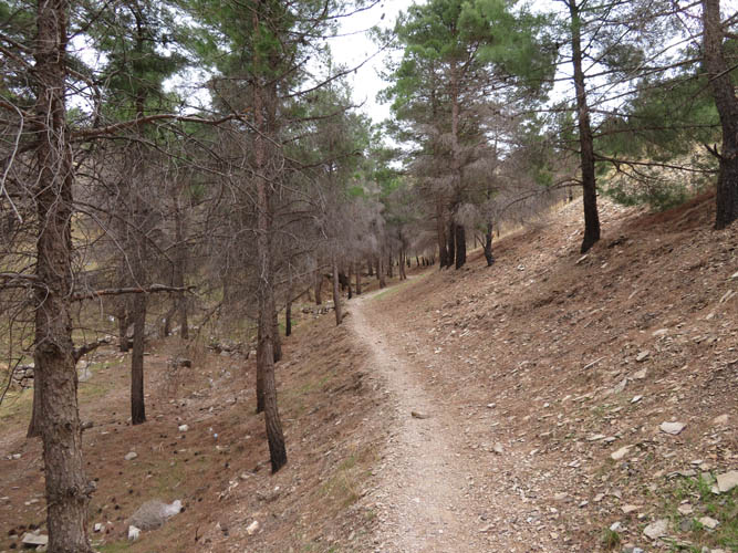
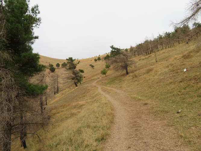
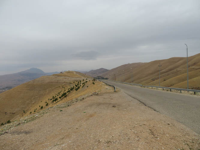
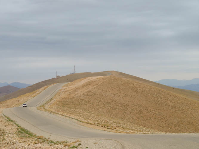
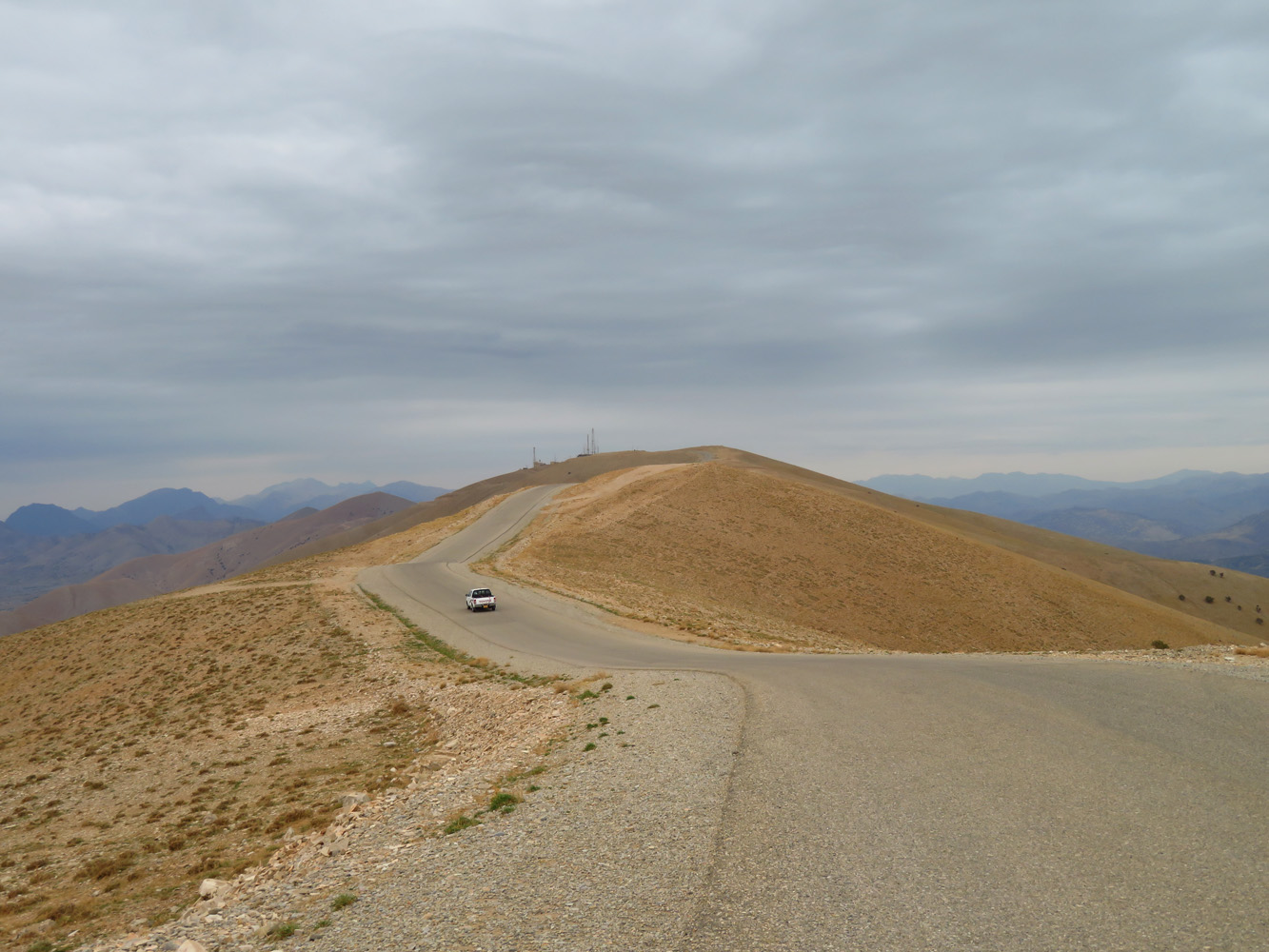
The weather today was cold, windy and drizzly, just as the forecast had predicted. Naturally, my expectations for the day were pretty low – this wasn’t going to be the best trip, but I still enjoyed being out and getting some exercise. And this is exactly what it turned out to be: a work-out hike, nothing more. The bulk of the day was along (mostly deserted) asphalt roads that run along Goizha and Azmar ridge tops, which is obviously not the most attractive way to hike. Only a small portion was on an actual hiking trail, the ascent up the west slopes of Goizha from the outskirts of Suly. The path here runs up a pretty valley full of pine trees. Unfortunately, copious amounts of trash attest to the popularity of this forest as a picnic and rest area for locals and tourists alike.
As soon as I came out at the top of the Goizha ridge, a strong wind almost blew me over and I quickly sought shelter behind a small radio tower hut. A friendly Kurdish guy working inside the hut invited me to warm up inside and, even though he didn’t speak any English (and my Kurdish is limited to about 5 words), we had a lovely chat and I asked if it was ok for me to hike along the ridge on Azmar Mountain. “Yes, of course, you can hike there. No problem!”
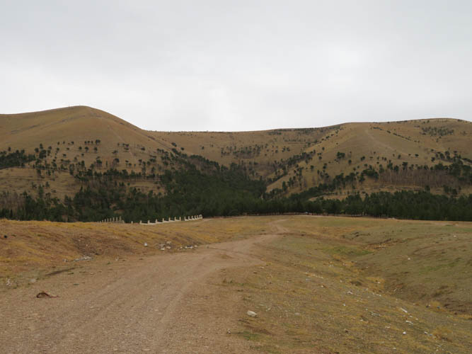
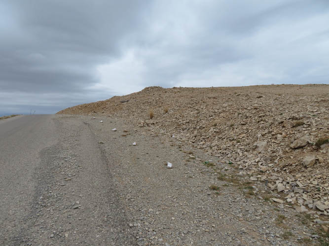
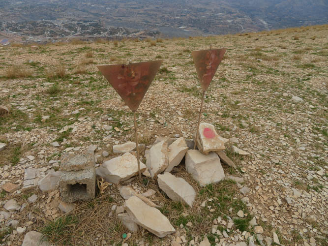
Well, two small problems, actually: landmines and a military zone. After skirting by the high point of Goizha along its southern end (the actual summit is occupied by a fenced building), I continued mostly along a small paved road to the long north-south ridge that makes up Azmar. A few kilometres in, near the high point of Azmar, a line of white or red painted rocks suddenly popped up on the right side of the road. Then, near a small rocky outcropping, that dreaded black triangle sign again, complete with skull and bones: landmines or UXO’s (unexploded ordnance). Just mere metres from the side of the road! I was later told that most of the mines are left-overs from the 1980s when Saddam Hussein waged a brutal war against a Kurdish uprising in the north. Millions of mines were placed, killing or maiming countless soldiers during the war, and civilians in its aftermath. To this day there are still many areas that haven’t been fully cleared.
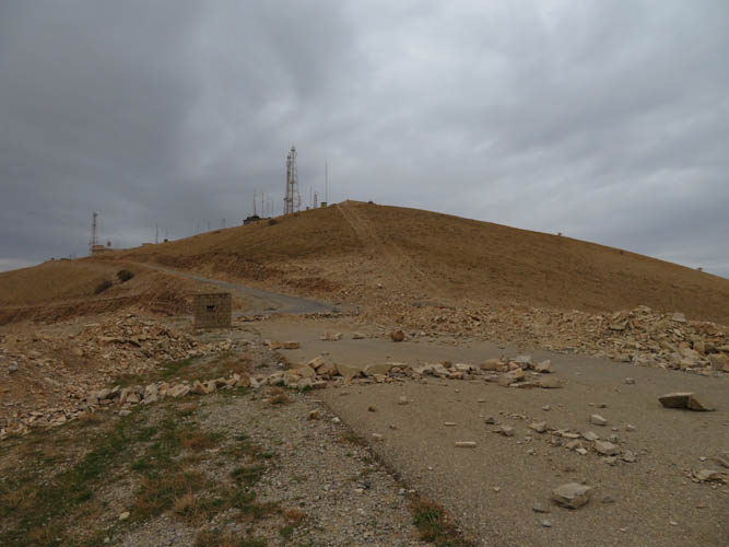
Steering well clear of that area, I continued my “road walk” to a point just before the summit, which is occupied by a military telecommunications station. The road here is blocked by makeshift rock barriers, and this should be the “end of the road” for any hiker so to speak. Just as I was about to turn around, a couple of workers from the station happened to drive by and explained to me that this area was off limits to civilians. However, they allowed me to continue to walk down the north side where the road winds its way back into the valley, saving me having to backtrack my entire route. Note that simply walking off-trail down the seemingly gentle grassy slopes of Azmar is a very bad idea: these slopes apparently still harbour mines and other left-over ammunition from the war.
The rest of my trip was a pretty uninspiring walk along paved roads back into the city. Suffice it to conclude that Azmar Mountain isn’t really worth the trouble. It’s not a fun hike when a paved road runs along the entire length of it, plus the landmines plus the military zone. And of course the actual summit of Azmar, which is called Jabal Harutah on some maps, is inaccessible to the casual hiker.
Goizha makes for a more interesting short day trip, even if there’s also a road along its summit ridge. Just make sure to wait for a clear day to enjoy the views over the city!
| Elevation: | Goizha: 1512 m (my GPS) |
| Azmar: 1696 m (my GPS) | |
| Elevations refer to highest accessible points. | |
| Elevation gain: | 1100 m |
| Time: | 6.5 h |
| Distance: | 25.3 km |
| Difficulty level: | Easy (Kane), T1/T2 (SAC) |
| Reference: | No route information was available to me prior to trip |
| Personal rating: | 2 (out of 5) for Goizha, 1 (out of 5) for Azmar |
DISCLAIMER: Use at your own risk for general guidance only! Do not follow this GPX track blindly but use your own judgement in assessing terrain and choosing the safest route.